Petaluma Bombing Target Archive Search Report ... - Corpsfuds.org
Petaluma Bombing Target Archive Search Report ... - Corpsfuds.org
Petaluma Bombing Target Archive Search Report ... - Corpsfuds.org

You also want an ePaper? Increase the reach of your titles
YUMPU automatically turns print PDFs into web optimized ePapers that Google loves.
Thz land referred to herein is described as follows:<br />
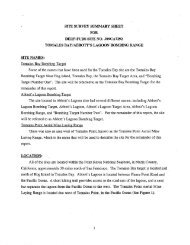
ARCHIVES SEARCH REPORT - FINDINGS<br />
<strong>Petaluma</strong> 12th Naval District <strong>Bombing</strong> <strong>Target</strong> No. 9<br />
<strong>Petaluma</strong>. CA<br />
~ll that certain real property situate, lying and being in the County<br />
of Sonoma, State of California, bounded and described as follows:<br />
So much of the tract of land described in that certain Patent issued<br />
by the State of California to Henry Botten, September 30, 1872, and<br />
recorded in the office of the County Recorder of Soqona County in<br />
Liber A of Patents at pages 665, et seq., as lies west of the center<br />
line of <strong>Petaluma</strong> Creek, and is not cmbraccd by Son~ma County Stcamp and<br />
Overflowed Land Survey No. 73, amendatory to a former return, as<br />
surveyed by the County Surveyor of Sonoma County, July 19th, 1872.<br />
Also, so much of the following described tract.ot Land as lies east of<br />
th$ center line of San Antonio Creek:<br />
(Swamp and Overflo'(r~ed Land Survey of Marin County No. 57.1<br />
Beginning at a stake due West, 17.00 chains from the northeast corner<br />
of Scction 31, (as described by A. D. Easkoc?, County Surveyor of<br />
Narin County, March 26th, 1860) in Township 4 North, Rancje 6 k!cst,<br />
Mount Diablo l.:eridian; thence along the linc of 2loc'r's Rancho, as<br />
surveyed by the United States, North 14-1/2' Nest, 12.12 chains, rlorth<br />
?8-1/2" Wcst, 24.85 chains, Xorth 30' West, 6.15 chains, North 55-3/4O<br />
East, 21.00 chains, North 17O West, 6.49 chains; thence East, 67.03<br />
chains; thence South, 40 chains to the line of survey of Sh7anp and<br />
Overfloeed Land of Marin County No. 54; thence along said linc, West,<br />
52.50 chains'to the place of beginning.<br />
Also, so much of the following describcd tract of land as lies cast of<br />
the center linc of San Antonio Creek:<br />
(Swamp and Overflowed Land Survey of Marin County No. 58.1<br />
Beginning at it stake, North, 37-1/2" West, 52.00 chaim from the<br />
southeast corner of Section 30, as adopted by A. D. Easkoot, County<br />
Surveyor of Marin County, March ZGth, 1860, in Township 4 North, Range<br />
6 West, Mt. Diablo Meridian; thence along the boundary line of Elock's<br />
Rancho, as surveyed by the United Statcs, North 72O Vest, 5.50 chains,<br />
Noxth 6B0 Wcst, 31-00 chains, North 15-1/2O East, 27-67 chaifis; thcnce<br />
East, 69 chairas, South, 20 chains, East, 20 chains, South, 20 chains to<br />
the corner of Swamp and Cverflowed Land Survey of Marin County GO. 57;<br />
thcnce along said Survey, West, 66-50 chains to the place of beginnhg.<br />
Also, so much of the following described tract of land as lies east of<br />
the center line of San Antonio Creek:<br />
(Swamp and Ovexflowed Land Survey No. 59.)<br />
Begi-tning at a stake due West, 51.00 chains from the northeas: corner<br />
of Scction 30, [as adopted by A. D. Easkooc, County Surveyor of fixin<br />
Appendix E - Letters /Memorandums / Miscellaneous Items<br />
Page E-38