Petaluma Bombing Target Archive Search Report ... - Corpsfuds.org
Petaluma Bombing Target Archive Search Report ... - Corpsfuds.org
Petaluma Bombing Target Archive Search Report ... - Corpsfuds.org
Create successful ePaper yourself
Turn your PDF publications into a flip-book with our unique Google optimized e-Paper software.
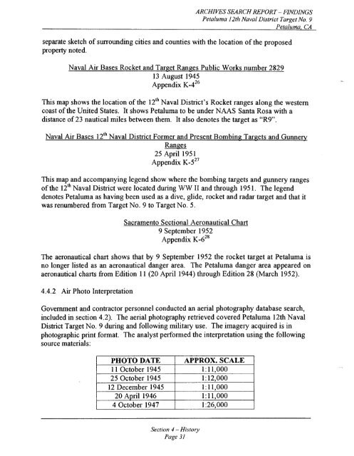
ARCHNES SEARCH REPORT - FINDINGS<br />
<strong>Petaluma</strong> 12th Naval District <strong>Target</strong> No. 9<br />
separate sketch of surrounding cities and counties with the location of the proposed<br />
property noted.<br />
Naval Air Bases Rocket and <strong>Target</strong> Ranges Public Works number 2829<br />
13 August 1945<br />
Appendix ~ - 4 ~ ~<br />
This map shows the location of the 12'~ Naval District's Rocket ranges along the western<br />
coast of the United States. It shows <strong>Petaluma</strong> to be under NAAS Santa Rosa with a<br />
distance of 23 nautical miles between them. It also denotes the target as "R9".<br />
Naval Air Bases 12'~ Naval District Former and Present <strong>Bombing</strong> <strong>Target</strong>s and Gunnery<br />
Ranges<br />
25 April 195 1<br />
Appendix ~ - 5 ~ ~<br />
This map and accompanying legend show where the bombing targets and gunnery ranges<br />
of the 12" Naval District were located during WW I1 and through 195 1. The legend<br />
denotes <strong>Petaluma</strong> as having been used as a dive, glide, rocket and radar target and that it<br />
was renumbered from <strong>Target</strong> No. 9 to <strong>Target</strong> No. 5.<br />
Sacramento Sectional Aeronautical Chart<br />
9 September 1952<br />
Appendix ~ - 6 ~ ~<br />
The aeronautical chart shows that by 9 September 1952 the rocket target at <strong>Petaluma</strong> is<br />
no longer listed as an aeronautical danger area. The <strong>Petaluma</strong> danger area appeared on<br />
aeronautical charts from Edition 11 (20 April 1944) through Edition 28 (March 1952).<br />
4.4.2 Air Photo Interpretation<br />
Government and contractor personnel conducted an aerial photography database search,<br />
included in section 4.2). The aerial photography retrieved covered <strong>Petaluma</strong> 12th Naval<br />
District <strong>Target</strong> No. 9 during and following military use. The imagery acquired is in<br />
photographic print format. The analyst perfoimed the interpretation using the following<br />
source materials:<br />
-<br />
PHOTO DATE<br />
1 1 October 1945<br />
25 October 1945<br />
12 December 1945<br />
20 April 1946<br />
4 October 1947<br />
Section 4 -History<br />
Page 31<br />
APPROX. SCALE<br />
1: 11.000<br />
1: 12,000<br />
1: 11,000<br />
1: 11,000<br />
1 :26,000


