

Top 10 Madeira (Eyewitness Top 10 Travel Guides)
Top 10 Madeira (Eyewitness Top 10 Travel Guides)
Top 10 Madeira (Eyewitness Top 10 Travel Guides)

You also want an ePaper? Increase the reach of your titles
YUMPU automatically turns print PDFs into web optimized ePapers that Google loves.
Around Central <strong>Madeira</strong><br />
78<br />
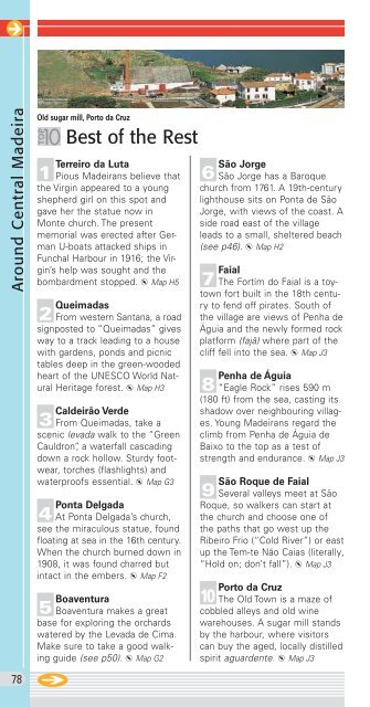
Old sugar mill, Porto da Cruz<br />
Best of the Rest<br />
! Terreiro da Luta<br />
Pious <strong>Madeira</strong>ns believe that<br />
the Virgin appeared to a young<br />
shepherd girl on this spot and<br />
gave her the statue now in<br />
Monte church. The present<br />
memorial was erected after German<br />
U-boats attacked ships in<br />
Funchal Harbour in 1916; the Virgin’s<br />
help was sought and the<br />
bombardment stopped. d Map H5<br />
@ Queimadas<br />
From western Santana, a road<br />
signposted to “Queimadas” gives<br />
way to a track leading to a house<br />
with gardens, ponds and picnic<br />
tables deep in the green-wooded<br />
heart of the UNESCO World Natural<br />
Heritage forest. d Map H3<br />
£ Caldeirão Verde<br />
From Queimadas, take a<br />
scenic levada walk to the “Green<br />
Cauldron”, a waterfall cascading<br />
down a rock hollow. Sturdy footwear,<br />
torches (flashlights) and<br />
waterproofs essential. d Map G3<br />
$ Ponta Delgada<br />
At Ponta Delgada’s church,<br />
see the miraculous statue, found<br />
floating at sea in the 16th century.<br />
When the church burned down in<br />
1908, it was found charred but<br />
intact in the embers. d Map F2<br />
% Boaventura<br />
Boaventura makes a great<br />
base for exploring the orchards<br />
watered by the Levada de Cima.<br />
Make sure to take a good walking<br />
guide (see p50). d Map G2<br />
São Jorge ^ São Jorge has a Baroque<br />
church from 1761. A 19th-century<br />
lighthouse sits on Ponta de São<br />
Jorge, with views of the coast. A<br />
side road east of the village<br />
leads to a small, sheltered beach<br />
(see p46). d Map H2<br />
& Faial<br />
The Fortím do Faial is a toytown<br />
fort built in the 18th century<br />
to fend off pirates. South of<br />
the village are views of Penha de<br />
Águia and the newly formed rock<br />
platform (fajã) where part of the<br />
cliff fell into the sea. d Map J3<br />
* Penha de Águia<br />
“Eagle Rock” rises 590 m<br />
(180 ft) from the sea, casting its<br />
shadow over neighbouring villages.<br />
Young <strong>Madeira</strong>ns regard the<br />
climb from Penha de Águia de<br />
Baixo to the top as a test of<br />
strength and endurance. d Map J3<br />
( São Roque de Faial<br />
Several valleys meet at São<br />
Roque, so walkers can start at<br />
the church and choose one of<br />
the paths that go west up the<br />
Ribeiro Frio (“Cold River”) or east<br />
up the Tem-te Não Caias (literally,<br />
“Hold on; don’t fall”). d Map J3<br />
) Porto da Cruz<br />
The Old Town is a maze of<br />
cobbled alleys and old wine<br />
warehouses. A sugar mill stands<br />
by the harbour, where visitors<br />
can buy the aged, locally distilled<br />
spirit aguardente. d Map J3