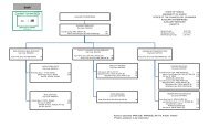
american samoa - University of Hawaii at Manoa
american samoa - University of Hawaii at Manoa
american samoa - University of Hawaii at Manoa

Create successful ePaper yourself
Turn your PDF publications into a flip-book with our unique Google optimized e-Paper software.
Soils differ in origin and age <strong>of</strong> the parent<br />
bedrock, and younger soils tend to be more fertile<br />
than older clayey soils. However, most <strong>of</strong> the park<br />
area Ins the same origin-the old Pago Pago volcano,<br />
the caldera <strong>of</strong> which forms Pago Pago harbor. The<br />
major differences in soil are between the hillside<br />
soils and the alluvial soils <strong>of</strong> some <strong>of</strong> the valleys,<br />
which leads to differences in the forests <strong>of</strong> the<br />
alluvial valleys and the forests <strong>of</strong> the ridges. The<br />
vast majority <strong>of</strong> the park area is classified as "Fagasa<br />
family-Lithic Hapludolls-Rock outcrop associ<strong>at</strong>ion"<br />
(Nakamura 1984), which comprises the ridges and<br />
upper valleys. The only other significant type<br />
present is "Aua very stony silty clay loam," which is<br />
loc<strong>at</strong>ed on the lower slopes and lowlands around<br />
V<strong>at</strong>ia, <strong>at</strong> Va'aogeoge Cove west <strong>of</strong> V<strong>at</strong>ia, and <strong>at</strong><br />
Amalau Bay east <strong>of</strong> V<strong>at</strong>ia.<br />
Topography is rel<strong>at</strong>ed to soil, since the alluvial<br />
valleys are fl<strong>at</strong> to gently sloping and the hillsides are<br />
steep. Steep slopes increase the r<strong>at</strong>e <strong>of</strong> run-<strong>of</strong>f, and<br />
presumably cre<strong>at</strong>e drier soil conditions. Conversely,<br />
the soil <strong>of</strong> the alluvial valleys is fl<strong>at</strong>, with slower<br />
run-<strong>of</strong>f and more w<strong>at</strong>er available from the streams<br />
and rivulets from the slopes, and presumably the<br />
trees found there thrive because <strong>of</strong> the moister soil<br />
conditions.<br />
Elev<strong>at</strong>ion is important for two reasons-tempera-<br />
ture and rainfall. Rainfall generally increases with<br />
elev<strong>at</strong>ion. In Western Samoa, Wright (1963)<br />
estim<strong>at</strong>ed it increased <strong>at</strong> a r<strong>at</strong>e <strong>of</strong> 22-30% with<br />
every 100 m increase in elev<strong>at</strong>ion, <strong>at</strong> least in the<br />
areas he identified as "foothills." Temper<strong>at</strong>ure<br />
decreases with elev<strong>at</strong>ion, <strong>at</strong> a r<strong>at</strong>e <strong>of</strong> about 0.7"C<br />
(1.3"F) per 100 m. Elev<strong>at</strong>ion probably makes a<br />
significant contribution to the vari<strong>at</strong>ion <strong>of</strong> rainforest<br />
within the park, since it varies from near sea level to<br />
480 m elev<strong>at</strong>ion-a potential difference <strong>of</strong> 106 to<br />
144% in rainfall, if Wright's figures can be applied<br />
to Tutuila. Temper<strong>at</strong>ure is probably not th<strong>at</strong><br />
significant a factor, since the difference between the<br />
coastal areas and the summit <strong>of</strong> the park would be<br />
less than 3.S°C (6.3"F).<br />
Disturbance is a factor th<strong>at</strong> is difficult to assess.<br />
Veget<strong>at</strong>ion is not st<strong>at</strong>ic; it is always in a st<strong>at</strong>e <strong>of</strong> flux.<br />
But when a forest becomes rel<strong>at</strong>ively stable in flora<br />
and structure for long periods <strong>of</strong> time, it is termed<br />
climax forest. But since there are continually<br />
occurring disturbances-both man-made and<br />
n<strong>at</strong>ural-th<strong>at</strong> affect small and large areas <strong>of</strong> the<br />
forest, the result is a mosaic <strong>of</strong> veget<strong>at</strong>ion <strong>at</strong><br />
different ages <strong>of</strong> development. If the disturbance is<br />
complete, i.e., the canopy trees are removed and the<br />
disturbance is <strong>of</strong> short dur<strong>at</strong>ion (a hurricane, or<br />
several crops grown there before the land is<br />
abandoned), the area will rel<strong>at</strong>ively quickly undergo<br />
a series <strong>of</strong> predictable structural and floristic<br />
changes, a process known as succession.<br />
The longer the period between disturbance, the<br />
more the mosaic parts tend to become uniform in<br />
flora and structure. The larger the area <strong>of</strong><br />
disturbance, the larger the pieces in the mosaic.<br />
There are certain species whose presence in forest is<br />
an indic<strong>at</strong>ion <strong>of</strong> past disturbance, particularly Rhus<br />
taitensis, Alphitonia zizyphoides, Macaranga<br />
stipulosa, and Hibiscus tiliaceus, which are<br />
discussed in more detail in the section on secondary<br />
forest.<br />
The classific<strong>at</strong>ion <strong>of</strong> the rainforest <strong>of</strong> the park into<br />
smaller units (communities or associ<strong>at</strong>ions) is a<br />
difficult and <strong>of</strong>ten unrewarding task. While<br />
c<strong>at</strong>egories can be constructed by looking <strong>at</strong> part <strong>of</strong><br />
the park, the classific<strong>at</strong>ion becomes less and less<br />
maintainable when more areas are sampled. Th<strong>at</strong> is<br />
because such classific<strong>at</strong>ions are artificial-they are<br />
constructed mainly for the convenience <strong>of</strong> those<br />
studying the subject and may not represent any<br />
meaningful reality in n<strong>at</strong>ure. Plant species each<br />
distribute themselves in their own unique ways,<br />
based on environmental factors, and to link these<br />
species with variable distributions into concrete<br />
veget<strong>at</strong>ion units can only lead to inconsistencies.<br />
Another problem encountered when trying to put<br />
veget<strong>at</strong>ion into c<strong>at</strong>egories is boundaries. If the<br />
community to be defined is monodominant (i.e., it is<br />
entirely domin<strong>at</strong>ed by a single species), a clear<br />
boundary may be present. Mangroves, for example,<br />
have a rel<strong>at</strong>ively clear boundary marked by the<br />
upper limits <strong>of</strong> the influx <strong>of</strong> salt w<strong>at</strong>er. However,<br />
communities with several dominant species are<br />
more difficult to define with boundaries. This is<br />
particularly a problem on ridges th<strong>at</strong> extend from the<br />
sea to high elev<strong>at</strong>ion with no abrupt environmental<br />
boundaries (such as change in soil type). This<br />
uniformity <strong>of</strong> environment and absence <strong>of</strong> abrupt<br />
environmental boundaries is characteristic <strong>of</strong> the<br />
park.