

DARLING RIVERINE PLAINS BIOREGION Background Report
DARLING RIVERINE PLAINS BIOREGION Background Report
DARLING RIVERINE PLAINS BIOREGION Background Report

Create successful ePaper yourself
Turn your PDF publications into a flip-book with our unique Google optimized e-Paper software.
16/08/02 Darling Riverine Plains Bioregion <strong>Background</strong> <strong>Report</strong><br />
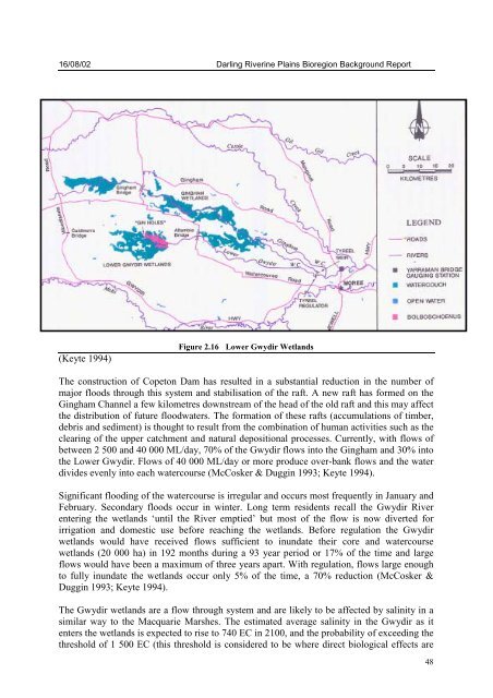
(Keyte 1994)<br />
Figure 2.16 Lower Gwydir Wetlands<br />
The construction of Copeton Dam has resulted in a substantial reduction in the number of<br />
major floods through this system and stabilisation of the raft. A new raft has formed on the<br />
Gingham Channel a few kilometres downstream of the head of the old raft and this may affect<br />
the distribution of future floodwaters. The formation of these rafts (accumulations of timber,<br />
debris and sediment) is thought to result from the combination of human activities such as the<br />
clearing of the upper catchment and natural depositional processes. Currently, with flows of<br />
between 2 500 and 40 000 ML/day, 70% of the Gwydir flows into the Gingham and 30% into<br />
the Lower Gwydir. Flows of 40 000 ML/day or more produce over-bank flows and the water<br />
divides evenly into each watercourse (McCosker & Duggin 1993; Keyte 1994).<br />
Significant flooding of the watercourse is irregular and occurs most frequently in January and<br />
February. Secondary floods occur in winter. Long term residents recall the Gwydir River<br />
entering the wetlands ‘until the River emptied’ but most of the flow is now diverted for<br />
irrigation and domestic use before reaching the wetlands. Before regulation the Gwydir<br />
wetlands would have received flows sufficient to inundate their core and watercourse<br />
wetlands (20 000 ha) in 192 months during a 93 year period or 17% of the time and large<br />
flows would have been a maximum of three years apart. With regulation, flows large enough<br />
to fully inundate the wetlands occur only 5% of the time, a 70% reduction (McCosker &<br />
Duggin 1993; Keyte 1994).<br />
The Gwydir wetlands are a flow through system and are likely to be affected by salinity in a<br />
similar way to the Macquarie Marshes. The estimated average salinity in the Gwydir as it<br />
enters the wetlands is expected to rise to 740 EC in 2100, and the probability of exceeding the<br />
threshold of 1 500 EC (this threshold is considered to be where direct biological effects are<br />
48


