Bushland Weeds Manual - Environmental Weeds Action Network
Bushland Weeds Manual - Environmental Weeds Action Network
Bushland Weeds Manual - Environmental Weeds Action Network

You also want an ePaper? Increase the reach of your titles
YUMPU automatically turns print PDFs into web optimized ePapers that Google loves.
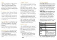
Chapter 7 Weed Mapping in Remnant <strong>Bushland</strong><br />
Mapping in practice<br />
It is simplest to map one weed at a time. If a small<br />
group of people are present, colour photocopies of the<br />
aerial photograph can be provided so that each person<br />
can map a different weed. Before mapping begins,<br />
place a label on the bottom corner of the overlay and<br />
write the date, the name of the weed being mapped<br />
and those people participating in the mapping<br />
exercise. The date is essential if the map is to be used<br />
as a monitoring tool.<br />
Traversing the bushland<br />
Start at one edge of the bushland and walk across the<br />
site at regular, parallel, intervals. The intervals can be<br />
around 10 to 50 metres apart depending on the<br />
vegetation type and the visibility of the weed. A<br />
compass may be helpful. If the site is disected by<br />
paths, mapping within the sections of bushland<br />
created, can be more accurate.<br />
Marking weed populations on the map<br />
Many weeds occur in discrete clumps. Mark the<br />
location and spread (using the map scale as a guide to<br />
size) of the weed population on the map. Features on<br />
the overlay and aerial photograph (tracks, water<br />
bodies, vegetation boundaries, isolated trees and the<br />
roofs of houses adjacent to bushland) can be used to<br />
pinpoint the location of weed populations. Most<br />
serious weeds can be mapped in this way including<br />
bulbous, cormous and tuberous species like Watsonia<br />
(Watsonia meriana), Arum Lily (Zantedeschia<br />
aethiopica), Bridal Creeper (Asparagus asparagoides)<br />
and Freesia, woody weeds including weedy Acacias<br />
and Blackberry (Rubus fruticosus) and some grass<br />
weeds like African Lovegrass (Eragrostis curvula).<br />
Mapping cover<br />
Weed cover can also be mapped. Changes in cover<br />
over time can provide information on the success of a<br />
control program, increase or decrease in weed<br />
numbers or vigour and can give an indication of where<br />
to start control works. To map cover, different symbols<br />
or different colors can be used to represent cover<br />
classes. For example:<br />
Light infestation 1-10 % of ground cover (green)<br />
Light-medium 11-30 % (blue)<br />
Medium-heavy 31-70 % (orange)<br />
Heavy >70 % (red)<br />
Mapping weed cover can be subjective but is often the<br />
only practical method of recording weed species that<br />
are spread throughout bushland in varying densities<br />
such as Perennial Veldgrass (Ehrharta calycina). Kings<br />
Park developed a system for mapping Veldgrass by<br />
estimating cover within a series of 50 m grids across<br />
the bushland (Bob Dixon unpublished data). This<br />
method was used at Blue Gum Lake (case study 3.4)<br />
and at Shenton <strong>Bushland</strong> (Box 7.3). The usefulness and<br />
practicalities of mapping weeds in this way will depend<br />
on the size of your reserve and the patchiness of the<br />
weed’s distribution.<br />
Weed mapping along creeks and waterways<br />
It can be difficult to use aerial photographs to map<br />
along waterways as a dense overstorey of fringing<br />
vegetation often obscures recognisable features below.<br />
At Gingin Brook an aerial photograph was used to<br />
produce a scale mud map (Figure 2). The area along the<br />
brook was then walked and all the major weeds were<br />
mapped. The result is not as detailed as the maps<br />
mentioned previously but still helps in setting priorities<br />
and monitoring the success of control programs.<br />
Virginia Creeper<br />
Castor Oil Bush<br />
Honeysuckle<br />
Canna Lily<br />
Morning Glory<br />
Taro<br />
Blackberry<br />
Edible Fig<br />
Brazilian Pepper<br />
Arum Lily<br />
Para Grass<br />
Kurrajong<br />
Olive<br />
Reed Sweet Grass<br />
Figure 2. Mud map showing generalised distribution of weeds along<br />
Gingin Brook.<br />
Using weed maps<br />
Protecting the good bushland: Maps of individual<br />
weed species enable targeted control work and<br />
protection of priority areas from weed invasion. By<br />
overlaying maps of individual weed species onto a<br />
bushland condition map (Chapter 2, Box 2.1, Box 7.2)<br />
weed control strategies can be developed that aim to<br />
protect the least disturbed bushland. For example,<br />
small isolated patches of serious weeds in relatively<br />
undisturbed bushland can be identified and listed as a<br />
high priority for control.<br />
Understanding the distribution of weeds in bushland:<br />
Overlaying weed maps onto vegetation maps can<br />
highlight relationships between weed species and<br />
particular plant communities. For example, Tribolium<br />
(Tribolium uniolae) distribution in the Brixton Street<br />
Wetlands is clearly associated with Marri woodlands and<br />
drier shrublands or the soil types these communities<br />
91