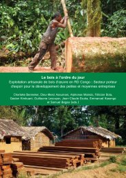
Download the publication - Tropenbos International
Download the publication - Tropenbos International
Download the publication - Tropenbos International

You also want an ePaper? Increase the reach of your titles
YUMPU automatically turns print PDFs into web optimized ePapers that Google loves.
2.1. INTRODUCTION<br />
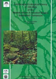
Central African tropical rain forest structure and composition<br />
The Campo-Ma’an area is recognised as an important site within <strong>the</strong> Guineo-<br />
Congolian Centre of Endemism (White, 1983; Gartlan 1989; Davis et al., 1994).<br />
Most of <strong>the</strong> area is covered by lowland evergreen tropical rain forests that extend<br />
from Sou<strong>the</strong>ast Nigeria to Gabon and <strong>the</strong> Mayombe area in Congo. Campo-Ma’an is<br />
situated at <strong>the</strong> middle of this belt and <strong>the</strong> main vegetation type is part of <strong>the</strong> domain<br />
of <strong>the</strong> dense humid evergreen forest that belongs to <strong>the</strong> Atlantic Biafran district and<br />
<strong>the</strong> Atlantic littoral district (Letouzey, 1968 & 1985). The Campo area is dominated<br />
by lowland evergreen forests rich in Caesalpinioideae, with Calpocalyx heitzii and<br />
Sacoglottis gabonensis, a vegetation type that is only known from this area. The<br />
drier Ma’an area in <strong>the</strong> rain shadow, to <strong>the</strong> east of Campo, is dominated by a mixed<br />
evergreen and semi-deciduous forest. The Campo-Ma’an area also supports a great<br />
diversity of habitats from coastal vegetation on sandy shorelines at sea level to <strong>the</strong><br />
submontane forest at about 1100 m.<br />
Man affects <strong>the</strong> forest ecosystem with his economic activities, through logging,<br />
agro-industrial and shifting agriculture, and hunting. Clearance of <strong>the</strong> natural forest<br />
to provide land for agro-industrial companies is <strong>the</strong> biggest and most destructive<br />
threat to <strong>the</strong> lowland forests. More than 7.5% of <strong>the</strong> area has been cleared to<br />
establish large plantations of oil palm and rubber. Ano<strong>the</strong>r use of <strong>the</strong> forest that<br />
leads to impoverishment is logging. Logging concessions represent about 31.4% of<br />
<strong>the</strong> area and a considerable portion of forest has already been logged at least twice<br />
during <strong>the</strong> past 30 years. Although <strong>the</strong> Campo-Ma’an area has been disturbed by<br />
logging and agriculture, <strong>the</strong> area is still mostly forested. In order to save <strong>the</strong>se<br />
remaining forests, a sound botanical assessment should be carried out to provide <strong>the</strong><br />
baseline data essential for <strong>the</strong> description and mapping of <strong>the</strong> existing forest types.<br />
The first attempt to classify <strong>the</strong> vegetation types of Cameroon was made by<br />
Letouzey (1968 & 1985) who adopted <strong>the</strong> phytogeographic approach to map <strong>the</strong><br />
vegetation of Cameroon at a scale of 1:500,000. These maps were based on aerial<br />
photos taken during <strong>the</strong> 1960’s with ground checking and descriptive observations<br />
done during field trips in various parts of Cameroon. However, he did not cover <strong>the</strong><br />
country evenly and <strong>the</strong> Campo-Ma’an area was apparently poorly investigated,<br />
although some major forest types were identified and described.<br />
The importance of environmental variables, past and present human disturbance as<br />
well as Pleistocene history in determining plant species richness along ecological<br />
gradients in <strong>the</strong> tropical rain forest has been studied by several authors. It is largely<br />
argued that <strong>the</strong> number of tree species in <strong>the</strong> tropical rain forest tends to increase<br />
with rainfall, seasonality (Gentry, 1988; van Rompaey, 1993; Clinebell et al., 1995;<br />
Condit et al., 1996; Swaine, 1996; Givnish, 1999) and soil fertility (Hart et al., 1989;<br />
Duivenvoorden & Lips, 1995; Swaine, 1996), and decreases with altitude (Hedberg,<br />
1951; Lebrun, 1960; Gentry, 1988; Tchouto, 1995; Lieberman et al., 1996; Givnish,<br />
1999). Some of <strong>the</strong>se authors argued that rainfall and altitude are likely to lead to<br />
stronger distributional patterns than those of soil nutrients. In <strong>the</strong> present study, we<br />
will classify, describe and map <strong>the</strong> various vegetation types in <strong>the</strong> Campo-Ma’an<br />
area and analyse its forest structure and composition. In order to study <strong>the</strong> effect of<br />
rainfall, altitude, soils, proximity to <strong>the</strong> sea and human disturbance that influence or<br />
delimit <strong>the</strong>se vegetation types, we will test <strong>the</strong> following predictions:<br />
21