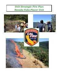
Nevada-Yuba-Placer Strategic Fire Plan 2011 - Board of Forestry ...
Nevada-Yuba-Placer Strategic Fire Plan 2011 - Board of Forestry ...
Nevada-Yuba-Placer Strategic Fire Plan 2011 - Board of Forestry ...

Create successful ePaper yourself
Turn your PDF publications into a flip-book with our unique Google optimized e-Paper software.
<strong>Fire</strong> history for the last decade (2000’s) show that most “failures”, that is fires that are greater<br />
than 10 acres, occur on brush and grass covered lands west <strong>of</strong> Highway 49 – and to a much<br />
lesser extent – in the Truckee and Tahoe basins. Factors that contribute to these failures<br />
include:<br />
Limited State & Local resources – long response times<br />
High incidence <strong>of</strong> arson and negligent acts<br />
<strong>Fire</strong>s that burn for a longer period <strong>of</strong> time before being detected / reported.<br />
<strong>Fire</strong>s in fuel types that support a more rapid rate <strong>of</strong> spresd<br />
Multiple jurisdictions from different dispatching facilities (PSAP’s)<br />
Longer aircraft flight times.<br />
The fire-threat is significant along the 20-49-80 corridor, and there are many factors that<br />
contribute to a high success rate in containing wildfires:<br />
Quick detection – Many people, cell phones, lookout towers…<br />
Numerous State & Local fire suppression resources<br />
A single dispatch center (Grass Valley ECC) for most agencies<br />
Rapid response & turn-around times for air resources (tankers)<br />
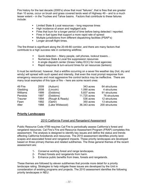
It must be reinforced, however, that a wildfire occurring on a sever fire weather day (hot, dry and<br />
windy) will spread with such speed and intensity, that even the most prompt response from<br />
emergency resources and most aggressive fire control tactics may be ineffective. There are<br />
many local examples <strong>of</strong> this type <strong>of</strong> fire – here are some recent ones:<br />
49 <strong>Fire</strong> 2009 (Auburn) 343 acres 64 structures<br />
Gladding 2008 (Lincoln) 1,090 acres 4 structures<br />
Williams 1999 (Dobbins) 5,837 acres 91 structures<br />
Pendola 1997 (Dobbins) 11,725 acres 76 structures<br />
Trauner 1994 (Rough & Ready) 536 acres 12 structures<br />
Fawn 1992 (Ophir) 350 acres 13 structures<br />
49er 1988 (Lake Wildwood) 36,343 acres 200 structures<br />
Priority Landscapes<br />
2010 California Forest and Rangeland Assessment<br />
Public Resource Code 4789 requires Cal <strong>Fire</strong> to periodically assess California’s forest and<br />
rangeland resources. Cal <strong>Fire</strong>’s <strong>Fire</strong> and Resource Assessment Program (FRAP) completes this<br />
assessment. The analysis is designed to identify key issues and define the status and trends<br />
effecting California forestlands and resources. The 2010 assessment identifies priority landscapes<br />
and associated forest and rangeland impacts. These priority landscapes are developed<br />
based on three primary themes and related subthemes. The three general themes <strong>of</strong> the recent<br />
assessment are:<br />
1- Conserve working forest and range landscapes.<br />
2- Protect forests and rangelands from harm.<br />
3- Enhance public benefits from trees, forests and rangelands.<br />
These themes are followed by eleven subthemes that provide more detail for a priority<br />
landscape rating. Strategies to help mitigate these issues are developed by the Unit in<br />
consideration <strong>of</strong> existing programs and projects. The 2010 assessment identifies the following<br />
priority landscapes in NEU:<br />
- 13 –