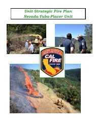
Nevada-Yuba-Placer Strategic Fire Plan 2011 - Board of Forestry ...
Nevada-Yuba-Placer Strategic Fire Plan 2011 - Board of Forestry ...
Nevada-Yuba-Placer Strategic Fire Plan 2011 - Board of Forestry ...

You also want an ePaper? Increase the reach of your titles
YUMPU automatically turns print PDFs into web optimized ePapers that Google loves.
2. Educate the homeowners <strong>of</strong> the state law requirements regarding defensible space<br />
standards and what they should do to help the chances <strong>of</strong> their house surviving a wildfire in<br />
the area.<br />
The <strong>Nevada</strong> <strong>Yuba</strong> <strong>Placer</strong> Unit has found, in its LE 38 Inspection program in 2003, that less than<br />
1% <strong>of</strong> the residences required a third inspection.<br />
Event 3: Second LE 38 inspection <strong>of</strong> approximately 1,122 housing units.<br />
Event 4: Third LE 38 inspection <strong>of</strong> approximately 34 housing units.<br />
Event 5: Homeowner support for removal <strong>of</strong> vegetation as a result <strong>of</strong> the LE 38 inspections.<br />
The inspections will most likely occur in the late spring and summer months. Residents who<br />
remove vegetation as a result <strong>of</strong> the inspections may need alternative ways to dispose <strong>of</strong> the<br />
material. Burn days will be limited due to air quality and fire hazard concerns. The proposed<br />
support for the homeowner is to notify the residents that have been inspected as to a time frame<br />
when a chipper and crew will be by their street. The homeowner can then clear vegetation<br />
around their residence and bring it to the curbside. The crew will then chip the vegetation and<br />
deposit the material back onto the property.<br />
Event 6: A series <strong>of</strong> prescribed burn units along the north side <strong>of</strong> the North Fork <strong>of</strong> the<br />
American River designed to reduce the fuel load along the slope in a mosaic pattern. Treatment<br />
<strong>of</strong> these units will break the continuity <strong>of</strong> the mature and dense brush currently occupying the<br />
slope. The advance <strong>of</strong> wildfire at this location would slow as it moved into a treated unit allowing<br />
fire suppression resources more time and a better location for fire fighting operations.<br />
• Prescribed <strong>Fire</strong> size is approximately 320 acres over 8 units<br />
Potential Stakeholders to participate in Cost Sharing to Fund the Project:<br />
• <strong>Placer</strong> County<br />
• Local Service Groups<br />
• <strong>Placer</strong> County Resource Conservation District<br />
• Natural Resources Conservation Service<br />
• <strong>Placer</strong> County Air Pollution<br />
• <strong>Placer</strong> Hills <strong>Fire</strong> District<br />
• American River Watershed CRMP<br />
• Homeowners Associations<br />
Estimated Cost <strong>of</strong> Proposed Project Total = $259,355.70<br />
To date over $98,000 has been expended towards this program. The funding has came from<br />
variety <strong>of</strong> programs including Pacific Gas & Electric settlement funds, Prop 204, and National<br />
<strong>Fire</strong> <strong>Plan</strong> monies.<br />
138