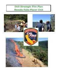
Nevada-Yuba-Placer Strategic Fire Plan 2011 - Board of Forestry ...
Nevada-Yuba-Placer Strategic Fire Plan 2011 - Board of Forestry ...
Nevada-Yuba-Placer Strategic Fire Plan 2011 - Board of Forestry ...

You also want an ePaper? Increase the reach of your titles
YUMPU automatically turns print PDFs into web optimized ePapers that Google loves.
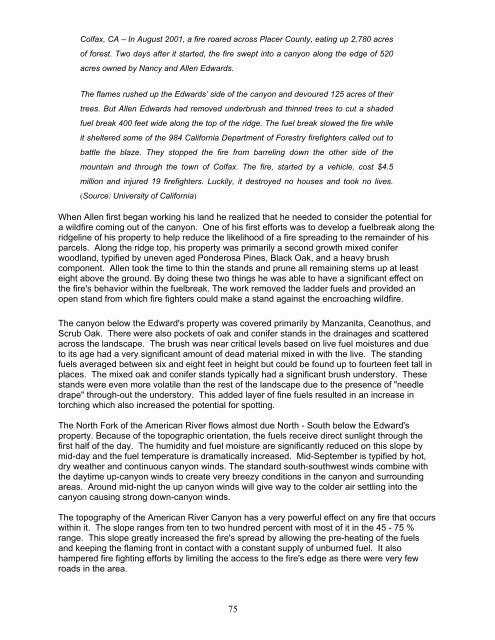
Colfax, CA – In August 2001, a fire roared across <strong>Placer</strong> County, eating up 2,780 acres<br />
<strong>of</strong> forest. Two days after it started, the fire swept into a canyon along the edge <strong>of</strong> 520<br />
acres owned by Nancy and Allen Edwards.<br />
The flames rushed up the Edwards’ side <strong>of</strong> the canyon and devoured 125 acres <strong>of</strong> their<br />
trees. But Allen Edwards had removed underbrush and thinned trees to cut a shaded<br />
fuel break 400 feet wide along the top <strong>of</strong> the ridge. The fuel break slowed the fire while<br />
it sheltered some <strong>of</strong> the 984 California Department <strong>of</strong> <strong>Forestry</strong> firefighters called out to<br />
battle the blaze. They stopped the fire from barreling down the other side <strong>of</strong> the<br />
mountain and through the town <strong>of</strong> Colfax. The fire, started by a vehicle, cost $4.5<br />
million and injured 19 firefighters. Luckily, it destroyed no houses and took no lives.<br />
(Source: University <strong>of</strong> California)<br />
When Allen first began working his land he realized that he needed to consider the potential for<br />
a wildfire coming out <strong>of</strong> the canyon. One <strong>of</strong> his first efforts was to develop a fuelbreak along the<br />
ridgeline <strong>of</strong> his property to help reduce the likelihood <strong>of</strong> a fire spreading to the remainder <strong>of</strong> his<br />
parcels. Along the ridge top, his property was primarily a second growth mixed conifer<br />
woodland, typified by uneven aged Ponderosa Pines, Black Oak, and a heavy brush<br />
component. Allen took the time to thin the stands and prune all remaining stems up at least<br />
eight above the ground. By doing these two things he was able to have a significant effect on<br />
the fire's behavior within the fuelbreak. The work removed the ladder fuels and provided an<br />
open stand from which fire fighters could make a stand against the encroaching wildfire.<br />
The canyon below the Edward's property was covered primarily by Manzanita, Ceanothus, and<br />
Scrub Oak. There were also pockets <strong>of</strong> oak and conifer stands in the drainages and scattered<br />
across the landscape. The brush was near critical levels based on live fuel moistures and due<br />
to its age had a very significant amount <strong>of</strong> dead material mixed in with the live. The standing<br />
fuels averaged between six and eight feet in height but could be found up to fourteen feet tall in<br />
places. The mixed oak and conifer stands typically had a significant brush understory. These<br />
stands were even more volatile than the rest <strong>of</strong> the landscape due to the presence <strong>of</strong> "needle<br />
drape" through-out the understory. This added layer <strong>of</strong> fine fuels resulted in an increase in<br />
torching which also increased the potential for spotting.<br />
The North Fork <strong>of</strong> the American River flows almost due North - South below the Edward's<br />
property. Because <strong>of</strong> the topographic orientation, the fuels receive direct sunlight through the<br />
first half <strong>of</strong> the day. The humidity and fuel moisture are significantly reduced on this slope by<br />
mid-day and the fuel temperature is dramatically increased. Mid-September is typified by hot,<br />
dry weather and continuous canyon winds. The standard south-southwest winds combine with<br />
the daytime up-canyon winds to create very breezy conditions in the canyon and surrounding<br />
areas. Around mid-night the up canyon winds will give way to the colder air settling into the<br />
canyon causing strong down-canyon winds.<br />
The topography <strong>of</strong> the American River Canyon has a very powerful effect on any fire that occurs<br />
within it. The slope ranges from ten to two hundred percent with most <strong>of</strong> it in the 45 - 75 %<br />
range. This slope greatly increased the fire's spread by allowing the pre-heating <strong>of</strong> the fuels<br />
and keeping the flaming front in contact with a constant supply <strong>of</strong> unburned fuel. It also<br />
hampered fire fighting efforts by limiting the access to the fire's edge as there were very few<br />
roads in the area.<br />
75