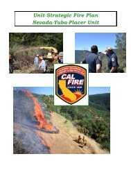
Nevada-Yuba-Placer Strategic Fire Plan 2011 - Board of Forestry ...
Nevada-Yuba-Placer Strategic Fire Plan 2011 - Board of Forestry ...
Nevada-Yuba-Placer Strategic Fire Plan 2011 - Board of Forestry ...

Create successful ePaper yourself
Turn your PDF publications into a flip-book with our unique Google optimized e-Paper software.
Description <strong>of</strong> the Battalion<br />
Ignition Management <strong>Plan</strong><br />
Battalion 14<br />
At over 357,139 acres the Smartsville – Columbia Hill Battalion (B-14) is the largest in the Unit.<br />
It includes more than 160,000 acres <strong>of</strong> SRA and 15,000 acres <strong>of</strong> Federal land under State DPA.<br />
The main centers <strong>of</strong> population include Penn Valley, Rough & Ready, North San Juan, North<br />
Columbia, Smartsville, Beale Air Force Base, Linda and Wheatland. Most <strong>of</strong> these communities<br />
have been identified on the federal registry <strong>of</strong> Wildland Urban Interface Communities at Risk.<br />
The Battalion is made up <strong>of</strong> the <strong>Yuba</strong> River, Deer Creek, and Bear River Watersheds all <strong>of</strong><br />
which have portions that have been identified as High Hazard Watersheds. From west to east<br />
the Battalion begins in the relatively flat lands <strong>of</strong> the Sacramento Valley and continues northeast<br />
to the mountainous terrain <strong>of</strong> the Tahoe National Forest (TNF). In between these boundaries<br />
one will find fuel types that represent at least twelve <strong>of</strong> the thirteen fuel models. From the valley<br />
floor to around 800’ – 900’ ft elevation is primarily the grass models. Beginning around 700’, the<br />
oak-woodland begins to appear and it continues on up in elevation to about 1,400 ft. The brush<br />
models begin to appear around 800’ and carry on up to over 3,000 ft in places. The timber<br />
models begin at approximately 1,600 ft, in places, and continue to the TNF boundary. Most <strong>of</strong><br />
the Battalion is zoned for residential properties <strong>of</strong> five acres or more, agriculture, or timber<br />
production.<br />
Along with the several fire agency cooperators, which include Penn Valley <strong>Fire</strong> Protection<br />
District, Smartsville <strong>Fire</strong> District, North San Juan <strong>Fire</strong> District, Rough & Ready <strong>Fire</strong> District,<br />
Wheatland <strong>Fire</strong> Authority, Linda <strong>Fire</strong> District, the Bureau <strong>of</strong> Land Management (BLM), the TNF,<br />
and Beale Air Force Base we have several non-fire agency cooperators that assist us with our<br />
fuel reduction and fire prevention efforts. These cooperators include but are not limited to: The<br />
University <strong>of</strong> California Research and Cooperative Extension Center who allows us to hold<br />
annual training burns at their facility. The California Department <strong>of</strong> Fish and Game (DFG),<br />
provides us with areas to conduct wildland training exercises and fuel reduction projects. The<br />
Army Corps <strong>of</strong> Engineers provides water shuttle services for rescues and fire responses across<br />
and around Englebright Reservoir. The California State Parks have worked with us in the past<br />
to conduct several large Vegetation Management Program (VMP) burns on their lands<br />
expanding our fuel reduction efforts in the <strong>Yuba</strong> River Drainage. Several large landowners who<br />
have also participated or are eager to take part in the VMP to continue to augment those same<br />
fuel reduction efforts.<br />
Discussion <strong>of</strong> fire occurrence within Battalion<br />
Since 1970, there have been twenty-five fires in excess <strong>of</strong> 100 acres within the Battalion. The<br />
most notable <strong>of</strong> those are the 49er <strong>Fire</strong>, the Trauner <strong>Fire</strong>, and the Oak Tree <strong>Fire</strong>.<br />
The Unit’s most costly and damaging fire occurred entirely within the Smartsville – Columbia Hill<br />
Battalion. The 49er <strong>Fire</strong> began on Sunday, September 11 th , 1988 near the intersection <strong>of</strong><br />
Highway 49 and Birchville Rd. and was contained on Thursday September 15, 1988 about five<br />
miles south <strong>of</strong> Highway 20 in the Smartsville area. Over the course <strong>of</strong> five days the fire burned<br />
33,500 acres and destroyed 148 homes, 358 other structures, 89 vehicles, and 17 boats.<br />
Suppression costs were estimated at 7.5 million dollars and the total dollar lost was estimated at<br />
22.7 million dollars.<br />
The Trauner <strong>Fire</strong> occurred in 1994. It burned 536 acres and destroyed several residences and<br />
historic structures within the community <strong>of</strong> Rough & Ready. The cause was determined to be<br />
poor maintenance <strong>of</strong> the vegetation growing around powerlines. As a result, 739 counts <strong>of</strong><br />
77