- Page 1:
models: 795 and 796 Pilot's Guide
- Page 5 and 6:
Copyright © 2011 Garmin Ltd. or it
- Page 7 and 8:
190-01194-00 Rev. A Warnings, Cauti
- Page 9 and 10:
190-01194-00 Rev. A Warnings, Cauti
- Page 11 and 12:
190-01194-00 Rev. A Garmin aera 795
- Page 13 and 14:
190-01194-00 Rev. A Garmin aera 795
- Page 15 and 16:
SECTION 1 OVERVIEW 1.1 UNIT OVERVIE
- Page 17 and 18:
SD Card Slot CHARGING THE BATTERY 1
- Page 19 and 20:
TURNING THE UNIT ON/OFF Press and h
- Page 21 and 22:
Viewing the GPS status: From the Ma
- Page 23 and 24:
SCROLLING AND PANNING Scrolling and
- Page 25 and 26:
190-01194-00 Rev. A Garmin aera 795
- Page 27 and 28:
190-01194-00 Rev. A TFR Displays TF
- Page 29 and 30:
1.4 MENUS AND DATA ENTRY OPTION MEN
- Page 31 and 32:
Entering predetermined data options
- Page 33 and 34:
190-01194-00 Rev. A Pinch fingers t
- Page 35 and 36:
Activating the map pointer: 190-011
- Page 37 and 38:
MAP DETAIL 190-01194-00 Rev. A Garm
- Page 39 and 40:
Or: Press the POWER Button and ente
- Page 41 and 42:
ADDITIONAL SETTINGS 190-01194-00 Re
- Page 43 and 44:
Changing the Nearest Type: 1) From
- Page 45 and 46:
SECTION 2 GPS NAVIGATION 2.1 INTROD
- Page 47 and 48:
Changing the information shown in t
- Page 49 and 50:
NUMERIC FLIGHT DATA The numeric fli
- Page 51 and 52:
2.2 HSI/PANEL 190-01194-00 Rev. A G
- Page 53 and 54:
190-01194-00 Rev. A Garmin aera 795
- Page 55 and 56:
Configuring a VNAV profile: 1) From
- Page 57 and 58:
• Topography data MAP ORIENTATION
- Page 59 and 60:
190-01194-00 Rev. A Garmin aera 795
- Page 61 and 62:
190-01194-00 Rev. A d) Touch OK. Or
- Page 63 and 64:
190-01194-00 Rev. A d) Touch OK. Or
- Page 65 and 66:
4) Touch the Back Icon to return to
- Page 67 and 68:
190-01194-00 Rev. A Garmin aera 795
- Page 69 and 70:
INTERSECTIONS 190-01194-00 Rev. A G
- Page 71 and 72:
190-01194-00 Rev. A Garmin aera 795
- Page 73 and 74:
190-01194-00 Rev. A e) Touch the OK
- Page 75 and 76:
190-01194-00 Rev. A AIrSpAce Alert
- Page 77 and 78:
2.6 DIRECT-TO NAVIGATION 190-01194-
- Page 79 and 80:
SECTION 3 FLIGHT PLANNING 3.1 INTRO
- Page 81 and 82:
3.2 FLIGHT PLAN CREATION 190-01194-
- Page 83 and 84:
ADDING WAYPOINTS TO AN EXISTING FLI
- Page 85 and 86:
3) Touch the 'Activate Leg' menu op
- Page 87 and 88:
Deleting an individual waypoint fro
- Page 89 and 90:
SELECTING AN APPROACH 190-01194-00
- Page 91 and 92:
190-01194-00 Rev. A a) From the Mai
- Page 93 and 94:
SECTION 4 HAZARD AVOIDANCE 4.1 Siri
- Page 95 and 96:
190-01194-00 Rev. A Garmin aera 795
- Page 97 and 98:
ECHO TOPS 190-01194-00 Rev. A Garmi
- Page 99 and 100:
METARS AND TAFS 190-01194-00 Rev. A
- Page 101 and 102:
AIRMETS 190-01194-00 Rev. A Garmin
- Page 103 and 104:
FREEZING LEVELS 190-01194-00 Rev. A
- Page 105 and 106:
190-01194-00 Rev. A Sunny Partly Cl
- Page 107 and 108:
190-01194-00 Rev. A Garmin aera 795
- Page 109 and 110:
Viewing legends for displayed weath
- Page 111 and 112:
190-01194-00 Rev. A Garmin aera 795
- Page 113 and 114:
TERRAIN ALERTS & SETUP Enabling/Dis
- Page 115 and 116:
Adjusting terrain alert audio: 1) F
- Page 117 and 118:
TRAFFIC GROUND TRACK 190-01194-00 R
- Page 119 and 120:
SECTION 5 ADDITIONAL FEATURES 190-0
- Page 121 and 122:
3D VISION OPERATION 3D Vision is ac
- Page 123 and 124:
5.2 AIRPORT DIRECTORY DATA 190-0119
- Page 125 and 126:
5.3 CHARTVIEW 190-01194-00 Rev. A G
- Page 127 and 128:
CHART RANGE 190-01194-00 Rev. A Air
- Page 129 and 130:
1) From the map, highlight an airpo
- Page 131 and 132:
190-01194-00 Rev. A Garmin aera 795
- Page 133 and 134:
SAFETAXI CYCLE NUMBER AND REVISION
- Page 135 and 136:
USING SiriusXM RADIO 190-01194-00 R
- Page 137 and 138:
190-01194-00 Rev. A Minus (-) Butto
- Page 139 and 140:
190-01194-00 Rev. A Garmin aera 795
- Page 141 and 142:
SECTION 6 APPENDICES 190-01194-00 R
- Page 143 and 144: AIRSPACE MESSAGES 190-01194-00 Rev.
- Page 145 and 146: DATA FIELD & NUMERIC DATA OPTIONS (
- Page 147 and 148: APPENDIX B: ABNORMAL OPERATION LOSS
- Page 149 and 150: DATABASES 190-01194-00 Rev. A Garmi
- Page 151 and 152: 190-01194-00 Rev. A WorlDWIDe terrA
- Page 153 and 154: 190-01194-00 Rev. A Garmin aera 795
- Page 155 and 156: 190-01194-00 Rev. A Garmin aera 795
- Page 157 and 158: CONNECTING TO A COMPUTER 190-01194-
- Page 159 and 160: 190-01194-00 Rev. A Connection Wire
- Page 161 and 162: CONNECTING TO A GTX 330 MODE S TRAN
- Page 163 and 164: 190-01194-00 Rev. A ADVAnceD nMeA o
- Page 165 and 166: 190-01194-00 Rev. A Garmin aera 795
- Page 167 and 168: APPENDIX F: GENERAL TIS INFORMATION
- Page 169 and 170: 190-01194-00 Rev. A Garmin aera 795
- Page 171 and 172: APPENDIX G: UTILITIES DOCUMENT VIEW
- Page 173 and 174: DELETING FLIGHT LOG RECORDS 190-011
- Page 175 and 176: 190-01194-00 Rev. A Garmin aera 795
- Page 177 and 178: HEADING LINE 190-01194-00 Rev. A Ga
- Page 179 and 180: 190-01194-00 Rev. A Garmin aera 795
- Page 181 and 182: Entering an aircraft profile: 190-0
- Page 183 and 184: 190-01194-00 Rev. A Garmin aera 795
- Page 185 and 186: 190-01194-00 Rev. A Garmin aera 795
- Page 187 and 188: APPENDIX H: DISPLAY SYMBOLS VFR SYM
- Page 189 and 190: Unknown 190-01194-00 Rev. A Item Sy
- Page 191 and 192: 190-01194-00 Rev. A Item Symbol Dan
- Page 193: APPENDIX I: MAP DATUM AND LOCATION
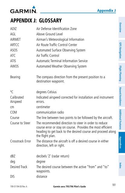
- Page 197 and 198: 190-01194-00 Rev. A Garmin aera 795
- Page 199 and 200: pm revolutions per minute SBAS Sate
- Page 201 and 202: APPENDIX K: LICENSE AGREEMENT AND W
- Page 203 and 204: 190-01194-00 Rev. A Garmin aera 795
- Page 205 and 206: A Abnormal Operation 133 Acquiring
- Page 207 and 208: NEXRAD 81 NMEA 149 Numeric Data Opt
- Page 210: © 2011 Garmin Ltd. or its subsidia


