Supporting documents - Renfrewshire Council
Supporting documents - Renfrewshire Council
Supporting documents - Renfrewshire Council

Create successful ePaper yourself
Turn your PDF publications into a flip-book with our unique Google optimized e-Paper software.
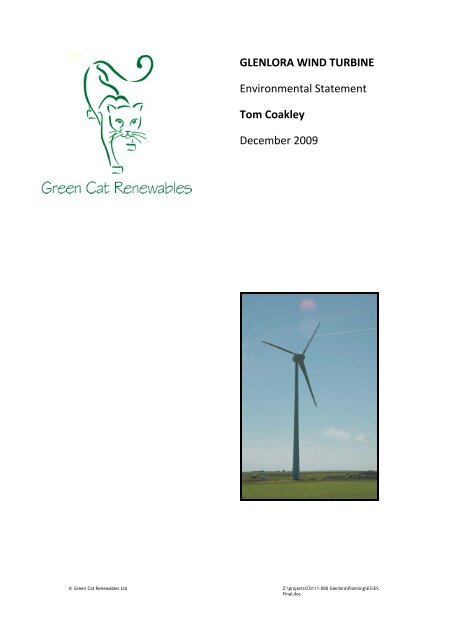
een GLENLORA WIND TURBINE<br />
Environmental Statement<br />
Tom Coakley<br />
December 2009<br />
© Green Cat Renewables Ltd Z:\projects\C0111-080 Glenlora\Planning\ES\ES<br />
Final.doc
© Green Cat Renewables Ltd Z:\projects\C0111-080 Glenlora\Planning\ES\ES<br />
Final.doc
Environmental Statement<br />
Prepared By:<br />
Gavin Catto<br />
Cameron Sutherland<br />
Robert Beck<br />
Andrew Johnston<br />
Ife Thompson<br />
Jacqueline Marshall<br />
Stephanie Woods<br />
Covington Mill<br />
Thankerton<br />
Biggar, South Lanarkshire<br />
ML12 6NE<br />
Tel: 01899 309100<br />
Fax: 01899 309105<br />
z:\projects\c0111‐080 glenlora\planning\es\es final.doc<br />
Checked By:<br />
Approved By:<br />
GLENLORA WIND TURBINE<br />
TOM COAKLEY<br />
December 2009<br />
© Green Cat Renewables Ltd Z:\projects\C0111-080 Glenlora\Planning\ES\ES<br />
Final.doc<br />
Date:<br />
Date:
© Green Cat Renewables Ltd Z:\projects\C0111-080 Glenlora\Planning\ES\ES<br />
Final.doc
Preface<br />
This Environmental Statement seeks to address the local environmental effects of<br />
the proposed Glenlora wind turbine. This is an Environmental Statement for the<br />
purposes of the Planning EIA Regulations (the Environmental Impact Assessment<br />
(Scotland) Regulations 1999) covering what are believed to be the major<br />
environmental effects arising from this proposal.<br />
A wind project is (in the terminology of the 1999 regulations) a schedule 2<br />
development which would “require an EIA if it is likely to have significant<br />
environmental effect because of factors such as its nature, size or location”.<br />
<strong>Renfrewshire</strong> <strong>Council</strong> have determined in their Screening Opinion that the proposed<br />
single wind turbine of 800kw requires an EIA due to the perceived “likelihood of it<br />
having significant environmental effects within the scope of the Environmental<br />
Impact Assessment (Scotland) Regulations 1999”.<br />
A request for a scoping opinion in respect of the proposed turbine was assessed by<br />
<strong>Renfrewshire</strong> <strong>Council</strong> and has been determined as follows:<br />
“The <strong>Council</strong> is of the opinion that the scope of the Environmental Impact Assessment<br />
to accompany an application for planning permission for the erection of a wind<br />
turbine should concentrate on assessing the potential impacts arising from matters<br />
of Ecology/Fauna, Landscape and Visual Impact, Noise, Cultural<br />
Heritage/Archaeology, Existing Infrastructure and Recreational Access. The<br />
Landscape and Visual Impact Assessment should have regard to the ‘Landscape<br />
Institute and Institute of Environmental Management and Assessment Guidelines for<br />
Landscape and Visual Impact Assessment 2 nd Edition 2002. The impact of an on‐site<br />
borrow pit and construction of access roads should be appraised as part of the<br />
overall impact of the scheme including impact on water and groundwater”.<br />
© Green Cat Renewables Ltd Z:\projects\C0111-080 Glenlora\Planning\ES\ES<br />
Final.doc
© Green Cat Renewables Ltd Z:\projects\C0111-080 Glenlora\Planning\ES\ES<br />
Final.doc
Table of Contents<br />
1 Description of Development ....................................................................... 9<br />
1.1 Background ................................................................................................. 9<br />
1.2 The Proposed Development ..................................................................... 14<br />
1.3 Planning and Environmental Policy Context ............................................. 24<br />
2 Alternatives Considered ............................................................................ 37<br />
2.1 Site Selection ............................................................................................. 37<br />
3 Environmental Studies .............................................................................. 39<br />
3.1 Climate Change ......................................................................................... 39<br />
3.2 Local Economic Benefit ............................................................................. 43<br />
3.3 Ecology/Fauna ........................................................................................... 51<br />
3.4 Landscape and Visual Impact .................................................................... 79<br />
3.5 Noise ....................................................................................................... 105<br />
3.6 Cultural Heritage/Archaeology ............................................................... 110<br />
3.7 Surface and Groundwater Hydrology ..................................................... 127<br />
3.8 Existing Infrastructure, Telecommunications, Television, Aviation and<br />
Electromagnetic Safety ........................................................................... 140<br />
3.9 Summary and Conclusions ...................................................................... 145<br />
3.10 Safety ...................................................................................................... 146<br />
3.11 Items Scoped Out of Environmental Assessments ................................. 155<br />
Appendix 1 ‐ Ecology/Fauna ..................................................................................... 156<br />
Appendix 2 ‐ Landscape and Visual Impact .............................................................. 157<br />
Appendix 3 ‐ Cultural Heritage and Archaeology ..................................................... 172<br />
Appendix 4 ‐ Surface and Groundwater Hydrology .................................................. 173<br />
© Green Cat Renewables Ltd Z:\projects\C0111-080 Glenlora\Planning\ES\ES<br />
Final.doc
© Green Cat Renewables Ltd Z:\projects\C0111-080 Glenlora\Planning\ES\ES<br />
Final.doc
© Green Cat Renewables Ltd<br />
GLENLORA WIND TURBINE<br />
1 Description of Development<br />
1.1 Background<br />
This project comprises a single turbine project on the Glenlora Estate, Corsefield Road,<br />
Lochwinnoch. Glenlora Estate comprises of a combination of areas of semi‐improved<br />
grass pasture for grazing cattle and sheep, rough grazing land and mixed woodland.<br />
Mr Tom Coakley, director of the Glasgow based ‘Coakley Group’ property developers<br />
are looking at the opportunity of constructing a single wind turbine on his private<br />
estate. Every year the proposed turbine would generate sufficient electricity to satisfy<br />
the requirements of the private estate and existing infrastructure. Mr Coakley is keen<br />
to diversify to wind generation in order to provide an additional income stream to help<br />
offset fluctuations in energy prices incurred in the running of the estate as well as<br />
reduce the ‘carbon footprint’ of current operations.<br />
The majority of developments that Mr Coakley is involved in both personally and<br />
commercially have a ‘green footprint’. Recently Pro‐Active Energy (one of Mr Coakley’s<br />
operating companies) have been granted planning permission for the Uk’s largest<br />
biogas facility to be constructed on the new M74 Eco Park. From a personal<br />
perspective and for the benefit of the local area an anaerobic digester plant<br />
(09/0417/PP) and alterations to existing shed (with associated infrastructure and<br />
landscaping works) as well as a small scale hydro plant is proposed on the Glenlora<br />
Estate.<br />
A number of potential locations across the estate were investigated and this location<br />
was identified as the most suitable as it meets all of the technical requirements and<br />
has a relatively low environmental impact. The key factors used in identifying these<br />
potential sites are listed below:<br />
1. Wind Speed – The NOABL database of wind speeds indicates that the resource<br />
is potentially very good in this area with 7.9m/s at 45 agl.<br />
2. Grid Connection – An application for a grid connection has been issued and a<br />
formal offer from Scottish Power is imminent.<br />
3. Access – It is intended that the turbines would be landed at Grangemouth and<br />
transported southwest via the following transport networks: A904, M9, M876,<br />
M80, M8, A737 and A760.<br />
4. Civil and Military Aviation – The BAA, CAA, NATS and the MoD have been<br />
consulted and one response has been received to date. Although the site is<br />
located outside of the physical Aerodrome Safeguarding area for Glasgow<br />
Airport an objection has been raised by BAA as there may be a potential effect<br />
on the radars. An independent radar expert has been consulted and discussions<br />
with BAA to determine the most appropriate means of mitigation are<br />
underway. Recent discussions (December 2009) with Colin Cragg, Head of<br />
Aerodrome Safeguarding, BAA have been positive in terms of highlighting<br />
feasible mitigation options (including blanking) and a meeting with the<br />
Safeguarding team is proposed in January to agree a satisfactory solution for all<br />
parties.<br />
Page 9 of 173
© Green Cat Renewables Ltd<br />
GLENLORA WIND TURBINE<br />
5. EMI – Ofcom and the main microwave link operators have been consulted. The<br />
regulator has found no links crossing the immediate area of the proposed<br />
turbine location; therefore no issue can be anticipated in terms of interference<br />
with existing telecommunication infrastructures.<br />
6. Planning – An open dialogue with <strong>Renfrewshire</strong> <strong>Council</strong> planners and SNH has<br />
been carried out throughout the development process. The key planning issues<br />
identified have been:<br />
a. The site is located in a green belt area and is within the boundaries of<br />
Clyde Muirshiel Regional Park where windfarm development have<br />
generally been resisted due to the landscape impacts implications.<br />
Given the small scale of the development and client’s commitment to<br />
‘green energy’ projects it is hoped that a balanced and pragmatic view<br />
will be taken by consultees.<br />
b. Ecology –The site is relatively close (~1.8km to the southeast and ~700m<br />
to the northwest) of <strong>Renfrewshire</strong> Height SPA/SSSI, however extensive<br />
bird surveys of the site have/ have not identified significant use or<br />
overflight of the site by qualifying species.<br />
c. Noise – Turbines will be in excess of 500m to the nearest property<br />
(owned by Glenlora Estate). Assessments carried out demonstrate that<br />
noise levels will be acceptable following the implementation of suitable<br />
planning conditions.<br />
Considering all these factors a suitable site and layout was identified, see Figure 1.1.2<br />
Page 10 of 173
1.1.1 Wind Energy<br />
© Green Cat Renewables Ltd<br />
GLENLORA WIND TURBINE<br />
The UK is widely recognised as having over 40% of Europe’s wind resource. This<br />
natural benefit, resulting from the UK’s position on the western edge of the continent,<br />
significantly increases the contribution that the development of wind energy projects<br />
can make to the UK’s energy generating portfolio.<br />
The UK’s first operational wind farm was commissioned in 1991. As of October 2009,<br />
~2636 wind turbines operate throughout the UK, contributing to the Government’s<br />
targets to increase the use of renewable energy and to reduce the emission of<br />
greenhouse gases. As a result of the growth in the use of wind energy, the<br />
understanding of the issues involved has improved markedly.<br />
Wind power in Scotland is an area of considerable activity, with over 1550 MW of<br />
installed capacity as at November 2009. Wind power is the fastest growing of the<br />
renewable energy technologies in Scotland and the world's largest wind turbine<br />
generator (5 MW) is currently undergoing testing in the North Sea, 15 miles off the<br />
east coast. There are numerous large wind farms as well as a number, both planned<br />
and operating, which are in community ownership. The siting of turbines is sometimes<br />
an issue, but surveys have shown high levels of community acceptance for wind power<br />
in Scotland. There is further potential for expansion, especially offshore, given the high<br />
average wind speeds.<br />
The Climate Change (Scotland) Act 2009 introduces ambitious, world‐leading<br />
legislation to reduce emissions by at least 80 per cent by 2050, and will drive new<br />
thinking, new solutions and new technologies putting Scotland at the forefront of<br />
building a sustainable low carbon economy. The majority of this is likely to come from<br />
wind power.<br />
1.1.2 Public Attitudes to Wind Power<br />
Surveys of public attitudes to wind farms consistently show strong support for wind<br />
energy (typically between 70 and 80% in favour). The Mori poll conducted on behalf of<br />
the Scottish Executive (http://www.scotland.gov.uk/Publications/2003/08/18049/25579) is<br />
typical of findings across the UK over the past decade. The survey targeted residents<br />
living close to existing wind farms and consistent with previous targeted studies found<br />
that the majority of residents were more positive towards the projects once they were<br />
built than before.<br />
1.1.3 The Rural Economy – Farm Diversification<br />
Government renewable energy policy includes a specific aim of promoting the<br />
interests of the rural economy. Those interests include the farming industry.<br />
Every wind farm in a rural area contributes to the farming economy with the provision<br />
of additional income. However, a project like this where the rural business is the<br />
developer rather than simply a landlord, has an even greater benefit to the local<br />
economy.<br />
Page 11 of 173
© Green Cat Renewables Ltd<br />
GLENLORA WIND TURBINE<br />
Wind turbines provide a source of income whilst coexisting with the previous farming<br />
practices, arable or pastoral. Organisations such as the NFU “are in favour of the use of<br />
renewable energy and see wind farming, and other types of renewable energy such as<br />
energy crops, as an opportunity for farmers”.<br />
1.1.4 Noise<br />
Wind turbines, by their very nature, do generate some noise, mostly from the blades<br />
passing through the air. However, the level of noise is often exaggerated in the press<br />
and by those opposed to wind energy. It is because of this that people are usually<br />
surprised at how quiet modern wind turbines are, when they visit them. It is useful to<br />
consider the low noise levels attributable to modern wind turbines at the sorts of<br />
distances separating nearest residential properties and wind turbines ‐ usually at least<br />
400m. This is illustrated in the Table 1.1.1 below:<br />
Source / Activity Indicative noise level (decibels – dBA)<br />
Threshold of pain 140<br />
Jet aircraft at 250m 105<br />
Pneumatic drill at 7m 95<br />
Truck at 30mph at 100m 65<br />
Busy general office 60<br />
Car at 40mph at 100m 55<br />
Wind farm at 350m 35‐45<br />
Quiet bedroom 35<br />
Rural night‐time background 20‐40<br />
Threshold of hearing 0<br />
Table 1.1.1 – Typical Noise Levels<br />
Planning Advice Note 45 (revised 2002) – “Renewable Energy Technologies”<br />
1.1.5 Wind Energy in <strong>Renfrewshire</strong><br />
Although <strong>Renfrewshire</strong> <strong>Council</strong> do not currently have a Renewable Energy Strategy; in<br />
February 2007 the <strong>Council</strong> made a commitment with councils across Scotland to<br />
reduce the effects of climate change. The <strong>Council</strong> has signed the Scottish Climate<br />
Change Declaration which brings together the Convention of Scottish Local Authorities,<br />
Scottish Local Authorities and the Scottish Executive in a commitment to work with<br />
others to lessen the effects of climate change.<br />
The site is located within the Glasgow & Clyde Valley Green Belt and the Clyde<br />
Muirshiel Regional Park which are subject to specific planning and development<br />
policies. Based on the above policy context, we believe that it is demonstrated in the<br />
following sections that this single turbine project is appropriate to the location and<br />
that its nature and advantages would outweighs a continued protection of the private<br />
estate that it is situated in.<br />
Page 12 of 173
© Green Cat Renewables Ltd<br />
GLENLORA WIND TURBINE<br />
To date there have not been a significant number of wind farm or single turbine<br />
developments in <strong>Renfrewshire</strong>. Projects we are currently aware of include a small<br />
single turbine constructed on Craigend Hill behind St John Bosco Primary School.<br />
A number of medium and large scale wind farm developments have been granted<br />
planning permission in neighbouring local authority areas. The intervisbility between<br />
this proposal and several of the built projects and other projects should they be built<br />
will be discussed further in Section 3.4.<br />
There will of course be other projects that are not yet in the public domain or that are<br />
currently on hold but may be revived in the future. It is clear that <strong>Renfrewshire</strong> has<br />
not had the attention from large wind farm developers that many other regions of<br />
Scotland have. However, there is now considerable interest in smaller single turbine<br />
projects usually being developed by educational, commercial establishments or private<br />
landowners.<br />
There are a number of reasons why <strong>Renfrewshire</strong> has not been targeted by<br />
developers, notably the Structure Plan describes the area as an area of Strategic<br />
Environmental Resource. In Schedule 7 of the Structure Plan the area is described as<br />
having Ecological Resources: SAC’s, SPAs, SSSIs, NNRs, RSPB and SWT reserves, and<br />
species or habitats protected by national or international legislation or recognised in<br />
the Local Plan.<br />
Another potential constraint to wind farm development in the <strong>Renfrewshire</strong> area is the<br />
proximity to Glasgow Airports Radar safeguarding zone. Taking this into account all<br />
wind turbine proposals within 30km of any of British Airport Authority (BAA) airports<br />
have to be assessed by BAA’s extental consultants National Air Traffic Services (NATS).<br />
1.1.6 The Energy Contribution of Wind Power<br />
In the UK (BWEA October 2009) there are currently ~2,690 turbines at 250 wind farms<br />
with a capacity of ~3,898MW; with a further ~2,100MW at 35 wind farms under<br />
construction; and over ~6,800MW of projects with consent, including ~3,300MW<br />
onshore. Assuming that most of the consented projects get built in the next couple of<br />
years there will be ~12,700MW of capacity. There is a further ~9,400MW currently in<br />
the planning system, including ~7,400MW onshore.<br />
Although it is recognised that wind energy is inherently an intermittent source of<br />
electricity, its variable nature poses no special problems for power system operation.<br />
Indeed the Renewable Energy Advisory Group (REAG) Report (1992) shows that the<br />
national grid can readily accommodate beween 10‐20% of its input from intermittent<br />
sources. In western Denmark the grid system typically accepts 16‐17% penetration<br />
from wind turbines, with peak hourly penetration rates of up to 78%.<br />
Despite the variability of wind conditions at wind farm sites, turbines in Scotland<br />
typically have a capacity factor in the order of 30‐45%, and generate electricity for 60‐<br />
85% of the time, in a year of average winds.<br />
Page 13 of 173
© Green Cat Renewables Ltd<br />
GLENLORA WIND TURBINE<br />
1.1.7 The Energy Balance of Wind Turbines<br />
Wind turbines have a positive energy balance, and therefore produce many times<br />
more energy than that required for their manufacture, installation and maintenance.<br />
Specific research into the Vestas V80 onshore wind turbine indicates that they recover<br />
all the energy used in their manufacture, installation, maintenance, decommissioning<br />
and disposal within 8 months of operation on an average site. This figure is dependent<br />
on the wind speed (and hence energy generation) at a site, but is clearly a much<br />
shorter period than a wind turbine's operational life of over 25 years. This fact is<br />
central to wind energy’s contribution to sustainable energy supplies.<br />
1.2 The Proposed Development<br />
The proposed development at Glenlora Estate, near Lochwinnoch would comprise the<br />
installation and operation of a single 800kW wind turbine no greater than 85m to<br />
blade tip.<br />
The Enercon E48 wind turbine is in the company’s medium‐class power range and is<br />
the most profitable system within it’s class. With a maximum rated power of 800kw<br />
and a capacity of 7000 megawatt hours per annum expected it is the ideal choice for a<br />
‘private’ estate. The green form of energy will result in huge carbon savings per year<br />
over the turbines expected 25 year lifespan which in line with Policy REN1 of the<br />
<strong>Renfrewshire</strong> Local Plan which is generally supportive of an increase in the proportion<br />
of electricity produced from renewable sources.<br />
The proposed development is located on Glenlora Estate near Lochwinnoch, ~25km<br />
west of Glasgow city centre, as shown in Figure 1.1.1 and 1.1.2 below. The proposal is<br />
located within the Glasgow & Clyde Valley Green Belt and the Clyde Muirshiel Regional<br />
Park which are subject to specific planning and development policies. The turbine<br />
position and site boundary are shown in Figure 1.1.2.<br />
Page 14 of 173
Figure 1.1.1 – Site Location<br />
© Green Cat Renewables Ltd<br />
Site Location<br />
Figure 1.1.2 – Turbine layout and site boundary<br />
GLENLORA WIND TURBINE<br />
Turbine under construction National Grid Coordinates<br />
T1 E232597 N659104<br />
Table 1.1.2 – Turbine location (NGC)<br />
Page 15 of 173<br />
Proposed turbine location<br />
Land ownership boundary<br />
Nearest properties +500m exclusion zone
© Green Cat Renewables Ltd<br />
GLENLORA WIND TURBINE<br />
The single turbine proposed is positioned at location 1 in Figure 1.1.2 above. National<br />
grid coordinates for the turbine are detailed in Table 1.1.2 above.<br />
1.2.1 Site Layout<br />
Every effort has been made to ensure that the project and associated infrastructure<br />
are positioned to take account of the assessments identified in this report notably<br />
ecology, landscape/visual effects and noise.<br />
The planning application layout has been finalised following a design development<br />
process which has balanced the need to capture the greatest energy from the wind at<br />
the site while respecting any site specific constraints identified and engineering<br />
considerations.<br />
As the project involves a single turbine any undesirable clustering effects will be<br />
avoided.<br />
Glenlora Estate extends to circa 100 acres and comprises garden grounds which are<br />
well maintained with the capacity to house grazing animals. The area taken by the<br />
proposed project is small and it is therefore anticipated that the existing land use<br />
would continue around the wind turbines and associated infrastructure.<br />
1.2.2 Project Detailed Design<br />
It is intended that this project will be let as either a single Engineer Procure Contract<br />
(EPC) with a ‘turnkey’ supplier or a pair of back to back EPC contracts with a turbine<br />
supplier and an engineering contractor. As such the detailed design will not be<br />
completed until the turbine supplier and the contractors have been selected. Further,<br />
some aspects of the design cannot be completed until intrusive ground investigations<br />
have been carried out.<br />
The following project description sets out the conceptual design in sufficient detail that<br />
the project can be understood and assessed from a planning perspective. It is<br />
anticipated that some of the more detailed aspects that have not yet been fully<br />
evaluated will be handled as planning conditions.<br />
The EPC contract(s) will be competitively let, however, local contractors or contractors<br />
who sub‐contract work locally will be favoured.<br />
1.2.3 Specification of Wind Turbines<br />
The proposed turbine within the Glenlora Estate would comprise the installation of a<br />
medium sized 800kW wind turbine. A diagram of the principal dimensions of a typical<br />
turbine in this size range is shown in Figure 1.1.3 below.<br />
Page 16 of 173
© Green Cat Renewables Ltd<br />
GLENLORA WIND TURBINE<br />
Figure 1.1.3 – Enercon E48 (800kW) wind turbine showing principal dimensions<br />
The wind turbine at Glenlora would have an overall height to blade tip of up to 85<br />
metres. The turbine would be of a modern, quiet design, incorporating tapered<br />
tubular towers and three blades attached to a nacelle housing containing the<br />
generator, gearbox and other operating equipment. The transformer for each turbine,<br />
depending on the final selection of wind turbine used, may be contained inside the<br />
tower base. The turbine operation would be fully independent and automatic. It is<br />
proposed that the finish of the wind turbine, tower and blades will be semi‐matt and<br />
pale grey in colour.<br />
In line with all modern wind turbines the machine would start generating when wind<br />
speeds rise to the ‘cut‐in’ wind speed of 2 m/s. The level of generation would increase<br />
with wind speed to the rated wind speed (16 ‐ 32rpm, approx 13 m/s), and generation<br />
would then be limited to that rated level at higher wind speeds. In the event of<br />
extreme wind speeds, in excess of those that the turbine can operate at (typically 10<br />
minute averages of 25 m/s or a top value of 30m/s), the turbines would shut down<br />
until the wind speed has dropped to a level where it can safely start operating again.<br />
Page 17 of 173
© Green Cat Renewables Ltd<br />
GLENLORA WIND TURBINE<br />
Once erected the wind turbines would operate automatically, requiring visits to the<br />
site by maintenance staff. These visits would typically involve two to four visits per<br />
month in light commercial vehicles, vans, Land Rovers or similar. This would include<br />
longer visits for scheduled servicing every six months. In normal conditions the wind<br />
cluster would be operated and monitored remotely.<br />
1.2.4 Access from the Public Highway<br />
It is intended that the turbines would be landed at Grangemouth, transported<br />
southwest via the A904, M9, M876, M80, M8 and onto the A737. The route then takes<br />
the 2 nd exit at Roadhead Junction on the A760. The route then turns west onto<br />
Corsefield Road and enters the Glenlora Estate via an access track located on the<br />
eastern side of Glenlora House.<br />
At this stage a level of minor road works with minimum removal of trees and<br />
hedgerows is anticipated.<br />
1.2.5 Site Tracks<br />
The construction of new on‐site tracks would be required for the purposes of providing<br />
access from the existing road to the wind turbines. This new stretch of track will likely<br />
have a total length of approximately 800m. The tracks would be typically 4.0m wide<br />
with 0.5m shoulders on each side and made up of crushed stone to an average depth<br />
of up to 500mm. On corners, it will be necessary to construct wider areas of track (up<br />
to 5.5m) to reflect the minimum bend‐radii for the longest construction loads (the<br />
blades).<br />
Construction of the site tracks would involve the removal of the vegetation and top soil<br />
to a depth of approximately 200mm. This would be stored adjacent to the tracks for<br />
later, partial reinstatement. Where necessary, a geotextile layer would be placed<br />
directly onto the exposed subsoil upon which the crushed rock would be placed.<br />
Appropriate drainage requirements would be incorporated where the site specific<br />
conditions make this necessary. If any areas of softer ground are encountered, the<br />
depth of crushed rock may need to increase to approximately 700mm and a layer of<br />
geotextile material embedded within the structure would be used.<br />
Construction of site tracks will utilise stone brought in from a nearby quarry. In<br />
addition to the site tracks themselves, a temporary working area of 450m 2 (30m by<br />
15m) would be required at each of the wind turbine positions. This area is additional to<br />
three areas of hardstanding (30m by 20m) to support the cranes (including outriggers)<br />
used for the erection of the wind turbines. The precise shape of the temporary<br />
working area will be refined to reflect construction and environmental factors at the<br />
turbine location. The construction of these areas of hardstanding will be similar to the<br />
construction of site tracks. Indicative layouts are shown in Figure 1.1.4 below:<br />
Page 18 of 173
Figure 1.1.4 – Indicative hardstanding<br />
© Green Cat Renewables Ltd<br />
GLENLORA WIND TURBINE<br />
Reinstatement of the track verges and the areas of hardstanding would be undertaken<br />
following construction. As there would be a continuing need to use the site tracks, the<br />
tracks will be left in place for the duration of the project.<br />
Running surfaces would be suitably profiled to reduce surface drainage flows. Any<br />
surface water drainage for the tracks and hardstanding will be designed to comply with<br />
the principals of Sustainable Drainage Systems (SuDS).<br />
The design of drainage and mitigation measures for control of surface waters will be<br />
carried out to:<br />
CIRIA Guideline C697 ‘The SUDS Manual’.<br />
CIRIA Guideline C698 ‘Site Handbook for Construction of SUDS’.<br />
The concept of Sustainable Drainage Systems (SuDS) is to minimise the effects and<br />
impact of development on waterways, namely flooding and pollution. This can be<br />
achieved through a system that tries to copy natural drainage of a site by using<br />
Page 19 of 173
© Green Cat Renewables Ltd<br />
GLENLORA WIND TURBINE<br />
different techniques to treat pollution and to slow down or reduce flows. These<br />
techniques can utilise the features of vegetation to improve habitats of wildlife. The<br />
aim of C697 is to summarise current knowledge, apply best practice to design and<br />
construction and to improve knowledge in the areas of hydrology, hydraulics,<br />
structural aspects, water quality and ecology of various SuDS.<br />
A permanent drainage solution for the site could be a swale running alongside the<br />
roads and hardstanding if ground conditions are appropriate. If this is not practical<br />
then drains will be installed along the length of the tracks which will then feed into a<br />
soakaway. See Figure 1.1.5 below (reproduced from the CIRIA web site). The final<br />
design will be carried out by the civil contractor once the ground investigations have<br />
been carried out and will be agreed with the planning authority/SEPA at that time.<br />
Figure 1.1.5 ‐ Potential SuDS Drainage Solutions<br />
1.2.6 Construction Compound<br />
The main ground works will be carried out by a local contractor who will use the<br />
existing small compound on the site for site offices, welfare facilities and storage of<br />
tools etc. During the one to three weeks construction period this compound would be<br />
located near to the site entrance/start of new access track. It is not intended to store<br />
any oils or chemicals on the site. There will be a small temporary site office, toilets and<br />
mess facilities for the duration of the project. Toilets would be self contained ‘port‐a‐<br />
loo’ type to avoid any discharges into local water courses. Following construction any<br />
debris on the site will be removed.<br />
1.2.7 Turbine Foundations<br />
The wind turbine requires foundations which are covered by topsoil when construction<br />
is complete, leaving a plinth of about 5.5m in diameter at the surface level upon which<br />
Page 20 of 173
© Green Cat Renewables Ltd<br />
GLENLORA WIND TURBINE<br />
the turbine would be bolted. The foundation would require an excavation with a<br />
diameter of up to 18m and a depth of 1.7m. The foundation would typically have a<br />
diameter of up to 16m, giving an additional metre all around to allow shuttering<br />
access, with the shuttering positioned and supported. The foundation would comprise<br />
up to 170 cubic metres of concrete and 17 tonnes of reinforced steel bar. All of these<br />
sizes are conservative as they are for a buoyant foundation, a larger type of foundation<br />
that is required when the groundwater table is higher than the base of the foundation.<br />
If the groundwater table is lower than the base of the foundation a standard, or non‐<br />
buoyant, foundation will be used.<br />
Much of the material removed during excavation would be replaced following the<br />
construction of the foundation to leave only the plinth at the surface with the turbine<br />
bolted on to it. The original excavated area would be reinstated to ground level<br />
following the construction of the foundation, with the removed topsoil replaced and<br />
reseeded.<br />
1.2.8 Site Cable Runs<br />
The wind turbines envisaged for use on this site produce electricity at 400 volts. This<br />
would be transformed to 11kV using a transformer adjacent to the turbine. From the<br />
transformer, underground cable runs will link the turbine to a substation building.<br />
Excavated material from the trench would be stored alongside the trench and replaced<br />
during back‐filling. Topsoil would be stored separately and fully reinstated over the<br />
trench following construction.<br />
1.2.9 Grid Connection<br />
An application for a grid connection has been issued and a formal offer from Scottish<br />
Power is awaited. The project will utilise a new sub‐station and a grid connection to<br />
the existing 11kv network will be established.<br />
Subject to consultation with Scottish Power, a small building is likely to be required to<br />
house the necessary metering and protection equipment; provision for this is included<br />
in this application. The building would be single storey and approximately 2.5m by 5m<br />
in size and a drawing of the type of building proposed is included as Figure 1.1.6.<br />
Page 21 of 173
© Green Cat Renewables Ltd<br />
GLENLORA WIND TURBINE<br />
Figure 1.1.6 – Control, Metering and Protection Building<br />
1.2.10 Construction Programme<br />
The main construction period would last for approximately 3 to 5 months, from<br />
commencement of construction through reinstatement at the end of the construction<br />
period. Construction would consist of the following phases:<br />
Construction of site track for access to the turbine location including the excavation<br />
of cable trenches and the laying of electricity and communication cables.<br />
Construction of turbine foundations.<br />
The delivery and erection of turbine towers, nacelles and blades.<br />
Commissioning of the wind turbines.<br />
Site reinstatement.<br />
Measures to prevent contamination of the ground during the construction period<br />
would be implemented and continue throughout the life of the project. Including the<br />
following measures:<br />
Concrete: The foundation concrete specified would be of high strength structural<br />
grade which is not prone to leaching of alkalis.<br />
Page 22 of 173
© Green Cat Renewables Ltd<br />
GLENLORA WIND TURBINE<br />
Coolants: The transformers that will be used in the development are sealed units<br />
containing non‐toxic cooling oil. These units are similar to those used elsewhere in<br />
the UK and leakage is negligible.<br />
There will be no long term storage of lubricants or other petrochemical products on<br />
the site.<br />
1.2.11 Construction Traffic<br />
Wind turbine components would be delivered to the site on articulated lorries.<br />
Extended trailers would be used to deliver the turbine blades which are up to 24m in<br />
length. Typically a 500 tonne and a 100 tonne mobile crane would be required for the<br />
erection of the turbine. A typical 500 tonne crane would have a travelling weight of<br />
120 tonnes on ten axles with a maximum axle load of 12 tonnes and would have<br />
steering on all axles to help navigate bends.<br />
It is proposed that the road stone for the site tracks would come from a nearby quarry,<br />
using an internal road. This is anticipated to require approximately 60 lorry loads of<br />
aggregates in total. It is estimated that approximately 40 deliveries of concrete would<br />
be required together with 2 articulated trailer lorries carrying reinforcement steel for<br />
the foundation. Approximately 1 articulated low loader delivery for the turbine would<br />
be required to deliver the tower, the nacelle and the blades and a further lorry‐load<br />
would be required to transport the necessary cabling to the site.<br />
Further traffic movements would be required for the relevant personnel employed in<br />
the construction of the project, amounting to an average of some 6‐10 cars/vans per<br />
day at peak times.<br />
1.2.12 Decommissioning<br />
At the end of the project’s operational life the wind turbine would be<br />
decommissioned, the principal elements removed, and the site restored leaving little if<br />
any visible trace. This is a process which is easily achievable within a short period of<br />
time, unlike many other forms of electricity generation.<br />
The wind turbine would be removed from the site and the foundations and site track<br />
not required for ongoing farming activities would be covered over with topsoil and<br />
reseeded. The cables would be de‐energised and left in place, with any cables marker<br />
signs removed. The electrical substation building would be removed and the building<br />
demolished to ground level with the foundation covered with topsoil and reseeded.<br />
The decommissioning process would take approximately two months to complete. A<br />
decommissioning programme would be agreed with the relevant authority prior to the<br />
commencement of decommissioning works.<br />
Page 23 of 173
© Green Cat Renewables Ltd<br />
GLENLORA WIND TURBINE<br />
1.3 Planning and Environmental Policy Context<br />
The National Planning Framework for Scotland 2 (NPF2) 2009, expresses the spatial<br />
aspect of the Governments Economic Strategy and confirms the importance of<br />
renewable energy to Scotland’s energy mix. This 2 nd National Planning Framework for<br />
Scotland, ‘takes forward the spatial aspects of the Scottish Government’s policy<br />
commitments on sustainable economic growth and climate change, which will see<br />
Scotland move towards a low carbon economy’. It is stated that the ‘Government is<br />
committed to establishing Scotland as a leading location for the development of<br />
renewable energy technology and an energy exporter over the long term’ and that ‘the<br />
aim of national planning policy is to develop Scotland’s renewable energy potential<br />
whilst safeguarding the environment and communities.’<br />
An application for the development of a wind project should be assessed in the context<br />
of national policy and guidance; the local planning authority development plan; and<br />
supplementary planning guidance. It was considered useful to summarise the relevant<br />
planning guidance and policies here to inform the process of defining the scope of<br />
assessments required for this project.<br />
1.3.1 National Planning Policy Guidance<br />
National planning policy for Scotland is currently expressed through seventeen<br />
separate Scottish Planning Policies (SPPs) and National Planning Policy Guidelines<br />
(NPPGs). This series is being rationalised into a single statement of national planning<br />
policy: Scottish Planning Policy (SPP). The first part of this consolidated Scottish<br />
Planning Policy (SPP) was published in October 2008, superseding SPP 1 of the existing<br />
SPP series. The final part of the SPP, which covers community engagement, sustainable<br />
development, the subject policies and the outcomes of the planning process is<br />
currently a consultative draft (April 2009) with the final version due to be published<br />
late 2009.<br />
Until the final part of the consolidated SPP is published a number of SPP/NPPGs are<br />
material and relevant to the determination of this application:<br />
SPP 6 (2007) Renewable Energy: relating to renewable energy in general and<br />
wind energy in particular.<br />
SPP 15 (February 2005) Planning for Rural Development: which examines how<br />
the statutory land‐use planning system can assist rural areas to diversify and<br />
achieve sustainable development.<br />
NPPG 14 (1999) Natural Heritage: relating to understanding, enhancement and<br />
enjoyment of Scotland’s unique environment.<br />
Other Relevant National Policy Documents<br />
Circulars<br />
10/1999 Planning and Noise; and<br />
8/2007 The Environmental Impact Assessment (Scotland) Regulations 1999.<br />
Page 24 of 173
© Green Cat Renewables Ltd<br />
GLENLORA WIND TURBINE<br />
PANs<br />
PAN 42: Archaeology – The Planning Process and Scheduled Ancient Monument<br />
Procedures;<br />
PAN 45: Renewable Energy Technologies;<br />
PAN 56: Planning and Noise;<br />
PAN 58: Environmental Impact Assessment; and<br />
PAN 60: Planning for Natural Heritage.<br />
Scottish Planning Policy (SPP)<br />
The first part of the consolidated Scottish Planning Policy (SPP, October 2008) covers<br />
the core principles, aspirations and expectations for the planning system. ‘The Scottish<br />
Government believes that a properly functioning planning system is essential to<br />
achieving its central purpose of increasing sustainable economic growth.’<br />
In Paragraph 7 under ‘The Purpose of Planning’ it is stated that:<br />
‘Planning has a critical balancing role to play when competing interests emerge in the<br />
consideration of future development. It is essential to recognise that planning issues, by<br />
their very nature, will often bring differing interests into opposition and disagreement<br />
and the resolution of those issues one way or another will inevitably disappoint some<br />
parties. Planning cannot be expected to satisfy all interests all of the time. It should,<br />
however, enable speedy decision making in ways which are transparent and<br />
demonstrably fair.’<br />
It is emphasised that there should be a ‘genuinely plan led system’ and that<br />
development plans have a statutory duty to contribute to sustainable development.<br />
‘Development Management’ is recognised as a ‘key part of the planning system and<br />
must operate in support of the Government’s central purpose’: Sustainable economic<br />
growth.<br />
In Paragraph 25 it is stated that the ‘planning system operates in the long term public<br />
interest.’<br />
The proposal, which involves the production of energy from a clean and renewable<br />
source and which leaves no lasting effect on the landscape or environment for future<br />
generations, accords with the principles of sustainable development.<br />
SPP 6: Renewable Energy<br />
SPP 6 seeks to encourage more electricity generation from renewable sources and is<br />
regarded as a vital element of both the UK and Scottish Climate Change Programmes.<br />
It further recognises the ability of renewable energy to contribute to secure and<br />
diverse energy supplies and its potential to support economic growth, by:<br />
“setting out the national planning policies for renewable energy developments that planning<br />
authorities should consider when preparing development plans and when determining planning<br />
applications. It identifies the issues that Scottish Ministers will take into account when<br />
Page 25 of 173
© Green Cat Renewables Ltd<br />
GLENLORA WIND TURBINE<br />
considering renewable energy policies in development plans, and when considering applications<br />
for planning permission which come before them on appeal or call‐in.”<br />
The 2010 target was achieved before the publication of SPP 6 in 2007 and it was the<br />
intention of SPP 6 to facilitate successful achievement of the 2020 target, quantified as<br />
6 GigaWatts (GW) of installed renewables capacity and it was confirmed that this<br />
target should not be regarded as a cap. In November 2007 the Scottish Government<br />
announced an increase in the 2020 target to 50%, with an interim target of 31% by<br />
2011.<br />
The SPP states that support for renewable energy and the need to protect and<br />
enhance Scotlands natural and historic environment should be considered as<br />
compatible goals. Further it states that:<br />
‘The planning system has a significant role to play in resolving conflicts so that progress towards<br />
the 2020 target continues to be made in a way that affords appropriate protection to the<br />
natural and historic environment without unreasonably restricting the potential for renewable<br />
energy development’.<br />
The SPP reinforces the primacy of the development plan in the planning process and<br />
provides a general policy background to support the development plan.<br />
The SPP contains a set of guiding principles to ensure the planning system plays its part<br />
in supporting the Government’s commitment to the climate change programme:<br />
“The Scottish Ministers expect planning authorities to make positive provision for<br />
renewable energy developments by:<br />
supporting a diverse range of renewable energy technologies including<br />
encouraging the development of emerging and new technologies;<br />
recognising the importance of fully engaging with local communities and other<br />
stakeholders at all stages of the planning process;<br />
guiding development to appropriate locations and providing clarity on the<br />
issues that will be taken into account when assessing specific proposals; and<br />
maximising environmental, economic and social benefits;<br />
while, at the same time:<br />
meeting international and national statutory obligations to protect designated<br />
areas, species and habitats and protecting the historic environment from<br />
inappropriate forms of development; and<br />
ensuring impacts on local communities and other interests are satisfactorily<br />
addressed. Such interests will vary from technology to technology.”<br />
The SPP notes that, particularly in rural areas, there is the potential for community<br />
projects where local projects are developed for local benefit. Small scale wind farms<br />
are particularly identified as an opportunity in this respect. It goes on to stress that:<br />
Page 26 of 173
© Green Cat Renewables Ltd<br />
GLENLORA WIND TURBINE<br />
“The top priority of the Scottish Executive is to grow Scotland's economy. This includes<br />
the start up and growth of Scottish business, encouraging and supporting key<br />
manufacturing industries and supporting innovation and technology transfer to grow<br />
high value and high skills businesses with the potential for expansion. “Going for Green<br />
Growth: a Green Jobs Strategy for Scotland” sets out how this priority should be<br />
delivered through sustainable economic development.”<br />
And, to state:<br />
“The Scottish Ministers believe that a thriving renewables industry in Scotland has the<br />
potential to develop new indigenous industries, particularly in rural areas; to provide<br />
significant export opportunities and to enhance Scotland's manufacturing capacity. The<br />
planning system has a key role in supporting Scotland's economic competitiveness and<br />
employment market. The scope for developments to contribute to national or local<br />
economic development priorities should be a material consideration when considering<br />
policies and decisions.<br />
With respect to clarifying the planning process and providing certainty, it states;<br />
“Planning authorities should use the development plan process to set the framework<br />
for considering proposals for all renewable energy developments in their areas. Plans<br />
should support the development of all technologies, regardless of scale, whilst ensuring<br />
that an area’s renewable energy potential is realised in a way that is compatible with<br />
other development plan policies and objectives. Plans should also ensure that individual<br />
proposals are assessed against clear policies so that clarity is provided to the industry,<br />
local communities and others on the potential for the development of renewable<br />
technologies throughout the area. This should be done, where appropriate, through<br />
spatial policies supported by broad criteria identifying the issues that must be<br />
satisfactorily addressed to enable development to take place.”<br />
Specifically with respect to wind, the SPP states:<br />
“During the lifetime of this SPP, onshore wind power is likely to make the most<br />
substantial contribution towards meeting renewable targets. Scotland has considerable<br />
potential to accommodate this technology in the landscape although, increasingly,<br />
careful consideration must be given to the need to address cumulative impacts.<br />
Development plans should set out a spatial framework, supported by broad criteria, for<br />
the consideration of wind farm proposals over 20 megawatts. Annex A sets out the<br />
considerations that should be taken into account when undertaking this work. This<br />
framework should not be used to put in place a sequential approach to determining<br />
applications.<br />
The extent to which considerations set out in Annex A are relevant to proposals below<br />
20 megawatts will be dependent on the scale of development proposed, whilst<br />
recognising that the design and location of any development must reflect the scale and<br />
character of the landscape. This should be recognised in development plans but the<br />
existence of natural heritage designations and other constraints should not be<br />
incompatible with the need to encourage smaller‐scale wind developments, particularly<br />
Page 27 of 173
© Green Cat Renewables Ltd<br />
GLENLORA WIND TURBINE<br />
community and decentralised energy schemes or those within urban and industrial<br />
settings.<br />
In all instances, applications should be assessed in relation to criteria based policies to<br />
provide clarity on the issues that must be addressed to enable development to take<br />
place. This criteria will vary depending on the scale of development and its relationship<br />
to the characteristics of the surrounding area but are likely to include impacts on<br />
landscapes and the historic environment; ecology (including birds), biodiversity and<br />
nature conservation; the water environment, communities; aviation;<br />
telecommunications; noise; shadow flicker; and any cumulative impacts that are likely<br />
to arise.”<br />
With respect to cumulative impact, the SPP states:<br />
“Planning authorities should ensure that, where relevant, applicants adequately<br />
address the cumulative impact that their proposal would have on the area. This will<br />
apply primarily to larger scale developments although it should be recognised that<br />
smaller community developments may also contribute to a cumulative effect,<br />
particularly if poorly sited. In reaching decisions on individual applications, planning<br />
authorities should take account of those projects in the vicinity that have been built,<br />
those which have permissions and those that are currently the subject of valid but<br />
undetermined applications. Where relevant, the views of neighbouring authorities<br />
should be taken into account. Decisions should not be unreasonably delayed because<br />
other schemes in the area are at a less advanced stage in the consideration process<br />
and, in such circumstances, the weight that planning authorities should attach to<br />
undetermined applications should reflect their position in the application process.”<br />
In Appendix A the SPP sets out a spatial framework for wind farms over 20MW. The<br />
Annex goes on to set out the criteria that should be used in developing spatial<br />
strategies. The key elements that are identified where spatial policies should be used<br />
to identify areas to be afforded significant protection are:<br />
areas designated for their national or international natural heritage value;<br />
green belts; and<br />
areas where cumulative impacts may be an issue.<br />
In other areas it identifies the key constraints that should be considered and how<br />
development plan policies should be developed to clearly set out the criteria by which<br />
proposals should be assessed.<br />
SPP 15: Planning for Rural Development<br />
As the proposal is located in a rural area, a number of the provisions of SPP 15 are of<br />
relevance.<br />
In setting out how the land use planning system can assist sustainable development in<br />
rural areas, the guidance considers a number of factors which should be considered<br />
when dealing with planning applications and in the preparation of development plans.<br />
Paragraph 9 notes that:<br />
Page 28 of 173
© Green Cat Renewables Ltd<br />
GLENLORA WIND TURBINE<br />
“...Rural diversification should be embraced to help businesses, land managers and<br />
farmers expand or start new enterprises in appropriate circumstances and at an<br />
appropriate scale. New development must be carefully planned if the character and<br />
quality of the countryside is not to be undermined. One of the Scottish Ministers’<br />
objectives for the planning system is to assist in promoting a strong, diverse and<br />
competitive economy by providing land in sufficient quantity and quality to meet<br />
demand. The planning system helps to bring stability so that investment decisions are<br />
not undermined by inappropriate development. It is important therefore for planning<br />
authorities to be aware of new trends, pressures and opportunities and be ready to<br />
react positively but sensitively.”<br />
and, in paragraph 15, that:<br />
“Many landowners, including farmers, have already diversified some of their activity<br />
away from traditional farming and forestry. Many other rural businesses are also<br />
expanding into new areas. Further diversification of the rural economy should be<br />
encouraged and there is enormous scope to exercise initiative and creativity. Planning<br />
policy has to be in tune with this fundamental economic reality. Planning authorities<br />
along with others can support diversification in ways that benefit the economy and lead<br />
to good development on the ground. The LECs have a good idea of the type of business<br />
development likely to succeed in an area and where there may be market potential for<br />
further development. Planning authorities should liaise closely with these organisations<br />
to help promote and support targeted business opportunities in their development<br />
plans”<br />
NPPG 14: Natural Heritage<br />
NPPG 14 defines Government guidance on how the implementation of policies for the<br />
conservation and enhancement of Scotland’s natural heritage should be reflected<br />
within the land use planning system. Specifically the NPPG:<br />
“sets out national planning policy considerations in relation to Scotland’s<br />
natural heritage;<br />
summarises the main statutory obligations in relation to the conservation of<br />
natural heritage;<br />
explains, as part of a wider framework for conservation and development, how<br />
natural heritage objectives should be reflected in development plans;<br />
describes the role of the planning system in safeguarding sites of national and<br />
international importance;<br />
provides guidance on the approach to be adopted in relation to local and non‐<br />
statutory designations; and<br />
draws attention to the importance of safeguarding and enhancing natural<br />
heritage beyond the confines of designated areas.”<br />
The document defines the statutory (and non‐statutory), framework for habitat<br />
protection which has emerged in Scotland and stresses the requirement to continue to<br />
conserve, safeguard and where appropriate, enhance habitats and ecosystems as well<br />
as the opportunities for enjoying and learning about the natural environment of<br />
Page 29 of 173
© Green Cat Renewables Ltd<br />
GLENLORA WIND TURBINE<br />
Scotland. It includes regional and local designations and the role which Scottish<br />
Natural Heritage has to play in providing advice in the implementation of policy.<br />
Advice is also provided on the role of both structure and local plans in delivering<br />
natural heritage guidance through policy frameworks at a more local level.<br />
1.3.2 Local Planning Policy<br />
The proposed Glenlora Wind turbine is located in the <strong>Renfrewshire</strong> administrative area<br />
which is included in the Glasgow and Clyde Valley Structure Plan along with seven<br />
other councils. The key local development plans are:<br />
The Glasgow and Clyde Valley Joint Structure Plan, 2006.<br />
The <strong>Renfrewshire</strong> Local Plan 2006.<br />
The Glasgow and Clyde Valley Structure Plan, 2006<br />
The Scottish Ministers issued their final modifications to the plan on 25 th April 2008,<br />
with the structure plan becoming operational from 29 th April 2008. This sets out an<br />
agenda for sustained growth as the basis for a twenty year planning and development<br />
strategy for Glasgow and Clyde Valley. It is based on a vision which will contribute to<br />
the renaissance of Scotland by providing a framework for growth and regeneration<br />
based upon care for the environment.<br />
The Structure Plan has been prepared by the Joint Committee on behalf of the eight<br />
councils of East Dunbartonshire, East <strong>Renfrewshire</strong>, Glasgow City, Inverclyde, North<br />
Lanarkshire, <strong>Renfrewshire</strong>, South Lanarkshire and West Dunbartonshire. It maintains a<br />
long tradition in the west of Scotland which recognises that communities of the<br />
conurbation are interdependent and that a shared vision is required to tackle the<br />
major economical, social and environmental challenges that we all face. In meeting<br />
these challenges the plan takes account of the diversity of the area reflected in the<br />
variety of towns, villages and their diverse roles.<br />
The overall goal of the Structure Plan is to promote the balanced and sustainable<br />
development of the area by:<br />
Setting the land use framework for sustainable development;<br />
Encouraging economic, social and environmental regeneration; and<br />
Maintaining and enhancing the quality of the natural heritage and built<br />
environment.<br />
Scottish Planning Policies set out a framework of action for the Structure Plan in<br />
meeting this goal (ref: Appendix 1 of the Structure Plan), promoting sustainable<br />
development within a settlement strategy which has a twenty‐year horizon whilst<br />
protecting and enhancing environmental resources. These national requirements<br />
underpin the Structure Plan policies and proposals.<br />
Page 30 of 173
The <strong>Renfrewshire</strong> Local Plan 2006<br />
© Green Cat Renewables Ltd<br />
GLENLORA WIND TURBINE<br />
Renewable Energy in <strong>Renfrewshire</strong><br />
While there has been a low level of interest to date in new renewable energy<br />
developments in <strong>Renfrewshire</strong>, there may nevertheless be increasing interest from<br />
developers in the future, particularly in wind power.<br />
Objective<br />
To reflect the Government’s policy of increasing the proportion of electricity produced<br />
from renewable sources, and the Structure Plan’s support for wind farm<br />
developments, while ensuring that this is not achieved at the expense of unacceptable<br />
damage to the environment and amenity.<br />
The <strong>Council</strong>’s approach is in accordance with national planning guidance on renewable<br />
energy, which requires the planning system to make positive provision for renewable<br />
energy developments through the development plan system.<br />
The <strong>Council</strong>’s strategy is also in accordance with the Structure Plan, which deals with<br />
renewable energy under the heading of Sustainable Development of Natural<br />
Resources. In relation to wind energy, it identifies preferred and intermediate areas<br />
which will be used for evaluating proposals. There are, however, no such areas within<br />
<strong>Renfrewshire</strong>. There will be a presumption against wind farm developments in<br />
sensitive areas, i.e. locations covered by various environmental designations. In<br />
relation to biomass production, the Indicative Forestry Strategy identifies<br />
opportunities for biomass energy crops within certain areas of under‐used land, of<br />
which there are three within <strong>Renfrewshire</strong>, i.e. to the south and north of Paisley and in<br />
the vicinity of Lochwinnoch.<br />
The <strong>Council</strong> has approved a Draft Local Agenda 21 Strategy 2000‐2010 which has been<br />
submitted to the Scottish Executive. Under the theme of “Waste”, it is stated that the<br />
<strong>Council</strong> will minimise the amount of waste for disposal by, among other things,<br />
recovering energy from waste residue. Local Agenda 21 matters will now be<br />
progressed through the Community Planning process.<br />
In seeking to accommodate renewable energy development, it is essential to ensure<br />
that this is not achieved at the expense of unacceptable damage to the environment<br />
and amenity. In addition, all of <strong>Renfrewshire</strong> is covered by the Glasgow Airport<br />
consultation zone for wind power. All proposals for wind turbines will therefore be<br />
considered under POLICY AIRPORT 4.<br />
Page 31 of 173
© Green Cat Renewables Ltd<br />
GLENLORA WIND TURBINE<br />
POLICY<br />
POLICY Ren 1: Criteria for Assessing Proposals for Development of<br />
Renewable Energy Sources<br />
The <strong>Council</strong> is supportive of an increase in the proportion of electricity produced from<br />
renewable sources, but will require proposals for development of renewable energy<br />
sources to meet the following criteria:‐<br />
(a) there is no unacceptable impact on the amenity of nearby residents, in terms of<br />
statutory air quality objectives, noise or other nuisances;<br />
(b) visual intrusion within the landscape in terms of scale, location, design, etc. has<br />
been minimised;<br />
(c) during the process leading to the selection of the proposed site, consideration was<br />
also given to alternative sites, and the selection of the proposed site can be justified;<br />
(d) the cumulative impact of the proposed development along with any other existing<br />
and approved similar developments will not lead to an unacceptable impact on the<br />
environment and amenity;<br />
(e) arrangements are in place to ensure restoration of the site to an acceptable<br />
standard after the operation has ceased.paras 12.3‐12.6<br />
Greenbelt<br />
The Local Plan will protect and enhance the countryside environment by defining a<br />
Greenbelt boundary drawn tightly around the existing towns and villages; by strictly<br />
limiting the types of development permissible within the Greenbelt area; and by<br />
applying strict criteria when considering proposals for those forms of development<br />
which are considered appropriate. Most forms of development will therefore be<br />
directed to the towns and villages, in accordance with the plan’s sustainable<br />
settlement strategy.<br />
The Greenbelt policy has been a long standing key element in the development plan<br />
for <strong>Renfrewshire</strong>. Not only does the Greenbelt policy protect the countryside around<br />
our towns, it also directs development to the built‐up area and thereby contributes to<br />
the renewal of our urban areas in a sustainable way. The policy was embodied in the<br />
Renfrew District Local Plan and the Structure Plan; it has been shown to be robust and<br />
the <strong>Council</strong> has consistently supported it in defence of the Greenbelt against<br />
inappropriate development. In view of the long‐established commitment to it which<br />
has been shown by the <strong>Council</strong>, and the importance given to it in the Structure Plan<br />
and National Policy, it is important that the robust and successful policy approach to<br />
Green Belt policy should continue.<br />
Page 32 of 173
Objectives<br />
© Green Cat Renewables Ltd<br />
GLENLORA WIND TURBINE<br />
To define a Green Belt boundary within the framework of Structure Plan<br />
policyand Government guidance which:<br />
delineates the limits of the built‐up areas and the extent of<br />
thecountryside within which encroachment of development will<br />
be resisted; and<br />
compliments the development strategy for <strong>Renfrewshire</strong> by<br />
directing development away from greenfield sites beyond the<br />
built‐up areas towards brownfield sites within the built‐up areas.<br />
To provide a positive planning framework within which acceptable countryside<br />
uses including access and informal recreation can be encouraged, whilst<br />
unacceptable uses are resisted.<br />
To indicate clearly the planning criteria against which proposals for<br />
development within the Greenbelt will be considered.<br />
The main source of guidance on national policy on the Greenbelt is the Scottish<br />
Development Department Circular 24/1985 ‐ “Developments in the Countryside and<br />
Greenbelts.” This specifies that local plans are to define the precise boundaries of the<br />
Greenbelt. Towns and villages should not be allowed to expand beyond the limits<br />
established by the Greenbelt boundary.<br />
In accordance with national guidance the Structure Plan defines the general location of<br />
the Greenbelt. Almost all of the land outside the boundaries of the towns and villages<br />
in <strong>Renfrewshire</strong> lies within the Greenbelt area indicated in the Structure Plan. 9.7 In<br />
respect of the Greenbelt the main thrust of the Glasgow and the Clyde Valley Structure<br />
Plan remains the same as in the previous Structure Plan, requiring the continued<br />
designation and safeguarding of the Glasgow and the Clyde Valley Greenbelt, with<br />
Local Plans defining the detailed boundaries and policies to safeguard the Greenbelt.<br />
Clear guidance on the types of development which are considered appropriate to a<br />
Greenbelt location, the circumstances under which the specific proposals might be<br />
acceptable and the detailed criteria against which such proposals ‐ and development<br />
proposals not listed as acceptable categories of development ‐ will be assessed, is<br />
required to ensure that the <strong>Council</strong>’s land use strategy for the Greenbelt is robust and<br />
easily understood.<br />
POLICY<br />
POLICY GB1: Greenbelt<br />
The <strong>Council</strong> will protect the Glasgow & the Clyde Valley Greenbelt within <strong>Renfrewshire</strong><br />
as defined on the Proposals Map. Acceptable forms of development in the Greenbelt<br />
will be limited to those falling into the categories 1 to 13 listed below, subject to their<br />
meeting the relevant specified conditions and the specified criteria in PANEL GB1. All<br />
other development proposals will be considered to be contrary to Green Belt Policy<br />
Page 33 of 173
© Green Cat Renewables Ltd<br />
GLENLORA WIND TURBINE<br />
and will be assessed against the specific need for that development to have a Green<br />
Belt location and the criteria in PANEL GB1.<br />
Acceptable forms of development:‐<br />
1. Housing:<br />
(a) New Dwellings: Will only be permitted where the applicant can clearly demonstrate<br />
that it is required to maintain and support a viable agricultural, horticultural or forestry<br />
activity, that it is necessary for the dwelling to be located outwith a settlement and<br />
that an existing structure cannot be converted for the purpose. Where these<br />
requirements can be met, consent will be limited initially to temporary<br />
accommodation until a bona fide agricultural or forestry use, which requires<br />
associated permanent residential accommodation, has been established.<br />
(b) Conversion:<br />
The conversion and rehabilitation of redundant buildings in the<br />
countryside to residential use.<br />
(c) Extensions:<br />
Extensions to existing dwellings, where the original building will require to form the<br />
dominant part of the final overall development.<br />
(d) Replacement Dwellings:<br />
Will only be permitted where (i) a dwelling has suffered serious accidental damage to<br />
the extent that its re‐instatement is unviable; or, (ii) it is shown, by means of a<br />
structural survey, that refurbishment of an existing dwelling to habitable standards as<br />
defined in the Housing Acts is not economically and practically possible, due to<br />
condition, age and form of construction. The replacement dwelling should be of a<br />
similar scale, character and massing to the dwelling it is to replace, and should be<br />
constructed as nearly as possible within the same footprint.<br />
2. Industry:<br />
The extension of existing industrial and business premises; the expansion of existing<br />
business and industry operations; and the conversion of redundant buildings to<br />
smallscale industrial and business use.paras 9.1‐9.12<br />
3. Hotel/Leisure Complex:<br />
The change of use of existing buildings to hotel use, and associated outdoor and indoor<br />
recreation facilities. This may include extension to the building to facilitate the proper<br />
functioning of the facility: the original building is to remain the dominant feature of the<br />
overall development.<br />
4. Holiday Caravan/Chalet/Lodge parks.<br />
5. Outdoor Recreational Facilities.<br />
6. Riding Stables/Boarding Kennels.<br />
Page 34 of 173
© Green Cat Renewables Ltd<br />
GLENLORA WIND TURBINE<br />
7. Residential institutional use (Class 8):<br />
The conversion of existing redundant buildings to residential institutional use.<br />
8. Re‐use/redevelopment of Institutional premises.Where residential Institutional<br />
premises in the Green Belt:<br />
(i) become redundant, and it can be demonstrated that conversion and/or adaptation<br />
of existing buildings is not practicable, or will not suffice to allow a new use to operate;<br />
or:<br />
(ii) are subject of rebuild/expansion proposals; consideration will be given to an<br />
element of redevelopment or extension which can be demonstrated as necessary for<br />
the effective functioning of the new or existing use, subject to the approval by the<br />
<strong>Council</strong> of a comprehensive Master Plan designed to ensure the protection and<br />
enhancement of the Green Belt, subject to the original building(s) forming the<br />
dominant part of the final development. Where a Master Plan has been approved, any<br />
subsequent proposals will be assessed against the Master Plan.<br />
9. Mineral Extraction: subject to the provisions of POLS M1 & M2.<br />
10. Disposal of Waste: subject to the provisions of POL W1.<br />
11. Cemeteries.<br />
12. Telecommunications Development: subject to provisions of POL Tel 1.<br />
13. Renewable Energy Developments: subject to provisions of POL Ren1.<br />
Other Local Policy Documents<br />
• <strong>Renfrewshire</strong> Core Paths Plan, <strong>Renfrewshire</strong>, February 2009; and<br />
• Inverclyde, <strong>Renfrewshire</strong>, East <strong>Renfrewshire</strong> Local Biodiversity Plan, April<br />
2004.<br />
1.3.3 Summary<br />
It is clear from current national renewable energy policy that the Scottish Government<br />
through the recent passing of the Climate Change (Scotland) Act, 2009; the publication<br />
of the 2 nd National Planning Framework for Scotland (NPF2) June 2009; and the<br />
Scottish Climate Change Programme is committed to tackling climate change, moving<br />
towards a zero‐waste Scotland and increasing the use of renewable energy.<br />
In summary the Government’s renewable energy policy can be considered as having<br />
five key aims:<br />
• To assist the UK to meet national and international targets for the<br />
reduction of emissions including greenhouse gases;<br />
• To help provide secure, diverse, sustainable and competitive energy<br />
supplies;<br />
Page 35 of 173
© Green Cat Renewables Ltd<br />
GLENLORA WIND TURBINE<br />
• To stimulate the development of new technologies to provide the basis for<br />
continuing growth of the contribution from renewables into the longer<br />
term;<br />
• To assist the UK renewables industry to become competitive in home and<br />
export markets and, in doing so, provide employment; and<br />
• To make a contribution to rural development.<br />
The proposal is located within the Glasgow & Clyde Valley Green Belt and the Clyde<br />
Muirshiel Regional Park which are subject to specific planning and development<br />
policies.<br />
Page 36 of 173
2 Alternatives Considered<br />
2.1 Site Selection<br />
© Green Cat Renewables Ltd<br />
GLENLORA WIND TURBINE<br />
Our client, Mr Tom Coakley is currently involved in a number of renewable energy<br />
developments across the South Lanarkshire and <strong>Renfrewshire</strong> <strong>Council</strong> areas. He is keen<br />
to diversify to wind generation in order to provide an additional income stream to help<br />
offset fluctuations in energy prices incurred in the running of the estate as well as<br />
reduce the ‘carbon footprint’ of current operations.<br />
The key factors used to assess the site are listed below.<br />
Figure 2.1.1 Initial scoping layout<br />
The landholding and initial scoping layout, shown in Figure 2.1.1 above, was subjected<br />
to a rigorous screening process which considered:<br />
Wind resource<br />
Noise<br />
Access<br />
Ecology<br />
Cultural heritage<br />
Electromagnetic interference<br />
Wind Resource<br />
The proposed turbine was designed to respect the environmental constraints<br />
identified and also to allow the turbine to operate as ‘efficiently’ as possible. In the<br />
Page 37 of 173<br />
Proposed turbine location<br />
Land ownership boundary<br />
Nearest properties +500m exclusion zone
© Green Cat Renewables Ltd<br />
GLENLORA WIND TURBINE<br />
absence of measured wind data this part of the landholding was chosen as it had a<br />
reasonable NOABL windspeed. While we accept that the NOABL gives only a rough<br />
guide it is clear that when site specific constraints such as proximity to dwellings and<br />
forestry are considered, the turbine site chosen are in the best locations.<br />
Noise<br />
In order to minimise the risk of noise nuisance from turbine, it was located so that<br />
predicted noise levels would have the least impact on residential receptors.<br />
Access<br />
The access from the public road to the crane hardstanding was designed to respect the<br />
environmental constraints identified and to minimise the length of new track required<br />
while following existing field boundaries where possible to minimise any adverse visual<br />
impacts.<br />
Landscape and Visual<br />
The turbine has been situated to minimise visibility from the Regional Park to the<br />
northwest.<br />
Ecology<br />
The turbine site and the access track have been situated to minimise the potential<br />
disturbance to mammals or bird species using the site.<br />
Cultural Heritage<br />
The turbine layout and access track avoids any direct impact on any feature of cultural<br />
heritage. The potential for development to encounter previously unrecorded features<br />
is considered to be low, being limited by the small extent of intrusive works associated<br />
with the proposed development.<br />
A desk based assessment and walkover was carried out by Headland Archaeology Ltd<br />
in November 2009 at the site of the proposed wind turbine. The desk assessment<br />
identified a number of known archaeological features within a 1km study area around<br />
the site, most of which are post‐medieval in date and agricultural or domestic in<br />
function. It was concluded by Headland Archaeology Ltd that no known sites will be<br />
directly affected by the development. The walkover survey did not identify any<br />
previously unknown archaeological features.<br />
Following an assessment of the impact of the project on cultural heritage features<br />
within a 10km radius the significance of impact on cultural heritage features was found<br />
to be low.<br />
Electromagnetic Interference<br />
The turbine has been situated to minimise the potential for any electromagnetic<br />
interference.<br />
Page 38 of 173
3 Environmental Studies<br />
3.1 Climate Change<br />
© Green Cat Renewables Ltd<br />
GLENLORA WIND TURBINE<br />
This section considers the impact of the proposed wind turbine on climate change.<br />
3.1.1 Potential Impacts<br />
There are two distinct aspects of wind turbine development that could have an impact<br />
on climate change:<br />
Wind turbine manufacture, construction and decommissioning; and<br />
Wind turbine operation.<br />
The wind turbine construction and decommissioning phases will lead to the emission<br />
of greenhouse gases, while the operation phase will offset greenhouse gases that<br />
would be emitted by generating the equivalent amount of energy via a conventional<br />
energy source. Thus, in assessing the overall impact of the project on climate change,<br />
the full lifecycle of the wind turbine are considered.<br />
The main greenhouse gas pollutants associated with conventional power stations<br />
include: carbon dioxide (CO2); sulphur dioxide (SO2); and oxides of nitrogen (NOX).<br />
3.1.2 Guidance<br />
This section has been written with reference to the following technical guidance:<br />
SNH Technical Guidance Note, ‘Windfarms and Carbon Savings’, SNH, 2003.<br />
‘Calculations for wind energy statistics’, http://www.bwea.com/edu/calcs.html<br />
British Wind Energy Association (Accessed: October 2009)<br />
Guidance on the emissions saved by wind power generation relative to conventional<br />
sources can be found from the British Wind Energy Association (BWEA) who assert that<br />
‘The average wind farm in the UK will pay back the energy used in its manufacture<br />
within three to ten months, and over its lifetime a wind turbine will produce over 30<br />
times more energy that was used in its manufacture.” 1 .<br />
The UK and Scottish Governments have developed targets for tackling climate change.<br />
The UK Government in the 2008 Climate Change Act made a commitment to reduce<br />
the UK’s emissions of CO2, the most significant greenhouse gas, by 34% of 1990 levels<br />
by 2020 and 80% by 2050. While the Climate Change (Scotland) Act 2009 sets in<br />
statute the Government Economic Strategy target to reduce Scotland’s emissions of<br />
greenhouse gases by 80 % by 2050 with an interim target of at least 42%.<br />
The Scottish Government has developed a Climate Change Programme which sets a<br />
goal of increasing the use of renewably produced electricity to 50% of the total by<br />
2020 with an interim target of 31% by 2011 2 .<br />
1 BWEA website ‐ Calculations for energy statistics,<br />
http://www.bwea.com/edu/calcs.html, accessed November 2008<br />
2 Climate Change in Scotland, Annual Report 2008‐09, The Scottish Government, June 2009<br />
Page 39 of 173
© Green Cat Renewables Ltd<br />
GLENLORA WIND TURBINE<br />
In the Climate Change Programme, the Scottish Government outlines its vision for<br />
Scotland: ‘We want Scotland to become recognised as the best small country in the<br />
world and one of the ways we can do that is through our actions to tackle climate<br />
change. The Scottish Executive is committed to playing its part in full, encouraging<br />
others to do likewise … we have a moral responsibility to reduce our carbon footprint<br />
....”<br />
3.1.3 Baseline Data<br />
The SNH Technical Guidance Review suggests that carbon dioxide savings associated<br />
with any wind project development in the UK should be calculated assuming that wind<br />
energy displaces carbon emissions produced per unit of electricity generated from<br />
fossil fuel sourced grid mix. The new guideline explains that wind power does not<br />
displace renewable and nuclear generation and therefore that the counterfactual<br />
factors to use should be the fossil fuel mix factor rather than the grid mix.<br />
The annual carbon dioxide emissions saving of a wind turbine are estimated as:<br />
CO2 emissions saving = total electricity generation expected [MWh] x Emission<br />
Factor of Displaced Generation [tCO2/MWh]<br />
Capacity Factor<br />
In calculating the total electricity generation expected, a wind project capacity factor<br />
has to be determined. This is the ratio of the actual energy generated to the<br />
theoretical amount that the machine would generate if running at full rated power<br />
during a given period of time. The average capacity factor observed for the onshore<br />
windfarms in the UK between 2003 and 2007 is 27.3% 3 . The Scottish average is<br />
believed to be better thanks to higher wind speeds blowing more frequently. The SNH<br />
Technical Guidance Review suggests that a 30% utilisation rate should be used in the<br />
absence of wind data for the actual site. It is believed that, for this location, this figure<br />
represent a realistic estimate when accounting for the carbon emissions due to back‐<br />
up sources of electricity as suggested in the new SNH Guidelines. The new approach<br />
presented also suggests including CO2 emissions from peatland potentially disturbed.<br />
The immediate area of proposed turbine locations and access track is rough grazing.<br />
This area includes areas improved grassland, unimproved grassland and acid flushes<br />
interspersed with conifer shelter belts.<br />
No significant volume of peat disturbance would be involved and therefore no further<br />
reduction of the capacity factor has been applied.<br />
Project CO2 emission savings<br />
The calculation was carried out following the new approach as presented in the<br />
Appendix 2 of the SNH Guidance Review. This suggests that the carbon saving from the<br />
wind project should be calculated using the fossil fuel sourced grid mix as the<br />
3 DUKES Annual tables ‐ Capacity of, and electricity generated from, renewable sources (DUKES 7.4)<br />
http://www.berr.gov.uk/whatwedo/energy/statistics/source/renewables/page18513.html, accessed<br />
November 2008<br />
Page 40 of 173
© Green Cat Renewables Ltd<br />
GLENLORA WIND TURBINE<br />
counterfactual. At the present time, it is thought that discussion is ongoing between<br />
the British Wind Energy Association (BWEA) and the Advertising Standard industry<br />
(ASA) regarding updated values to publish. The emissions factors used for this<br />
application have been published in the SNH guidance review and are commonly used<br />
in the industry.<br />
Power Generation Characterisitcs<br />
Number of turbines 1<br />
Turbine Capacity 0.8MW<br />
Capacity Factor<br />
30%<br />
Lifetime (conservative)<br />
25 years<br />
Annual Energy Output ~2,100 MWh/yr<br />
Counterfactual Emissions Factors<br />
Fossil fuel mix generation 0.607 tCO2 /MWh<br />
Project estimated CO2 emission savings over:<br />
Fossil fuel mix generation ~1,280 tCO2 /yr<br />
Assuming 1 tCO2 = 0.27 tC:<br />
Total Project Estimated Carbon saving over:<br />
Fossil fuel mix generation ~8,600 tC /25yr<br />
Carbon balance<br />
Generally, the total Carbon loss from a wind project can be expressed as:<br />
Ltot = Llife + Lback+ Lfix + Ldirect + Lindirect+ LDOC + Lforest + Limprovement<br />
Where,<br />
Ltot is the total loss of Carbon from a windfarm development in tonnes.<br />
Llife is the total loss of CO2 emission savings due to production, transportation, erection,<br />
operation and dismantling of the wind farm. In the absence of a specific life cycle<br />
assessment for the turbine, the SNH Technical Guidance Review recommends using<br />
the following equation:<br />
Llife = 138 + (286xCturbine), where Cturbine is the capacity of the machine.<br />
The lifecycle CO2 emissions of the turbine can be estimated to be 370 tonnes which<br />
corresponds to a payback time of around 3.5 months against the fossil fuel mix<br />
generation.<br />
Lback is the total loss of CO2 emission savings due to backup power generation. The SNH<br />
Technical Guidance Review indicates that carbon loss from wind farms due to backup<br />
generation requirements become relevant if wind power contributes more than 20%<br />
to the national grid. It is estimated in the guidelines that the contribution of wind<br />
Page 41 of 173
© Green Cat Renewables Ltd<br />
GLENLORA WIND TURBINE<br />
power to the national grid will not exceed 20% until 2038, therefore no additional CO2<br />
loss from back up generation requirements can be attributed to the project.<br />
Lfix is the loss of CO2 fixing potential of peat land<br />
Ldirect is the loss of CO2 from removed peat<br />
Lindirect is the loss of CO2 due to drainage<br />
LDOC is the loss of CO2 due to leaching of dissolved organic carbon<br />
Lforest is the loss of CO2 due to forestry clearance<br />
Limprovement is the loss of CO2 emissions due to habitat improvement<br />
All the above losses are due to various effects on peat land or forestry. Given that the<br />
peat disturbance due to the development would be negligible, and no commercial<br />
forestry will be affected the losses above are deemed to be negligible and therefore<br />
have not been included for the calculations.<br />
Other Polluting Gas Emissions Savings<br />
Other gas emissions resulting for fossil fuel sourced electricity generation are sulphur<br />
dioxide (SO2) and nitrogen dioxide (NOx), responsible for acid rains. Emissions savings<br />
relating to the project can be calculated using the BWEA guidance. This suggests that<br />
the SO2 and NOx emissions savings are, respectively, 10 and 3 kg per MWh. This<br />
translates to emissions factors of 0.01 and 0.003 [tonnes/MWh] respectively.<br />
Project total emission savings of:<br />
SO2<br />
~525 tonnes /25yr<br />
NOx ~160 tonnes /25yr<br />
3.1.4 Mitigation<br />
As the development as a whole is expected to have a beneficial effect on climate<br />
change in terms of offsetting greenhouse gas emissions, no mitigating actions are<br />
suggested.<br />
3.1.5 Assessment of Significance<br />
It is concluded from the above that the turbine would have an overall positive effect<br />
in reducing UK greenhouse gas emissions. The project will displace, year on year, CO2<br />
produced through the UK generation mix and will provide a positive energy payback<br />
after life cycle considerations have been taken into account. Therefore, the<br />
development is assessed to have a significant, positive impact on climate change.<br />
Page 42 of 173
3.2 Local Economic Benefit<br />
3.2.1 Introduction<br />
© Green Cat Renewables Ltd<br />
GLENLORA WIND TURBINE<br />
Any wind project may give rise to a range of socio‐economic and community impacts.<br />
This section considers these impacts associated with the proposed Glenlora wind<br />
turbine.<br />
The key objectives of the assessment are:<br />
to determine the nature of the local economy, including the economic use of<br />
the site and surrounding area;<br />
to determine existing recreational provision and use within the proposed<br />
development site and the surrounding area (facilities, footpaths, cycle ways<br />
etc.);<br />
to establish what direct and indirect impacts wind project may have on existing<br />
economic activities, local businesses and the local population;<br />
to identify any impacts on recreational activities (including direct impacts on<br />
access and indirect impacts on users from visual impacts and traffic movements<br />
etc.);<br />
to consider any impacts on public safety;<br />
to evaluate the magnitude and significance of any identified impacts; and,<br />
to highlight any residual impacts that cannot be mitigated.<br />
3.2.2 Potential Impacts<br />
As with any large development there are potentially some local economic impacts both<br />
direct, such as generation of employment and local contracts, and indirect, such as<br />
changes to recreational use of the site and adjacent land.<br />
3.2.3 Methodology<br />
An assessment of the nature of the local economy and existing land use in the vicinity<br />
of the site was undertaken to establish the existing social and economic conditions of<br />
the area. The assessment was undertaken by means of a desk‐based study. An<br />
assessment of existing recreation provision and use was carried out to establish what<br />
forms of recreational activity take place in the vicinity of the scheme. This was also by<br />
means of a desk‐based study.<br />
The desk‐based study included a review of the following information sources to<br />
establish current social and economic conditions in the area and to identify areas<br />
which are currently used for recreation (footpaths and cycle routes):<br />
The Glasgow and Clyde Valley Joint Structure Plan, 2006.<br />
The <strong>Renfrewshire</strong> Local Plan 2006.<br />
Page 43 of 173
© Green Cat Renewables Ltd<br />
GLENLORA WIND TURBINE<br />
Summary of the 2008 Mid Year estimates (MYES) for population and<br />
households <strong>Renfrewshire</strong> <strong>Council</strong> 2009.<br />
Demographic changes in <strong>Renfrewshire</strong> and the potential impact on <strong>Council</strong><br />
Services.<br />
<strong>Renfrewshire</strong> <strong>Council</strong> website (http://www.renfrewshire.gov.uk)<br />
Ordnance Survey Landranger Maps.<br />
Ordnance Survey Pathfinder Maps.<br />
Various tourist promotional material.<br />
Scotland Office Website http://www.scotlandoffice.gov.uk.<br />
<strong>Renfrewshire</strong> Core Paths Plan, <strong>Renfrewshire</strong>, February 2009.<br />
Inverclyde, <strong>Renfrewshire</strong>, East <strong>Renfrewshire</strong> Local Biodiversity Plan, April 2004.<br />
3.2.4 Baseline Data<br />
<strong>Renfrewshire</strong> is the ninth largest of the 32 local authority areas in Scotland with a<br />
population of 169,800 and covers a predominantly rural area of 270 square kilometres.<br />
<strong>Renfrewshire</strong> borders the south‐west of Glasgow and contains many of Glasgow's<br />
commuter towns and villages. <strong>Renfrewshire</strong> also has boundaries with North Ayrshire,<br />
East <strong>Renfrewshire</strong>, Inverclyde and West Dunbartonshire. Although by area one of<br />
Scotland's smallest unitary authorities (excluding the cities), it is one of the country's<br />
most populous areas, being the fifth largest unitary authority and the ninth largest<br />
including the city authorities.<br />
Over the past number of years, the projected change in both the absolute population<br />
and the age of the population in Scotland has been increasingly important in<br />
determining the policy direction of the Scottish Government (and the Scottish<br />
Executive). It is widely established and accepted that Scotland is facing a declining and<br />
ageing population (immigration increases the population in the medium term), with a<br />
range of reactions evident from both private and public sectors. The majority of these<br />
reactions are negative – increased costs of social care for the elderly; a reduced<br />
workforce to support these increased costs; the capacity of public services to cope<br />
with increased demand; reduced economic competiveness and so on. Broadly<br />
speaking, <strong>Renfrewshire</strong>’s population projections are consistent with the national<br />
position, although they are slightly more pessimistic with a population change of ‐3.4%<br />
recorded between 1991 and 2008.<br />
Unemployment<br />
The claimant count unemployment figures in 2009 for <strong>Renfrewshire</strong>, Scotland and the<br />
UK is shown in Table 3.2.1 below. It highlights that the unemployment rate for<br />
<strong>Renfrewshire</strong> is low in comparison with the rate for Scotland and the UK.<br />
Area Amount<br />
<strong>Renfrewshire</strong> 4,888 (4.6%)<br />
Scotland 192,000 (7.1%)<br />
UK 1,523,482 (7.9%)<br />
Table 3.2.1 – Claimant count unemployment, October 2009, Source: Scotland Office<br />
http://www.scotlandoffice.gov.uk<br />
Page 44 of 173
Existing Recreational Provision<br />
© Green Cat Renewables Ltd<br />
GLENLORA WIND TURBINE<br />
<strong>Renfrewshire</strong> Leisure<br />
There are currently eight leisure centres located within <strong>Renfrewshire</strong> which aim to<br />
provide opportunities for all through a wide range of sports and leisure programmes<br />
and activities.<br />
<strong>Renfrewshire</strong> <strong>Council</strong> is committed to providing high quality and affordable sports and<br />
leisure facilities across the area. The Playing Field Strategy for <strong>Renfrewshire</strong> has been<br />
produced following extensive data collection and analysis, including an assessment of<br />
the quality and capacity of existing playing fields. 'Playing fields' are defined as areas<br />
where people can play organised pitch sports such as football, rugby, hockey, cricket,<br />
American football and softball. It is understood that <strong>Renfrewshire</strong> <strong>Council</strong> consulted on<br />
this strategy through a series of meetings and an online survey which has since closed.<br />
<strong>Renfrewshire</strong> council’s vision is “to encourage and enable more people in <strong>Renfrewshire</strong><br />
to become more active”. It will be realised through continued partnership and by<br />
increasing opportunities for the people of <strong>Renfrewshire</strong> to become more active.<br />
<strong>Renfrewshire</strong> <strong>Council</strong> have implemented ‘The Active <strong>Renfrewshire</strong> Strategy’ which is<br />
the result of a shared vision across the Community Planning Partnership, developed in<br />
consultation with local people, community based groups and national governing<br />
bodies for sport. It is supported by sportscotland, members of local and national<br />
sporting organisations, <strong>Renfrewshire</strong> Leisure Limited and Clyde Muirshiel Park<br />
Authority.<br />
<strong>Renfrewshire</strong>s Core Paths Plan<br />
<strong>Renfrewshire</strong> council adopted its Core Paths Plan in February 2009. This was one of the<br />
duties that the <strong>Council</strong> had to carry out under the Land Reform (Scotland) Act 2003.<br />
The plan has been developed over a number of years and has been led largely as a<br />
result of public consultation. It identifies the paths and routes that the public feel are<br />
the most important in the area for providing access by non motorised means.<br />
The plan shows routes that are surfaced paths, dirt tracks, grass paths, pavements and<br />
minor roads. Access points have been shown to the National Cycle Network and to<br />
rivers and lochs in the area. Over the whole network there are routes for walkers,<br />
cyclists, horse riders and people with disabilities. Dr Kate Cuthbert, <strong>Renfrewshire</strong><br />
<strong>Council</strong>s Access Officer was consulted on the 24 th November 2009 in relation to the<br />
impact the proposed turbine may have on recreational pursuits around the Glenlora<br />
Estate. A response was received on the 30 th November 2009 confirmed that no Right<br />
of Way is recorded on the <strong>Council</strong>’s register of Rights of Way for Glenlora Estate nor<br />
have there been any core paths designated within the area. There are, however, three<br />
designated core paths close to the Glenlora Estate which are shown in Figure 3.2.1<br />
below, reproduced from Map 8, Core Paths Plan, <strong>Renfrewshire</strong> <strong>Council</strong>, 2009.<br />
Page 45 of 173
<strong>Council</strong><br />
Boundary<br />
© Green Cat Renewables Ltd<br />
Turbine<br />
Location<br />
GLENLORA WIND TURBINE<br />
Figure 3.2.1 ‐ Core Paths Plan<br />
NB – Plan not to scale – Reproduced from map 8, Core Paths Plan, <strong>Renfrewshire</strong> <strong>Council</strong>, 2009.<br />
Path 21 utilises the track to the west of the estate and runs approximately 133m from<br />
the proposed turbine at it’s closest point. Paths Loch 22 and Loch 23 are both minor<br />
public roads which have been designated as core paths. Loch 22 runs along the south<br />
eastern boundary and Loch 23 is 70m from the site boundary at its closest point.<br />
Under the Land Reform (Scotland) Act 2003 the public have a statutory right of<br />
responsible non motorised access to most land and inland water in Scotland, subject to<br />
certain specified exempted categories of land, and to rights reserved to have other<br />
areas of land exempted from access rights. Under this legislation access is not<br />
restricted to paths and tracks. To date <strong>Renfrewshire</strong> <strong>Council</strong> has not exercised its rights<br />
under the Act to exclude from the public’s rights of access, to any part of the Glenlora<br />
Estate.<br />
Current Land Use<br />
The immediate landuse in the locality of the proposed turbine and the turbine site<br />
itself is predominantly agriculture. The proposed turbine and associated access track<br />
will take up a very small area and it is expected that the current use will continue<br />
undisturbed.<br />
Page 46 of 173
3.2.5 Predicted Impact<br />
© Green Cat Renewables Ltd<br />
GLENLORA WIND TURBINE<br />
Construction Phase Impacts<br />
The construction of the proposal would represent a moderate investment in the local<br />
area. The installed cost of a wind turbine of the capacity proposed is approximately<br />
£1,500,000. Of this sum, about 20% £300,000 would typically be spent in the locality of<br />
the project, with a range of contracts being placed with electrical and civil engineering<br />
companies to fencers and hoteliers.<br />
Public safety<br />
Under the Construction (Design and Management) Regulations 2007, site‐specific<br />
safety and emergency procedures will be initially addressed as part of the Pre‐Tender<br />
Health and Safety Plan for the project. This will be prepared by the Principle Planning<br />
Supervisor. The contractor will then be required to prepare a Construction Phase<br />
Health and Safety Plan and to forward information to the Planning Supervisor during<br />
the works to enable the Health and Safety File to be completed.<br />
Any deep excavations will be fenced off for safety reasons during construction.<br />
Impacts on public safety during construction are therefore considered to be<br />
insignificant. During the operation of the site no areas will need to be fenced off with<br />
the exception of the substation.<br />
Noise impacts<br />
Any increased noise levels during construction could affect peoples’ recreation<br />
experience. However, given that the site currently has limited recreational<br />
opportunities, it is considered that few people would be affected by noise levels on<br />
site. Therefore, the impact of noise during construction on recreation is considered to<br />
be negligible.<br />
Operation Phase Impacts<br />
Once the wind turbine starts to supply electricity into the local electricity network, the<br />
landowner/developer directly involved in the project would benefit from reduced<br />
electricity bills and income from electricity sales payments, thus presenting a viable<br />
diversification opportunity, helping maintain the viability of a significant local business.<br />
When the landowner payments are combined with local authority rates, community<br />
benefit payments and other ongoing site maintenance expenses, this project would<br />
represent a substantial long term investment in the local area.<br />
Noise and Safety Impacts<br />
The noise impacts of the wind turbine are considered in the noise assessment detailed<br />
in Section 3.5. This concludes that no significant impact is expected on the<br />
surrounding area due to noise.<br />
Wind turbines are designed to operate to a high standard of safety. Worldwide there<br />
are approximately 50,000 large wind turbines in operation and although malfunctions<br />
and design faults can occur, there have been very few cases where wind turbines have<br />
shed a whole or part of a blade.<br />
Page 47 of 173
© Green Cat Renewables Ltd<br />
GLENLORA WIND TURBINE<br />
The few cases of injury reported have been confined to operational staff and have<br />
generally been caused by a failure to observe manufacturers’ and operators’<br />
instructions. Also, there have been a number of cases in Germany where driver<br />
distraction caused by turbines suddenly coming in to view have been cited as a<br />
contributory factor to a road traffic accident. This factor is not considered to be<br />
relevant to this development. See Section 3.10 for a detailed consideration of the<br />
safety issues of wind turbines.<br />
Tourism<br />
The impact of wind farms on tourism is uncertain. There have been a number of<br />
surveys carried out with a variety of conclusions with as many surveys finding a<br />
positive effect as negative. A MORI poll carried out in 2002 provides evidence that<br />
wind farms do not adversely affect tourism (conducted for the Scottish Renewables<br />
Forum and the British Wind Energy Association) 4 . This study involved 307 face‐to‐face<br />
interviews with tourists in five locations in Argyll, Scotland. Two of the main findings<br />
of the report follow:<br />
“When asked whether the presence of wind farms had a positive or negative effect,<br />
two in five (43%) maintained that it had a positive effect, while a similar proportion felt<br />
it was equally positive and negative. Less than one in ten (8%) felt that it had a<br />
negative effect”;<br />
And<br />
“When asked whether the presence of wind farms in Argyll made any difference to the<br />
likelihood of them visiting the area, the majority, (91%), maintained that it made no<br />
difference.”<br />
Figure 3.2.2 Photographs from ‘The impact of wind farms on the tourist industry in the UK’ Prepared<br />
by the British Wind Energy Association (BWEA) forthe All‐Party Parliamentary Group on Toursim May<br />
2006<br />
4 MORI Scotland (2002) “Tourist Attitudes towards Wind Farms – Summary Report”, September 2002<br />
Page 48 of 173
© Green Cat Renewables Ltd<br />
GLENLORA WIND TURBINE<br />
There is also evidence that, where provision is made, wind farms can prove to be<br />
tourist attractions. During the 1990s the Delabole Wind Farm in Cornwall attracted<br />
some 14,000 paying visitors each year.<br />
A more recent study on ’The impact of wind farms on the tourist industry in the UK’,<br />
prepared by the British Wind Energy Association (BWEA) for the All‐Party<br />
Parliamentary Group on Tourism, May 2006, confirms the findings of the 2002 MORI<br />
poll and the ‘Eco‐Tourism’ potential of wind turbines:<br />
‘People are fascinated by wind turbines. When new wind farms are built, the plans<br />
often specify the construction of lay‐bys so passing traffic can pull over and watch the<br />
turbines.’<br />
At the consented Arecleoch wind farm in South Ayrshire, Scottish Power is ‘working<br />
with the local community to develop an access strategy, linking the wind farm to the<br />
Southern Upland Way and the Carrick Way making the local village a major hub for<br />
walking in south west Scotland.’<br />
The NFO System Three, ‘Investigation into the potential impact of wind farms on<br />
tourism in Scotland’, for VisitScotland, 2002, found that:<br />
‘Concerns that some visitors might find wind farms offputting were counterbalanced by<br />
positive reactions, and by arguments that wind power could be used to promote<br />
Scotland’s reputation as a ‘green’, environmentally‐friendly country. Far more tourists<br />
associated wind farms with clean energy than with landscape damage, although all<br />
regarded sensitive siting as critical.’(Extract from ‘Green on Green: Public perceptions<br />
of wind power in Scotland and Northern Ireland’ Journal of Environmental Planning and<br />
Law, November 2005.)<br />
Potential Recreation Impacts<br />
There are no rights of way on the site that might be directly affected and the nearest<br />
core path is located between 70m to 133m from the proposed turbine location at it’s<br />
nearest point and screened by woodland. However, any excavations left open will be<br />
fenced off for safety reasons. Fencing may also be necessary during reinstatement of<br />
vegetation.<br />
Visual impacts on recreational users<br />
The visual impacts of the wind turbine are considered in the landscape and visual<br />
impact assessment detailed in Section 3.4.<br />
3.2.6 Assessment of Significance<br />
Overall the economic impacts from this development are considered to be positive<br />
which will result in a demand for local services during the construction phase.<br />
The wind turbine will provide an additional income stream for Glenlora Estate which<br />
will help offset fluctuations in the substantial energy costs incurred in the day to day<br />
Page 49 of 173
© Green Cat Renewables Ltd<br />
GLENLORA WIND TURBINE<br />
running of the estate; and also reducing the carbon footprint. Thus improving the long<br />
term viability of a private estate which dates back to the 1900’s and securing jobs.<br />
No adverse impacts are predicted on local recreation and tourist interests.<br />
Page 50 of 173
3.3 Ecology/Fauna<br />
3.3.1 Introduction<br />
© Green Cat Renewables Ltd<br />
GLENLORA WIND TURBINE<br />
This section considers the potential effects of the proposed wind turbine on the nature<br />
conservation interests on and around the proposed site and sets out the scope of<br />
assessments carried out and the evaluation of significance that has been made based<br />
on these assessments.<br />
The general methodology of this ecological impact assessment pays explicit regard to<br />
the requirements of, and the advice given in the following <strong>documents</strong>:<br />
<strong>Council</strong> Directive 79/409/EEC on the conservation of wild birds (the “Birds<br />
Directive”);<br />
<strong>Council</strong> Directive 92/43/EEC on the conservation of natural habitats and of wild<br />
fauna and flora (the “Habitats Directive”);<br />
The Conservation (Natural Habitats, &c.) Amendment (Scotland) Regulations<br />
2007 (the “Habitats Regulations”, which translates the Birds Directive and<br />
Habitats Directive into UK law);<br />
The Wildlife and Countryside Act 1981, as amended;<br />
Nature Conservation (Scotland ) Act 2004;<br />
‘National Planning Policy Guideline (NPPG) 14: Natural Heritage’, The Scottish<br />
Office, 1999;<br />
The UK Biodiversity Action Plan (BAP);<br />
Inverclyde, <strong>Renfrewshire</strong>, East <strong>Renfrewshire</strong> Local Biodiversity Action Plan<br />
(LBAP); and<br />
Joint Nature Conservation Committee (1988) Handbook for Phase 1 habitat<br />
survey – a technique for environmental audit. JNCC, Peterborough.<br />
The impact of the proposed wind project on birds has been assessed with specific<br />
regard to the guidance provided in the following <strong>documents</strong>:<br />
Guidelines on Environmental Impacts of Wind Farms and Small Scale Hydro<br />
Electric Schemes, Scottish Natural Heritage, 2001;<br />
Survey methods for use in assessing the impacts of onshore windfarms on bird<br />
communities, Scottish Natural Heritage, November 2005;<br />
Windfarms and birds: Calculating a theoretical collision risk assuming no<br />
avoiding action, Scottish Natural Heritage, 2000; and<br />
Developing field and analytical methods to assess avian collision risk at wind<br />
farms, Band et al, in press.<br />
The ecological impact assessment has been carried out according to current guidance<br />
published by the Institute of Ecology and Environmental Management (2006), which is<br />
recognised as best practice.<br />
Page 51 of 173
3.3.2 Site Background and Context<br />
© Green Cat Renewables Ltd<br />
GLENLORA WIND TURBINE<br />
This section considers the potential effects of the proposed turbine on the nature<br />
conservation interests on and around the proposed turbine location.<br />
Glenlora Estate is a combination of semi‐improved grass pasture for grazing beef cattle<br />
a sheep, rough grazing and mixed woodland. This comprises approximately 30%<br />
grazing and 70% woodland. The land area below Glenlora consists of mainly silage and<br />
hay and has provision for sheep and cattle grazing.<br />
The scope of this Ecological Impact Assessment (EcIA) was derived from preliminary<br />
investigations of the site, knowledge of the issues affecting the site, and an<br />
understanding of the potential for nature conservation receptors to be significantly<br />
affected. This was supported by a consultation exercise, whereby Scottish Natural<br />
Heritage (SNH) were consulted at various stages to review the proposed methodology<br />
for assessing ecological issues and a scoping report was submitted to <strong>Renfrewshire</strong><br />
<strong>Council</strong>.<br />
The results of the consultation, together with the guidance highlighted above, have<br />
been used to define the scope of the assessment. As a result the EcIA encompasses the<br />
following elements:<br />
A description of the habitats and vegetation, based on a Phase 1 habitat survey,<br />
and an assessment of how they will be affected by the proposed development;<br />
Consideration of how the development would affect nearby sites with statutory<br />
and non‐statutory nature conservation designations, and the species using<br />
those sites;<br />
An assessment of the presence and distribution of protected species and other<br />
species of conservation concern, and how they will be affected; and<br />
Presentation of mitigation measures designed to minimise the impact of the<br />
development on those protected species or habitats present within or adjacent<br />
to the site.<br />
3.3.3 Methodology of Assessment<br />
The following outlines the scope of the assessments that have been carried out to<br />
assess the potential impact on ecology and fauna.<br />
An ornithological and habitat scoping report was written by Dr Eric Donnelly in March<br />
2009. This document was aimed at designing the scope of work required for<br />
assessment of the potential impact of the erection of a single wind turbine at Glenlora<br />
Estate, through habitat loss, displacement or collision risk on ornithological and<br />
ecological interests at a local to international level.<br />
Information from desk based studies, reconnaissance visits and initial ornithological<br />
and habitat surveys on and around the site was considered, with potential impacts and<br />
suitable survey methodologies proposed for habitats and birds.<br />
Page 52 of 173
© Green Cat Renewables Ltd<br />
GLENLORA WIND TURBINE<br />
Bird and habitat surveys were carried out by Dr Eric Donnelly in March and November<br />
2009 while bat and mammal survey work was carried out by Thomas Donnelly in June<br />
and July 2009.<br />
Dr Donnelly has worked on many ornithological research projects and as a consultant<br />
on wind farm developments, including three years on the Joint Raptor Study and a<br />
season on the hen harrier supplementary feeding Study at Langholm, researching ring<br />
ouzels in Galloway and wader surveys for RSPB, as a senior ecological consultant for<br />
two Edinburgh consultancies working on projects across the Highlands of Scotland. For<br />
the last three years Eric has worked as a self‐employed ecologist across Scotland on<br />
sites from Galloway to Thurso, including VP and/or breeding surveys of many upland<br />
bird species such as eagles and other Scedule 1 species, divers, greenshank, black<br />
grouse and migratory geese for RPS Ltd, NRP Ltd, SKM Ltd, MBEC, NES Ltd, Atmos and<br />
of course Greencat Renewables Ltd.<br />
Dr Donnelly’s habitat/ vegetation experience covers bracken ecology (MSc and PhD<br />
thesis) and Phase 1/NVC surveys for 8 proposed/in construction wind farm sites<br />
(including detailed survey of montane heath and blanket bog) and for six borrowpit<br />
applications. He has also been sub‐contracted to carry out Betula nana surveys in the<br />
mountains above Glen Affric and has been contracted to carry out annual tree seedling<br />
surveys in Glenfeshie for Deer Commission Scotland.<br />
Mr Thomas Donnelly has a wide range of conservation/survey experience which<br />
includes walkovers, common bird census, view point watches, collision risk analysis<br />
and mitigation planning over a range of project types. Thomas is currently employed as<br />
an Area Officer with Scottish Natural Heritage involved in the surveying of birds,<br />
mammals and amphibians. Mr Thomas Donnelly has a wide range of experience<br />
surveying birds on a voluntary basis for RSPB, BTO and SOC. He has also held a<br />
peregrine falcon Schedule 1 licence for 15 years, formerly for monitoring of nest sites<br />
and laterally for his role as SNH area officer/casework officer. Thomas has also worked<br />
as a consultant carrying out bird surveys on proposed wind farm sites across Scotland<br />
as well as a proposed forestry site in Dumbartonshire.<br />
Desk Study<br />
An initial desk based search was carried out by Dr Eric Donnelly in March 2009. This<br />
included designated sites and associated and protected species and habitats at a local<br />
and regional level. Further scoping was carried out in July 2009 to form a more<br />
complete assessment of potential impacts and survey requirements. This included<br />
discussions with and/or formal scoping requests from:<br />
Scottish Natural Heritage;<br />
Royal Society for the Protection of Birds (RSPB);<br />
Local bird recorders; and<br />
Local Raptor Study Group.<br />
Page 53 of 173
Walkover Survey<br />
© Green Cat Renewables Ltd<br />
GLENLORA WIND TURBINE<br />
An initial walkover survey was carried out by Dr Eric Donnely on 30 th March 2009.<br />
Habitats, birds and animals observed were noted.<br />
Habitats<br />
Background information<br />
This site does not have any habitat conservation designations on or within a<br />
reasonable distance, which could be impacted on by this proposed development.<br />
The proposed site (centred at NS 326 520), extending to around 0.5 km 2 100‐200m<br />
above sea level is located at Glenlora, a private estate near Lochwinnoch,<br />
<strong>Renfrewshire</strong>. Land on this site includes improved grassland, unimproved grassland<br />
and acid flushes interspersed with conifer shelter belts. A loch is also found on the<br />
west side of the site.<br />
Unimproved grassland is a <strong>Renfrewshire</strong> <strong>Council</strong> LBAP habitat, but is unlikely to be<br />
impacted on due to this turbine placement. The immediate area of proposed turbine<br />
placement is semi improved grassland. Apart from supporting breeding birds, this<br />
grazing area has no significant conservation value due to its improvement.<br />
It is understood that the conifer woods close to the proposed turbine location are due<br />
to be felled, due to trees blown over in high winds.<br />
Survey requirements for habitats<br />
Any species or habitats of particular interest were mapped and presented as target<br />
notes. Further requirements for NVC level survey of any important features were also<br />
carried out.<br />
Birds of conservation interest and survey requirements<br />
Site visit records<br />
During a site visit carried out by Dr Eric Donnely on the 30th March 2009, few species<br />
of conservation concern were recorded. Only one lapwing was noted off site to the<br />
east. Two designated sites are recorded within the vicinity of the site.<br />
3.3.4 Baseline Data<br />
Desk Study<br />
Designated Sites<br />
<strong>Renfrewshire</strong> Heights Special Protection Area (SPA) comprises a large area of upland<br />
moorland south of Greenock (see Figure 3.3.3). The area is mainly covered by blanket<br />
mire, wet and dry heaths, and rough grassland. Much of the heath and mire is<br />
dominated by dwarf shrubs, especially heather Calluna vulgaris. <strong>Renfrewshire</strong> Heights<br />
SPA lies around 1km to the northwest of the Glenlora Estate.<br />
Page 54 of 173
© Green Cat Renewables Ltd<br />
GLENLORA WIND TURBINE<br />
<strong>Renfrewshire</strong> Heights SPA qualifies under Article 4.1 by regularly supporting a breeding<br />
population of European importance of the Annex 1 species hen harrier Circus cyaneus<br />
(an average of 10 breeding females annually between 1998 and 2004, 2% of Great<br />
Britain, SNH 2009).<br />
Hen harriers are likely to hunt over the proximity of this ground in both winter and in<br />
summer, although of course the frequency is unknown. This would depend on the<br />
distance to the nearest breeding female. Suitable nesting habitat at the edge of the<br />
SPA was noted during the walkover, so until harrier nest sites are known (from survey<br />
and Raptor Study Group information), a regime of 12 hours per month (two days) of<br />
vantage point surveys was recommended.<br />
The boundaries of the SPA are coincident with those of the <strong>Renfrewshire</strong> Heights SSSI.<br />
<strong>Renfrewshire</strong> Heights is of national and international importance for its population of<br />
breeding hen harrier Circus cyaneus. The area regularly supports 10 breeding pairs of<br />
hen harriers, which represents approximately 2% of the breeding population of Great<br />
Britain. The hen harrier, amongst other bird species that are considered vulnerable or<br />
rare, is listed on Annex I to Directive 79/409/EEC on the Conservation of Wild Birds<br />
(the Birds Directive). As such, the Government is required to take special conservation<br />
measures to ensure the hen harrier’s survival and reproduction. Due to the numbers of<br />
hen harrier breeding on the SSSI, the site qualifies as a Special Protection Area under<br />
Article 4 of the Birds Directive. Besides breeding hen harriers, the site has other<br />
animals and plant communities that add to its natural heritage interest but do not<br />
qualify as protected natural features of the SSSI. These include a wide variety of upland<br />
breeding birds, with others listed on Annex I to the Birds Directive such as short‐eared<br />
owl Asio flammeus, merlin Falco columbarius, peregrine Falco peregrinus and golden<br />
plover Pluvialis apricaria. Numerous other birds – such as red grouse, lapwing, curlew<br />
and snipe – breed on the high ground, while black grouse are known to inhabit the<br />
moorland fringe. Otters are known to use watercourses within the site.<br />
Page 55 of 173
Figure 3.3.3 – <strong>Renfrewshire</strong> Heights SPA<br />
Source: SNH 2009<br />
© Green Cat Renewables Ltd<br />
GLENLORA WIND TURBINE<br />
Approximate site location<br />
Castle Semple and Barr Lochs Strathclyde & Ayrshire SSSI is partly designated for<br />
breeding and wintering birds. This SSSI is located around 2km to the southeast of this<br />
site.<br />
The Barr Loch and Aird Meadow marshland vegetation and fringing woodland areas<br />
provide nesting habitat for a wide range of bird species, including great‐crested grebe,<br />
teal, shoveler, tufted duck and water rail. The wintering bird population is also of<br />
interest, with regionally important concentrations of tufted duck and pochard on the<br />
open water areas. Geese and swans are also found around the lochs over the winter.<br />
Although these species are unlikely to feed on this site, there is a possibility that these<br />
species might fly between here and other sites over winter. Geese and swans roosting<br />
on the lochs might also fly over the site in winter.<br />
Potential impacts on species of conservation concern<br />
Moorland on the SPA is potential breeding and hunting areas for Schedule 1 species<br />
and other species of conservation concern, include hen harrier, merlin, goshawk, red<br />
kite, and barn owl. Breeding waders might also be located on the moorland and<br />
farmland, including curlew and lapwing.<br />
Peregrine falcons are known to hunt nearby, although the location of the nest site has<br />
not been gained from the local bird surveyors. Peregrines are schedule 1 species and if<br />
they are found hunting over or near the site will require additional VP effort (up to 12<br />
hours per month during the breeding season).<br />
Page 56 of 173
3.3.5 Survey Techniques<br />
Bird Survey Techniques<br />
© Green Cat Renewables Ltd<br />
GLENLORA WIND TURBINE<br />
A variety of bird survey techniques were utilised during the Environmental Impact<br />
Assessment for the proposed wind turbine due to the potential presence of sensitive<br />
Schedule 1 and Annex I/II species.<br />
Ornithological surveys on and around the site were designed to assess potential<br />
impacts of birds throughout the year, which could arise due to:<br />
Potential loss, fragmentation and degradation of bird habitats arising from the<br />
construction of the turbin base, crane pad, access track, a sub‐station and<br />
temporary construction compound;<br />
Potential displacement of hunting or migrating birds through avoidance of<br />
turbines, work staff and machinery;<br />
Disturbance to hunting and/or breeding birds due to noise from operating<br />
turbines;<br />
Potential disturbance to nesting birds (for example, displacement of birds from<br />
breeding habitats) resulting from the construction activities; and<br />
Potential for birds to collide with turbine blades.<br />
Information gained from these surveys was used to assess potential adverse impacts<br />
from turbine placement and for potential mitigation against any possible detrimental<br />
impacts of the potential wind turbine through:<br />
Assessment of placement, number of and height of turbine;<br />
The adjustment of construction timing;<br />
Realignment of access track and other construction related structures;<br />
habitat management to mitigate for possible negative impacts; and<br />
Other possible mitigation measures, e.g. shutting off turbine, dawn and dusk<br />
during autumn migration.<br />
Bird survey requirements and methodology<br />
General Vantage Point (VP) survey methods<br />
Data from VP surveys are utilised as part of the assessment of potential impacts,<br />
including species presence, density, distribution and behaviour. One vantage point was<br />
considered to be sufficient on this site. It was positioned at NS 326 594, looking south<br />
with a 270 0 arc. This VP allows coverage of the entire site, part of the <strong>Renfrewshire</strong><br />
Heights SPA, the Lochs and the general area to the southeast. The viewpoint position<br />
Page 57 of 173
© Green Cat Renewables Ltd<br />
GLENLORA WIND TURBINE<br />
allowed flights of moorland birds to be recorded during the breeding season (in<br />
relation to the SPA) and winter bird flights over the whole area.<br />
Breeding season VPs ran from March – August 2009. Minimal VP time according to<br />
Scottish Natural Heritage guidelines is for six hours per month during this period.<br />
However, until the location of breeding harrier and merlin are known, 12 hours per<br />
month was considered to be suitable. If hunting was recorded this would continue.<br />
VPs in early winter (late‐September – November 2009) were recommended to be<br />
carried out with migratory movements of geese as the primary focus, twelve hours per<br />
month. From December to mid May, six hours was anticipated to be covered with a<br />
possible increase in hours of wintering birds are noted over or near the site.<br />
Winter VPs involve the completion of dawn and dusk VPs. Morning VPs normally start<br />
one hour before sunrise and two hours after, and evening VPs normally start two<br />
hours before sunset and one hour after.<br />
During the VPs, flight data for all target species are recorded. These include all geese,<br />
swans, ducks, Schedule 1 raptor, black grouse and other species of high conservation<br />
concern. Flight line data includes the species and number of each, the flight line taken<br />
by the bird(s), the height of flight (Banded 0‐10m, 10‐90m and 90m+) and the time at<br />
each height each 15 seconds, marked on each section of flight line. Other behavioural<br />
information is also recorded.<br />
Secondary species (other raptors and red list species) are recorded every five minutes.<br />
Weather aspects are also be recorded every hour, including wind speed (Beaufort<br />
scale), wind direction, cloud cover (eights) and precipitation. Dawn and dusk VPs take<br />
place in all weather, including low cloud, to assess impact of poor weather on geese<br />
movements on and around the site.<br />
Winter walkover surveys<br />
Winter walkover surveys were recommended to be undertaken three times during the<br />
winter and all birds of conservation interest were recorded.<br />
Breeding birds surveys<br />
Breeding bird surveys were recommended to be carried out in April, May and June and<br />
to include common bird census methods and woodland point counts. This included a<br />
250m buffer outside the site.<br />
The site and an area of 2km out‐with the site boundary was surveyed for raptors and<br />
owls. For raptors, this involved searching all areas to within 250m in open ground and<br />
walking forest edges, four times between late‐March and August. Survey of barn owls<br />
included searching sheds and barns and survey for Tawny owls involves transecting the<br />
site with taped calls.<br />
Page 58 of 173
Mammals<br />
© Green Cat Renewables Ltd<br />
GLENLORA WIND TURBINE<br />
No signs of badger, otter, watervoles or bat were recorded during initial walkovers,<br />
although a suitable habitat was observed. Signs and sightings of mammals were<br />
recorded during the breeding bird surveys, separately from the specialist mammal<br />
surveys to be carried out.<br />
Field Survey<br />
Phase 1 Survey<br />
The habitat survey of the site and approximate buffer of 250m was carried out on the<br />
10th November 2009 by Dr Eric Donnelly. Although this survey was completed outside<br />
the preferred period through the summer, the surveyor considered that there were<br />
enough plants present and identifiable to allow assessment to Phase 1 level and in<br />
some cases NVC level.<br />
Phase 1 habitat survey categories (NCC 1988) were assigned to all areas of the site,<br />
with NVC classifications (Averis et. al., 2004) defined in areas of conservation<br />
significance. For NVC classification of habitats, the presence of all plant species and<br />
their relative dominance were recorded within 2m 2 quadrats at points with visibly<br />
different vegetations types.<br />
Bird Surveys<br />
Breeding birds<br />
Breeding bird surveys (inc. common bird census methods and woodland point counts)<br />
included a 250m buffer outside the site were carried out by Dr Eric Donnely in April,<br />
May and June 2009<br />
The site and an area of 2km out‐with the site boundary were surveyed for raptors and<br />
owls. For raptors, this involved searching all areas to within 250m in open ground and<br />
walking forest edges, four times between late‐March and August. Survey of barn owls<br />
included searching sheds and barns and survey for tawny owls involved transecting the<br />
site with taped calls.<br />
Each survey involved walking transects around the site and recording bird locations<br />
and behaviour. Birds were considered to be breeding if singing, displaying or carrying<br />
nest material; if nests or young were found; if adults repeatedly alarmed; if there was<br />
disturbance display; if adults were seen carrying food; or if there were territorial<br />
disputes. These data were subsequently analysed to create a map of breeding bird<br />
activity, see Figure 3.3.4 to 3.3.7 of Confidential Annex 3.3.<br />
Common bird Census (CBC)<br />
CBC were carried out on the 3 rd May, 14 th of may and 4 th of July 2009 up to 30 minutes<br />
before sunrise. All points of the site and 250m buffer were surveyed to within 50m by<br />
experienced surveyors. All birds in open areas were recorded, numbers summarised in<br />
Page 59 of 173
© Green Cat Renewables Ltd<br />
GLENLORA WIND TURBINE<br />
Table 3.3.1 and locations summarised in Figure 3.3.4 of Confidential Annex 3.3. Birds<br />
in the woodland were also recorded during the CBC, in case any species were missed<br />
during woodland point counts. Species not found during the woodland point counts<br />
are also included in Figure 3.3.4 of Confidential Annex 3.3.<br />
Woodland point counts<br />
Woodland point counts were carried out as part of the CBC surveys, starting up to 30<br />
minutes before sunrise. CBC surveys were carried out on the 3 rd June, 14 th June and 4 th<br />
July 2009 by Dr Eric Donnely, covering all of the site to within 50m excluding woodland<br />
areas. Woodland point counts were also completed, assessing woodland bird species<br />
and densities.<br />
Tawny owl survey<br />
As the site was identified as potential owl habitat, tawny owl surveys were carried out<br />
by Dr Eric Donnely on the 24 th May and 3 rd July 2009. Surveys began at dusk, with the<br />
surveyor using a taped male call to attract the attention of breeding males.<br />
Vantage Point (VP) Surveys<br />
To assess the potential for collision or displacement of feeding by birds from the<br />
location of the proposed turbine location, vantage point watches were carried out.<br />
Vantage point methods<br />
One vantage point location was used on this site at NS 326 594, looking south with a<br />
270 0 arc. This VP allows coverage of the entire site, part of the <strong>Renfrewshire</strong> Heights<br />
SPA and the Lochs and general area to the south‐east.<br />
During the VPs, the area was continually scanned using binoculars and scope and flight<br />
data for all target species was recorded, including all geese, ducks, Schedule 1 raptors.<br />
Flight line data includes the species and number of each, the flight line taken by the<br />
bird(s), the height of flight (Banded 0‐10m, 10‐50m, 50‐100m, 100‐150m and 150m+)<br />
and the time at each height each 15 seconds, marked on each section of flight line.<br />
Other behavioural information was also recorded.<br />
Secondary species (other raptors and red list species) were recorded every five<br />
minutes.<br />
Weather aspects were also recorded every hour, including wind speed (Beaufort<br />
scale), wind direction, cloud cover (eights) and precipitation.<br />
Breeding season VP methods<br />
<strong>Renfrewshire</strong> Heights Special Protection Area (SPA) lies around 1km to the northwest<br />
of the Glenlora site. This SPA is designated for breeding hen harrier density, at around<br />
an average of 10 breeding females each year, or 2% of the British breeding population.<br />
For this reason, a total of 73 hours of VP time was undertaken through the breeding<br />
season from the 29 th of April to the 21 st of August 2009, (Table 3.3.2).<br />
Page 60 of 173
© Green Cat Renewables Ltd<br />
GLENLORA WIND TURBINE<br />
Date Time Hours<br />
29/04/2009 1600 3<br />
29/04/2009 1200 3<br />
10/05/2009 1150 3<br />
10/05/2009 1550 3<br />
12/05/2009 1100 3<br />
12/05/2009 1500 3<br />
13/05/2009 1100 3<br />
13/05/2009 1500 3<br />
14/05/2009 0730 3<br />
15/05/2009 1200 3<br />
15/05/2009 1600 3<br />
24/05/2009 1630 2<br />
24/05/2009 1900 2<br />
14/06/2009 1215 3<br />
25/06/2009 1345 3<br />
25/06/2009 1725 2<br />
27/06/2009 1315 2<br />
27/06/2009 1530 2<br />
27/07/2009 1615 3<br />
27/07/2009 1215 3<br />
04/08/2009 0600 3<br />
04/08/2009 1000 3<br />
05/08/2009 1200 3<br />
05/08/2009 0800 3<br />
21/08/2009 1215 3<br />
21/08/2009 1615 3<br />
Table 3.3.2 ‐ Dates and times of breeding season VPs<br />
Autumn migration VP methods<br />
VPs in early winter were carried out from the 26 th of September to the 29 th of<br />
November 2009 with migratory movements of geese as the primary focus. A total of<br />
36 hours of VP time was undertaken (Table 3.3.3). Autumn migration VPs covered<br />
dawn and dusk periods due to the increased movement of wintering birds to and from<br />
roost sites and feeding grounds. Dawn VPs started one hour before sunrise and<br />
finished two hours after, and dusk VPs started two hours before sunset and finished<br />
one hour after.<br />
Page 61 of 173
© Green Cat Renewables Ltd<br />
GLENLORA WIND TURBINE<br />
Date Time Hours Dawn/Dusk<br />
26/09/2009 0600 3 Day<br />
26/09/2009 1700 3 Dusk<br />
03/10/2009 0630 3 Dawn<br />
03/10/2009 1650 3 Dusk<br />
15/10/2009 1610 3 Dusk<br />
17/10/2009 0645 3 Dawn<br />
02/11/2009 1430 3 Dusk<br />
08/11/2009 1425 3 Dusk<br />
08/11/2009 0635 3 Dusk<br />
28/11/2009 0715 3 Dawn<br />
28/11/2009 1355 3 Dusk<br />
29/11/2009 0715 3 Dawn<br />
Table 3.3.3 ‐ Dates and times of autumn migration VPs<br />
During the VPs, flight data for all target species were recorded, including all Special<br />
Protection Areas (SPA) qualifying species, Schedule 1 raptors and owls, waders,<br />
wildfowl and swans.<br />
Flight lines are detailed in Figures 3.3.5 to 3.3.7 of Confidential Annex 3.3.<br />
Schedule 1 raptor survey<br />
A schedule 1 raptor search of the area out to 2km was undertaken by Dr Eric Donnely<br />
in May and June 2009.<br />
3.3.6 Bird Survey Findings<br />
Common Bird Census (CBC)<br />
All birds in open areas were recorded, numbers summarised in Table 3.3.4 and<br />
locations summarised in Figure 3.3.4 of Confidential Annex 3.3. Birds in the woodland<br />
were also recorded during the CBC, in case any species were missed during woodland<br />
point counts. Species not found during the woodland point counts are also included in<br />
Figure 3.3.4.<br />
Most of the birds listed were found in the buffer zone around the site on moorland,<br />
with no breeding birds found in the field proposed for turbine location. A number of<br />
the species are red listed species, including cuckoo, grasshopper warbler, linnet, reed<br />
bunting, skylark and yellowhammer. It is unlikely that this turbine would impact on any<br />
of these species. No waders were located during CBC surveys.<br />
Page 62 of 173
© Green Cat Renewables Ltd<br />
GLENLORA WIND TURBINE<br />
Species Number Population status<br />
Cuckoo 1 red list<br />
Dunnock 3 amber list<br />
Goldfinch 3 green list<br />
Grasshopper warbler 2 red list<br />
Linnet 3 red list<br />
Meadow pipit 5 amber list<br />
Pied wagtail 2 green list<br />
Reed bunting 1 red list<br />
Skylark 10 red list<br />
Wheatear 2 amber list<br />
Yellowhammer 1 red list<br />
Table 3.3.4 ‐ Species, number and conservation status of birds located during CBC surveys<br />
Woodland point counts<br />
Six locations were visited and the surveyor located the point using GPS, then waited<br />
quietly for five minutes to allow birds to settle. All woodland birds heard were then<br />
recorded for five minutes to assess species and number to within 30 metres of the<br />
surveyor. Bird species and number are summarised in Table 3.3.5.<br />
One song thrush was located at point No. 6. This species is red listed. As the proposed<br />
turbine location is around 300m away from this point, it should be considered unlikely<br />
that this turbine would impact on song thrush populations locally. Willow warblers<br />
were located at all of the points. This species is amber listed. Willow warblers might fly<br />
between woodland areas, but at a height below that of the blade sweep for this size of<br />
turbine.<br />
Page 63 of 173
Poin<br />
t No.<br />
1<br />
2<br />
3<br />
4<br />
5<br />
6<br />
Table 3.3.5 – Woodland Point count results<br />
© Green Cat Renewables Ltd<br />
GLENLORA WIND TURBINE<br />
Species<br />
Grid<br />
referenc<br />
e<br />
NS 32967<br />
Date Time B C WW WP Gt Ch Bt St S R G W<br />
59030 03/05/2009 0550 1 2 1 1 1 1<br />
14/05/2009 0520 2 3 2 3<br />
04/07/2009 0920 4 2<br />
NS 32748<br />
59125 03/05/2009 0610 2 2 1 1 2<br />
14/05/2009 0540 2 1 2<br />
04/07/2009 0845 3 1 2 3<br />
NS 32578<br />
59159 03/05/2009 0628 4 1 2 2<br />
14/05/2009 0840 1 2 3<br />
04/07/2009 0750 1 1<br />
NS 32395<br />
59538 03/05/2009 0713 1 2 2 2 1<br />
14/05/2009 0740 1 2 2 2<br />
04/07/2009 0655 2 5 2 1<br />
NS 32394<br />
59179 03/05/2009 0730 1 1<br />
14/05/2009 0710 2 1 1<br />
04/07/2009 0610 3 2 2 2<br />
NS 32671<br />
58724 03/05/2009 0800 1 2 1 1 1 1<br />
14/05/2009 0710 2 3 3 1 1 4<br />
04/07/2009 0535 1 3 3<br />
Notes:<br />
B – Blackbird, C‐ Chaffinch, WW‐ Willow Warbler, WP‐Wood Pigeon, Gt‐Great tit, Ch‐Chiffchaff, Bt‐Blue tit, St‐Song thrush, S‐Siskin, R‐<br />
Robin, G‐Goldcrest, W‐Wren<br />
VP Results<br />
Breeding Season<br />
Peregrine falcon flights were recorded on nine occasions (See Figure 3.3.5 of<br />
Confidential Annex 3.3). Most of these flights were short where the bird was seen<br />
diving over the hillside outside the site boundary, typically above surrounding<br />
moorland.<br />
Only one flight was recorded over the site itself (27/07/09), a flight lasting 150<br />
seconds, of which 75 seconds were at collision risk height. In this case, the female was<br />
hunting over the site and passed directly through the proposed turbine location. From<br />
this small amount of flight time over the site in over one breeding season it should be<br />
concluded that the impact of a single turbine on this species would be low.<br />
No hen harriers were seen from this VP during the breeding season. From this data<br />
over one breeding season it should be concluded that the impact of a single turbine on<br />
this species would be low.<br />
Page 64 of 173
© Green Cat Renewables Ltd<br />
GLENLORA WIND TURBINE<br />
Two greylag geese were recorded crossing the site within 250m of the propose turbine<br />
location on the 15 th of May 2009 (Figure 3.3.6), at collision risk for 46 seconds only. It<br />
is unlikely that this turbine would have any impact on greylag geese.<br />
Autumn migration<br />
No geese were recorded from the vantage point location during autumn migration.<br />
From this data it should be considered that the proposed turbine would have little<br />
impact on geese populations during the autumn migration period.<br />
Three goosanders (Figure 3.3.7) were recorded crossing the site from north to south<br />
on the 2 nd of November 2009, at collision risk height for 13 seconds. From this small<br />
number of flights, it should be considered that this turbine would have little or no<br />
impact on goosander populations.<br />
Secondary species<br />
Secondary species seen from the VP were those species found during CBC and<br />
woodland point counts, with the addition of herring gull, greater black‐backed gull,<br />
raven and other corvids, sparrowhawk, kestrel and buzzard.<br />
Schedule 1 raptor search surveys<br />
The area of 2km around the site was surveyed for breeding Schedule 1 on the 24 th of<br />
May and 2 nd and 14 th of July. All areas within 250m were covered over these days, with<br />
short vantage point watches carried out at intervals.<br />
No Schedule 1 breeding activity was recorded. Only two Schedule 1 raptors were<br />
recorded during these surveys, a female harrier passing through the site hunting on<br />
24 th may and a male harrier flying over the moorland to the northwest on the 2 nd of<br />
June. From this data it should be considered that the proposed turbine would have<br />
little impact on schedule 1 raptors (inc. hen harriers).<br />
3.3.7 Mammal surveys – Methodology and Findings<br />
Bats<br />
Methods<br />
Bat surveys were carried out by Thomas Donnelly on 22nd June and 3rd July 2009<br />
using a Pertesen D230 bat detector. Weather conditions were always at times of low<br />
wind conditions, Beauford scale 3 or less. The observations began 30 minutes before<br />
dusk and continued until 2.5hrs after dusk. All bat passes and species of bat were<br />
recorded.<br />
A reconnaissance visit was carried out during the first visit to assess the habitats on<br />
and around the site to help establish the local bat population in the area. Twenty<br />
stations at possible roost or feeding areas in areas in and around the site were also<br />
selected (See Figure 1, Glenlora Mammal Survey Report, Confidential Annex 3.3).<br />
During the first visit, each station was visited by car for five minutes, with the number<br />
Page 65 of 173
© Green Cat Renewables Ltd<br />
GLENLORA WIND TURBINE<br />
of bat passes recorded. Areas between these stations were also surveyed, looking and<br />
listening for bats using the bat detector. Only the stations on the site and 500m buffer<br />
were surveyed during the second visit.<br />
Site assessment<br />
Glenlora Estate is a combination of semi‐improved grass pasture for grazing beef cattle<br />
a sheep, rough grazing and mixed woodland. This is divided into approximately 30%<br />
grazing and 70% woodland. The land area below the site consists of mainly silage and<br />
hay and grazing for sheep and cattle. The field boundaries are mainly hedges with<br />
some large trees and dykes, which offer a potential suitable habitat for insects<br />
required by feeding bats.<br />
The farm steading and houses provide possible roosting opportunities for bats.<br />
Results<br />
The results for the stations during the drive around surveys are shown in Table 3.3.6<br />
and Table 3.3.7 below.<br />
55 bat passes were recorded during the first visit, the majority of which were soprano<br />
pipistrelle. These bats were located mainly on the lower ground well away from the<br />
proposed turbine location, the closest being at Station 10, 11, 12 and 17, around 500m<br />
away from the nearest turbine.<br />
Only one bat pass was recorded during the second survey at Station 17. The species<br />
was a soprano pipistrelle and was observed more than 500m away from the turbine<br />
locations.<br />
None of the bats found were considered to be near enough or certainly not at a height<br />
that would endanger bats. Added to the safety distance, the height on the hill itself<br />
plus the height of the turbines allows a generous safety margin should any bats stray<br />
into that zone. For the above reasons bats are not considered to be an issue on this<br />
site.<br />
Site Glenlora Date 03.07.09 Sunset<br />
(time)<br />
Surveyor(s) Bat Passes Heard<br />
Station Time Common Soprano Myotis or<br />
No<br />
pipistrelle pipistrelle long‐eared<br />
1 2200<br />
2 2215<br />
3 2223 2<br />
4 2237 1 7<br />
5 2254 28<br />
6 2303 2 4<br />
7 2311 2<br />
8 2324 1<br />
Page 66 of 173<br />
22:10 Weather W‐6/10. F1<br />
west<br />
Large bats.<br />
(noctule,<br />
serotine,<br />
Leisler’s)<br />
Other
9 2337<br />
10 2345 1 3<br />
11 0005 1<br />
12 0014 1<br />
13 0027<br />
14 0043<br />
15 0055<br />
16 0115<br />
17 0127 2<br />
18 0148<br />
19 0203<br />
20 0220<br />
© Green Cat Renewables Ltd<br />
GLENLORA WIND TURBINE<br />
Table 3.3.6 ‐ Results of Station surveys in the area outside the proposed site, 22th June 2009<br />
Site Glenlora Date 22.6.9 Sunset<br />
(time)<br />
Surveyor(s) Bat Passes Heard<br />
Station No Time Common Soprano Myotis or<br />
pipistrelle pipistrelle long‐eared<br />
10 1012<br />
11 1027<br />
12 1052<br />
13 1111<br />
14 1128<br />
15 1144<br />
16 1206 1<br />
17 1217<br />
18 1233<br />
19 1252<br />
20 0124<br />
Table 3.3.7 ‐ Results of Station surveys in the area outside the proposed site, 4 th July 2009<br />
Otters (Lutris lutris),<br />
Methods<br />
An otter and water vole survey was carried out on 5th August 2009 by Thomas<br />
Donnelly.<br />
Where access was possible, the bank side of each watercourse was closely searched<br />
for signs of otter activity. All bank sides were slowly walked looking for signs of otter<br />
activity including spraint, food remains, tracks, slides, haul outs, couches and holts.<br />
Searches for access points under fences, trees and dense scrub were also carried out.<br />
Where access was not possible due to dense scrub, a judgment of presence or<br />
otherwise was made using best estimate based on available information. The walkover<br />
route of otters and watervole is shown in Figure 3.3.9 below.<br />
Page 67 of 173<br />
22:30 Weather W‐4/10. F2<br />
west<br />
Large bats.<br />
(noctule,<br />
serotine,<br />
Leisler’s)<br />
Other
© Green Cat Renewables Ltd<br />
GLENLORA WIND TURBINE<br />
Available Habitat<br />
There are two small watercourses running through the site, the Lora Burn and an<br />
unnamed burn to the north of the site. The Lora Burn arises outwith the footprint of<br />
the site and passes through to the east below Glenlora House. The second burn arises<br />
from a spring near Dunconnel Hill and passes through to a point some 100m to the<br />
north of the end of the farm track.<br />
The Lora Burn in particular is heavily modified with dense scrub cover at least 50% of<br />
its length. The unnamed burn is also heavily modified mainly due to trampling by<br />
cattle. Consequently neither watercourse was considered to provide an ideal otter<br />
habitat.<br />
There is also a small man‐made loch for fishing. It is not known if it is stock but any fish<br />
observed appeared to be very small.<br />
At the loch, a search of the banksides was made including scanning the Equesetum<br />
beds that stretch out some two to three metres on all side using close focusing<br />
binoculars to look for signs of animals leaving a track through this soft vegetation. No<br />
physical signs were found of any description nor were there any signs of access around<br />
the loch or through the Equesetum.<br />
Results<br />
No otters were found nor were any signs found that suggested the presence of this<br />
species.<br />
Conclusion<br />
Currently otter are not present at Glenlora. In the unlikely event that this should<br />
change and an otter is found on the construction site, it is recommended that all work<br />
must stop and SNH be contacted. The majority of the watercourses at Glenlora are not<br />
considered to be suitable for this species. The banks are considered to be too steep<br />
and are solid rock over at least 50% of the watercourses or too heavily wooded.<br />
Watervoles (Arvicola terrestris)<br />
The preferred habitat for water vole comprises well‐vegetated mosaics of sedge, rush,<br />
grass and ericoids adjacent to slow flowing, shallow burns with penetrable banks and<br />
relatively gentle bank angles (SNH 2005).<br />
The areas covered by the otter survey were also surveyed for signs of watervoles,<br />
including the voles themselves or closely cropped 'lawns' in narrow strips that appear<br />
similar to pavements and signs of grass and reed clippings and a network of tunnels<br />
'runways' in dense grass in the bank sides of the watercourse.<br />
Results<br />
No watervoles or signs of water voles were found.<br />
Conclusion<br />
Currently water voles are not present at Glenlora. The majority of the watercourses at<br />
Glenlora are not considered to be suitable for this species. The banks are considered to<br />
Page 68 of 173
© Green Cat Renewables Ltd<br />
GLENLORA WIND TURBINE<br />
be too steep and are solid rock over at least 50% of the watercourses or too heavily<br />
wooded.<br />
Figure 3.3.9 ‐ Route walked for Otter and Watervole surveys<br />
Badgers (Meles meles)<br />
Background<br />
Badgers live in setts which can vary in size and use depending on the number of<br />
badgers in the group and the time of season. Group size is generally between 4‐ 6<br />
adults but this varies depending on the availability of suitable habitat and food. They<br />
are very territorial creatures. The group will have a number of setts which individuals<br />
within the group will move between depending on its use. The main sett is usually the<br />
breeding sett and can have a large number of holes. Annexe setts are close to main<br />
setts (
© Green Cat Renewables Ltd<br />
GLENLORA WIND TURBINE<br />
for badgers. The loss of such feeding areas can have a significant impact on the<br />
viability of a social group.<br />
A number of foraging areas may be found although badgers seldom forage together<br />
(Kruuk, 1989).<br />
It is thought that badgers move to other setts to avoid the build up of parasites<br />
amongst the group which is usually the species specific flea Paraceras melis (Butler &<br />
Roper, 1996). The flea reacts to carbon dioxide produced by the badger (Cox et al,<br />
1999). Badgers avoid this build up in flea infestation by either enlarging their main sett<br />
or by building new ones, including annex, subsidiary or outlier setts.<br />
Up to ¾ of a badgers time (mainly juveniles) can be spent in an outlier sett and mainly<br />
during the summer months (Roper et al, 2001).<br />
Methodology<br />
Badgers surveys were carried out by Thomas Donnelly on the 6th August 2009.<br />
All woodland edges were slowly walked looking for signs of badger activity including<br />
setts, single outlier tunnels, tracks, diggings, latrines and access points under fences,<br />
trees and dense scrub. Where signs of activity was found the area was further<br />
searched for evidence of badgers and setts. Where access was not possible due to<br />
dense scrub, a judgment of presence or otherwise was made using best estimate<br />
based on available information. The route taken for the badger survey is shown in<br />
Figure 3, Glenlora Mammal Survey Report in Confidential Annex 3.3.<br />
Results<br />
Various signs of badgers were found around the site.<br />
For the purpose of this report the turbine is depicted as T1. The badger sett locations<br />
are depicted as S1 and S2. S1 being closest to farm buildings located to the northeast<br />
of Glenlora House.<br />
T1 is some 350m from S1 and 200m from S2.<br />
Sett 1 appears to be an animal run out from a hole under the stock fence that<br />
surrounds woodland large enough for badgers to use. This track leads across to an area<br />
of recently deposited soil which would provide a valuable and easy source of food<br />
items for badgers. However during the survey there were no visible signs such as<br />
footprints or scratching/digging due to the recent very heavy rain.<br />
Beyond the hole in the fence into the woodland a number of obvious signs of<br />
scratching and a strong smell of badger was observed. It was not possible to find an<br />
actual sett due to the presence of very dense undergrowth. More signs of digging for<br />
food both in the woodland and also along the edge of the field were noted.<br />
Based on the above observations there is no doubt that a badger sett exists in this<br />
woodland.<br />
Page 70 of 173
© Green Cat Renewables Ltd<br />
GLENLORA WIND TURBINE<br />
Sett 2 is located approximately 200m from sett 1 in dense undergrowth. As with sett<br />
one, there was evidence of scratching and diggings for food and also a strong smell of<br />
badger. At this distance these setts are considered to be be related and are most likely<br />
to be separate parts of the same clan. It is likely that one sett may a breeding sett and<br />
the other for general use.<br />
Mitigation<br />
Based on the above findings the proposed turbine is not considered to have a<br />
detrimental impact on badgers. No areas of their territory will be lost to the<br />
development nor will there be any impact on any well established paths used to travel<br />
between setts and feeding areas in the woodland.<br />
3.3.8 Field Survey<br />
Phase 1 Habitat Survey<br />
The results of the Phase 1 Habitat Survey are described below. For clarity the<br />
descriptions have been divided up into the broad habitat types that have been<br />
identified within the site.<br />
Habitat Types<br />
A map of vegetation types on the proposed site are shown in Appendix 1, Figure 3.3.8.<br />
The site is based around a country estate with livestock grazing and mixed woodland.<br />
The majority of woodland around the site is characterised as broad‐leaved plantation<br />
woodland (A1.1.2). This woodland consists predominantly of Acer pseudoplatanus,<br />
Betula pendula, Picea sitchensis, Corylus avellana, Sorbus aucuparia, Fagus sylvatica<br />
and Querus petraea. Understory vegetation in these areas is typical of the area of open<br />
ground next to them. On the higher areas, Juncus effusus, Vaccinium myrtilus, Ulex<br />
auropeaus, Deschampsia flexuosa, Deschampsia cespitosa, Rhytididelphus squarosus<br />
and other moorland plants. In the lower areas, plants such as Rubus Chamaemorus,<br />
Rubus ideaus, Utrica dioica, Bellis perennis, Rannunculus repens, Anthriscus sylvestris<br />
and Dryopterisis dilatata. Rhododendron ponticum was present in many areas of the<br />
broad‐leaved woodland.<br />
Coniferous plantations (A1.2.2) are located near to the proposed turbine location on<br />
the higher ground of the site (Picea sitchensis and Pinus sylvestris) and above the site<br />
on the hill ground named ‘The Ward’ (Larix deciduas).<br />
Mixed plantation woodland (A1.3.2) is also found on the west of the site with a<br />
mixture of Pinus sylvestris, Larix decidua, Picea sitchensis, and Acer pseudoplanatus.<br />
Rhododendron ponticum was present in the mixed plantation woodland. The<br />
understory vegetation here includes species found in upland acid grassland and acid<br />
flush. Some open areas are found in these woodlands.<br />
Areas of scrub (A2) with Ulex europaeus are found in the 250m buffer zone to the west<br />
of the site. This area was found growing on Semi‐improved acid grassland (B1.2). The<br />
gorse in these areas was not continuous.<br />
Page 71 of 173
© Green Cat Renewables Ltd<br />
GLENLORA WIND TURBINE<br />
Unimproved acid grassland (B1.1) U4a Festuca ovina‐Agrostis capillaris‐Galium saxatile<br />
grassland is found on the upper slopes on thinner soils, leading in to Semi‐improved<br />
acid grassland (B1.2) lower down the slopes. These areas would have originally have<br />
been acid heath (NVC classification H12) and acid grassland, but through grazing (for<br />
B1.1) and both grazing and fertilisation (for B1.2) the species composition has been<br />
changed with Ericoids removed. As well as the species noted in the NVC classification,<br />
other species present in B1.2 areas included Galium saxatile, Potentilla erecta, Nardus<br />
stricta, Rhytidiadelphus loreus, Cirsium arvense, Plantago lanceolata, Rannunculus<br />
repens, Deschampsia flexuosa, Pleurozium schreberi, Rumex acetosella and Carex<br />
nigra. B1.1 areas included sections of Polytrichum commune, Juncus squarossus and<br />
Nardus stricta, and Vaccinium myrtilus.<br />
Semi‐improved neutral grassland (B2.2) MG10a Holcus lanatus‐Juncus effuses rush‐<br />
pasture was associated with acid flush E2.1 M23a,b Juncus effuses‐Galium palustre<br />
rush‐pasture and was found on mid sections of the site in the form of poorly drained<br />
permanent pastures. As well as Holcus lanatus and Juncus effusus, MG10a contains<br />
Dactylus glomerata, Trifolium repens, Agrostis capillaris, Rannunculus repens and<br />
Rumex acetosella.<br />
Improved grassland (B4) is present within the lower areas of the site and 250m buffer,<br />
mainly utilised for grazing. These enclosed fields were dominated by Lolium perenne<br />
and Phleum pratense with some coverage of Rannunculus repens, and Bellis perennis.<br />
Marshy grassland (B5) MG9 Holcus lanatus‐Deschampsia cespitosa grasslands was<br />
found on the west and northern edges of the pond (G1) found on the western edge of<br />
the site. In this area Deschampsia cespitosa was dominant but the species composition<br />
in this area was not assessed for safety reasons.<br />
Wet heath/acid grassland mosaic (D6) is found on one area in the boundary to the<br />
north of the site. Sphagnum magellanicum and Sphagnum cuspidatum were found in<br />
the wet heath areas, but the lack of other wet heath species due to grazing made<br />
identification of the NVC classification difficult. The acid grassland was U4a Festuca<br />
ovina‐Agrostis capillaris‐Galium saxatile grassland.<br />
Acid flush (E2.1) M23a,b Juncus effuses‐Galium palustre rush‐pasture was found on<br />
wetter areas among areas of MG10a, flatter areas and next to slow moving<br />
watercourses. M23a was the more species rich sub‐community of this classification,<br />
with Juncus acutiflorus the dominant Juncus species, with other species including<br />
Cirsium arvense, Pleurozium schreberi, Potentilla erecta, Epilobium palustre, Valeriana<br />
officinalis, Ranunculus flammula,Angelica sylvstris, myosotis sylvatica, and Geum<br />
rivale. M23b areas of acid flush were typically species poor, Juncus effuses was the<br />
most common species, with Holcus lanatus, Ranunculus repens, Deschampsia cespitosa<br />
and occasional Festuca ovina, Galium palustre, Epilobium palustre and Rumex<br />
acetosella.<br />
Various boundaries are located across the site; including Intact hedge (J2.1), mainly<br />
formed by planted Crataegus mongyna and Fagus sylvatica. Hedgerows with trees<br />
Page 72 of 173
© Green Cat Renewables Ltd<br />
GLENLORA WIND TURBINE<br />
(J2.3) were also present, with trees species including Betula pendula, Quercus robur,<br />
Acer pseudoplatanus, Rhododendron ponticum, Fagus sylvatica and Crataegus<br />
mongyna. Understory vegetation in some areas was rich, including Geranium<br />
robertanum, Rubus Chamaemorus, Rubus ideaus, Utrica dioica, Bellis perennis,<br />
Rannunculus repens, Anthriscus sylvestris and Dryopterisis dilatata.<br />
Dry stone walls (J2.5) are also found on the higher ground.<br />
Open water (G1) was found in the form of a pond in the south‐west of the site.<br />
Bare ground (J4) was located in the south of the site on an area excavated for building<br />
on.<br />
The full Phase 1 habitat survey report and survey target notes are included Appendix<br />
1.<br />
3.3.9 Outline Assessment of Effects and Mitigation<br />
Constraints on Study Information<br />
No constraints were identified during the survey. All parts of the site could be fully<br />
accessed during the surveys. All survey work was carried out at an appropriate time of<br />
the year and in suitable weather conditions.<br />
Legislation<br />
Section 1 of the Nature Conservation Scotland Act 2004 states that ‘It is the duty of<br />
every public body and office‐holder, in exercising any functions, to further the<br />
conservation of biodiversity so far as is consistent with the proper exercise of those<br />
functions’. To assist with this objective Section 2(4) of the Act sets out the<br />
requirement to publish a list of flora and fauna considered to be of principal<br />
importance in Scotland. This list has now been published and includes a diverse range<br />
of habitats and species. The measures required to protect these species and habitats<br />
are set out in the document ‘Scotland's Biodiversity: It's in Your Hands ‐ A strategy for<br />
the conservation and enhancement of biodiversity in Scotland’ (Scottish Executive,<br />
2004).<br />
The Conservation (Natural Habitats &c.) Regulations, 1994; the Conservation (Natural<br />
Habitats, &c.) Amendment (Scotland) Regulations, 2006; and the Nature Conservation<br />
(Scotland) Act 2004, are the three key pieces of wildlife legislation that set out the<br />
framework for the protection of certain species, habitats and sites in Scotland.<br />
Potential Impacts – Construction Phase<br />
The erection of a wind turbine presents certain challenges, both with respect to<br />
transporting materials to the site and creating appropriate foundations and access<br />
tracks to service the development.<br />
Page 73 of 173
© Green Cat Renewables Ltd<br />
GLENLORA WIND TURBINE<br />
The construction phase of the proposed development will involve a number of<br />
elements, all of which will have the potential to impact upon the ecological interest of<br />
the site. The construction elements that are most likely to result in an ecological<br />
impact include:<br />
construction of an access track across the site;<br />
construction of turbine foundation and crane pad;<br />
installation of electrical cabling etc;<br />
establishment of a construction compound and a materials lay‐down area; and<br />
erection and commissioning of the wind turbine.<br />
The impact of all of the above construction processes are considered further within<br />
this section.<br />
Impacts on Habitats and Vegetation<br />
Ecological Appraisal and Impact Assessment<br />
Areas of woodland are important for nesting birds of prey, owls and other species. A<br />
survey of the exact track route is recommended to be undertaken if going through<br />
tress to assess whether any trees of conservation value will be felled, potentially<br />
rerouting the track. In most cases, planting of new trees can be used as mitigation for<br />
this.<br />
Unimproved acid grassland (B1.1) is listed as a habitat which a plan has been produced<br />
as part of the <strong>Renfrewshire</strong> LBAP, and so should not be constructed on. This is unlikely<br />
as this habitat is above the proposed turbine location.<br />
Improved acid grassland (B1.1) and improved grassland (B4) are a potentially<br />
important habitat for nesting skylarks Alauda arvensis and other ground nesting birds,<br />
when harvesting regimes are suitably timed and grazing pressure is low. These habitats<br />
are all found off site. Construction of tracks and placement of turbine bases on this<br />
habitat should be limited as much as possible.<br />
Acid flush (E2.1: M23a) is of conservation significance due to the amount of insects,<br />
mammals and birds which forage and breed in and around them. These habitats are<br />
not found within the vicinity of the proposed turbine. Construction activities on this<br />
area are likely to be of low impact.<br />
Mitigation and Recommendations:<br />
i. Movement of site vehicles should be restricted to a narrow marked working<br />
corridor from the start of surveying, in order to limit disturbance to adjacent<br />
habitats. If possible this should be carried out when the ground is reasonably<br />
dry.<br />
Page 74 of 173
© Green Cat Renewables Ltd<br />
GLENLORA WIND TURBINE<br />
ii. No refuelling of machinery or tree cutting machinery should take place within<br />
10m of watercourses and a bund should be placed around specific refuelling<br />
areas to avoid contamination of soil, ground water and watercourses.<br />
iii. Before the commencement of construction activities, consultation with SEPA<br />
will be carried out to agree a ‘ground water protection plan’ for the site and all<br />
operations.<br />
iv. It is recommended that soil removal and restoration should not take place<br />
during wet or frosty conditions. The movement of soil during heavy rain should<br />
also be avoided as excessive erosion is likely to occur, increasing the risk of<br />
water course pollution.<br />
Impacts on Breeding Birds<br />
No species of conservation concern recorded around the immediate turbine area<br />
during the breeding bird surveys. Construction in this area however is likely to deter<br />
any breeding birds from nesting close to the turbine and roads. Due to the availability<br />
of other areas for nesting birds it is concluded that this development will have a low<br />
significance of impact.<br />
Impact on Tawny Owls<br />
Male and female were observed during both surveys within the field located to the<br />
south of the turbine (~250m). Tawny Owls do not tend to fly at collision risk height, as<br />
they hunt voles and mice. Given this, the overall impact on owls is assessed as low.<br />
Impacts on Schedule 1 Raptors<br />
No breeding schedule 1 raptors have been noted during the raptor searches carried<br />
out within a 2km radius around the proposed turbine locations.<br />
Hen Harrier<br />
Hen Harriers have been occasionally observed flying over the Glenlora Estate area and<br />
surrounding areas over the autumn and winter time for hunting. Only a flight of one<br />
hen harrier was noted across the site and within 500m of the propsed turbine. Given<br />
the low numbers of hen harriers observed and small development footprint of the<br />
project it is not considered likely that the project would have a considerable adverse<br />
impact on the local population of Hen Harriers and the significance of impact would be<br />
low. In this regard no further survey work was considered to be necessary.<br />
Peregrine Falcon<br />
Peregrine Falcon is also a schedule 1 species that has been occasionally observed flying<br />
over the Glenlora Estate area and surrounding areas. One pair (male/female) flying<br />
together is the most common observation over the year. Since April, only a flight of a<br />
single hen harrier was noted across the site and 500m boundary.<br />
Page 75 of 173
© Green Cat Renewables Ltd<br />
GLENLORA WIND TURBINE<br />
Given their flying ability and the relatively small footprint of the development, it can be<br />
expected that any Peregrines will adapt their flight behaviour and avoid the turbine.<br />
There is one recorded fatality for this species in peer reviewed papers in the UK (Meek,<br />
E.R et al. 1993). Considering that there are few recorded mortalities of Peregrines and<br />
similar falcons in ornithological literature and they are generally also recognised as<br />
being at low risk of collision with wind turbines (Madders, M., et al. 2006); it is very<br />
unlikely that mortality will occur at a sufficiently significant rate to have an adverse<br />
impact on the local or national population. Therefore the magnitude of impact of the<br />
project is more likely to be low and the significance of impact is considered as low<br />
overall.<br />
Impacts on Bats<br />
The proposed development is surrounded by semi‐improved grazed grassland which is<br />
not a favoured foraging habitat for bats. The footprint area of the proposed<br />
development is sited on wet heath/acid grassland mosaic which is not suitable for<br />
foraging bats.<br />
Common pipistrelle and Soprano pipistrelle bats were observed during the survey<br />
period.<br />
No myotis/long eared or larger bats such as noctule or serotine leislers were observed<br />
during the survey period.<br />
Pipistrelle bats are low flying species which tend to follow along tree lines, hedgerows,<br />
dykes and water courses to forage and do not tend to feed over wide open land. Due<br />
to their foraging and flight patterns they are unlikely to be affected by the proposed<br />
turbine (Natural England 2008).<br />
The risk to Pipistrelle bat populations from this proposed development is assessed to<br />
be low due to the unsuitability of foraging habitat.<br />
Impacts on Otters and Watervoles<br />
As no suitable habitat was found for otter or water vole within the survey area, it is<br />
unlikely that the proposed development would affect either species. The risk to otter<br />
and watervole populations from this proposed development is assessed to be low due<br />
to the unsuitability of foraging habitat.<br />
Impacts on Badgers<br />
A single turbine development is unlikely to disturb the badgers.<br />
No areas of their territory will be lost to the development nor will there be any impact<br />
on any well established paths used to travel between setts and feeding areas in the<br />
woodland. As a result no mitigation measures are proposed as the risk to badger<br />
populations from this proposed development is assessed to be low.<br />
Page 76 of 173
3.3.10 Summary of Main Conclusions<br />
© Green Cat Renewables Ltd<br />
GLENLORA WIND TURBINE<br />
It is proposed to construct a single wind turbine and associated infrastructure on an<br />
area of semi‐improved grassland located at Glenlora Estate. A range of breeding bird<br />
species have been identified within the site and there is no evidence that protected<br />
species will be affected by the development. When accounting for mitigating factors<br />
the overall significance of impact of the proposal is assessed as being acceptable.<br />
3.3.11 Ecology Reports<br />
A copy of the following ecology reports are contained in Confidential Annex 3.3.<br />
a) Glenlora Ecology Scope Outline, March 2009;<br />
b) Glenlora Mammal Surveys, June‐August 2009;<br />
c) Glenlora Habitat Survey, November 2009;<br />
d) Glenlora Ecology Report April‐July 2009;<br />
e) Glenlora Bird Summary Report, November 2009.<br />
3.3.12 References<br />
Averis, A., Averis, B., Birks, J., Horsfled, D., Thompson, D. and Yeo, M. (2004) An<br />
illustrated guide to British Upland Vegetation. Joint Nature Conservation Committee.<br />
Bat Conservation Trust Species Information leaflet, Pipistrelle Bat, 2005<br />
Bat Conservation Trust Species Information leaflet, Noctule Bat, 2005<br />
Bat Conservation Trust Species Information leaflet, Leislers Bat, 2005<br />
Brown, A.F. & Shepherd, K.B. 1993. A method for censusing upland breeding waders.<br />
Bird Study 40: 89–195.<br />
Butler J. M. & Roper t. J., 1996: Ectoparasites and sett use in European badgers.<br />
Animal Behaviour., 52: 621.629.<br />
Harris, S. Creswell, P. and Jeffries, D.J. (1989) “Surveying Badgers”. The Mammal<br />
Society, London. 133.<br />
Kruuk, H. 1989. The Social Badger. Oxford University Press, Oxford, UK Press,<br />
Meek, E.R., Ribbands, J.B., Christer, W.G., Davy, P.R., and Higgingson, I., (1993) The<br />
Effects of Aero‐generators on Moorland Bird Populations in the Orkney Islands,<br />
Scotland. Bird Study 40: 140 – 143.<br />
Page 77 of 173
© Green Cat Renewables Ltd<br />
GLENLORA WIND TURBINE<br />
Madders, M. & Whitfield D.P. Upland Raptors and the Assessment of Wind Farm<br />
Impacts, 2006 British Ornithologists’ Union, Ibis, 148, 43‐56.<br />
Nature Conservation <strong>Council</strong> (1988) Handbook for Phase 1 Habitat Survey.<br />
Peterborough, NCC.<br />
Natural England; Bats and onshore wind turbines: Interim guidance note, May 2008<br />
P Chanin, 1987. Otters. The Mammal Society, London.<br />
SNH. The ecology and conservation of water voles in upland habitats. Commissioned<br />
Report No. 099 (ROAME No. F99AC320), 2005<br />
R. Cox, P. D. Stewart and D. W. Macdonald, 1999. The Ectoparasites of the European<br />
Badger, Meles meles, and the Behavior of the Host‐Specific Flea, Paraceras melis<br />
Roper, T.J., Ostler, J.R., Schmid, T.K., Christian, S.F., 2001. Sett use in European Badger<br />
Meles meles.<br />
Page 78 of 173
3.4 Landscape and Visual Impact<br />
3.4.1 Introduction<br />
© Green Cat Renewables Ltd<br />
GLENLORA WIND TURBINE<br />
A landscape and visual impact assessment (LVIA), including an outline cumulative LVIA,<br />
has been undertaken for this project in accordance with the relevant EIA Regulations.<br />
This section reports on the potential landscape and visual effects of the proposed<br />
Glenlora wind development, which will comprise of a single turbine, 84m to blade tip,<br />
and associated infrastructure.<br />
The aims of the assessment process are to promote the best “environmental fit” for<br />
the development through consideration of the existing landscape resource, the<br />
potential landscape and visual effects, design alternatives and any mitigation that<br />
might be possible. The assessment process refers to landscape value and, in particular,<br />
landscape designations and related planning policy, as well as landscape character and<br />
capacity for wind turbine development at this site.<br />
3.4.2 Guidance<br />
The methodology for the landscape and visual impact assessment (LVIA) and the<br />
cumulative landscape and visual assessment (CLVIA) has been undertaken in<br />
accordance with the methodology set out below and conforms with The Guidelines for<br />
Landscape and Visual Impact Assessment, Second Edition (Landscape Institute and<br />
IEMA, 2002).<br />
Additional guidance has been taken from the following publications:<br />
Glasgow and the Clyde Valley Landscape Assessment, SNH Review No.<br />
116, Land Use Consultants, 1999;<br />
Guidelines on Environmental Impacts of Wind farms and Small Scale<br />
Hydro Electric Schemes, Scottish Natural Heritage, 2002;<br />
Visual Representation of Windfarms Good Practice Guidance, prepared<br />
by Horner + Maclennan and Envision for Scottish Natural Heritage, The<br />
Scottish Renewables Forum and the Scottish Society of Directors of<br />
Planning, February 2007;<br />
Landscape Character Assessment: Guidance for England and Scotland<br />
Countryside Agency and Scottish Natural Heritage publication,<br />
prepared by the University of Sheffield and Landuse Consultants 2002;<br />
Guidance: Cumulative Effects of Wind Farms, Scottish Natural Heritage<br />
Advisory Service, Version 2, 13/04/05;<br />
Guidelines on Landscape and Visual Impact Assessment (GLVIA Second<br />
Edition), Landscape Institute and Institute of Environmental<br />
Management and Assessment, 2002;<br />
Page 79 of 173
© Green Cat Renewables Ltd<br />
GLENLORA WIND TURBINE<br />
Visual Assessment of Wind Farms: Best Practice, University of<br />
Newcastle, Scottish Natural Heritage Report No. F01AA303A, 2002.<br />
Strategic Locational Guidance for Onshore Wind Farms in Respect of<br />
the Natural Heritage, Scottish Natural Heritage, Policy Statement<br />
No.02/02, March 2009.<br />
3.4.3 Assessment Methodology<br />
Defining the Study Area<br />
An overall Study Area of 25km radius from the site centre has been established based<br />
on SNH guidance. The study area was further defined for each part of the assessment<br />
process as follows:<br />
Landscape and Visual Impact Assessment (LVIA) – the study area was<br />
restricted to the application site, access routes, and the potential Zone<br />
of Theoretical Visibility (ZTV) from where there may be a view of the<br />
development at up to 25km distance from the site centre.<br />
Cumulative Landscape and Visual Impact Assessment (CLVIA) ‐<br />
considered existing wind energy development, proposals that have<br />
permissions, and those that are currently the subject of undetermined<br />
applications within a 50km radius of the site centre. Some pre‐<br />
application wind energy development proposals have been<br />
considered, but not all, as information about them may be confidential<br />
and details are likely to change as the assessment progresses.<br />
The assessment has been accompanied by analysis of a computer model of the<br />
proposed wind turbine and existing landform (DTM) to produce ZTV graphics (zone of<br />
theoretical visibility), wireframes and photomontages of the proposed development.<br />
These graphics provide an indication of the proposed wind turbine as it would appear<br />
in the landscape, once constructed.<br />
The ZTV was calculated using the ReSoft © WindFarm computer software to produce<br />
areas of potential visibility of any part of the proposed wind project calculated to blade<br />
tip and hub‐height. The ZTV, however, does not take account of built development<br />
and vegetation, which can significantly reduce the area and extent of actual visibility in<br />
the field and as such provides the limits of the visual assessment study area.<br />
Figure 3.4.3 illustrates the ZTV for 84m to blade tip at 1:250,000 scale, Figure 3.4.4<br />
illustrates the ZTV to a hub height of 60m at this scale, while Figures 3.4.5a‐c illustrate<br />
the blade tip ZTV at a more detailed scale.<br />
Consultation and Scope<br />
Consultation was undertaken with statutory consultees through a ‘screening opinion’.<br />
Further consultation was conducted with representatives from <strong>Renfrewshire</strong> <strong>Council</strong><br />
and SNH to agree the scope of the Landscape and Visual assessment, choice of<br />
assessment viewpoints, design options, and mitigation. SNH agreed the proposed<br />
viepoints were acceptable and sensible given the size of the proposed development.<br />
The manager of Clyde Muirshiel Regional Park was also contacted (10/11/09) in order<br />
Page 80 of 173
© Green Cat Renewables Ltd<br />
GLENLORA WIND TURBINE<br />
to confirm the suitability of the viewpoints, although no reply was received at the time<br />
of writing.<br />
The scope of the assessment (Table 3.4.1) has been established on the basis of<br />
consultation process and professional judgement.<br />
Landscape Issues Description<br />
Landscape Character The effects of the proposed development on the landscape character and<br />
quality of the site area, as defined by the <strong>Renfrewshire</strong> Landscape<br />
Assessment and site survey.<br />
Landscape Elements Direct or physical effects on landscape elements.<br />
Visual Issues Description<br />
Local Community Views from the local rural community, particularly from sensitive receptors<br />
near the site and from local settlements which lie within the ZTV. Views<br />
from roads and popular tourist / walker destinations and hilltops will also be<br />
taken into consideration.<br />
Landscape<br />
Designations<br />
Views from the Areas of Landscape Significance, Historic Gardens and<br />
Designed Landscapes as well as views from other areas of landscape<br />
character as perceived by people.<br />
Tourist Destinations Views from popular outdoor tourist destinations which entail an<br />
appreciation of the landscape, and the setting of features and the visitor<br />
experience.<br />
Major Transport<br />
Routes and<br />
Recreational Paths.<br />
Transport routes including the A760 and the A737.<br />
Cumulative<br />
Assessment<br />
The cumulative assessment includes viewpoint assessment within the Study<br />
Area where simultaneous and/or successive views of more than one wind<br />
turbine may be achieved, and sequential cumulative assessment, where<br />
more than one wind turbine may be viewed along transport routes<br />
(simultaneous or successive).<br />
Table 3.4.1 ‐ Scope of the landscape and visual assessment<br />
Describing the Baseline Landscape Resource<br />
This part of the LVIA refers to the existing landscape character, quality or condition and<br />
value of the landscape and landscape elements on the site and within the surrounding<br />
area, as well as general trends in landscape change across the study area. A brief<br />
description of the existing land use of the area includes reference to settlements,<br />
transport routes, vegetation cover, as well as landscape planning designations, local<br />
landmarks, and tourist destinations.<br />
Assessing Landscape Effects<br />
Landscape Effects are defined by the Landscape Institute as “changes to landscape<br />
elements, characteristics, character, and qualities of the landscape as a result of<br />
development”. The potential landscape effects, occurring during the construction and<br />
operation period, may therefore include, but are not restricted to, the following:<br />
Changes to landscape elements: the addition of new elements or the<br />
removal of trees, vegetation, and buildings and other characteristic<br />
elements of the landscape character type.<br />
Page 81 of 173
© Green Cat Renewables Ltd<br />
GLENLORA WIND TURBINE<br />
Changes to landscape quality: degradation or erosion of landscape<br />
elements and patterns, particularly those that form characteristic<br />
elements of landscape character types.<br />
Changes to landscape character: landscape character may be affected<br />
through the incremental effect on characteristic elements, landscape<br />
patterns and qualities and the cumulative addition of new features,<br />
the magnitude of which is sufficient to alter the overall landscape<br />
character type of a particular area.<br />
Cumulative landscape effects: where more than one wind farm may<br />
lead to a potential landscape effect.<br />
Development may have a direct (physical) effect on the landscape as well as an indirect<br />
effect or effect perceived from outwith the landscape character area.<br />
Sensitivity<br />
According to the GLVIA, the sensitivity of the landscape resource is defined as:<br />
‘The degree to which a particular landscape type or area can accommodate change<br />
arising from a particular development, without detrimental effects on its character<br />
[which] will vary with existing land use; the pattern and scale of the landscape; visual<br />
enclosure/openness of views , and distribution of visual receptors; the scope for<br />
mitigation, which would be in character with the existing landscape; the value placed<br />
on the landscape…The determination of the sensitivity of the landscape resource is<br />
based upon an evaluation of each key element or characteristic of the landscape likely<br />
to be affected.’<br />
Magnitude<br />
To assess the scale or magnitude of landscape effects, the GLVIA suggests:<br />
‘…it may be helpful to rank or quantify individual effects within a series of levels or<br />
categories, indicating a gradation from high to low…There is no standard methodology<br />
for the quantification of the scale or magnitude of relative effects. However, it is<br />
generally based on the scale or degree of change to the landscape resource, the nature<br />
of the effect and its duration including whether it is permanent or temporary. It may<br />
also be appropriate to consider whether the effects are reversible.’<br />
The following general criteria outlined in Tables 3.4.2 and 3.4.3 below, have been used<br />
in the assessment of significance and magnitude of any direct or indirect impact on<br />
landscape components:<br />
Page 82 of 173
Sensitivity Landscape<br />
Component<br />
© Green Cat Renewables Ltd<br />
Definition<br />
GLENLORA WIND TURBINE<br />
High Scale Enclosed or small scale diverse landscapes.<br />
Quality Where the landscape is largely intact, coherent and<br />
balanced.<br />
Value Valued landscape character with important components<br />
of a particular character that are susceptible to small<br />
changes: small exceptional landscapes; flat or rolling,<br />
smooth or sweeping, high moorlands; remoteness; is in<br />
excellent or good condition with valued and/or<br />
distinguished features; and/or considered attractive and<br />
valued nationally e.g. National Park and National Scenic<br />
Areas; and locally e.g. Green Belt and public open space<br />
within settlements.<br />
Cultural Heritage Landscape contains Category ‘A’ listed buildings,<br />
Scheduled Ancient Monuments, Non‐statutory List of sites<br />
likely to be of national importance, Historic Gardens and<br />
Designed Landscapes.<br />
Level of Intrusion Landscape contains no or very few intrusive or discordant<br />
features.<br />
Medium Scale Medium scale landscape<br />
Quality Where the landscape is no longer intact and coherent<br />
and/or may have evidence of alteration, degradation or<br />
erosion.<br />
Value Landscape of moderately valued characteristics,<br />
reasonably tolerant of change; areas in good condition<br />
with some distinguished or valued features; and/or with<br />
local importance e.g. Areas of Landscape Significance;<br />
landscapes which in a local context are unique or rare.<br />
Cultural Heritage Landscape contains Category ‘B’ and ‘C’ (S) listed<br />
buildings; are/or sites listed on the Scottish Sites and<br />
Monuments Record and the National Monuments Record<br />
of Scotland or regional and local importance.<br />
Level of Intrusion Landscape contains a number of confusing, discordant or<br />
intrusive features.<br />
Low Scale Large scale landscape.<br />
Quality Where the landscape is of low quality and may be<br />
despoiled or degraded.<br />
Value Landscape is relatively unimportant, not valued locally, the<br />
nature of which is potentially tolerant to substantial<br />
change e.g. of poor condition, with weak landscape<br />
structure and few valued or distinguished features, large<br />
scale intervention i.e. tree felling or mineral extraction.<br />
Cultural Heritage Landscape contains archaeological sites of lesser<br />
importance and/or non‐inventory gardens and designed<br />
landscapes.<br />
Level of Intrusion The landscape contains many confusing, discordant or<br />
intrusive elements.<br />
Table 3.4.2 ‐ Sensitivity of existing landscape components<br />
Page 83 of 173
© Green Cat Renewables Ltd<br />
GLENLORA WIND TURBINE<br />
Magnitude Definition<br />
High Where the project may result in a major change, which is easily discernible to key<br />
features/elements of the baseline conditions such that a noticeable change to the<br />
landscape components results. Change: noticeable.<br />
Medium Where the project may result in a moderate, but still discernible change, loss or<br />
alteration to one or more key features/elements of the base line conditions such<br />
that the underlying landscape components are partially changed. Change: partial.<br />
Low Where the project may result in a minor loss/alteration to some of the<br />
elements/features of the baseline conditions. The landscape components would<br />
be largely intact and similar to pre‐development circumstances/patterns. Change:<br />
distinguishable.<br />
Negligible Where the project may result in a very slight loss/alteration to the baseline<br />
conditions. Change: barely distinguishable.<br />
Table 3.4.3 ‐ Magnitude of impact<br />
The level of an effect is determined by the combination of sensitivity and magnitude of<br />
change. The following matrix, Table 3.4.4, is based on the general principles of The<br />
Guidelines for Landscape and Visual Impact Assessment Second Edition 2002, by the<br />
Landscape Institute.<br />
Magnitude<br />
of Change<br />
Sensitivity<br />
High Medium Low<br />
High High High Medium<br />
Medium High Medium Low<br />
Low Medium Low Negligible/Positive<br />
Negligible Low Negligible/Positive Negligible/Positive<br />
Key: Significant in terms of the EIA Regulations<br />
Not Significant<br />
Table 3.4.4 ‐ Magnitude and sensitivity matrix for assessing overall level of effect<br />
Assessing Visual Effects<br />
Visual effects are recognised by the Landscape Institute as a subset of landscape<br />
effects and are concerned wholly with the effect of the development on views, and the<br />
general visual amenity. The visual effects are identified for different receptors<br />
(people) who will experience the view at their places of residence, during recreational<br />
activities, at work, or when travelling through the area. These may include:<br />
Visual effect: a change to an existing view, views or wider visual amenity as<br />
a result of development or the loss of particular landscape elements or<br />
features already present in the view.<br />
Cumulative visual effects: the cumulative or incremental visibility of similar<br />
types of development may combine to have a cumulative visual effect.<br />
Page 84 of 173
© Green Cat Renewables Ltd<br />
GLENLORA WIND TURBINE<br />
o Simultaneously: where a number of developments may be viewed<br />
from a single fixed viewpoint simultaneously, within the viewer’s<br />
field of view without moving.<br />
o Successively: where a number of developments may be viewed from<br />
a single viewpoint successively by turning around at a viewpoint, to<br />
view in other directions.<br />
o Sequentially: where a number of developments may be viewed<br />
sequentially or repeatedly from a range of locations when travelling<br />
along a route.<br />
o Perceived: where the knowledge that certain developments exist has<br />
an effect on the receptor whether or not the developments can be<br />
seen.<br />
The general principles adopted for the assessment of visual effects were taken from<br />
The Guidelines for Landscape and Visual Impact Assessment Second Edition, produced<br />
by the Landscape Institute, 2002. The following specific visual assessment criteria in<br />
Tables 3.4.5 and 3.4.6 below have been used to assess the sensitivity of visual quality<br />
and magnitude of visual impact.<br />
Sensitivity Definition of The View<br />
High Good quality, distinctive and valued nationally.<br />
Contains very few intrusive features.<br />
Visible by sensitive visual receptors such as: strategic or significant recreational<br />
footpaths; community path networks; important landscape features; beauty<br />
spots; picnic areas; built and cultural heritage buildings/structures; valued views<br />
enjoyed by the community; and residential properties.<br />
Medium Attractive and valued locally.<br />
Visible by less sensitive visual receptors such as: land recreational users where the<br />
landscape adds to their enjoyment; secondary footpaths; road users; or travellers<br />
on trains or other transport routes.<br />
Low Unattractive and not valued locally.<br />
The setting of built and cultural heritage buildings/structures would not be<br />
affected.<br />
Contains a number of discordant or intrusive elements.<br />
Visible by visual receptors of low sensitivity such as: land/water recreational users<br />
that do not rely on the appreciation of the landscape; and views from places of<br />
work.<br />
Table 3.4.5 ‐ Visual sensitivity<br />
Magnitude Definition of Visual Impact<br />
High A major or easily discernible change to key elements of the baseline conditions.<br />
Introduction of uncharacteristic elements.<br />
Noticeable change to visual components.<br />
This change in view is very prominent involving substantial obstruction of existing<br />
view. The project would be conspicuous and distinct, and would dominate or<br />
control the view.<br />
Medium A moderate (partial loss/alteration) but still discernible change to one or more key<br />
elements of the baseline conditions.<br />
Introduction of prominent but not uncharacteristic elements.<br />
Partial change to visual components where the change may be prominent but not<br />
substantially different in scale and character from the surroundings and the wider<br />
setting.<br />
Page 85 of 173
© Green Cat Renewables Ltd<br />
GLENLORA WIND TURBINE<br />
This change in view may involve partial obstruction of the existing view, as the<br />
development may be an obvious feature in the landscape/townscape.<br />
Low A minor, but still discernible change to some elements of the baseline conditions.<br />
Introduction of elements that may not be uncharacteristic with the surrounding<br />
landscape/townscape.<br />
Visual components would be left largely intact<br />
This change in view would be slightly distinguishable, but the development would<br />
be less apparent.<br />
Negligible A change of indiscernible nature such that the baseline conditions remain almost<br />
or completely unchanged.<br />
This change in view would be barely distinguishable from its surroundings. The<br />
development would be inconspicuous and not obvious.<br />
Table 3.4.6 ‐ Magnitude of visual impact<br />
Pan 45 recognises that ‘the visual effect of turbines will be dependent on the distance<br />
over which a wind farm may be viewed’. It provides a general guide to the effect which<br />
distance has on the perception of the development in an open landscape, Table 3.4.7:<br />
Perception<br />
Up to 2km Likely to be a prominent feature<br />
2‐5km Relatively prominent feature<br />
5‐15km Only prominent in clear visibility – seen as part of the wider landscape<br />
15‐39km Only seen in very clear visibility – a minor element in the landscape<br />
Table 3.4.7 ‐ General perception of a wind farm in an open landscape<br />
Regardless of the visual sensitivity and the potential degree of change, the visual<br />
composition of a view from a given viewpoint location may be enhanced or marred by<br />
the proposed design of the development. A key factor to consider will be the opinion<br />
of the viewers. Public opinions as to the perception of wind farms and their effects on<br />
the existing landscape resource are varied. The results of research into public opinions<br />
of wind farms consistently finds that the majority of people do not find wind turbines<br />
visually unsightly, however, letters to local newspapers clearly show that a minority of<br />
people find them extremely unsightly.<br />
In the context of this project, the visual effects during operation are always direct and<br />
long term (reversible after 25 years), with the exception of any perceived cumulative<br />
effects, which are indirect. Effects may also be non‐cumulative or cumulative. Despite<br />
the majority of people’s positive or neutral attitudes toward wind developments<br />
generally, none of the visual effects relating to this project have been considered<br />
positive in order to present a worst case view of any effects.<br />
Viewpoint Analysis Method<br />
Viewpoint analysis is used to assist the LVIA from selected viewpoints within the study<br />
area. The purpose of this is to assess both the level of visual impact for particular<br />
receptors and to help guide the assessment of the overall effect on visual amenity and<br />
landscape character. The assessment involves visiting the viewpoint location; viewing<br />
wireframes and photomontages prepared for each viewpoint location, with fieldwork<br />
carried out in good weather. Illustrated turbines always face the viewer to give a<br />
worst case impression of the development under consideration.<br />
Page 86 of 173
© Green Cat Renewables Ltd<br />
GLENLORA WIND TURBINE<br />
Methodology for Production of Visualisations<br />
With the views selected, the locations were confirmed and photographed with a digital<br />
SLR camera set to produce photographs equivalent to that of a manual 35mm SLR<br />
camera with a fixed 50mm focal length lens. Panoramic images were produced from<br />
these photographs to record a 76 angle of view illustrating a typical extent of view<br />
that would be experienced by a viewer at the viewpoint when facing in one direction<br />
and also provides an indication of the visual context of the proposed development.<br />
Viewpoint assessments also accounted for the wider context of views outside the 76,<br />
with photographs and wirelines of this wider context produced for a number of the<br />
cumulative viewpoints.<br />
Each view was illustrated using a panoramic photograph, a wireframe and, in some<br />
cases, a photomontage. Wirelines and photomontages were produced using Resoft©<br />
WindFarm software and utilizing OS dtm height data covering the study area. A<br />
viewing distance of 30cm was adopted for the A3 visualizations, which conforms to the<br />
SNH guidance (Visual Representation of Windfarms – Good Practice Guidance, 2007).<br />
Visual Assessment of Cultural Heritage Features<br />
An assessment of the visual effects likely to be experienced by people visiting cultural<br />
heritage features may differ from an assessment of effects on the setting of that<br />
feature made by an archaeologist because the focus of the assessment is the visual<br />
receptors or people in those locations and their ability to enjoy and appreciate those<br />
features which may or may not include the cultural heritage value.<br />
The assessment of sensitivity follows the methodology for visual assessment and<br />
particular consideration is given to whether the feature is publicly accessible, the<br />
location, and context of the view (in terms of landscape value, quality, and capacity),<br />
the visitor experience, and the importance or popularity of the view. Consideration is<br />
also given to the type of feature (such as an upstanding scheduled ancient monument,<br />
Historic Gardens and Designed Landscapes, and listed buildings) and its relationship to<br />
the surroundings or ‘setting’. In the case of Historic Gardens and Designed Landscapes<br />
for example, the location of buildings would often have been chosen to be ‘set’ with a<br />
particular landscape context and to relate to particular features or views in the wider<br />
landscape, which was often under the control or landownership of the original owner.<br />
In order to have a setting a feature must usually be upstanding and recognisable above<br />
ground.<br />
Cumulative Landscape and Visual Assessment<br />
In addition to the Landscape Institute methodology for LVIA, the viewpoint analysis has<br />
considered the emerging guidance from Scottish Natural Heritage’s Guidance:<br />
Cumulative Effects of Wind Farms, Scottish Natural Heritage Advisory Service, Version<br />
2, 13/04/05.<br />
Predicting Cumulative Landscape Effects<br />
The assessment considers the extent to which the proposed development, in<br />
combination with others, may change landscape character through either incremental<br />
effect on characteristic elements, landscape patterns and quality, or by the cumulative<br />
Page 87 of 173
© Green Cat Renewables Ltd<br />
GLENLORA WIND TURBINE<br />
addition of new features. Identified cumulative landscape effects are described in<br />
relation to each individual Landscape Character Area and for any designated landscape<br />
areas that exist within the study area.<br />
Predicting Cumulative Visual Effects<br />
The assessment of cumulative visual effects involves reference to the cumulative<br />
visibility ZTV maps and the cumulative viewpoint analysis. Cumulative visibility maps<br />
are analysed to identify the residential and recreational locations and travel routes<br />
where cumulative visual effects on receptors (e.g people) may occur as a result of the<br />
proposed development.<br />
With potential receptor locations identified, cumulative effects on individual receptor<br />
groups are then explored through viewpoint analysis, which involves site visits<br />
informed by wireframe illustrations that include other wind turbine developments.<br />
Travel routes are driven to assess the visibility of different wind developments and<br />
inform the assessment of sequential cumulative effects that may occur along a route<br />
or journey.<br />
Cumulative Viewpoint Selection<br />
Cumulative viewpoints are selected to illustrate:<br />
The relationship of the proposed development to other wind energy<br />
development within the same or adjacent Landscape Character Areas;<br />
Viewpoints in sensitive or designated landscapes where more than one wind<br />
energy development may be visible;<br />
Locations where more than one wind energy development may be visible<br />
simultaneously;<br />
Locations where different wind energy development may be visible<br />
successively.<br />
Evaluation of Cumulative Landscape and Visual Effects<br />
The level and significance of cumulative landscape and visual effects is determined in<br />
the same manner as the main LVIA, using Table 3.4.4. The additional criteria required<br />
to evaluate cumulative effects relate to the certainty of any effects of currently built<br />
projects; the likely effects of approved but not built projects; and the uncertain effects<br />
of known proposed wind farms currently within the planning system.<br />
Locations of existing, planned and proposed wind farms were obtained within a 50km<br />
radius of the Glenlora site. A map showing these can be found on Figure 3.4.6. This<br />
map formed the basis for the assessment of cumulative effects.<br />
3.4.4 Landscape Design Considerations<br />
Project Description<br />
The proposed Glenlora wind turbine would comprise the installation and operation of<br />
a single wind turbine to the west of Glasgow, near Lochwinnoch.<br />
Page 88 of 173
© Green Cat Renewables Ltd<br />
GLENLORA WIND TURBINE<br />
The project will include a single turbine with a maximum turbine height of 84m and an<br />
expected rated capacity of 800kW.<br />
Landscape Design Considerations<br />
In accordance with SNH’s Strategic Locational Guidance for Onshore Wind Farms,<br />
updated March 2009, the site location would lie on the border between a Zone 1 and<br />
Zone 2 area, which are described as follows:<br />
Zone 1: Lowest natural heritage sensitivity identifies areas at the broad scale<br />
with least sensitivity to wind farms, with the greatest opportunity for<br />
development, within which overall a large number of developments could be<br />
acceptable in natural heritage terms, so long as they are undertaken sensitively<br />
and with due regard to cumulative impact.<br />
Zone 2: Medium natural heritage sensitivity identifies areas with some<br />
sensitivities to wind farms. However, by careful choice of location within these<br />
areas there is often scope to accommodate development of an appropriate<br />
scale, siting and design (again having regards to cumulative effects) in a way<br />
which is acceptable in natural heritage terms.<br />
However, this above assessment is the result of a broad based study and provides an<br />
indication only. The Glenlora site has been subject to LVIA in accordance with the<br />
relevant EIA Regulations.<br />
Turbine Selection<br />
The LVIA has been assessed on the basis of a turbine up to a maximum height of 84m<br />
to tip. The candidate turbine is the Enercon E48 which has a sleek modern<br />
appearance; a balanced rotor to tower ratio; and a tapered tower that minimises the<br />
appearance of the tower by giving it a more ‘refined’ shape.<br />
Site Entrance and Access Tracks<br />
Access to the Glenlora turbine would be along a new section of road ~450‐550m from<br />
Glenlora house to the turbine location. An area of hardstanding will be required<br />
adjacent to the turbine. At this stage, it is intended that all aggregates will be sourced<br />
from an on‐site borrow pit.<br />
The construction phase will require a site construction compound for laydown of the<br />
turbine components, and portacabins and welfare facilities for the construction<br />
workers. These will be positioned near the access to the site and will remain in place<br />
for the duration of the construction.<br />
Site Substation and Electrical Cables<br />
It is intended that the new substation cubical would be located just off the access track<br />
near the turbine. Electrical cables will be laid in trenches alongside the access track<br />
from the turbine to the substation.<br />
Grid Connection<br />
Page 89 of 173
© Green Cat Renewables Ltd<br />
GLENLORA WIND TURBINE<br />
The project will be connected to the local grid network operated by Scottish &<br />
Southern. It is expected to involve a connection to the existing 11kV overhead line.<br />
Reducing Landscape and Visual Effects: Construction<br />
Potential landscape and visual effects, likely to occur during the construction period,<br />
may result from the visibility of construction activity, use of temporary laydown and<br />
erection of site compounds, loss of land to development and up‐grading of the existing<br />
access road:<br />
i) The construction phase will require a site construction compound for laydown<br />
of turbine components, and portacabins and welfare facilities for the<br />
construction workers. These will be positioned near the access to the site and<br />
will remain in place for the duration of the construction.<br />
ii) Permanent land‐take in terms of hard standing and access roads will be<br />
minimised.<br />
iii) The access track has been designed to be the shortest practical distance and<br />
routed to extend, by ~450‐550m in total from the existing minor road. Best<br />
practice will be adopted in the design and construction to avoid erosion and<br />
creation of unsightly tracks. It is not proposed to fence off the wind turbine<br />
and existing land management practice is expected to continue around the<br />
turbine.<br />
iv) The proposed grid connection, will be by underground cable from the turbine<br />
to the onsite substation building, and then by buried cable or wooden pole<br />
11kV overhead line to the existing 11kV line. The switchgear housing will be<br />
located adjacent to the access track and will be designed to avoid landscape<br />
and visual impacts particularly with regard to location, colour of materials and<br />
reinstatement works.<br />
All disturbed areas resulting from the construction (around turbine bases, access tracks<br />
and on site compounds and lay‐down areas) will be restored upon completion of the<br />
construction period.<br />
Reducing Landscape and Visual Effects: Operation<br />
The main potential landscape and visual effects to be considered during operation<br />
include effects on landscape character, visual amenity and views caused by the<br />
presence of the turbine (introducing movement to the landscape), a new access track<br />
and associated switchgear building:<br />
v) A Modern turbine will be used that has a simple and balanced appearance<br />
with three blades and tapered, tubular towers.<br />
vi) The turbine will be semi‐matt and light or pale grey in colour to reduce its<br />
contrast with the background sky.<br />
vii) A single turbine is proposed. This should be easily accommodated within the<br />
landscape.<br />
Page 90 of 173
© Green Cat Renewables Ltd<br />
GLENLORA WIND TURBINE<br />
viii) The turbine will be located within relative proximity of electricity users and as<br />
such the design will appear appropriate and rational within its landscape<br />
setting.<br />
ix) Access tracks will be partially reinstated to reduce their width to 3‐4 m and<br />
the verges reseeded to help soil stabilisation and to minimise the visual<br />
impact.<br />
x) The turbine is located a sufficient distance away from settlements and<br />
residences to avoid the appearance of the development over impinging upon<br />
these in general views and / or obstructing or blocking views from these<br />
properties.<br />
Decommissioning<br />
All of the visible, above ground structures (turbine, transformers, sub station and grid<br />
connection) will be removed upon decommissioning, thus rendering the landscape and<br />
visual effects of the development as reversible. There would therefore, be no<br />
landscape and visual effects remaining after decommissioning.<br />
3.4.5 Existing Landscape Resource<br />
Information on the existing landscape resource has been collected by reference to<br />
Local Plans, OS maps and relevant literature, including the National programme of<br />
landscape assessment for <strong>Renfrewshire</strong> as well as information gathered from field<br />
surveys.<br />
The proposed site location and surrounding landscape types are illustrated in Figure<br />
3.4.1 (in the Landscape Figures document).<br />
Broad Landscape Context<br />
Within the Clyde Valley area ten Regional Character Areas (RCA’s) have been<br />
identified. The Glenlora project is located in the Clyde Basin Farmlands area.<br />
‘This RCA comprises much of the lowland area of the Clyde Basin surrounding the<br />
Glasgow conurbation. It includes the plateau farmlands that form the transition from<br />
the enclosing moorlands; the rolling farmlands lying over glacial and fluvio‐glacial<br />
deposits and the remaining floodplain farmlands on fluvial deposits. This is the most<br />
settled area within the study area and has the greatest density of designed landscapes.<br />
Urban areas, focused on the Glasgow conurbation, occupy the central part of the zone.<br />
Green corridors and urban greenspace are found within the urban area. Areas within<br />
this RCA have been subject to mineral working and industrial development, resulting in<br />
areas of derelict or damaged land.’<br />
There are further classifications to describe landscape character areas and individual<br />
landscape units. Within this further classification Glenlora lies in Area 10: broad valley<br />
lowland:<br />
‘These open valleys are underlain by a variety of rocks, principally millstone grits and<br />
limestones. These have proved to be less resistant to erosion than the harder basalts<br />
Page 91 of 173
© Green Cat Renewables Ltd<br />
GLENLORA WIND TURBINE<br />
which form the moorlands between the Clyde Valley and Ayrshire and the Kilsyth<br />
Hills/Campsie Fells. These harder rocks stand as steep escarpments and slopes along<br />
the north‐west side of the upper valley of the Black Cart and along the north side of<br />
Strathkelvin. Both valleys include igneous intrusions and dykes, creating the craggy hills<br />
to the south west of Johnstone, and Bar Hill and Croy Hill, to the south of Kilsyth.’<br />
‘Glacial erosion has created broad, relatively flat bottomed breach valleys. The upper<br />
Black Cart valley forms part of a lowland corridor between the Clyde basin and the<br />
Ayrshire basin, while Strathkelvin forms a lowland route between the Clyde and the<br />
Forth at Grangemouth. The low‐lying valleys are often wet, as evidenced by lochs,<br />
drainage channels and occasional flooding incidences. Barr Loch and Castle Semple<br />
Loch, in particular, comprise important landscape features. They are also of nature<br />
conservation (particularly for birds) and recreation importance, as recognised by the<br />
establishment of the RSPB Reserve at Lochwinnoch.’<br />
‘Woodland cover in these areas is generally limited to policy woodland (e.g. at<br />
Twechar) or narrow broadleaf woods along the short, steep burns which drain the<br />
valley sides. The River Calder, draining into Lochwinnoch is one of the best examples of<br />
these burns. Agricultural land use is dominated by improved grassland with some<br />
arable cultivation on the valley floors, grading into rougher grassland on the valley<br />
slopes’<br />
‘The valleys’ communication function is reflected in the presence of the Forth‐Clyde<br />
Canal along the southern side of Strathkelvin, railways (both existing and disused) and<br />
important road corridors. The valleys also provide lowland routes for electricity pylons.<br />
Other modern features include communication masts on the valley slopes. While<br />
settlements such as Lochwinnoch, and Kilsyth have experienced some growth, this has<br />
been limited by steep slopes, on the one hand, and wet valley floors on the other.<br />
Within Strathkelvin, there has been a history of shallow mining for coal and ores along<br />
the valley sides and many of the bings are visible in the otherwise agricultural<br />
landscape. Urban influences grow as these valleys approach the urban area, with<br />
extensive areas of housing around the north and south‐western edges of Glasgow.’<br />
Other landscape characters covered by the <strong>Renfrewshire</strong> Landscape Assessment in the<br />
vicinity of the project are Area 6: Rugged upland farmland, to the north and south, and<br />
Area 20: Rugged moorland hills, to the north‐west.<br />
Rugged upland farmland:<br />
‘North and west of Newton Mearns, the smooth plateau farmlands and higher plateau<br />
moorlands give way to a more rugged farmland landscape, forming a transition to the<br />
rugged moorland area further north‐west.’<br />
‘These landscapes are, for the large part underlain by millstone grits and carboniferous<br />
limestone with peripheral, higher areas of basalt. They are characterised, to a greater<br />
or lesser degree, by a rugged, hummocky landscape of steep, craggy bluffs interspersed<br />
with more gentle farmland. Many of the troughs and valleys are flooded, providing<br />
Page 92 of 173
© Green Cat Renewables Ltd<br />
GLENLORA WIND TURBINE<br />
reservoirs for urban areas to the north. The area south of Gleniffer Braes is more gentle<br />
and plateau‐like.<br />
‘Woodland cover is relatively extensive, with many of the rugged hillocks covered in<br />
stands of beech or pine. The more hospitable areas are mostly improved pasture<br />
(mainly given over to sheep farming). Beech hedgerow trees are a distinctive feature in<br />
many parts of this landscape, often associated with past estates. Farms and villages<br />
tend to be concentrated in more sheltered areas, particularly near the northern edge of<br />
these areas.’<br />
‘Although this area does not include urban areas, influences include electricity<br />
infrastructure and masts, particularly around Gleniffer Braes, some forestry, isolated<br />
suburban development, settlement expansion and the aural impact of aircraft<br />
approaching or leaving Glasgow Airport. From the northern part of this area fine views<br />
are possible over the Glasgow conurbation (and well beyond).’<br />
Rugged moorland hills:<br />
‘The hills share a common geology, being underlain by basalts which are more resistant<br />
than surrounding rocks and have withstood glacial and fluvial erosion to stand as<br />
rugged uplands around the north western part of the Clyde Basin. The southern edge of<br />
the Campsie Fells/Kilsyth Hills is defined by the Campsie Fault, creating the escarpment<br />
slopes along the edge of the Kelvin Valley. Summits range in height between about 400<br />
metres in the Kilpatrick Hills, to 500 metres in the Renfrew Heights and 580 metres in<br />
the Campsie Fells.’<br />
‘Landcover on these hills is dominated by moorland plant communities including<br />
heather (particularly on the Renfrew Heights and Kilpatrick Hills) and rough grasslands.<br />
Extensive areas of peatland are found on the Renfrew Heights. Fields, enclosed within<br />
walls and hedges push onto some of the slopes around the edges of these hills. Some of<br />
these have been abandoned and are becoming invaded by bracken or rushes, while<br />
their boundaries decline. The hills include area of nature conservation interest,<br />
including those associated with small stream, burns and wetlands.’<br />
‘Commercial conifer plantations are found in all three areas. Within the Renfrew<br />
Heights they are concentrated in the shallow headwater valley of the River Gryfe. In the<br />
Kilpatricks, coniferous plantations are found mainly on the rolling plateau area, though<br />
woodland does extend down the slope towards Bowling on the north side of the Clyde.<br />
Within the Campsie Fells/Kilsyth Hills, extensive coniferous woodland is limited to the<br />
plateau and, with the exception of a number of much smaller blocks, does not impinge<br />
upon the south facing escarpment.’<br />
‘Settlement in these exposed upland areas is generally very sparse. However, all three<br />
areas of moorland include reservoirs which were constructed to supply nearby urban<br />
areas with water. The uplands are also of recreational importance for the Glasgow<br />
conurbation. The hills provide long views across the Glasgow conurbation, emphasising<br />
the contrast between the remote upland and the developed lowlands.’<br />
Page 93 of 173
© Green Cat Renewables Ltd<br />
GLENLORA WIND TURBINE<br />
Landscape Guidelines<br />
The main issues affecting the broad valley lowland landscape type are summarised as<br />
follows:<br />
Development pressures associated with settlements within, or bordering the<br />
valleys;<br />
Pressures to upgrade or improve transport infrastructure, particularly roads<br />
and concerns that this could result in the loss of important local landscape<br />
features and characteristic qualities, introduce modern engineering structures<br />
into the valley landscape, and modify people’s perceptions of the landscape;<br />
The importance of conserving historic sites and their context, and encouraging<br />
awareness and appreciation of them;<br />
The need to maintain field boundaries (hedges, walls, field boundary trees),<br />
particularly on the higher slopes where there has been a decline or loss;<br />
The importance of minimising the impact of mineral working on the valley<br />
landscapes;<br />
The need to strike a balance between the reclamation of mineral sites and the<br />
conservation of industrial archaeology;<br />
The importance of encouraging water management which is sensitive to the<br />
character of these naturally low‐lying and wet valley landscapes;<br />
The importance of maintaining nature conservation interest, particularly<br />
related to the valley lochs.<br />
There are no specific landscape guidelines for each of the different character areas,<br />
within <strong>Renfrewshire</strong>, only for the area as a whole. The guideline appropriate to wind<br />
energy states:<br />
‘The landscape impact of wind farms reflects a variety of factors. Most significant,<br />
perhaps, is the size of individual turbines (the blade tip of largest being some 100<br />
metres above the ground), the vertical, modern and industrial appearance and the<br />
movement that they introduce to the landscape. Opinions vary with some considering<br />
the turbines to be dramatic almost sculptural landscape features. Others argue that<br />
turbines can appear incongruous and intrusive, particularly in a sparsely developed<br />
upland or coastal location. Clearly, the effects increase with the number and density of<br />
turbines in any single wing farm development. Associated infrastructure, including<br />
buildings and service roads can also be visible features. Factors which are likely to<br />
affect a scheme’s landscape impact may include:<br />
‐ Height of turbines and number and length of blades;<br />
‐ The relationship between individual turbines within a development (linear,<br />
clustered, dispersed);<br />
‐ The relationship between turbines and the skyline, particularly when viewed<br />
from sensitive locations;<br />
‐ The noise generated and the proximity/likely proximity of people to hear it;<br />
‐ The nature o the local landform and landcover and the scope for full or partial<br />
screening;<br />
‐ The dominant alignment of key landscape features – a wind farm will normally<br />
be most obvious in a landscape dominated by horizontal rather than vertical<br />
elements;<br />
Page 94 of 173
© Green Cat Renewables Ltd<br />
GLENLORA WIND TURBINE<br />
‐ The complexity and diversity of the landscape and its real or apparent<br />
‘wildness’.’<br />
‘Cumulative impact where more than one wind farm in visible from a particular<br />
location or where travellers encounter two or more in close succession are a key<br />
concern (sequential impact). This can change perceptions of the landscape in question,<br />
three thresholds may be identified in considering the impact of wind farm, or similar<br />
developments on the landscape:<br />
‐ Where a wind farm is introduced into a landscape where none other currently<br />
exists. Although there may be specific visual impacts (i.e. effects for particular<br />
viewpoints or groups of people) it may be that the development can be<br />
accommodated as a feature without altering significantly the intrinsic character<br />
of the landscape in question;<br />
‐ Where the number of wind farms in a given landscape (not necessarily all visible<br />
from a single location) means that this form of development becomes a factor<br />
in influencing the character of the landscape in question.<br />
‐ Where the number of wind farms in a given landscape (again, not necessarily<br />
visible from a single location) means that this form of development becomes the<br />
dominant influence on the character of the landscape in question, the result is a<br />
wind energy landscape.’<br />
‘The present level of wind power development in Glasgow and the Clyde Valley is low,<br />
although some prominent and distinctive landscapes have been targeted in the past,<br />
e.g. the Campsie Fells. There is much interest in adjacent hill areas in Ayrshire and<br />
Dumfries and Galloway. With growing concerns about carbon dioxide emissions, and<br />
many farmers and landowners looking to boost rural incomes, it is likely that these<br />
pressures will increase in the future. It is conceivable, therefore, that wind farm<br />
developments in neighbouring local authority areas (i.e. outside the Structure Plan<br />
Area) could compound the visual impacts of any permitted within the study area and<br />
that the cumulative effect could be significant, particularly in the south west. This<br />
scenario demands close liaison between planning officials in neighbouring authorities.’<br />
‘The Strathclyde structure plan (Strathclyde Regional <strong>Council</strong>, 1995) identified Preferred<br />
and Intermediate Areas for wind farms. Within Glasgow and the Clyde Valley, these<br />
areas are concentrated on the moorland plateau dividing the Clyde and Ayr Basins.<br />
Given the open and simple character of these uplands, the capacity of the landscape to<br />
absorb a number of wind farms may be limited. However, the tendency for transport<br />
routes to run across the hills, rather than along them, and their concentration within<br />
valley corridors, may help to reduce cumulative and sequential impacts in these areas.’<br />
Landuse, Landscape Change and Visual Context<br />
The project is sited on the south side of Lairdside Hill, looking down over the town of<br />
Lochwinnoch and Castle Semple Loch. Scattered across the landscape are a large<br />
number of mostly deciduous shelter belts, and some of the turbines of the built<br />
projects of Ardrossan and Dalry Community can be seen to the south‐west.<br />
Page 95 of 173
© Green Cat Renewables Ltd<br />
GLENLORA WIND TURBINE<br />
The nearest properties are the farmsteads and houses of Gillsyard and Fairhills to the<br />
south‐east, Cockston to the south‐west and Glenlora farmhouse to the south. Other<br />
farms with associated traditional style houses and a variety of farm buildings<br />
consistent with modern farming practice are scattered in the near vicinity in most<br />
directions.<br />
The nearest settlements to the proposed scheme are the towns of Lochwinnoch (~2km<br />
to the east‐south‐east), Kilbirnie (~4km to the south‐west) and Beith (~5km to the<br />
south). The main transport routes in the area are the A760 ~2.1km to the south‐east<br />
and the A737 ~4.2km to the south‐east, which are all mainly used for day‐to‐day<br />
business and for commuters to and from the city of Glasgow.<br />
Due to its elevated position, there are some fairly long distance views available from<br />
the site, particularly to the <strong>Renfrewshire</strong> Heights though the undulations in the<br />
landscape significantly restrict views. The views are generally a mixture of agricultural,<br />
semi‐rural and urban with a frequent scattering of trees in shelter belts breaking up<br />
the views.<br />
Landscape Planning Designations<br />
Section 1.3.2 provides a description of the Planning Policy context for the area. The<br />
proposed site is not located in an area with any particular planning designations.<br />
However, a number of landscape designated areas and cultural heritage features fall<br />
within the blade tip ZTV illustrated in Figures 3.4.3 to 3.4.5. They may be indirectly<br />
affected in terms of their landscape character, visual amenity and views.<br />
i) Areas of Landscape Significance:<br />
The development site is within the Clyde Muirshiel Regional Park, on the<br />
eastern slopes of the <strong>Renfrewshire</strong> Heights which is characterised as an area<br />
of rugged Moorland Hills (Area 20) in the SNH Landscape Character<br />
Assessment report produced for Glasgow & Clyde Valley, 1999.<br />
The project will be observed from the Clyde Muirshiel Regional Park, the<br />
extent of the visibility is concentrated to a small section of the south‐eastern<br />
part of the park. The project will not be visible over the majority of the park<br />
area.<br />
ii) Scheduled Ancient Monuments:<br />
The ruin of Larabank Castle is the closest scheduled ancient monument within<br />
at~580m away from the proposed development. This monument consists of a<br />
natural hill, scarped to form a motte‐like‐mound. The ruin has an overall<br />
theoretical visibility to the turbine. This is dealt with in greater detail in<br />
Section 3.6 Cultural Heritage/Archaeology.<br />
iii) Listed buildings:<br />
The closest A‐listed building to the proposed scheme is Ladyland House,<br />
~1.2km to the south‐east. This A‐listed building comprises a private dwelling<br />
Page 96 of 173
© Green Cat Renewables Ltd<br />
GLENLORA WIND TURBINE<br />
which has recently been extended. It is predicted to experience an overall<br />
theoretical visibility of the site. This is dealt with in greater detail in Section<br />
3.6 Cultural Heritage/Archaeology.<br />
iv) Historic Gardens and Designed Landscapes (HGDLs):<br />
The closest HGDL, Duchai and Kelburn Castle are situated ~9‐10km northwest<br />
and southwest of the site. The turbine is likely to be screened from these<br />
locations by topography, buildings/structures and tree cover. This is dealt with<br />
in greater detail in Section 3.6 Cultural Heritage/Archaeology.<br />
3.4.6 Assessment of Landscape Effects<br />
The proposed development will add a single turbine to an area of farmland that forms<br />
part of the ‘Broad Valley Lowland’ character type, which is part of the broad landscape<br />
character, ‘Clyde Basin Farmlands’. This project will add a single turbine to this<br />
landscape character type.<br />
Using the Guidelines for Landscape and Visual Impact Assessment criteria for<br />
evaluating landscape sensitivity, the following detailed in Table 3.4.8 is deemed to<br />
apply to the local area surrounding Glenlora:<br />
Landscape Property Sensitivity Rating<br />
Scale: The local Clyde Basin Farmlands is a ‘medium scale<br />
landscape (e.g. valley – rugged and semi enclosed mountain<br />
moorland and farming complex)<br />
Medium<br />
Quality: ‘Landscape of moderately valued characteristics, Medium<br />
reasonably tolerant of change (e.g. …agricultural<br />
lowlands)…and/or of value locally (e.g. Areas of Landscape<br />
Significance).’<br />
Features of Cultural Heritage: No archaeological sites were<br />
identified at the location of the wind turbine and a desk<br />
based assessment has shown that there is a low level of<br />
archaeological features within a 1km radius of the turbine.<br />
Sites identified outwith 1km within the wider study area<br />
were assessed as having a low to medium sensitivity rating.<br />
There is an A‐listed building approximately 1.2km from the<br />
site with predicted views of the project.<br />
Medium<br />
Level of Intrusion: The landscape character area contains a<br />
few intrusive elements, and is indirectly affected by other<br />
wind projects in the area, such as Ardrossan and Dalry<br />
Community.<br />
Medium<br />
Overall Landscape Sensitivity<br />
Table 3.4.8 ‐ Sensitivity of local landscape character<br />
Medium<br />
The magnitude of effect on the local landscape character is assessed below:<br />
Page 97 of 173
© Green Cat Renewables Ltd<br />
GLENLORA WIND TURBINE<br />
Landscape Property Magnitude of Effect<br />
Change to landscape character: As a single turbine in this<br />
landscape character type, the overall character of the<br />
landscape will experience a moderate change ‘such that the<br />
underlying landscape character, composition and quality<br />
will be partially changed’. The landscape character is<br />
already quite patchwork in nature, which may allow the<br />
turbine to fit in better.<br />
Low/Medium<br />
Change to landscape composition: While there may be<br />
some locally significant change, the overall effect on the<br />
landscape composition is less significant.<br />
Low<br />
Change to landscape quality: There may be a ‘moderate, Medium<br />
but still discernible change to one or more key<br />
features/elements of the baseline conditions.’<br />
Overall Magnitude of Landscape Effect<br />
Table 3.4.9 ‐ Magnitude of effect on local landscape character<br />
Low/Medium<br />
As the local landscape character is expected to be affected by the project to a<br />
low/medium extent and has medium sensitivity to such impacts, it is considered that<br />
the significance of the turbine on the character of the landscape would be<br />
low/medium.<br />
Effects of Landscape Elements<br />
During construction some minor works will be undertaken to upgrade the existing<br />
minor road and extend this existing access to the turbine site. The new track will be a<br />
permanent feature. Although the landscape effects of this work are not considered to<br />
be significant, appropriate care and design consideration will be taken to preserve the<br />
existing landscape quality of this area.<br />
Cumulative Effects on the Landscape<br />
There are a number of existing wind projects within the study area in the Clyde Basin<br />
Farmlands character type: the small scale projects of Myres Hill and Sainsbury’s and<br />
the larger scale projects of Whitelee and Earlsburn. The projects of Whitelee<br />
extension, Over Enoch and Ardoch and Blantyre Muir have been consented in this<br />
character type. In addition, projects in planning: Harelaw Renewable Energy Park,<br />
Middleton, Cathkin Braes, Earlsburn North, Ballindalloch Muir and Waterhead Moor<br />
would be located in the same character type as the Glenlora project.<br />
In one of the nearby character types, Plateau Moorlands, there are two existing wind<br />
projects: Dalry Community and Ardrossan, with Kelburn Estate approved and the<br />
Millour Hill project in planning.<br />
Using the Guidelines for Landscape and Visual Impact Assessment criteria for<br />
evaluating landscape sensitivity to cumulative impact, the same criteria apply as for<br />
landscape impact. Therefore, the sensitivity to cumulative landscape impact remains<br />
medium.<br />
Page 98 of 173
© Green Cat Renewables Ltd<br />
GLENLORA WIND TURBINE<br />
Using Guidelines for Landscape and Visual Impact Assessment criteria for evaluating<br />
magnitude of cumulative landscape effects, the following is deemed to apply for<br />
Glenlora:<br />
Landscape Property Magnitude of Effect<br />
Change to landscape character – due to the fairly large Low<br />
scale of the landscape type and the existence of two<br />
developments in the study area on this character type,<br />
which are of a greater scale than Glenlora, Glenlora is not<br />
expected to create more than a minor change to the<br />
landscape character.<br />
Change to landscape composition – the scale of the turbine Negligible<br />
proposed is similar to those already built and those<br />
proposed.<br />
Change to landscape quality – Glenlora is expected to Low<br />
create ‘a minor, but still discernible change’ relative to<br />
other built and planned projects.<br />
Overall Magnitude of Landscape Effect Low<br />
Table 3.4.10 ‐ Magnitude of effect of cumulative impact on the local landscape character<br />
As the local landscape character is expected to be affected cumulatively to a low<br />
extent and has low/medium sensitivity to such impacts, it is considered that the<br />
significance of cumulative effect on the character of the landscape is negligible/low.<br />
3.4.7 Assessment of Visual Effects<br />
ZTV and Visual Receptors<br />
A blade tip ZTV (Zone of Theoretical Visibility) is illustrated in Figures 3.4.3 to 3.4.5 and<br />
is representative of the potential visibility of the wind turbine, assuming bare ground<br />
conditions i.e. taking no account of screening from buildings, hedgerows, plantations<br />
etc.<br />
From within the landscape it is clear that much of the computer generated ZTV is<br />
actually screened by existing buildings and vegetation.<br />
Town/Village Distance Comments<br />
Lochwinnoch ~2km Theoretically visible<br />
Kilbirnie ~4km Theoretically visible<br />
Beith ~5km Theoretically visible<br />
Glasgow ~7km Theoretically visible in the west of the city<br />
Bridge of Weir ~8km No visibility predicted.<br />
Dalry ~9km Theoretically visible in the north and west of the village<br />
Houston ~10km No visibility predicted.<br />
Kilmacolm ~10km No visibility predicted.<br />
Uplawmoor ~11km No visibility predicted.<br />
Largs ~11km No visibility predicted.<br />
Fairlie ~12km No visibility predicted.<br />
Dunlop ~12km Theoretically visible<br />
Greenock ~14km No visibility predicted.<br />
Neilston ~14km No visibility predicted.<br />
Page 99 of 173
© Green Cat Renewables Ltd<br />
GLENLORA WIND TURBINE<br />
Kilwinning ~15km Limited theoretical visibility<br />
Langbank ~15km No visibility predicted.<br />
Skelmorlie ~15km No visibility predicted.<br />
Stewarton ~16km No visibility predicted.<br />
West Kilbride ~16km No visibility predicted.<br />
Millport ~16km No visibility predicted.<br />
Bishopton ~16km Limited theoretical visibility<br />
Wemyss Bay ~16km No visibility predicted.<br />
Erskine ~17km Limited theoretical visibility from the south and west of town<br />
Ardrossan ~17km No visibility predicted.<br />
Dumbarton ~17km No visibility predicted.<br />
Inverkip ~17km No visibility predicted.<br />
Irvine ~18km Limited theoretical visibility<br />
Cardross ~18km No visibility predicted.<br />
Hawkhead ~18km No visibility predicted.<br />
Kilmaurs ~19km No visibility predicted.<br />
Waterfoot ~20km No visibility predicted.<br />
Springside ~20km Limited theoretical visibility<br />
Fenwick ~20km No visibility predicted.<br />
Innellan ~21km No visibility predicted.<br />
Kilmarnock ~21km Limited theoretical visibility from the north of town<br />
Helensburgh ~22km No visibility predicted.<br />
Kilcreggan ~22km No visibility predicted.<br />
Rothesay ~22km No visibility predicted.<br />
Crosshouse ~23km Theoretically visible<br />
Dunoon ~23km No visibility predicted.<br />
Table 3.4.11 Population centres within the study area.<br />
In summary, the proposed scheme is expected to be visible from a small number of<br />
settlements, mostly located to the south and east of the site. It has to be noted that in<br />
practice, the visibility is likely to be significantly reduced due to local screening (i.e<br />
trees, buildings etc.)<br />
In addition to the centres of population there are a large number of dispersed houses,<br />
farms and small hamlets that will be able to see the development.<br />
Cumulative ZTV Study<br />
The cumulative visual impact has been assessed for all known wind projects within<br />
50km of the site using 25km ZTV radii for each wind project. Cumulative ZTVs were<br />
produced, indicating where simultaneous or successive visibility may theoretically<br />
occur between Glenora and other projects (built, under construction, approved, in<br />
planning and scoping). As there were a number of projects within a 50km radius from<br />
Glenlora, separate cumulative ZTVs were produced to show:<br />
Cumulative impact with built projects (Figures 3.4.7 to 3.4.10)<br />
Cumulative impact with projects under construction or approved (Figures<br />
3.4.11 to 3.4.16)<br />
Cumulative impact with projects in planning (Figures 3.4.17 to 3.4.20)<br />
Cumulative impact with all projects within 10km (Figure 3.4.21)<br />
Page 100 of 173
© Green Cat Renewables Ltd<br />
GLENLORA WIND TURBINE<br />
These ZTVs suggest that, if all currently proposed projects were built, views of multiple<br />
projects (including Glenlora) may be fairly widespread.<br />
Table 3.4.12 below summarises the other projects within 50km of Glenlora. We have<br />
defined their scale purely based on turbine number, with a ‘cluster’ being 2‐3 turbines,<br />
a ‘small‐scale’ wind farm being 4‐9 turbines, a ‘medium scale’ project having 10‐20<br />
turbines, and a ‘large scale’ wind farm containing 21 or more turbines.<br />
Development Name Scale of Project (Single turbine, Distance to Project<br />
PROJECTS BUILT<br />
cluster, small, medium or large) (approx. in km)<br />
Ardrossan Medium 15<br />
Cruach Mhor Large 39<br />
Dalry Community Small 10<br />
Earlsburn Medium 48<br />
Myres Hill Cluster 27<br />
Sainsbury’s Single turbine 32<br />
Whitelee Large 22<br />
PROJECTS APPROVED/UNDER CONSTRUCTION<br />
Blantyre Muir Cluster 36<br />
Kelburn Estate Medium 8<br />
Lochhead Farm Cluster 47<br />
Over Enoch and Ardoch Small 26<br />
Whitelee ext.<br />
PROJECTS IN PLANNING<br />
Large 24<br />
Ballindalloch Muir Small 39<br />
Bankend Rig Medium 41<br />
Cathkin Braes Cluster 28<br />
Dungavel Hill Medium 41<br />
Dunoon Small 26<br />
Earlsburn North Small 49<br />
Harelaw Renewable Energy Park Large 16<br />
Knoweside Medium 46<br />
Lochhead Farm ext. Cluster 47<br />
Middleton Small 17<br />
Millour Hill Small 8<br />
Neilston Community Cluster 14<br />
Waterhead Moor Large 6<br />
Table 3.4.12 ‐ Summary of wind projects in Glenlora’s cumulative study area<br />
There are, overall, twenty‐five projects within a 50km radius of Glenlora, seven of<br />
which have been built to date, five of which have been approved and thirteen of which<br />
are in planning.<br />
Viewpoint Assessment<br />
Our assessment has considered views from dwellings; key transport corridors;<br />
significant natural heritage sites; and significant cultural heritage features.<br />
An outline viewpoint assessment has been conducted from particular viewpoints and<br />
visual receptors within the study area. The viewpoints were chosen based on the<br />
following criteria:<br />
Viewpoints should be representative of the likely impacts;<br />
Viewpoints should show a range of different types of views;<br />
Viewpoints should be representative of a range of different receptor groups;<br />
Page 101 of 173
© Green Cat Renewables Ltd<br />
GLENLORA WIND TURBINE<br />
Viewpoints should be representative of a range of distances;<br />
Viewpoints should be representative of the varying image of the wind turbine<br />
in the landscape.<br />
The viewpoint locations are shown in Figures 3.4.3 to 3.4.5 and the viewpoints are<br />
illustrated in Figures 3.4.22 to 3.4.30. Our assessment has considered the following<br />
views:<br />
A760 south of site<br />
Lochwinnoch<br />
Kilbirnie<br />
A760/A737 junction<br />
Beith<br />
Dalry<br />
M8, junction 29<br />
Misty Law<br />
These represent a typical range of setting, directions and distances from the project<br />
and are believed to give a good overview of the context that the project will sit within.<br />
If a viewpoint represents a view from a location near the project, or looking generally<br />
in a single direction, then it is accompanied by a computer generated wireline, a<br />
photographic record of the site and photomontage. If the viewpoint represents a<br />
more open view, perhaps from the top of a hill for example, then it is accompanied by<br />
a photographic record of the site and a computer generated wireline, split up to look in<br />
every direction where there are open views and also highlight the location of other<br />
wind projects within the study area to show potential cumulative impact. In either<br />
case, the baseline conditions for each assessment include any already built turbines<br />
that can be seen from the viewpoint.<br />
A description of each of the viewpoints is contained in Appendix 2, including a table at<br />
the end showing which of the projects considered for cumulative impact can be seen<br />
from each location. A summary of the significance of impact is outlined in Table 3.4.13<br />
below:<br />
Viewpoint Dist. (km) Sensitivity Magnitude Significance<br />
VP01 – A760 south of<br />
site<br />
2.7 Medium Low/Medium Low/Medium<br />
VP02 – Lochwinnoch 3.0 High<br />
Medium High<br />
VP03 – Kilbirnie<br />
4.1 Medium/High Low/Medium Medium<br />
VP04 – A760/A737<br />
Junction<br />
4.2 Low/Medium Low<br />
Negligible/Low<br />
VP05 – Beith<br />
2.7 Medium Low<br />
Low<br />
VP06 – Dalry<br />
9.2 Medium Negligible Negligible<br />
VP07 – M8, junction 29 15.1 Low<br />
Negligible Negligible<br />
VP08 – Misty Law<br />
4.5 Medium Low<br />
Low<br />
Table 3.4.13 Summary of significance of impact on views<br />
Page 102 of 173
Cumulative Visual Impact on Views<br />
© Green Cat Renewables Ltd<br />
GLENLORA WIND TURBINE<br />
An analysis of the sensitivity and overview of the cumulative visual impact of each<br />
project in the study area for each viewpoint is detailed in Table 3.4.16 presented in<br />
Appendix 2.<br />
With a baseline including already built projects, the contribution that Glenlora makes<br />
to cumulative visual impact is often significantly less than the wind farms of Dalry<br />
Community project and Ardrossan. In all the viewpoints there was no significant visual<br />
coalescence with other built projects. In some cases Glenlora would introduce a<br />
turbine in a direction where previously none could be seen.<br />
With the addition of approved and under construction projects, only the Kelburn<br />
Estate project would appear relatively close to Glenlora. This project would be close to<br />
the built project of Dalry Community and will visually coalesce from some viewpoints.<br />
The project is easily distinguishable from Glenlora, though the addition of the<br />
proposed turbine may put strain on nearby views where a number of projects may be<br />
seen. These are particularly evident in the area around Kilbirnie.<br />
With the addition of projects in planning the number of turbines visible across<br />
<strong>Renfrewshire</strong> significantly increases, with some larger scale projects visible at<br />
Waterhead Moor and Harelaw Renewable Energy Park. In general, Glenlora’s<br />
contribution to cumulative visual impact will not be affected for close in views, and is<br />
likely to be reduced for further away, or wide, open views.<br />
Sequential Cumulative Visual Effects<br />
An outline sequential assessment was carried out from the A760 (Largs to Roadhead<br />
roundabout) and from the A737 (Irvine to Paisley) and was assessed from the<br />
perspective of road users. The wind turbine was considered in detail with respect to<br />
the other projects potentially visible along this route within 50km of Glenlora.<br />
The assessment is contained within Appendix 2. A summary of significance of impact is<br />
outlined in Table 3.4.17 below:<br />
Viewpoint Sensitivity Magnitude Significance<br />
A760<br />
Medium<br />
Certain<br />
Low<br />
Low<br />
Likely<br />
Low<br />
Low<br />
Uncertain<br />
A737<br />
Low<br />
Low<br />
Certain Low<br />
Low<br />
Negligible<br />
Likely<br />
Low<br />
Negligible<br />
Uncertain<br />
Low<br />
Negligible<br />
Table 3.4.17 ‐ Summary of significance of impact on major routes within study area<br />
Perceived Cumulative Visual Effects<br />
No specific perceived effects were noted in relation to this project.<br />
Page 103 of 173
3.4.8 Summary and Conclusions<br />
© Green Cat Renewables Ltd<br />
GLENLORA WIND TURBINE<br />
From the outline assessment of landscape effects it is considered that the landscape<br />
will readily absorb the proposed development of a single turbine without any<br />
significant adverse effects on the existing, intrinsic landscape character, composition<br />
and quality of the area. The landscape impact within the character areas surrounding<br />
the site is considered to be of low significance.<br />
From the above brief assessments of visual effects it has been found that, the Glenlora<br />
wind turbine may have a moderate visual impact on a few nearby views due to the<br />
number of residential, i.e. high sensitivity, receptors that would experience these<br />
views. However, as a single 84m tall turbine sitting on the southern slopes of a hill in<br />
an area of rolling farmland, the development would be a simple, discrete feature<br />
within the local landscape, without being dominant or overbearing on receptors. From<br />
further away viewpoints, the visual impact of the turbine is significantly reduced, both<br />
due to the distance to the project and visibility to the projects of Dalry Community and<br />
Ardrossan that already exists in some of the views. On balance, then, the visual impact<br />
within the study area is considered to be of low significance.<br />
Overall, it is concluded that the landscape and visual effects of the Glenlora wind<br />
turbine would be of low significance.<br />
From the outline assessment of cumulative landscape effects it is considered that the<br />
landscape has a high capacity to absorb the proposed single turbine development<br />
without significantly increasing cumulative effects already influencing the existing,<br />
intrinsic landscape character, composition and quality.<br />
From the assessment of combined and successive cumulative visual effects relating to<br />
static viewpoints, it has been found that the Glenlora wind turbine is likely to<br />
contribute a minor level of cumulative impact to views. From the assessment of<br />
sequential cumulative visual effects relating to key transport routes in the area, it is<br />
concluded that there may be some low/negligible cumulative effects due to Glenlora<br />
on users of the A760 and the A373. No specific perceived cumulative effects were<br />
noted in relation to the project.<br />
Overall, it is concluded that the cumulative landscape and visual effects due to the<br />
Glenlora wind turbine would be of low significance.<br />
Page 104 of 173
3.5 Noise<br />
3.5.1 Introduction<br />
© Green Cat Renewables Ltd<br />
GLENLORA WIND TURBINE<br />
This section considers the potential noise impacts and effects associated with the<br />
operation of the proposed Glenlora wind turbine.<br />
3.5.2 Potential Impacts<br />
Noise can have an effect on the environment and on the quality of life enjoyed by<br />
individuals and communities. The impact of noise can therefore be an important<br />
consideration in the determination of planning applications. Noise impacts can arise<br />
from three distinct areas of the wind farm development.<br />
The construction of the wind turbine;<br />
During operation of the wind turbine; and<br />
Resulting from increased traffic flow during the construction and operation<br />
stages.<br />
Given the relatively small scale of the development, construction noise will be short<br />
term and in the most part will not increase background noise levels beyond the<br />
recommended limits set out by the World Health Organisation and the former<br />
Department of the Environment. As such it s not considered that it should be<br />
necessary to assess the construction phase noise.<br />
3.5.3 Terminology<br />
The symbols used for noise levels in this report are:<br />
LWA is the A‐weighted sound power level – a measure of the total sound energy<br />
emitted by a source of noise.<br />
LA,eq is the A‐weighted equivalent continuous sound pressure level, which is a<br />
measure of the total ambient noise at a given place at a given time.<br />
LA90,10min is the A‐weighted sound pressure level exceeded for 90 percent of the<br />
time in the averaging time period specified – in this case 10 minutes – and is<br />
the normal index used for background noise level measurements.<br />
The wind speeds referred to in this report:<br />
v10 are wind speeds measured at 10m height above ground level and used to<br />
determine the correlation between wind speed and noise levels.<br />
<br />
3.5.4 Guidance<br />
Guidance for assessing operational noise from wind farms is given in:<br />
1. ‘ETSU‐R‐97: the Assessment and Rating of Noise from Wind Farms (1997), The<br />
Department of Trade and Industry. (usually referred to as the Noise Working<br />
Group Recommendations)<br />
Page 105 of 173
© Green Cat Renewables Ltd<br />
GLENLORA WIND TURBINE<br />
Whilst this remains the most authoritative guidance document on assessing noise from<br />
wind farms, recent changes in the World Health Guidelines on acceptable night‐time<br />
noise levels have led to a slight tightening of the accepted night‐time noise levels. The<br />
Noise Working Group methodology but with the reduced night‐time noise level have<br />
been followed.<br />
3.5.5 Baseline<br />
Overview of Assessment Procedure for a single turbine<br />
Wind projects need to be designed such that the noise levels from the proposed<br />
turbine will not exceed the noise limits set out in the Noise Working Group<br />
Recommendations at surrounding properties.<br />
Six key noise sensitive properties have been identified within about 1km of the turbine<br />
representing the worst case scenario for properties in all directions, the closest of<br />
which is the landowner’s property (H1) at ~520m away from the proposed wind<br />
turbine.<br />
Operational noise predictions have been run using RESoft WindFarm software which<br />
uses the model as prescribed by the Danish Ministry of the Environment ‘Statutory<br />
Order from the Ministry of the Environment No. 304 of May 14 1991, Noise from<br />
Windmills’. This model predicts noise levels at the identified receptors discussed<br />
above and creates a noise contour map, and tabulated results, illustrating the<br />
predicted noise levels surrounding the proposed site.<br />
At this stage it is assumed that the turbine is an Enercon E48 800kW turbine, as this is<br />
the most likely candidate to be used at the site. Warranted noise levels for the E48<br />
turbine operating at its loudest setting at a wind speed of 10m/s at 10m height<br />
(102.5dB(A)) have been used to calculate the noise contour map shown in Figure 3.5.6.<br />
The propagation model has been run for warranted broadband noise levels of an E48<br />
wind turbine running at full power (102.5dB(A)). An atmospheric attenuation of 0.005<br />
has been used, corresponding to typical temperature and humidity conditions, as<br />
suggested by the Danish noise model described bwlow.<br />
Choice of Propagation Model and application of guidance<br />
The Danish model used, as implemented by ReSoft WindFarm software, assumes that<br />
ground conditions are hard and no barriers are present between the turbine and the<br />
receptors. Therefore, the prediction of turbine noise should be an overestimate.<br />
The ETSU‐R‐97 guidelines also indicate that for single turbines or for turbines located a<br />
considerable distance away from the nearest properties, a simplified approach can be<br />
taken.<br />
If it can be demonstrated that the noise levels due to the turbine would exceed<br />
35dB(A) LA90,10min at the nearest sensitive receptors with 10ms ‐1 wind speed in 10m<br />
height then further protection of amenity for the receptor would not be required.<br />
Page 106 of 173
© Green Cat Renewables Ltd<br />
GLENLORA WIND TURBINE<br />
In the low noise environments expected here, the ETSU guidelines recommend that<br />
the wind turbine noise should be limited to an absolute lower limit, in this case<br />
35dB(A) [LA90,10min] for quiet daytime periods and 43dB(A) for night-time periods, or<br />
5dB(A) above the background noise levels, whichever the greater. The night-time<br />
period lower limit was set to the more stringent 38dB(A) level to reflect the World<br />
Health Organisation guidelines on sleep disturbance.<br />
3.5.6 Predicted Impacts & Effects<br />
The Danish model computes noise levels using the LA,eq measure shown in Figure 3.5.1,<br />
which is also what the warranted noise data for the turbine is derived from, whereas<br />
the ETSU Guidelines noise limits are based on the LA90,10min measure. The Noise<br />
Working Group Recommendations indicate that the LA90,10min level is typically found to<br />
be 1.5-2.5dB(A) lower than the LA,eq noise level and suggest that 2dB(A) can be<br />
deducted from LA,eq measurements to equate to LA90,10min levels. The LA90,10min levels<br />
are shown in Table 3.5.1 and 3.5.2 below.<br />
Figure 3.5.1 – Warranted sound power level calculation<br />
Page 107 of 173<br />
Land Boundary
© Green Cat Renewables Ltd<br />
GLENLORA WIND TURBINE<br />
House ID House Name Easting Northing Altitude Turbine LAeq<br />
[m] Distance[m] [dB(A)]<br />
1 Glenlora 1 232990 658764 133 520 37.6 35.5<br />
2 Glenlora 2 233011 658797 137 520 37.7 35.6<br />
3 Glenlora Cottage 233140 658868 142 590 36.1 34.1<br />
4 Lonabank 232781 658554 158 580 36.4 34.4<br />
5 Cockston 231974 658549 200 830 31.9 29.9<br />
6 North Fairhills 233608 659039 127 1010 29.3 27.3<br />
Table 3.5.1 ‐ Predicted noise levels<br />
3.5.7 Mitigation<br />
Page 108 of 173<br />
LA90,10min<br />
As can be seen from the table above, predicted noise levels at the identified properties<br />
H1 and H2 are predicted to be above the 35dB(A) indicative threshold using this<br />
simplified approach with all other properties expected to be able to meet the<br />
indicative constraint. Furthermore, the noise levels calculated by the model are<br />
conservative for a number of reasons, the key ones being outlined below:<br />
While the warranted turbine noise levels have been used to compute the noise<br />
emissions of the turbine, the noise levels of this type of turbine are, to a<br />
degree, controllable, and so the 102.5dB(A) represents the maximum noise<br />
level for the standard operation of the turbine which could be adjusted<br />
downwards to meet particular constraints.<br />
The model assumes that noise emissions from the turbine are truly<br />
hemispherical, when in reality they will be somewhere between hemispherical<br />
and spherical.<br />
<br />
Table 3.5.2 below shows the noise level at Glenlora 1 and 2 (H1 and H2) after ground<br />
attenuation has been considered, using the ISO 9612 Part 2 method for calculating<br />
ground attenuation over semi‐soft ground, which is representative of typical farmland.<br />
Due to these effects, it is expected that a reduction of sound of ~1dB(A) at Glenlora 1<br />
(H1) and Glenlora 2 (H2) which are owned by the landowner (developer) would be<br />
experienced.<br />
House House Name Easting Northing Altitude(M) Turbine<br />
ID<br />
distance(M)<br />
1 Glenlora 1 232990 658764 133 520 36.5 34.5<br />
2 Glenlora 2 233011 658797 137 520 36.5 34.5<br />
Table 3.5.2 – Noise levels at receptors<br />
LAeq[dB(A)] LA90, 10min<br />
When the above factors are taken into account, it is our considered opinion that<br />
predicted noise levels demonstrate that noise levels encountered at H1 and H2 which<br />
are owned by landowner (developer) would be comfortably below the ETSU‐R‐97<br />
indicative threshold.<br />
3.5.8 Evaluation of Effects<br />
In view of all of these factors, it is concluded that a single Enercon E48 turbine located<br />
at this site would be able to meet the simplified ETSU‐R‐97 constraint at all the<br />
considered noise sensitive receptors and that noise would have a negligible level of<br />
effect on the surrounding properties.
© Green Cat Renewables Ltd<br />
GLENLORA WIND TURBINE<br />
All the properties are in a fairly quiet rural areas expected to have a low background<br />
noise environment. Other specific mitigation noted in relation to background noise<br />
levels are the dense line of trees surrounding properties H1 and H2.<br />
3.5.9 Assessment of Significance<br />
It is concluded that this project would have a negligible noise impact on surrounding<br />
properties when mitigating factors are taken into account.<br />
3.5.10 Conclusions<br />
It has been demonstrated that the project could meet the simplified ETSU‐R‐97<br />
constraint, with mitigating factors considered, at all surrounding noise sensitive<br />
receptors. On this basis, noise would have a negligible effect on any sensitive<br />
receptors.<br />
Page 109 of 173
3.6 Cultural Heritage/Archaeology<br />
© Green Cat Renewables Ltd<br />
GLENLORA WIND TURBINE<br />
This section considers the potential effects of the proposed wind farm on the cultural<br />
heritage interests of the application site and surrounding landscape.<br />
Cultural heritage is represented by a wide range of features, both above and below<br />
ground, which result from past human use of the landscape. These include standing<br />
buildings, many still in use, sub‐surface archaeological remains and artefact scatters.<br />
These also include earthwork monuments as well as landscape features such as field<br />
boundaries and industrial remains.<br />
3.6.1 Methodology<br />
In the preparation of this assessment, a range of historical and technical data was<br />
collected and analysed. It is becoming normal practice to include a review of other<br />
potential issues that fall under the umbrella term of cultural heritage, such as historic<br />
buildings and landscapes, in addition to purely archaeological factors. The following<br />
sources were consulted:<br />
Sites and Monuments Record (SMR)<br />
National Monuments Record Scotland (NMRS);<br />
Aerial photograph collection held by the Royal Commission on the Ancient and<br />
Historical Monuments of Scotland (RCAHMS);<br />
National Library of Scotland (Map Library).<br />
In order to help place the site within its local context and assess the potential for<br />
previously unrecorded sites of cultural heritage interest the searches included all land<br />
within the proposed application boundary, and all land within 1km of the proposed<br />
turbine location.<br />
The setting of ‘B’ listed buildings were considered up to 3km from the project while<br />
highly sensitive receptors such as ‘A’ listed buildings, Scheduled Ancient Monuments<br />
and HGDLs, were considered up to 10km away (see Figures 3.6.1, 3.6.2 and 3.6.3).<br />
Analysis of a computer model of the proposed wind turbines and existing landform<br />
(DTM) to produce a zone of theoretical visibility (ZTV) was used to assess the potential<br />
predicted theoretical views of the proposed turbines.<br />
Assessment Criteria<br />
The following general criteria detailed in Tables 3.6.1 and 3.6.2 have been used in the<br />
assessment of significance of any direct or indirect impact on any site of cultural<br />
heritage importance. While the matrix of magnitude of effect and sensitivity detailed<br />
in Table 3.6.3, has been used to define the significance of impact of the project.<br />
Page 110 of 173
© Green Cat Renewables Ltd<br />
GLENLORA WIND TURBINE<br />
Sensitivity Definition<br />
High Category A listed building<br />
Scheduled Ancient Monument<br />
Non‐statutory List of sites likely to be of national importance<br />
Historic Designed Gardens and Landscapes<br />
Medium Category B & C(S) listed building<br />
Archaeological sites on the Sites and Monuments Record (of regional and local<br />
importance)<br />
Conservation Areas<br />
Low Archaeological sites of lesser importance<br />
Non‐Inventory Gardens and Designed Landscapes<br />
Table 3.6.1 ‐ Sensitivity: Built and cultural heritage on the site<br />
Magnitude Definition<br />
High Any number of wind turbines and/or ancillary development that would result in:<br />
the removal or partial removal of key features, areas or evidence important to the<br />
historic character and integrity of the site, which could result in the substantial loss<br />
of physical integrity; and/or<br />
a substantial obstruction of existing view by the addition of uncharacteristic<br />
elements dominating the view, significantly altering the quality of the setting or the<br />
visual amenity of the site both to and from.<br />
Where the mechanical or aerodynamic noise from any number of wind turbines (or<br />
from other neighbouring wind energy developments) that are likely to detract from<br />
site amenity of a popular built or cultural heritage site managed as a visitor<br />
attraction adjacent to a wind energy development.<br />
Medium Any number of wind turbines and/or ancillary development that would result in:<br />
the removal of one or more key features, parts of the designated site, or evidence at<br />
the secondary or peripheral level, but are not features fundamental to its historic<br />
character and integrity; and/or<br />
a partial obstruction of existing view by the addition of uncharacteristic elements<br />
which, although not affecting the key visual and physical relationships, could be an<br />
important feature in the views, and significantly alter the quality of the setting or<br />
visual amenity of the site both to and from.<br />
Where the noise intrusion (mechanical or aerodynamic) from any number of wind<br />
turbines (or from other neighbouring wind energy developments) may detract from<br />
the amenity of a built or cultural heritage site adjacent to a wind energy<br />
development.<br />
Low Any number of wind turbines or ancillary developments that may result in:<br />
a partial removal/minor loss, and/or alteration to one or more peripheral and/or<br />
secondary elements/features, but not significantly affecting the historic integrity of<br />
the site or affect the key features of the site; and/or<br />
an introduction of elements that could be intrusive in views, and could alter to a<br />
small degree the quality of the setting or visual amenity of the site both to and from.<br />
Where the noise intrusion (mechanical or aerodynamic) from any number of wind<br />
turbines (or from other neighbouring wind energy developments) is unlikely to<br />
detract from the amenity of a built or cultural heritage site adjacent to a wind energy<br />
development.<br />
Negligible Any number of wind turbines or ancillary developments that may result in:<br />
a relatively small removal, and/or alteration to small, peripheral and/or unimportant<br />
elements/features, but not affect the historic integrity of the site or the quality of<br />
the surviving evidence; and/or<br />
an introduction of elements that could be visible but not intrusive in views, and the<br />
overall quality of the setting or visual amenity of the site would not be affected both<br />
to and from.<br />
Where he noise intrusion (mechanical or aerodynamic) from any number of wind<br />
Page 111 of 173
© Green Cat Renewables Ltd<br />
GLENLORA WIND TURBINE<br />
turbines (or from other neighbouring wind energy developments) would not have<br />
any noticeable affect on the amenity of a built or cultural heritage site adjacent to a<br />
wind energy development.<br />
Table 3.6.2 ‐ Magnitude of built and cultural heritage effects<br />
Sensitivity<br />
Magnitude High Medium Low<br />
High High High Medium<br />
Medium High Medium Low<br />
Low Medium Low Negligible or positive<br />
Negligible Low Negligible or positive Negligible or positive<br />
Table 3.6.3 – Matrix of magnitude of effect and sensitivity used to test the significance of impact<br />
3.6.2 Baseline Data<br />
A phased approach was adopted to the assessment of cultural heritage receptors. All<br />
known cultural heritage sites within 1km of the proposed turbine were considered first<br />
as these were considered to be at the greatest risk of direct impact or ‘high’ magnitude<br />
indirect impact. Then all ‘B’ listed buildings and ‘high’ sensitivity sites were considered<br />
out to 3km from the site centre point. It was considered that according to the<br />
assessment criteria above, the impact in this zone could be ‘medium’ and hence the<br />
impact ‘significant’ on a ‘high’ sensitivity receptor. Beyond 3km and out to 10km the<br />
magnitude was unlikely to be greater than ‘low’ and as such only ‘high’ sensitivity sites<br />
that were considered to be likely to be particularly susceptible to changes in long<br />
distance views such as HGDLs , ‘A’ listed buildings and Scheduled Ancient Monuments<br />
were considered. Beyond 10 km the magnitude would be ‘negligible’ on all receptors.<br />
3.6.3 Features of Historical Significance within 1km<br />
At the request of the West of Scotland Archaeological Society a desk based assessment<br />
and walkoverwas carried out by Headland Archaeology Ltd. This assessmen identified<br />
a number of known features within a 1km study area around the site.<br />
Archaeological desk based assessment<br />
A scoping response was received from <strong>Renfrewshire</strong> <strong>Council</strong> on the 26 th October 2009.<br />
A consultation response from West of Scotland Archaeology Service (WOSAS)<br />
recommended that:<br />
“the applicant be directed to include the results of an archaeological walkover survey”.<br />
A desk based assessment and walkover was carried out by Headland Archaeology Ltd<br />
by Jamie Humble on the 16 th November 2009. The desk based assessment identified a<br />
number of known archaeological features within a 1km study area around the site,<br />
most of which are post‐medieval in date and agricultural or domestic in function.<br />
Methodology<br />
The study was intended to provide an assessment of all readily available and relevant<br />
archaeological and historical records within the proposed development area and a<br />
study area based on a radius of roughly 1km from the site boundary. Records from<br />
Page 112 of 173
© Green Cat Renewables Ltd<br />
GLENLORA WIND TURBINE<br />
further afield were also studied to allow for significant sites located just outside the<br />
1km boundary. The objective was to determine the likely presence of known or<br />
unknown archaeological sites within the development area. It was designed to provide<br />
a summary assessment of the implications for the development site, not as an<br />
exhaustive historical discussion.<br />
For the purposes of this assessment within the immediate study area around the<br />
development, all features pre‐dating Ordnance Survey 1 st edition mapping were<br />
considered to be potentially of cultural heritage significance.<br />
The following sources were consulted:<br />
National Monuments Record of Scotland (NMRS)<br />
West of Scotland Archaeology Service (WoSAS) SMR<br />
Historic Scotland Schedule of Ancient Monuments and List of Listed Buildings<br />
Vertical air photos held by RCAHMS<br />
Maps held by the National Library of Scotland and<br />
Other readily accessible published sources<br />
The information was collated in a gazetteer, cross‐referenced to a map showing the<br />
location and extent of all features of cultural heritage interest. (Figure 1,<br />
Archaeological desk based assessment report).<br />
A walkover survey was also carried out in order to assess the character of the site, its<br />
current land use and condition. Further to this, any sites not previously noted would be<br />
identified and recorded.<br />
Results – Desk based assessment<br />
No archaeological sites were identified at the location of the wind turbine. A number<br />
of sites were however identified within the study area. The following is a summary of<br />
the archaeological evidence identified during the desk study, a gazetteer of all<br />
identified sites, including figures (HA) are included in the Archaeological desk based<br />
assessment report).<br />
Sites with Statutory designation<br />
Two listed buildings exist within the study area. Glenlora House and bridge (HA9) and<br />
stables (HA8) both constructed circa 1840 and are category B and C listed respectively.<br />
The ruin of Larabank Castle (HA2) is the only scheduled ancient monument within the<br />
study area. This monument consists of a natural hill, scarped to form a motte‐like<br />
mound. No evidence of masonry or other evidence of a building is now evident.<br />
Undesignated sites<br />
Prehistoric<br />
There is a single prehistoric monument within the study area, that of Dunconnel Hill<br />
(HA1) a small circular structure, probably a fortified homestead. Material recovered<br />
after a hill fire in 1955 suggests a Late Iron Age date.<br />
Page 113 of 173
© Green Cat Renewables Ltd<br />
GLENLORA WIND TURBINE<br />
Medieval and Post‐medieval<br />
A single site of medieval origin exists within the study area. The scheduled ancient<br />
monument of Larabank Castle (HA2) may have subsidiary settlement around the<br />
mound.<br />
Sites of post‐medieval date are of domestic and agricultural in nature with farmsteads<br />
at Cockston and Barnbeth Hill (HA4 & HA7. There is also a sheepfold at Corsefield Road<br />
(HA5) and an unroofed structure at Garpel Burn (HA6).<br />
Cartographic evidence<br />
The earliest available mapping of the area is Pont’s 1583‐96 map of <strong>Renfrewshire</strong>. This<br />
shows the castle at Larabank however there are as yet no buildings at Glen Lora. The<br />
castle at Larabank appears to remain as the principal residence in the area until<br />
Ainslie’s 1800 Map of the county of Renfrew. At this time the castle at Larabank no<br />
longer appears and Glen Lora house has yet to be built.<br />
The forestry surrounding the turbine location appears on the 1 st edition Ordnance<br />
Survey mapping of the area of 1863, which is also the first time that Glen Lora House is<br />
depicted.<br />
Walkover survey<br />
No further sites were identified during the walkover survey, in which the turbine<br />
location and a possible access track were investigated. The site is in upland rough<br />
grazing in a landscape with frequent small rocky outcrops.<br />
Additional details<br />
A consultation response was received from Historic Scotland as part of <strong>Renfrewshire</strong><br />
<strong>Council</strong>s scoping response received on 26 th October 2009. This stated that the:<br />
‘scheduled monument known as ‘Larabank Castle, motte (index no 5644) lies within the<br />
site boundary. It lies approximately 500m south east of the proposed turbine site. It is<br />
recommended that the EA considers the likely impact of the development on the setting<br />
of the scheduled monument’<br />
Taking the findings from the above assessment into account and the fact that there is<br />
now no evidence of masonry or other evidence of a building present in the vicinity of<br />
the area where Larabank Castle is recorded overall impact is deemed to be low and no<br />
further assessment is considered to be necessary.<br />
3.6.4 Features of Historical Significance within 3km<br />
Historical features identified within the 3km study radius are located in Figures 3.6.1<br />
and 3.6.2 below. Also identified on Figure 3.6.1 is Larabank Castle (SAM 1) and<br />
Glenlora House (LB 1) that formed part of the desk based assessment carried out by<br />
Headland Archaeology Ltd.<br />
Page 114 of 173
© Green Cat Renewables Ltd<br />
GLENLORA WIND TURBINE<br />
Figure 3.6.1 ‐ Extract from Pastmap web site, study area to 3km<br />
The listed and scheduled features identified in Figure 3.6.1 are described below. A<br />
large number of listed buildings are located in Lochwinnoch. These are identified<br />
within the Lochwinnoch detailed area in Figure 3.6.3 below.<br />
LB 2 – Ladyland House, ‘A’ listed<br />
HBNUM: 7532 Map sheet: NS35NW<br />
Ladyland House is an ‘A’ listed, classical mansion house dating from 1816. It is set in<br />
extensive wooded grounds. See Photograph 1 of Figure 3.6.2 below.<br />
LB 3 – Ladyland House Sun Dial. ‘A’ listed<br />
HBNUM: 7499 Map sheet: NS35NW<br />
The Ladyland House sun dial, ‘A’ listed dates from 1673. Described as ‘polygonal stone<br />
dial on stepped plinth with recessed heart and circular shapes, and several dials<br />
mounted on 4‐sided baluster, with curved base and egg and dart cornice’. It is situated<br />
to the front of Ladyland House.<br />
Page 115 of 173
© Green Cat Renewables Ltd<br />
GLENLORA WIND TURBINE<br />
LB 4 – Ladyland Castle and Garden Walls, & Walled Garden, ‘B’ listed<br />
HBNUM: 7531 Map sheet: NS35NW<br />
Ladyland Castle, garden walls and walled gardens are ‘B’ listed and situated ~1.5km<br />
from the project. Dating from 1609, the castle was demolished in 1815. Fragments of<br />
wall remain and they are incorporated in the later, 19 th century, garden wall.<br />
LB 5 – Ladyland Garden Sundial, ‘B’ listed<br />
HBNUM: 7498 Map sheet: NS35NW<br />
The Ladyland garden sundial is ‘B’ listed and dates from 1821. It is a facet headed<br />
stone sundial, mounted on fluted baluster, pedestal with stylised Ionic scrolled capital.<br />
It is situated within a walled garden.<br />
LB 6 – Ladyland Stables, ‘B’ listed<br />
HBNUM: 7500 Map sheet:<br />
The ‘B’ listed stables comprise a single storey u‐plan stable block dating from 1817. It is<br />
rubble built, lime washed with painted margins.<br />
Listed buildings 2 to 5 described above are all situated ~1.5km south‐south‐west of the<br />
proposed wind turbine. The ZTV study predicts theoretical visibility however mature<br />
woodland within the Ladyland estate will provide a substantial element of screening to<br />
ground level views.<br />
Figure 3.6.2 – Photographs of Ladyland House and Glengarnock Castle<br />
LB 7, SAM 2 – Glengarnock Castle, ‘B’<br />
HBNUM: 7491 Index no.: 318 Map sheet: NS35NW<br />
Glengarnock Castle, is ’B’ listed and a Scheduled Ancient Monument. It is situated<br />
~2.5km south‐west of the proposed turbine on a promontory overlooking the River<br />
Garnock. Dating from the 15 th , early 16 th century, it was stabilised in the mid‐19 th<br />
century and a sizeable ruin remains today. No theoretical views are predicted.<br />
LB 8 – Nervelstone House steading and walled garden, ‘B’ listed<br />
HBNUM: 12626 Map sheet: NS35NW<br />
Page 116 of 173
© Green Cat Renewables Ltd<br />
GLENLORA WIND TURBINE<br />
Nervelstone House steading and walled garden is situated ~2.6km south of the project.<br />
The ‘B’ listed house dates from 1835 and has two storeys and 3 bays. The walled<br />
garden is to the west. Theoretical views are predicted.<br />
LB 9 – Calderbank Mill, ‘B’ listed<br />
HBNUM: 12605 Map sheet: NS35NW<br />
Calderbank Mill is situated ~2.6km north‐east of the project. Category ‘B’ listed, the<br />
mill dates from the late 18 th /early 19 th century and comprises the surviving blocks of<br />
the former Calderbank Bleachfield. Outwith ZTV, therefore no theoretical views are<br />
predicted.<br />
The locations of listed buildings 10 to 34 (one of which is also a SAM) and SAM 4 are<br />
identified in the Lochwinnoch detailed map below in Figure 3.6.3. Lochwinnoch is<br />
located ~3km east of the project and 8km west of Paisley. The village is situated on the<br />
banks of the River Calder and being a conservation area much of its character has been<br />
maintained.<br />
Figure 3.6.3 ‐ Lochwinnoch detailed inset<br />
LB 10– Burnfoot House, Lochwinnoch, ‘B’ listed<br />
HBNUM: 13834 Map sheet: NS35NW<br />
Page 117 of 173
© Green Cat Renewables Ltd<br />
GLENLORA WIND TURBINE<br />
Burnfoot House is situated ~2.5km east of the project. Dating from the early 19 th<br />
century it is 2 storeys, 3 bays, with an additional single storey bay to the east and a<br />
single storey rear wing. It is predicted that the proposed turbine will be visible.<br />
LB 11 – Bridgend Bridge, ‘B’ listed<br />
HBNUM: 12902 Map sheet: NS35NW<br />
The 18 th century Bridgend Bridge is a single semi‐circular arched bridge over the River<br />
Calder. It is described as ‘recessed ashlar arch-ring and coursed, tooled and<br />
squared rubble abutments. Corbelled, droved ashlar parapet, balustraded<br />
above between central and terminal piers’.<br />
LB 12 – Caul near to Bridgend Bridge, ‘B’ listed<br />
HBNUM: 13052 Map sheet: NS35NW<br />
The Caul is situated upstream from Bridgend Bridge and was built late 18 th or early 19 th<br />
century during a major period of Lochwinnoch’s industrial development.<br />
LB 13, SAM 3 – Barr Castle, ‘B’ listed<br />
HBNUM: Index no.:1650 Map sheet: NS35NW<br />
Barr Castle comprises the remains of an early 16 th century, rectangular‐plan keep.<br />
Rubble built with ashlar dressings, walls survive up to the level of corbelling.<br />
The 3 ‘B’ listed buildings, LB 11, 12 and 13 (SAM 3), described above are situated<br />
~2.5km east of the project. All three are within the ZTV and theoretical views of the<br />
turbine are predicted.<br />
LB 14 – Loch Bridge, ‘B’ listed<br />
HBNUM: 12646 Map sheet: NS35NE<br />
Loch Bridge over Loch Water dates from the early 1800’s. It is a single segmental‐span<br />
bridge, of droved ashlar and polished ashlar arch‐ring.<br />
LB 15 – Calder Bridge, ‘B’ listed<br />
HBNUM: 12650 Map sheet: NS35NE<br />
Calder Bridge over the River Calder, dates from the early 19 th century. Described as 3<br />
segmental arches with triangular cut‐waters; droved ashlar, with ashlar buttresses,<br />
piers and parapet coping, and bullfaced voussoirs.<br />
The two ‘B’ listed bridges, LB14 and 15, described above are situated ~3km east of the<br />
project to the south‐east of Lochwinnoch. Lying within the ZTV, theoretical views of<br />
the proposed turbine are predicted.<br />
The ZTV study has predicted that the proposed turbine will be theoretically visible<br />
from 19 ‘B’ listed buildings, LB 16 to LB 34, identified within Lochwinnoch and shown in<br />
Figure 3.6.3 above. However the ZTV assessment uses a bare earth model that does<br />
not account for any existing natural and built features. Due to their location within<br />
Lochwinnoch these listed buildings will be screened from the project and no ground<br />
level views are expected. A list of LB 16 – LB 34 is contained in Appendix 3, Table 3.6.4.<br />
Page 118 of 173
© Green Cat Renewables Ltd<br />
GLENLORA WIND TURBINE<br />
3.6.5 Features of Historical Significance within 10km<br />
Within the 10km study radius 9 ‘A’ listed buildings (1 also a Sam), 1 HGDL and 7 further<br />
SAMs have been identified.<br />
Figure ‐ 3.6.4 ‐ Features of Historical Significance (within 10km) and Theoretical Visibility<br />
LB 35 – Woodside House, ‘A’ listed<br />
HBNUM: 943 Map sheet: NS35NW<br />
Woodside House is situated 4km south‐south‐east of the project. The original tower<br />
house dates from 1551, while various additions and alterations have taken place over<br />
the years mainly around 1759. It is described as ‘baronial detailed 2‐storey, attic and<br />
basement 7‐bay mansion’. The site is within the ZTV however the house is set in<br />
extensive wooded grounds that will provide a substantial element of ground level<br />
screening.<br />
LB 36 – Kilbirnie Auld Kirk & Cemetry Walls, ‘A’ listed<br />
HBNUM: 7492 Map sheet: NS35SW<br />
Kilbirnie Auld Kirk is situated in the village of Kilbirnie ~6km south of the project.<br />
Original parts of the building date from 1470, with later additions and alterations<br />
spanning into the 20 th century. Although within the ZTV, the Kirk’s location within<br />
Kilbirnie will screen ground level views of the project.<br />
Page 119 of 173
© Green Cat Renewables Ltd<br />
GLENLORA WIND TURBINE<br />
LB 37 – Swindridgemuir, ‘A’ listed<br />
HBNUM: 1254 Map sheet: NS34NW<br />
Swindridgemuir is situated ~10km south of the project. Dating from 1815 it is<br />
described as a ‘2 storey over basement, with attic, 3‐bay classical house’. It is within<br />
the ZTV, however wooded grounds to the north of the house provide screening; and<br />
given its distance from the proposed turbine, there will be negligible impact on its<br />
setting or visual amenity.<br />
LB 38 – Caldwell House, ‘A’ listed<br />
HBNUM: 14255 Map sheet: NS45SW<br />
Caldwell House is situated ~ 10km south‐east of the project. It is a castellated 3‐storey<br />
and basement, symmetrical mansion house of rectangular plan dating from 1771. Lying<br />
outwith the ZTV, the turbine will not be visible.<br />
LB 39, SAM 5 – Castle Semple, Collegiate Church, ‘A’ listed<br />
HBNUM: 12667 Index no.: 90067 NGR: 375601<br />
Castle Semple, ‘A’ listed and Scheduled, dates from 1504 and is situated ~5km east of<br />
the project. It is a rectangular‐plan church with debased Gothic detailing and a 4‐<br />
storey square tower at the west gable. Lying outwith the ZTV, no views of the turbine<br />
are predicted.<br />
LB 40 ‐ Garthland Bridge, over Black Cartwater, ‘A’ listed<br />
HBNUM: 13842 Map sheet: NS36SE<br />
Garthland Bridge is a stone built, single span bridge with stone parapets extending as<br />
curved approach walling. Dating from 1767 it is situated ~7km from the proposed<br />
turbine. Lying outwith the ZTV, no views of the turbine are predicted.<br />
LB 41 – Kilbarchan Steeple & steeple buildings, ‘A’ listed<br />
HBNUM: 12839 Map sheet: NS46SW<br />
Kilbarchan Steeple and buildings consists of a square clock‐tower dating from 1755 and<br />
a two storey village hall of 1782. In niche is a bronze statue 1922 (replica of a wooden<br />
one of 1822) of Habbie Simpson (1550‐1620) who was the piper of Kilbarchan.<br />
LB 42 – Weavers Cottage, The Cross, ‘A’ listed<br />
HBNUM: 12843 Map sheet: NS46SW<br />
Weavers Cottage dates from 1723. It is one and two storeys, rubble built and slated;<br />
with a steep roof of ‘cruck’ construction.<br />
Both LB 40 and LB 41 described above are located in the town of Kilbarchan, ~8.5km<br />
from the project. Lying outwith the ZTV, no views of the turbine are predicted from<br />
either building.<br />
LB 43, HGDL 1 – Duchal House, ‘A’ listed<br />
HBNUM: 12463 Map sheet: NS36NE<br />
Duchal House and HDGL is situated 9.5km north of the project. It is described as a<br />
relatively modest country house of 3‐storeys and basement, with original parts dating<br />
from 1710. The main garden area is located to the north‐west of the house, with the<br />
Page 120 of 173
© Green Cat Renewables Ltd<br />
GLENLORA WIND TURBINE<br />
walled garden one of the principle components of the HGDL. Lying outwith the ZTV, no<br />
ground level views of the turbine are predicted from either Duchal House or its estate.<br />
SAM 4 – Tower House, Castle Semple Loch,<br />
Index no.: 7146 NGR: NS361587<br />
This SAM is situated ~4km east of the project and comprises the masonry ruins of a<br />
small tower house, named ‘Peel Tower’. It stands on a wooded causeway between<br />
Castel Semple Loch and the Aird Meadow RSPB reserve. It can only be viewed from the<br />
Loch. No land access is available. Lying within the ZTV, theoretical views of the turbine<br />
are predicted.<br />
SAM 6 – Cuff Hill Plantation, long cairn<br />
Index no.: 303 NGR: NS 386551<br />
This SAM is situated ~7.5km south‐east of the project. Described as a chambered long<br />
cairn, its scheduled area measures a maximum of 50m by 50m. Lying outwith the ZTV,<br />
no views of the proposed turbine are predicted.<br />
SAM 7 – Walls Hill, fort<br />
Index no.: 5213 NGR: NS411588<br />
Walls Hill fort, is situated on the summit of a steep sided plateau ~8.5km east of the<br />
project. The remains of the fort is contained within a scheduled area measuring a<br />
maximum of 700m x 400m. The proposed turbine is predicted to be visible but given<br />
the distance from the project the visual impact on the setting of this SAM is assessed<br />
to be low.<br />
SAM 8 – Ranfurly Castle<br />
Index no.: 4428 NGR: NS383651<br />
Ranfurly Castle comprisies a medieval tower about 6m square and related domesetic<br />
buildings within a scheduled area measuring 31m x 32m.<br />
SAM 9 – Castle Hill, motte, Ranfurly<br />
Index no.: 4600 NGR: NS384650<br />
Castle Hill motte comprises medieval motte 30m in diameter, surrounded by a ditch.<br />
Both SAM 8 and 9 are located ~8km north‐east of the project and are outwith the ZTV.<br />
No views of the turbine are predicted.<br />
SAM 10 – Duchal Castle<br />
Index no.: 5522 NGR: NS334685<br />
SAM 10 comprises the remains of Duchal Castle, an extensive 13 th century fortified<br />
site. The maximum scheduled area measures 90m x 40m. Situated ~9.5km north of<br />
the project, this site is also outwith the ZTV and no views of the turbine are predicted.<br />
SAM 11 – Aitnock Fort, dun, Hindog Glen<br />
Index no.: 2866 NGR: NS279509<br />
Aitnock Fort is situated in Hindog Glen ~9.5km south‐south‐east of the project. It<br />
consists of a rocky knoll protected on the east by a vertical drop and on the north by<br />
steep natural slopes. Lying outwith the ZTV, no views of the turbine are predicted.<br />
Page 121 of 173
© Green Cat Renewables Ltd<br />
GLENLORA WIND TURBINE<br />
3.6.6 Mitigation Incorporated into the Proposed Development<br />
Planning guidance (PAN 42) states that there is a presumption in favour of preserving<br />
in situ archaeological sites of national importance. There is no evidence that any of<br />
these exist within the potential development sites.<br />
Where there are known features of cultural heritage interest of less than national<br />
importance within or near the potential development sites it is appropriate for<br />
significant effects to be mitigated by a programme of archaeological field investigation<br />
and preservation by record, if their destruction is unavoidable. The project has been<br />
designed such that the features identified by this assessment lie outside the sites<br />
identified for potential development.<br />
Permanent Land‐take and Operation<br />
Current proposals indicate that the turbine locations, road routes and other aspects of<br />
development avoid the locations of known features of cultural heritage interest.<br />
Likewise there may be indirect effects on the Scheduled Ancient Monuments and listed<br />
buildings identified in Figures 3.6.1, 3.6.2 and 3.6.3 above. No mitigation is proposed.<br />
While this assessment has found no indication of the survival of any archaeological<br />
features or deposits that are not visible above ground level, it is nevertheless possible<br />
that such features do exist within the application area.<br />
Restoration<br />
No restoration measures are currently proposed.<br />
3.6.7 Predicted Impacts and Effects<br />
Summary of Predicted Impacts<br />
No direct impact has been identified on any feature of cultural heritage interest,<br />
according to current proposals. There may be indirect visual impacts on the setting of<br />
a number of Scheduled Ancient Monuments, Listed Buildings and HGDL in the study<br />
area.<br />
Permanent Land‐take and Operation<br />
The permanent land‐take associated with the proposed development would be<br />
expected to remove any presently unrecorded features of cultural heritage that may<br />
be present in those areas.<br />
Page 122 of 173
3.6.8 Evaluation of Effects<br />
© Green Cat Renewables Ltd<br />
GLENLORA WIND TURBINE<br />
Direct Effects<br />
Effect Probability Sensitivity Magnitude Significance Comment<br />
Direct effects<br />
on known<br />
features within<br />
the site<br />
Direct effect on<br />
presently<br />
unrecorded<br />
archaeology<br />
Unlikely High Negligible Low Site design has avoided direct<br />
effects on any known features of<br />
Cultural Heritage Significance.<br />
Unknown Unknown Low Low The small area of intrusive works are<br />
unlikely to have a significant effect<br />
on archaeological remains. An<br />
archaeological watching brief as<br />
surface layers are removed from the<br />
site should allow any finds<br />
encountered to be avoided by<br />
micro‐siting or recorded as<br />
appropriate<br />
Table 3.6.4 ‐ Effects and evaluation of significance: Direct effects<br />
Indirect Effects within 1km<br />
The desk assessment undertaken by Headland Archaeology in November 2009 has<br />
shown that there is a low level of archaeological features within the 1km study area.<br />
These are all located on the lower ground in the south‐eastern half of the study area.<br />
There are solitary examples of prehistoric and medieval features within the study area.<br />
The majority of the sites identified in the assessment are post‐medieval domestic and<br />
agricultural structures.<br />
The potential for unidentified archaeology to be present at the turbine site is<br />
considered to be low. This area of upland grazing has seen little activity that would<br />
destroy upstanding archaeological remains, therefore it is to be expected that any<br />
archaeological sites with a surface expression would have been identified previously.<br />
Certain types of archaeological sites, such as timber structures, however would not be<br />
expected to present surface remains but to survive purely as below ground<br />
archaeology and these would not have been identified.<br />
Indirect Effects<br />
Name Distance Sensitivity Magnitude Significance Comment<br />
LB 1 – Glenlora House,<br />
‘B’ listed<br />
SAM 1 – Larabank<br />
Castle<br />
~520m Medium Medium Medium Within ZTV. Ground level<br />
views screened by woodland<br />
to the north‐east of house.<br />
~540m High Low Medium Within ZTV. Very little<br />
remains of Castle above<br />
ground. Woodland to north<br />
will provide screening.<br />
Table 3.3.5 – Effects and evaluation of significance: Indirect effects on features within 1km<br />
Page 123 of 173
© Green Cat Renewables Ltd<br />
GLENLORA WIND TURBINE<br />
Indirect Effects within 3km<br />
Name Distance Sensitivity Magnitude Significance Comment<br />
LB 2 – Ladyland<br />
House, ‘A’ listed<br />
LB 3 –Ladyland House<br />
sun dial, ‘A’ listed<br />
LB 4 – Ladyland Castle,<br />
‘B’ listed<br />
LB 5 – Ladyland<br />
garden sun dial, ‘B’<br />
listed<br />
LB 6 – Ladyland<br />
Stables, ‘B’ listed<br />
LB 7, SAM 2 –<br />
Glengarnock Castle,<br />
‘B’ listed<br />
LB 8 –Nervelstone<br />
House Steading, ‘B’<br />
listed<br />
LB 9 – Calderbank Mill,<br />
‘B’ listed<br />
LB 10 – Burnfoot<br />
House, ‘B’ listed<br />
LB 11 – Bridgend<br />
Bridge, ‘B’ listed<br />
LB 12 – Caul near<br />
Bridgend Bridge, ‘B’<br />
listed<br />
LB 13, SAM 3 – Barr<br />
Castle ‘B’ listed<br />
LB 14 – Loch Bridge,<br />
‘B’ listed<br />
LB 15 – Calder Bridge,<br />
‘B’ listed<br />
LB 16 – 34, ‘B’ listed<br />
buildings,Lochwinnoch<br />
~1.5km High Low Medium Turbine may be visible.<br />
Wooded grounds will<br />
provide substantial ground<br />
level screening.<br />
~1.5km High Low Medium Turbine may be visible.<br />
Wooded grounds will<br />
provide substantial ground<br />
level screening.<br />
~1.5km Medium Low Low Turbine may be visible.<br />
Wooded grounds will<br />
provide substantial ground<br />
level screening.<br />
~1.5km Medium Low Low Turbine may be visible.<br />
Wooded grounds will<br />
provide substantial ground<br />
level screening.<br />
~1.5km Medium Low Low Turbine may be visible.<br />
Wooded grounds will<br />
provide substantial ground<br />
level screening.<br />
~2.5km High Negligible Low Turbine may be visible.<br />
Wooded grounds will<br />
provide substantial ground<br />
level screening.<br />
~2.6km Medium Low Low Turbine may be visible.<br />
~2.6km Medium Negligible Negligible No visibility predicted.<br />
~2.5km Meduim Low Low Turbine may be visible.<br />
~2.5km Medium Low Low Turbine may be visible.<br />
~2.5km Medium Low Low Turbine may be visible.<br />
~2.5km High Low Medium Turbine may be visible.<br />
~3.2km Medium Low Low Turbine may be visible.<br />
~3km Medium Low Low Turbine may be visible.<br />
~2.7 ‐3.2km Medium Negligible Negligible Turbine may be visible. But<br />
substantial ground level<br />
screening exists from built<br />
environment of<br />
Lochwinnoch.<br />
Table 3.6.6 ‐ Effects and evaluation of significance: Indirect effects features within 3km<br />
Page 124 of 173
Indirect Effects within 10km<br />
© Green Cat Renewables Ltd<br />
GLENLORA WIND TURBINE<br />
Name Distance Sensitivity Magnitude Significance Comment<br />
LB 35 – Woodside House,<br />
‘A’ listed<br />
LB 36 – Kilbirnie Auld Kirk,<br />
‘A’ listed<br />
LB 37 – Swindridgemuir, ‘A’<br />
listed<br />
LB 38 – Caldwelll House, ‘A’<br />
listed<br />
LB 39, SAM 5 – Castle<br />
Semple, ‘A’ listed<br />
LB 40 – Garthland Bridge<br />
LB 41 – Kilbarchan Steeple,<br />
‘A’ listed<br />
LB 42 – Weavers Cottage,<br />
‘A’ listed<br />
LB 43, HGDL 1 – Duchal<br />
House, ‘A’ listed<br />
SAM 4 – Peel Tower, Castle<br />
Semple Loch<br />
SAM 6 –Cuff Hill Plantation,<br />
long cairn<br />
SAM 7 – Walls Hill, fort<br />
SAM 8 – Ranfurly Castle<br />
SAM 9 – Castle Hill, motte<br />
SAM 10 – Duchal Castle<br />
SAM 11 – Aitnock, dun<br />
~4km High Negligible Low Potential ground level<br />
visibility. Substantial<br />
screening from<br />
surrounding wooded<br />
estate.<br />
~6km High Negligible Low Potential views,<br />
however built up area<br />
of Kilbirnie screens any<br />
ground level view of<br />
turbine.<br />
~10km High Negligible Low Potential views.<br />
Wooded grounds<br />
surrounds site.<br />
~10km High Negligible Low Outwith ZTV. No<br />
visibility predicted.<br />
~5km High Negligible Low Outwith ZTV. No<br />
visibility predicted.<br />
~7km High Negligible Low Outwith ZTV. No<br />
visibility predicted.<br />
~8.5km High Negligible Low Outwith ZTV. No<br />
visibility predicted.<br />
~8.5km High Negligible Low Outwith ZTV. No<br />
visibility predicted.<br />
~9.5km High Negligible Low Outwith ZTV. No<br />
visibility predicted.<br />
~4km High Low Medium Potentiall visibility.<br />
~7.5km High Negligible Low Outwith ZTV. No views<br />
predicted.<br />
~8.5km High Negligible Low Potentiall views<br />
predictedfrom parts of<br />
the scheduled area.<br />
~8km High Negligible Low Outwith ZTV. No views<br />
predicted.<br />
~8km High Negligible Low Outwith ZTV. No views<br />
predicted.<br />
~9.5km High Negligible Low Outwith ZTV. No views<br />
predicted.<br />
~9.5km High Negligible Low Outwith ZTV. No views<br />
predicted.<br />
Table 3.6.7 ‐ Effects and evaluation of significance: Indirect effects features within 10km<br />
3.6.9 Effects and Evaluation of Significance<br />
Direct Impacts<br />
No direct impacts on any features of cultural heritage have been identified. The<br />
potential for development to encounter previously unrecorded features is considered<br />
to be low being limited by the small extent of intrusive works associated with the<br />
proposed development.<br />
Indirect Impacts<br />
Within 1km of the site the significance of impact on the ‘B’ listed Glenlora House and<br />
the Scheduled Ancient Monument, Larabank Castle; is assessed as being medium. Both<br />
Page 125 of 173
© Green Cat Renewables Ltd<br />
GLENLORA WIND TURBINE<br />
of these sites lie to the south of woodland and benefit from the screening provided. No<br />
ground level view of the turbine is predicted for Glenlora House.<br />
Within the 3km study a number of the ‘B’ listed buildings identified, LB 16 – 34, are<br />
screened at ground level from the project by the built up area of Lochwinnoch. This is<br />
confirmed through a comprehensive review of available data and photographic<br />
appraisal of the local area and surroundings. The project is assessed to have a<br />
negligible impact on these buildings.<br />
The 2 ‘A’ listed features within this study radius, namely Ladyland House and Ladyland<br />
House Sundial, are surrounded by mature woodland. Taking account of this effective<br />
screening no ground level views are predicted and the significance of impact is<br />
assessed as being medium.<br />
Two Scheduled Ancient Monuments, Barr Castle and Peel Tower, are predicted to have<br />
views of the proposed turbine. Although ‘magnitude’ of impact of the project is<br />
predicted to be low; given their ‘high’ sensitivity, ‘significance’ of impact is assessed to<br />
be medium.<br />
Conclusion<br />
Overall the indirect visual impact of the proposed wind turbine at Glenlora Estate, on<br />
the setting and integrity of the archaeological and cultural heritage features identified<br />
in the surrounding area are assessed to be low.<br />
Page 126 of 173
© Green Cat Renewables Ltd<br />
GLENLORA WIND TURBINE<br />
3.7 Surface and Groundwater Hydrology<br />
3.7.1 Introduction and Background<br />
This chapter presents the impact assessment of the proposed development on water<br />
quality, resources and flooding. The assessment has considered the development<br />
impacts on the water environment in addition to drainage and flood risk.<br />
Hydrological and drainage baseline conditions have been reviewed to inform the<br />
assessment of impacts which are predicted to occur during the construction and<br />
operational stages of site development and as a result of the permanent development<br />
of the site. Mitigation measures have been proposed to alleviate and prevent<br />
predicted impacts on site.<br />
The study is mainly concerned with the site area, but the water environment within a<br />
buffer zone of approximately 1km out with the site has been included. It is taken that<br />
the life‐span of the development is 25 years.<br />
Understanding surface and groundwater environments is critically important to<br />
designing a successful project. Surface water includes watercourses, water bodies and<br />
runoff. Groundwater includes all water stored in permeable underground strata (or<br />
aquifers). In any construction project it is important to understand both where and<br />
how they relate to each other so that the project can be designed to minimise the risk<br />
of pollution or any other impact.<br />
Surface water provides important water resources for potable and other supply,<br />
amenity, aesthetic value, conservation and ecological environments and importantly,<br />
recharge to ground water systems. Key pollution concerns for surface water from a<br />
project like this are; sediment erosion and contaminated silty runoff, chemical spill<br />
from activities such as refueling, contaminated groundwater from any dewatering<br />
activities, and modification or destruction of habitats.<br />
Groundwater is also an important resource, providing more than a third of the potable<br />
water supply in the UK. In addition it provides essential baseflow to rivers and wetland<br />
areas, often supporting important ecological systems. Key pollution concerns for<br />
ground water are; chemical spill and creation of new pollution pathways through, for<br />
example, excavation or piling.<br />
3.7.2 Methodology and Approach<br />
The methodology of this assessment is based on the collection of data and information<br />
from published material as well as consultations with statutory bodies, principally<br />
SEPA, <strong>Renfrewshire</strong> <strong>Council</strong>, as well as the land owners own knowledge of the site.<br />
Although hydrological issues are likely to be relatively minor at this site, the risk of<br />
pollution of watercourses, groundwater bodies and, most importantly, private water<br />
Page 127 of 173
© Green Cat Renewables Ltd<br />
GLENLORA WIND TURBINE<br />
sources within or near the site needs to be assessed and appropriately mitigated<br />
where necessary.<br />
Assessment Methods<br />
The assessment methods adopted to assess impacts on the water environment were:<br />
‐ Determination of the baseline hydrological conditions and the sensitivity of the<br />
site and adjacent receptors;<br />
‐ Review of the proposed development to determine the predicted impacts<br />
posed by the development itself and any restriction to the construction and<br />
operational stages; and<br />
‐ Evaluation of the significance of predicted impacts taking into account impact<br />
magnitude (before and after mitigation) and baseline environmental sensitivity.<br />
Information Sources<br />
A baseline desk study of existing drainage features on the site and surrounding<br />
watercourses was undertaken, including a review of the main legislation and policy<br />
guidance relating to water quality, resources and flooding:<br />
Legislation<br />
Town and Country Planning (Scotland) Act 1997<br />
Environmental Impact Assessment (Scotland) Regulations 1999<br />
Town & Country Planning (Hazardous Substances) (Scotland) Regulations 1993<br />
Environmental Assessment (Scotland) Act 2005<br />
Town & Country Planning (General Development Procedure) (Scotland) Order<br />
1992<br />
Guidance<br />
‐ Drainage Assessment ‐ Notes for Guidance (<strong>Renfrewshire</strong> <strong>Council</strong>)<br />
‐ SEPA Pollution Prevention Guidelines (PPGs):<br />
‐ PPG 1: General guide to the prevention of water pollution;<br />
‐ PPG 5: Works in, near of liable to affect watercourses;<br />
‐ PPG 6: Working at construction and demolition sites; and<br />
‐ PPG 21: Pollution incident response planning.<br />
‐<br />
‐ National Planning Policy Guidelines (NPPGs):<br />
‐ NPPG 10: Planning and Waste Management<br />
‐ Scottish Planning Policies (SPPs):<br />
‐ SPP7: Planning and Flooding<br />
Planning Advice Notes (PANs):<br />
Page 128 of 173
© Green Cat Renewables Ltd<br />
GLENLORA WIND TURBINE<br />
‐ PAN 50: Controlling the Environmental Effects of Surface Mineral<br />
Workings;<br />
‐ PAN 69: Planning and Building Standards Advice on Flooding;<br />
‐ PAN 61: Planning and Sustainable Urban Drainage Systems.<br />
The Water Environment and Water Services (Scotland) Act 2003 and The Water<br />
Environment (Controlled Activities) (Scotland) Regulations 2005.<br />
SEPA Water quality classification interactive database (2009 data).<br />
Other Sources:<br />
‐ Ordnance Survey mapping at 1.10,000 scales;<br />
‐ British Geological Survey (BGS) Hydrogeological Map of Scotland Scale<br />
1:625,000;<br />
‐ Glenlora Estate Wind Turbine Scoping Report (Green Cat Renewables Ltd,<br />
August 2009); and<br />
‐ Consultation with statutory and non statutory organisations<br />
The Water Framework Directive<br />
The requirements and implications of the Water Framework Directive (WFD) are key<br />
considerations for the project and it is important to ensure that the development<br />
proposals support the WFD objectives of achieving good ecological status of<br />
watercourses (i.e. Maich Water). In order to achieve these objectives, SEPA regulates<br />
engineering activities in and around watercourses under the Water Environment<br />
(Controlled Activities) (Scotland) Regulations 2005 (CAR).<br />
A CAR authorisation is intended to control impacts on the water environment including<br />
the mitigation of effects on other water users. Given the nature and scale of<br />
development and distance to the nearest watercourse a CAR authorisation was not<br />
considered to be necessary.<br />
Consultation<br />
The assessment has taken into consideration the issues raised in the consultation<br />
feedback received from the organisations in response to a request for a Scoping<br />
opinion registered by <strong>Renfrewshire</strong> <strong>Council</strong> on 21/08/09. A scoping response was<br />
received from <strong>Renfrewshire</strong> <strong>Council</strong> on the 26 th October 2009 which referenced SEPAs<br />
consultation response. Consultation responses relevant to water resources, quality and<br />
flooding are summarised in Table 3.7.1.<br />
Page 129 of 173
© Green Cat Renewables Ltd<br />
GLENLORA WIND TURBINE<br />
Consultee Consultation Response Consideration in<br />
Environmental Report<br />
Scottish<br />
Environment<br />
Protection<br />
Agency<br />
(SEPA)<br />
Table 3.7.1 ‐ Assessment of Effects<br />
The impact of having an on‐site<br />
borrow pit (including dust, blasting,<br />
and impact on water) should be<br />
appraised as part of the overall<br />
impact of the scheme.<br />
Possible threat of water pollution<br />
may arise due to the release of<br />
sediment from exposed surfaces and<br />
accidental spillage. This would apply<br />
to both the initial construction works<br />
and future decommissioning of the<br />
site.<br />
Page 130 of 173<br />
Pollution prevention for the<br />
water environment is assessed<br />
in this chapter.<br />
Scope and Limitations of Assessment<br />
Intrusive site investigations have not been specifically undertaken as part of the impact<br />
assessment on the water environment. Historical data, including previous site<br />
investigations and desk studies, where available, have been used to inform the<br />
assessment. The assessment of impacts on the water environment is based on the<br />
most up to date development plan for the site made available. Any changes to other<br />
aspects of the site may have environmental consequences and would therefore need<br />
additional assessment to determine.<br />
Sustainable Urban Drainage (SUDS) features have been described from a conceptual<br />
perspective only and are subject to further technical verification and detailed design.<br />
3.7.3 Baseline conditions<br />
This section presents an overview of the baseline water environment at the site,<br />
including the location and quality of surface and groundwater resources, drainage and<br />
flood risk. An assessment of impacts at the various stages of the turbine development<br />
is presented in the following section, section 3.7.4.<br />
Surface Waters<br />
There are two small watercourses on and within close proximity to Glenlora Estate, the<br />
Lora Burn and an unnamed burn. The Lora Burn arises outwith the boundary of the site<br />
and passes through to the east to the southern side of Glenlora House. The second<br />
watercourse arises from a spring near Dunconnel Hill and passes through to a point<br />
100m to the northwestern end of a farm track located on the eastern boundary of the<br />
site. A small manmade loch is located within the western portion of the site.
© Green Cat Renewables Ltd<br />
GLENLORA WIND TURBINE<br />
Lora Burn<br />
As it flows through the site in a northwesterern to southeastern direction, the Lora<br />
Burn is approximately 0.5‐1.0m wide and fast flowing. The banks are predominantly<br />
dense scrub cover across approximately half of it’s length. This feature is shown in<br />
Figure 3.7.1 below:<br />
Figure 3.7.1 ‐ Lora Burn<br />
Unnamed Burn<br />
As it flows in a northwesterern to southeastern direction, the unnamed burn is<br />
approximately 0.5m wide and of moderate flow speed. Similarly the banks comprise<br />
dense scrub cover across approximately half of it’s length. This feature is shown in<br />
Figure 3.7.2. below:<br />
Figure 3.7.2 ‐ Unnamed burn<br />
Page 131 of 173
© Green Cat Renewables Ltd<br />
GLENLORA WIND TURBINE<br />
Loch<br />
The small manmade loch for fishing is approximately 45 x 45m 2 and located within the<br />
western portion of the site. The banks are densely vegetated. This feature is shown in<br />
Figure 3.7.3 below:<br />
Figure 3.7.3 ‐ Loch<br />
Watercourse classification<br />
All water features on the site and immediate surrounds are currently unclassified<br />
under the SEPA River Classification Scheme (2009). The closest SEPA classified surface<br />
watercourse is the Maich Water which is classified as being of a High quality.<br />
Existing Site Drainage and Topography<br />
The proposed turbine is located at one of the highest points on the landholding at an<br />
elevation of approximately 210m above sea level and comprises semi‐improved grass<br />
pasture and rough grazing. This area is predicted to drain in a southern and<br />
Page 132 of 173
© Green Cat Renewables Ltd<br />
GLENLORA WIND TURBINE<br />
southwesterly direction towards the Lora Burn (~450m) and the Loch (~450m). The<br />
approximate gradient of the hill is 1:6.<br />
The turbine location is shown in Figure 3.7.4 below:<br />
Figure 3.7.4 Turbine location<br />
Field drains<br />
There are no field drains within the vicinity of the turbine.<br />
Springs/Wells<br />
The nearest spring and well are located ~460m (spring) and 550m (well) in a<br />
northeasterly and southeasterly direction from the proposed turbine. None of these<br />
springs/wells appear to be in use as private water supplies.<br />
The turbines are not located in the immediate proximity of any other existing surface<br />
water feature or drainage systems. Hydrological features can be seen on Figure 3.7.5,<br />
Appendix 4.<br />
Flooding<br />
According to the SEPA Floodmap (2009) the turbine location is not located within<br />
1000m of an area at risk of flooding from rivers, the sea, or from both rivers and the<br />
sea.<br />
Private Water Supplies<br />
Glenlora House is connected to the public water supply system which is understood to<br />
be maintained and managed by Scottish Water. No network engineering drawings<br />
Page 133 of 173
© Green Cat Renewables Ltd<br />
GLENLORA WIND TURBINE<br />
have been consulted as part of this assessment and no further assessment of utilities<br />
infrastructure has been made.<br />
The 2006 private water supply regulations distinguish between Type A and Type B<br />
supplies. Type A supplies are commercial supplies and include all those premises with<br />
holiday accommodation and dairy farms. Type B supplies are domestic supplies.<br />
<strong>Renfrewshire</strong> <strong>Council</strong> were contacted on the 25 th November to establish if any private<br />
water supplies were located within the vicinity of the turbine. A response was received<br />
from Heather Connoly, <strong>Renfrewshire</strong> <strong>Council</strong> on the 30 th November 2009. This<br />
confirmed that there are a few private water supplies (Type B supplies only) registered<br />
for properties in the area; at Lorabank, Glenlora Cottage and The Stables all located<br />
within Corsefield Road. As shown in Figure 3.7.5 these properties are all located in<br />
excess of 500m from the proposed turbine.<br />
Hydrogeology<br />
SEPA does not attribute a groundwater resource classification to the aquifers in<br />
Scotland. The BGS 1:625,000 scale Groundwater Vulnerability Map of Scotland (1995)<br />
indicates that the strata beneath the site are classified as weakly permeable. These are<br />
formations of generally low permeability that do not widely contain groundwater in<br />
exploitable quantities. However, some formations can locally yield water supplies in<br />
sufficient quantities for private/domestic use. This is considered equivalent to the<br />
Environment Agency (England and Wales) classification of a Secondary Aquifer, with<br />
the under lying bedrock also representing a Secondary Aquifer.<br />
Secondary Aquifers are described as ‘…being able to provide modest amounts of<br />
water, but the nature of the rock or the aquifers structure limit their use’.<br />
The BGS Hydrogeological Map of Scotland indicates that the strata beneath the site is<br />
classified as extrusive rocks which comprise regions underlain by impermeable rocks,<br />
generally without groundwater except at shallow depth.<br />
Intrusive ground investigations will be completed to gain site specific information such<br />
as groundwater levels and geology. This will be done prior to any final construction<br />
design and any mitigation measures will be implemented if required.<br />
3.7.4 Impact Appraisal<br />
This section presents an assessment of impacts on the water environment which are<br />
predicted to occur during the construction, operational and decommissioning phases<br />
of the project. Mitigation measures are outlined and an assessment of residual<br />
impacts is made.<br />
The potential impact of the wind turbine on water quantity is minimal, so the<br />
mitigation measures focus on preventing water pollution. The major potential risk to<br />
the water environment is from erosion of exposed ground and consequent suspended<br />
solid pollution during construction. There is also a smaller risk from chemical pollution<br />
from, for example, oil, or fuel spills and concrete.<br />
Page 134 of 173
© Green Cat Renewables Ltd<br />
GLENLORA WIND TURBINE<br />
Further relevant information may be found within Section 2 – ‘The Proposed<br />
Development’ and Section 12 – ‘Safety’ of this report.<br />
Predicted Impacts ‐ Construction Phase<br />
The majority of potentially significant negative impacts on the water environment are<br />
predicted to occur in the short term during the construction stage. Therefore, in this<br />
section, predicted temporary construction impacts on the water environment are<br />
assessed. Land‐based construction activities that are likely to have the most significant<br />
impacts on water quality and may include:<br />
‐ Site clearance, including removal of vegetation;<br />
‐ Earthworks, including ground re‐profiling;<br />
‐ Possible increases in the volume of surface water runoff caused by the<br />
construction of turbine base, crane pad, substation building and temporary<br />
compound (impermeable areas);<br />
‐ Construction materials handling, including the storage and use of fuels and oils,<br />
excavated materials and other potentially polluting construction materials,<br />
including hydrocarbons;<br />
‐ Handling of potentially polluting silt‐laden runoff; Accidental spillage or<br />
uncontrolled release of potentially polluting material such as diesel, oil or<br />
hydraulic fluid, concrete or chemicals;<br />
‐ Construction works in the ground, including laying of services, particularly<br />
electricity infrastructure, at depth, which may introduce new drainage<br />
pathways which could generate silt laden runoff; and<br />
‐ Construction of approximately 550m of track to turbine from existing<br />
infrastructure (inc. provision for surface water drainage), which may introduce<br />
new drainage pathways which could generate silt laden runoff.<br />
‐ Soil compaction is predicted to occur as a result of construction vehicles and<br />
plant passing over unsurfaced land. Soil compaction can cause a reduction in<br />
water permeating to the ground, resulting in increased silt laden runoff and a<br />
change in the drainage characteristics and flows across the site.<br />
Surface runoff containing silt, particularly during and after rainfall events, has the<br />
potential to enter watercourses. Silty water is predicted to arise from excavations,<br />
exposed ground, , plant, and run‐off from site tracks and roads. Silt laden runoff has<br />
the potential to block drains in and around the site and to impact on water quality of<br />
receiving watercourses and affect habitats and species through smothering of river<br />
gravels and increasing turbidity. Ecological impacts are considered in more detail in<br />
Section 3.3.<br />
Pollutants such as construction chemicals or fuel may be mobilised and carried in<br />
drainage if they are spilled or leak from plant and storage facilities. Unless managed<br />
Page 135 of 173
© Green Cat Renewables Ltd<br />
GLENLORA WIND TURBINE<br />
appropriately, the pollutants could be washed into nearby watercourses, causing<br />
hydro chemical impacts with implications for aquatic ecology and habitats.<br />
3.7.5 Mitigation Measures<br />
This section presents mitigation measures which would be adopted to manage the<br />
predicted impacts at the site during the construction phase.<br />
The following mitigation measures are recommended with regard to predicted<br />
construction impacts at the site:<br />
‐ All earth moving works or similar operations will be carried out in accordance<br />
with BSI Code of Practice for Earth Works BS6031:1981;<br />
‐ During construction of the track, drainage will be controlled by placing<br />
excavated soils on the uphill slopes with lateral drainage ditches on the<br />
downhill slopes;<br />
‐ Track running surfaces would be suitably profiled to reduce surface drainage<br />
flows. Any surface water drainage for the track and hard standing will be<br />
designed to comply with the principals of Sustainable Drainage Systems (SuDS)<br />
which will promote natural infiltration. The SuDS network will be kept separate<br />
from the existing field drain network to avoid any potentially contaminated<br />
runoff from the new infrastructures to be discharged into the local water<br />
courses. If this is not practical then drains will be installed along the length of<br />
the tracks which will then feed in to a soakaway via a silt trap. A possible<br />
drainage layout solution is shown on Figure 3.7.5;<br />
‐ Construction will be carried out according to SEPA and CIRIA guidance for site<br />
works.<br />
‐ Construction traffic will use specified roads and parking areas at all times,<br />
where practicable, to reduce compaction and associated run‐off in the wider<br />
area. Appropriate temporary control measures such as drainage ditches will be<br />
installed to intercept run‐off from haul roads and other compacted areas prior<br />
to its discharge to existing watercourses or surface drains;<br />
‐<br />
‐ To minimise disturbance impacts, cables will be laid in small trenches along the<br />
side of the access tracks as far as possible. Trenches will be dug during drier<br />
periods, if possible, and spoil material will be temporarily placed on the uphill<br />
slope to reduce the likelihood of runoff entering the excavations. The electric<br />
cables will be laid quickly and backfilled to minimise water ingress to the<br />
trenches. Turbine and substation location is shown on Figure 3.7.5;<br />
‐ All fuel and other chemicals will be stored and managed in accordance with<br />
best practice procedures, including at a safe distance from existing<br />
watercourses and in appropriate impermeable bunded containers/areas. Best<br />
practice included in SEPA Pollution Prevention Guidance Notes (PPGs);<br />
Page 136 of 173
© Green Cat Renewables Ltd<br />
GLENLORA WIND TURBINE<br />
‐ All earth bunds and soil and waste material storage areas will be located as far<br />
as possible from site watercourses and will be well managed to minimise runoff<br />
and erosion;<br />
‐ Any contaminated material encountered during construction would be dealt<br />
with according to environmental best practice, following suitable chemical<br />
analysis, and will be contained, treated or disposed of following best practice to<br />
a suitably licensed disposal facility;<br />
‐ Drainage on site will be developed in line with the guidance given in Drainage<br />
Assessment – Notes for Guidance (<strong>Renfrewshire</strong> <strong>Council</strong>).<br />
‐ The turbine foundation design minimises excavation requirements and<br />
encourages some re‐vegetation after construction. High grade concrete which<br />
does not leach alkalis will be used where required.<br />
‐ A pollution incidence response plan will be developed in accordance with SEPA<br />
PPG 21. Spill response measures will be put in place to ensure that any<br />
accidental spillages at the surface can be contained and quickly removed from<br />
site.<br />
In accordance with SEPA PPG 21 the following mitigation measures are relevant to<br />
controlling erosion and runoff from turbine bases/crane pad construction:<br />
- Scheduling construction activities to minimise the area and period of time that<br />
soil will be exposed, particularly during winter periods;<br />
- Installation of cut‐off drains around the working areas to intercept<br />
uncontaminated surface runoff and divert it around the works;<br />
- Minimise the stockpiling of materials and locating essential stockpiles as far<br />
away as possible from watercourses, and<br />
- Re‐vegetation of foundation and crane pad working areas as soon as possible<br />
after construction.<br />
The mitigation measures noted above will be built in to the tendering process so that<br />
all contractors are obliged to follow the agreed methods of pollution control.<br />
Appropriate clauses will be incorporated within contractual <strong>documents</strong> to ensure that<br />
appropriate measures are taken.<br />
The site induction for contractors will include a specific section on environmental risks,<br />
including water pollution from construction activity. There will be no storage of oils<br />
and diesel on site. Where oils and diesel are brought on to site for refuelling or<br />
maintenance, these operations will be carried out in designated areas of hard standing<br />
located at least 20m from the nearest watercourse or drain. Standard methods will be<br />
adopted within these designated areas that minimise the risk of spillage. Contingency<br />
plans will also be in place for dealing with any spillage that may occur.<br />
Page 137 of 173
3.7.6 Predicted Impacts<br />
© Green Cat Renewables Ltd<br />
GLENLORA WIND TURBINE<br />
Construction Impacts<br />
Even with mitigation measures in place, minor volumes of sediment eroded from<br />
access tracks may enter local watercourses. This is most likely during heavy rain,<br />
although the dilution potential of the watercourses is also at its greatest during these<br />
periods. During low flow periods it is very unlikely that silt could reach a watercourse.<br />
No impact on the potential fisheries interest of the streams is therefore envisaged.<br />
The laying of track and hardstanding on otherwise vegetated surfaces will change the<br />
runoff characteristics of the land used. However, the tracks and hard standings<br />
represent a small area of the site and no change in flood risk or channel erosion is<br />
predicted as a result.<br />
The cable trenches are small, temporary features and as such their potential impact on<br />
the water environment is low. Their actual impact in terms of creation of new<br />
drainage pathways or damage to soil profile is likely to be negligible provided the best<br />
practice methods are followed.<br />
The foundations are large structures and will require substantial excavations. There is a<br />
small risk of minor surface water pollution from the construction activities or the<br />
temporary spoil heaps. However, provided the best practice construction methods are<br />
followed this risk should be very low. Once construction is complete and the soil has<br />
been replaced over the foundation and reseeded, the change to surface water runoff<br />
and risk of pollution is considered to be negligible.<br />
The substation building and temporary compound will cause a minor change in the<br />
hydrological response of the area affected, with locally increased runoff rates.<br />
However the area affected will be very small in the context of the site and the<br />
temporary compound will be recovered and reseeded at the end of the construction<br />
period.<br />
The ongoing risk of pollution on the site after construction is considered to be very<br />
low.<br />
The proposed mitigation for the construction of the access roads will continue to<br />
function through the life of the project. Methods incorporated are designed to be<br />
sustainable and to cope with storm events. Only routine maintenance is envisaged to<br />
be required for the roads and all such maintenance will be carried out in summer<br />
months when the tracks are dry.<br />
There will be a few on‐site activities during operation of the wind turbine relating to<br />
regular maintenance or repair of the turbines. During these activities there will be a<br />
need to bring small quantities of oil and greases and other materials on to the site.<br />
Operational best practice procedures will continue to be adopted.<br />
Operational Impacts<br />
Even with mitigation the access track will result in localised changes to the surface<br />
water hydrology. The cambered tracks will shed water more quickly than an<br />
Page 138 of 173
© Green Cat Renewables Ltd<br />
GLENLORA WIND TURBINE<br />
equivalent area of farmland. During heavy rainfall events there is therefore the<br />
potential for the erosion of track surfaces and excavated spoil material, which could<br />
lead to sediment being carried with the runoff. However adoption of Sustainable<br />
Drainage Systems making use of vegetation to slow water flows and filter sediments is<br />
predicted to minimise the risk of such sediments reaching watercourses. The risk of<br />
pollution of watercourses due to sediment runoff is considered low.<br />
The small scale of site works during operation means that any spillages or leaks are<br />
likely to be small and easily dealt with. The risk of water pollution from such activities<br />
is therefore considered to be negligible.<br />
Decommissioning Phase<br />
The potential impacts during decommissioning will be similar to those during<br />
construction.<br />
However, as the tracks and below ground foundations will be left in place the amount<br />
of machinery and time spent on site will be less, with a commensurate reduction in the<br />
risk. Mitigation similar to that during construction (updated to take account of the<br />
current legislation) is anticipated.<br />
3.7.7 Evaluation of Effects<br />
The evaluation of significance of effects is based on a combination of an assessment of<br />
likelihood and sensitivity. The assessment of the effects is summarised in the Table<br />
3.7.2 below.<br />
Effect<br />
Probability Magnitude Sensitivity Significance Comments<br />
Erosion of track surfaces Low Medium Low Low Suitable mitigation will<br />
producing silt laden runoff<br />
minimise this risk<br />
Disruption of natural flow High Low Low Low In most areas the track is<br />
paths<br />
either located near the highest<br />
point or is already existing<br />
Increased runoff volumes High Low Low Low Surface area is small so<br />
effect will be small<br />
Generation of runoff during Low Medium Low Low Best practice procedures will<br />
foundation construction<br />
be used to minimise this risk<br />
Accidental spillage or Low Medium Low Low Best practice procedures will<br />
uncontrolled release of<br />
potentially polluted<br />
materials<br />
be used to minimise this risk<br />
Contamination of<br />
Low Medium Medium Low Suitable mitigation will<br />
groundwater environment<br />
minimise this risk<br />
Table 3.7.2 ‐ Assessment of Effects<br />
3.7.8 Summary<br />
The majority of potentially significant negative impacts on water quality are only<br />
predicted to occur in the short term through potential increased sedimentation and<br />
construction pollution during the construction phase. It is anticipated that the<br />
adoption of best practice management and control procedures by all site personnel<br />
and the implementation of the mitigation methods proposed will bring these risks<br />
down to acceptable levels.<br />
Page 139 of 173
© Green Cat Renewables Ltd<br />
GLENLORA WIND TURBINE<br />
3.8 Existing Infrastructure, Telecommunications, Television,<br />
Aviation and Electromagnetic Safety<br />
3.8.1 Introduction<br />
This part of the report looks at the proposed turbine at Glenlora Estate in the<br />
context of possible effects on existing telecommunications, television, aviation and<br />
electromagnetic safety. This is necessary as a wind turbine can interfere with any<br />
communications networks utilising electromagnetic signals, in common with all<br />
structures of that size.<br />
3.8.2 Guidance<br />
Guidance for assessing EMI from wind farms is given in:<br />
Scottish Executive, 2002. Planning Advice Note (PAN) 45: Renewable Energy<br />
Technologies.<br />
3.8.3 Approach<br />
A list of consultees with telecommunications and television interests in the area<br />
were identified based on advice given in PAN 45. The consultees pertinent to this<br />
report are listed in Table 3.8.1 below:<br />
Consultee Response Received Objection<br />
Arqiva / National Grid Wireless (NGW)<br />
BBC<br />
CSS<br />
Ofcom<br />
Orange<br />
BT<br />
Joint Radio Company (JRC)<br />
CAA<br />
Prestwick Airport<br />
BAA<br />
NERL Safeguarding<br />
MoD<br />
NATS<br />
Page 140 of 173<br />
Yes<br />
Yes<br />
Yes<br />
Yes<br />
Yes<br />
Yes<br />
Yes<br />
Yes<br />
Yes<br />
Yes<br />
Yes<br />
No<br />
Yes<br />
Table 3.8.1 ‐ Consultations Made With Respect To Existing Telecommunications and Television<br />
Reception<br />
No<br />
No<br />
No<br />
No<br />
No<br />
No<br />
No<br />
No<br />
No<br />
Yes<br />
No<br />
No response received<br />
No response received
3.8.4 Initial Responses<br />
© Green Cat Renewables Ltd<br />
GLENLORA WIND TURBINE<br />
Arqiva/National Grid Wireless (NGW)<br />
A response was received from NGW by email on the 8 th May 2009. This stated that<br />
the proposed turbine is unlikely to affect any UHF Re‐Broadcast feeds.<br />
CSS<br />
A response was received from CSS by email on the 15 th June 2009. This stated that<br />
there was no objection to the proposed turbine in relation to UHF Radio Scanning<br />
Telemetry communications used by their client in that region. It was made clear in<br />
the response that this no objection was not in relation to any Microwave Links<br />
operated by Scottish Water.<br />
Ofcom<br />
A response was received from Ofcom by email on the 17 th April 2009. This stated<br />
that there are no fixed link ends within or fixed link paths crossing the 750m radius<br />
around the site centre. It was also stated that this assessment is based on the Ofcom<br />
fixed links database status as of the 16 th April 2009, which may vary before the<br />
windfarm project implementation. Also, they identified CSS Spectrum Management<br />
Services and JRC as interested parties. These operators, along with the main<br />
communication providers have been consulted and the responses received are<br />
summarised in the following sections.<br />
While television transmission is the joint responsibility of the BBC and Ofcom, the<br />
following was given in Ofcom’s response to the initial co‐ordination request:<br />
‘Regarding assessment with respect to TV reception, the BBC has an online tool<br />
available on their website: http://windfarms.kw.bbc.co.uk/. Ofcom do not forward<br />
enquiries to the BBC.’<br />
Orange<br />
A response was received from Orange by email on the 27 th May 2009. This stated<br />
that Orange’s Network Planning teamhave assessed the proposal and there are no<br />
Orange microwave links affected.<br />
BT<br />
A letter response was received from BT dated 8 th May 2009. This stated that they<br />
“have studied this initial proposal with respect to EMC and related problems to BT<br />
point‐to‐point microwave radio links and satellite. The conclusion is that, the Wind<br />
farm Project indicated should not cause interference to BT’s current and presently<br />
planned radio networks.’<br />
JRC<br />
A response was received from JRC by email on 24 th April 2009. This stated that “in the<br />
case of this proposed wind energy development, JRC does not foresee any potential<br />
problems based on known interference scenarios and the data you have provided.<br />
However; if any details of the wind farm change, particularly the disposition or scale<br />
of any of the turbines, it will be necessary to re‐evaluate the proposal”.<br />
Page 141 of 173
© Green Cat Renewables Ltd<br />
GLENLORA WIND TURBINE<br />
CAA<br />
A response was received from CAA by email on the 19 th May 2009. This stated that<br />
Glasgow and Prestwick Airport may be affected by the proposal and therefore should<br />
be consulted accordingly.<br />
Prestwick Airport<br />
A response was received from Prestwick Airport by email on the 20 th May 2009. This<br />
stated that “the proposed turbine is located approximately 33 km from the primary<br />
surveillance radar at Glasgow Prestwick Airport at a bearing of approximately 350<br />
degrees. Based on the information with which you have supplied us, the proposed<br />
turbine will be entirely terrain shielded (and therefore not visible) to our radar.<br />
Therefore, we would not be minded to object to its construction.”<br />
BAA<br />
A letter response was received from BAA dated 17 th June 2009. This stated that should<br />
a full planning application be submiited an objection would be raised by Glasgow<br />
Airport. This response is cited further in the Scoping Opinion response letter from<br />
<strong>Renfrewshire</strong> <strong>Council</strong> dated 26 th October 2009.<br />
BAA responded to say that:<br />
“The proposed development lies 16.7km in a South Westerly direction from the<br />
Aerodrome Reference Point (ARP) for Glasgow Airport. This area is outside the physical<br />
Aerodrome Safeguarding area and therefore the only concern for the airport will be<br />
that of the potential effect on the radars.”<br />
“ Assessment shows that the proposed turbine will be in line of sight to the Glasgow<br />
Primary Radar. The siting of this wind turbine would cause clutter in a location that<br />
would affect 99% of the operations into Glasgow Airport and would be a significant<br />
problem that is impossible to alleviate for Glasgow NATS and BAA. Neither routeing<br />
through or around the clutter caused by this turbine is an option as this would<br />
compromise the safety of all aircraft in and out of Glasgow. It would involve a<br />
significant heading change at the most critical point of an aircrafts flight (just before<br />
landing and just after take off) and would also mean breaking the noise abatement<br />
rules”.<br />
NERL Safeguarding<br />
The Scoping Opinion response letter from <strong>Renfrewshire</strong> <strong>Council</strong> dated 26 th October<br />
2009 states that NERL Safeguarding were consulted but did not have any comments to<br />
make.<br />
MoD<br />
At the time of writing no response had been received from MoD.<br />
NATS<br />
At the time of writing no direct response had been received from NATS. However it is<br />
understood that BAA have consulted with NATS on our behalf.<br />
Page 142 of 173
© Green Cat Renewables Ltd<br />
GLENLORA WIND TURBINE<br />
3.8.5 Impacts, Issues and Mitigating Actions<br />
Issues requiring mitigation are discussed below and summarised in Table 3.8.2.<br />
Telecommunications<br />
Future Fixed Link Telecommunications Traffic<br />
In relation to the potential impacts on future fixed links for the telecommunications<br />
industry, the proposed wind turbine, given permission, will become an established<br />
element within the area. It will not be possible to establish a new fixed link through<br />
the site with the wind turbine in situ. If a new link is required in the area it should<br />
not be an insurmountable problem to find alternative routes around the proposed<br />
turbines.<br />
Public Service Telecommunications Users<br />
No serious issues regarding public service telecommunication users are expected if<br />
the proposal is consented.<br />
Television<br />
The proposed turbine locations are not in close proximity to a television transmitter.<br />
However, wind turbines have the potential to interfere with television reception.<br />
Television Reception<br />
Although the proposed wind turbine will be situated in a fairly sparsely populated<br />
area, the BBC’s online tool predicted television reception problems ‘…would be likely<br />
to affect no homes for whom there is no alternative off‐air service. In addition, you<br />
may affect up to 2330 homes for whom there may be an alternative off‐air service.’<br />
The transmitters likely to be affected are: Black Hill CH5, Lochwinnoch, Darvel,<br />
Lanarkshire, Darvel CH5 and Black Hill.<br />
It will be the responsibility of the developer to rectify these problems.<br />
Most television reception problems can be dealt with by improving the receiving<br />
aerials or providing the affected households with an alternative signal source. This<br />
alternative source could be a different transmitter, existing cable system (though<br />
unlikely to be suitable for this location) or a satellite. Where these workarounds are<br />
not possible, an investigation may have to be made to implement and provide<br />
customised distribution systems to the affected households.<br />
As potential television reception problems are difficult to predict and identify,<br />
assurance that the developer will rectify any problems is often given in the form of a<br />
planning agreement, which is now fairly standard practice with approved wind farm<br />
applications.<br />
Page 143 of 173
BAA/NATS<br />
© Green Cat Renewables Ltd<br />
GLENLORA WIND TURBINE<br />
All wind turbine proposals within 30km of any of BAA airports are assessed by BAA’s<br />
external consultants National Air Traffic Services (NATS) and it is generally their<br />
advice that drives any decision.<br />
“This area is located outside the physical Aerodrome Safeguarding area and<br />
therefore the only concern for the airport will be that of the potential effect on the<br />
radars. Initial assessment shows that turbines of 84m high in this location would be<br />
visible to the radars of Glasgow Airport. It is possible that the proposed turbine will<br />
cause operational problems for air traffic control at the airport.”<br />
On receipt of the above objection a highly regarded independent radar expert (Ian<br />
Fletcher – Wind Business Support) was consulted in relation to the application to<br />
open up dialogue with BAA and NATS in the hope of discussing mitigation options at<br />
an early stage.<br />
Following dialogue with Ian Fletcher, Colin Cragg and Lesley Duggan (BAA<br />
Safeguarding); it is understood that there is ongoing work with the integration of the<br />
SPE3000 processing system to Glasgow Radar, which is expected to offer improved<br />
capability to mitigate certain wind turbines. As the next phase of this integration will<br />
run from October 2009 to May 2010 it is presumed that from a safeguarding<br />
perspective any new filtering techniques are not expected to be available until early<br />
next year and as a result the objection would stand until then which would coincide<br />
with the application being dealt with through the planning process.<br />
Recent discussions (December 2009) with Colin Cragg, Head of Aerodrome<br />
Safeguarding, BAA have been positive in terms of highlighting feasible mitigation<br />
options (including blanking) and a meeting with the Safeguarding team is proposed<br />
in January 2010 to agree a satisfactory solution for all parties.<br />
Page 144 of 173
© Green Cat Renewables Ltd<br />
GLENLORA WIND TURBINE<br />
Table 3.8.2 - Mitigation Summary Table: Existing Telecommunications and Television Reception<br />
Impact / Issue Mitigation Predicted<br />
success of<br />
mitigation<br />
Television<br />
Not likely to affect any<br />
homes for whom there<br />
is no alternative off‐air<br />
service.<br />
Potential to affect up to<br />
2330 homes for whom<br />
there may be an<br />
alternative off‐air<br />
service<br />
MoD<br />
The turbine is unlikely<br />
to have an effect on any<br />
MoD radar.<br />
BAA/NATS<br />
The turbines may cause<br />
unacceptable impact on<br />
NATS/BAA operations<br />
Key to predicted success of mitigation:<br />
Re‐tuning the TV to an alternative transmitter may<br />
overcome possible interference.<br />
NR NR NR<br />
At the time of writing no response had been received<br />
from the MoD.<br />
The turbine is not located within the highest point of<br />
the estate and have been positioned in an area to<br />
minimise visibility.<br />
The turbine would be visible<br />
Initial assessment shows that turbines of 84m<br />
high in this location would be visible to the radars<br />
of Glasgow Airport.<br />
There are a number of technical ‘fixes’ being<br />
developed with the integration of the SPE3000<br />
processing system to Glasgow Radar that would<br />
allow the radar to filter (blank) out the wind turbine.<br />
Fully ‐ Impact fully mitigated and no effects predicted.<br />
Substantially ‐ Mitigation would be largely successful at reducing impact, though<br />
some effects are possible.<br />
Partially ‐ Mitigation would be successful at reducing impacts, but some effects<br />
likely.<br />
Page 145 of 173<br />
Mitigation method<br />
Fully Planning Agreement<br />
Fully Negotiation with the<br />
MoD<br />
Fully Negotiation with<br />
NATS/BAA (January<br />
2010)<br />
No other significant EMI impacts are expected to occur from this development.<br />
3.9 Summary and Conclusions<br />
For the wind turbine at Glenlora Estate to have a disruptive effect on civil or military<br />
air operations/safeguarding, telecommunications or television service could be<br />
unacceptable. If the mitigating actions suggested are taken, then no unacceptable<br />
degradation of telecommunications or television services is expected from the<br />
building of the proposed wind turbine.
3.10 Safety<br />
3.10.1 Background<br />
© Green Cat Renewables Ltd<br />
GLENLORA WIND TURBINE<br />
Wind turbines have a proven track record for safety. A very small number of turbines<br />
have been known to lose parts of the rotor assembly through accidental damage<br />
such as lightning or mechanical failure. There is no record of a member of a member<br />
of the public being injured by an operational wind turbine in the UK.<br />
Nonetheless aspects of a project of this nature still have the potential to create<br />
hazards to contractors and the general public. The greatest hazards occur during the<br />
scope of each life phase of a wind farm:<br />
Site Development and Planning;<br />
Design, Specification, Manufacture & Assembly;<br />
Construction, Commissioning (and demolition); and<br />
Operation And Maintenance<br />
3.10.2 Legislation and Standards<br />
In October 2008 The British Wind Energy Association (BWEA) produced Health and<br />
Safety guidance specifically for wind projects. Health & Safety procedures would take<br />
into account BWEA guidance along with the most relevant statutory (i.e. legal,<br />
requirements) and best practice guidelines.<br />
The following acts, regulations and standards are relevant to UK health & safety<br />
legislation for wind turbines:<br />
Acts or Regulations<br />
The Health and Safety at Work, etc. Act 1974 (HASWA)<br />
Management of Health & Safety at Work Regulations 1999 (MHSW)<br />
Construction (Design and Management) Regulations 2007 (CDM)<br />
The Work at Height Regulations 2005<br />
The Supply of Machinery (Safety) Regulations 1992 (2007 will come into<br />
force in December 2009)<br />
Health & Safety (First Aid) Regulations 1981<br />
The Reporting of Injuries, Diseases and Dangerous Occurrences Regulations<br />
1995 (RIDDOR)<br />
The Workplace (Health, Safety and Welfare) Regulations 1992<br />
Personal Protective Equipment at Work (PPE) Regulations<br />
The Manual Handling Operations Regulations 1992<br />
The Provision and Use of Work Equipment Regulations 1998 (PUWER)<br />
Lifting Operations & Lifting Equipment Regulations 1998 (LOLER)<br />
Control of Substances Hazardous to Health Regulations 2002 (COSHH)<br />
Page 146 of 173
© Green Cat Renewables Ltd<br />
GLENLORA WIND TURBINE<br />
The Control of Noise at Work Regulations 2005<br />
The Control of Vibration at Work Regulations 2005<br />
Electricity at Work Regulations 1989<br />
Confined Spaces Regulations 1997<br />
The Regulatory Reform (Fire Safety) Order 2005<br />
Driving at Work Regulations 1997<br />
The Health & Safety (Safety Signs & Signals) Regulations 1996<br />
Relevant British & European Standards<br />
There are a number of British and European Standards which have been published or<br />
are in draft which may impact the health safety of a wind farm/turbine.<br />
The following Standards have been identified as being relevant to this development:<br />
BSEN 50308:2004 ‐ Wind turbines – protective measures – Requirements for<br />
design, operation and maintenance.<br />
BSEN 61400‐1:2005 ‐ Wind turbines, Design requirements<br />
BSEN 61400‐2:2006 – Design requirements for small wind turbines<br />
BSEN 61400‐11:2003 – Wind turbine generator systems. Acoustic noise<br />
measurement terchniques<br />
BSEN 61400‐12:1998 ‐ Wind turbine generator systems. Wind turbine power<br />
performance testing.<br />
DD IEC TS 61400‐13:2001 ‐ Wind turbine generator systems. Measurement of<br />
mechanical loads.<br />
BS EN 61400‐21:2002 – Wind turbine generator systems. Measurement and<br />
assessment of power quality characteristics of grid connected wind turbines.<br />
DD IEC TS 61400‐23:2002 ‐ Wind turbine generator systems. Full scale<br />
structural testing of rotor blades.<br />
PD IEC/TR 61400‐24:2002 ‐ Wind turbine generator systems. Lightning<br />
protection.<br />
BS EN 61508 – Functional safety of Electrical/Electronic/Programmable<br />
Electronic Safety‐related systems.<br />
This is by no means an exhaustive list of the guidance, legislation and standards.<br />
3.10.3 Risk Assessment<br />
The Wind Turbines<br />
Modern wind turbines are designed and built to established safety standards and<br />
have an excellent safety record.<br />
Turbine control and monitoring systems operate with several levels of redundancy to<br />
protect the plant from damage. In the case of faults arising, including over‐speed of<br />
the blades, over‐power production or loss of grid connection, turbines shut down<br />
automatically via fail‐safe braking mechanisms. In addition, turbines are fitted with<br />
Page 147 of 173
© Green Cat Renewables Ltd<br />
GLENLORA WIND TURBINE<br />
vibration sensors so that if a blade was damaged, or unbalanced due to the<br />
formation of ice on blades, the turbine would automatically shut down.<br />
The Construction and Decommissioning Phases<br />
Throughout the design, construction and decommissioning phases of the<br />
development the relevant statutory requirements would be adhered to including<br />
CDM Regulations. All potentially hazardous areas would be fenced off and all<br />
unattended machinery would be stored in the temporary site compound or<br />
immobilised to prevent unauthorised use. It is not intended that any hazardous<br />
material will be stored on the site, however, should this change then appropriate<br />
bunding would be incorporated to limit the horizontal spread of any spillage and an<br />
impervious membrane would be located within the bund to prevent leaching of<br />
potentially hazardous materials into the ground.<br />
Construction or Maintenance Related Fatal Accident<br />
The vast majority of accidents related to wind power occur during construction,<br />
commissioning, major repair or decommissioning. This is perhaps not surprising<br />
considering that in addition to the standard construction risks of working with large<br />
machinery there is considerable amount of working at height, lifting operations often<br />
in unpredictable weather and working with high voltage electricity.<br />
There have been very few fatal accidents worldwide relating to wind energy projects.<br />
The majority of accidents that have occurred have been related to falls from height,<br />
many of them where proper procedures have not been followed. According to the<br />
BWEA and the World Wind Energy Association (WWEA) in October 2009 there were<br />
2636 operational wind turbines in the UK and at the end of 2008, worldwide<br />
nameplate capacity of wind‐powered generators was 121.2 gigawatts (GW) which<br />
equates to approximately 100,000 machines.<br />
Most construction related accidents can be avoided through strict adherence to<br />
Health and Safety procedures. The Construction Design and Management (CDM)<br />
regulations have been instrumental in reducing construction related accidents in the<br />
UK in recent years. This project will come under the CDM regulations and as part of<br />
the tendering process for this project we will ensure that only manufacturers with a<br />
good safety record on relevant projects will be selected to tender.<br />
The CDM Regulations identify clear responsibilities for all parties associated with a<br />
project and ensure that clients, designers, contractors and sub‐contractors are<br />
represented by competent individuals and familiar with their individual<br />
responsibilities. CDM Coordinator and Principal Contractor roles have been<br />
established specifically to manage the health and safety at various stages of a<br />
project.<br />
The Operational Phase<br />
Modern wind turbines are designed to operate to high standards of safety and<br />
reliability, and have an excellent safety record. The wind turbine type proposed<br />
Page 148 of 173
© Green Cat Renewables Ltd<br />
GLENLORA WIND TURBINE<br />
would carry certification by an internationally renowned organisation, such as<br />
Germanischer Lloyd.<br />
Of the tens of thousands of wind turbines that are operating world‐wide, there has<br />
been no recorded incident of death or injury to members of the public, directly<br />
caused by wind turbines, passing close to or underneath them. It may therefore be<br />
concluded that the risk to public safety is virtually non‐existent.<br />
There have been a small number of road accidents where driver distraction due to<br />
wind turbines has been cited as a contributory factor. Problems with driver<br />
distraction seem to be specific to certain conditions where turbines suddenly come<br />
into the driver’s field of view at close range near to some other form of hazard, such<br />
as a major junction. This project comprises a single wind turbine and will be a<br />
considerable distance from any major public roads so it is unlikely to ‘suddenly come<br />
into view’ significantly mitigating this risk. Further there are a number of examples<br />
of wind turbines being located adjacent to major highways in the UK where there do<br />
not appear to have been any problems with driver distraction.<br />
Structural Failure During Operation<br />
This is an issue that is increasingly being raised by wind farm objectors. In order to<br />
understand the risks presented by the different forms of structural failure that are<br />
possible it was considered useful to separate causes of failure from the<br />
consequences so that the likelihood and significance, and hence the overall risk, can<br />
be understood.<br />
A summary risk assessment is detailed in Table 3.10.1 below which identifies the<br />
significance of the development based on existing conditions, potential impacts and<br />
effects and sensitivity of receptors for issues such as: electrical risk; mechanical risk;<br />
projectile risk; aircraft risk (inc. primary and secondary radar); road and lightning risk.<br />
If significant adverse effects are identified mitigation measures will be put in place to<br />
prevent the occurrence and severity.<br />
Page 149 of 173
© Green Cat Renewables Ltd<br />
GLENLORA WIND TURBINE<br />
Risk<br />
Table 3.10.1 ‐ Potential structural failure related risks<br />
Hazard Probability Mitigation Significance<br />
Lightning strike ‐ Lightning can strike wind Blade Disintegration ‐ The most common Low Warning Signs ‐ Signs will be set up at the site Negligible<br />
turbines, so modern wind turbines are fitted symptom of a massive lightning strike is the<br />
access point to advise people not to enter the wind<br />
with a lightning conductor system which damage to a turbine blade. This is caused by large<br />
cluster area during weather conditions where<br />
carries the lightning safely to earth causing electric currents travelling down the GRP blade<br />
lightning may occur.<br />
no damage to the turbine. Lightning material vaporising small pockets of moisture. This<br />
protection is usually designed to safely deal causes the fabric to break apart, causing areas of<br />
with over 99% of lightning strikes. However, the blade to shatter into relatively small strips of<br />
on very rare occasions high energy strikes can glass fibre and packing foam. This is extremely<br />
overwhelm the protection and cause unlikely to cause injury. Properties are located too<br />
structural damage including blade far from the turbines to be affected by falling<br />
disintegration and fire.<br />
debris and staff and visitors would not tend to visit<br />
the site during periods of severe lightning storms.<br />
Fire – Another risk from lightning is fire. If a fire<br />
does start in the nacelle any loose oil will ignite<br />
and burn quickly. The nacelle housing itself is<br />
generally made from flammable materials. The<br />
blades often survive fires as they will be positioned<br />
upwind of the nacelle such that the wind blows the<br />
flames away from the blades. If the blades are<br />
destroyed they would fall to the ground near the<br />
turbine. Properties are located too far from the<br />
turbines to be affected by falling debris and staff<br />
and visitors should not stand close to a burning<br />
turbine.<br />
Page 150 of 173<br />
Low Maintenance – Lightning strikes require flammable<br />
material to be subjected to the effect of the<br />
lightning strike. Ensuring that the machines are well<br />
maintained and loose oil is not allowed to<br />
accumulate in the nacelle will minimise this risk.<br />
Warning Signs – as above, warning signs to limit use<br />
of the site during lightning conditions would further<br />
reduce the risk of injury to any member of the<br />
public.<br />
Negligible
Structural failure ‐ The complete failure of a<br />
foundation, tower or yaw ring or blade<br />
leading to the nacelle, blade or tower<br />
collapsing, triggered by a design flaw,<br />
multiple simultaneous component failures or<br />
freak weather event is extremely rare.<br />
Failures such as this tend to be associated<br />
with prototype machines or exceptional<br />
weather conditions.<br />
© Green Cat Renewables Ltd<br />
GLENLORA WIND TURBINE<br />
Total Collapse ‐ where a major collapse has<br />
occurred the turbine has tended to fall as one<br />
complete unit and the danger area is therefore<br />
limited to a radius of little over the tip height.<br />
Some elements of the device will clearly be<br />
smashed and some wind blown debris may be<br />
caused by the impact as it lands, but as this debris<br />
starts from ground level it only travels a shorter<br />
distance.<br />
Properties are located too far from the turbines to<br />
be affected by falling debris and staff and visitors<br />
would not tend to visit the site during periods of<br />
sever wind speed which would cause such an<br />
incident.<br />
Blade Breaking Off ‐ A complete blade or<br />
substantial portion of a blade could conceivably<br />
brake loose due to a manufacturing flaw or<br />
assembly error in the hub, pitch bearing, or ‘root’<br />
of a blade. Simple projectile calculations indicate<br />
that even from the worst case failure condition<br />
from a 65m tall tower a significant part of the<br />
blade is unlikely to travel more than 200m and<br />
even allowing for some extra distance due to a<br />
certain amount of tumbling as it lands, this only<br />
increases to ~250m.<br />
Properties are located too far from the turbines to<br />
be affected by falling debris and staff and visitors<br />
would not tend to visit the site during periods of<br />
sever wind speed which would cause such an<br />
incident.<br />
Page 151 of 173<br />
Negligible Turbine Selection and Contractor Selection – The<br />
turbine will be selected from a reputable<br />
manufacturer and the foundation will be designed<br />
and manufactured by a reputable contractor with<br />
experience of wind projects in Scotland in<br />
accordance with the relevant European and British<br />
Standards.<br />
Low As Above<br />
Negligible<br />
Negligible
Runaway ‐ Runaway is where the turbine’s<br />
two independent braking systems fail<br />
simultaneously and the turbine is accelerated<br />
up to a speed significantly in excess of the<br />
design speed and mechanical failure follows.<br />
The most common form of this type of failure<br />
is where the primary braking system fails and<br />
for some reason the control system fails to<br />
deploy the back‐up braking system. This is<br />
most common in prototype machines where<br />
insufficient effort has been put in to<br />
debugging the control software, although it<br />
can happen in more ‘mature’ machines.<br />
Electrical Fault ‐ Electrical faults are probably<br />
one of the most common types of fault that<br />
occur in wind turbines. Some of these will<br />
have been instigated by lightning and some<br />
may have been due to human error or<br />
material failure.<br />
Sabotage ‐ Whilst there have been incidents<br />
of vandalism and sabotage against small<br />
machines and anemometer masts it is<br />
difficult to imagine how such an act could<br />
lead to a major failure.<br />
© Green Cat Renewables Ltd<br />
GLENLORA WIND TURBINE<br />
Total Collapse – See Above<br />
Blade Breaking Off ‐ See Above<br />
Fire – If a fire does start in the nacelle any loose oil<br />
will ignite and burn quickly. The nacelle housing<br />
itself is generally made from flammable materials.<br />
The blades often survive fires as they will be<br />
positioned upwind of the nacelle such that the<br />
wind blows the flames away from the blades. If<br />
the blades are destroyed they would fall to the<br />
ground near the turbine. Properties are located<br />
too far from the turbines to be affected by falling<br />
debris and staff and visitors would tend not to<br />
stand close to a burning turbine.<br />
Page 152 of 173<br />
Negligible As Above<br />
Negligible<br />
Low As Above Negligible<br />
Low Maintenance – As with lightning strikes electrical<br />
fires require flammable material to be readily<br />
available to instigate a fire. Ensuring that the<br />
machines are well maintained and loose oil is not<br />
allowed to accumulate in the nacelle will minimise<br />
this risk.<br />
Negligible<br />
No identified Hazard Negligible N/A Negligible
3.10.4 Other Risks<br />
© Green Cat Renewables Ltd<br />
GLENLORA WIND TURBINE<br />
Ice Throw<br />
Ice throw is where ice builds up on the turbine blades and then breaks off when the<br />
turbine is rotating. The usual scenario is that the turbine has been stopped during a<br />
winter calm with sub‐zero temperatures and ice has formed on the blades, then<br />
when the turbine starts to rotate the ice breaks off and is thrown from the blades.<br />
This has primarily been a problem in continental Europe, particularly Germany,<br />
where the conditions for forming ice are more common than the UK and turbines<br />
tend to be located much closer to dwellings. Modern wind turbines are fitted with<br />
vibration sensors which can detect ice breaking loose, so that if an ice throwing<br />
event starts to happen the machine is shut down immediately. This will generally<br />
happen long before the turbine gets up to speed, limiting the danger area to a small<br />
area around the base of the turbine. Even if the turbine was allowed to reach full<br />
speed, simple projectile physics suggests that it would only be thrown ~150m. This<br />
seems to tie well with reports of ice shedding from Germany where ice throw has<br />
been reported to 140m.<br />
The probability of this occurring in the UK is low but signs will be set up at each<br />
access point to the site advising people not to enter the wind cluster area during<br />
weather conditions where ice formation may occur to further mitigate this.<br />
Aircraft<br />
All wind turbine proposals within 30km of any of BAA airports are assessed by BAA’s<br />
external consultants National Air Traffic Services (NATS) and it is generally their<br />
advice that drives any decision. An initial assessment by BAA stated that the<br />
proposed turbine will be in the line of sight to the Glasgow Primary Radar and that<br />
the proposed location of this wind turbine would cause clutter in a location that<br />
would effect 99% of the operations into Glasgow Airport and would be a significant<br />
problem that is impossible to alleviate for Glasgow NATS and BAA.<br />
As detailed in Section 3.8, on receipt of the above objection a highly regarded<br />
independent radar expert (Ian Fletcher – Wind Business Support) was consulted in<br />
relation to the application to open up dialogue with BAA and NATS in the hope of<br />
achieving a mitigation solution.<br />
3.10.5 Assessment of Risk Significance<br />
Construction and Decommissioning<br />
If the mitigation detailed above is followed the likelihood of any accidents happening<br />
is low. However, given that accidents often lead to fatalities the magnitude is high.<br />
The overall significance is judged to be medium.<br />
Operational Phase<br />
The risk of a major turbine failure is low and the risk of such a failure leading to a<br />
public injury or fatality is negligibly low. The overall significance is judged to be<br />
negligible.<br />
Page 153 of 173
© Green Cat Renewables Ltd<br />
GLENLORA WIND TURBINE<br />
The risk of an ice shedding event happening during the life of the project is low, and<br />
the risk of this causing serious injury to a member of the public is very low. The<br />
overall significance is therefore judged to be negligible.<br />
The risk of interference to Glasgow Airport radar occurring during the life of the<br />
project is considered to be low as such effects would be appropriately mitigated.<br />
3.10.6 Construction Best Practice<br />
Construction Best Practice would be adopted to maintain site safety and protect the<br />
interests of ecology and hydrology.<br />
All personnel working on the site would undergo an induction covering topics<br />
including health & safety, environmental protection and pollution prevention,<br />
control and response.<br />
A project Health, Safety and Environmental Plan would be developed to ensure a<br />
coordinated approach. This plan would highlight the health, safety and<br />
environmental considerations related to the proposed works and define the controls<br />
to be implemented to ensure a safe system of work.<br />
A scoping response was received from <strong>Renfrewshire</strong> <strong>Council</strong> on the 26 th October<br />
2009. At the time of writing a scoping consultation response had not been received<br />
from the Health & Safety Executive.<br />
Page 154 of 173
GLENLORA WIND TURBINE<br />
3.11 Items Scoped Out of Environmental Assessments<br />
3.11.1 Shadow Flicker<br />
PAN45 5 suggests that shadow flicker should not pose problems beyond 10 rotor<br />
diameters (480m). As no sensitive receptors have been identified within 480m of<br />
the turbine location no further assessment or mitigation in relation to shadow flicker<br />
was considered necessary with the overall level of impact would be negligible or<br />
zero.<br />
5<br />
Scottish Executive Planning Advice Note, PAN45 (revised 2002): Renewable Energy Technologies,<br />
Wind Power, http://www.scotland.gov.uk/library/pan/pan45‐04.asp, para. 64, 01/11/05<br />
© Green Cat Renewables Ltd<br />
Page 155 of 173
Contents<br />
Appendix 1 ‐ Ecology/Fauna<br />
Figure 3.3.8 Habitat Types<br />
© Green Cat Renewables Ltd<br />
GLENLORA WIND TURBINE<br />
Remaining ecology information is provided in Confidential Annex 3.3.<br />
Page 156 of 173
© Green Cat Renewables Ltd<br />
GLENLORA WIND TURBINE<br />
Appendix 2 ‐ Landscape and Visual Impact<br />
Viewpoint Analysis<br />
Viewpoint 1 – View from A760 – South of the site<br />
Viewpoint 1 is taken from E233584 N656622 looking north‐north‐west towards the<br />
site which is located ~2.7km away. The view was selected to represent what<br />
motorists on the closest major route to the site (A760) would see of the proposed<br />
development, as the closest major route to the site.<br />
The foreground of the view is dominated by the A760 beyond this the landscape<br />
opens out to rolling farmland. The topography of the land is reasonably flat into the<br />
middle distance, sloping gently upwards to rolling hills in the background. The view<br />
feels somewhat constrained due to the presence of various trees and bushes<br />
concentrated in the middle distance, screening from view the hills in the<br />
background. The trees in the centre of the view are slightly shorter and so the view<br />
opens up to the background, showing patches of dense plantations across the hills<br />
which are otherwise bare topped.<br />
A few signs of development are evident from this viewpoint. Buildings and dwellings<br />
can be seen amongst the trees, largely screened from view. Where the view opens<br />
up to the background, a line of large electricity pylons marches across the scene,<br />
piercing the horizon.<br />
Sensitivity<br />
Receptors: Receptors of this view would primarily be commuters<br />
on the A760.<br />
Quality: The view is mainly constrained to a couple of low lying<br />
hills, with no obvious features except for the electricity lines<br />
running along their tops.<br />
Value: The view is not thought to be valued locally and the<br />
landscape is thought to be reasonably tolerant to change.<br />
Page 157 of 173<br />
Medium<br />
Low/Medium<br />
Low/Medium<br />
Scale of Landscape: The surrounding landscape is medium scale, Medium<br />
with the local topography allowing long range views in some<br />
directions while being restricted in others.<br />
Overall: Medium<br />
Magnitude<br />
Distance: Receptors of this view are located at approximately<br />
2.7km from the proposed turbine location.<br />
Extent: The turbine would occupy a very modest portion of the<br />
view shown. The change in view is likely to be noticeable at this<br />
close distance.<br />
Degree of Contrast: The turbine would breach the horizon, but is<br />
in scale with the electricity pylons which also cross this view.<br />
Medium<br />
Low/Medium<br />
Low
© Green Cat Renewables Ltd<br />
GLENLORA WIND TURBINE<br />
Overall: Low/Medium<br />
Overall Visual Impact<br />
The overall visual impact is judged to be of low/medium significance.<br />
Viewpoint 2 – View from Lochwinnoch<br />
Viewpoint 2 is taken from E235555 N658922 approximately 3km east of the<br />
proposed turbine location, and is representative of the view for residents of the<br />
village of Lochwinnoch.<br />
The view is taken from a street in the southern part of the town where the views are<br />
more open to the west. As a result of the location of the viewpoint the view feels<br />
constrained, bounded by houses and buildings intermingled with mature trees and<br />
shrubbery, opening out slightly towards the site where the rolling farmland<br />
landscape appears topped by moorland and frequent shelter belts of trees.<br />
The view is well developed; houses sit in rows parallel to the road. A church spire<br />
breaks the horizon to the south‐west of the town, partially screened by trees.<br />
Numerous lampposts and other street furniture may be observed at intervals along<br />
the pavements and verges of the streets of Lochwinnoch. A line of large electricity<br />
pylons runs along the background hills, while occasional telecommunications masts<br />
can also be seen stretching skyward.<br />
Sensitivity<br />
Receptors: Receptors of this view would be the residents of High<br />
Lochwinnoch.<br />
Quality: The view is pleasant, but not particularly distinctive. Medium<br />
Value: This scene is likely to be valued by high sensitivity High<br />
receptors.<br />
Scale of Landscape: The view from the street is fairly High<br />
constrained by buildings, only allowing visibility in a few<br />
directions, which may make it more sensitive to change.<br />
Overall: High<br />
Magnitude<br />
Distance: Receptors of this view are located at approximately<br />
3.0km from the proposed turbine location.<br />
Extent: The turbine takes up a moderate portion of the extent of<br />
the scene<br />
Page 158 of 173<br />
Medium<br />
Medium<br />
Degree of Contrast: The turbine may cause a ‘moderate, but still Medium<br />
discernible change to one or more key elements/features of the<br />
baseline conditions’.<br />
Overall: Medium
© Green Cat Renewables Ltd<br />
GLENLORA WIND TURBINE<br />
Overall Visual Impact<br />
The overall visual impact is judged to be of high significance.<br />
Viewpoint 3 – View from Kilbirnie<br />
Viewpoint 3 is taken from E232458 N655038 looking in a north‐easterly direction<br />
towards the site located ~4.1km away. The view is taken from the outskirts of the<br />
town of Kilbirnie and is representative of the view that residents of the town would<br />
have of the proposed development.<br />
The view looks out across a mixture of open farmland and well developed residential<br />
areas. The topography is fairly flat in the foreground, rolling gently downwards<br />
towards a mixture of private landholdings, farmhouses and cottages to the south‐<br />
west and undulating upwards becoming hilly in the background, stretching right<br />
round to the north‐east towards the site. A hedgerow lines the side of the road,<br />
making the view feel slightly constrained, beyond this the middle distance is strewn<br />
with tall deciduous trees and electricity pylons<br />
A number of signs of development are evident: the town of Kilbirnie sits in a dip<br />
between hills; The A760 winds its way out of the town lined with marker posts and<br />
other street furniture; large electricity pylons criss‐cross the scene; and some<br />
telecommunications masts are also evident. Beyond Kilbirnie two significant wind<br />
farms can be made out, the closest being Dalry Community wind farm, with<br />
Ardrossan on a more distant hill. A scattering of houses may be observed around the<br />
hills in the middle distance.<br />
Sensitivity<br />
Receptors: Receptors of this and similar views would primarily High<br />
be the local residents in the area.<br />
Quality: The view is fairly attractive but contains a number of Medium<br />
intrusive elements.<br />
Value: This scene is likely to be valued by high sensitivity High<br />
receptors.<br />
Scale of Landscape: The view is fairly open across rolling hills in Medium<br />
all directions.<br />
Overall: Medium/High<br />
Magnitude<br />
Distance: Receptors of this view are located at approximately Medium<br />
4.1km from the proposed turbine location.<br />
Extent: At this distance, the turbine occupies a minor proportion Low<br />
of a wide ranging view.<br />
Degree of Contrast: The blades of the turbine would breach the Low/Medium<br />
horizon, but the scale is comparable to nearby electricity pylons.<br />
Overall: Low/Medium<br />
Page 159 of 173
© Green Cat Renewables Ltd<br />
GLENLORA WIND TURBINE<br />
Overall Visual Impact<br />
The overall visual impact is judged to be of medium significance.<br />
Viewpoint 4 – View from A760/A737 Junction<br />
Viewpoint 4 is taken from E236586 N657774 looking north‐west to the site ~4.2km<br />
away. The view is representative of motorists on the A760 and the A737, which are<br />
both popular and frequented commuter routes.<br />
The landscape appears broadly to consist of rolling farmland. The topography of the<br />
land slopes gently away to the middle distance before gaining height and forming<br />
moorland topped, rolling hills which serve as a backdrop to the view. As such, the<br />
view feels rather open, particularly to the west. The presence of large deciduous<br />
trees, forming a small wooded area towards the middle distance, partially screens<br />
views of the far distance.<br />
There are numerous signs of development in this view. Houses sit nestled amongst<br />
the trees by the side of the road. The road is lined with various street furniture. A<br />
post‐and‐wire fence marks the border of a field. Beyond this field, on the far distant<br />
hill, the wind development of Dalry Community is visible, impinging upon the<br />
horizon. Lines of large electricity pylons can just be discerned running along the<br />
background hills and telecommunications masts are also occasionally visible.<br />
Sensitivity<br />
Receptors: Receptors of this and similar views would primarily Medium<br />
be users of the A‐roads, which are important commuter routes.<br />
Quality: The view is moderately attractive, but is no longer intact Medium<br />
and signs of development are evident.<br />
Value: This scene and similar ones along this stretch of road Low<br />
have no particular value attributed to them.<br />
Scale of Landscape: The views are open and far reaching across Low<br />
rolling hills, particularly to the south‐west.<br />
Overall: Low/Medium<br />
Magnitude<br />
Distance: Receptors of this view are located at approximately<br />
4.2km from the proposed Glenlora turbine location.<br />
Extent: As a single turbine within a fairly open view, the turbine<br />
would occupy a negligible proportion of the visible area. Its<br />
vertical extent would easily be accommodated by the local<br />
landform.<br />
Degree of Contrast: The turbine would be seen, partly because it<br />
would breach the horizon and introduce movement. However,<br />
other features in the view, such as the road and the other wind<br />
farms, would tend to distract attention away from Glenlora. The<br />
turbine proposed is of a size that could be readily<br />
Page 160 of 173<br />
Medium<br />
Negligible<br />
Low
© Green Cat Renewables Ltd<br />
GLENLORA WIND TURBINE<br />
accommodated by the scale of local landform.<br />
Overall: Low<br />
Overall Visual Impact<br />
The overall visual impact is judged to be of negligible/low significance.<br />
Viewpoint 5 – View from Beith<br />
Viewpoint 5 is taken from E234569 N654634 ~2.7km south‐south‐east of the<br />
proposed development. The view is representative of those available to the<br />
residents of Beith and is taken on the outskirts of town, by the cemetery, where the<br />
most open views of the site are available.<br />
The land rolls away from the viewer, and then gently undulates into the distance<br />
before gradually rising upwards to hills in the background. This creates an open feel<br />
to the view which is supported by the rolling farmland character of the landscape.<br />
Tall trees and other vegetation sit in clusters around the scene, occasionally<br />
observed bordering fields or roads.<br />
A post‐and‐wire fence crosses the view, in the foreground. A small, unclassified road<br />
can be seen winding its way from Beith. Sitting beside the road are a number of<br />
dwellings, which stand out against the autumnal colours of the woods behind. Large<br />
buildings of the industrial estate to the west can be seen, though these are fairly well<br />
camouflaged against the landscape. Atop hills in the distance are the wind farms of<br />
Dalry Community and Ardrossan. Single dwellings and buildings can be seen around<br />
the countryside in addition to the larger settlement of Kilbirnie to the north‐west.<br />
Sensitivity<br />
Receptors: Receptors of this view would primarily be the<br />
residents of Beith.<br />
Page 161 of 173<br />
High<br />
Quality: The view is fairly pleasant though there are a few Medium<br />
intrusive elements visible from the town in this area, particularly<br />
the wind farms on the distant hills and the lines of large<br />
electricity pylons trooping across the scene.<br />
Value: This view is likely to be valued by high sensitivity High<br />
receptors.<br />
Scale of Landscape: The views are far reaching across rolling hills Low<br />
in all directions.<br />
Overall: Medium<br />
Magnitude<br />
Distance: Receptors of this view are located at approximately Medium<br />
2.7km from the proposed turbine location.<br />
Extent: The turbines would occupy a minor proportion of the Low<br />
view.<br />
Degree of Contrast: Despite being relatively close by, the turbine Negligible/Low
© Green Cat Renewables Ltd<br />
GLENLORA WIND TURBINE<br />
would sit below the horizon and other, larger, vertical elements<br />
are visible above the horizon from this location.<br />
Overall: Low<br />
Overall Visual Impact<br />
The overall visual impact is judged to be of low significance.<br />
Viewpoint 6 – View from Dalry<br />
Viewpoint 6 is taken from E228868 N650716 looking north‐north‐east towards the<br />
site approximately 9.2km away. This viewpoint was selected to represent the view<br />
that residents of Dalry would have of the Glenlora wind project.<br />
The view looks out onto rolling farmland, through a clearing in some trees. The land<br />
is flat out to the middle distance then gains height beyond this, rising gradually to<br />
the far distance. The view to the north‐east is more open, looking down to the valley<br />
of Lochwinnoch.<br />
An avalanche of differently sized electricity pylons stretch down into the valley,<br />
frequently breaching the horizon. Farm houses and outbuildings, surrounded by<br />
trees, sit on the nearby hillside. The view appears quite developed, looking out<br />
towards Beith and Kilbirnie in the north‐east.<br />
Sensitivity<br />
Receptors: Receptors of this view would primarily be the<br />
residents of Dalry.<br />
Page 162 of 173<br />
High<br />
Quality: The view has its attractions but is marred by the Low<br />
frequent presence of large pylons, as well as containing<br />
significant areas of developed countryside.<br />
Value: This view is likely to be valued by high sensitivity High<br />
receptors.<br />
Scale of Landscape: Views from this location appear to be of a Medium<br />
medium scale landscape.<br />
Overall: Medium<br />
Magnitude<br />
Distance: Receptors of this view are located at approximately<br />
9.2km from the proposed turbine location.<br />
Extent: The single turbine would take up a negligible proportion<br />
of the view.<br />
Low<br />
Negligible<br />
Degree of Contrast: Although breaching the horizon, the scale of Negligible<br />
the turbine would be comfortably accommodated by the<br />
surrounding landform. With pylons and other large structures<br />
immediately apparent close by, the turbine would be barely<br />
noticeable.<br />
Overall: Negligible
© Green Cat Renewables Ltd<br />
GLENLORA WIND TURBINE<br />
Overall Visual Impact<br />
The overall visual impact is judged to be of negligible significance.<br />
Viewpoint 7 – View from M8, Junction 29<br />
Viewpoint 7 is taken from E246262 N665346 looking south‐west towards the site<br />
which is located ~15.1km away. The photograph was taken to represent the views of<br />
the large number of road users on the M8 to and from Glasgow.<br />
The view is very open with the land sloping down away from the viewer, offering<br />
long range views out across the surrounding landscape. In the far‐distance the<br />
topography becomes more undulating and hilly. The landscape is predominantly<br />
urban, surrounded by open farmland. Some screening of the numerous towns and<br />
roads is offered by large deciduous trees.<br />
The A737 branches off from the M8. It is visible to the left of the scene lined with<br />
lampposts and road signs, it may be observed stretching into the distance,<br />
connecting the towns to the south‐west of Glasgow.<br />
Sensitivity<br />
Receptors: The M8 is used by a large number of motorists for<br />
various purposes.<br />
Quality: The view is heavily developed, and arguably degraded<br />
by the motorway itself, large industrial estates, electricity pylons<br />
and communications masts.<br />
Page 163 of 173<br />
Medium<br />
Low<br />
Value: This view is unlikely to have any value attached to it. Low<br />
Scale of Landscape: The views are long range and open. Low<br />
Overall: Low<br />
Magnitude<br />
Distance: Receptors of this view are located at approximately Negligible<br />
15.1km from the proposed turbine location.<br />
Extent: The turbine would take up a negligible proportion of the Negligible<br />
longer distance view.<br />
Degree of Contrast: The Glenlora development would cause an Negligible<br />
almost indiscernible change to the baseline conditions.<br />
Overall: Negligible<br />
Overall Visual Impact<br />
The overall visual impact is judged to be of negligible significance.<br />
Viewpoint 8 – View from Misty Law<br />
Viewpoint 8 is anticipated to be taken from E229490 N661933 looking south‐east to<br />
the site which is located approximately 4.5km away. The viewpoint was selected to<br />
represent the view that walkers of the hill would have of the proposed development.
© Green Cat Renewables Ltd<br />
GLENLORA WIND TURBINE<br />
A photograph is not available of this view, however a wireline has been produced of<br />
a 360° view from the hill to show the project with cumulative impact of all built,<br />
approved and planned projects in the surrounding area.<br />
Sensitivity<br />
Receptors: The view is expected to be visible by less sensitive<br />
receptors using the land for recreational purposes.<br />
Quality: The view is fairly pleasant though there are a few<br />
intrusive elements visible from the hill in this area, particularly<br />
the wind farms on the distant hills.<br />
Value: The view is likely to be valued by recreational users of the<br />
land.<br />
Page 164 of 173<br />
Medium<br />
Medium<br />
Medium<br />
Scale of Landscape: The views are long range and open. Low<br />
Overall: Medium<br />
Magnitude<br />
Distance: Receptors of this view are located at approximately<br />
4.5km from the proposed turbine location.<br />
Extent: As a single turbine within a fairly open view, the turbine<br />
would occupy a negligible proportion of the visible area. Its<br />
vertical extent would easily be accommodated by the local<br />
landform.<br />
Medium<br />
Negligible<br />
Degree of Contrast: The turbine would be seen, partly because it Negligible<br />
would breach the horizon and introduce movement. However<br />
the number of other wind farms visible, would tend to distract<br />
attention away from Glenlora. The turbine proposed is of a size<br />
that could be readily accommodated by the scale of local<br />
landform.<br />
Overall: Low<br />
Overall Visual Impact<br />
The overall visual impact is judged to be of low significance.<br />
Cumulative Visual Impact – Viewpoints<br />
For each viewpoint, an assessment of impact significance has been carried out for<br />
the Glenlora project, taking account of all other built, approved, planned and scoped<br />
projects within a 50km radius cumulative study radius. To allow the information to<br />
be displayed as concisely as possible the, following key has been used to represent<br />
high, medium, low sensitivity and high, medium, low & negligible magnitude, the<br />
descriptions of which can be found in Tables 3.4.5 and 3.4.6 in the main report. Each<br />
project will be assessed cumulatively with the baseline for its status and other<br />
projects at the same stage e.g. assessment of the cumulative impact of a planning<br />
project will consider built, approved and under construction and other planning<br />
projects, but not those in scoping.
© Green Cat Renewables Ltd<br />
GLENLORA WIND TURBINE<br />
Table 3.4.14 – Key for Sensitivity<br />
Heading Meaning Code Description<br />
R Receptors 1 Visible by low sensitivity receptors.<br />
2 Visible by medium sensitivity receptors.<br />
3 Visible by high sensitivity receptors.<br />
Q Quality 1 View is of low quality.<br />
2 View is of medium quality.<br />
3 View is of high quality.<br />
V Value 1 View is of low value.<br />
2 View is of medium value.<br />
3 View is of high value.<br />
S Scale 1 View is of large scale.<br />
2 View is of medium scale.<br />
3 View is of small scale.<br />
Table 3.4.15 – Key for Magnitude<br />
Heading Meaning Code Description<br />
D Distance ‐ Project not visible.<br />
1 Project is >15km away.<br />
2 Project is 5‐15km away.<br />
3 Project is 2‐5km away.<br />
4 Project is
© Green Cat Renewables Ltd<br />
GLENLORA WIND TURBINE<br />
Whitelee ‐ ‐ ‐ ‐ ‐ ‐ 1 1 1 ‐ ‐ ‐<br />
Approved or Under Construction Wind Energy Development<br />
Blantyre Muir ‐ ‐ ‐ ‐ ‐ ‐ ‐ ‐ ‐ ‐ ‐ ‐<br />
Kelburn Estate 2 2.5 2.5 2 1.5 1.5 2 3.5 3.5 2 2.5 2<br />
Lochhead Farm ‐ ‐ ‐ ‐ ‐ ‐ ‐ ‐ ‐ ‐ ‐ ‐<br />
Over Enoch and Ardoch ‐ ‐ ‐ ‐ ‐ ‐ ‐ ‐ ‐ ‐ ‐ ‐<br />
Whitelee ext. ‐ ‐ ‐ ‐ ‐ ‐ ‐ ‐ ‐ ‐ ‐ ‐<br />
Proposed Wind Energy Development with Planning Application Submitted<br />
Ballindalloch Muir ‐ ‐ ‐ ‐ ‐ ‐ ‐ ‐ ‐ ‐ ‐ ‐<br />
Bankend Rig ‐ ‐ ‐ ‐ ‐ ‐ ‐ ‐ ‐ ‐ ‐ ‐<br />
Cathkin Braes ‐ ‐ ‐ ‐ ‐ ‐ ‐ ‐ ‐ ‐ ‐ ‐<br />
Dungavel Hill ‐ ‐ ‐ ‐ ‐ ‐ ‐ ‐ ‐ ‐ ‐ ‐<br />
Dunoon ‐ ‐ ‐ ‐ ‐ ‐ ‐ ‐ ‐ ‐ ‐ ‐<br />
Earlsburn North ‐ ‐ ‐ ‐ ‐ ‐ ‐ ‐ ‐ ‐ ‐ ‐<br />
Harelaw ‐ ‐ ‐ ‐ ‐ ‐ 1 1.5 1.5 ‐ ‐ ‐<br />
Knoweside ‐ ‐ ‐ ‐ ‐ ‐ ‐ ‐ ‐ ‐ ‐ ‐<br />
Lochhead Farm ext. ‐ ‐ ‐ ‐ ‐ ‐ ‐ ‐ ‐ ‐ ‐ ‐<br />
Middleton ‐ ‐ ‐ ‐ ‐ ‐ 1 1 1 ‐ ‐ ‐<br />
Millour Hill 2 3 3 2 2.5 2.5 2 3.5 3.5 2 2.5 2.5<br />
Neilston Community ‐ ‐ ‐ ‐ ‐ ‐ ‐ ‐ ‐ ‐ ‐ ‐<br />
Waterhead Moor ‐ ‐ ‐ ‐ ‐ ‐ ‐ ‐ ‐ ‐ ‐ ‐<br />
Wind Energy Site VP05 VP06 VP07 VP08<br />
Sensitivity R Q V S R Q V S R Q V S R Q V S<br />
3 2 3 1 3 1 3 2 2 1 1 1 2 2 2 1<br />
Overall Sensitivity Low Negligible Negligible Low/Medium<br />
Magnitude D E C D E C D E C D E C<br />
Existing Wind Energy Development<br />
Ardrossan 2 2.5 2.5 2 3 3 1 1 1 1 1 1<br />
Cruach Mhor ‐ ‐ ‐ ‐ ‐ ‐ ‐ ‐ ‐ ‐ ‐ ‐<br />
Dalry Community 2 3 3 3 3.5 3.5 1 1.5 1.5 2 3 3<br />
Earlsburn ‐ ‐ ‐ ‐ ‐ ‐ ‐ ‐ ‐ ‐ ‐ ‐<br />
Myres Hill ‐ ‐ ‐ 1 1 1 ‐ ‐ ‐ 1 1 1<br />
Sainsbury’s ‐ ‐ ‐ ‐ ‐ ‐ ‐ ‐ ‐ 1 1 1<br />
Whitelee ‐ ‐ ‐ 1 2 2 1 2 2 1 2 2<br />
Approved or Under Construction Wind Energy Development<br />
Blantyre Muir ‐ ‐ ‐ ‐ ‐ ‐ ‐ ‐ ‐ 1 1 1<br />
Kelburn Estate 2 3.5 3 3 3.5 3 1 1.5 1.5 2 3.5 3.5<br />
Lochhead Farm ‐ ‐ ‐ ‐ ‐ ‐ ‐ ‐ ‐ 1 1 1<br />
Over Enoch and Ardoch ‐ ‐ ‐ ‐ ‐ ‐ ‐ ‐ ‐ 1 1 1<br />
Whitelee ext. ‐ ‐ ‐ 1 1 1 1 1 1 1 2 2<br />
Proposed Wind Energy Development with Planning Application Submitted<br />
Ballindalloch Muir ‐ ‐ ‐ ‐ ‐ ‐ ‐ ‐ ‐ 1 1 1<br />
Bankend Rig ‐ ‐ ‐ ‐ ‐ ‐ ‐ ‐ ‐ 1 1 1<br />
Cathkin Braes ‐ ‐ ‐ ‐ ‐ ‐ 1 1.5 1.5 1 1 1<br />
Dungavel Hill ‐ ‐ ‐ ‐ ‐ ‐ ‐ ‐ ‐ 1 1 1<br />
Dunoon ‐ ‐ ‐ ‐ ‐ ‐ ‐ ‐ ‐ 1 1.5 2<br />
Earlsburn North ‐ ‐ ‐ ‐ ‐ ‐ ‐ ‐ ‐ ‐ ‐ ‐<br />
Harelaw ‐ ‐ ‐ 1 2 2 ‐ ‐ ‐ 1 2.5 2<br />
Knoweside ‐ ‐ ‐ ‐ ‐ ‐ ‐ ‐ ‐ 1 1 1<br />
Lochhead Farm ext. ‐ ‐ ‐ ‐ ‐ ‐ ‐ ‐ ‐ 1 1 2<br />
Middleton ‐ ‐ ‐ 1 1.5 2 ‐ ‐ ‐ 1 2 2<br />
Millour Hill 2 3.5 3.5 4 4 4 1 2 1.5 2 3 3<br />
Neilston Community ‐ ‐ ‐ 1 1.5 1.5 ‐ ‐ ‐ 1 1.5 1.5<br />
Waterhead Moor 2 1 1 ‐ ‐ ‐ ‐ ‐ ‐ 3 3.5 3.5<br />
Page 166 of 173
Cumulative Route Analysis<br />
(All routes assume a typical travelling speed of 80kmph)<br />
A760 Description<br />
Section and<br />
Approx. Time<br />
1.<br />
0–7mins<br />
2.<br />
7–12mins<br />
3.<br />
12–17mins<br />
4.<br />
17‐19mins<br />
© Green Cat Renewables Ltd<br />
GLENLORA WIND TURBINE<br />
Travelling in a general easterly direction along the A760 from Largs to Roadhead roundabout<br />
The A760 heads out of Largs in a south‐easterly direction, continuing past houses on the outskirts of town and<br />
winding its way up a hill through a densely wooded area. Atop the hill the view opens up to open farmland. The<br />
road winds its way around the side of a large hill and comes into the valley between two hills. Muirhead Loch<br />
appears into view and the road travels along the banks, on the left hand side.<br />
The wind turbine at Glenlora is not predicted to be visible through this section.<br />
The road continues along the banks of Muirhead Loch before zigzagging its way through rolling farmland, passing<br />
farm buildings and dwellings on either side along with numerous wooded and forested areas. The view becomes<br />
more built up and signs of development more evident as the road turns towards Kilbirnie. The A760 goes through<br />
the centre of the town, passing the local school and playing fields on the left hand side, before turning into a<br />
roundabout.<br />
Glenlora comes into view as the road comes into Kilbirnie and the views open up to the north‐east. Some<br />
screening of the project is likely as the road passes through the centre of Kilbirnie.<br />
Taking the first exit on the roundabout the road continues east out of Kilbirnie with views out over Kilbirnie Loch<br />
to the south. The landscape is relatively flat through this section, although hills are visible to the north, in the<br />
distance. The road cuts through agricultural farmland, passing farmhouses and other associated buildings. The<br />
road comes close to Loch Barr, which becomes screened from view as it enters a wooded area before turning into<br />
Lochwinnoch.<br />
Glenlora is theoretically fully visible throughout this section directly ahead of the driver, passing close to the<br />
turbine site at 2km away.<br />
The road by‐passes the town of Lochwinnoch and turns south‐east past the north‐eastern shores of Loch Barr and<br />
looking out across Castle Semple Loch and the town of Lochwinnoch to the north‐east. The road then crosses over<br />
the railway line, with Lochwinnoch station visible to the right. Passing by a few farmhouses, the road ends at the<br />
Roadhead roundabout – turning onto the A737.<br />
Glenlora is fully visible throughout this section, looking in the opposite direction beyond the town of Lochwinnoch.<br />
Sensitivity The A760 is a significant commuter route, connecting the towns of Largs, Kilbirnie and Lochwinnoch. The views<br />
from the road are predominantly over open farmland and a series of Lochs. A number of wind developments may<br />
be observed whilst travelling along this route, most evident are the projects of Dalry Community and Ardrossan.<br />
On balance, then, the sensitivity to cumulative effects is deemed to be medium.<br />
Magnitude of Effect<br />
Wind Energy Site Sections<br />
where<br />
visible<br />
Direction Dist.<br />
away<br />
(km)<br />
Comments<br />
Glenlora 2,3,4 NE,NW 2‐6 The most significant period of predicted visibility is between<br />
Kilbirnie and Lochwinnoch, when the road passes in close<br />
proximity to the project.<br />
Existing Wind Energy Development<br />
Ardrossan 3,4 SW 10‐17 Most evident on the road out of Kilbirnie<br />
Cruach Mhor ‐ ‐ ‐ ‐<br />
Page 167 of 173
© Green Cat Renewables Ltd<br />
GLENLORA WIND TURBINE<br />
Dalry Community 2,3,4 SW 3‐12 Significant views of the project as the road passes in close.<br />
Earlsburn ‐ ‐ ‐ ‐<br />
Myres Hill 2 SE 27‐30 Visible on the approach to Kilbirnie<br />
Sainsbury’s ‐ ‐ ‐ ‐<br />
Whitelee 1,2,3 SE 20‐30 Full visibility through section 2, briefly visible on the road out of<br />
Kilbirnie.<br />
In the sections on which Glenlora is visible, other projects may also be visible, alleviating the visual impact of the single turbine<br />
development near to the road. Glenlora is expected to make a low/medium contribution to cumulative visual impact along the A760.<br />
Approved or Under Construction Wind Energy Development<br />
Blantyre Muir ‐ ‐ ‐ ‐<br />
Kelburn Estate 1,2,3,4 SE,S,SW 1‐10 Visibility predicted along the whole route, slightly limited<br />
towards Lochwinnoch.<br />
Lochhead Farm ‐ ‐ ‐ ‐<br />
Over Enoch and Ardoch ‐ ‐ ‐ ‐<br />
Whitelee ext. 2 SE 22‐25 Visibility of the project predicted on the road to Kilbirnie.<br />
The addition of the above projects will not have a significant impact on views from the A760 since most will not be seen from the road.<br />
The Kelburn estate project that may be observed will be closer to the road than Glenlora, as such the cumulative visual impact of<br />
Glenlora from the A760 is considered to be low.<br />
Proposed Wind Energy Development with Planning Application Submitted<br />
Ballindalloch Muir ‐ ‐ ‐ ‐<br />
Bankend Rig 1,2 SE 40‐46 The project is unlikely to be noticeable at this distance.<br />
Cathkin Braes ‐ ‐ ‐ ‐<br />
Dungavel Hill 1,2 SE 40‐46 The project is unlikely to be noticeable at this distance.<br />
Dunoon 1 NW 20‐21 The project may be glimpsed on the road out of Largs.<br />
Earlsburn North ‐ ‐ ‐ ‐<br />
Harelaw 1,2,3 SE 13‐22 Mainly visible on the road to Kilbirnie.<br />
Knoweside 2 S 40‐41 Unlikely to be noticeable at this distance.<br />
Lochhead Farm ext. ‐ ‐ ‐ ‐<br />
Middleton 2,3 E 16‐20 Direct views predicted on approach to Kilbirnie.<br />
Millour Hill 2,3,4 SW 2‐10 As the road passes close to the project, views are likely to be<br />
significant.<br />
Neilston Community 2 W 14‐17 Noticeable on the approach to Kilbirnie.<br />
Waterhead Moor 1 N 4 The project may be glimpsed to the north.<br />
The addition of projects in planning is unlikely to affect Glenlora’s contribution to sequential cumulative visual impact, which remains<br />
low.<br />
Overall Visual<br />
Impact<br />
The overall cumulative visual impact is judged to be of low significance when considered for existing, approved,<br />
planning or scoping projects.<br />
Page 168 of 173
A737 Description<br />
Section and<br />
Approx. Time<br />
1.<br />
0–5mins<br />
2.<br />
5–11mins<br />
3.<br />
11–20mins<br />
© Green Cat Renewables Ltd<br />
GLENLORA WIND TURBINE<br />
Travelling in a general north‐easterly direction along the A737 from Irvine to Paisley<br />
The A737 slips off the A78 at the Eglington Interchange, continuing in a northerly direction. An industrial estate is<br />
visible on the left hand side of the road, on the opposite side of the river that comes in close to the road. The<br />
views are open across fields to the right, but further along the road the landscape becomes more built‐up and<br />
developed. Approaching the outskirts of Kilwinning, the road passes houses and some recreational park land. The<br />
road follows the line of the river heading into the centre of Kilwinning, eventually crossing it and turning in the<br />
opposite direction.<br />
The wind turbine at Glenlora is predicted to be obliquely intermittently visible through this section, though it is<br />
likely to be largely screened by buildings and at this distance, is unlikely to be noticeable.<br />
The A737 continues out of Kilwinning heading north. Beyond the town the landscape becomes open farmland<br />
with occasional farm buildings. Sections of the road pass through wooded areas of deciduous trees. The river is<br />
once again visible and the road passes close to it on several occasions. The terrain is relatively flat throughout this<br />
section. Turning the corner into Dalry, the view is screened by houses and buildings.<br />
As the road passes out of Kilwinning, it is expected that there will be full visibility of the Glenlora turbine.<br />
Passing through Dalry, the road heads north‐east. The road crosses over a railway line and continues out through<br />
farmland, consisting of open fields. The A737 passes by a number of small settlements and industrial type<br />
buildings as it heads towards Beith. On the approach to Beith, the A737 bypasses the town on the south east side.<br />
Houses on the outskirts of town may be observed from this ring road.<br />
Glenlora is theoretically fully visible throughout this section.<br />
Page 169 of 173
4.<br />
20‐25mins<br />
5.<br />
25‐29mins<br />
6.<br />
29‐37mins<br />
© Green Cat Renewables Ltd<br />
GLENLORA WIND TURBINE<br />
The road continues north‐east past Dalry. Views out over Barr Loch and Castle Semple Loch may be observed<br />
whilst looking north‐east. In the distance the topography of the landscape appears hilly. The road turns into the<br />
Roadhead roundabout, where the A760 turns off towards Lochwinnoch.<br />
Glenlora is obliquely fully visible throughout this section, passing close to the turbine site at 4km away<br />
Taking the second exit on the roundabout, the A737 passes close in to Castle Semple Loch. The terrain gently<br />
undulates in the middle distance, becoming hillier beyond this. Forests of coniferous trees are spread around the<br />
countryside in plantations. As the road approaches Howwood, signs of development become more evident.<br />
Glenlora is predicted to be visible along most of this section, looking in the opposite direction. Towards Howwood,<br />
visibility becomes more restricted.<br />
The A737 by‐passes the town of Howwood and passes briefly through a section of farmland and open fields.<br />
Quickly, the landscape becomes more industrial and urban, passing the towns of Kilbarchan, Johnstone and<br />
Linwood. Beyond Linwood the view opens up slightly and across the open fields Barochan Moss forest is visible to<br />
the north. To the south the houses and buildings of Paisley come into view. Glasgow airport appears into view<br />
ahead of the driver. The A737 turns into the M8 and ends.<br />
Glenlora is predicted to be intermittently visible along most of this section, with more consistent visibility beyond<br />
Linwood.<br />
Sensitivity The A737 is a major commuter route, connecting towns in the south‐west to the city of Glasgow. The road passes<br />
through open farmland between towns and becomes more industrial towards the north‐eastern end of the road.<br />
A number of wind developments may be observed along this road, most significant are the projects of Dalry<br />
Community and Ardrossan<br />
On balance, then, the sensitivity to cumulative effects is deemed to be low.<br />
Magnitude of Effect<br />
Wind Energy Site Sections<br />
where<br />
visible<br />
Direction Dist.<br />
away<br />
(km)<br />
Comments<br />
Glenlora 1,2,3,4,5,6 NE,N,W,SW 4‐17 The most significant period of predicted visibility is between<br />
Dalry and Howwood, as the road passes to the south of the<br />
proposed turbine location.<br />
Existing Wind Energy Development<br />
Ardrossan 1,2,3,4,5,6 NW,W,SW 6‐29 Easily discernible, especially in the first half of the route.<br />
Cruach Mhor ‐ ‐ ‐ ‐<br />
Dalry Community 1,2,3,4,5,6 NW,W,SW 4‐24 Visible along the whole route<br />
Earlsburn ‐ ‐ ‐ ‐<br />
Myres Hill 1,2,3 NE,E,SE 23‐27 Visible along the first half of the route.<br />
Sainsbury’s ‐ ‐ ‐ ‐<br />
Whitelee 1,2,3,6 E,SE 17‐22 Predicted visibility most significant along the first half of the<br />
route.<br />
Page 170 of 173
© Green Cat Renewables Ltd<br />
GLENLORA WIND TURBINE<br />
The visibility of other projects, particularly Dalry Community, distracts from the visibility of Glenlora along this route, as such Glenlora<br />
is expected to make a low/medium contribution to cumulative visual impact along the A737.<br />
Approved or Under Construction Wind Energy Development<br />
Blantyre Muir 6 SE 38‐39 Possibly visible for a brief period on the road past Johnstone.<br />
Kelburn Estate 1,2,3,4,5,6 NW,W,SW 6‐25 Theoretically visible over the whole route, likely to be less<br />
noticeable towards Glasgow due to the distance.<br />
Lochhead Farm ‐ ‐ ‐ ‐<br />
Over Enoch and Ardoch 6 SE 20 Predicted visibility towards the end of the section.<br />
Whitelee ext. 1,2,3 NW,W,SW 19‐22 Theoretically visible along the first half of the route, particularly<br />
between Irvine and Kilwinning.<br />
With the addition of the above projects, many more projects would be visible from the road, with some having a major impact on<br />
views from the road. As Glenlora is a single turbine project, the cumulative impact is mitigated by larger schemes which are visible,<br />
making its contribution to cumulative visual impact from the A737 low.<br />
Proposed Wind Energy Development with Planning Application Submitted<br />
Ballindalloch Muir ‐ ‐ ‐ ‐<br />
Bankend Rig 1,2,3 SE 34‐36 Theoretically visible along the first half of the route, particularly<br />
between Irvine and Kilwinning, but it is unlikely to be<br />
noticeable at this distance.<br />
Cathkin Braes 6 SE 16‐19 Theoretically visible along the latter half of section 6, though it<br />
is likely to be heavily screened by buildings in this built up area.<br />
Dungavel Hill 1,2,3 SE 33‐36 May be observed in the same general view as Bankend Rig.<br />
Dunoon ‐ ‐ ‐ ‐<br />
Earlsburn North ‐ ‐ ‐ ‐<br />
Harelaw 1,2,3 NW,W 10‐18 Oblique views predicted.<br />
Knoweside 1,2,3 S,SW 28‐41 Mainly visible along the first half of the route.<br />
Lochhead Farm ext. ‐ ‐ ‐ ‐<br />
Middleton 1,2,3 NE,E 13‐20 Disappears from view for a period close to Dalry.<br />
Millour Hill 1,2,3,4,5,6 NW,W,SW 3‐23 Likely to be seen in the same views as Dalry Community and<br />
Kelburn Estate.<br />
Neilston Community 1,2,3 NW,W 9‐18 Brief visibility in the first two sections, more consistent in the<br />
third.<br />
Waterhead Moor 1,2,3,4 NW 11‐21 It is likely that the project will be significantly screened.<br />
The addition of projects in planning is unlikely to affect Glenlora’s contribution to sequential cumulative visual impact, which remains<br />
low.<br />
Overall Visual<br />
Impact<br />
The overall cumulative visual impact is judged to be of negligible significance when considered for existing,<br />
approved, planning or scoping projects.<br />
Page 171 of 173
© Green Cat Renewables Ltd<br />
GLENLORA WIND TURBINE<br />
Appendix 3 ‐ Cultural Heritage and Archaeology<br />
Table 3.6.4 – Listed buildings LB 16 ‐34, Lochwinnoch<br />
Number Description HBNUM Listing<br />
LB 16 Calderhaugh House 12621 ‘B’<br />
LB 17 Calderhaugh Mill 12620 ‘B’<br />
LB 18 United Free Church 12656 ‘B’<br />
LB 19 United Free Church Manse 12657 ‘B’<br />
LB 20 Ladeside House 12655 ‘B’<br />
LB 21 27 High Street 12610 ‘B’<br />
LB 22 42 High Street 12615 ‘B’<br />
LB 23 K6 Telephone Kiosk 12632 ‘B’<br />
LB 24 Parish Hall 12654 ‘B’<br />
LB 25 23‐25 High Street 12609 ‘B’<br />
LB 26 1 Main St/ 2 Church St 12618 ‘B’<br />
LB 27 29 High Street 12611 ‘B’<br />
LB 28 1 Harvey Sq/21‐27 Church St 12618 ‘B’<br />
LB 29 79 High Street 12612 ‘B’<br />
LB 30 St. Winnock’s Church 12622 ‘B’<br />
LB 31 5 Johnshill 12616 ‘B’<br />
LB 32 East End Knapdale 12658 ‘B’<br />
LB 33 East End Manse 12659 ‘B’<br />
LB 34 Johnshill Crookside 12617 ‘B’<br />
Page 172 of 173
© Green Cat Renewables Ltd<br />
GLENLORA WIND TURBINE<br />
Appendix 4 ‐ Surface and Groundwater Hydrology<br />
Figure 3.7.5 Hydrological Context of Site<br />
Page 173 of 173