Supporting Documentation - Renfrewshire Council
Supporting Documentation - Renfrewshire Council
Supporting Documentation - Renfrewshire Council

Create successful ePaper yourself
Turn your PDF publications into a flip-book with our unique Google optimized e-Paper software.
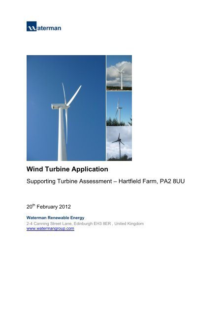
Wind Turbine Application<br />
<strong>Supporting</strong> Turbine Assessment – Hartfield Farm, PA2 8UU<br />
20 th February 2012<br />
Waterman Renewable Energy<br />
2-4 Canning Street Lane, Edinburgh EH3 8ER , United Kingdom<br />
www.watermangroup.com
Suppporting<br />
TTurbine<br />
Assessm A ment – Hartfield H Farm, PPA2<br />
8UU U<br />
Client NName:<br />
Inte elligent Landd<br />
Investmen nts (Renewable<br />
Energyy)<br />
Document<br />
Refereence:<br />
CIV V12920/Harttfield<br />
Farm/ /STA/A01<br />
Projectt<br />
Number: CIV V12920<br />
Quality Assurance – Approval Status<br />
This doccument<br />
hass<br />
been prep pared and checked<br />
in accordance<br />
a with Waterrman<br />
Group p’s<br />
IMS (BSS<br />
EN ISO 9001:<br />
2008 and a BS EN ISO 14001:<br />
2004)<br />
Issue<br />
A01<br />
Commeents<br />
Commeents<br />
Our Maarkets<br />
Datee<br />
Prep pared by<br />
17/002/12<br />
SB AD A<br />
Properrty<br />
& Buildiings<br />
Trans sport &<br />
Infras structure<br />
Che ecked by<br />
BP<br />
Appproved<br />
by y<br />
MBB<br />
Ene ergy & Utili ities EEnvironmen<br />
nt
Disclaimer<br />
This report is for the private and confidential use of the client who is defined within the report, and for whom it was<br />
prepared for the purposes requested by the client. It should not be reproduced in whole or in part or relied upon by<br />
any third party for any use whatsoever without the express written authority of Waterman Group.
Content<br />
1. Introduction .......................................................................................................................................... 1<br />
1.1 Background ............................................................................................................................... 1<br />
1.2 The Application ......................................................................................................................... 1<br />
1.3 The Applicant ............................................................................................................................ 2<br />
1.4 General Turbine Specifications ................................................................................................. 2<br />
1.5 <strong>Supporting</strong> <strong>Documentation</strong> ....................................................................................................... 2<br />
2. Site Information and Planning Assessment ..................................................................................... 3<br />
2.1 Site and Environment ................................................................................................................ 3<br />
2.2 Designation Review/Ecology .................................................................................................... 4<br />
2.2.1 Designation Review .................................................................................................................. 4<br />
2.2.2 General Ecology ....................................................................................................................... 4<br />
2.2.2.1 Summary ................................................................................................................................... 8<br />
2.2.3 Ornithology ................................................................................................................................ 8<br />
2.3 Local Plan Policy ..................................................................................................................... 10<br />
3. Technical Assessment ...................................................................................................................... 12<br />
3.1 Site Topography ...................................................................................................................... 12<br />
3.2 Geology and Hydrogeology .................................................................................................... 12<br />
3.3 Hydrology ................................................................................................................................ 13<br />
3.4 Forestry ................................................................................................................................... 13<br />
3.5 Archaeology ............................................................................................................................ 14<br />
3.6 Visibility ................................................................................................................................... 16<br />
3.6.1 Zone of Theoretical Visibility ................................................................................................... 16<br />
3.6.2 Viewpoints ............................................................................................................................... 16<br />
3.6.3 Visualisations .......................................................................................................................... 16<br />
3.7 Noise Sensitive Receptors ...................................................................................................... 17<br />
3.8 Vibration .................................................................................................................................. 18<br />
3.9 Shadow Flicker........................................................................................................................ 18<br />
3.10 Main Infrastructure .................................................................................................................. 19<br />
3.10.1 Transport ................................................................................................................................. 19<br />
3.10.2 Access ..................................................................................................................................... 20<br />
3.10.3 Method Statement ................................................................................................................... 20<br />
3.10.4 Right of Way ............................................................................................................................ 21<br />
3.11 Aviation/NATS/MOD & Telecommunication ........................................................................... 21<br />
3.11.1 Aviation/NATS/MOD ............................................................................................................... 21<br />
3.11.2 Telecommunications ............................................................................................................... 23<br />
3.12 Cumulative Impact .................................................................................................................. 23<br />
3.12.1 Regional .................................................................................................................................. 23<br />
3.12.2 Local ........................................................................................................................................ 25<br />
3.13 Turbine Location ..................................................................................................................... 25<br />
Waterman Group, Renewable Energy, 2/4 Canning Street Lane, Edinburgh, EH3 8ER T:0131 221 7020<br />
K:\Projects\CIV12920_ILI Windfarms_Batch 7\CIV12920_XXX_Hartfield<br />
Farm\Documents\Reports\CIV12920_1202xx_Hartfield_<strong>Supporting</strong> Turbine Assessment_225kW.docx
3.14 Wind Resource Assessment ................................................................................................... 26<br />
3.15 Electrical Grid Connection Assessment .................................................................................. 27<br />
3.16 Health and Safety ................................................................................................................... 27<br />
3.17 Maintenance ............................................................................................................................ 28<br />
3.18 Decommissioning .................................................................................................................... 28<br />
4. Wider Environmental, Social Benefits ............................................................................................. 29<br />
5. Summary ............................................................................................................................................ 30<br />
Figures<br />
Figure 1: Site Location Plan ..................................................................................................................... 1<br />
Figure 2: Site Location Plan ..................................................................................................................... 3<br />
Figure 3: SEPA Flood Map .................................................................................................................... 13<br />
Figure 4: Location of National Monuments ............................................................................................ 14<br />
Figure 5: Turbine Access ....................................................................................................................... 20<br />
Figure 6: Turbine Location ..................................................................................................................... 26<br />
Tables<br />
Table 1: Protected Species ..................................................................................................................... 6<br />
Table 2: National Monument Details ..................................................................................................... 15<br />
Table 3: Primary Surveillance Radar .................................................................................................... 22<br />
Table 4: Operational Wind Farms ......................................................................................................... 24<br />
Table 5: Wind Farms Under Construction ............................................................................................. 24<br />
Table 6: Consented Projects ................................................................................................................. 25<br />
Table 7: Projects in Planning ................................................................................................................ 25<br />
Table 8: RenewableUK Windspeed Data for NS4258 .......................................................................... 27<br />
Table 9: Predicted Cost Including 25yrs Inflation Allowance ................................................................ 28<br />
Appendices<br />
A. Site Location Plans<br />
B. Planning Application Boundary<br />
C. Local Environmental Constraints<br />
D. Turbine Location and Site Constraints<br />
E. Proposed Transport Route<br />
F. Typical Turbine Details<br />
G. Viewpoints & Visualisation<br />
H. Hub and Blade Tip - Zone of Theoretical Visibility<br />
I. Primary Surveillance Radar (PSR), Line-of-Sight<br />
J. Plan of Developments within 30km of the Site<br />
Waterman Group, Renewable Energy, 2/4 Canning Street Lane, Edinburgh, EH3 8ER T:0131 221 7020<br />
K:\Projects\CIV12920_ILI Windfarms_Batch 7\CIV12920_XXX_Hartfield<br />
Farm\Documents\Reports\CIV12920_1202xx_Hartfield_<strong>Supporting</strong> Turbine Assessment_225kW.docx
1. Introduction<br />
1.1 Background<br />
Hartfield Farm, PA2 8UU (NS437579) is located approximately 3.6km Southwest from Paisley in<br />
<strong>Renfrewshire</strong>. The application site bounds a gently sloping hill, rising from a ground level of approximately<br />
185m above ordnance datum (AOD) in the North with the hillside rising up to a level of approximately<br />
220m AOD in the centre of the site. The site lies in an area of grazing land.<br />
Figure 1: Site Location Plan<br />
OS Map Data<br />
1.2 The Application<br />
The proposal is for the erection of a single mono pole 45.9m high (to blade tip) mast with a 27m blade<br />
diameter. The supporting tower would be painted grey or a colour suitable to the local planning authority.<br />
The proposed turbine location is approximately 866m northwest from the B775 at an elevated position of<br />
approximately 12m to the road. The nearest third party property is approximately 420m from the proposed<br />
turbine location. The reservoir at Caplaw Dam is located approximately 786m to the East of the proposed<br />
turbine location. The electricity produced will be connected to the national grid to allow Scotland to meet<br />
its climate change obligations and meet the government’s renewable energy targets.<br />
Waterman Group, Renewable Energy, 2/4 Canning Street Lane, Edinburgh, EH3 8ER T:0131 221 7020<br />
1<br />
K:\Projects\CIV12920_ILI Windfarms_Batch 7\CIV12920_XXX_Hartfield<br />
Farm\Documents\Reports\CIV12920_1202xx_Hartfield_<strong>Supporting</strong> Turbine Assessment_225kW.docx
1.3 The Applicant<br />
Intelligent Land Investments Renewable Energy (ILI RE) structure a business strategy which puts the<br />
landowners and the environment first. The reason for their growth over the years has been putting the<br />
landowner, local authority, consultant and local community partnership at the heart of that process.<br />
Presently ILI RE is working alongside set government strategies to encourage the growth for single rural<br />
turbines. This is an opportunity like no other for landowners and local communities to play their part in<br />
making the government strategy become reality. The Government believes that Scotland could become<br />
the "hi-tech workshop of the world" driven by a green energy revolution and Intelligent Land Investments<br />
is set to help achieve these targets.<br />
1.4 General Turbine Specifications<br />
• A single wind turbine is planned with a maximum tip height of 45.9m.<br />
• The turbine is predicted to generate around 0.59 GWh per year, enough power to displace<br />
about 254 tonnes of CO2 per annum.<br />
• The turbine is positioned along a field boundary to minimise the amount of productive<br />
farmland lost, and is as far away from houses as possible.<br />
• The construction period will be relatively short, minimising any traffic disruption. The main<br />
impact on the roads will be bringing in stone for the hard standing area and concrete for the<br />
foundations. Turbines generally re-pay the energy used in their manufacture and<br />
installation in about 6 – 8 months.<br />
• These turbines are relatively quiet, according to manufacturer’s guidelines, and noise<br />
levels experienced at nearby residencies will be minimal, the background noise effectively<br />
masking that produced by the turbine.<br />
• Further technical information is available from; Waterman Group, Tel: 0131 221 7020.<br />
1.5 <strong>Supporting</strong> <strong>Documentation</strong><br />
Waterman provide civil, structural, environmental, mechanical & electrical design services to our clients in<br />
support of project planning, design, construction and management.<br />
As the demand for renewable power increases we face the challenge of meeting this demand whilst<br />
creating sustainable solutions. We provide pre-planning advice on site-selection and assist throughout<br />
the planning.<br />
Waterman takes the lead in delivering environmentally sustainable solutions and our specialist<br />
understanding of planning issues that include environmental solutions, transportation planning, land<br />
engineering and hydrology help clients to deliver plans that achieve approval, and make concept become<br />
reality.<br />
Waterman Group, Renewable Energy, 2/4 Canning Street Lane, Edinburgh, EH3 8ER T:0131 221 7020<br />
2<br />
K:\Projects\CIV12920_ILI Windfarms_Batch 7\CIV12920_XXX_Hartfield<br />
Farm\Documents\Reports\CIV12920_1202xx_Hartfield_<strong>Supporting</strong> Turbine Assessment_225kW.docx
2. Site Information and Planning Assessment<br />
2.1 Site and Environment<br />
The plan below illustrates the area of land ownership of the Farm, consisting of 37 fields with a combined<br />
site area of 258.58 hectares.<br />
Figure 2: Site Location Plan<br />
Land Ownership Boundaries supplied by ILI<br />
The surrounding land use is agricultural, with plantation forestry approximately 881m to the Southeast of<br />
the proposed turbine location. Caplaw Dam Reservoir is located approximately 786m the East from the<br />
proposed turbine location, with Old Patrick Water located approximately 831m to the Southeast were it<br />
feeds the Caplaw Dam Reservoir. There is also a small drainage channel to the Northwest. To the<br />
Northeast is a large electricity substation approximately 2.5km away, with seven high voltage lines and<br />
associated high rise pylons heading to the South and Southeast, and two further high voltage lines<br />
heading to the Northwest. Further to the Northeast, is Gleniffer Braes Country Park. There are numerous<br />
telecommunications masts in the area.<br />
Waterman Group, Renewable Energy, 2/4 Canning Street Lane, Edinburgh, EH3 8ER T:0131 221 7020<br />
3<br />
K:\Projects\CIV12920_ILI Windfarms_Batch 7\CIV12920_XXX_Hartfield<br />
Farm\Documents\Reports\CIV12920_1202xx_Hartfield_<strong>Supporting</strong> Turbine Assessment_225kW.docx
2.2 Designation Review/Ecology<br />
2.2.1 Designation Review<br />
The adopted <strong>Renfrewshire</strong> Local Plan identifies the area of Hartfield Farm as outside a settlement<br />
boundary. There are no designated Housing Areas within the site boundary or in close proximity.<br />
Scottish Natural Heritage has not designated the site as having landscape, recreation, biodiversity or<br />
earth science interest. Hartfield Farm is not within the following designated sites; Site of Special Scientific<br />
Interest (SSSI), Special Area of Conservation (SAC), Special Protection Area (SPA), Ramsar Site,<br />
National Scenic Area (NSA), National Nature Reserve, National Park, or Local Nature Reserve. See<br />
Appendix C for Local Environmental Constraints.<br />
A local nature reserve is located at Durrockstock Park within Paisley. The closest SSSI is Loch Libo,<br />
located North of Uplawmoor, over 3km away. Caplaw Dam is identified within the <strong>Renfrewshire</strong> Local<br />
Plan Map A of Rural Areas as a Site of Importance for Nature Conservation (SINC). Areas to the<br />
northwest, West of Mid Hartfield and North of Whittliemuir Midton Loch are also identified as SINCs. The<br />
SINC bounds the site to the northwest and appears to enclose the northern most field of the farm. The<br />
proposed turbine location is outside the areas designated as SINCs. Caplaw Dam is used for recreational<br />
activities, and is adjacent to Lapwing Lodge activity centre and campsite. The site and the surrounding<br />
area is not identified as a Special Protection Area. The site is identified as Greenbelt within the<br />
<strong>Renfrewshire</strong> Local Plan Map A Rural Area and therefore, Renewable Energy Proposals should be<br />
compatible with Policy POLICY GB1: Green Belt and POLICY Ren1.<br />
It is noted that there may be habitats suitable for protected species due to the site’s undeveloped nature<br />
and the presence of open ground and watercourses. There may also be species present which are<br />
ascribed action plans within the Local Biodiversity Action Plan. However, being located within a field and<br />
owing to the distance the proposed turbine location is from watercourses, it is assumed that many<br />
species would not be directly affected by the development.<br />
The positioning of the wind turbine has taken account of the local designations and avoided areas of<br />
special scientific interest and high wildlife value. In accordance with the national planning policy guidance<br />
the chosen location will still allow the land to be worked and allow scenic values to be maintained. The<br />
proposed turbine with a hub height of 32.4m and a tip height of 45.9m is modest in comparison to<br />
operational wind farm developments. It has considerably reduced visual impact, being in many cases less<br />
than half the size of operational turbines in large wind farms. See Section 3.12 for descriptions of<br />
operational wind farms. The site is outside the search areas designated for significant wind farms as<br />
identified in the Glasgow and the Clyde Valley Structure Plan 2006.<br />
The proposal is supported from the Scottish Government’s stated commitment to increase the amount of<br />
electricity generated from renewable sources, which it sees as a vital part of its response to climate<br />
change. Scottish Planning Policy (SPP) indicates that the current objective for 50% of Scotland’s<br />
electricity to be generated from renewable sources by 2020 is a target, and not a cap. It is expected that<br />
onshore wind power will continue to be the main sources of renewable energy supplies.<br />
2.2.2 General Ecology<br />
A desktop survey of available information and a walkover of the site have been undertaken as part of this<br />
report to carry out a preliminary assessment of the ecology in the area.<br />
As part of any planning application, it is suggested that a review of possible protected and/or notable<br />
species is carried out to analyse the possible effect of erecting a turbine at a proposed location. There are<br />
Waterman Group, Renewable Energy, 2/4 Canning Street Lane, Edinburgh, EH3 8ER T:0131 221 7020<br />
4<br />
K:\Projects\CIV12920_ILI Windfarms_Batch 7\CIV12920_XXX_Hartfield<br />
Farm\Documents\Reports\CIV12920_1202xx_Hartfield_<strong>Supporting</strong> Turbine Assessment_225kW.docx
a large number of wildlife species which are protected in Scotland and they should be identified and<br />
included in any ecological assessment of an area. Many are protected under one or more of a number of<br />
key pieces of legislation which cover protected species, with further legislation also in place for the<br />
increased protection of certain species.<br />
The Habitats Directive was drawn up to help in the protection of Europe’s nature. To implement this<br />
European legislation, the Habitat Regulations 1994 (as amended in Scotland) were drawn up to ensure<br />
that the species listed under the above directive, in Annex IV, were protected adequately in Scotland.<br />
These are namely European Protected Species such as otters, bats and wild cats. However, the<br />
regulations also encompass protected plants and other species. These regulations ensure that species<br />
onshore and those living in inshore waters are protected, if listed under the above directive. The<br />
regulations are applicable in Scotland only and therefore, do not mirror the regulations in England and<br />
Wales.<br />
The Habitats Regulations, also known as The Conservation (Natural Habitats &c) Regulations 1994 are<br />
made up of a number of schedules including:<br />
• Schedule 2 – ensures the protection of European Protected Species of animals<br />
• Schedule 3 – ensures the protection of those animals in Annex V of the Habitats and Species<br />
Directive whose natural range includes Great Britain<br />
• Schedule 4 – ensures the protection of European Protected Species of plants.<br />
Under the above regulations for European Protected Species, it is an offence, except as permitted under<br />
the Regulations, to deliberately or recklessly:<br />
• Capture, injure, or kill a wild animal of a European Protected Species;<br />
• Harass an animal or group of animals;<br />
• Disturb such an animal while it is rearing or otherwise caring for its young;<br />
• Obstruct access to a breeding site or resting place, or otherwise deny the animal use of the<br />
breeding site or resting place;<br />
• Disturb such an animal while it is occupying a structure or place used for shelter or protection;<br />
• Disturb such an animal in a manner that is, or in circumstances which are, likely to significantly<br />
affect the local distribution or abundance of the species to which it belongs;<br />
• Disturb such an animal in a manner that is, or in circumstances which are, likely to impair its<br />
ability to survive, breed, or reproduce, or rear or otherwise care for its young;<br />
• Take or destroy the eggs of such an animal;<br />
• Damage, or destroy a breeding site or resting place of such an animal.<br />
If disturbance of a European Protected Species is necessary, a licence for the activity is likely to be<br />
needed which is sought from the Scottish Government or Scottish Natural Heritage (SNH).<br />
SNH provide a search tool for locating species in an area. Table 2 below indicates those which have been<br />
recorded in the area since the 1960s. It should be noted that this database is not completely up to date and so<br />
the table below gives merely an indication of what could be on the site.<br />
Waterman Group, Renewable Energy, 2/4 Canning Street Lane, Edinburgh, EH3 8ER T:0131 221 7020<br />
5<br />
K:\Projects\CIV12920_ILI Windfarms_Batch 7\CIV12920_XXX_Hartfield<br />
Farm\Documents\Reports\CIV12920_1202xx_Hartfield_<strong>Supporting</strong> Turbine Assessment_225kW.docx
Otters<br />
SPECIES LOCATION<br />
EUROPEAN OTTER CAPLAW DAM 1993<br />
DAUBENTONS BAT ACROSS THE AREA 1960<br />
PIPISTRELLE ACROSS THE AREA 1960<br />
LONG EARED BAT SPECIES ACROSS THE AREA 1960<br />
SOPRANO PISTRELLE GLENNIFER ROAD 2005<br />
EUROPEAN WATER VOLE ACROSS THE AREA 1960<br />
EURASIAN COMMON SHREW ACROSS THE AREA 1960<br />
EURASIAN PYGMY SHREW ACROSS THE AREA 1960<br />
EURASIAN WATER SHREW ACROSS THE AREA 1960<br />
WEST EUROPEAN<br />
HEDGEHOG<br />
ACROSS THE AREA 1965<br />
MOUNTAIN HARE ACROSS THE AREA 1965<br />
BROWN HARE ACROSS THE AREA 1965<br />
EURASIAN BADGER ACROSS THE AREA 1960<br />
EURASIAN RED SQUIRREL ACROSS THE AREA 1990<br />
COMMON FROG ACROSS THE AREA 1975<br />
COMMON TOAD ACROSS THE AREA 1975<br />
SMOOTH NEWT ACROSS THE AREA 1975<br />
PALMATE NEWT ACROSS THE AREA 1975<br />
GREAT CRESTED NEWT ACROSS THE AREA 1960<br />
SLOW WORM ACROSS THE AREA 1975<br />
ADDER ACROSS THE AREA 1975<br />
COMMON LIZARD ACROSS THE AREA 1975<br />
Table 1: Protected Species<br />
LATEST<br />
SIGHTING<br />
Source: Extracts from Scottish Natural Heritage Species Sighting Tool 2010<br />
Otters are a European Protected Species and so are protected under Schedule 2 of the Habitat<br />
Regulations 1994 (as amended in Scotland). If a development is likely to involve activities which could<br />
lead to an offence under the above regulations, then it is advisable to seek further information from SNH<br />
and it is likely a licence will be required. However, licences will only be given for certain activities and<br />
consultation should be sought from SNH to ascertain if a particular activity is possible and if a licence will<br />
be needed.<br />
As the proposed turbine is located in an open field approximately 786m from Caplaw Dam it is unlikely<br />
that otters will be found in close proximity to the sit.<br />
Waterman Group, Renewable Energy, 2/4 Canning Street Lane, Edinburgh, EH3 8ER T:0131 221 7020<br />
6<br />
K:\Projects\CIV12920_ILI Windfarms_Batch 7\CIV12920_XXX_Hartfield<br />
Farm\Documents\Reports\CIV12920_1202xx_Hartfield_<strong>Supporting</strong> Turbine Assessment_225kW.docx
Bats<br />
Bats are a European Protected Species and so are protected under Schedule 2 of the Habitat<br />
Regulations 1994 (as amended in Scotland). If a development is likely to involve activities which could<br />
lead to an offence under the above regulations, then it is advisable to seek further information from SNH<br />
and it is likely a licence will be required. However, licences will only be given for certain activities and<br />
consultation should be sought from SNH to ascertain if a particular activity is possible and if a licence will<br />
be needed.<br />
As the proposed turbine location is located in an open area with few buildings and trees in close<br />
proximity, it is unlikely that bats will be found in the area.<br />
Water Voles and other Shrew Species<br />
These mammals are protected under Schedule 5 of the Wildlife and Countryside Act 1981 as amended.<br />
In Scotland, they only have partial protection and shrews are only protected against certain types of<br />
trapping. killing methods.<br />
As the proposed turbine location is located approximately 831m from a watercourse (Old Patrick Water)<br />
and approximately 786m away from Caplaw Dam it is unlikely that water voles will be present. In addition,<br />
as the site is in quite an open area with few woodland areas or hedgerows in close proximity, it is unlikely<br />
that shrews will be found in the area.<br />
Badgers<br />
Badgers are protected under the Protection of Badger’s Act 1992 as amended. This Act states that<br />
licences are only available to developers to “interfere with a badger set” if it is for development. It is not<br />
permitted for “removal, translocation or killing of badgers” for the purposes of development. It is<br />
suggested that if a development is likely to be within 30m of a sett entrance, then further information be<br />
sought from SNH and a licence is likely to be required.<br />
As the proposed turbine location is located in an open area, away from woodland it is unlikely that<br />
badgers will be present. No specific sitings of badgers have been recorded locally by SNH.<br />
Red Squirrels<br />
Red Squirrels are protected under Schedule 5 of the Wildlife and Countryside Act 1981 as amended and<br />
the Nature Conservation (Scotland) Act 2004. In addition, in 2007 the species was added to the Species<br />
Action Framework for Conservation Action which puts in place a number of practical measures to help<br />
conserve a species from dying out. Since then a number of other policies regarding Red Squirrels have<br />
also been past to ensure their survival as they are an endangered species in Scotland at present.<br />
As the proposed turbine location is located in an open area, away from woodland it is unlikely that red<br />
squirrels will be present.<br />
Wildcats<br />
Wildcats are a European Protected Species and so are protected under Schedule 2 of the Habitat<br />
Regulations 1994 (as amended in Scotland). If a development is likely to involve activities which could<br />
lead to an offence under the above regulations, then it is advisable to seek further information from SNH<br />
and it is likely a licence will be required. However, licences will only be given for certain activities and<br />
consultation should be sought from SNH to ascertain if a particular activity is possible and if a licence will<br />
be needed.<br />
Waterman Group, Renewable Energy, 2/4 Canning Street Lane, Edinburgh, EH3 8ER T:0131 221 7020<br />
7<br />
K:\Projects\CIV12920_ILI Windfarms_Batch 7\CIV12920_XXX_Hartfield<br />
Farm\Documents\Reports\CIV12920_1202xx_Hartfield_<strong>Supporting</strong> Turbine Assessment_225kW.docx
As the proposed turbine is located in an open area, away from woodland and moorland it is unlikely that<br />
wildcats will be present.<br />
Amphibians and Reptiles<br />
There are a large number of these creatures found across Scotland. Of all of the types found, Great<br />
Crested Newts, Natterjack Toads, Sand Lizards, and all Marine Turtles are designated as European<br />
Protected Species and so are protected under Schedule 2 of the Habitat Regulations 1994 (as amended<br />
in Scotland). Therefore, if a development is likely to disturb or endanger any of these specific species, a<br />
licence is likely to be required.<br />
The proposed turbine location is located in a field approximately 316m away watercourse it is unlikely that<br />
the above named species will be present.<br />
Non-native Invasive Plant Species<br />
Japanese Knotweed is a Schedule 9 Species, on the Wildlife and Countryside Act 1981 as amended and<br />
it is an offence to introduce or cause this species to spread in the wild. It is easily spread by parts of the<br />
root or stem and its root systems can spread to a distance of up to 7m from the plant.<br />
SNH have not recorded Japanese Knotweed in the area and a site walkover failed to record any in the<br />
proposed area of works or nearby. In addition, it is unlikely to be found in open field areas such as that<br />
used for the proposed turbine. Should it be identified at the site of the proposed turbine during<br />
construction it will be eradicated and disposed of according to SNH and SEPA guidance. The expected<br />
method, should the plant be identified, would be to use a glyphosate based weed killer according to<br />
relevant guidance in consultation with SEPA. Should the plant be found near a watercourse, the range of<br />
herbicides available for use is restricted and written permission would need to be obtained from SEPA.<br />
Habitat Protection<br />
The turbine’s position is located within a field within Hartfield Farm, conserving field margin habitats<br />
maintained at the site. The construction access will border the field boundaries using previously used<br />
access where possible.<br />
2.2.2.1 Summary<br />
Overall, no sightings or evidence of the species listed was seen during the site visit.<br />
Given the unlikely potential for the species listed to be present on site we do not anticipate any further<br />
investigation required other than that detailed above.<br />
Based on guidance notes given by Scottish Natural Heritage – Protected Species<br />
http://www.snh.gov.uk/protecting-scotlands-nature/protected-species/<br />
2.2.3 Ornithology<br />
The Royal Society for the Protection of Birds (RSPB) considers climate change to be the biggest threat to<br />
birds and other wildlife; they believe that the development of wind power generation in the UK can be<br />
achieved in harmony with the natural environment rather than at the expense of it. Switching to green<br />
energy solutions such as wind powered electricity will minimise climate change and subsequently reduce<br />
the threat to birds. Therefore, with careful location of wind turbines and respect to sensitive bird species,<br />
wind turbines will have no significant adverse impact on bird populations or their habitat and will ultimately<br />
benefit birds.<br />
Waterman Group, Renewable Energy, 2/4 Canning Street Lane, Edinburgh, EH3 8ER T:0131 221 7020<br />
8<br />
K:\Projects\CIV12920_ILI Windfarms_Batch 7\CIV12920_XXX_Hartfield<br />
Farm\Documents\Reports\CIV12920_1202xx_Hartfield_<strong>Supporting</strong> Turbine Assessment_225kW.docx
Wind turbines can affect birds in four ways:<br />
1. Collision<br />
2. Displacement (due to disturbance)<br />
3. Barrier<br />
4. Habitat Loss<br />
The RSPB produced a Bird Sensitivity Map which aids the location of onshore wind turbine development<br />
in Scotland. This map is based on bird species of conservation concern and Special Protection Areas<br />
(SPA) and indicates where wind turbines are more likely to conflict with bird sensitivities.<br />
The proposed wind turbine site of Hartfield Farm appears to fall within an area of low sensitivity, which<br />
means that it is unlikely to be classed as sensitive to bird species. Further investigation as outlined below<br />
was deemed necessary to confirm this.<br />
BirdTrack, through a partnership between the BTO, the RSPB, Birdwatch Ireland and the Scottish<br />
Ornithologists' Club, is a system that looks at migration movements and distributions of birds throughout<br />
Britain and Ireland. BirdTrack provides facilities for observers to store and manage their own personal<br />
records as well as using these to support species conservation at local, regional, national and<br />
international scales. Area wide surveys identify which species can be present, demonstrate diversity and<br />
determine how sensitive an area might be to development. Information which pinpoints the specific or<br />
exact location of breeding rare birds is often protected.<br />
On checking the database for the NS45 10km tetrad, where regional data appropriate to the site can be<br />
identified, it indicated that during the current determination period there is a regional species diversity with<br />
a percentage (90%) of potentially present species recorded in the winter and at breeding times.<br />
On checking the database for grid reference NS45 10km tetrad, there is the possibility of a number of<br />
different species being found in the greater area based on previous studies and recordings made<br />
between 2007 and 2011 during which a total of 89 different species were identified. Common garden,<br />
grassland and water birds have been identified across this area. Protected and rare species identified in<br />
the greater area where Black Throated Diver, Brambling, Common Scooter, Hen Harrier, Jack Snipe,<br />
Smew, and Whooper Swan. On checking the database for grid reference NS4258 two species were<br />
identified in 2011, Brambling and Raven.<br />
The SNH search tool for locating protected species also provides information regarding bird species<br />
found in the surrounding area. A total of 66 different bird species were identified in the broader area from<br />
the Clyde Breeding Bird Tetrad Atlas 1985-1991 and Bird Conservation Targeting Project (BCTP) in the<br />
UK, 2005-2010 Sensitive Species winter sightings in the UK. These included Long-eared Owl, Short-<br />
eared Owl, Peregrine Falcon, Willow Ptarmigan and Skylark.<br />
Large survey areas of 10km wide tetrads would be expected to support a variety of different birds. The<br />
surveys indicate a relatively large diversity and therefor,e it is likely that the area may be deemed to be of<br />
medium sensitivity to bird species. However it is unlikely to be of high concern to important rare species.<br />
The RSPB website in 2011 states that ‘Switching to renewable energy now, rather than in ten or twenty<br />
years time, is essential if we are to stabilise levels of greenhouse gases in the atmosphere at safe levels.<br />
Wind power is the most advanced renewable technology available at a large scale during this time period.<br />
For this reason, the RSPB supports a significant growth in offshore and onshore wind power generation in<br />
the UK.’<br />
Waterman Group, Renewable Energy, 2/4 Canning Street Lane, Edinburgh, EH3 8ER T:0131 221 7020<br />
9<br />
K:\Projects\CIV12920_ILI Windfarms_Batch 7\CIV12920_XXX_Hartfield<br />
Farm\Documents\Reports\CIV12920_1202xx_Hartfield_<strong>Supporting</strong> Turbine Assessment_225kW.docx
To meet renewables targets, the RSPB has also stated ‘it favours a broad mix of renewables, including<br />
solar, wind, and marine power, wherever they are used in ways that minimise unnecessary damage to<br />
wildlife and the natural environment.’ The RSPB ‘particularly support solutions that enable individuals and<br />
communities to generate their own power close their homes and businesses.’ This single turbine proposal<br />
is compatible with these aims and the choice of proposed turbine location respects bird sensitivities.<br />
Extracts from the RSPB website http://www.rspb.org.uk/ (August – September 2011)<br />
2.3 Local Plan Policy<br />
2.3.1 <strong>Renfrewshire</strong> Local Plan<br />
POLICY Ren 1: Criteria for Assessing Proposals for Development of Renewable Energy Sources<br />
The <strong>Council</strong> is supportive of an increase in the proportion of electricity produced from renewable sources,<br />
but will require proposals for development of renewable energy sources to meet the following criteria:-<br />
(a) there is no unacceptable impact on the amenity of nearby residents, in terms of statutory air quality<br />
objectives, noise or other nuisances;<br />
(b) visual intrusion within the landscape in terms of scale, location, design, etc. has been minimised;<br />
(c) during the process leading to the selection of the proposed site, consideration was also given to<br />
alternative sites, and the selection of the proposed site can be justified;<br />
(d) the cumulative impact of the proposed development along with any other existing and approved<br />
similar developments will not lead to an unacceptable impact on the environment and amenity;<br />
(e) arrangements are in place to ensure restoration of the site to an acceptable<br />
Section 12 Renewable Energy of the <strong>Renfrewshire</strong> Local Plan, Wider Environmental Framework, notes in<br />
12.6 that ‘In seeking to accommodate renewable energy development, it is essential to ensure that this is<br />
not achieved at the expense of unacceptable damage to the environment and amenity. In addition, all of<br />
<strong>Renfrewshire</strong> is covered by the Glasgow Airport consultation zone for wind power. All proposals for wind<br />
turbines will therefore be considered under POLICY AIRPORT 4.<br />
POLICY AIRPORT 4: Airport Safeguarding Areas<br />
The <strong>Council</strong> will refer planning applications located within designated airport safeguarding areas, as<br />
identified on safeguarding plans which are reviewed on occasion by the Civil Aviation Authority or<br />
appropriate body, to the appropriate authority and will refuse consent where airport or aircraft safety is<br />
considered to be compromised. The <strong>Council</strong> will similarly refer development proposals which are<br />
considered likely to be in conflict with the operation of the airport’s aerial approach and departure routes.<br />
Response to Local Plan Policy POLICY Ren 1:<br />
The application for the proposed turbine includes information in response to Policy REN 1 in regard to the<br />
impact on amenity, visual intrusion, site selection, cumulative impact, impact on the environment and<br />
restoration. These are included within Section 3 Technical Appraisal.<br />
Waterman Group, Renewable Energy, 2/4 Canning Street Lane, Edinburgh, EH3 8ER T:0131 221 7020<br />
10<br />
K:\Projects\CIV12920_ILI Windfarms_Batch 7\CIV12920_XXX_Hartfield<br />
Farm\Documents\Reports\CIV12920_1202xx_Hartfield_<strong>Supporting</strong> Turbine Assessment_225kW.docx
The proposed development is for a single turbine which has a tip height of 45.9m and is of reduced size<br />
and capacity in comparison to turbines currently installed within wind farms which may have tip heights of<br />
100m-120m. It consequently has reduced visual impact. The effect of visual impact is discussed within<br />
Section 3.6 and turbine visualisations have been prepared and are contained within the Appendices.<br />
Noise levels are described within Section 3.7 as is the effect of shadow flicker in Section 3.9. Associated<br />
separation distances are graphically displayed in the Appendices.<br />
The proposed development is sympathetic to its environment and there will be no significant,<br />
unacceptable adverse impact, or adverse cumulative impact from the development. Its size and capacity<br />
are suited for community wind energy projects and farm diversification. Farming can continue at the<br />
proposed site and the proposal is compatible with encouraging diversification among the farming<br />
community in rural <strong>Renfrewshire</strong>.<br />
POLICY ENV 3: Local Designations: Sites of Importance for Nature Conservation (SINCs)<br />
The <strong>Council</strong> will protect and where possible enhance SINCs, and, where appropriate, promote links<br />
between SINCs which will act as wildlife corridors. However, the <strong>Council</strong> recognises that some of the<br />
identified SINCs coincide with sites which are regarded as being suitable for development through Local<br />
Plan policies and where there is a presumption in favour of development. Development proposals for<br />
sites covered by the SINC designation will be assessed, therefore, against the following criteria.<br />
(a) The social and economic benefits of the development proposal.<br />
(b) Any adverse impact on the nature conservation interest of the site being acceptable to the <strong>Council</strong>.<br />
(c) The provision of satisfactory compensatory nature conservation benefits. The above would also apply<br />
to SINCs identified and approved in the future by the <strong>Council</strong>.<br />
Response to ENV 3<br />
Land to the North of Hartfield Farm and Caplaw Dam contain areas identified as SINCs. The proposed<br />
turbine location will be microsited to be outside such designated areas. The proposed turbine will be<br />
microsited in response to the need to protect the habitat within the SINC. The access road will not cross<br />
the SINC.<br />
The proposed development is sympathetic to its environment and there will be no significant,<br />
unacceptable adverse impact, or adverse cumulative impact from the development. Its size and capacity<br />
are suited for community wind energy projects and farm diversification. Farming can continue at the<br />
proposed site and the proposal is compatible with encouraging diversification among the farming<br />
community in rural East <strong>Renfrewshire</strong>, in accordance with the East <strong>Renfrewshire</strong> Rural Development<br />
Strategy 2008 - 2013.<br />
POLICY GB1: Green Belt<br />
The <strong>Council</strong> will protect the Glasgow & the Clyde Valley Green Belt within <strong>Renfrewshire</strong> as defined on the<br />
Proposals Map. Acceptable forms of development in the Green Belt will be limited to those falling into the<br />
categories 1 to 13.<br />
Category 13, Renewable Energy Developments, will be subject to provisions of POLICY Ren1.<br />
Waterman Group, Renewable Energy, 2/4 Canning Street Lane, Edinburgh, EH3 8ER T:0131 221 7020<br />
11<br />
K:\Projects\CIV12920_ILI Windfarms_Batch 7\CIV12920_XXX_Hartfield<br />
Farm\Documents\Reports\CIV12920_1202xx_Hartfield_<strong>Supporting</strong> Turbine Assessment_225kW.docx
3. Technical Assessment<br />
3.1 Site Topography<br />
The application site bounds a gently sloping hill, rising from a ground level of approximately 185m above<br />
ordnance datum (AOD) in the North with the hillside rising up to a level of approximately 220m AOD in the<br />
centre of the site. A drainage channel is present in the North with the ground described as boggy in OS<br />
Map close to what was described as Whittliemuir Midton Loch.<br />
It appears unlikely that there will be any significant development constraints linked to site topography, and<br />
these works would be classed as common civil and structural engineering issues which are controlled by<br />
Planning Policy Guidelines (PPG).<br />
3.2 Geology and Hydrogeology<br />
The British Geological Survey 1:50,000 scale (solid and drift) map indicates that the site is underlain by<br />
Devensian Till. Till (Boulder Clay) is usually described as a heterogeneous mixture of stiff to hard clay,<br />
sand, gravel and boulders varying widely in size and shape.<br />
Superficial deposits are underlain by Clyde Plateau Volcanic Formation of Strathclyde Group. Clyde<br />
Plateau Volcanic Formation comprises of lavas, tuffs and volcaniclastic sedimentary rocks with a wide<br />
range of compositions. These are mainly basaltic and trachytic rocks.<br />
Given the geology of the site, it is unlikely that any past mineral extraction has taken place beneath the<br />
site. From the information currently available to the Coal Authority, a mining report is not required for this<br />
site.<br />
The superficial deposits would be classified as a locally important aquifer. BGS Hydrogeological Map of<br />
Scotland indicates that the site is in a region underlain by impermeable rocks, generally without<br />
groundwater, except at shallow depth.<br />
In conclusion, no significant geological or hydrogeological constraints have been identified for this site,<br />
and therefore, pose no constraint to development<br />
Waterman Group, Renewable Energy, 2/4 Canning Street Lane, Edinburgh, EH3 8ER T:0131 221 7020<br />
12<br />
K:\Projects\CIV12920_ILI Windfarms_Batch 7\CIV12920_XXX_Hartfield<br />
Farm\Documents\Reports\CIV12920_1202xx_Hartfield_<strong>Supporting</strong> Turbine Assessment_225kW.docx
3.3 Hydrology<br />
An examination of the SEPA indicative flood map for the site indicates that the site is unlikely to be at risk<br />
of flooding. The proposed turbine site is located outside the indicative flood plains of Old Patrick Water.<br />
Figure 3: SEPA Flood Map<br />
Extract of SEPA Flood Map<br />
It is anticipated that the development will have no impact on the watercourses or groundwater. The<br />
contractor will follow all planning policy guidelines in relation to pollution control as outlined by SEPA.<br />
The turbine and access roads will not have any positive drainage proposals and therefore will provide<br />
Greenfield runoff and be designed in accordance with planning guidelines and SEPA recommendations.<br />
Ensuring the above notes are taken in to account the proposed development will present no hydrological<br />
constraints.<br />
3.4 Forestry<br />
No significant constraints are expected as there are no areas of forestry identified on the site which are<br />
likely to be affected by the proposed turbine. Should additional screening be necessary, it would be<br />
possible to extend this natural effect by planting within the site boundaries.<br />
Waterman Group, Renewable Energy, 2/4 Canning Street Lane, Edinburgh, EH3 8ER T:0131 221 7020<br />
13<br />
K:\Projects\CIV12920_ILI Windfarms_Batch 7\CIV12920_XXX_Hartfield<br />
Farm\Documents\Reports\CIV12920_1202xx_Hartfield_<strong>Supporting</strong> Turbine Assessment_225kW.docx
3.5 Archaeology<br />
An examination of the Pastmap website indicates no scheduled ancient monuments within the site<br />
boundary. There are however, several entries on the National Monuments Record of Scotland, outside<br />
the site boundary, as stated in Table 2 below:<br />
Figure 4: Location of National Monuments<br />
Pastmap<br />
Waterman Group, Renewable Energy, 2/4 Canning Street Lane, Edinburgh, EH3 8ER T:0131 221 7020<br />
14<br />
K:\Projects\CIV12920_ILI Windfarms_Batch 7\CIV12920_XXX_Hartfield<br />
Farm\Documents\Reports\CIV12920_1202xx_Hartfield_<strong>Supporting</strong> Turbine Assessment_225kW.docx
SITE NUMBER SITE NAME CLASS<br />
NS45NW.1.- WALLS HILL NS 4117058800<br />
NS45NW.6.-<br />
NS45NW.7.7<br />
NS45NW.7.8<br />
NS45NW.7.1<br />
NS45NW.7.2<br />
NS45NW.7.3<br />
NS45NW.7.4<br />
NS45NW.7.5<br />
NS45NW.7.6<br />
WHITTLIEMUIR MIDTON LOCH<br />
NS 41455922<br />
WHITTLIEMUIR MIDTON LOCH<br />
NS 41845864<br />
WHITTLIEMUIR MIDTON LOCH<br />
NS 4170 5918<br />
WHITTLIEMUIR MIDTON LOCH,<br />
NORTH DAM NS 4170 5918<br />
WHITTLIEMUIR MIDTON LOCH, WEST<br />
DAM NS 4156 5893<br />
WHITTLIEMUIR MIDTON LOCH<br />
NS 4191 5868<br />
WHITTLIEMUIR MIDTON LOCH<br />
NS 4179 5858<br />
WHITTLIEMUIR MIDTON LOCH<br />
NS 4170 5918<br />
WHITTLIEMUIR MIDTON LOCH<br />
NS 4163 5868<br />
Table 2: National Monument Details<br />
Source: Extracts from Pastmap Search Tool<br />
FORT, FLAKE (FLINT), UNIDENTIFIED<br />
POTTERY (IRON AGE)<br />
FARMSTEAD, FIELD SYSTEM(S), MIDDEN<br />
(POSSIBLE)<br />
STONE HEAP(S)<br />
STONE HEAP<br />
Waterman Group, Renewable Energy, 2/4 Canning Street Lane, Edinburgh, EH3 8ER T:0131 221 7020<br />
15<br />
K:\Projects\CIV12920_ILI Windfarms_Batch 7\CIV12920_XXX_Hartfield<br />
Farm\Documents\Reports\CIV12920_1202xx_Hartfield_<strong>Supporting</strong> Turbine Assessment_225kW.docx<br />
DAM<br />
DAM<br />
ROAD<br />
STRUCTURE<br />
DAM (POSSIBLE), ROAD (POSSIBLE)<br />
STONE HEAP(S)<br />
Balgray Barn and Balgray Cottage are Category B and C(S) listed buildings respectively. Old maps,<br />
namely the 1863-1964 <strong>Renfrewshire</strong> 1:10,560, show Whittliemuir Dam and Hartfield Farm.<br />
Potential issues may comprise disturbance or destruction of sub-surface archaeological deposits as a<br />
result of turbine construction and enabling works. The above sites have been considered when<br />
positioning the turbine so are therefore, unlikely to be affected by its construction. In relation to<br />
archaeology we therefore, do not anticipate the need for any further investigation at the proposed site<br />
location; however should archaeological features be found on site during construction, a detailed site<br />
survey will be carried out in accordance with Planning Policy Statement 5 (PPS 5) and other relevant<br />
Scottish Planning Policies, such as Scottish Historic Environment Policy (SHEP), Scottish Planning Policy<br />
(SPP) and Planning Advice Note 2/2011 (PAN 2/2011), as well as other relevant Local <strong>Council</strong> Policies.<br />
In addition, if thought necessary by the council and archaeological services, the client is prepared to<br />
engage an archaeological organisation, approved by the council, to carry out an archaeological watching<br />
brief throughout all ground disturbance activities. They will be given access at reasonable times and<br />
allowed to record, recover and report any items of interest and finds.
3.6 Visibility<br />
Visual analysis of the proposed development is carried out in three stages:<br />
1. Zone of Theoretical Visibility<br />
2. Viewpoints<br />
3. Visualisations<br />
3.6.1 Zone of Theoretical Visibility<br />
The Zone of Theoretical Visibility (ZTV) identifies where the proposed wind turbine can theoretically be<br />
seen and gives a good indication of the broad area this visibility extends too. The ZTV represents visibility<br />
as though the ground surface was bare, not considering screening from trees, buildings etc. The earth<br />
curvature and refraction of light affect the visibility over a great distance. This was not calculated during<br />
the ZTV for the farm which means the visibility will be over calculated.<br />
As recommended, in the SNH Visual Representation of Wind Farm report, for a turbine height of 45.9m to<br />
the tip, the ZTV distance of 15km was used from the centre of the turbine. The target height (turbine) was<br />
taken to be centred over the base of the wind turbine. The Hub and Blade Tip Zone of Theoretical<br />
Visibility map is shown in Appendix H. Visibility is constrained from the North East and South of the<br />
turbine. Potential visibility extents North and West with the hub being visible 15km away. Just because a<br />
development is seen does not mean it is a significant visual impact.<br />
The SNH Visual Representation of Wind Farm report states that at 10km from a turbine, the nacelle detail<br />
cannot be identified. At 15km, the blade movement would be unnoticed to a casual observer.<br />
Taking the above note into account, along with the ZTV results illustrated in Appendix H, the properties in<br />
close proximity of the turbine will evidently have the most prominent view of the turbine. However, it is<br />
anticipated that the visibility of the wind turbine will not generate a substantial concern to the visual impact<br />
of the local community and out with.<br />
3.6.2 Viewpoints<br />
Viewpoints are selected places from which the proposal may be seen. Viewpoints are used to assess the<br />
existing visual resource, sensitivity of this resource to wind development, and predicted appearance of<br />
the final proposed development.<br />
A viewpoint can be representative or specific. A representative viewpoint illustrates a range of views that<br />
will see the proposed development. Specific viewpoints are views from a specific location, such as local<br />
visitor attractions, settlements, routes valued for their scenic amenity and places with cultural landscape<br />
association.<br />
Three viewpoints were selected as part of the visual analysis. Their locations are shown in Appendix G.<br />
A photograph was taken from each point towards the proposed turbine position representing the existing<br />
view from this location. Further visualisations were carried out as explained below.<br />
As can be seen in the visualisations, the view of the turbine location from each of the viewpoints proves<br />
not to be intrusive.<br />
3.6.3 Visualisations<br />
Visualisations are illustrations that represent the observer’s view, from the above viewpoints, of the<br />
proposed wind turbine, such as photomontages, wireframes and photographs.<br />
Waterman Group, Renewable Energy, 2/4 Canning Street Lane, Edinburgh, EH3 8ER T:0131 221 7020<br />
16<br />
K:\Projects\CIV12920_ILI Windfarms_Batch 7\CIV12920_XXX_Hartfield<br />
Farm\Documents\Reports\CIV12920_1202xx_Hartfield_<strong>Supporting</strong> Turbine Assessment_225kW.docx
A photomontage is a computer-generated image based on a photograph taken from a specific point. The<br />
photomontages in Appendix G, represent the predicted view and illustrates the predicted visual effect on<br />
this view from the chosen viewpoints.<br />
Wireframes are computer-generated line drawings, showing a 3D image of the landscape and help with<br />
the assessment of the scale and position of the turbine within the surrounding area. Wireframes were<br />
produced for each viewpoint representing the turbine visibility from the same point the photograph was<br />
taken.<br />
A panoramic view of the local landscape has also been produced to indicate the visibility of the proposed<br />
turbine in the surrounding area. This view was taken from 1.0km from the turbine and is shown in<br />
Appendix G.<br />
The viewpoints and visualisation are shown in Appendix G.<br />
3.7 Noise Sensitive Receptors<br />
The sound power level measurements are taken from measurement data provided by the turbine<br />
manufacturer. The measurements given were calculated according to ETSU-R-97 guidelines for L90-<br />
10min levels and performed according to the International Standard IEC 64100-11 December 2002:<br />
"Wind turbine generator systems – Part 11: Acoustic noise measurement techniques ".<br />
ETSU-R-97 provides a framework for the assessment and rating of noise from wind turbine installations<br />
and the noise limit criteria will be carried out in accordance to it. The guidelines recommend the<br />
application of noise limits at the nearest noise sensitive properties to protect outside amenity and prevent<br />
sleep disturbance inside dwellings. This guidance proposes a site standard of 5dB 22 LA90 10min above<br />
background noise level. The guidance also includes a fixed limit at wind speeds or locations where<br />
background noise levels are low. It would be expected a planning condition be applied to day time<br />
operation of the turbine for this application of 35 – 40dB 22 LA90 10min. The night time guidance recommends<br />
a limit of 43dB 22 LA90 10min. where the background noise is below 38 dB 22 LA90 10min. For the applicant, this<br />
level night time level is raised to 45dB 22 LA90 10min.<br />
From the manufacturer’s guidance documents, it is stated that at 420m away, a noise level of 35dB is<br />
expected to be recorded and for a distance of 260m, a noise level of 40dB is likely. Therefore, it is<br />
deemed likely that dwellings over 420m away from the proposed turbine site will not be affected by noise<br />
levels. If however, a property is within 420m, but more than 260m from the proposed turbine location, it is<br />
deemed likely that the noise levels recorded will still be within the range allowed as stated above. In<br />
addition, the manufacturer's guidance states that tonal elements "cannot be classified as distinctly<br />
audible" and therefore, are assumed not to be of consequence.<br />
Other than the applicant, the closest noise sensitive receptors to the site include;<br />
• Beech Tree Cottage, immediately adjacent to the site, approximately 420m from the proposed<br />
turbine location.<br />
• Brownside, two cottages at Mid Hartfield over 420m away, within 1km of the site.<br />
As the nearest noise receptor other than the applicant, is over 420m away, the expected noise limits are<br />
predicted to be below ETSU guidance. Therefore, it is concluded that a full noise impact assessment is<br />
not deemed necessary.<br />
Waterman Group, Renewable Energy, 2/4 Canning Street Lane, Edinburgh, EH3 8ER T:0131 221 7020<br />
17<br />
K:\Projects\CIV12920_ILI Windfarms_Batch 7\CIV12920_XXX_Hartfield<br />
Farm\Documents\Reports\CIV12920_1202xx_Hartfield_<strong>Supporting</strong> Turbine Assessment_225kW.docx
3.8 Vibration<br />
The Dunlaw study was designed to measure effects of extremely low level vibration on one of the quietest<br />
sites (Eskdalemuir) in the world, and one which houses one of the most sensitive seismic installations in<br />
the world. This study was designed to measure effects of extremely low level vibration at Eskdalemuir,<br />
housing. In a rebuttal to the negative press coverage which followed publication of the report, it was<br />
stated that while it is technically correct that vibrations can be picked up as far away as 10km, to give this<br />
impression that they can be felt at this distance is misleading.<br />
Vibrations at this level and in the frequency range will be available from all kinds of sources such as traffic<br />
and background noise and are certainly not confined to wind turbines. To put this level of vibration into<br />
context, they are ground vibrations with amplitudes of about one millionth of a millimetre. There is no<br />
possibility of humans sensing the vibration and absolutely no risk to human health. The department of<br />
trade and industry (DTI) by ETSU carried out a study into low frequency noise and vibration from wind<br />
farms. The study conclusions were that vibration levels attenuated rapidly with distance; 100m from the<br />
turbine, vibration levels were 10 times lower than those recommended for human exposure in critical<br />
buildings; there was no clear increase in vibration with wind speed and tones above 3.0Hz were found to<br />
attenuate rapidly with distance.<br />
Due to the distance to the nearest residential property it is concluded there will be no constraints to<br />
development and no need for any further assessment.<br />
3.9 Shadow Flicker<br />
Wind turbines, like all tall structures, cast shadows. The shadow length varies depending on the sun’s<br />
altitude, geographical position, the time of day, time of year and rotor diameter. As the sun passes<br />
behind the blade of the wind turbine a moving shadow is cast over the neighbouring properties. If this<br />
shadow passes over a window, the light in the room will decrease and increase as the blade rotate<br />
creating a flick-on flick-off affect know as shadow flicker.<br />
Information specific to shadow flicker may be found in “Planning for Renewable Energy: A Companion<br />
Guide to Planning Policy Statement PPS22 Renewable Energy.” The Companion Guide states that<br />
‘Although problems caused by shadow flicker are rare, for sites where existing development may be<br />
subject to this problem, applicants for planning permission for wind turbine installation should provide an<br />
analysis to quantify the effect.’<br />
Therefore, in order to quantify this effect, a Shadow Impact Assessment has been carried out in<br />
accordance with the above policy which states that shadow flicker effects have been proven to occur only<br />
within 10 rotor diameters of a turbine and the area within 130 degrees each side of north. Areas outwith<br />
this are not affected as there is no path between the sun and the turbine which could cause shadow<br />
flicker. Additionally, in situations where there are properties within the shadow flicker area, they will only<br />
be affected if there are windows or openings facing the turbine.<br />
The turbine rotor in this assessment is 27m diameter. The study area is therefore limited to a 270m<br />
radius from the proposed turbine. As illustrated in the Turbine and Constraints drawing contained in<br />
Appendix D, there are no dwelling houses, workplace or community facilities within the area which can be<br />
affected. It can therefore be concluded that shadow flicker will not be an issue for this site.<br />
Waterman Group, Renewable Energy, 2/4 Canning Street Lane, Edinburgh, EH3 8ER T:0131 221 7020<br />
18<br />
K:\Projects\CIV12920_ILI Windfarms_Batch 7\CIV12920_XXX_Hartfield<br />
Farm\Documents\Reports\CIV12920_1202xx_Hartfield_<strong>Supporting</strong> Turbine Assessment_225kW.docx
3.10 Main Infrastructure<br />
The location of the proposed single turbine is approximately 866m from the B775, minimising alterations<br />
required to the current road network.<br />
An evaluation of the route on public roads confirms that no alterations will be required.<br />
3.10.1 Transport<br />
The proposed site is located on a field boundary, close to a minor C road which bisects the farm<br />
northwest to southwest. The site is currently farmland with a fence line running to and past the site, so<br />
providing a suitable route for an access track to the proposed turbine site to be constructed. The field<br />
enclosing the turbine can be accessed from the minor C road from an existing field access. See Appendix<br />
B Planning Application Boundary for the position of the proposed primary access route.<br />
An existing gate is present on the minor C road at the field boundary against where the access road will<br />
be constructed. This can be used to access the field. The minor C road is considered to be lightly<br />
trafficked, and predominately used by agricultural traffic. Access to the minor C road adjacent to the site<br />
can be achieved from the B775 in the southeast.<br />
The B775 is subject to a 60mph speed restriction and provides access from the A736 at Lugton and M8<br />
at Paisley. The transport route is expected to avoid passing through Paisley whenever possible. The<br />
B775 possesses steep gradients southwest of Paisley at Gleniffer Braes which may reduce access from<br />
the north along the B775.<br />
Structures along these routes will be investigated and assessed if necessary, in consultation with the<br />
<strong>Council</strong> and national road authority.<br />
The following constraints apply when transporting this type of turbine;<br />
• A minimum clearance width of 3.5m<br />
• A clearance height 5m<br />
• A maximum longitudinal slope of 10 degrees<br />
• Maximum Axle Load of 13t<br />
The majority of the wind turbine components are transported on a standard flatbed truck, up to 40ft in<br />
length. The following delivery units are normally required:<br />
• Nacelle (1 delivery truck per turbine, normally an open top 40ft container)<br />
• Tower Sections (1 delivery truck per turbine)<br />
• Blades (1 delivery truck for every turbines, i.e. 3 blades per truck, with support structure if on a<br />
flatbed truck)<br />
• Foundation section (1 truck for 2 rings, normally 20ft platform or 4 rings on one 40ft platform)<br />
Therefore, from an initial assessment of the local and national infrastructure it would appear that the local<br />
network is acceptable for delivery with limited modification of the network. See Appendix E for the<br />
proposed transport route drawing.<br />
Waterman Group, Renewable Energy, 2/4 Canning Street Lane, Edinburgh, EH3 8ER T:0131 221 7020<br />
19<br />
K:\Projects\CIV12920_ILI Windfarms_Batch 7\CIV12920_XXX_Hartfield<br />
Farm\Documents\Reports\CIV12920_1202xx_Hartfield_<strong>Supporting</strong> Turbine Assessment_225kW.docx
3.10.2 Access<br />
Access to the turbine will be provided along an access road which extends North West from the minor Croad<br />
to the South East of the site, towards the proposed turbine location.<br />
Figure 5: Turbine Access<br />
OS Map Data<br />
3.10.3 Method Statement<br />
It is anticipated that the construction period will be no more than 4 weeks with only light traffic during the<br />
last 2 weeks, except for the turbine delivery vehicle and crane which will be accompanied in from and rear<br />
by escort vehicles.<br />
The information below is based on granular material being sourced from a local quarry and concrete<br />
being delivered from a local plant using 6 or 9m 3 vehicles. Other materials such as reinforcement and<br />
cables will be delivered wing 6 wheel lorries and excavation plant will be delivered on low loaders.<br />
In regards to the amount of excavated material, we have assumed an approximation of 2 cubic meters<br />
per meter of access track and 64 cubic meters for the turbine foundation. This estimate is subject to<br />
change dependant on ground conditions on site etc. However, as an approximation based on an access<br />
track length of 620m the total amount of excavated material would be 1304 cubic meters or 2477.6t<br />
(based on 1900kg/m 3 ). It has been assumed that standard 20t vehicles will be used. Any excavated<br />
material will be retained on-site.<br />
Waterman Group, Renewable Energy, 2/4 Canning Street Lane, Edinburgh, EH3 8ER T:0131 221 7020<br />
20<br />
K:\Projects\CIV12920_ILI Windfarms_Batch 7\CIV12920_XXX_Hartfield<br />
Farm\Documents\Reports\CIV12920_1202xx_Hartfield_<strong>Supporting</strong> Turbine Assessment_225kW.docx
The material excavated from the turbine foundation area will be retained on site.<br />
Approximate Vehicle Trips<br />
Numbers shown are for in and out:<br />
Stone: 248 trips<br />
Concrete: 10 trips<br />
Reinforcement: 2 trips<br />
Cables: 4 trips<br />
General Waste: 2 trips<br />
Miscellaneous: 2 trips<br />
Plant: Low loader – 20t excavator x 2<br />
Low loader – 8t excavator x 2<br />
Dump truck x 2<br />
Abnormal Loads: Crane x 2<br />
Total: 284<br />
Low Loader x 2 – crane equipment<br />
Turbine x 6 – the turbine arrives in 3 parts, column blades and nacelle<br />
Should suitable material be found on site, including concrete batching, the numbers indicated could be<br />
reduced.<br />
3.10.4 Right of Way<br />
The OS mapping of the site and the information held by the Local Authority do not denote any paths<br />
crossing the site. The small number of tracks that are denoted are expected to be farm tracks and their<br />
status as public rights of way is very unlikely. A site visit confirmed that there are no tracks adjacent to<br />
the proposed wind turbine location.<br />
3.11 Aviation/NATS/MOD & Telecommunication<br />
3.11.1 Aviation/NATS/MOD<br />
Wind turbine interaction with aviation operations, civil and military aerodromes and other air navigation<br />
service providers, present two main obstructions.<br />
1) Physical obstruction<br />
2) Impact on radar services<br />
It is understood that the Ministry of Defence (MOD), the Civil Aviation Authority (CAA) and National Air<br />
Traffic Control Services Ltd (NATS) will need to be consulted over the propose wind turbine site. The<br />
“Wind Farm Developers Application Proforma” was sent on the 12 nd October 2011 to the MOD and CAA<br />
in relation to the erection of the proposed wind turbine and we are awaiting a response.<br />
Waterman Group, Renewable Energy, 2/4 Canning Street Lane, Edinburgh, EH3 8ER T:0131 221 7020<br />
21<br />
K:\Projects\CIV12920_ILI Windfarms_Batch 7\CIV12920_XXX_Hartfield<br />
Farm\Documents\Reports\CIV12920_1202xx_Hartfield_<strong>Supporting</strong> Turbine Assessment_225kW.docx
Self assessment maps show that the site;<br />
• Appears to be outwith a Primary Surveillance Radar (PSR) zone<br />
• is in an area of concern with MOD/MET office radar for larger wind farms<br />
• is in an area with no military flying concerns<br />
• appears to fall within a Civil Aviation Aerodrome or Consultation Zone<br />
Maps are also available through NATS EN-Route Plc (NERL), which are designed to aid developers in<br />
understanding where interference with NERL infrastructure is likely. The maps provide guidance and do<br />
not represent no-go areas nor do they represent an exhaustive list of areas which will be affected.<br />
The proposed turbine position is within 15 nautical miles of a Secondary Surveillance Radar (SSR) and it<br />
is within 10km of a Navigation Aids (NAV) consultation zones. Air Traffic Services would carry out a full<br />
in-depth assessment, upon receiving a turbine application. It is outwith10km from an Air Ground Air<br />
(AGA) zone.<br />
In addition, the proposed site with a 45.9m to tip wind turbine on it is not within 10km of an Air-Ground-Air<br />
or Navigation Aid site or within the detection zone of NERL’s Primary Surveillance Radar.<br />
Five civil aviation primary surveillance radar (PSR) positions were identified as listed in Table 3 below.<br />
On examining the distance from the identified PSRs, it was established that it is unlikely that any, other<br />
than Glasgow PSRs, would be affected. Therefore, radar lines-of-site were analysed to identify the<br />
likelihood of the Glasgow’s radar being affected by the development. From this it is considered possible<br />
that Glasgow PSR could be affected as it is visible. However, it should be noted that being visible to radar<br />
does not always mean that there will be a sustained objection as buildings or trees may shield the<br />
proposed development, the radar operator may have no operational concerns and the turbine may be a<br />
significant distance from the radar so as not to cause clutter. The lines-of- sight for the PSRs are shown<br />
in Appendix I.<br />
In addition to the above airport PSRs, Aberdeen, Wick, Inverness and Campbeltown airports were also<br />
investigated. However, owing to all being over 50km from the proposed turbine site, it was assumed they<br />
will be unaffected by the proposed development.<br />
PSR OS REFERENCE DISTANCE<br />
EASTING NORTHING<br />
FROM<br />
TURBINE<br />
(KM)<br />
EDINBURGH AIRPORT 314080 674096 73<br />
GLASGOW AIRPORT 247719 667299 9<br />
KINCARDINE 292458 687947 57<br />
LOWTHER HILL 289016 610709 63<br />
PRESTWICK AIRPORT 236415 625963 32<br />
Table 3: Primary Surveillance Radar<br />
(Source: NATS 2009: Engineering and Programmes – Scottish TMA Primary Radar Capability Study”)<br />
Waterman Group, Renewable Energy, 2/4 Canning Street Lane, Edinburgh, EH3 8ER T:0131 221 7020<br />
22<br />
K:\Projects\CIV12920_ILI Windfarms_Batch 7\CIV12920_XXX_Hartfield<br />
Farm\Documents\Reports\CIV12920_1202xx_Hartfield_<strong>Supporting</strong> Turbine Assessment_225kW.docx
3.11.2 Telecommunications<br />
Wind turbines can cause interference to local TV and Radio reception either by obstruction or by<br />
reflection. Viewers situated forward of the wind farm (aerial point through the turbines) may have their<br />
signals periodically obstructed by the rotating blades causing a scattering of the signal. Viewers to the<br />
side may experience periodic reflection from the blade, giving rise to a delayed image.<br />
Microwave links can be affected by reflection, blocking and radio frequency interference. Generally a<br />
clear distance of 200m between the boresite of the microwave link and a turbine is set to avoid any<br />
interference.<br />
There are two transmitters, 22m and 13.8m tall, 2.3km Southeast of the proposed turbine location on<br />
Sergeant Law Road, operated by 3 and T-Mobile respectively. There is a 15m telecommunications mast<br />
operated by Orange located approximately 2.8km Northwest of the proposed turbine location by the<br />
electricity substation off the B775. There is a 40.5m telecommunications mast operated by Vodafone at<br />
Sargent Law and six other masts identified on OS Maps approximately 3km away.<br />
Spectrum Licensing, formally known as The Office of Communications (Ofcom), is responsible for the<br />
licensing of two-way radio transmitters and holds a register and database of most microwave links. The<br />
GIS database map was studied on 21 th October 2011 regarding the proposed turbine location to establish<br />
the links that could be affected in the area. Link details were then requested from the affected operators,<br />
and once the position of these links are known they will be checked against the turbine position.<br />
The BBC is responsible for terrestrial television transmission for domestic reception within the UK. The<br />
BBC was consulted on the 11 th October 2011 regarding the potential effects the proposed wind turbine<br />
may have on television reception. Their response states that a turbine erected in the proposed position is<br />
likely to affect 0 homes for which there is no alternative off-air service and 1159 homes for which there<br />
may be an alternative off-air service. The transmitters likely to be affected are Black Hill CH5, Darvel,<br />
Darvel CH5, Black Hill and Uplawmoor.<br />
The BBC’s response takes no account of the size of the proposed turbine which is significantly smaller<br />
than operational turbines found in wind farms generally. The proposed turbine, because of its size, is also<br />
likely to pose fewer potential effects on television reception than larger turbines. Blades are also made<br />
from modern materials such as fibre glass reinforced polyester (GFRP) and consequently present fewer<br />
issues.<br />
The extent of interference will only become apparent once the wind turbine is operational. The turbine<br />
blades may affect analogue signals considerably more than digital signals. Stage 2 of the digital switch<br />
over in this area has already been completed eliminating the concern of interference to analogue signals.<br />
In conclusion interference levels are predicted to be low.<br />
3.12 Cumulative Impact<br />
3.12.1 Regional<br />
RenewableUK maintain records of wind farms which are operational, under construction, consented or in<br />
planning. These are outlined below;<br />
Waterman Group, Renewable Energy, 2/4 Canning Street Lane, Edinburgh, EH3 8ER T:0131 221 7020<br />
23<br />
K:\Projects\CIV12920_ILI Windfarms_Batch 7\CIV12920_XXX_Hartfield<br />
Farm\Documents\Reports\CIV12920_1202xx_Hartfield_<strong>Supporting</strong> Turbine Assessment_225kW.docx
Table 4: Operational Wind Farms<br />
NAME &<br />
REGION<br />
ARDROSSAN<br />
EXTENSION,<br />
NORTH<br />
AYRSHIRE<br />
ARDROSSAN,<br />
NORTH<br />
AYRSHIRE<br />
WARDLAW<br />
WOOD,<br />
DALRY<br />
COMMUNITY<br />
WINDFARM,<br />
NORTH<br />
AYRSHIRE<br />
HARE HILL,<br />
EAST<br />
AYRSHIRE<br />
WHITELEE,<br />
EAGLESHAM<br />
MOOR EAST<br />
RENFREWSH<br />
IRE, EAST<br />
AYRSHIRE<br />
DATE<br />
OPERATIONAL<br />
NOS. OF<br />
TURBINES<br />
TURBINE DETAILS PROJECT<br />
HUB<br />
HEIGHT<br />
(M)<br />
ROTOR<br />
DIAMETER<br />
(M)<br />
CAPACITY<br />
(MW)<br />
GRID REF DEVELOPER<br />
OCTOBER 2008 2 60 80 6 NS 236 471 INFINIS/<br />
FEBRUARY<br />
2004<br />
TERRA FERMA<br />
12 80 24 NS 227 443 INFINIS/<br />
TERRA FERMA<br />
JUNE 2006 6 60 90 18 NS 290497 COMMUNITY<br />
WINDPOWER<br />
NOVEMBER<br />
2000<br />
20 40<br />
60<br />
Waterman Group, Renewable Energy, 2/4 Canning Street Lane, Edinburgh, EH3 8ER T:0131 221 7020<br />
24<br />
K:\Projects\CIV12920_ILI Windfarms_Batch 7\CIV12920_XXX_Hartfield<br />
Farm\Documents\Reports\CIV12920_1202xx_Hartfield_<strong>Supporting</strong> Turbine Assessment_225kW.docx<br />
47<br />
40<br />
13 NS 658084<br />
SCOTTISH<br />
POWER<br />
MAY 2009 140 100 101 322 NS 600460 SCOTTISH<br />
POWER<br />
Table 5: Wind Farms Under Construction<br />
NAME &<br />
REGION<br />
MILLOUR HILL,<br />
(NORTH<br />
AYRSHIRE)<br />
WHITELEE<br />
PHASE 2<br />
EXTENSION,<br />
EAST<br />
AYRSHIRE<br />
WHITELEE<br />
PHASE 1<br />
EXTENSION<br />
EAST<br />
RENFREWSHIR<br />
E<br />
DATE<br />
LISTED<br />
JANUARY<br />
2011<br />
DECEMBER<br />
2010<br />
DECEMBER<br />
2010<br />
NOS. OF<br />
TURBINES<br />
PROJECT<br />
CAPACITY<br />
(MW)<br />
GRID REF DEVELOPER<br />
6 18 NS 257 527 COMMUNITY<br />
WINDPOWER<br />
39 109 NS 600 460 SCOTTISH POWER<br />
36 108 NS 599 460 SCOTTISH POWER
Table 6: Consented Projects<br />
NAME &<br />
REGION<br />
KELBUR,<br />
NORTH<br />
AYRSHIRE<br />
DATE<br />
APPROVED<br />
Table 7: Projects in Planning<br />
NOS. OF<br />
TURBINES<br />
PROJECT<br />
CAPACITY<br />
(MW)<br />
GRID REF DEVELOPER<br />
MARCH 2009 14 28 NS 245 555 RES<br />
NAME & REGION DATE LISTED NOS. OF<br />
TURBINES<br />
WATERHEAD MOOR<br />
RE-SUBMISSION,<br />
NORTH AYRSHIRE<br />
HARELAW<br />
RENEWABLE ENERGY<br />
PARK, EAST<br />
AYRSHIRE, EAST<br />
RENFREWHIRE<br />
COWANS LAW, EAST<br />
AYRSHIRE<br />
3.12.2 Local<br />
GRID REF<br />
SEPTEMBER 2010 29 NS 255 625<br />
JUNE 2009 40 NS 476 519<br />
SEPTEMBER 2008 25 NS 525 418<br />
No planning applications have been submitted on behalf of Intelligent Land Investments within a 7km<br />
radius of the proposed turbine site.<br />
3.13 Turbine Location<br />
Having considered site constraints and completed consultations, the turbine has been located as<br />
indicated below. There may be a need to adjust the turbine or access track location during construction<br />
due to conditions on site that are currently unknown. These will only be identified through detailed design.<br />
We therefore request a micrositing allowance of 25m.<br />
Waterman Group, Renewable Energy, 2/4 Canning Street Lane, Edinburgh, EH3 8ER T:0131 221 7020<br />
25<br />
K:\Projects\CIV12920_ILI Windfarms_Batch 7\CIV12920_XXX_Hartfield<br />
Farm\Documents\Reports\CIV12920_1202xx_Hartfield_<strong>Supporting</strong> Turbine Assessment_225kW.docx
Figure 6: Turbine Location<br />
OS Map Data<br />
3.14 Wind Resource Assessment<br />
The wind speed at the proposed turbine location has been taken from the RenewableUK database and<br />
forms the basis of the energy yield assessment carried out during the review process.<br />
The turbine will be a 225kW turbine. The wind speed database for the turbine location has a yearly<br />
average wind speed of 8.5m/s at a height of 45m. However extrapolating the likely average wind velocity<br />
at a hub height of 32.4m, the expected wind speed on average is expected to be approximately 8.06m/s.<br />
As this speed is within the manufacture’s guideline range for operational wind speed, it is predicted to<br />
operate effectively for the majority of its lifetime.<br />
Waterman Group, Renewable Energy, 2/4 Canning Street Lane, Edinburgh, EH3 8ER T:0131 221 7020<br />
26<br />
K:\Projects\CIV12920_ILI Windfarms_Batch 7\CIV12920_XXX_Hartfield<br />
Farm\Documents\Reports\CIV12920_1202xx_Hartfield_<strong>Supporting</strong> Turbine Assessment_225kW.docx
WIND SPEED AT 45M ABOVE GROUND LEVEL (in m/s)<br />
8.1 8.2 8.3<br />
8.6 8.5 8.5<br />
8.6 8.6 8.6<br />
WIND SPEED AT 25M ABOVE GROUND LEVEL (in m/s)<br />
7.5 7.6 7.6<br />
8.1 7.9 7.8<br />
8.1 8 8.0<br />
WIND SPEED AT 10M ABOVE GROUND LEVEL (in m/s)<br />
6.7 6.8 6.8<br />
7.5 7.1 7<br />
7.4 7.3 7.4<br />
Table 8: RenewableUK Windspeed Data for NS4258<br />
3.15 Electrical Grid Connection Assessment<br />
The main technical consideration for the site is where the likely electrical connection to the grid might<br />
occur. There are also consideration surrounding costs associated with diversion, access and point of<br />
connection. Connection to the grid would be the subject to a separate Section 37 Electricity Act 1989<br />
application by Scottish Power as they are the local operator of the gird within this area.<br />
The closest electrical grid connection is currently being investigated with Scottish Power and will be<br />
developed further allowing an assessment on site risk capital cost of connection. From reviewing Scottish<br />
Power drawings the nearest primary hub substation is 3.5km from the site. In addition there is a 11kV<br />
overhead line network in the area. We therefore, see no constraints to development in relation to grid<br />
connection at this stage.<br />
3.16 Health and Safety<br />
The wind turbine specified for the proposed development will be designed and manufactured to<br />
international engineering design and manufacturing standards, including British Standard BS EN 61400-<br />
1:2005 and European Standard EN 50308:2004. The proposed development will be required to comply<br />
with all UK legislation, regulations and codes of practices and guidance, including the Health and Safety<br />
at Work Regulations and RenewableUK’s “Guidelines for Onshore and Offshore Wind Farms: Health &<br />
Safety in Wind Energy Sector”<br />
A common concern for the public is the potential for blade shear, ice throw and ice shear. Blade shear is<br />
where a part of a blade shred from the main body of the turbine. There is no known case or incidents of<br />
an injury caused to member of the public by such an incident.<br />
Waterman Group, Renewable Energy, 2/4 Canning Street Lane, Edinburgh, EH3 8ER T:0131 221 7020<br />
27<br />
K:\Projects\CIV12920_ILI Windfarms_Batch 7\CIV12920_XXX_Hartfield<br />
Farm\Documents\Reports\CIV12920_1202xx_Hartfield_<strong>Supporting</strong> Turbine Assessment_225kW.docx
Under certain conditions, ice may form on the blades. Ice throw is where ice is thrown from the blade due<br />
to the blade movement. Ice shear is where the ice falls from the blades and therefore, only affects the<br />
area directly under the turbine.<br />
Public access to the base of a turbine is normally restricted; where this is not the case signage is normally<br />
present informing the public of any hazards.<br />
Mitigation measures can be taken at a time of high risk, including a commitment to switch the turbine off<br />
during potential icing days. This will prevent any ice being thrown from the blades. In the event of the<br />
turbine being switched of, the commercial impact would be limited as ice normally occurs on days which<br />
are cold and still.<br />
After careful consideration, it is concluded that the development has no major health and safety concerns,<br />
provided that all mitigation measures are carried through.<br />
3.17 Maintenance<br />
Preventative and corrective maintenance is necessary to ensure optimal performance of the turbine.<br />
Typically this involves two men, in a small work van, visiting the site every 3-6months to carry out<br />
lubrication and review all settings and operational parameters.<br />
3.18 Decommissioning<br />
The normal service life of this type of turbine is 20-25 years. After the end of this time, the turbine would<br />
be decommissioned and the land returned, as close as practicable, to its original state.<br />
All above ground equipment would be removed from site. Any oversized elements would be cut to size to<br />
facilitate removal using standard lorries. The concrete foundation would be removed to a depth of 0.5m;<br />
the remaining foundation would be coved in peat, stone or other indigenous material. The underground<br />
cables would be left in place and disconnected from the grid. The access track will be removed, unless it<br />
is more beneficial to remain. The predicted cost for decommissioning works is outlined in Table 9. This<br />
cost includes an allowance for inflation over a 25 year period.<br />
PREDICTED COST<br />
DECOMMISSIONING £28,800<br />
SCRAP SALVAGE £23,562<br />
TOTAL COST MINUS SALVAGE £5,238<br />
Table 9: Predicted Cost Including 25yrs Inflation Allowance<br />
Waterman Group, Renewable Energy, 2/4 Canning Street Lane, Edinburgh, EH3 8ER T:0131 221 7020<br />
28<br />
K:\Projects\CIV12920_ILI Windfarms_Batch 7\CIV12920_XXX_Hartfield<br />
Farm\Documents\Reports\CIV12920_1202xx_Hartfield_<strong>Supporting</strong> Turbine Assessment_225kW.docx
4. Wider Environmental, Social Benefits<br />
Every unit (kWh) of electricity produced by wind power can displace a unit of power produced by power<br />
stations burning fossil fuels. Therefore, when wind turbines produce, they can displace output from coal<br />
and gas fired power stations, unit for unit.<br />
Gaseous emissions that wind energy can directly prevent being emitted by replacing fossil fuel fired plant<br />
are estimated to be 430g CO2/kWh (figure provided by RenewableUK). A turbine, with a rate capacity of<br />
225kW can supply electricity equivalent to the yearly demands of around 125 households. This would<br />
equate to a carbon saving of up to 254 tonnes per annum.<br />
The UK is a net importer of gas, with the majority coming from eastern European countries. An<br />
interruption in supply could expose the UK to power shortages. Therefore, increasing the number of wind<br />
energy power supplies can address the concerns of over-dependence by diversification.<br />
Community Benefit Fund<br />
Community benefit is a good will contribution voluntarily donated by a developer for the benefit of the<br />
community affected by the development. Community benefit can be a direct funding of local projects,<br />
technical financial or advisory support for community owned schemes and contribution to a community<br />
benefit fund.<br />
Intelligent Land Investments proposes to make a payment of £5000 per megawatt of installed capacity to<br />
a local community organisation that is £1125 per year for a 225kW. The amount would be paid for each<br />
year the wind turbine operates. The arrangements for disbursing this amount would be arranged with the<br />
relevant community organisation. There is a preference to identify a suitable organisation within 5km of<br />
the project location. In the event that a suitable organisation cannot be identified, then work will be done<br />
through a body such as the Scottish Communities Foundation.<br />
Waterman Group, Renewable Energy, 2/4 Canning Street Lane, Edinburgh, EH3 8ER T:0131 221 7020<br />
29<br />
K:\Projects\CIV12920_ILI Windfarms_Batch 7\CIV12920_XXX_Hartfield<br />
Farm\Documents\Reports\CIV12920_1202xx_Hartfield_<strong>Supporting</strong> Turbine Assessment_225kW.docx
5. Summary<br />
This site has been considered using various criteria including wind speeds, site area, proximity to grid<br />
connections, flexible consideration of altitude and location site gradients, site access, protection<br />
designations and minimum separation from habitation. The findings from this review of the key criteria<br />
are listed below and contained in-depth, within the main body of this document.<br />
• Environmental Designation Review: The positioning of the wind turbine has taken account<br />
of the local designations and avoided areas of special scientific interest and high wildlife<br />
value. The turbine is not predicted to pose a risk to the natural environment. The turbine’s<br />
location is not in an area of high environmental sensitivity.<br />
• Local Policy: The local policy has been reviewed and taken into consideration when<br />
developing this proposal. The turbine is positioned near a field boundary to minimise the<br />
amount of productive farmland lost, and is as far away from houses as possible.<br />
• Hydrology: No impact on watercourses or ground water is predicted from the development.<br />
The proposed turbine location is outside the indicative flood plain of local watercourses.<br />
• Archaeology: Entries on the National Monuments Record of Scotland were considered<br />
during the site selection and positioning of the turbine and further investigation is not<br />
deemed necessary.<br />
• Visual Impact: The size of the proposed turbine at a tip height of 45.9m has reduced visual<br />
impact and suited to development within lowlands. The site and proposed turbine size is<br />
unlikely to raise concerns regarding visual impact. The location and choice of the proposed<br />
turbine was carefully selected to provide the necessary performance without introducing<br />
unacceptable visual intrusion. The turbine is of a size that is compatible with the<br />
surrounding landscape.<br />
• Noise: The closest noise receptors other than the applicant where identified at being 420m<br />
away, and noise is expected to be below ETSU guidance limits. Noise is not predicted to<br />
be a problem.<br />
• Shadow flicker: The impacts from shadow flicker were described and identified and are not<br />
predicted to be a problem.<br />
• Transport and Access: Access and transport routes can be made via the B775. Structures<br />
that are anticipated to require weight capacity assessments along the transport route will<br />
be assessed in consultation with the local and national road authorities prior to<br />
construction. Access will be gained from a newly constructed access road.<br />
• Wind: The expected average wind speed is approximately 8.06m/s, and is of a suitable<br />
threshold for renewable power generation by the turbine.<br />
Consultation and a site visit by engineering and development personnel have highlighted that this site is<br />
suitable for development of a single wind turbine.<br />
Waterman Group, Renewable Energy, 2/4 Canning Street Lane, Edinburgh, EH3 8ER T:0131 221 7020<br />
30<br />
K:\Projects\CIV12920_ILI Windfarms_Batch 7\CIV12920_XXX_Hartfield<br />
Farm\Documents\Reports\CIV12920_1202xx_Hartfield_<strong>Supporting</strong> Turbine Assessment_225kW.docx
APPENDICES<br />
Waterman, Renewable Energy, 2/4 Canning Street Lane, Edinburgh, EH3 8ER T:0131 221 7020
A. Site Location Plans<br />
Waterman, Renewable Energy, 2/4 Canning Street Lane, Edinburgh, EH3 8ER T:0131 221 7020
B. Planning Application Boundary<br />
Waterman, Renewable Energy, 2/4 Canning Street Lane, Edinburgh, EH3 8ER T:0131 221 7020
C. Local Environmental Constraints<br />
Waterman, Renewable Energy, 2/4 Canning Street Lane, Edinburgh, EH3 8ER T:0131 221 7020
D. Turbine Location and Site Constraints<br />
Waterman, Renewable Energy, 2/4 Canning Street Lane, Edinburgh, EH3 8ER T:0131 221 7020
E. Proposed Transport Route<br />
Waterman, Renewable Energy, 2/4 Canning Street Lane, Edinburgh, EH3 8ER T:0131 221 7020
F. Typical Turbine Details<br />
Waterman, Renewable Energy, 2/4 Canning Street Lane, Edinburgh, EH3 8ER T:0131 221 7020
G. Viewpoints & Visualisation<br />
Waterman, Renewable Energy, 2/4 Canning Street Lane, Edinburgh, EH3 8ER T:0131 221 7020
Hartfield Turbine Viewpoint A<br />
Existing View<br />
Viewpoint Data<br />
Grid Reference: 242123,658267<br />
Elevation: 202m AOD<br />
Turbine Elevation: 185m AOD<br />
Wireframe/Photograph<br />
Height Above Ground: 1.8m<br />
Camera: Nikon D80 Version 1.01<br />
Lense: 35mm focal length<br />
Location Plan<br />
Proposed Turbine Information<br />
Hub Height: 32.4m AOD<br />
Blade Tip Height: 45.9m AOD<br />
Waterman, Renewable Energy, 2/4 Canning Street Lane, Edinburgh, EH3 8ER T:0131 221 7020
Photomontage of Predicted View (indicative) – turbine hidden behind trees<br />
Waterman, Renewable Energy, 2/4 Canning Street Lane, Edinburgh, EH3 8ER T:0131 221 7020
Wireframe<br />
Waterman, Renewable Energy, 2/4 Canning Street Lane, Edinburgh, EH3 8ER T:0131 221 7020
Hartfield Turbine Viewpoint B<br />
Existing View<br />
Viewpoint Data<br />
Grid Reference: 242732,658630<br />
Elevation: 212m AOD<br />
Turbine Elevation: 185m AOD<br />
Wireframe/Photograph<br />
Height Above Ground: 1.8m<br />
Camera: Nikon D80 Version 1.01<br />
Lense: 35mm focal length<br />
Location Plan<br />
Proposed Turbine Information<br />
Hub Height: 32.4m AOD<br />
Blade Tip Height: 45.9m AOD<br />
Waterman, Renewable Energy, 2/4 Canning Street Lane, Edinburgh, EH3 8ER T:0131 221 7020
Photomontage of Predicted View (indicative)<br />
Waterman, Renewable Energy, 2/4 Canning Street Lane, Edinburgh, EH3 8ER T:0131 221 7020
Wireframe<br />
Waterman, Renewable Energy, 2/4 Canning Street Lane, Edinburgh, EH3 8ER T:0131 221 7020
Hartfield Turbine Viewpoint C<br />
Existing View<br />
Viewpoint Data<br />
Grid Reference: 243402,659180<br />
Elevation: 191m AOD<br />
Turbine Elevation: 185m AOD<br />
Wireframe/Photograph<br />
Height Above Ground: 1.8m<br />
Camera: Nikon D80 Version 1.01<br />
Lense: 35mm focal length<br />
Location Plan<br />
Proposed Turbine Information<br />
Hub Height: 32.4m AOD<br />
Blade Tip Height: 45.9m AOD<br />
Waterman, Renewable Energy, 2/4 Canning Street Lane, Edinburgh, EH3 8ER T:0131 221 7020
Photomontage of Predicted View (indicative)<br />
Waterman, Renewable Energy, 2/4 Canning Street Lane, Edinburgh, EH3 8ER T:0131 221 7020
Wireframe<br />
Waterman, Renewable Energy, 2/4 Canning Street Lane, Edinburgh, EH3 8ER T:0131 221 7020
Hartfield Turbine Panoramic View<br />
Viewpoint Data<br />
Grid Reference: 243402,659180<br />
Elevation: 191m AOD<br />
Turbine Elevation: 185m AOD<br />
Wireframe/Photograph<br />
Height Above Ground: 1.8m<br />
Camera: Nikon D80 Version 1.01<br />
Lense: 35mm focal length<br />
Proposed Turbine Information<br />
Hub Height: 32.4m AOD<br />
Blade Tip Height: 45.9m AOD<br />
Location Plan<br />
Waterman, Renewable Energy, 2/4 Canning Street Lane, Edinburgh, EH3 8ER T:0131 221 7020
Existing Panoramic View of Turbine<br />
Photomontage of the Panoramic View of Turbine (indicative)<br />
Waterman, Renewable Energy, 2/4 Canning Street Lane, Edinburgh, EH3 8ER T:0131 221 7020
H. Hub and Blade Tip - Zone of Theoretical Visibility<br />
Waterman, Renewable Energy, 2/4 Canning Street Lane, Edinburgh, EH3 8ER T:0131 221 7020
I. Primary Surveillance Radar (PSR), Line-of-Sight<br />
Waterman, Renewable Energy, 2/4 Canning Street Lane, Edinburgh, EH3 8ER T:0131 221 7020
Sightline from Glasgow PSR<br />
Height AoD (m)<br />
350<br />
300<br />
250<br />
200<br />
150<br />
100<br />
50<br />
0<br />
0 2000 4000 6000 8000 10000 12000 14000<br />
Distance from Radar (m)<br />
Waterman, Renewable Energy, 2/4 Canning Street Lane, Edinburgh, EH3 8ER T:0131 221 7020<br />
Ground Profile<br />
Radar Sightline<br />
Wind Turbine<br />
Radar Site<br />
Blocking Point
J. Plan of Developments within 30km of the Site<br />
Waterman, Renewable Energy, 2/4 Canning Street Lane, Edinburgh, EH3 8ER T:0131 221 7020
Waterman, Renewable Energy, 2/4 Canning Street Lane, Edinburgh, EH3 8ER T:0131 221 7020