RPT - ONE PAGERS - Minnesota State Legislature
RPT - ONE PAGERS - Minnesota State Legislature
RPT - ONE PAGERS - Minnesota State Legislature

Create successful ePaper yourself
Turn your PDF publications into a flip-book with our unique Google optimized e-Paper software.
This document is made available electronically by the <strong>Minnesota</strong> Legislative Reference Library<br />
as part of an ongoing digital archiving project. http://www.leg.state.mn.us/lrl/lrl.asp<br />
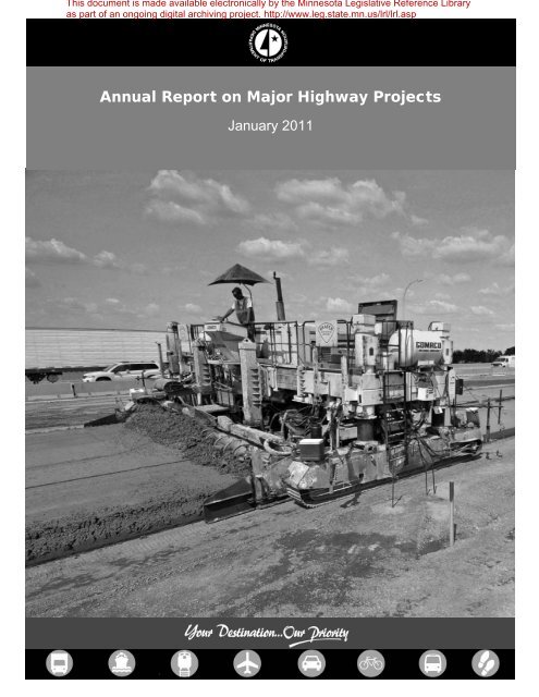
Annual Report on Major Highway Projects<br />
January 2011
Annual Report on Major Highway Projects<br />
<strong>Minnesota</strong> Department of Transportation Page | 2<br />
395 John Ireland Boulevard<br />
Saint Paul, <strong>Minnesota</strong> 55155-1899<br />
Phone: 651-366-3798<br />
Toll-Free: 1-800-657-3774<br />
TTY, Voice or ASCII: 1-800-627-3529<br />
www.dot.state.mn.us
Table of Contents<br />
Report Costs Page 5<br />
Executive Summary Page 6<br />
• Purpose and scope of the report<br />
• Number of projects throughout <strong>Minnesota</strong> increased last year<br />
• Project status changes<br />
• American Recovery and Reinvestment Act of 2009 and Chapter 152 Bridge<br />
Improvement Program<br />
Highway Investment Plan Process Page 9<br />
Project Summary Sheets Page 10<br />
Abbreviations to Annual Report on Major Highway Projects Page 11<br />
<strong>Minnesota</strong> Statute 174.56, Subdivisions 1-3 Page 12<br />
Index of Major Highway Projects Page 13-17<br />
Overall <strong>State</strong> Project Location Map<br />
Project Summary Pages<br />
District 1<br />
District Project Location Map<br />
District Project Summary Page A1<br />
Project Summary Pages Page A2-A16<br />
District 2<br />
District Project Location Map<br />
District Project Summary Page B1<br />
Project Summary Pages Page B2-B10<br />
District 3<br />
District Project Location Map<br />
District Project Summary Page C1<br />
Project Summary Pages Page C2-C12<br />
District 4<br />
District Project Location Map<br />
District Project Summary Page D1<br />
Project Summary Pages Page D2-D6<br />
District 6<br />
District Project Location Map<br />
District Project Summary Page E1<br />
Project Summary Pages Page E2-E15<br />
Annual Report on Major Highway Projects<br />
<strong>Minnesota</strong> Department of Transportation Page | 3
District 7<br />
District Project Location Map<br />
District Project Summary Page F1<br />
Project Summary Pages Page F2-F8<br />
District 8<br />
District Project Location Map<br />
District Project Summary Page G1<br />
Project Summary Pages Page G2-G6<br />
Metro District<br />
District Project Location Map<br />
District Project Summary Page H1<br />
Project Summary Pages Page H2-H24<br />
Annual Report on Major Highway Projects<br />
<strong>Minnesota</strong> Department of Transportation Page | 4
Cost of completing this report<br />
The estimated costs associated with the preparation of this report are:<br />
Staff Time $ 26,000<br />
Annual Report on Major Highway Projects<br />
<strong>Minnesota</strong> Department of Transportation Page | 5
Executive Summary<br />
Purpose and scope of the report<br />
The projects identified in this third annual report are major projects on the state trunk highway<br />
system, which includes the interstate system. Per <strong>Minnesota</strong> Statute 174.56, projects with cost<br />
estimates equal to or in excess of $25 million in the Twin Cities metro area and projects with<br />
cost estimates equal to or in excess of $10 million in Greater <strong>Minnesota</strong> have been included as<br />
a part of this report. The information provided in this report is current as of November 2010.<br />
This annual report includes information on projects that meet the total project cost estimate<br />
criteria and are either under construction, programmed or planned within the next 15 years.<br />
Projects currently under construction will be reported on an annual basis through the year of<br />
substantial completion, i.e., when the highway opens to traffic. At that point, they will no longer<br />
be reported. Also, projects that were previously reported because estimated costs met the<br />
statute criteria, will no longer be reported when the estimated costs fall below the required cost<br />
estimate.<br />
Number of projects throughout <strong>Minnesota</strong> increased from last year<br />
There were an additional 10 projects reported this year that met the statutory requirements. Of<br />
the 89 projects reported last year, 15 were completed and removed from the list this year, along<br />
with 6 other projects that do not meet the criteria any longer, they are listed in a table below.<br />
Of the 78 projects reported this year, 21 are in the Twin Cities metro area and 57 are in Greater<br />
<strong>Minnesota</strong>. Projects vary in type from pavement preservation projects to bridge replacement<br />
and rehabilitation projects and expansion projects. Total project cost estimates range from $10<br />
million to $355 million.<br />
Last year, there were 89 projects reported, of which 23 were in the Twin Cities metro area and<br />
66 were in Greater <strong>Minnesota</strong>.<br />
Project Status Changes<br />
Table 1.1 identifies 13 projects that are substantially complete this year and will therefore not be<br />
documented in this report in the future.<br />
Annual Report on Major Highway Projects<br />
<strong>Minnesota</strong> Department of Transportation Page | 6
Annual Report on Major Highway Projects<br />
<strong>Minnesota</strong> Department of Transportation Page | 7<br />
Table 1.1<br />
Mn/DOT<br />
District Route County Project Location<br />
1 Hwy 53 St. Louis Hwy 194 to Haines Road<br />
1 Hwy 61 Cook 2.7 miles to 6.2 miles north of Tofte<br />
2 Hwy 11 Marshall West of Robbin‐ Robbin/Drayton Bridge<br />
2 Hwy 11 Koochiching Frontier to Indus<br />
3 Hwy 10 Sherburne Westbound lanes from St. Cloud to Clear Lake<br />
3 I‐94 Wright New bridges east of Monticello<br />
6 Hwy 14 Steele I‐35 to West Steele county line<br />
6 I‐90 St. Charles 2.2 miles east of Hwy 74 to west junction Hwy 43<br />
8 Hwy 23 Lyon Russell to Marshall<br />
M I‐494 Washington Lake Rd to I‐94 ramps<br />
M I‐694 Oakdale I‐94 to 40 th street bridges<br />
M Hwy 610 Hennepin Hwy 169 to Hennepin County Road 81<br />
M Hwy 169 Hennepin County Road 81 to County Road 109<br />
The six projects in the table below that no longer meet the statute cost thresholds are not<br />
included in this report.<br />
Table 1.2<br />
Mn/DOT<br />
District Route County Project Location<br />
2 Hwy 34 Hubbard Park Rapids to Akeley<br />
2 Hwy 200 Hwy 75 to Ada<br />
4 I-94 Clay Hwy 36 to Downer Exit<br />
4 Hwy 10 Becker Boyer Lake to Detroit Lakes<br />
6 Hwy 52 Fillmore Fountain to Chatfield<br />
M I-35 E Ramsey Maryland Ave Bridge, now part of Cayuga Pr.<br />
Some reasons why the project cost estimates no longer meet the statute criteria include scope<br />
reductions, changes in the type of repair and changes in bridge type.
American Recovery and Reinvestment Act of 2009 and Chapter 152 Bridge Improvement<br />
Program<br />
The American Recovery and Reinvestment Act of 2009 provided funding for seven projects in<br />
Table 1.1, which allowed them to be advanced. The projects funded with ARRA funds were<br />
selected based on project readiness, consistency with performance based plans, statewide<br />
coverage, work-type balance and project advancement.<br />
The Chapter 152 Bridge Improvement Program provided bond funding for approximately 31 of<br />
these major highway projects. The projects funded through this program include bridges that are<br />
classified as a Tier 1 or Tier 2 bridge as required by Law of 2008, Chapter 152. 1<br />
1 A Tier 1 bridge consists of any bridge in the program that has an average daily traffic count greater than 1,000 and<br />
a sufficiency rating that is at or below 50, or is identified by the commissioner as a priority project. A Tier 2 bridge<br />
consists of any bridge that is not a Tier 1 bridge and is classified as fracture critical or has a sufficiency rating that is<br />
at or below 80. For more information on the Chapter 152 Bridge Improvement Program, refer to the Trunk Highway<br />
Bridge Improvement Program Chapter 152 Annual Update Report, prepared by the <strong>Minnesota</strong> Department of<br />
Transportation’s Office of Capital Programs and Performance Measures and the Bridge Office.<br />
Annual Report on Major Highway Projects<br />
<strong>Minnesota</strong> Department of Transportation Page | 8
Highway Investment Plan Process<br />
The 20-year Highway Investment Plan (HIP) is an important link between the policies and<br />
strategies established in the <strong>State</strong>wide Transportation Policy Plan and the capital improvements<br />
made to the state highway system. The plan sets the framework for future capital improvements<br />
by identifying investment needs and priorities for available funding.<br />
As shown in the above graphic, a project moves from the Long Range Plan, to the Highway<br />
Investment Plan, to the <strong>State</strong> Transportation Improvement Program (STIP) to construction.<br />
The flow chart above illustrates Mn/DOT’s steps in developing the HIP. Mn/DOT begins the<br />
process by identifying investment needs, starting with roads not meeting performance targets,<br />
when determining how to invest. Finally, Mn/DOT produces revenue forecasts to determine the<br />
federal and state funds available. Mn/DOT considers legislative direction, stakeholder input, and<br />
the need to meet system-wide performance targets. Then Mn/DOT sets statewide and district<br />
investment goals for four strategic priorities: traveler safety, infrastructure preservation, mobility<br />
and regional and community improvements. Investments are selected to make progress<br />
towards goals in each area.<br />
The HIP includes three planning periods: 1) the four-year STIP identifies specific construction<br />
projects; 2) the mid- and long-range Highway Investment Plans allocate revenue to the four<br />
strategic priorities, not to specific projects; 3) unfunded investment needs and updated<br />
performance data are fed back into the process and prioritization begins anew.<br />
Annual Report on Major Highway Projects<br />
<strong>Minnesota</strong> Department of Transportation Page | 9
Project Summary Sheets<br />
A one-page project summary sheet has been created for each project in this report. The<br />
summary sheets are categorized by district and include the following project information:<br />
• Project location<br />
• Project description<br />
• Project history<br />
• Schedule<br />
• Date of approved STIP and<br />
estimated project cost<br />
• Date(s) of environmental<br />
approvals<br />
Annual Report on Major Highway Projects<br />
<strong>Minnesota</strong> Department of Transportation Page | 10<br />
• Date(s) of municipal approvals<br />
• Date of final geometric layout<br />
approval<br />
• Date of establishment of<br />
construction limits<br />
• Total project cost estimates<br />
• Past and potential reasons for<br />
delay in letting or completing the<br />
project<br />
For those projects currently under construction, the construction letting cost is shown in<br />
the “Current Estimate” column. The costs for projects that have been let are shown as<br />
actual construction contract amounts and costs are estimated for other elements, right of<br />
way and engineering.<br />
For those projects within the four-year STIP, a baseline cost estimate has been<br />
established and is shown under the “Baseline Est.” column on the one-page project<br />
summary sheet. This is the cost estimate that was established when a project first<br />
entered into the STIP. For this report, those projects that entered the STIP before<br />
December 2008, the baseline cost will be the December 2008 estimate. The most<br />
current project cost estimate is shown under the “Current Estimate” column and<br />
compared to the costs shown under the “Baseline Estimate” column for projects that are<br />
in the STIP.<br />
Projects outside of the STIP timeframe, but within the 15-year reporting period, will have<br />
a total project cost estimate range shown under the “Current Estimate” column. Since<br />
many of these projects are in the planning stages (beyond the four-year STIP), cost<br />
estimates and scopes are preliminary and not yet well defined.<br />
In accordance with paragraph 3, Subd. 2, of the statute, all projects identified within the 2011-14<br />
STIP are fundable with our current revenue projections (fiscally constrained) and are of a high<br />
priority to the districts. Projects within the 2015-25 HIP periods are a priority, but forecasts are<br />
more uncertain and full funding may not have been identified. Projects identified in this report<br />
that are outside of the HIP period have a larger degree of uncertainty.<br />
A spreadsheet containing a list of the major highway projects is included as quick reference.<br />
The spreadsheet identifies the Mn/DOT district, trunk highway or interstate, year in which<br />
construction is anticipated, project location, description, and the total cost estimate. The maps<br />
included are identified by the Area Transportation Partnership (ATP) 2 boundaries.<br />
2 An ATP is a group of traditional and non-traditional transportation partners including representatives from<br />
Mn/DOT, Metropolitan Planning Organizations, Regional Development Commissions, counties, cities, tribal<br />
governments, special interests, and the public that have the responsibility of developing a regional transportation<br />
improvement program for their area of the state.
Abbreviations to Annual Report on Major Highway Projects<br />
AUAR = Alternative Urban Area-wide Review<br />
CRAVE = Cost Risk Assessment Value Engineering<br />
DB = Design Build<br />
E = East<br />
EA = Environmental Assessment<br />
EB = Eastbound<br />
FONSI = Finding of No Significant Impact<br />
Hwy = Highway<br />
I = Interstate<br />
Jct. = Junction<br />
MI = Miles<br />
N = North<br />
NB = Northbound<br />
NBIS = National Bridge Inventory System<br />
NEPA = National Environmental Policy Act<br />
ROW = Right of Way<br />
RR = Railroad<br />
S = South<br />
SB = Southbound<br />
TPCE = Total Project Cost Estimate (includes engineering, right of way and construction)<br />
W = West<br />
WB = Westbound<br />
Annual Report on Major Highway Projects<br />
<strong>Minnesota</strong> Department of Transportation Page | 11
<strong>Minnesota</strong> Statute 174.56, Subdivision 1-3<br />
Subdivision 1. Report required.<br />
The commissioner of transportation shall submit a report on January 15, 2009, and<br />
on January 15 of each year thereafter, on the status of major highway projects under<br />
construction or planned during the year of the report and for the ensuing 15 years. For<br />
purposes of this section, a "major highway project" is a highway project that has a total<br />
cost for all segments that the commissioner estimates at the time of the report to be at<br />
least (1) $25,000,000 in the metropolitan highway construction district, or (2) $10,000,000<br />
in any nonmetropolitan highway construction district.<br />
Subd. 2. Report contents.<br />
For each major highway project the report must include:<br />
(1) a description of the project sufficient to specify its scope and location;<br />
(2) a history of the project, including, but not limited to, previous official actions by<br />
the department or the appropriate area transportation partnership, or both, the date on<br />
which the project was first included in the state transportation improvement plan, the cost<br />
of the project at that time, the dates of environmental approval, the dates of municipal<br />
approval, the date of final geometric layout, and the date of establishment of any<br />
construction limits;<br />
(3) the project's priority listing or rank within its construction district, if any, as well as<br />
the reasons for that listing or rank, the criteria used in prioritization or rank, any changes<br />
in that prioritization or rank since the project was first included in a department work plan,<br />
and the reasons for those changes; and<br />
(4) past and potential future reasons for delay in letting or completing the project.<br />
Subd. 3. Department resources.<br />
The commissioner shall prepare and submit the report with existing department staff<br />
and resources.<br />
History:<br />
2008 c 287 art 1 s 74<br />
Annual Report on Major Highway Projects<br />
<strong>Minnesota</strong> Department of Transportation Page | 12
ANNUAL REPORT ON MAJOR HIGHWAY PROJECTS<br />
JANUARY 15, 2010<br />
TPCE (Total<br />
Project Cost<br />
Estimates)<br />
(Millions)<br />
Construction<br />
Letting Cost<br />
(Millions)<br />
<strong>State</strong> Project<br />
Projected Year of<br />
District No. Route Project Location Project Description<br />
Construction<br />
1 6904-46 Hwy. 1 0.3 Miles west of Six Mile Rd to Deer Reconstruction of 4.8 miles, pipe culvert replacement and<br />
2012/2013 $19.0<br />
A2<br />
Haven Rd<br />
addition of turn lanes<br />
1 6937-69100D Hwy. 2 Bong Bridge over St.Louis River Bridge repair 2014 $14.9<br />
A3<br />
1 0980-139<br />
6982-287<br />
I 35 St. Louis River to Boundary Avenue Bituminous overlay, culvert replacement and repairs Summer 2013 $22.8<br />
A4<br />
1 5880-177 I 35 North of Hinckley to South of Sandstone<br />
(North &South Bound)<br />
unbonded concrete overlay Spring 2011 $14.1<br />
A5<br />
1 6982-290 I 35 Boundary Avenue to 26th Avenue East Bridge and pavement replacement and repair, new access<br />
road, culverts, ramp repairs, signing and lighting<br />
4/10- 9/12 $85.2 $66.1 A6<br />
1 5880-173 I 35 Sandstone to Rutledge (North and South<br />
Bound)<br />
Unbonded concrete overlay, Bridge BR91099 Fall 2011 $29.9<br />
A7<br />
1 0980-138 I 35 North of Sturgeon Lake to south of<br />
Mahtowa<br />
Unbonded concrete overlay, concrete pavement repairs Spring 2011 $22.3<br />
A8<br />
1 6915-129 Hwy. 53 Hwy. 194 to Haines Road Roadway reconstruction, new intersections, turn lanes, signals<br />
and storm water ponds<br />
7/2008-10/2010 $33.7 $23.5 A9<br />
1 6920-48 Hwy. 53 4.5 miles south of Junction Hwy. 1 to south Roadway reconstruction, new alignment, bridge construction, 2011-2013 $53.6<br />
A10<br />
limits of Cook<br />
pipe culvert replacement<br />
1 1601-48 Hwy. 61 2.7 miles to 6.2 miles north of Tofte Reconstruct 3.5 miles, construct bicycle/pedestrian trail and<br />
underpass, construct bridge at Onion River<br />
2009/2010 $16.4 $12.2 A11<br />
1 3806-60 Hwy. 61 Split Rock River to Chapins Curve Reconstruction of 3.5 miles, construct bicycle/pedestrian<br />
underpass, construct bridge to replace existing box culvert<br />
2010/2011 $15.7 $10.8 A12<br />
1 3112-34 Hwy. 65 North limits of Nashwauk to Hwy. 1 Pavement reclamation, pipe culvert replacement 2010-2011 $13.6 $10.5 A13<br />
2 4509-05 Hwy. 1 Red River of the North at Oslo Remove and replace or rehabilitate Bridge 9100 2013 $18.7<br />
B2<br />
2 6015-07 Hwy. 2 US 2B over Red River in East Grand Forks Remove and replace Bridge 4700. Will include improved<br />
2018-2019 $45.9 - $61.5<br />
B3<br />
(Sorlie)<br />
access for pedestrians and bicyclists<br />
2 6018-02 Hwy. 2 Kennedy Bridge in East Grand Forks Rehabilitate existing Bridge 9090 including enhanced pigeon<br />
2016 $11.4 - $17.4<br />
B4<br />
(Kennedy)<br />
abatement, new paint system, new bridge deck<br />
2 3501-13 Hwy. 11 West of Robbin-Robbin/Drayton Bridge Replace Mn/DOT Bridge 6690. Will include re-grading and<br />
2009-2010 $14.8 $13.5 B5<br />
(Robbin/Drayton)<br />
realignment of the bridge approach<br />
2 3604-69 Hwy. 11 Frontier to Indus Reclaim bituminous road surface, install geo-grid, shoulder<br />
widening, culvert replacement, construct bypass lane and one<br />
turn lane, realign road intersections, minor grade adjustment<br />
2010 $15.1 $13.0 B6<br />
2 0409-12 Hwy. 71 3.0 miles south of Hubbard/Beltrami Five-lane expansion, center left turn lane addition, grade and 2010-2011 $26.5<br />
B7<br />
County line to Hwy. 197 in Bemidji<br />
surface, bridge construction and rehabilitation, signal<br />
installation, pavement rehabilitation<br />
2 3905-09 Hwy. 72 Rainy River Bridge in Baudette Replace Mn/DOT Bridge 9412 2018-2019 $62.5<br />
B8<br />
3 7103-51 Hwy. 10 Westbound lanes from St. Cloud to Clear<br />
Lake<br />
Pavement replacement 2010-2011 $17.0 $13.6 C2<br />
3 7321-47 Hwy. 15 Stearns County Road 120 in St.<br />
Cloud/Sartell<br />
Construct new interchange 2013 $20.3<br />
C3<br />
3 7108-23 Hwy. 24 Replace Bridge 6557 over Mississippi<br />
River in Clearwater<br />
Bridge replacement 2016 $29.4<br />
C4<br />
Questions about information contained in this report should be directed to Mn/DOT Office of Investment Management and Performance Measure Page 12<br />
See<br />
Also<br />
Page
ANNUAL REPORT ON MAJOR HIGHWAY PROJECTS<br />
JANUARY 15, 2010<br />
TPCE (Total<br />
Project Cost<br />
Estimates)<br />
(Millions)<br />
Construction<br />
Letting Cost<br />
(Millions)<br />
<strong>State</strong> Project<br />
Projected Year of<br />
District No. Route Project Location Project Description<br />
Construction<br />
3 8680-142 I 94 Replace Bridge 86813 and 86814 with New<br />
Bridges 86819 and 86820 east of Monticello<br />
Bridge replacement 2009-2010<br />
C5<br />
3 1805-74 Hwy. 210 Replace Bridge 5060 over Mississippi<br />
River in Brainerd<br />
Bridge replacement 2020-2021 $15.2<br />
C6<br />
3 1810-92 Hwy. 371 Nisswa to Pine River Expansion of 16 miles of existing 2-lane to divided 4-lane Stage 1 - 2012 $156.9<br />
C7<br />
3 1810-95 Hwy. 371 From Design Drive in Baxter to Nisswa Mill and overlay, pave shoulders, construct left turn lanes 2011 $13.3<br />
C8<br />
4 2102-58 Hwy. 29 Bridges in Alexandria over I-94 Replace bridge, construct approach panels, grade and<br />
concrete surface tie-ins<br />
May-October 2015 $19.0 - $26.0<br />
D2<br />
4 2107-09 Hwy. 55 West Douglas County Line to Glenwood Mill bituminous, reclaim, paving, culvert replacements, bridge May-October 2010 $11.8 $8.1 D3<br />
(6107-11)<br />
replacement<br />
4 0305-31 Hwy. 59 North of TH 34 in Detroit Lakes to 0.4 Recondition the pavement and restore ride quality, add<br />
2014 $10.4<br />
D4<br />
miles south of the Buffalo River<br />
turn/bypass lanes, culvert replacements<br />
4 1480-142 I 94 Hwy. 336 to Downer Exit Unbonded concrete overlay, replace bituminous shoulders,<br />
replace off and on ramp shoulders, re-deck and new approach<br />
panels for bridge<br />
May-August 2010 $11.2 $7.5 D5<br />
4 1406-66 I 94/Hwy. 75 I 94 and Hwy. 75 Interchange I 94/Hwy. 75 interchange modification June-November 2016 $16.0 - $23.0<br />
D6<br />
6 7401-34 Hwy. 14 I 35 to West Steele County line Four-lane expansion 2009-2012 $66.8 $51.3 E2<br />
6 7480-113 Hwy. 35 Owatonna Vicinity Construct Auxillary Lane, Replace Bridges 2014 $39.8<br />
E3<br />
6 8503-46 Hwy. 43 Winona Bridge over Mississippi River Replace Bridge 5900 2014 $181.4<br />
E4<br />
6 2505-48 Hwy. 52 Elk Run interchange Construct interchange 2011-2012 $43.3 $34.3 E5<br />
6 2506-52 Hwy. 52 Cannon Falls interchange Construct interchange 2019 $52.0<br />
E6<br />
6 5507-60 Hwy. 52 I 90 to Chatfield Reconstruct Highway 52 2017-2018 $46.0<br />
E7<br />
6 2515-21 Hwy. 63 Red Wing Bridge over Mississippi River<br />
(Red Wing)<br />
Replace Bridge 9040 2018-2019 $182.5<br />
E8<br />
6 8580-149 I 90 Dresbach Bridge over Mississippi River<br />
(Dresbach)<br />
Replace Bridge 9320 and roadway approaches 2012-14 $198.1<br />
E9<br />
6 8580-152 I 90 Hwy. 43 to Hwy. 76 (Eastbound Lane) Add unbonded concrete overlay 2011 $11.3 $10.3 E10<br />
6 8580-156 I 90 From 2.2 Miles east of Hwy. 74 to west<br />
Junction Hwy. 43 Eastbound Lanes (St.<br />
Charles-Lewiston)<br />
Unbonded concrete overlay 2010 $16.3 $15.3 E11<br />
6 Hwy. 250 Replace Bridge 6975 and 6977 Bridge replacement 2018 $11.1<br />
E12<br />
7 0804-81 Hwy. 14 Bridge over the <strong>Minnesota</strong> River in New<br />
Ulm (<strong>Minnesota</strong> River Bridge)<br />
Replace bridge, provide pedestrian crossing, adjust ramps 2018-2019 $44.1 - $51.4<br />
F2<br />
7 5203-85 Hwy. 14 County Road 6 to Lor Ray Drive in North Reconstruction and expansion from two to four lanes,<br />
$31.4<br />
F3<br />
Mankato<br />
construction of new interchange, realignment, traffic signals<br />
7 8103-49 Hwy. 14 County Road 2 to Waseca-Steele County Construct 4-lane divided highway, realignment of highway, 7/2008-6/2011 $76.7 $57.5 F4<br />
line<br />
construct 10 new bridges<br />
7 5202-50 Hwy. 14 At East edge to New Ulm Reconstruct Hwy14 and Hwy15 interchange 2018 $43.0 - $59.0<br />
F5<br />
7 1703-69 Hwy. 60 Windom to St. James Construct 4 lane divided roadway in two-lane gap areas, re- Summer 2013 - Fall $110.8<br />
F6<br />
1703-70<br />
8308-44<br />
align 3 county roads to lessen skew<br />
2018<br />
Questions about information contained in this report should be directed to Mn/DOT Office of Investment Management and Performance Measure Page 13<br />
See<br />
Also<br />
Page
ANNUAL REPORT ON MAJOR HIGHWAY PROJECTS<br />
JANUARY 15, 2010<br />
TPCE (Total<br />
Project Cost Construction See<br />
District<br />
<strong>State</strong> Project<br />
No. Route Project Location Project Description<br />
Projected Year of<br />
Construction<br />
Estimates)<br />
(Millions)<br />
Letting Cost<br />
(Millions)<br />
Also<br />
Page<br />
7 5305-56 Hwy. 60 Bigelow to Worthington Construct 4-lane expressway, reduce access locations,<br />
2010 - 2013 $116.9<br />
F7<br />
5305-58<br />
5305-59<br />
remove skew, replace union pacific railroad bridge<br />
7 0711-26 Hwy. 83 Jct. TH 30 to St. Clair Mill and Overlay, remove guard rail 2012 $12.8 $9.9 F8<br />
7 4008-25 Hwy. 99 Bridge over <strong>Minnesota</strong> River in St. Peter<br />
(St. Peter Bridge)<br />
Rehabilitation of bridge or new bridge on existing alignment 2013-2014 $44.2 - $50.8<br />
F9<br />
7 2212-28 Hwy. 109 Winnebago to Wells Reclaim Roadway 2015 $19.7<br />
F10<br />
7 0708-35 Hwy. 60\169 From CO Rd 115 (Cray Corner) to<br />
Northstar Bridge in Mankato<br />
Mill and Overlay 2012 $10.2<br />
F11<br />
7 2207-32 Hwy. 169 Blue Earth from the S. Limits at 14th St.<br />
North to JCT CSAH 6<br />
Road Reconstruction and Roundbound 2013<br />
F12<br />
8 3408-15 Hwy. 23 Paynesville bypass Construction of 4-lane bypass on new alignment Spring 2010 to<br />
Summer 2012<br />
$68.9 $44.9 G2<br />
8 4203-46 Hwy. 23 Russell to Marshall, including all 2 and 4<br />
lane sections.<br />
Mill and concrete overlay 2010 $21.7 $16.7 G3<br />
8 4203-50 Hwy. 23 Cottonwood to Granite Falls Mill and concrete overlay 2017 $30.0 - $40.6<br />
G4<br />
M 0282-34 I-35E From south of Ramsey Co CSAH 96 to Unbonded concrete overlay, drainage corrections, cable<br />
2011/2012 $25.4<br />
H2<br />
/<br />
6281-23<br />
north junction I-35W<br />
median barrier, etc.<br />
M 6280-308 I 35E Cayuga Bridge between University Avenue Bridge replacements of 6515, 9265 and 6517, replace<br />
2012-2015 $189.6<br />
H3<br />
and Maryland Avenue including the Pennsylvania interchange with interchange at Cayuga,<br />
Maryland Ave Bridge (Cayuga)<br />
geometric improvements, reconstruction and lane addition on<br />
35E<br />
M 1981-124 I-35W I-35 W over <strong>Minnesota</strong> River Bridge I-35 W over <strong>Minnesota</strong> River Bridge 5983 replacement 2020 $50.0 - $100.0<br />
H4<br />
M I 35W At Ramsey County Road E2 Rebuild interchange 2018 $26.1<br />
H5<br />
M 2782-281 I 35W I 35W/Highway 62 Crosstown Reconstruction of I 35W/Highway 62 commons area and<br />
addition of high occupancy vehicle (HOV) lane, addition of<br />
general purpose lane, additional capacity on Highway 62,<br />
proposed new access ramp, closure of existing access to<br />
westbound Highway 62<br />
5/07-12/10 $288.0 $288.0 H6<br />
M 2782-278 I 35W I 35 South Bound over Highway 65 North Replace Bridge 27871 and 27868, adjust horizontal and<br />
2018 $61.0<br />
H7<br />
Bound<br />
vertical alignment of I 35W and adjust horizontal alignment of<br />
Highway 65 southbound<br />
M 6212-148 Hwy. 36 Hamline Avenue to Victoria Avenue Replace bridge and reconstruct interchange 2014-2015 $24.9 - $33.6<br />
H8<br />
M 8214-114 Hwy. 36/95 St. Croix River Crossing Bridge replacement, two intersections and one interchange in<br />
<strong>Minnesota</strong>, one interchange and one overpass in Wisconsin<br />
2013-2016 $355.0<br />
H9<br />
M 6244-30 Hwy. 52 Lafayette River Bridge over Mississippi Bridge replacement, ramps, loops to Hwy. 94 and connection 2011-2014 $172.7 $130.4 H10<br />
River (Lafayette)<br />
to East 7th Street, replace/rehab Hwy. 52 Bridge over Plato<br />
Blvd and Hwy. Bridge over Hwy. 94<br />
M 1913-64 Hwy. 61 Hastings Bridge over Mississippi River Rehabilitate or replace Bridge 5895, replace 2-lane bridge with 07/01/2010<br />
H11<br />
(Hastings)<br />
4-lane bridge, maintain navigational clearances, provide<br />
ped/bike shared-use trail, provide walls, grading, roadways,<br />
utility work and storm sewer<br />
Questions about information contained in this report should be directed to Mn/DOT Office of Investment Management and Performance Measure Page 14
ANNUAL REPORT ON MAJOR HIGHWAY PROJECTS<br />
JANUARY 15, 2010<br />
TPCE (Total<br />
Project Cost Construction See<br />
District<br />
<strong>State</strong> Project<br />
No. Route Project Location Project Description<br />
Projected Year of<br />
Construction<br />
Estimates)<br />
(Millions)<br />
Letting Cost<br />
(Millions)<br />
Also<br />
Page<br />
M 2781-415 I 94 Lowry Hill Tunnel to John Ireland Boulevard Mill and Overlay and develop a managed corridor using<br />
2011 $55.0 $50.0 H12<br />
2781-443<br />
2781-443<br />
advance traffic technology.<br />
M I 94 I 94 on ramp over I 94 and Highway 65 Replace Bridge 27842 and 27843, adjust horizontal and<br />
vertical alignment of westbound I 94, vertical alignment of I-94<br />
eastbound and vertical alignment of Highway 65<br />
2018 $90.0 - $110.0<br />
H13<br />
M 2734-33 Hwy. 100 36th Street to 25 1/2 Street Freeway and interchange reconstruction, replace Bridges<br />
5308, 5309, 5462, and 5598, grading surfacing, drainage,<br />
utilities, noise and retaining walls, TMC<br />
2016-2018 $80.0<br />
H14<br />
M 2750-57 Hwy. 169 At County Road 81 and County Road 109 Build Highway 169 over the top of County Road 81, County<br />
Road 109 and Burlington Northern Santa Fe railroad tracks,<br />
diamond interchange at County Road 109<br />
July-08 - July-11 $58.6 $50.0 H15<br />
M 2760 Hwy. 169 At 93rd Street in Brooklyn Park Convert Intersection into a new interchange 2012-2013 $23.0<br />
H16<br />
M 2771-37 Hwy. 610 New alignment from County Road 81 (Elm This project is to continue the construction of Hwy. 610. It will 2020-2025 $135.0 - $175.0<br />
H17<br />
Creek Blvd.)to I-94 in Maple Grove and extend a four-lane freeway section from Hennepin County<br />
Brooklyn Park.<br />
Road 81 to I 94 in Maple Grove on new alignment.<br />
M 8285-93 I 494 Lake Road to I-94 Bituminous widening, temporary bypass construction, widen 2009-2010 $21.3<br />
H18<br />
8285-94<br />
Bridge 9775, majority of new drainage and project grading,<br />
unbonded concrete overlay, pave shoulders, guardrail, median<br />
barrier, impact attenuators<br />
M 2785-367<br />
2785-364<br />
I-494 34th Ave to France Ave Mill & Overlay, construct WB Aux lane from Penn Ave to NB<br />
TH 100,. Replace Xerxes Ave Bridge<br />
2013 $35.0 - $45.0<br />
H19<br />
M<br />
2785-378<br />
2771-38 Hwy. 610 New alignment Hwy. 169 to Hennepin This project is to continue the construction of Hwy. 610. It will 2009-2011 $49.8 $47.8 H20<br />
County Road 81 (Elm Creek Blvd)<br />
extend a four-lane freeway section from Hwy. 169 to Hennepin<br />
County Road 81 on new alignment.<br />
M 2776-03 Hwy. 169 / I Interchange Remove three signals, connect north and south frontage roads Nov 10 - Nov 12 $170.0 $125.2 H21<br />
494<br />
under Highway 169, convert expressway to freeway, construct<br />
noise barriers/visual barriers, construct drainage and water<br />
quality facilities<br />
M 8286-64 I 694 I-94 to 40th Street Bridge Concrete overlay, 4 bridge deck replacements, and 2 bridge<br />
repairs<br />
2010 $13.2 $13.2 H22<br />
M 6285-135 I-694 From Lexington Avenue to west of Old Replace bridges, add one lane in each direction on I-694,<br />
2011-2013 $70.6<br />
H23<br />
Highway 10<br />
remove weave section between TH 10 and I-694, etc.<br />
Questions about information contained in this report should be directed to Mn/DOT Office of Investment Management and Performance Measure Page 15
!!<br />
!<br />
!<br />
!<br />
!<br />
!<br />
!<br />
!<br />
!<br />
!<br />
!<br />
!<br />
!<br />
!<br />
!<br />
!<br />
!<br />
!<br />
!<br />
!<br />
!<br />
!<br />
!<br />
!<br />
!<br />
!<br />
!<br />
!<br />
!<br />
!<br />
!<br />
!<br />
!<br />
!<br />
!<br />
!<br />
!<br />
!<br />
!<br />
!<br />
!<br />
!"a$<br />
!"b$<br />
!"`$<br />
)x<br />
?°A@<br />
)q<br />
)i<br />
?ÝA@<br />
?Ä@<br />
)w<br />
?ÄA@<br />
?¬A@<br />
?ªA@<br />
?«A@<br />
)r<br />
?¾A@<br />
)o<br />
)s<br />
?ØA@<br />
?åA@<br />
)n<br />
?òA@<br />
?¦A@<br />
?¼A@<br />
?}A@<br />
?}A@<br />
?òA@<br />
?ÒA@<br />
)p<br />
?öA@<br />
!"b$<br />
?ôA@<br />
?ÑA@<br />
?¦A@<br />
)m<br />
?ØA@<br />
?êA@<br />
?ÀA@<br />
)s<br />
?óA@<br />
?±A@<br />
?ÜA@<br />
?¡A@<br />
)r<br />
?|A@<br />
?îA@<br />
?³A@<br />
?ÍA@<br />
?ÚA@<br />
?ÞA@<br />
?ÓA@<br />
+¢<br />
?ïA@<br />
+£<br />
)o<br />
?ÀA@<br />
?ÁA@<br />
?íA@<br />
?ãA@<br />
?±A@<br />
?ÆA@<br />
?ÛA@<br />
?»A@<br />
?§A@<br />
?dA@<br />
?âA@<br />
?ÈA@<br />
?ÎA@<br />
)i<br />
)w<br />
?äA@<br />
?çA@<br />
?bA@<br />
)i<br />
)y<br />
?¦A@<br />
?À@<br />
)q<br />
?ÃA@<br />
?½A@<br />
?¿A@<br />
)m<br />
?²A@<br />
?½A@<br />
)v<br />
?ùA@<br />
?ØA@<br />
)t<br />
?Á@<br />
?Á@<br />
)w<br />
?ÏA@<br />
?ýA@<br />
?±A@<br />
)r<br />
!"a$<br />
)i<br />
?ºA@<br />
?àA@<br />
?rA@<br />
)m<br />
?öA@<br />
?ÙA@<br />
?òA@<br />
!"b$<br />
)u<br />
?yA@<br />
?ôA@<br />
)z<br />
?¸A@<br />
?°A@<br />
)p<br />
)w<br />
?eA@ ?¹A@<br />
?vA@<br />
?ÜA@<br />
)x<br />
)y<br />
)p<br />
?ÜA@<br />
)i<br />
?kA@<br />
)o<br />
)x<br />
?}A@<br />
+¡<br />
)r<br />
?ÄA@<br />
?¬A@<br />
)y<br />
?ÜA@<br />
)n<br />
?²A@<br />
)m<br />
?gA@<br />
?òA@<br />
?¼A@<br />
?¼A@<br />
?àA@<br />
!"`$<br />
?ÃA@<br />
?¸A@<br />
)w<br />
?²A@<br />
?¸A@<br />
?¾A@<br />
?fA@<br />
?ÉA@<br />
?³A@<br />
?àA@<br />
?Ä@<br />
)y<br />
!"a$<br />
?òA@<br />
?ÝA@<br />
)w<br />
?»A@<br />
)r<br />
)o<br />
?aA@<br />
)n<br />
?ÜA@<br />
)w<br />
)x<br />
?èA@<br />
?|A@<br />
)w<br />
)y<br />
?ËA@<br />
?àA@<br />
?³A@<br />
!"`$<br />
?ÜA@<br />
?«A@<br />
)o<br />
?¸A@<br />
?¦A@<br />
?ðA@<br />
?¼A@<br />
?ÙA@<br />
?ÅA@<br />
?ÂA@<br />
?ªA@<br />
?òA@<br />
?ÃA@<br />
?¼A@<br />
)o<br />
?«A@<br />
?¦A@<br />
)y<br />
?âA@<br />
!"b$<br />
?©A@<br />
?èA@<br />
?ÀA@<br />
?ÃA@<br />
?ÁA@<br />
?}A@<br />
?±A@<br />
?ÀA@<br />
?ÃA@<br />
?àA@<br />
?ºA@<br />
?ÃA@<br />
?åA@<br />
?½A@<br />
?¼A@<br />
?ãA@<br />
?æA@<br />
)x<br />
)m<br />
)w<br />
?¼A@<br />
)x<br />
?¾A@<br />
)x<br />
?ùA@<br />
?»A@<br />
?âA@<br />
)q<br />
?}A@<br />
?ãA@<br />
?ÎA@<br />
)w<br />
?°A@<br />
?¬A@<br />
?Á@<br />
?ßA@<br />
)r<br />
+£<br />
)r<br />
?|A@<br />
?Ä@<br />
?óA@<br />
+¡<br />
?ãA@<br />
?¸A@<br />
)t<br />
?«A@<br />
?°A@<br />
?»A@<br />
?àA@<br />
)r<br />
?¼A@<br />
)w<br />
?ÃA@<br />
?|A@<br />
?ßA@<br />
?ÁA@<br />
?ÄA@<br />
)o<br />
?Ä@<br />
?»A@<br />
?¦A@<br />
?ýA@<br />
?¦A@<br />
?æA@<br />
?Ä@<br />
?ØA@<br />
?ÀA@<br />
?²A@<br />
?aA@<br />
?»A@<br />
)s<br />
?ÒA@<br />
?òA@<br />
!"a$<br />
?¾A@<br />
)x<br />
?¬A@<br />
?çA@<br />
?¸A@<br />
)n<br />
?æA@<br />
?ÆA@<br />
?ÀA@<br />
?ÆA@<br />
?ÙA@<br />
!"`$<br />
?ËA@<br />
?«A@<br />
%&h(<br />
%&h(<br />
!"b$<br />
%&d(<br />
%&f(<br />
%&c(<br />
%&e(<br />
%&d(<br />
%&f(<br />
%&c(<br />
!"b$<br />
%&c(<br />
%&f(<br />
!"`$<br />
!"b$<br />
!"`$<br />
!"b$<br />
!"b$<br />
%&d(<br />
)y<br />
)s<br />
)p<br />
)y<br />
)s<br />
)y<br />
)y<br />
)z<br />
)z<br />
)n<br />
)m<br />
)s<br />
)m<br />
)m<br />
)p<br />
)s<br />
)m<br />
)p<br />
)l<br />
?ÙA@<br />
?¹A@<br />
?ØA@<br />
?±A@<br />
?«A@<br />
?èA@<br />
?ÇA@<br />
?Á@<br />
?©A@<br />
?éA@<br />
?ºA@<br />
?ñA@<br />
?ÓA@<br />
?±A@<br />
?cA@<br />
?³A@<br />
?uA@<br />
?¾A@<br />
?tA@<br />
?ÞA@<br />
?¸A@<br />
?ÑA@<br />
?lA@<br />
?ÙA@<br />
?ÖA@<br />
?ØA@<br />
?ÒA@<br />
?¾A@<br />
?ØA@<br />
?tA@<br />
?¸A@<br />
?«A@<br />
?óA@<br />
?±A@<br />
?©A@<br />
?ûA@<br />
?ÌA@<br />
?öA@<br />
?ûA@<br />
?©A@<br />
?¾A@<br />
?úA@<br />
?àA@<br />
?§A@<br />
?ÇA@<br />
?öA@<br />
?öA@<br />
?öA@<br />
?§A@<br />
?ÒA@<br />
?÷A@<br />
?©A@<br />
?àA@<br />
?¸A@<br />
?ÕA@<br />
?ØA@<br />
?ÒA@<br />
?©A@<br />
?øA@<br />
Major Highway Projects 2011 .<br />
Major Highway Projects
!<br />
?åA@<br />
?åA@<br />
?}A@<br />
?ÀA@<br />
)i<br />
?|A@<br />
?òA@<br />
?¼A@<br />
?±A@<br />
?òA@<br />
?îA@<br />
Brainerd<br />
Baxter<br />
Little Falls<br />
?}A@<br />
! ?Á@<br />
)m<br />
Sartell<br />
?¾A@<br />
?ÑA@<br />
?¦A@<br />
)w<br />
?ªA@<br />
?ÀA@<br />
?¼A@<br />
?ªA@<br />
?Á@<br />
)y<br />
?ÉA@<br />
?öA@<br />
!"b$ ?¾A@<br />
! Becker<br />
)m<br />
)y<br />
?½A@ Monticello !<br />
!"b$ ?ûA@<br />
Saint Cloud<br />
Crosby<br />
Foley<br />
?ØA@<br />
)n<br />
?¾A@<br />
?°A@<br />
International Falls<br />
)n<br />
)y<br />
?¦A@<br />
?|A@<br />
?¡A@<br />
?ÒA@<br />
%&e(<br />
)y<br />
Cohasset<br />
Grand Rapids<br />
Milaca<br />
Princeton<br />
%&f( )y<br />
)i<br />
?àA@<br />
)q<br />
?àA@<br />
?àA@<br />
?àA@<br />
?öA@<br />
?ÒA@<br />
?àA@<br />
?}A@<br />
?ÀA@<br />
?Á@<br />
?àA@ ?¼A@<br />
?À@<br />
! ! !<br />
!<br />
?¾A@<br />
%&c(<br />
?ÒA@ ?àA@<br />
%&h( ! ?ÖA@<br />
!"b$<br />
?ÇA@ ! %&c(<br />
?ÑA@<br />
?©A@ ! !"b$ !<br />
?æA@<br />
?æA@<br />
)q<br />
?æA@<br />
!"`$<br />
?äA@<br />
?ñA@<br />
%&h(<br />
!"`$<br />
?ÈA@<br />
?ÓA@<br />
?öA@<br />
!"`$<br />
)l<br />
?àA@ Duluth<br />
Chisago City?Á@<br />
Rockville<br />
Zimmerman<br />
Saint Augusta<br />
East Bethel<br />
?ØA@<br />
Elk River ?ÒA@<br />
Annandale<br />
Otsego Columbus ?øA@<br />
)y<br />
Scandia<br />
)m<br />
Saint Michael !"b$<br />
?½A@<br />
?³A@<br />
?²A@<br />
)s<br />
%&d(<br />
?öA@<br />
GreenfieldDayton<br />
Blaine Hugo<br />
?óA@<br />
)m<br />
)n<br />
Cokato<br />
Corcoran<br />
?ØA@<br />
!"b$<br />
Grant<br />
Major Highway Projects 2011<br />
District 1<br />
Mora<br />
Pine City<br />
?÷A@<br />
?¸A@<br />
?ÇA@<br />
?lA@<br />
?©A@<br />
?öA@<br />
?¼A@<br />
)q<br />
?vA@<br />
Mountain Iron<br />
Chisholm)y<br />
Virginia<br />
Eveleth<br />
Hibbing<br />
Rush City<br />
Moose Lake<br />
Cambridge<br />
North Branch<br />
)i<br />
?ÅA@<br />
!"`$<br />
?rA@<br />
?¦A@<br />
Hoyt Lakes<br />
Hermantown<br />
Duluth<br />
Cloquet Proctor<br />
!<br />
?ÝA@<br />
Ely<br />
Two Harbors<br />
?¦A@<br />
Silver Bay<br />
?ÝA@<br />
Major Highway Projects<br />
.
District Project Summary<br />
District 1<br />
ROUTE PROJECT LOCATION PAGE<br />
Hwy. 1 0.3 Miles west of Six Mile Rd to Deer Haven Rd A 2<br />
Hwy. 2 Bong Bridge over St.Louis River A 3<br />
I 35 St. Louis River to Boundary Avenue A 4<br />
I 35 North of Hinckley to South of Sandstone (North &South Bound) A 5<br />
I 35 Boundary Avenue to 26th Avenue East A 6<br />
I 35 Sandstone to Rutledge (North and South Bound) A 7<br />
I 35 North of Sturgeon Lake to south of Mahtowa A 8<br />
Hwy. 53 Hwy. 194 to Haines Road A 9<br />
Hwy. 53 4.5 miles south of Junction Hwy. 1 to south limits of Cook A 10<br />
Hwy. 61 2.7 miles to 6.2 miles north of Tofte A 11<br />
Hwy. 61 Split Rock River to Chapins Curve A 12<br />
Hwy. 65 North limits of Nashwauk to Hwy. 1 A 13<br />
Annual Report on Major Highway Projects<br />
<strong>Minnesota</strong> Department of Transportation<br />
Page A1
Schedule:<br />
Environmental Document Approval Date: Pending Approval<br />
Municipal Consent Approval Date: Not Needed<br />
Geometric Layout Approval Date: Pending Approval<br />
Construction Limits Established Date: Pending Approval<br />
Original Letting Date: 12/17/2010<br />
Current Letting Date: 6/8/2012<br />
Construction Season: 2012/2013<br />
Estimated Substantial Completion: 2013<br />
Project History:<br />
Highway 1 between 0.3 Miles West of Six Mile<br />
Lake Rd to Deer Haven Rd has substandard<br />
horizontal and vertical alignments, narrow<br />
shoulders and steep in-slopes, lack of safety turn<br />
lanes, trees/vegetation encroachment in the<br />
highway clear zone, and lack of safe passing<br />
opportunities. Some above mentioned safety<br />
problems contribute to crash rates on some<br />
sements of the highway to be higher then the<br />
district average and statewide average for miles of<br />
two lane highways.<br />
Project Benefits:<br />
Improve Safety by improving vertical and<br />
horizontal alignment.<br />
Project Risks:<br />
Annual Report on Major Highway Projects<br />
<strong>Minnesota</strong> Department of Transportation<br />
PROJECT SUMMARY<br />
Hwy. 1<br />
0.3 Miles west of Six Mile Rd to Deer Haven Rd<br />
<strong>State</strong> Project No. 6904-46<br />
www.dot.state.mn.us/d1/projects/hwy1_tower_ely<br />
Project Description:<br />
The project is located in St. Louis County.<br />
The proposed project is a reconstruction and<br />
passing lane project located 0.3 Miles west<br />
of Six Mile Lake Rd to Deer Haven Rd. The<br />
project is a total reconstruction of 4.8 miles<br />
of Hwy. 1. It includes pipe culvert<br />
replacements and the addition of turn lanes.<br />
Recent Changes and Updates:<br />
Key Cost Estimate Assumptions:<br />
627<br />
26<br />
969<br />
408<br />
797<br />
775<br />
585<br />
360<br />
797<br />
318<br />
599<br />
360<br />
Saint Louis<br />
Total Project Cost Estimate (millions)<br />
Date in which the project entered into the STIP:<br />
Baseline Est. Current Est.<br />
Construction Letting: $ 10.6<br />
$ 14.4<br />
Other Construction Elements: $ 0.4<br />
$ 0.6<br />
Engineering: $ 2.1<br />
$ 2.9<br />
Right of Way: $ 1.1<br />
$ 0.0<br />
Total: $ 14.2 $ 19.0<br />
Construction cost estimates are adjusted to the mid-year of construction, using inflation rates provided by<br />
OCPPM.<br />
<strong>Minnesota</strong> Department of Transportation<br />
District 1<br />
1123 Mesaba Ave<br />
(218) 725-2745<br />
District Engineer: Michael Robinson<br />
Project Manager: Brian Larson<br />
Original date of Posting: Jan 2009<br />
Revised Date: 1/15/2011<br />
21<br />
796<br />
408<br />
795<br />
774<br />
128<br />
583<br />
620<br />
593<br />
904<br />
795<br />
404<br />
490<br />
698<br />
Babbitt<br />
70<br />
Page A3
Schedule:<br />
Environmental Document Approval Date: Pending Approval<br />
Municipal Consent Approval Date: Not Needed<br />
Geometric Layout Approval Date: Not Needed<br />
Construction Limits Established Date: Pending Approval<br />
Original Letting Date: 02/28/2014<br />
Current Letting Date: 02/28/2014<br />
Construction Season: 2014<br />
Estimated Substantial Completion: 2014<br />
Project History:<br />
Note: WISCONSIN DOT IS LEAD AGENCY.<br />
Bridge 69100 was built in 1982 and consists of a<br />
steel tied-arch main span and beam approach<br />
spans with a cast-in-place concrete deck. Bridge<br />
69100 is 8,320 feet long. This bridge is classified<br />
as adequate with NBI ratings of Deck 6,<br />
Superstructure 6, and Substructure 7.<br />
Project Benefits:<br />
Extend The useful life of Bridge 69100 through<br />
preventive maintenance activities<br />
Project Risks:<br />
Annual Report on Major Highway Projects<br />
<strong>Minnesota</strong> Department of Transportation<br />
PROJECT SUMMARY<br />
Hwy. 2<br />
Bong Bridge over St.Louis River<br />
Bridge 69100<br />
<strong>State</strong> Project No. 6937-69100D<br />
Project Description:<br />
The project is located in St. Louis County.<br />
The proposed project is for Bridge repair,<br />
paint, Bridge overlay, and Bridge joints. The<br />
purpose of the project is to extend the useful<br />
life of Bridge 69100 through preventive<br />
maintenance activities.<br />
Recent Changes and Updates:<br />
Key Cost Estimate Assumptions:<br />
Duluth<br />
91<br />
Saint Louis<br />
Total Project Cost Estimate (millions)<br />
Date in which the project entered into the STIP: 12/21/2010<br />
Baseline Est. Current Est.<br />
Construction Letting: $ 13.8<br />
$ 12.0<br />
Other Construction Elements: $ 0.6<br />
$ 0.5<br />
Engineering: $ 2.9<br />
$ 2.4<br />
Right of Way: $ 0.0<br />
$ 0.0<br />
Total: $ 17.3 $ 14.9<br />
35<br />
Lake Superior<br />
Construction cost estimates are adjusted to the mid-year of construction, using inflation rates provided by<br />
OCPPM.<br />
<strong>Minnesota</strong> Department of Transportation<br />
District 1<br />
1123 Mesaba Ave<br />
(218) 725-2745<br />
District Engineer: Michael Robinson<br />
Project Manager: Brian Larson<br />
Original date of Posting: Jan 2009<br />
Revised Date: 1/15/2011<br />
Page A4
Schedule:<br />
Environmental Document Approval Date: Need Unknown<br />
Municipal Consent Approval Date: Not Needed<br />
Geometric Layout Approval Date: Need Unknown<br />
Construction Limits Established Date: Pending Approval<br />
Original Letting Date: 07/22/2011<br />
Current Letting Date: 02/22/2013<br />
Construction Season: Summer 2013<br />
Estimated Substantial Completion: Fall 2013<br />
Project History:<br />
This section of Interstate 35 carries an average of<br />
27,600 vehicles per day, approximately 7% of<br />
which are classified as heavy commercial<br />
vehicles. Pavement modeling (based on current<br />
ride quality conditions, existing pavement type,<br />
and traffic levels) indicates that this section of road<br />
will need pavement preservation to improve its ride<br />
quality and thereby extend its useful life. Between<br />
2008 and 2009, The letting date delay was<br />
identified and the project scope reduced due to<br />
funding constraints based on funding forecasts.<br />
Project Benefits:<br />
Improved ride quality for road users, extend useful<br />
life<br />
Project Risks:<br />
Availability of recycled materials for Mill surface is<br />
an unknown and market conditions could result in<br />
increased Bituminous unit prices; Uncertainty of<br />
scope of repair at the Guss Rd (Co Rd 61)<br />
interchange; and Accessibility route requirements<br />
at the Boundary Ave and Highway 2 intersection.<br />
Annual Report on Major Highway Projects<br />
<strong>Minnesota</strong> Department of Transportation<br />
PROJECT SUMMARY<br />
I 35<br />
St. Louis River to Boundary Avenue<br />
<strong>State</strong> Project No. 0980-139, 6982-287<br />
Project Description:<br />
Both north bound and south bound directions<br />
will be preserved by a thin bituminous<br />
overlay. Culverts within the project limits will<br />
either be left in place, repaired, or replaced<br />
as deemed appropriate. The pavement and<br />
drainage at the Guss Rd interchange will be<br />
improved and repairs will be made at a<br />
number of Bridges. A short mill and overlay<br />
on Highway 2 from Boundary Ave to Skyline<br />
Drive is included with this project. Traffic on I-<br />
35 will be reduced to two lanes during<br />
construction.<br />
Total Project Cost Estimate (millions)<br />
Cloquet<br />
54<br />
Scanlon<br />
Carlton<br />
Date in which the project entered into the STIP:<br />
553<br />
118<br />
3<br />
16<br />
107<br />
119<br />
3<br />
878<br />
45<br />
116<br />
2<br />
101<br />
879<br />
879<br />
880<br />
152<br />
56<br />
Thomson<br />
1<br />
51<br />
696<br />
635<br />
Wrenshall<br />
4<br />
98<br />
161<br />
223<br />
18<br />
151<br />
150<br />
61<br />
859<br />
846<br />
846 889<br />
1<br />
12/21/2010<br />
Baseline Est. Current Est.<br />
Construction Letting: $ 9.9<br />
$ 13.4<br />
Other Construction Elements: $ 0.5<br />
$ 6.7<br />
Engineering: $ 2.1<br />
$ 2.7<br />
Right of Way: $ 0.0<br />
$ 0.0<br />
Total: $ 12.5 $ 22.8<br />
Recent Changes and Updates:<br />
4<br />
635<br />
889<br />
889<br />
889<br />
893<br />
894<br />
45<br />
897<br />
13<br />
899<br />
3<br />
19<br />
898<br />
898<br />
898<br />
73<br />
6<br />
Hermantown<br />
Construction cost estimates are adjusted to the mid-year of construction, using inflation rates provided by<br />
OCPPM.<br />
This project was originally prioritized by both the MPO and ATP as a 2013 federal aid<br />
project at the higher level of funding. Due to the SRC cuts in fiscal years 2010 and 2011,<br />
and the ripple effect they caused to our program, this project was deferred into FY 2014.<br />
The projects was modified to include repairs to a number of bridges and is reflected in the<br />
increased cost from the original estimate.<br />
Key Cost Estimate Assumptions:<br />
Overlay thickness Hydraulics needs, and Accessibility requirements at the Boundary Ave<br />
and Highway 2 intersection<br />
<strong>Minnesota</strong> Department of Transportation<br />
District 1<br />
1123 Mesaba Ave<br />
(218) 725-2700<br />
District Engineer: Michael Robinson<br />
Project Manager: Todd Campbell<br />
Original date of Posting: Jan 2009<br />
Revised Date: 1/15/2011<br />
11<br />
284<br />
896<br />
284<br />
696<br />
161<br />
56<br />
48<br />
Proctor<br />
14<br />
Duluth<br />
Page A5<br />
89
Schedule:<br />
Environmental Document Approval Date: 10/14/2010<br />
Municipal Consent Approval Date: Not Needed<br />
Geometric Layout Approval Date: Need Unknown<br />
Construction Limits Established Date: Assume no R/W need<br />
Original Letting Date: 11/19/2010<br />
Current Letting Date: 1/28/2011<br />
Construction Season: Spring 2011<br />
Estimated Substantial Completion: Fall 2011<br />
Project History:<br />
PROJECT SUMMARY<br />
I 35<br />
North of Hinckley to South of Sandstone (North &South Bound)<br />
<strong>State</strong> Project No. 5880-177<br />
This section of Interstate 35 carries an average of<br />
16,700 vehicles per day, approximately 7% of<br />
which are classified as heavy commercial<br />
vehicles. Pavement modeling (based on current<br />
ride quality conditions, existing pavement type,<br />
and traffic levels) indicates this section of road will<br />
need pavement preservation to improve its ride<br />
quality and thereby extend its useful life.<br />
Project Benefits:<br />
Improved ride quality for road users, extend useful<br />
life<br />
Project Risks:<br />
The scope and location of this project has been<br />
changed from Bituminous overlay to unbonded<br />
concrete overlay reducing the risks of fluctuating<br />
Bituminous prices but a price spike in concrete is<br />
still a valid risk.<br />
Annual Report on Major Highway Projects<br />
<strong>Minnesota</strong> Department of Transportation<br />
Project Description:<br />
Project begins 1.8 Miles south of the north<br />
Pine County Line and continues north to 2.6<br />
Miles south of Carlton County Road 4. All<br />
13.2 Miles of southbound lanes will be<br />
preserved with an unbonded concrete<br />
overlay. 4.5 Miles of the north lanes will be<br />
preserved with an unbonded concrete<br />
overlay. Traffic will be reduced to two-lanes<br />
during construction. Access to Barnum and<br />
Highway 73 at Moose Lake will be provided<br />
during construction.<br />
Aitkin<br />
Kanabec<br />
83<br />
Brook Park<br />
Total Project Cost Estimate (millions)<br />
Date in which the project entered into the STIP:<br />
13<br />
34<br />
85<br />
84<br />
20<br />
2<br />
23<br />
25<br />
3<br />
30<br />
21<br />
29<br />
38<br />
143<br />
140<br />
36<br />
131<br />
26<br />
17<br />
41<br />
17<br />
156<br />
18<br />
150<br />
28<br />
54<br />
40<br />
Denham<br />
27<br />
140<br />
39<br />
Finlayson<br />
61<br />
140<br />
35<br />
151<br />
Hinkley<br />
Hinkley<br />
133<br />
61<br />
134<br />
9782<br />
144<br />
16<br />
133<br />
42<br />
34<br />
Willow River<br />
Rutledge<br />
Pine<br />
5718<br />
Sandstone<br />
15<br />
52<br />
129<br />
12/21/2010<br />
Baseline Est. Current Est.<br />
Construction Letting: $ 16.5<br />
$ 11.3<br />
Other Construction Elements: $ 1.1<br />
$ 0.6<br />
Engineering: $ 3.5<br />
$ 2.3<br />
Right of Way: $ 0.0<br />
$ 0.0<br />
Total: $ 21.2 $ 14.1<br />
Construction cost estimates are adjusted to the mid-year of construction, using inflation rates provided by<br />
OCPPM.<br />
Recent Changes and Updates:<br />
The scope and project limit changes required more time to develop it and hence caused the<br />
delay from initially mentioned Let date. The change from bituminous overlay to unbonded<br />
concrete reduced the costs of the project significantly.<br />
Key Cost Estimate Assumptions:<br />
<strong>Minnesota</strong> Department of Transportation<br />
District 1<br />
1123 Mesaba Ave<br />
(218) 725-2700<br />
District Engineer: Michael Robinson<br />
Project Manager: Todd Campbell<br />
Original date of Posting: Jan 2009<br />
Revised Date: 1/15/2011<br />
61<br />
29<br />
20<br />
152<br />
33<br />
Askov<br />
142<br />
19<br />
21<br />
43<br />
145<br />
149<br />
30<br />
136<br />
32<br />
Bruno<br />
Page A6<br />
22
Schedule:<br />
Environmental Document Approval Date: 12/30/2008<br />
Municipal Consent Approval Date: Pending Approval<br />
Geometric Layout Approval Date: Pending Approval<br />
Construction Limits Established Date: 11/14/2008<br />
Original Letting Date: 7/24/2009<br />
Current Letting Date: 4/2/2010<br />
Construction Season: 4/10- 9/12<br />
Estimated Substantial Completion: 10/1/2011<br />
Project History:<br />
Boundary Avenue to 26th Avenue East<br />
Bridge 69831, 69832, 69880<br />
<strong>State</strong> Project No. 6982-290<br />
http://www.dot.state.mn.us/d1/projects/i35-reconstruct/<br />
I-35 from Boundary Avenue to Mesaba Avenue<br />
was constructed in the 1960's. The pavement is<br />
highly deteriorated and has been frequently<br />
patched. There are major bridges on the segment<br />
with substandard widths and fracture critical<br />
elements. Forty-six bridges in the corridor will<br />
require new railings, deck repairs and painting. I-<br />
35 from Mesaba Avenue to 26th Avenue East was<br />
opened in 1992 and requires concrete pavement<br />
repairs.<br />
Project Benefits:<br />
Replace fracture critical Bridges, improve ride and<br />
safety, extend the life of Bridges, reduce<br />
maintenance costs<br />
Project Risks:<br />
High traffic volumes, extremely poor soils, tight<br />
construction schedule for 3 years, limited access,<br />
weather<br />
Annual Report on Major Highway Projects<br />
<strong>Minnesota</strong> Department of Transportation<br />
PROJECT SUMMARY<br />
I 35<br />
Project Description:<br />
The project is located in Duluth (St. Louis<br />
County) from Boundary Avenue to 26th.<br />
Avenue East. The proposed project includes<br />
Bridge and pavement replacement and<br />
repair, a new access road, culverts, ramp<br />
repairs, signing and lighting.<br />
Hermantown<br />
Total Project Cost Estimate (millions)<br />
Date in which the project entered into the STIP:<br />
Recent Changes and Updates:<br />
Project is Let and first year of construction is complete.<br />
Key Cost Estimate Assumptions:<br />
56<br />
91<br />
89<br />
54<br />
90<br />
Saint Louis<br />
Duluth<br />
Lake Superior<br />
Baseline Est. Current Est.<br />
Construction Letting: $ 75.0<br />
$ 66.1<br />
Other Construction Elements: $ 3.0<br />
$ 3.3<br />
Engineering: $ 15.0<br />
$ 13.2<br />
Right of Way: $ 0.6<br />
$ 2.6<br />
Total: $ 93.6 $ 85.2<br />
Construction cost estimates are adjusted to the mid-year of construction, using inflation rates provided by<br />
OCPPM.<br />
<strong>Minnesota</strong> Department of Transportation<br />
District 1<br />
1123 Mesaba Ave<br />
(218) 725-2700<br />
District Engineer: Michael Robinson<br />
Project Manager: Roberta Dwyer<br />
Original date of Posting: Jan 2009<br />
Revised Date: 1/15/2011<br />
Page A7<br />
4
Schedule:<br />
Environmental Document Approval Date: Pending Approval<br />
Municipal Consent Approval Date: Not Needed<br />
Geometric Layout Approval Date:<br />
Construction Limits Established Date: Pending Approval<br />
Original Letting Date: 9/23/2011<br />
Current Letting Date: 9/23/2011<br />
Construction Season: Fall 2011<br />
Estimated Substantial Completion: Fall 2012<br />
Project History:<br />
This section of Interstate 35 carries an average of<br />
16,700 vehicles per day, approximately 7% of<br />
which are classified as heavy commercial<br />
vehicles. Pavement modeling (based on current<br />
ride quality conditions, existing pavement type,<br />
and traffic levels) indicates this section of road will<br />
need pavement preservation to improve its ride<br />
quality and thereby extend its useful life.<br />
Project Benefits:<br />
Improved ride quality for road users, extend useful<br />
life<br />
Project Risks:<br />
The scope and location of this project has been<br />
changed and now only involves an unbonded<br />
concrete overlay. The only risk would involve a<br />
spike in concrete prices.<br />
Annual Report on Major Highway Projects<br />
<strong>Minnesota</strong> Department of Transportation<br />
PROJECT SUMMARY<br />
I 35<br />
Sandstone to Rutledge (North and South Bound)<br />
Bridge 91099<br />
<strong>State</strong> Project No. 5880-173<br />
Project Description:<br />
The project is located between Sandstone<br />
and Rutledge on I-35. It includes an<br />
unbonded concrete overlay, bridge and<br />
drainage repairs, and safety improvements.<br />
!(<br />
¹<br />
?Á@<br />
§¨`<br />
Total Project Cost Estimate (millions)<br />
Date in which the project entered into the STIP:<br />
Recent Changes and Updates:<br />
Rutledge<br />
!(<br />
Sandstone<br />
!(<br />
12/21/2010<br />
Baseline Est. Current Est.<br />
Construction Letting: $ 13.0<br />
$ 24.1<br />
Other Construction Elements: $ 0.7<br />
$ 1.0<br />
Engineering: $ 2.6<br />
$ 4.8<br />
Right of Way: $ 0.0<br />
$ 0.0<br />
Total: $ 16.3 $ 29.9<br />
§¨`<br />
?¼A@<br />
Askov<br />
!(<br />
Construction cost estimates are adjusted to the mid-year of construction, using inflation rates provided by<br />
OCPPM.<br />
Project scope has been changed from a thick bituminous overlay to an unbonded conrete<br />
overlay. A formal STIP amendment will be done to document the scope change and the<br />
cost increase.<br />
Key Cost Estimate Assumptions:<br />
<strong>Minnesota</strong> Department of Transportation<br />
District 1<br />
1123 Mesaba Ave<br />
(218) 725-2700<br />
District Engineer: Michael Robinson<br />
Project Manager: Todd Campbell<br />
Original date of Posting:<br />
Revised Date: 1/15/2011<br />
Page A8
Schedule:<br />
Environmental Document Approval Date: 10/11/2010<br />
Municipal Consent Approval Date: Not Needed<br />
Geometric Layout Approval Date: Pending Approval<br />
Construction Limits Established Date: Assume no R/W need<br />
Original Letting Date: 11/20/2009<br />
Current Letting Date: 1/28/2011<br />
Construction Season: Spring 2011<br />
Estimated Substantial Completion: Fall 2011<br />
Project History:<br />
This section of Interstate 35 carries an average of<br />
15,900 vehicles per day, approximately 7% of<br />
which are classified as heavy commercial<br />
vehicles. Pavement modeling (based on current<br />
ride quality conditions, existing pavement type,<br />
and traffic levels) indicates this section of road will<br />
need pavement preservation to improve its ride<br />
quality and thereby extend its useful life.<br />
Project Benefits:<br />
Improved ride quality for road users, extend useful<br />
life<br />
Project Risks:<br />
Cross slope correction quantities are not<br />
determined until 90% design stage and could<br />
increase final concrete quantity estimates<br />
Annual Report on Major Highway Projects<br />
<strong>Minnesota</strong> Department of Transportation<br />
PROJECT SUMMARY<br />
I 35<br />
North of Sturgeon Lake to south of Mahtowa<br />
<strong>State</strong> Project No. 0980-138<br />
Project Description:<br />
Project begins 1.8 Miles south of the north<br />
Pine County Line and continues north to 2.6<br />
Miles south of Carlton County Road 4. All<br />
13.2 Miles of southbound lanes will be<br />
preserved with an unbonded concrete<br />
overlay. 4.5 Miles of the north lanes will be<br />
preserved with an unbonded concrete<br />
overlay. Traffic will be reduced to two-lanes<br />
during construction. Access to Barnum and<br />
Highway 73 at Moose Lake will be provided<br />
during construction.<br />
132<br />
134<br />
46<br />
160<br />
12<br />
Sturgeon Lake<br />
Total Project Cost Estimate (millions)<br />
Date in which the project entered into the STIP:<br />
Recent Changes and Updates:<br />
61<br />
161<br />
167<br />
51<br />
35<br />
15<br />
Moose Lake<br />
12/21/2010<br />
Baseline Est. Current Est.<br />
Construction Letting: $ 26.2<br />
$ 17.2<br />
Other Construction Elements: $ 1.7<br />
$ 0.9<br />
Engineering: $ 5.6<br />
$ 3.6<br />
Right of Way: $ 1.1<br />
$ 0.0<br />
Total: $ 33.5 $ 22.3<br />
Construction cost estimates are adjusted to the mid-year of construction, using inflation rates provided by<br />
OCPPM.<br />
The scope changes of the projects led to the delay in Letting and considerable reduction in<br />
costs from the original estimate.<br />
Key Cost Estimate Assumptions:<br />
<strong>Minnesota</strong> Department of Transportation<br />
District 1<br />
1123 Mesaba Ave<br />
(218) 725-2700<br />
District Engineer: Michael Robinson<br />
Project Manager: Todd Campbell<br />
Original date of Posting: Jan 2009<br />
Revised Date:<br />
46<br />
10<br />
50<br />
61<br />
137<br />
8<br />
162<br />
138<br />
13<br />
Page A9
Schedule:<br />
Environmental Document Approval Date: 08/25/2005<br />
Municipal Consent Approval Date: 09/26/2005<br />
Geometric Layout Approval Date: Not Needed<br />
Construction Limits Established Date:<br />
Original Letting Date: 2/23/2007<br />
Current Letting Date: 06/27/2008<br />
Construction Season: 7/2008-10/2010<br />
Estimated Substantial Completion: 06/30/2010<br />
Project History:<br />
Highway 53 was last reconstructed in 1984. Since<br />
that time, the area has rapidly developed with "big<br />
box" retailers and malls. The road system was not<br />
upgraded with the development resulting in local<br />
trips using Highway 53, a major tourist, freight and<br />
commuter route. As a result, congestion slowed<br />
Highway 53 traffic and created major delays. A<br />
study was initiated with local agencies in 2001 to<br />
address the congestion and access issues. This<br />
project is a result of the partnership and study.<br />
Project Benefits:<br />
Decrease congestion on Highway 53, provide<br />
routes for local traffic, improve ride and safety,<br />
reduce maintenance costs<br />
Project Risks:<br />
High traffic volumes, tight time schedule for 3<br />
years, limited access, contaminated soil, weather<br />
Annual Report on Major Highway Projects<br />
<strong>Minnesota</strong> Department of Transportation<br />
PROJECT SUMMARY<br />
Hwy. 53<br />
Hwy. 194 to Haines Road<br />
<strong>State</strong> Project No. 6915-129<br />
SUBSTANTIALLY COMPLETE<br />
Project Description:<br />
The project is located in Duluth (St. Louis<br />
County) from the junction with Highway 194<br />
(Central Entrance) to Haines Road and on<br />
Maple Grove Road from Joshua to Westberg<br />
Road. It is a join project with St. Louis<br />
County and the City of Duluth for a road<br />
network through a heavily developed<br />
commercial area. Project includes<br />
improvement of city and county streets to<br />
serve as frontage roads, new intersections,<br />
turn lanes, signals and storm water ponds.<br />
Recent Changes and Updates:<br />
Key Cost Estimate Assumptions:<br />
296<br />
237<br />
296<br />
17<br />
6<br />
Hermantown<br />
966<br />
724<br />
91<br />
56<br />
Saint Louis<br />
Total Project Cost Estimate (millions)<br />
Date in which the project entered into the STIP:<br />
Baseline Est. Current Est.<br />
Construction Letting: $ 23.5<br />
$ 23.5<br />
Other Construction Elements: $ 0.0<br />
$ 0.0<br />
Engineering: $ 0.0<br />
$ 0.0<br />
Right of Way: $ 10.2<br />
$ 10.2<br />
Total: $ 33.7 $ 33.7<br />
32<br />
54<br />
4<br />
Duluth<br />
90<br />
4<br />
TWIN POND UP<br />
Construction cost estimates are adjusted to the mid-year of construction, using inflation rates provided by<br />
OCPPM.<br />
<strong>Minnesota</strong> Department of Transportation<br />
District 1<br />
1123 Mesaba Ave<br />
(218) 725-2700<br />
District Engineer: Michael Robinson<br />
Project Manager: Roberta Dwyer<br />
Original date of Posting: Jan 2009<br />
Revised Date: 1/15/2011<br />
34<br />
Page A10
Schedule:<br />
Environmental Document Approval Date: 1/1/2007. ReEval n<br />
Municipal Consent Approval Date: Not Needed<br />
Geometric Layout Approval Date: 9/24/2010<br />
Construction Limits Established Date: 8/16/2010<br />
Original Letting Date: 7/23/2010<br />
Current Letting Date: 09/23/2011<br />
Construction Season: 2011-2013<br />
Estimated Substantial Completion: 2013<br />
Project History:<br />
This project is a 4-lane expansion. Construct<br />
Bridge. 69044 and Bridge. 69045. The new<br />
bridges are being built on new alignment.<br />
The previous pavement repair in the project areas<br />
were:<br />
1980 - Bituminous surfacing - full length<br />
1992 - 2005 mill and bituminous overlay -<br />
numerous segments<br />
Project Benefits:<br />
Provide additional driving lanes, improve ride,<br />
reduce maintenance costs<br />
Project Risks:<br />
PROJECT SUMMARY<br />
Hwy. 53<br />
4.5 miles south of Junction Hwy. 1 to south limits of Cook<br />
Annual Report on Major Highway Projects<br />
<strong>Minnesota</strong> Department of Transportation<br />
Bridge 69044, 69045<br />
<strong>State</strong> Project No. 6920-48<br />
Project Description:<br />
The project is located in St. Louis County.<br />
The proposed project is a reconstruction on<br />
a new alignment and consists of grading,<br />
surfacing and Bridges from 4.5 miles S of<br />
Hwy. 1 to south limits of Cook (4-lane<br />
expansion). The project also includes pipe<br />
culvert replacements.<br />
Total Project Cost Estimate (millions)<br />
Date in which the project entered into the STIP:<br />
488<br />
500<br />
923<br />
668<br />
25<br />
Saint Louis<br />
Baseline Est. Current Est.<br />
Construction Letting: $ 34.0<br />
$ 42.9<br />
Other Construction Elements: $ 1.4<br />
$ 1.7<br />
Engineering: $ 6.8<br />
$ 8.6<br />
Right of Way: $ 0.5<br />
$ 0.4<br />
Total: $ 42.7 $ 53.6<br />
Construction cost estimates are adjusted to the mid-year of construction, using inflation rates provided by<br />
OCPPM.<br />
Recent Changes and Updates:<br />
This project was deferred due to the SRC cuts that occurred in fiscal years 2010 and 2011.<br />
The loss of state funds made it impossible to match the HPP funds in the year the project<br />
was originally planned.<br />
Key Cost Estimate Assumptions:<br />
936<br />
488<br />
917<br />
914<br />
660<br />
668<br />
467<br />
540<br />
930<br />
937<br />
937<br />
487<br />
936<br />
487<br />
918<br />
22<br />
912<br />
912<br />
910<br />
124<br />
Cook<br />
<strong>Minnesota</strong> Department of Transportation<br />
District 1<br />
1123 Mesaba Ave<br />
(218) 725-2745<br />
District Engineer: Michael Robinson<br />
Project Manager: Brian Larson<br />
Original date of Posting: Jan 2009<br />
Revised Date: 1/15/2011<br />
652<br />
428<br />
652<br />
24<br />
597<br />
948<br />
115<br />
492<br />
600<br />
951<br />
987<br />
952<br />
936<br />
87<br />
430<br />
427<br />
683<br />
431<br />
431<br />
421<br />
512<br />
429<br />
478<br />
478<br />
78<br />
540<br />
758<br />
820<br />
381<br />
419<br />
Page A11
Schedule:<br />
Environmental Document Approval Date: 09/25/2008<br />
Municipal Consent Approval Date: Not Needed<br />
Geometric Layout Approval Date: 03/18/1997<br />
Construction Limits Established Date: 06/12/2001<br />
Original Letting Date: 12/20/1996<br />
Current Letting Date: 02/27/2009<br />
Construction Season: 2009/2010<br />
Estimated Substantial Completion: Fall 2010<br />
Project History:<br />
The Hwy. 61 Rehabilitation Project includes<br />
reconstruction of 3.5 miles of Hwy. 61 in Cook<br />
County to improve highway safety by correcting<br />
existing design issues such as narrow shoulders,<br />
steep in-slopes, and clear zone obstructions along<br />
the corridor. The reconstruction of Hwy. 61 will<br />
also reduce maintenance costs by replacing a<br />
deteriorating road core with a new structurally<br />
sound road core. Due to funding limitations the<br />
project was put on hold in the late 1990s. Since<br />
then, several issues have surfaced that needed to<br />
be addressed before proceeding with the letting f<br />
this project. Bicycle/pedestrian accessibility has<br />
been addressed by the addition of a bike/ped trail<br />
adjacent to the highway on the lake side. A<br />
bike/ped underpass will be constructed at the<br />
northeast terminus of the project near the County<br />
Road 34 connection. Fish passage concerns at<br />
the Onion River have been addressed by restoring<br />
the Onion River to a natural bottom crossing and<br />
constructing a bridge to carry the highway over the<br />
river.<br />
Project Benefits:<br />
Improved highway safety, reduced maintenance<br />
costs, bicycle/pedestrian accessibility, ensures fish<br />
passage at Onion River for spawning of Coaster<br />
Brook Trout<br />
Project Risks:<br />
Annual Report on Major Highway Projects<br />
<strong>Minnesota</strong> Department of Transportation<br />
PROJECT SUMMARY<br />
Hwy. 61<br />
2.7 miles to 6.2 miles north of Tofte<br />
<strong>State</strong> Project No. 1601-48<br />
SUBSTANTIALLY COMPLETE<br />
Project Description:<br />
Reconstruct 3.5 miles of Hwy 61, construct<br />
approximately 3.5 miles of bicycle/pedestrian<br />
trail, construct bicycle/pedestrian underpass,<br />
construct bridge at Onion River<br />
Total Project Cost Estimate (millions)<br />
Date in which the project entered into the STIP:<br />
Baseline Est. Current Est.<br />
Construction Letting: $ 15.0<br />
$ 12.2<br />
Other Construction Elements: $ 0.0<br />
$ 0.5<br />
Engineering: $ 2.9<br />
$ 2.4<br />
Right of Way: $ 1.3<br />
$ 1.3<br />
Recent Changes and Updates:<br />
Project is under construction; Cost estimate reduced due to bid results. This project was<br />
deferred indefinitely when it became apparent that the district would no longer be able to<br />
fund reconstruction projects in the Highway 61 corridor with regular porgram dollars due to<br />
the extremely high costs. Project eventually received High Priority Project funding was able<br />
to be let.<br />
Key Cost Estimate Assumptions:<br />
Cook<br />
Total: $ 19.2 $ 16.4<br />
Construction cost estimates are adjusted to the mid-year of construction, using inflation rates provided by<br />
OCPPM.<br />
<strong>Minnesota</strong> Department of Transportation<br />
District 1<br />
1123 Mesaba Ave<br />
(218) 725-2700<br />
District Engineer: Michael Robinson<br />
Project Manager: Todd Campbell<br />
Original date of Posting: Jan 2009<br />
Revised Date: 1/15/2011<br />
79<br />
34<br />
Page A12
Schedule:<br />
Split Rock River to Chapins Curve<br />
<strong>State</strong> Project No. 3806-60<br />
http://www.dot.state.mn.us/d1/projects/hwy61_split_rock/index.html<br />
Environmental Document Approval Date: 12/4/2009<br />
Municipal Consent Approval Date: Not Needed<br />
Geometric Layout Approval Date: 09/21/2008<br />
Construction Limits Established Date: 07/02/2008<br />
Original Letting Date: 11/23/2001<br />
Current Letting Date: 02/12/2010<br />
Construction Season: 2010/2011<br />
Estimated Substantial Completion: Fall 2011<br />
Project History:<br />
The Hwy. 61 Rehabilitation Project includes<br />
reconstruction of 3.4 Miles of Hwy. 61 in Lake<br />
County to improve highway safety by correcting<br />
existing design issues such as substandard<br />
horizontal curves, poor sight distance, narrow<br />
shoulders, steep in-slopes, and clear zone<br />
obstructions along the corridor. The<br />
reconstruction of Hwy. 61 will also reduce<br />
maintenance costs by replacing a deteriorating<br />
road core with a new structurally sound road core.<br />
Bicycle/pedestrian accessibility has been<br />
addressed by the addition of a bicycle/pedestrian<br />
underpass that connects the wayside rest just<br />
south of the Split Rock River to the existing<br />
bicycle/pedestrian trail.<br />
Project Benefits:<br />
Improved highway safety, increased sight<br />
distance, reduced maintenance costs, bike/ped<br />
accessibility<br />
Project Risks:<br />
If actual elevation of bed rock varies from the rock<br />
lines used for computation of quantities, the<br />
project costs could change significantly<br />
Annual Report on Major Highway Projects<br />
<strong>Minnesota</strong> Department of Transportation<br />
PROJECT SUMMARY<br />
Hwy. 61<br />
Project Description:<br />
Reconstruct 3.5 miles of Hwy. 61, construct<br />
bicycle/pedestrian underpass, construct a<br />
Bridge to replace existing box culvert<br />
Total Project Cost Estimate (millions)<br />
Date in which the project entered into the STIP:<br />
Recent Changes and Updates:<br />
The project is now let and is under construction.<br />
Key Cost Estimate Assumptions:<br />
3<br />
Lake<br />
15<br />
402<br />
4<br />
5<br />
Beaver Bay<br />
Lake Superior<br />
Baseline Est. Current Est.<br />
Construction Letting: $ 14.4<br />
$ 10.8<br />
Other Construction Elements: $ 0.6<br />
$ 0.4<br />
Engineering: $ 2.9<br />
$ 2.2<br />
Right of Way: $ 1.6<br />
$ 2.3<br />
Total: $ 19.5 $ 15.7<br />
107<br />
Silver Bay<br />
Construction cost estimates are adjusted to the mid-year of construction, using inflation rates provided by<br />
OCPPM.<br />
<strong>Minnesota</strong> Department of Transportation<br />
District 1<br />
1123 Mesaba Ave<br />
(218) 725-2700<br />
District Engineer: Michael Robinson<br />
Project Manager: Todd Campbell<br />
Original date of Posting: Jan 2009<br />
Revised Date: 1/15/2011<br />
Page A13
Schedule:<br />
Environmental Document Approval Date: 11/2/2009<br />
Municipal Consent Approval Date: Not Needed<br />
Geometric Layout Approval Date: Not Needed<br />
Construction Limits Established Date: 11/10/2008<br />
Original Letting Date: 7/22/2011<br />
Current Letting Date: 5/7/2010<br />
Construction Season: 2010-2011<br />
Estimated Substantial Completion: Fall 2011<br />
Project History:<br />
The pavement condition of Highway 65 between<br />
north limits of Nashwauk to the West Junction of<br />
Hwy. 1 is in disrepair.<br />
The previous pavement repair in the project areas<br />
were:<br />
1995 - Bituminous overlay - Nashwauk to 9.4 miles<br />
north (9.4 miles)<br />
1999-2000 - Bituminous overlay - various locations<br />
(6.5 miles)<br />
2001-2002 - Mill and bituminous overlay - Junction<br />
Hwy. 1 South 25.1 miles West (25 miles)<br />
Project Benefits:<br />
Improve ride, extend useful life of roadway, reduce<br />
maintenance costs<br />
Project Risks:<br />
Annual Report on Major Highway Projects<br />
<strong>Minnesota</strong> Department of Transportation<br />
PROJECT SUMMARY<br />
Hwy. 65<br />
North limits of Nashwauk to Hwy. 1<br />
<strong>State</strong> Project No. 3112-34<br />
Project Description:<br />
The project is located in Itasca County The<br />
proposed project is a pavement reclamation<br />
from the North limits of Nashwauk to the<br />
West Junction of Hwy 1. The project also<br />
includes pipe culvert replacements. The<br />
proposed project will have 2-12' driving<br />
lanes, 1' paved shoulders and 1' aggregate<br />
shoulders.<br />
Total Project Cost Estimate (millions)<br />
Date in which the project entered into the STIP:<br />
Recent Changes and Updates:<br />
Koochiching<br />
Itasca<br />
Baseline Est. Current Est.<br />
Construction Letting: $ 13.2<br />
$ 10.5<br />
Other Construction Elements: $ 0.7<br />
$ 0.4<br />
Engineering: $ 2.0<br />
$ 2.1<br />
Right of Way: $ 0.3<br />
$ 0.6<br />
Total: $ 16.2 $ 13.6<br />
Saint Louis<br />
Construction cost estimates are adjusted to the mid-year of construction, using inflation rates provided by<br />
OCPPM.<br />
The project has been let and is under construction. As some risks were mitigated the bid<br />
costs came in lower than the earlier estimated costs.<br />
Key Cost Estimate Assumptions:<br />
<strong>Minnesota</strong> Department of Transportation<br />
District 1<br />
1123 Mesaba Ave<br />
(218) 725-2745<br />
District Engineer: Michael Robinson<br />
Project Manager: Brian Larson<br />
Original date of Posting: Jan 2009<br />
Revised Date: 1/15/2011<br />
Page A14
!<br />
!<br />
!<br />
?¦A@<br />
!<br />
)r<br />
?yA@<br />
)x<br />
East Grand Forks<br />
)x<br />
)i<br />
)x<br />
Moorhead<br />
?°A@<br />
Crookston<br />
?¬A@<br />
?¬A@<br />
?|A@<br />
Barnesville<br />
?ÆA@<br />
!"b$<br />
?ÄA@<br />
Major Highway Projects 2011<br />
District 2<br />
)r<br />
?ÄA@<br />
?ÄA@<br />
Thief River Falls<br />
)m<br />
?¦A@<br />
?ôA@<br />
)r<br />
?aA@<br />
?òA@<br />
?fA@<br />
?ÆA@<br />
Detroit Lakes<br />
Bemidji<br />
Pelican Rapids<br />
Roseau<br />
?òA@<br />
?°A@<br />
Perham<br />
)i<br />
?ðA@<br />
?ôA@<br />
?òA@<br />
?|A@<br />
)m<br />
)w<br />
)w<br />
?òA@<br />
?¦A@<br />
Park Rapids<br />
Wadena<br />
Bemidji<br />
?ßA@<br />
?ÆA@<br />
)w<br />
?°A@<br />
?ßA@<br />
?òA@<br />
!<br />
?åA@<br />
?åA@<br />
)i<br />
?|A@<br />
?òA@<br />
?îA@<br />
?ÑA@<br />
?¦A@<br />
)w<br />
?ªA@<br />
Crosby<br />
.<br />
Major Highway Projects
District Project Summary<br />
District 2<br />
ROUTE PROJECT LOCATION PAGE<br />
Hwy. 1 Red River of the North at Oslo B 2<br />
Hwy. 2 US 2B over Red River in East Grand Forks (Sorlie) B 3<br />
Hwy. 2 Kennedy Bridge in East Grand Forks (Kennedy) B 4<br />
Hwy. 11 West of Robbin-Robbin/Drayton Bridge (Robbin/Drayton) B 5<br />
Hwy. 11 Frontier to Indus B 6<br />
Hwy. 71 3.0 miles south of Hubbard/Beltrami County line to Hwy. 197 in Bemidji B 7<br />
Hwy. 72 Rainy River Bridge in Baudette B 8<br />
Annual Report on Major Highway Projects<br />
<strong>Minnesota</strong> Department of Transportation<br />
Page B1
Schedule:<br />
Environmental Document Approval Date: Pending Approval<br />
Municipal Consent Approval Date: Need Unknown<br />
Geometric Layout Approval Date: Pending Approval<br />
Construction Limits Established Date: Pending Approval<br />
Original Letting Date: 11/16/2012<br />
Current Letting Date: 7/27/2012<br />
Construction Season: 2013<br />
Estimated Substantial Completion: 08/01/2014<br />
Project History:<br />
The expectation of this project is that the new<br />
bridge will be structurally redundant, replacing an<br />
in-place fracture critical truss. The existing<br />
structure was built in 1959 and has exhausted its<br />
useful life. It is functionally obsolete, so geometry<br />
and presumably safety will be enhanced.<br />
Project Benefits:<br />
Upgrading or replacement of a fracture critical<br />
structure will provide continued inter-state access.<br />
Project Risks:<br />
Need to coordinate project scheduling with<br />
emergency services, schools and transit, alternate<br />
alignments are limited due to proximity to existing<br />
infrastructure, closing the road during construction<br />
could prove to be politically difficult, several<br />
agencies are involved so an approval process is<br />
required. Seasonal flooding of Red River may<br />
provide construction difficulties.<br />
Annual Report on Major Highway Projects<br />
<strong>Minnesota</strong> Department of Transportation<br />
PROJECT SUMMARY<br />
Hwy. 1<br />
Red River of the North at Oslo<br />
Bridge 9100<br />
<strong>State</strong> Project No. 4509-05<br />
Project Description:<br />
Rehabilitate or replace Mn/DOT Bridge 9100<br />
over the Red River between <strong>Minnesota</strong> and<br />
North Dakota. If a new bridge is constructed<br />
there will likely need to be significant<br />
regrading on each approach.<br />
Total Project Cost Estimate (millions)<br />
Date in which the project entered into the STIP: 12/21/2010<br />
Baseline Est. Current Est.<br />
Construction Letting: $ 15.7<br />
$ 15.7<br />
Other Construction Elements: $ 0.5<br />
$ 0.5<br />
Engineering: $ 2.5<br />
$ 2.5<br />
Right of Way: $ 0.0<br />
$ 0.0<br />
Total: $ 18.7 $ 18.7<br />
Recent Changes and Updates:<br />
Key Cost Estimate Assumptions:<br />
RED R<br />
9100<br />
9<br />
22<br />
41<br />
139<br />
18<br />
17<br />
70<br />
64<br />
Marshall<br />
Construction cost estimates are adjusted to the mid-year of construction, using inflation rates provided by<br />
OCPPM.<br />
Safety will be improved as a result of upgrading or eliminating the current fracture critical<br />
structure and improving geometry.<br />
<strong>Minnesota</strong> Department of Transportation<br />
District 2<br />
3920 Highway 2 West<br />
(218) 755-6500<br />
District Engineer: Lynn C. Eaton<br />
Project Manager: Ray Gust<br />
Original date of Posting: Jan 2009<br />
Revised Date: 1/15/2011<br />
100<br />
Polk<br />
144<br />
19<br />
10<br />
4<br />
267<br />
20<br />
67<br />
23<br />
Page B2
Schedule:<br />
Environmental Document Approval Date: Pending Approval<br />
Municipal Consent Approval Date: Pending Approval<br />
Geometric Layout Approval Date: Pending Approval<br />
Construction Limits Established Date: Pending Approval<br />
Original Letting Date: 11/01/2015<br />
Current Letting Date: 11/17/2017<br />
Construction Season: 2018-2019<br />
Estimated Substantial Completion: 08/01/2019<br />
Project History:<br />
Rehabilitate or replace Mn/DOT Bridge 4700 over<br />
the Red River between <strong>Minnesota</strong> and North<br />
Dakota. Completed bridge will include improved<br />
access for pedestrians and bicyclists. If a new<br />
bridge is constructed the length and alignment will<br />
need to closely match the existing conditions due<br />
to proximity of downtown businesses and in-place<br />
flood protection facilities. The existing bridge is<br />
600 feet long.<br />
Project Benefits:<br />
Upgrading or replacement of a fracture critical<br />
structure will provide continued inter-state access<br />
in a metropolitan area.<br />
Project Risks:<br />
Need to coordinate project scheduling with<br />
emergency services, schools and transit. Bridge<br />
4700 is one of 24 historic bridges Mn/DOT has<br />
committed to the FHWA to preserve. Proximity to<br />
downtown business and inplace flood protection<br />
limits bridge profile. Seasonal flooding of Red<br />
River may provide construction difficulties.<br />
Annual Report on Major Highway Projects<br />
<strong>Minnesota</strong> Department of Transportation<br />
PROJECT SUMMARY<br />
Hwy. 2<br />
US 2B over Red River in East Grand Forks (Sorlie)<br />
Bridge 4700<br />
<strong>State</strong> Project No. 6015-07<br />
Project Description:<br />
Remove and replace bridge 4700 with new<br />
structurally redundant bridge. Bridge will<br />
include improved access for pedestrians and<br />
bicyclists. Current bridge length is<br />
approximately 600 feet, new bridge length<br />
will be very similar due to proximity of<br />
downtown.<br />
Total Project Cost Estimate (millions)<br />
Date in which the project entered into the STIP:<br />
Construction Letting:<br />
Other Construction Elements:<br />
Engineering:<br />
Right of Way:<br />
Recent Changes and Updates:<br />
9090<br />
RED R<br />
4700<br />
East Grand Forks<br />
Polk<br />
North Dakota DOT is the lead agency. The district needs more time for project<br />
development because the bridge is a historic structure and the alternative of rehabilitation<br />
instead of replacement requires more evaluation time.<br />
Key Cost Estimate Assumptions:<br />
Baseline Est. Current Est.<br />
29.0<br />
6.0<br />
9.5<br />
1.4<br />
Total: $ 45.9 - $<br />
Safety will be improved as a result of eliminating the current fracture critical structure,<br />
pedestrian/bicycle access will be improved<br />
$<br />
$<br />
$<br />
$<br />
- $<br />
- $<br />
- $<br />
- $<br />
50.6<br />
0.0<br />
9.5<br />
1.4<br />
61.5<br />
Construction cost estimates are adjusted to the mid-year of construction, using inflation rates provided by<br />
OCPPM.<br />
<strong>Minnesota</strong> Department of Transportation<br />
District 2<br />
3920 Highway 2 West<br />
(218) 755-6500<br />
District Engineer: Lynn C. Eaton<br />
Project Manager: J.T. Anderson<br />
Original date of Posting: Jan 2009<br />
Revised Date: 1/15/2011<br />
17<br />
19<br />
Page B3
Schedule:<br />
Environmental Document Approval Date: Pending Approval<br />
Municipal Consent Approval Date: Not Needed<br />
Geometric Layout Approval Date: Not Needed<br />
Construction Limits Established Date: Not Needed<br />
Original Letting Date: 11/17/2017<br />
Current Letting Date: 11/20/2015<br />
Construction Season: 2016<br />
Estimated Substantial Completion: 09/01/2016<br />
Project History:<br />
The expectation of this project is that Bridge 9090<br />
will be rehabilitated to address some of its<br />
currently deficient features. This structure was<br />
built in 1963 and is still very structurally sound.<br />
Pier repairs, pigeon abatement, a new paint<br />
system and a new deck will all be a part of this<br />
project.<br />
Project Benefits:<br />
Replace current lead based paint system with a<br />
new, more environmentally friendly one, improve<br />
pigeon abatement entities to increase safety to<br />
bridge workers and facilitate easier inspection of<br />
critical members, improve ride quality<br />
Project Risks:<br />
Need to coordinate project scheduling with<br />
emergency services, schools and transit, pier on<br />
ND side may need to be replaced if their project to<br />
stabilities it in 2010 is unsuccessful, several<br />
agencies involved in decision-making/approval<br />
process<br />
Annual Report on Major Highway Projects<br />
<strong>Minnesota</strong> Department of Transportation<br />
PROJECT SUMMARY<br />
Hwy. 2<br />
Kennedy Bridge in East Grand Forks (Kennedy)<br />
Bridge 9090<br />
<strong>State</strong> Project No. 6018-02<br />
Project Description:<br />
Rehabilitate existing Bridge 9090 including<br />
enhanced pigeon abatement, new paint<br />
system and new bridge deck.<br />
Total Project Cost Estimate (millions)<br />
Date in which the project entered into the STIP:<br />
Construction Letting:<br />
Other Construction Elements:<br />
Engineering:<br />
Right of Way:<br />
Recent Changes and Updates:<br />
Polk<br />
2<br />
RED R<br />
East Grand Forks<br />
Prior to the Chapter 152 funding, a bridge painting project was programmed for 2009. With<br />
the addition of this additional funding, more extensive rehabilitation work is now<br />
programmed for 2016 to include painting, deck and pier rehabilitation.<br />
Key Cost Estimate Assumptions:<br />
Baseline Est. Current Est.<br />
9.0<br />
0.0<br />
2.4<br />
0.0<br />
Total: $ 11.4 - $<br />
Structure life and integrity of its members will be enhanced considerably by this work.<br />
$<br />
$<br />
$<br />
$<br />
- $<br />
- $<br />
- $<br />
- $<br />
15.0<br />
0.0<br />
2.4<br />
0.0<br />
17.4<br />
Construction cost estimates are adjusted to the mid-year of construction, using inflation rates provided by<br />
OCPPM.<br />
<strong>Minnesota</strong> Department of Transportation<br />
District 2<br />
3920 Highway 2 West<br />
(218) 755-6500<br />
District Engineer: Lynn C. Eaton<br />
Project Manager: J.T. Anderson<br />
Original date of Posting: Jan 2009<br />
Revised Date: 1/15/2011<br />
Page B4
Schedule:<br />
Environmental Document Approval Date: 04/05/2006<br />
Municipal Consent Approval Date: 10/07/2008<br />
Geometric Layout Approval Date: ND Lead Agency<br />
Construction Limits Established Date: 04/13/2006<br />
Original Letting Date: 05/01/2007<br />
Current Letting Date: 11/21/2008<br />
Construction Season: 2009-2010<br />
Estimated Substantial Completion: 08/01/2011<br />
Project History:<br />
PROJECT SUMMARY<br />
Hwy. 11<br />
West of Robbin-Robbin/Drayton Bridge (Robbin/Drayton)<br />
This project is located on the border of <strong>Minnesota</strong><br />
and North Dakota and involves the replacement of<br />
Mn/DOT Bridge 6690 over the Red River of the<br />
North. This project will also include re-grading and<br />
realignment of the bridge approach. North Dakota<br />
is the lead agency for this project.<br />
Project Benefits:<br />
Bridge extension on the North Dakota side will<br />
eliminate/alleviate flooding at the bridge<br />
approach. The design will allow the approach<br />
elevation to be raised without raising the flood<br />
stage behind the bridge. Ensure the continued<br />
flow of traffic at this <strong>Minnesota</strong>/North Dakota<br />
border crossing which is critical to the agricultural<br />
manufacturing businesses in the region.<br />
Project Risks:<br />
Because this project has been let - the risks<br />
identified during the project scoping and design<br />
phases are yet to be realized.<br />
Annual Report on Major Highway Projects<br />
<strong>Minnesota</strong> Department of Transportation<br />
Bridge 6690<br />
<strong>State</strong> Project No. 3501-13<br />
SUBSTANTIALLY COMPLETE<br />
Project Description:<br />
Replace MnDOT Bridge 6690 over the Red<br />
River of the North at the Robbin/Drayton<br />
<strong>Minnesota</strong>/North Dakota border crossing.<br />
This project will also include regrading<br />
realignment of the bridge approach.<br />
Total Project Cost Estimate (millions)<br />
Date in which the project entered into the STIP:<br />
Recent Changes and Updates:<br />
RED R<br />
Kittson<br />
Marshall<br />
Baseline Est. Current Est.<br />
Construction Letting: $ 13.5<br />
$ 13.5<br />
Other Construction Elements: $ 0.0<br />
$ 0.2<br />
Engineering: $ 0.0<br />
$ 1.0<br />
Right of Way: $ 0.1<br />
$ 0.1<br />
Total: $ 13.6 $ 14.8<br />
Kennedy<br />
Donaldson<br />
Stephen<br />
Construction cost estimates are adjusted to the mid-year of construction, using inflation rates provided by<br />
OCPPM.<br />
Additional project development time was needed by the <strong>State</strong> of North Dakota, who did the<br />
project design and letting.<br />
Key Cost Estimate Assumptions:<br />
Continued flow of traffic at this crucial <strong>Minnesota</strong>/North Dakota border crossing of which<br />
promotes commerce in the region<br />
<strong>Minnesota</strong> Department of Transportation<br />
District 2<br />
3920 Highway 2 West<br />
(218) 755-6500<br />
District Engineer: Lynn C. Eaton<br />
Project Manager: Roger Hille<br />
Original date of Posting: Jan 2009<br />
Revised Date: 1/15/2011<br />
Page B5
Schedule:<br />
Environmental Document Approval Date: 01/24/2008<br />
Municipal Consent Approval Date: Not Needed<br />
Geometric Layout Approval Date: Not Needed<br />
Construction Limits Established Date: 08/04/2009<br />
Original Letting Date: 11/21/2008<br />
Current Letting Date: 2/26/2010<br />
Construction Season: 2010<br />
Estimated Substantial Completion: 7/1/2010<br />
Project History:<br />
The expectation of this project is that the ride<br />
quality will be improved as well as extending the<br />
useful life of the roadway. The culvert<br />
replacements will provide proper drainage and<br />
water flow movement throughout the project. The<br />
construction of the bypass lane and elimination of<br />
the crest of a hill which creates a sight distance<br />
problem are safety improvements of which are<br />
expected to eliminate the safety issues at these<br />
locations.<br />
Project Benefits:<br />
Increase capacity from 7 ton to 10 ton roadway,<br />
improve sight distance issues, improve ride<br />
quality, extend useful life of roadway<br />
Project Risks:<br />
Need to coordinate project scheduling with<br />
emergency services, schools and transit. Local<br />
access and unofficial detour routes.<br />
Annual Report on Major Highway Projects<br />
<strong>Minnesota</strong> Department of Transportation<br />
PROJECT SUMMARY<br />
Hwy. 11<br />
Frontier to Indus<br />
<strong>State</strong> Project No. 3604-69<br />
SUBSTANTIALLY COMPLETE<br />
Project Description:<br />
Reclaim the existing bituminous road<br />
surface, install Geo-grid in reclaim material,<br />
shoulder widening to stabilize steep in-slope<br />
embankments, culvert replacement,<br />
construct one bypass lane and one turn lane<br />
at Indus school, realign one county road<br />
intersections due to sharp skew with very<br />
poor sight lines, slight shift in centerline<br />
alignment for less than one mile due to close<br />
proximity to the Rainy River and minor grade<br />
adjustment with short rock excavation.<br />
Total Project Cost Estimate (millions)<br />
Date in which the project entered into the STIP:<br />
Recent Changes and Updates:<br />
4<br />
Pines Rd<br />
Frontier<br />
Pine Island <strong>State</strong> Forest<br />
Fiero Truck Tr<br />
88<br />
87<br />
4<br />
101<br />
Ontario<br />
Koochiching<br />
Sandsmark Tr<br />
85<br />
86<br />
Black River Rd<br />
Baseline Est. Current Est.<br />
Construction Letting: $ 14.5<br />
$ 13.0<br />
Other Construction Elements: $ 0.0<br />
$ 0.0<br />
Engineering: $ 2.0<br />
$ 2.0<br />
Right of Way: $ 0.1<br />
$ 0.1<br />
Total: $ 16.6 $ 15.1<br />
32<br />
148<br />
84<br />
Highway 71<br />
Highway 11<br />
Construction cost estimates are adjusted to the mid-year of construction, using inflation rates provided by<br />
OCPPM.<br />
This project is scheduled to be let in January 2010. Additional project development time was<br />
needed because some culverts have to be replaced instead of left in place. This was not<br />
anticipated and more time was needed to re-design and purchase right of way.<br />
Key Cost Estimate Assumptions:<br />
Safety will be improved as a result of eliminating the sight distance issues, extend the useful<br />
life of this portion of Hwy. 11 corridor as a result of increasing the capacity from seven-ton<br />
to ten-ton.<br />
<strong>Minnesota</strong> Department of Transportation<br />
District 2<br />
3920 Highway 2 West<br />
(218) 755-6500<br />
District Engineer: Lynn C. Eaton<br />
Project Manager: Dean Robertson<br />
Original date of Posting: Jan 2009<br />
Revised Date: 1/15/2011<br />
83<br />
West Fork Rd<br />
82<br />
Town Line Rd<br />
Indus<br />
1<br />
Page B6
PROJECT SUMMARY<br />
Hwy. 71<br />
3.0 miles south of Hubbard/Beltrami County line to Hwy. 197 in Bemidji<br />
Schedule:<br />
Environmental Document Approval Date: 02/10/2007<br />
Municipal Consent Approval Date:<br />
Geometric Layout Approval Date: 03/31/2005<br />
Construction Limits Established Date: Summer 2008<br />
Original Letting Date: 01/02/2009- phase 1<br />
Current Letting Date: 5/7/2010 - phase 2<br />
Construction Season: 2010-2011<br />
Estimated Substantial Completion: 08/01/2011<br />
Project History:<br />
The area along US 71 south of the City of Bemidji<br />
continues to see increased congestion, accidents,<br />
and access points. A temporary signal has been<br />
installed at the off ramp at US 2. Major retail is<br />
anticipated in the near future along the corridor.<br />
Project Benefits:<br />
Improve road capacity, improve traffic flow near<br />
key intersections, purchase access control,<br />
increase safety, improve ride<br />
Project Risks:<br />
R/W costs may exceed anticipated costs, entrance<br />
modifications and controlled access are<br />
controversial, City Utility unknowns, contaminated<br />
soil unknowns, detour routes and conditions<br />
Annual Report on Major Highway Projects<br />
<strong>Minnesota</strong> Department of Transportation<br />
Bridge 04012<br />
<strong>State</strong> Project No. 0409-12<br />
Project Description:<br />
Urban five-lane expansion within the City of<br />
Bemidji. Expansion of a rural two-lane<br />
roadway to a four-lane south of Bemidji,<br />
center left turn lane addition in rural two-lane<br />
areas. Work associated with this project<br />
includes grade and surface, bridge<br />
construction, bridge rehabilitation, signal<br />
installation, pavement rehabilitation.<br />
Existing Bridge 04012 becomes southbound.<br />
Total Project Cost Estimate (millions)<br />
Date in which the project entered into the STIP:<br />
Baseline Est. Current Est.<br />
Construction Letting: $ 21.2<br />
$ 21.2<br />
Other Construction Elements: $ 0.0<br />
$ 0.0<br />
Engineering: $ 2.8<br />
$ 2.8<br />
Right of Way: $ 2.5<br />
$ 2.5<br />
Total: $ 26.5 $ 26.5<br />
Construction cost estimates are adjusted to the mid-year of construction, using inflation rates provided by<br />
OCPPM.<br />
Recent Changes and Updates:<br />
The portion of the project north of TH 2 in Bemidji was completed October 2010. Work will<br />
continue in spring/summer 2011 to complete the grading and paving south of TH 2 and the<br />
new bidge construction over TH 2.<br />
Key Cost Estimate Assumptions:<br />
City utility work is limited, urban portion is constructed under traffic.<br />
48<br />
9<br />
14<br />
29<br />
11<br />
7<br />
6<br />
11<br />
402<br />
35<br />
52<br />
401<br />
98<br />
15<br />
21<br />
46<br />
9<br />
17<br />
Bemidji<br />
<strong>Minnesota</strong> Department of Transportation<br />
District 2<br />
3920 Highway 2 West<br />
(218) 755-6500<br />
District Engineer: Lynn C. Eaton<br />
Project Manager: William Pirkl<br />
Original date of Posting: Jan 2009<br />
Revised Date: 1/15/2011<br />
2<br />
8<br />
402<br />
406<br />
36<br />
19<br />
50<br />
12<br />
8<br />
400<br />
36<br />
403<br />
404<br />
8<br />
Page B7
Schedule:<br />
Environmental Document Approval Date: Pending Approval<br />
Municipal Consent Approval Date: Pending Approval<br />
Geometric Layout Approval Date: Pending Approval<br />
Construction Limits Established Date: Pending Approval<br />
Original Letting Date: 11/17/2017<br />
Current Letting Date: 11/17/2017<br />
Construction Season: 2018-2019<br />
Estimated Substantial Completion: 08/01/2019<br />
Project History:<br />
This Pennsylvania Steel High Truss bridge with an<br />
open grate bridge deck was constructed in 1959<br />
by the City of Baudette and operated as a toll<br />
bridge until Mn/DOT and Ontario Ministry of<br />
Transportation assumed ownership. The deck<br />
width is 26.5 feet, the main span length is 192.5<br />
feet with the structure length being 1,285 feet.<br />
Project Benefits:<br />
Upgrading or replacement of a fracture critical<br />
structure will improve geometry and traffic safety<br />
while proving continued international access.<br />
Project Risks:<br />
Possible relocation or modifications of US and<br />
Canadian Customs buildings and a transfer station<br />
which serves power to the cities of Baudette and<br />
Rainy River, Ontario, Canada. - cultural resource<br />
issues in <strong>Minnesota</strong> as well as Ontario, Canada. -<br />
international agreements will need to be developed<br />
and coordinated to enable budget and logistics<br />
planning.<br />
Annual Report on Major Highway Projects<br />
<strong>Minnesota</strong> Department of Transportation<br />
PROJECT SUMMARY<br />
Hwy. 72<br />
Rainy River Bridge in Baudette<br />
Bridge 9412<br />
<strong>State</strong> Project No. 3905-09<br />
Project Description:<br />
Rehabilitation or Replacement of Mn/DOT<br />
Bridge 9412 over the Rainy River.<br />
Total Project Cost Estimate (millions)<br />
Date in which the project entered into the STIP:<br />
Recent Changes and Updates:<br />
73<br />
39<br />
3<br />
1<br />
5<br />
22<br />
35<br />
26<br />
27<br />
9412<br />
Baudette<br />
Lake of the Woods<br />
Baseline Est. Current Est.<br />
Construction Letting: $ 42.0<br />
$ 42.0<br />
Other Construction Elements: $ 2.1<br />
$ 2.1<br />
Engineering: $ 8.4<br />
$ 8.4<br />
Right of Way: $ 10.0<br />
$ 10.0<br />
Total: $ 62.5 $ 62.5<br />
Construction cost estimates are adjusted to the mid-year of construction, using inflation rates provided by<br />
OCPPM.<br />
During winter 2010/2011 a preliminary study will be done to evaluate bridge options and<br />
also evaluate rehabilitation options.<br />
Key Cost Estimate Assumptions:<br />
Safety will be improved as a result of eliminating the current fracture critical structure and<br />
improving geometry.<br />
<strong>Minnesota</strong> Department of Transportation<br />
District 2<br />
3920 Highway 2 West<br />
(218) 755-6500<br />
District Engineer: Lynn C. Eaton<br />
Project Manager: Phil Bergem<br />
Original date of Posting: Jan 2009<br />
Revised Date: 1/15/2011<br />
19<br />
Page B8
Perham<br />
?gA@<br />
?¬A@<br />
)i<br />
?aA@<br />
!<br />
!<br />
?ýA@<br />
?ðA@<br />
?ôA@<br />
?¼A@<br />
?ÂA@<br />
Alexandria<br />
!"b$<br />
Glenwood<br />
?ØA@<br />
)m<br />
?}A@<br />
?ýA@<br />
?|A@<br />
)n<br />
)w<br />
)w<br />
)w<br />
Park Rapids<br />
Wadena<br />
Willmar<br />
)w<br />
?ÀA@<br />
)w<br />
)w<br />
Bemidji<br />
?ÁA@<br />
?Ä@<br />
?«A@<br />
?ßA@<br />
?ÆA@<br />
Staples<br />
Long Prairie<br />
Sauk Centre<br />
Brainerd<br />
Major Highway Projects 2011<br />
?ÑA@<br />
District 3<br />
?ßA@<br />
?òA@<br />
)m<br />
?}A@<br />
?ÀA@<br />
)i<br />
?|A@<br />
?òA@<br />
?±A@<br />
?òA@<br />
Little Falls<br />
?îA@<br />
Brainerd<br />
Baxter !<br />
)m<br />
?}A@<br />
?Á@<br />
?¾A@<br />
?ªA@<br />
Crosby<br />
?ÀA@<br />
?¼A@<br />
?Á@<br />
)y<br />
?ÉA@<br />
)y<br />
?|A@<br />
?ÒA@<br />
)y<br />
Cohasset<br />
Grand Rapids<br />
Milaca<br />
)i<br />
?àA@<br />
?àA@<br />
?}A@<br />
?ÀA@<br />
?Á@<br />
?àA@ ?¼A@ ?À@<br />
.<br />
Chisholm)y<br />
Hibbing ?ÈA@<br />
?æA@<br />
?æA@<br />
!"`$<br />
?äA@<br />
Melrose<br />
?ñA@<br />
Foley<br />
Rush City<br />
Sartell<br />
Sauk Rapids<br />
Waite Park ?öA@<br />
Princeton ?öA@ Cambridge<br />
Saint JosephSaint<br />
Cloud<br />
North Branch<br />
Cold Spring !"b$ ?¾A@<br />
?ÒA@ Isanti<br />
?öA@<br />
Rockville ?¼A@ Saint Augusta<br />
Zimmerman ?àA@<br />
!<br />
!"`$<br />
Paynesville<br />
Saint Francis<br />
)l<br />
Becker<br />
)m<br />
)y<br />
East Bethel<br />
Lindstrom<br />
Elk River Oak Grove<br />
Chisago City<br />
Big Lake<br />
?Ä@ ?ØA@<br />
?ÒA@<br />
?½A@ Monticello !<br />
Annandale<br />
Otsego<br />
Andover<br />
Columbus ?øA@ Scandia<br />
)y )m<br />
?½A@<br />
!"b$ ?ûA@ Ramsey<br />
Ham Lake<br />
Forest Lake<br />
!"b$<br />
Saint Michael<br />
?³A@<br />
?²A@<br />
Dayton Blaine<br />
)s<br />
Buffalo Anoka %&d(<br />
?öA@<br />
Hugo<br />
Litchfield<br />
Greenfield<br />
?óA@<br />
)m<br />
)n<br />
?ØA@ Corcoran Osseo<br />
Lino Lakes<br />
?¾A@<br />
%&c(<br />
?ÒA@ ?àA@<br />
Cokato<br />
!"b$<br />
Grant?÷A@<br />
?»A@<br />
?ØA@ Maple Grove Fridley<br />
%&h(<br />
Stillwater<br />
?¸A@<br />
)n<br />
!<br />
%&f( )y<br />
?ÖA@<br />
Medina Crystal<br />
?ÇA@<br />
Lake Elmo<br />
?¾A@ Delano<br />
!"b$<br />
)n<br />
! ?ÇA@<br />
?lA@<br />
?öA@<br />
Plymouth<br />
?©A@<br />
%&c(<br />
Independence<br />
?ÑA@<br />
%&h( Bayport<br />
Winsted<br />
Orono %&e( !<br />
! !"b$ !<br />
?©A@<br />
Minnetrista Minneapolis ! Saint Paul !"b$<br />
Mora<br />
!"`$<br />
?ÓA@<br />
?àA@<br />
Wyoming<br />
?Á@<br />
Major Highway Projects<br />
?ØA@<br />
Pine City<br />
Moose Lake
District Project Summary<br />
District 3<br />
ROUTE PROJECT LOCATION PAGE<br />
Hwy. 10 Westbound lanes from St. Cloud to Clear Lake C 2<br />
Hwy. 15 Stearns County Road 120 in St. Cloud/Sartell C 3<br />
Hwy. 24 Replace Bridge 6557 over Mississippi River in Clearwater C 4<br />
I 94 Replace Bridge 86813 and 86814 with New Bridges 86819 and 86820<br />
east of Monticello<br />
Hwy. 210 Replace Bridge 5060 over Mississippi River in Brainerd C 6<br />
Hwy. 371 Nisswa to Pine River C 7<br />
Hwy. 371 From Design Drive in Baxter to Nisswa C 8<br />
Annual Report on Major Highway Projects<br />
<strong>Minnesota</strong> Department of Transportation<br />
C5<br />
Page C1
Schedule:<br />
Environmental Document Approval Date: 05/01/2009<br />
Municipal Consent Approval Date:<br />
Geometric Layout Approval Date:<br />
Construction Limits Established Date:<br />
Original Letting Date: 01/22/2010<br />
Current Letting Date: 4/23/2010<br />
Construction Season: 2010-2011<br />
Estimated Substantial Completion: Fall 2010<br />
Project History:<br />
The west bound lanes of Hwy. 10 were<br />
constructed in 1951. A joint sealing project was<br />
conducted in 1974, followed by a repair project in<br />
1997. The shoulders and turn lanes are<br />
bituminous.<br />
Project Benefits:<br />
The new pavement will provide a smooth ride and<br />
will require minimal maintenance over the next 20<br />
years. The widened lanes will meet current<br />
standards.<br />
Project Risks:<br />
Annual Report on Major Highway Projects<br />
<strong>Minnesota</strong> Department of Transportation<br />
PROJECT SUMMARY<br />
Hwy. 10<br />
Westbound lanes from St. Cloud to Clear Lake<br />
<strong>State</strong> Project No. 7103-51<br />
SUBSTANTIALLY COMPLETE<br />
Project Description:<br />
Pavement replacement on westbound lanes<br />
from St. Cloud to Clear Lake, includes<br />
intersection reconstruction at 15th Avenue<br />
SE in St. Cloud and at Hwy 24 in Clear<br />
Lake. The existing 11 foot wide travel lanes<br />
will be widened to 12 feet to meet current<br />
standards.<br />
Recent Changes and Updates:<br />
Key Cost Estimate Assumptions:<br />
Sauk Rapids<br />
46<br />
Saint Cloud<br />
MISSISSIPPI R<br />
7<br />
94<br />
1<br />
Stearns<br />
Saint Augusta<br />
44<br />
63<br />
8<br />
45<br />
75<br />
45<br />
8<br />
65<br />
91<br />
90<br />
47<br />
Benton<br />
The estimate was based on estimated quantities and average bid prices.<br />
10<br />
143<br />
7<br />
3<br />
Sherburne<br />
66<br />
Wright<br />
Clearwater<br />
Total Project Cost Estimate (millions)<br />
Date in which the project entered into the STIP:<br />
Baseline Est. Current Est.<br />
Construction Letting: $ 16.9<br />
$ 13.6<br />
Other Construction Elements: $ 0.0<br />
$ 0.0<br />
Engineering: $ 3.4<br />
$ 3.4<br />
Right of Way: $ 0.0<br />
$ 0.0<br />
Total: $ 20.3 $ 17.0<br />
78<br />
57<br />
61<br />
20<br />
76<br />
25<br />
62<br />
16<br />
6<br />
48<br />
Clear Lake<br />
Construction cost estimates are adjusted to the mid-year of construction, using inflation rates provided by<br />
OCPPM.<br />
<strong>Minnesota</strong> Department of Transportation<br />
District 3<br />
7694 Industrial Boulevard<br />
(218) 828-5700<br />
District Engineer: Robert Busch<br />
Project Manager: Claudia Dumont<br />
Original date of Posting: Jan 2009<br />
Revised Date: 1/15/2011<br />
58<br />
71<br />
55<br />
54<br />
Page C2
Schedule:<br />
Environmental Document Approval Date: Pending Approval<br />
Municipal Consent Approval Date:<br />
Geometric Layout Approval Date:<br />
Construction Limits Established Date:<br />
Original Letting Date: 12/14/2012<br />
Current Letting Date: 2/24/2012<br />
Construction Season: 2013<br />
Estimated Substantial Completion: 2013<br />
Project History:<br />
The project was selected to receive $10 million in<br />
Greater MN Interchange Funds (Ch 152), based<br />
on economic development, safety and congestion<br />
needs. This project was the subject of a corridor<br />
study in 2007. During the study, the section of<br />
Hwy. 15 in the proposed project area had average<br />
travel speeds of 41.8 mph southbound and 41.8<br />
mph northbound. Since 1994, the Average Daily<br />
Traffic on this section of Hwy. 15 has experienced<br />
annual growth of 9.5% per year. The traffic<br />
analysis for the Epic Center Alternative Urban<br />
Areawide Review showed the intersection of Hwy.<br />
15 and County Road 120 will have failing level of<br />
service by 2015. Intersection delay due to<br />
development traffic will increase an additional 60%<br />
during the AM peak and 161% during the PM peak.<br />
Project Benefits:<br />
The interchange will provide better access to<br />
medical and facilities and a large retail complex,<br />
lessening congestion and improving safety. The<br />
proposed project will provide improved access,<br />
safety, and operations at the Hwy 15/County Road<br />
120 intersection to accommodate new and future<br />
development at the EPIC Center retail<br />
development. Project is consistent with long term<br />
vision for the Hwy 15 corridor. Improvements are<br />
anticipated to preempt safety problems at this<br />
location that are witnessed at of high-volume<br />
intersection on Hwy 15 through the metro area.<br />
Project Risks:<br />
Annual Report on Major Highway Projects<br />
<strong>Minnesota</strong> Department of Transportation<br />
PROJECT SUMMARY<br />
Hwy. 15<br />
Stearns County Road 120 in St. Cloud/Sartell<br />
<strong>State</strong> Project No. 7321-47<br />
Project Description:<br />
Construct tight urban interchange, narrowing<br />
the mainline and using retaining walls for<br />
ramps.<br />
Total Project Cost Estimate (millions)<br />
Date in which the project entered into the STIP:<br />
Recent Changes and Updates:<br />
134<br />
120<br />
Sartell<br />
1<br />
Stearns<br />
Saint Cloud<br />
12/21/2009<br />
Baseline Est. Current Est.<br />
Construction Letting: $ 13.0<br />
$ 14.0<br />
Other Construction Elements: $ 0.0<br />
$ 1.8<br />
Engineering: $ 2.5<br />
$ 2.5<br />
Right of Way: $ 2.0<br />
$ 2.0<br />
Total: $ 17.5 $ 20.3<br />
33<br />
Benton<br />
Sauk Rapids<br />
Construction cost estimates are adjusted to the mid-year of construction, using inflation rates provided by<br />
OCPPM.<br />
This project was submitted jointly for Chapter 152 Greater MN interchange funding<br />
consideration by the Cities of Sartell and St. Cloud and Stearns County. Mn/DOT will be the<br />
lead agency.<br />
Key Cost Estimate Assumptions:<br />
<strong>Minnesota</strong> Department of Transportation<br />
District 3<br />
7694 Industrial Boulevard<br />
(218) 828-5700<br />
District Engineer: Robert Busch<br />
Project Manager: Claudia Dumont<br />
Original date of Posting: Jan 2010<br />
Revised Date: 1/15/2011<br />
134<br />
Page C3
Schedule:<br />
Environmental Document Approval Date: Need Unknown<br />
Municipal Consent Approval Date: Need Unknown<br />
Geometric Layout Approval Date: Need Unknown<br />
Construction Limits Established Date: Need Unknown<br />
Original Letting Date: 2/26/2016<br />
Current Letting Date: 2/26/2016<br />
Construction Season: 2016<br />
Estimated Substantial Completion:<br />
Project History:<br />
New Project<br />
Project Benefits:<br />
Improve safety<br />
Project Risks:<br />
PROJECT SUMMARY<br />
Hwy. 24<br />
Replace Bridge 6557 over Mississippi River in Clearwater<br />
Parallel Bridge or Long Detour<br />
Annual Report on Major Highway Projects<br />
<strong>Minnesota</strong> Department of Transportation<br />
Bridge 6557<br />
<strong>State</strong> Project No. 7108-23<br />
Project Description:<br />
This project was programmed to replace the<br />
Bridge # 6557 over the Mississippi River.<br />
The bridge was constructed in 1958. Due to<br />
the age of the bridge, size and cost, it<br />
should be included in the Highway<br />
Improvement program. The deck is<br />
deteriorating with 9.3% delamination. The<br />
deck geometry and traffic volumes are a<br />
safety problem for motorists and pedestrians.<br />
143<br />
145<br />
40<br />
75<br />
Stearns<br />
Total Project Cost Estimate (millions)<br />
Date in which the project entered into the STIP:<br />
Construction Letting:<br />
Other Construction Elements:<br />
Engineering:<br />
Right of Way:<br />
Recent Changes and Updates:<br />
Key Cost Estimate Assumptions:<br />
BR# 6557<br />
Clearwater<br />
104<br />
8<br />
Wright<br />
7<br />
Baseline Est. Current Est.<br />
20.0<br />
2.0<br />
2.4<br />
5.0<br />
Total: $ 29.4<br />
$<br />
$<br />
$<br />
$<br />
Sherburne<br />
57<br />
Clear Lake<br />
Construction cost estimates are adjusted to the mid-year of construction, using inflation rates provided by<br />
OCPPM.<br />
<strong>Minnesota</strong> Department of Transportation<br />
District 3<br />
7694 Industrial Boulevard<br />
(218) 828-5700<br />
District Engineer: Robert Busch<br />
Project Manager: Terry Humbert<br />
Original date of Posting: Jan 2010<br />
Revised Date: 1/15/2011<br />
Page C4
Replace Bridge 86813 and 86814 with New Bridges 86819 and 86820 east of<br />
Monticello<br />
Bridge 86813, 86814, 86819, 86820<br />
<strong>State</strong> Project No. 8680-142<br />
Schedule:<br />
Environmental Document Approval Date: 05/11/2007<br />
Municipal Consent Approval Date: 03/23/2009<br />
Geometric Layout Approval Date: 10/22/2008<br />
Construction Limits Established Date:<br />
Original Letting Date: 05/15/2009<br />
Current Letting Date: 05/15/2009<br />
Construction Season: 2009-2010<br />
Estimated Substantial Completion: 2010<br />
Project History:<br />
Project was inititiated to address fatigue prone<br />
details in the bridge girders. Due to age of bridge<br />
and the ability to construct a shorter bridge, the<br />
district made a decision that it would be cost<br />
effective to replace the bridge. The shorter bridge<br />
eliminated having curved segments of the roadway<br />
on the bridge, which is a safety benefit. Auxiliary<br />
lanes will be added for the ramps from the County<br />
Road 18 interchange.<br />
Project Benefits:<br />
Improved bridge and improved safety due to<br />
shorter bridges and the addition of auxiliary lanes.<br />
Project Risks:<br />
Annual Report on Major Highway Projects<br />
<strong>Minnesota</strong> Department of Transportation<br />
PROJECT SUMMARY<br />
I 94<br />
Project Description:<br />
Replace I-94 bridges over railroad tracks and<br />
local road east of Monticello<br />
Total Project Cost Estimate (millions)<br />
Date in which the project entered into the STIP:<br />
Recent Changes and Updates:<br />
Sherburne<br />
BR# 86814<br />
BR# 86813<br />
Wright<br />
Baseline Est. Current Est.<br />
Construction Letting: $ 6.5<br />
Other Construction Elements: $ 0.0<br />
Engineering: $ 0.0<br />
Right of Way: $ 0.0<br />
Total:<br />
18<br />
14<br />
Monticello<br />
Construction cost estimates are adjusted to the mid-year of construction, using inflation rates provided by<br />
OCPPM.<br />
Cost estimate change due to additional grading costs related to new railroad clearance<br />
requirements. Current costs are based on Let costs<br />
Key Cost Estimate Assumptions:<br />
The final estimate was based on actual bid for the project.<br />
<strong>Minnesota</strong> Department of Transportation<br />
District 3<br />
7694 Industrial Boulevard<br />
(218) 828-5700<br />
District Engineer: Robert Busch<br />
Project Manager: Terry Humbert<br />
Original date of Posting: Jan 2009<br />
Revised Date: 1/15/2011<br />
Page C5
Schedule:<br />
Environmental Document Approval Date: Need Unknown<br />
Municipal Consent Approval Date: Need Unknown<br />
Geometric Layout Approval Date: Need Unknown<br />
Construction Limits Established Date: Need Unknown<br />
Original Letting Date: 2020-2021<br />
Current Letting Date: 2020-2021<br />
Construction Season: 2020-2021<br />
Estimated Substantial Completion:<br />
Project History:<br />
New Project<br />
Project Benefits:<br />
Replace functionally obsolete bridge<br />
Project Risks:<br />
PROJECT SUMMARY<br />
Hwy. 210<br />
Replace Bridge 5060 over Mississippi River in Brainerd<br />
Right of Way Impacts in City of Brainerd<br />
Annual Report on Major Highway Projects<br />
<strong>Minnesota</strong> Department of Transportation<br />
Bridge 5060<br />
<strong>State</strong> Project No. 1805-74<br />
Project Description:<br />
Project was initiated to plan for replacement<br />
of Bridge # 5060. Due to the age of the<br />
bridge, size and cost, it should be included<br />
in the Highway Investment Plan. The deck<br />
geometry and traffic volumes are a safety<br />
problem for motorists and pedestrians.<br />
Crow Wing<br />
Baxter<br />
Total Project Cost Estimate (millions)<br />
Date in which the project entered into the STIP:<br />
Construction Letting:<br />
Other Construction Elements:<br />
Engineering:<br />
Right of Way:<br />
Recent Changes and Updates:<br />
48<br />
49<br />
5<br />
153<br />
20<br />
Brainerd<br />
BR# 5060<br />
Project was delayed one year (to 2020) to address pavement preservation investment<br />
priorities identified in district's highway investment plan.<br />
Key Cost Estimate Assumptions:<br />
Baseline Est. Current Est.<br />
10.0<br />
1.0<br />
1.2<br />
3.0<br />
Total: $ 15.2<br />
Construction cost estimates are adjusted to the mid-year of construction, using inflation rates provided by<br />
OCPPM.<br />
$<br />
$<br />
$<br />
$<br />
<strong>Minnesota</strong> Department of Transportation<br />
District 3<br />
7694 Industrial Boulevard<br />
(218) 828-5700<br />
District Engineer: Robert Busch<br />
Project Manager: Terry Humbert<br />
Original date of Posting: Jan 2010<br />
Revised Date: 1/15/2011<br />
45<br />
3<br />
117<br />
Page C6
Schedule:<br />
Environmental Document Approval Date: 2010<br />
Municipal Consent Approval Date: Dec-10<br />
Geometric Layout Approval Date: Oct-10<br />
Construction Limits Established Date: Pending Approval<br />
Original Letting Date: 2011/2014<br />
Current Letting Date: 2012<br />
Construction Season: Stage 1 - 2012<br />
Estimated Substantial Completion:<br />
Project History:<br />
Nisswa to Pine River<br />
<strong>State</strong> Project No. 1810-92<br />
http://www.dot.state.mn.us/d3/projects/hwy371/index.html<br />
Final Environmental Impact <strong>State</strong>ment and Record<br />
of Decision were issued in 2005. In 2007, Pequot<br />
Lakes formally reversed its previous decision to<br />
have the new highway utilize the existing highway<br />
corridor and requested Mn/DOT to change<br />
preferred alignment to a bypass of the<br />
community. This caused the need for a<br />
supplement to the completed Environmental<br />
Impact <strong>State</strong>ment. This process was completed in<br />
2010. Funding constraints have caused Mn/DOT<br />
to delay this project several times since initiating<br />
the project in 2002.<br />
Project Benefits:<br />
Improved safety, reduced congestion, correction of<br />
design deficiencies<br />
Project Risks:<br />
Pequot Lakes bypass controversial, supplemental<br />
Environmental Impact <strong>State</strong>ment may be<br />
challenged, budget constraints may continue to<br />
delay project to an undetermined times, turnover<br />
of community leadership may cause significant<br />
changes, continued development along the<br />
existing corridor has the potential to cause<br />
significant changes to the chosen alignment or<br />
increase cost of required R/W<br />
Annual Report on Major Highway Projects<br />
<strong>Minnesota</strong> Department of Transportation<br />
PROJECT SUMMARY<br />
Hwy. 371<br />
Project Description:<br />
Expansion of 16 miles of existing two-lane<br />
medium priority Interregional Corridor to a<br />
divided four-lane highway facility. Project<br />
limits include the communities of Nisswa and<br />
Pequot Lakes (Stage 1 & 2) and Jenkins and<br />
Pine River (Stage 3 - not programmed).<br />
Environmental Impact <strong>State</strong>ment level<br />
environmental documentation required as<br />
well as Municipal Consent for each of the<br />
affected communities.<br />
Total Project Cost Estimate (millions)<br />
29<br />
78<br />
114<br />
Cass<br />
17<br />
Lake Shore<br />
Date in which the project entered into the STIP:<br />
Construction Letting:<br />
Other Construction Elements:<br />
Engineering:<br />
Right of Way:<br />
Recent Changes and Updates:<br />
77<br />
Jenkins<br />
145<br />
112<br />
16<br />
Pequot Lakes<br />
168<br />
11<br />
Nisswa<br />
Crow Wing<br />
Layout: Bypass of Pequot Lakes, elimination of grade separated interchanges<br />
It was delayed over the years because of department/district priorities and emphasis on<br />
preservation. A Supplemental Final EIS was completed in 2010. Municipal consent was<br />
granted in Pequot Lakes in Dec 2010. A small project has been scheduled for 2012 in<br />
coordination with realignment of crow wing county Road 18 in Nisswa.<br />
Key Cost Estimate Assumptions:<br />
92.0<br />
18.4<br />
17.7<br />
28.8<br />
107<br />
Baseline Est. Current Est.<br />
Total: $ 156.9<br />
Breezy Point<br />
Construction cost estimates are adjusted to the mid-year of construction, using inflation rates provided by<br />
OCPPM.<br />
Alignment studied in Supplemental Environmental Impact <strong>State</strong>ment will not have significant<br />
changes, 300' R/W corridor, R/W donation and spray irrigation field mitigation by Pequot<br />
Lakes, no interchanges, turnback of existing Hwy. 371 alignment to County Pequot Lakes<br />
$<br />
$<br />
$<br />
$<br />
<strong>Minnesota</strong> Department of Transportation<br />
District 3<br />
7694 Industrial Boulevard<br />
(218) 828-5700<br />
District Engineer: Robert Busch<br />
Project Manager: Jim Hallgren<br />
Original date of Posting: Jan 2009<br />
Revised Date: 1/15/2011<br />
18<br />
Page C7
Schedule:<br />
Environmental Document Approval Date: Pending Approval<br />
Municipal Consent Approval Date: Not Needed<br />
Geometric Layout Approval Date: 08/06/2009<br />
Construction Limits Established Date: Pending Approval<br />
Original Letting Date: 03/27/2009<br />
Current Letting Date: (3/25/2011<br />
Construction Season: 2011<br />
Estimated Substantial Completion: 2011<br />
Project History:<br />
Project initiated by the need for regular pavement<br />
rehabilitation. Scope was broadened to include<br />
several safety improvements. [Left turn lane<br />
modifications at Design and Clearwater Drive(s),<br />
Extension of all auxiliary lanes to 500 feet, partial<br />
implementation of access management plan<br />
developed in 2001]. Installation of three left turn<br />
lanes between Nisswa and Pequot Lakes [twolane<br />
section] scoped into this project to prevent<br />
further delay of these low-cost safety<br />
improvements.<br />
Project Benefits:<br />
Improved Safety and Reduced Congestion<br />
Project Risks:<br />
Closing 20+ median crossovers may become<br />
controversial. Section 4(f) property involved at one<br />
left turn lane location.<br />
Annual Report on Major Highway Projects<br />
<strong>Minnesota</strong> Department of Transportation<br />
PROJECT SUMMARY<br />
Hwy. 371<br />
From Design Drive in Baxter to Nisswa<br />
<strong>State</strong> Project No. 1810-95<br />
Project Description:<br />
Mill and overlay existing 4-lane section of<br />
Hwy 371 from Baxter to Nisswa. Improve left<br />
turn lanes at Clearwater and Design Drive(s).<br />
Install new dedicated left turn lanes at 3<br />
locations between Nisswa and Pequot<br />
Lakes. Partial implementation of access<br />
management plan developed in 2001.<br />
105<br />
Cass<br />
126<br />
East Gull Lake<br />
Total Project Cost Estimate (millions)<br />
Date in which the project entered into the STIP:<br />
Recent Changes and Updates:<br />
125<br />
Nisswa<br />
115<br />
77<br />
Crow Wing<br />
Baseline Est. Current Est.<br />
Construction Letting: $ 10.8<br />
$ 10.8<br />
Other Construction Elements: $ 0.5<br />
$ 0.5<br />
Engineering: $ 2.0<br />
$ 2.0<br />
Right of Way: $ 0.0<br />
$ 0.0<br />
The delay of SP 1810-92 resulted in a re-scope of this project including three left turn lanes<br />
being added in the segment where the four-lane project (SP 1810-92) will be built as an<br />
interim fix to address safety concerns. This added cost and complexity<br />
Key Cost Estimate Assumptions:<br />
No purchase of R/W needed. No extensive mitigation required for impact to section 4(f)<br />
property [Only requires permit from the DNR]<br />
Baxter<br />
Total: $ 13.3 $ 13.3<br />
146<br />
49<br />
127<br />
5<br />
Brainerd<br />
Construction cost estimates are adjusted to the mid-year of construction, using inflation rates provided by<br />
OCPPM.<br />
<strong>Minnesota</strong> Department of Transportation<br />
District 3<br />
7694 Industrial Park Road<br />
(218) 828-5700<br />
District Engineer: Robert Busch<br />
Project Manager: Jim Hallgren<br />
Original date of Posting: Jan 2009<br />
Revised Date: 1/15/2011<br />
20<br />
48<br />
Page C8
District Project Summary<br />
District 4<br />
ROUTE PROJECT LOCATION PAGE<br />
Hwy. 29 Bridges in Alexandria over I-94 D 2<br />
Hwy. 55 West Douglas County Line to Glenwood D 3<br />
Hwy. 59 North of TH 34 in Detroit Lakes to 0.4 miles south of the Buffalo River D 4<br />
I 94 Hwy. 336 to Downer Exit D 5<br />
I 94/Hwy. 75 I 94 and Hwy. 75 Interchange D 6<br />
Annual Report on Major Highway Projects<br />
<strong>Minnesota</strong> Department of Transportation<br />
Page D1
Schedule:<br />
Environmental Document Approval Date: Pending Approval<br />
Municipal Consent Approval Date: Need Unknown<br />
Geometric Layout Approval Date: Need Unknown<br />
Construction Limits Established Date: Pending Approval<br />
Original Letting Date: 01/22/2016<br />
Current Letting Date: 01/22/2015<br />
Construction Season: May-October 2015<br />
Estimated Substantial Completion: 08/01/2015<br />
Project History:<br />
Bridge abutments have rotated and moved toward<br />
the girder ends. Bridge has full depth patches and<br />
under deck delimitations. Bridge width and railings<br />
are substandard. Bridge built in 1965. Considered<br />
structurally deficient. NBI deck rating = 4.<br />
Sufficiency rating = 79 for Bridge 21813.<br />
Sufficiency rating = 66.7 for Bridge 21314.<br />
Increased maintenance required. Replacement<br />
may be the only feasible option.<br />
Project Benefits:<br />
Replaces a structurally deficient bridge with a<br />
bridge that meets current standards. Reduces<br />
long term maintenance. Adds left turn lane for I 94<br />
EB and WB on ramp for improved safety. Add<br />
single left turn lane on both bridges. Possible 4laning<br />
or frontage road to enhance level of service<br />
and safety.<br />
Project Risks:<br />
Traffic and development continues to increase<br />
along the Hwy 29 corridor. This may create the<br />
need for additional bridge width. This in turn will<br />
create the need for a 4-lane divided section to the<br />
south of the bridge. A planning study is being<br />
conducted.<br />
Annual Report on Major Highway Projects<br />
<strong>Minnesota</strong> Department of Transportation<br />
PROJECT SUMMARY<br />
Hwy. 29<br />
Bridges in Alexandria over I-94<br />
Bridge 21813, 21814<br />
<strong>State</strong> Project No. 2102-58<br />
Project Description:<br />
(2102-58) Replace Bridge 21813 southbound<br />
and 21814 northbound. Construct approach<br />
panels. Grade and concrete surface tie-ins.<br />
Possible 4 lane for 1.2 miles. 2015<br />
21<br />
Douglas<br />
Total Project Cost Estimate (millions)<br />
Date in which the project entered into the STIP:<br />
Construction Letting:<br />
Other Construction Elements:<br />
Engineering:<br />
Right of Way:<br />
Recent Changes and Updates:<br />
22<br />
89<br />
15<br />
6<br />
8<br />
78<br />
61<br />
45<br />
28<br />
82<br />
34<br />
104<br />
90<br />
88<br />
44<br />
11<br />
42<br />
Alexandria<br />
2181321814<br />
This project moved forward as it received Chapter 152 bond funds.<br />
Key Cost Estimate Assumptions:<br />
87<br />
4<br />
46<br />
106<br />
70<br />
43<br />
86<br />
Forada<br />
30<br />
87<br />
23<br />
111<br />
120<br />
81<br />
Pope<br />
Baseline Est. Current Est.<br />
85<br />
16.0<br />
1.0<br />
1.0<br />
1.0<br />
Total: $ 19.0 - $<br />
2 span steel girder span structure with tall abutments. These two bridges will be<br />
constructed as one project.<br />
$<br />
$<br />
$<br />
$<br />
20<br />
- $<br />
- $<br />
- $<br />
- $<br />
Carlos<br />
17<br />
27<br />
9<br />
Nelson<br />
77<br />
78<br />
91<br />
73<br />
74<br />
79<br />
110<br />
20.0<br />
2.0<br />
2.0<br />
2.0<br />
26.0<br />
Construction cost estimates are adjusted to the mid-year of construction, using inflation rates provided by<br />
OCPPM.<br />
<strong>Minnesota</strong> Department of Transportation<br />
District 4<br />
1000 Hwy 10 W<br />
(218) 846-3600<br />
District Engineer: Lee Berget<br />
Project Manager: Lori Vanderhider/Dan Kuh<br />
Original date of Posting: Jan 2009<br />
Revised Date: 1/15/2011<br />
28<br />
30<br />
31<br />
87<br />
71<br />
2<br />
Page D2
Schedule:<br />
Environmental Document Approval Date: 08/01/2009<br />
Municipal Consent Approval Date: Not Needed<br />
Geometric Layout Approval Date: Not Needed<br />
Construction Limits Established Date: 01/31/2009<br />
Original Letting Date: 04/22/2011<br />
Current Letting Date: 10/23/2009<br />
Construction Season: May-October 2010<br />
Estimated Substantial Completion: 08/01/2010<br />
Project History:<br />
Project was programmed because PSR and PQI<br />
have met their need year and the Suffency Rating<br />
will meet the need in 2009. At that time all values<br />
will be below the rehab trigger of 2.6.<br />
Replacement of Bridge 5481, although outside of<br />
the project limits, was included in the scoping due<br />
to low load rating of HS-15, problems with fill<br />
behind the abutment and to take advantage of the<br />
project detour. Year built 1936, NBI deck rating =<br />
5, NBI structural rating = 6, sufficiency rating =<br />
80.6.<br />
Project Benefits:<br />
Improve ride, eliminate all pavement distress,<br />
reclaim will provide stronger base course, use of<br />
polymer-modified asphalt will retard future<br />
cracking, reduce maintenance costs, improve<br />
hydraulics.<br />
Project Risks:<br />
New construction procedure in test section areas.<br />
Amendment produced and added in short time<br />
frame may have errors.<br />
Annual Report on Major Highway Projects<br />
<strong>Minnesota</strong> Department of Transportation<br />
PROJECT SUMMARY<br />
Hwy. 55<br />
West Douglas County Line to Glenwood<br />
Bridge 5481<br />
<strong>State</strong> Project No. 2107-09, (6107-11)<br />
SUBSTANTIALLY COMPLETE<br />
Project Description:<br />
(2107-09 - 6107-11) Mill bituminous 4",<br />
reclaim 8", pave 5", culvert replacements,<br />
replace Bridge 5481 (associated work)<br />
October 2009<br />
10<br />
38<br />
5<br />
Grant<br />
Stevens<br />
64<br />
47<br />
37<br />
20<br />
2<br />
51<br />
54<br />
36 56<br />
Total Project Cost Estimate (millions)<br />
Date in which the project entered into the STIP:<br />
3<br />
25<br />
1<br />
73<br />
75<br />
26<br />
82<br />
55<br />
99<br />
107<br />
24<br />
14<br />
96<br />
97<br />
72<br />
81<br />
7<br />
27<br />
57<br />
56<br />
8<br />
Douglas<br />
Baseline Est. Current Est.<br />
Construction Letting: $ 11.6<br />
$ 8.1<br />
Other Construction Elements: $ 1.3<br />
$ 1.1<br />
Engineering: $ 2.6<br />
$ 2.6<br />
Right of Way: $ 0.0<br />
$ 0.0<br />
Total: $ 15.5 $ 11.8<br />
Recent Changes and Updates:<br />
Costs based on Let costs<br />
Key Cost Estimate Assumptions:<br />
57<br />
3<br />
1<br />
36<br />
1<br />
53<br />
1<br />
5<br />
8<br />
51<br />
32<br />
3<br />
99<br />
2<br />
56<br />
103<br />
98<br />
5<br />
1<br />
15<br />
15<br />
11<br />
56<br />
79<br />
7<br />
155<br />
28<br />
94<br />
26<br />
93<br />
Pope<br />
41<br />
52<br />
74<br />
82<br />
16<br />
4<br />
12<br />
89<br />
13<br />
40<br />
18<br />
91<br />
76<br />
31<br />
28<br />
22<br />
15<br />
6<br />
21<br />
17<br />
16<br />
78<br />
15<br />
61<br />
45<br />
54<br />
19<br />
34<br />
104<br />
90<br />
88<br />
50<br />
11<br />
44<br />
21<br />
80<br />
87<br />
46<br />
4<br />
70<br />
43<br />
106<br />
157<br />
87<br />
30<br />
35<br />
42<br />
86<br />
18<br />
23<br />
120<br />
111<br />
23<br />
85<br />
28 81<br />
Construction cost estimates are adjusted to the mid-year of construction, using inflation rates provided by<br />
OCPPM.<br />
<strong>Minnesota</strong> Department of Transportation<br />
District 4<br />
1000 Hwy 10 W<br />
(218) 846-3600<br />
District Engineer: Lee Berget<br />
Project Manager: Lori Vanerhider/Seth Ylini<br />
Original date of Posting: Jan 2009<br />
Revised Date: 1/15/2011<br />
73<br />
25<br />
22<br />
Page D3
PROJECT SUMMARY<br />
Hwy. 59<br />
North of TH 34 in Detroit Lakes to 0.4 miles south of the Buffalo River<br />
<strong>State</strong> Project No. 0305-31<br />
Schedule:<br />
Environmental Document Approval Date: Need Unknown<br />
Municipal Consent Approval Date:<br />
Geometric Layout Approval Date:<br />
Construction Limits Established Date:<br />
Original Letting Date: 2014<br />
Current Letting Date: 2014<br />
Construction Season: 2014<br />
Estimated Substantial Completion:<br />
Project History:<br />
Need to provide pavement repair because RQI is<br />
below standard for statewide measures for<br />
principal arterial. Also considerable maintenance<br />
resources have been spent patching transverse<br />
and longitudinal cracks.<br />
Project Benefits:<br />
The PASB section will provide a drainable base<br />
layer. Hydraulics will be improved for the roadway<br />
and with the adjacent railroad.<br />
Project Risks:<br />
Agreement with railroad for combining pipes will<br />
involve coordination.<br />
Annual Report on Major Highway Projects<br />
<strong>Minnesota</strong> Department of Transportation<br />
Project Description:<br />
Mill 4" Pave 2" PASB and 4" Bituminous.<br />
The ride will be improved and frost heave<br />
areas fixed along with improved drainage<br />
along the corridor.<br />
Total Project Cost Estimate (millions)<br />
Date in which the project entered into the STIP: 12/21/2010<br />
Baseline Est. Current Est.<br />
Construction Letting: $ 8.2<br />
$ 8.2<br />
Other Construction Elements: $ 0.7<br />
$ 0.7<br />
Engineering: $ 1.5<br />
$ 1.5<br />
Right of Way: $ 0.0<br />
$ 0.0<br />
Total: $ 10.4 $ 10.4<br />
Construction cost estimates are adjusted to the mid-year of construction, using inflation rates provided by<br />
OCPPM.<br />
Recent Changes and Updates:<br />
Key Cost Estimate Assumptions:<br />
<strong>Minnesota</strong> Department of Transportation<br />
District 4<br />
1000 Hwy 10 W<br />
(218) 846-3600<br />
District Engineer: Lee Berget<br />
Project Manager: Lori Vanerhider/Seth Ylini<br />
Original date of Posting: Jan-11<br />
Revised Date: 1/1/2011<br />
Page D4
Schedule:<br />
Environmental Document Approval Date:<br />
Municipal Consent Approval Date: Not Needed<br />
Geometric Layout Approval Date: Not Needed<br />
Construction Limits Established Date: 12/01/2007<br />
Original Letting Date: 03/23/2007<br />
Current Letting Date: 3/12/2010<br />
Construction Season: May-August 2010<br />
Estimated Substantial Completion: 08/01/2010<br />
Project History:<br />
This portion of I-94 was constructed in 1970. It<br />
has severely cracked and potholes are developing<br />
as the pavement structure continues to deteriorate.<br />
Project Benefits:<br />
New concrete surface will provide long life, less<br />
maintenance, eliminate potholes, and improve<br />
ride. By doing all this, it will also increase safety.<br />
Shoulders will be brought to current design widths.<br />
Project Risks:<br />
Design is not completed. Environmental<br />
regulations for the deck drain piping and concrete<br />
paving may change.<br />
Annual Report on Major Highway Projects<br />
<strong>Minnesota</strong> Department of Transportation<br />
PROJECT SUMMARY<br />
I 94<br />
Hwy. 336 to Downer Exit<br />
Bridge 14803<br />
<strong>State</strong> Project No. 1480-142<br />
SUBSTANTIALLY COMPLETE<br />
Project Description:<br />
(1480-142)Unbonded concrete overlay,<br />
replace bituminous shoulders, replace off<br />
and on ramp shoulders, re-deck and new<br />
approach panels for Bridge 14803. 2010<br />
Total Project Cost Estimate (millions)<br />
77<br />
16<br />
Moorhead<br />
8<br />
76<br />
Sabin<br />
Date in which the project entered into the STIP:<br />
Recent Changes and Updates:<br />
Bridge work removed. Cross overs added. Materials design recommendation completed.<br />
Due to the huge increase in bituminous costs on other projects, let earlier, and due to the<br />
spring of 2009 flooding, this project was moved to 2010.<br />
Key Cost Estimate Assumptions:<br />
A project risk factor of 7% was used to calculate the contingency other than the specific risk<br />
listed on the left.<br />
11<br />
63<br />
75<br />
67<br />
12<br />
14<br />
68<br />
4<br />
68<br />
15<br />
17<br />
Clay<br />
52<br />
10<br />
Glyndon<br />
Baseline Est. Current Est.<br />
Construction Letting: $ 12.0<br />
$ 7.5<br />
Other Construction Elements: $ 1.0<br />
$ 0.7<br />
Engineering: $ 3.0<br />
$ 3.0<br />
Right of Way: $ 0.0<br />
$ 0.0<br />
Total: $ 16.0 $ 11.2<br />
Construction cost estimates are adjusted to the mid-year of construction, using inflation rates provided by<br />
OCPPM.<br />
<strong>Minnesota</strong> Department of Transportation<br />
District 4<br />
1000 Hwy 10 W<br />
(218) 846-3600<br />
District Engineer: Lee Berget<br />
Project Manager: Jesse Miller<br />
Original date of Posting: Jan 2009<br />
Revised Date: 1/15/2011<br />
117<br />
94<br />
79<br />
69<br />
71<br />
12<br />
62<br />
72<br />
21<br />
Page D5
Schedule:<br />
Environmental Document Approval Date: Pending Approval<br />
Municipal Consent Approval Date: Pending Approval<br />
Geometric Layout Approval Date: Pending Approval<br />
Construction Limits Established Date: Pending Approval<br />
Original Letting Date: 06/24/2016<br />
Current Letting Date: 06/24/2016<br />
Construction Season: June-November 2016<br />
Estimated Substantial Completion: 10/01/2016<br />
Project History:<br />
The purpose of the Hwy. 75 and 20th St. S.<br />
Corridor Study is to identify the future<br />
improvement needs along Hwy 75 from 20th Ave.<br />
S. to 60th Ave. S. and along 20th St. S. from SE<br />
Main to 60th Ave. S. The Study developed a<br />
range of alternatives that include a combination of<br />
safety, geometric, access management, capacity<br />
and aesthetic improvements. The alternatives<br />
include roadway capacity improvements to<br />
address corridor congestion. The Study also<br />
included a detailed analysis of the Hwy. 75/I-94<br />
and 20th St. S/I-94 interchange.<br />
Project Benefits:<br />
Loop construction eliminates most of the existing<br />
left turn conflicts at ramp junctions. Provides two<br />
right turn lanes southbound Hwy 75 to westbound I-<br />
94 to accommodate heavy volume. Eliminates<br />
unusual yield condition on westbound entrance<br />
ramp from northbound Hwy 75 to westbound I-94.<br />
Existing bridges on Hwy 75 over I-94 will remain<br />
(only widening is required). Provides<br />
pedestrian/bicycle pathway along west side of Hwy<br />
75. Provides sidewalk along the east side of the<br />
bridge.<br />
Project Risks:<br />
Business in southeast quadrant may be impacted.<br />
Loops may have to be designed with a tighter radii<br />
to minimize righ of way impacts (Design exception<br />
may be required). County Ditch in northeast<br />
quadrant may be affected. Retaining walls will be<br />
required<br />
Annual Report on Major Highway Projects<br />
<strong>Minnesota</strong> Department of Transportation<br />
PROJECT SUMMARY<br />
I 94/Hwy. 75<br />
I 94 and Hwy. 75 Interchange<br />
Bridge 14814<br />
<strong>State</strong> Project No. 1406-66<br />
Project Description:<br />
(1406-66) I-94/Hwy 75 Interchange will be<br />
modified to include loop ramps in the<br />
northeast and southeast quadrants. 2016<br />
Total Project Cost Estimate (millions)<br />
Date in which the project entered into the STIP:<br />
Construction Letting:<br />
Other Construction Elements:<br />
Engineering:<br />
Right of Way:<br />
Recent Changes and Updates:<br />
The Hwy 75 and 20th St. Corridor Study was completed in June 2008<br />
Key Cost Estimate Assumptions:<br />
Existing bridge over Hwy 75 will remain (only widening is required). Retaining walls will be<br />
incorporated to minimize right of way acquisitions. Planning Study Estimate used 2008<br />
dollars and was inflated to 2016 dollars (year of construction).<br />
94<br />
75<br />
Clay<br />
14814<br />
Baseline Est. Current Est.<br />
13.0<br />
1.0<br />
1.0<br />
1.0<br />
Total: $ 16.0 - $<br />
$<br />
$<br />
$<br />
$<br />
- $<br />
- $<br />
- $<br />
- $<br />
17.0<br />
2.0<br />
2.0<br />
2.0<br />
23.0<br />
Construction cost estimates are adjusted to the mid-year of construction, using inflation rates provided by<br />
OCPPM.<br />
<strong>Minnesota</strong> Department of Transportation<br />
District 4<br />
1000 Hwy 10 W<br />
(218) 846-3600<br />
District Engineer: Lee Berget<br />
Project Manager: Lori Vanderhider<br />
Original date of Posting: Jan 2009<br />
Revised Date: 1/15/2011<br />
Page D6
!<br />
!<br />
?ØA@<br />
)n<br />
?»A@<br />
!"b$<br />
)y<br />
Jordan<br />
New Prague<br />
)o<br />
?ÃA@<br />
?±A@<br />
?ùA@<br />
?±A@<br />
?±A@<br />
?ÜA@<br />
)v<br />
?ÒA@<br />
?öA@<br />
?àA@<br />
!<br />
! !<br />
!<br />
! ! !<br />
! ! !<br />
Prior Lake<br />
Lakeville<br />
Farmington<br />
Waseca<br />
?¸A@<br />
?ºA@<br />
!"`$<br />
Albert Lea<br />
!<br />
!<br />
)u<br />
?§A@<br />
Faribault<br />
Northfield<br />
Owatonna<br />
?½A@<br />
?¹A@<br />
+£<br />
?ÙA@<br />
)o<br />
+£<br />
!<br />
!<br />
)s<br />
?¸A@<br />
?ÚA@<br />
?ÃA@<br />
!"a$<br />
?ÜA@<br />
?ÛA@<br />
?ÙA@<br />
!<br />
KassonByron<br />
Rochester<br />
Dodge Center<br />
Austin<br />
Hastings<br />
Cannon Falls<br />
?ÙA@<br />
Rochester<br />
Major Highway Projects<br />
District 6<br />
Red Wing<br />
Zumbrota<br />
Pine Island<br />
?ºA@<br />
)p<br />
)o<br />
)t<br />
?ÃA@<br />
Stewartville<br />
?³A@<br />
)t<br />
Lake City<br />
Spring Valley<br />
)s<br />
?ÜA@<br />
?ÍA@<br />
Plainview<br />
Chatfield<br />
)p<br />
Wabasha<br />
?çA@<br />
?çA@<br />
Saint Charles<br />
!<br />
?³A@<br />
)p<br />
)s Winona !<br />
!<br />
?ÎA@<br />
!"a$<br />
?èA@<br />
?ÃA@<br />
?ÎA@<br />
Goodview<br />
?³A@<br />
?ÏA@<br />
Caledonia<br />
?èA@<br />
Major Highway Projects<br />
.<br />
!<br />
La Crescent<br />
?¿A@
District Project Summary<br />
District 6<br />
ROUTE PROJECT LOCATION PAGE<br />
Hwy. 14 I 35 to West Steele County line E 2<br />
Hwy. 35 Owatonna Vicinity E 3<br />
Hwy. 43 Winona Bridge over Mississippi River E 4<br />
Hwy. 52 Elk Run interchange E 5<br />
Hwy. 52 Cannon Falls interchange E 6<br />
Hwy. 52 I 90 to Chatfield E 7<br />
Hwy. 63 Red Wing Bridge over Mississippi River (Red Wing) E 8<br />
I 90 Dresbach Bridge over Mississippi River (Dresbach) E 9<br />
I 90 Hwy. 43 to Hwy. 76 (Eastbound Lane) E 10<br />
I 90 From 2.2 Miles east of Hwy. 74 to west Junction Hwy. 43 Eastbound<br />
Lanes (St. Charles-Lewiston)<br />
Hwy. 250 Replace Bridge 6975 and 6977 E 12<br />
Annual Report on Major Highway Projects<br />
<strong>Minnesota</strong> Department of Transportation<br />
E11<br />
Page E1
Schedule:<br />
Environmental Document Approval Date: 2009<br />
Municipal Consent Approval Date: Need Unknown<br />
Geometric Layout Approval Date: 2009<br />
Construction Limits Established Date: 2009<br />
Original Letting Date: 1/25/2009<br />
Current Letting Date: 01/23/2009<br />
Construction Season: 2009-2012<br />
Estimated Substantial Completion: 2012<br />
Project History:<br />
Highway 14 provides a direction connection<br />
between Mankato and Rochester, both major<br />
regional centers in southern <strong>Minnesota</strong>.<br />
Project Benefits:<br />
The purpose of this project is to improve the<br />
connectivity, safety and level of service for users<br />
on Trunk Highway 14 from Owatonna to the<br />
westerly Steele County Line as part of an overall<br />
effort to improve Trunk Highway 14 from Waseca<br />
to Owatonna.<br />
Project Risks:<br />
Traffic detour during construction.<br />
Annual Report on Major Highway Projects<br />
<strong>Minnesota</strong> Department of Transportation<br />
PROJECT SUMMARY<br />
Hwy. 14<br />
I 35 to West Steele County line<br />
<strong>State</strong> Project No. 7401-34<br />
Project Description:<br />
This project provides for a four-lane<br />
expansion of Trunk Highway 14 from<br />
Owatonna to the west Steele County Line.<br />
The majority of this project in on a new<br />
alignment, however, the existing interchange<br />
at the southerly junction of Trunk Highway<br />
14 and Interstate 35 will be reconstructed<br />
along with short segments of both Trunk<br />
Highway 14 and Interstate 35 in this area.<br />
10<br />
56<br />
5<br />
Waseca<br />
15<br />
63<br />
16<br />
20<br />
4<br />
18<br />
29<br />
73<br />
33<br />
162<br />
32<br />
7<br />
Rice<br />
111<br />
182<br />
14<br />
11<br />
112<br />
163<br />
Steele<br />
Total Project Cost Estimate (millions)<br />
Date in which the project entered into the STIP:<br />
Baseline Est. Current Est.<br />
Construction Letting: $ 65.3<br />
$ 51.3<br />
Other Construction Elements: $ 0.0<br />
$ 0.0<br />
Engineering: $ 3.2<br />
$ 3.2<br />
Right of Way: $ 12.3<br />
$ 12.3<br />
Total: $ 80.8 $ 66.8<br />
Construction cost estimates are adjusted to the mid-year of construction, using inflation rates provided by<br />
OCPPM.<br />
Recent Changes and Updates:<br />
Key Cost Estimate Assumptions:<br />
Traffic is assumed to be detoured during construction.<br />
7<br />
22<br />
16<br />
<strong>Minnesota</strong> Department of Transportation<br />
District 6<br />
2900 48th Street NW<br />
(507) 286-7500<br />
District Engineer: Nelrae Succio<br />
Project Manager: Chad Casey<br />
Original date of Posting: Jan 2009<br />
Revised Date: 1/15/2011<br />
10<br />
18<br />
4<br />
18<br />
4<br />
23<br />
4<br />
67<br />
17<br />
30<br />
23<br />
12<br />
9<br />
22<br />
Owatonna<br />
23<br />
31<br />
53<br />
102<br />
20<br />
34<br />
74804<br />
3<br />
21<br />
49<br />
45<br />
1<br />
98<br />
45<br />
9<br />
19<br />
48<br />
60<br />
Page E2<br />
3
Schedule:<br />
Environmental Document Approval Date:<br />
Municipal Consent Approval Date:<br />
Geometric Layout Approval Date:<br />
Construction Limits Established Date:<br />
Original Letting Date:<br />
Current Letting Date: 1/24/2014<br />
Construction Season: 2014<br />
Estimated Substantial Completion: Fall 2015<br />
Project History:<br />
Bridges 74815, 74816, 74817 & 74818 are<br />
approximately 45 years old are functionally<br />
obsolete and have various structural deficiencies.<br />
Bridges 74815 and 74816 span over the DM & E<br />
Railroad. Traffic safety issues exist on I-35 for<br />
traffic entering from TH 14 West and to Bridge<br />
street due to existing geometrics.<br />
Project Benefits:<br />
Auxiliary lanes and ramps will be built at I-35 and<br />
TH 14 West to improve safety. The bridges will be<br />
reconstructed as part of the safety. The bridges<br />
will be reconstructed as part of the safety<br />
improvements. The pavement will be replaced on I-<br />
35 within the Owatonna area and overlayed south<br />
and north of Owatonna which will increase the<br />
pavement life and increase the ride quality.<br />
Project Risks:<br />
Municipal consent from the City of Owatonna may<br />
be required for bridge replacement and ramp<br />
reconstruction. Railroad agreement with DM & E<br />
will be required for Bridge replacement. There may<br />
be Right of Way needs with potential business<br />
impacts. Traffic will be impacted through the City<br />
of Owatonna and there will likely be<br />
ramp/interchange closures for extended periods of<br />
time.<br />
Annual Report on Major Highway Projects<br />
<strong>Minnesota</strong> Department of Transportation<br />
PROJECT SUMMARY<br />
Hwy. 35<br />
Owatonna Vicinity<br />
Bridge 74815, 74816,74817, &, 74818<br />
<strong>State</strong> Project No. 7480-113<br />
Project Description:<br />
Construct Auxillary lane on North and South<br />
bound I-35 from TH 14 to Bridge street and<br />
replace bridges 74815,74816,74817 and<br />
74818. Reconstruct I-35 Pavement NB & SB<br />
from 40.787 to 42.608 and Bituminous Mill<br />
and overlay NB & SB from 35.906 to 39.999<br />
and from 42.608 to 55.268.<br />
New Project<br />
)o<br />
Total Project Cost Estimate (millions)<br />
Date in which the project entered into the STIP:<br />
Recent Changes and Updates:<br />
Key Cost Estimate Assumptions:<br />
?ÜA@<br />
!( Faribault<br />
!"`$<br />
Medford<br />
!(<br />
§¨`<br />
12/21/2010<br />
Owatonna<br />
!(<br />
Baseline Est. Current Est.<br />
Construction Letting: $ 34.1<br />
$ 34.1<br />
Other Construction Elements: $ 0.0<br />
$ 0.0<br />
Engineering: $ 6.8<br />
$ 5.2<br />
Right of Way: $ 0.5<br />
$ 0.0<br />
Total: $ 41.4 $ 39.8<br />
Construction cost estimates are adjusted to the mid-year of construction, using inflation rates provided by<br />
OCPPM.<br />
Traffic will be 2-Lane head to head in Owatonna. The remainder of the project will be<br />
completed under traffic.<br />
<strong>Minnesota</strong> Department of Transportation<br />
District 6<br />
2900 48th Street NW<br />
(507) 286-7500<br />
District Engineer: Nelrae Succio<br />
Project Manager: Kjersti Anderson<br />
Original date of Posting: Jan, 2010<br />
Revised Date:<br />
)o<br />
){<br />
¹<br />
Page E3
Schedule:<br />
Environmental Document Approval Date: Pending Approval<br />
Municipal Consent Approval Date: Pending Approval<br />
Geometric Layout Approval Date: Pending Approval<br />
Construction Limits Established Date: Pending Approval<br />
Original Letting Date: 1/24/2014<br />
Current Letting Date: 01/24/2014<br />
Construction Season: 2014<br />
Estimated Substantial Completion: 12/01/2017<br />
Project History:<br />
Winona Bridge over Mississippi River<br />
Bridge 5900<br />
<strong>State</strong> Project No. 8503-46<br />
http://www.dot.state.mn.us/d6/projects/winonabridge/<br />
Bridge 5900 was built in 1941 and has a<br />
sufficiency rating of 49.8, indicating the need for<br />
replacement. Bridge 5900 was recently closed<br />
after bridge inspections revealed corrosion issues<br />
and a retrofit project was implemented to open the<br />
bridge to traffic again.<br />
Project Benefits:<br />
Bridge 5900 is an important Mississippi River<br />
crossing for goods and commodities moving<br />
between <strong>Minnesota</strong> and Wisconsin.<br />
Project Risks:<br />
The close proximity of this bridge to the downtown<br />
business district of the City of Winona will present<br />
challenges. Numerous environmental permits are<br />
required. There may be contamination issues in<br />
the City of Winona within the project area. City of<br />
Winona Municipal Consent is required.<br />
Annual Report on Major Highway Projects<br />
<strong>Minnesota</strong> Department of Transportation<br />
PROJECT SUMMARY<br />
Hwy. 43<br />
Project Description:<br />
Replace Bridge 5900<br />
129<br />
21<br />
Goodview<br />
12<br />
Winona<br />
Total Project Cost Estimate (millions)<br />
Date in which the project entered into the STIP:<br />
Construction Letting:<br />
Other Construction Elements:<br />
Engineering:<br />
Right of Way:<br />
Recent Changes and Updates:<br />
Key Cost Estimate Assumptions:<br />
32<br />
44<br />
19<br />
MISSISSIPPI R<br />
Winona<br />
105<br />
5900<br />
17<br />
15<br />
12/21/2010<br />
Baseline Est. Current Est.<br />
140.0<br />
0.0<br />
25.2<br />
16.2<br />
Total: $ 181.4<br />
Construction cost estimates are adjusted to the mid-year of construction, using inflation rates provided by<br />
OCPPM.<br />
Environmental impacts with bridge and roadway approach work not significant.<br />
Contamination issues not cost prohibitive. Municipal Consent from the City of Winona is<br />
obtainable.<br />
$<br />
$<br />
$<br />
$<br />
<strong>Minnesota</strong> Department of Transportation<br />
District 6<br />
2900 48th Street NW<br />
(507) 286-7500<br />
District Engineer: Nelrae Succio<br />
Project Manager: Jai Kalsy<br />
Original date of Posting: Jan 2009<br />
Revised Date: 1/15/2011<br />
9<br />
9<br />
122<br />
7<br />
Page E4
Schedule:<br />
Elk Run interchange<br />
<strong>State</strong> Project No. 2505-48<br />
http://www.dot.state.mn.us/d6/projects/hwy52pineisland/index.html<br />
Environmental Document Approval Date: Pending Approval<br />
Municipal Consent Approval Date: Pending Approval<br />
Geometric Layout Approval Date: Pending Approval<br />
Construction Limits Established Date: 10/16/2009<br />
Original Letting Date: 8/28/2009<br />
Current Letting Date: 9/2/2010<br />
Construction Season: 2011-2012<br />
Estimated Substantial Completion:<br />
Project History:<br />
The current Highway 52 is a four-lane divided<br />
highway. The Highway 52 Interregional Corridor<br />
Management Plan, completed in 2002,<br />
recommends the construction of an interchange<br />
and supporting frontage roads in the vicinity of<br />
520th Street and County Road 31. A large-scale<br />
development known as 'Elk Run' for bioscience,<br />
commercial/retail and residential development is<br />
planned in the vicinity of this interchange. This is a<br />
design build project with contract approval granted<br />
November 2010<br />
Project Benefits:<br />
Improve safety and mobility in four-lane section of<br />
highway with construction of interchange,<br />
removing turning movements from 520th Street<br />
and CR 31. Improve connectivity of proposed<br />
Bioscience and Business Park with locations along<br />
the Highway 52 corridor and the City of Pine Island.<br />
Project Risks:<br />
Environmental assessment, traffic accommodation<br />
during construction, Right of Way acquisition,<br />
funding.<br />
Annual Report on Major Highway Projects<br />
<strong>Minnesota</strong> Department of Transportation<br />
PROJECT SUMMARY<br />
Hwy. 52<br />
Project Description:<br />
Construct interchange<br />
Total Project Cost Estimate (millions)<br />
5<br />
13<br />
Dodge<br />
17<br />
113<br />
Pine Island<br />
Date in which the project entered into the STIP:<br />
Recent Changes and Updates:<br />
27<br />
3<br />
105<br />
55<br />
52<br />
Olmsted<br />
The bids came in lower than the estimated cost or the design- build project.<br />
Key Cost Estimate Assumptions:<br />
Traffic is assumed to be detoured during construction.<br />
Mazeppa<br />
Goodhue Wabasha<br />
Baseline Est. Current Est.<br />
Construction Letting: $ 40.3<br />
$ 34.3<br />
Other Construction Elements: $ 0.0<br />
$ 2.3<br />
Engineering: $ 5.2<br />
$ 2.7<br />
Right of Way: $ 13.8<br />
$ 4.0<br />
Total: $ 59.3 $ 43.3<br />
14<br />
31<br />
11<br />
12<br />
18<br />
1<br />
Oronoco<br />
Construction cost estimates are adjusted to the mid-year of construction, using inflation rates provided by<br />
OCPPM.<br />
<strong>Minnesota</strong> Department of Transportation<br />
District 6<br />
2900 48th Street NW<br />
(507) 286-7500<br />
District Engineer: Nelrae Succio<br />
Project Manager: Terry Ward<br />
Original date of Posting: Jan 2009<br />
Revised Date: 1/15/2011<br />
71<br />
12<br />
21<br />
27<br />
118<br />
112<br />
Page E5
Schedule:<br />
Environmental Document Approval Date: Pending Approval<br />
Municipal Consent Approval Date: Pending Approval<br />
Geometric Layout Approval Date: Pending Approval<br />
Construction Limits Established Date: Pending Approval<br />
Original Letting Date:<br />
Current Letting Date: 1/25/2019<br />
Construction Season: 2019<br />
Estimated Substantial Completion:<br />
Project History:<br />
This intersection is located within the Highway 52<br />
segment categorized by the state as a high priority<br />
interregional corridor that connects two regional<br />
trade centers - the Twin Cities metro area and<br />
Rochester. Preliminary geometric layout approval<br />
expected in Dec 2010<br />
Project Benefits:<br />
Construction will accommodate growing traffic<br />
volumes and replace the remaining two signals on<br />
this roadway. One of the intersections to be<br />
removed is on the top 200 most dangerous<br />
intersection list. It will also improve connectivity of<br />
Hwy. 52 with other roadways in the area and<br />
enhance traffic safety. All of Hwy. 52 has been<br />
designated a Toward Zero Deaths Corridor.<br />
Project Risks:<br />
Traffic accommodation during construction, Right<br />
of Way acquisition, Municipal Consent, funding.<br />
Annual Report on Major Highway Projects<br />
<strong>Minnesota</strong> Department of Transportation<br />
PROJECT SUMMARY<br />
Hwy. 52<br />
Cannon Falls interchange<br />
<strong>State</strong> Project No. 2506-52<br />
Project Description:<br />
Construct interchange<br />
Total Project Cost Estimate (millions)<br />
Date in which the project entered into the STIP:<br />
Construction Letting:<br />
Other Construction Elements:<br />
Engineering:<br />
Right of Way:<br />
Recent Changes and Updates:<br />
24<br />
Goodhue<br />
Cannon Falls<br />
Th Let date of 2014 was reported in error and is now changed to 2019 and is consistent with<br />
the original Highway Investment Plan.<br />
Key Cost Estimate Assumptions:<br />
Baseline Est. Current Est.<br />
38.1<br />
0.0<br />
3.7<br />
10.2<br />
Total: $ 52.0<br />
Construction cost estimates are adjusted to the mid-year of construction, using inflation rates provided by<br />
OCPPM.<br />
Preliminary design will be completed winter of 2009-2010. Mn/DOT has partnered with the<br />
FHWA, Goodhue County, the city of Cannon Falls and area townships throughout the<br />
project development process. A location for the interchange has been chosen near the<br />
$<br />
$<br />
$<br />
$<br />
<strong>Minnesota</strong> Department of Transportation<br />
District 6<br />
2900 48th Street NW<br />
(507) 286-7500<br />
District Engineer: Nelrae Succio<br />
Project Manager: Craig Lenz<br />
Original date of Posting: Jan 2009<br />
Revised Date: 1/15/2011<br />
25<br />
Page E6
Schedule:<br />
Environmental Document Approval Date: Pending Approval<br />
Municipal Consent Approval Date: Need Unknown<br />
Geometric Layout Approval Date: Need Unknown<br />
Construction Limits Established Date: Need Unknown<br />
Original Letting Date: 01/22/2010<br />
Current Letting Date: 01/27/2017<br />
Construction Season: 2017-2018<br />
Estimated Substantial Completion: 2018<br />
Project History:<br />
The current roadway is a two-lane undivided<br />
highway. The original concrete Roadway was<br />
constructed between 1926 and 1939. A bituminous<br />
overlay was completed in 1969 and a bituminous<br />
Mill and Overlay was completed in 1986, along<br />
with the addition of turn lanes.<br />
Project Benefits:<br />
Improve safety, mobility and ride quality along the<br />
Highway 52 segment.<br />
Project Risks:<br />
Environmental assessment, traffic accommodation<br />
during construction, Right of Way acquisition,<br />
funding.<br />
Annual Report on Major Highway Projects<br />
<strong>Minnesota</strong> Department of Transportation<br />
PROJECT SUMMARY<br />
Hwy. 52<br />
I 90 to Chatfield<br />
<strong>State</strong> Project No. 5507-60<br />
Project Description:<br />
Reconstruct Highway 52<br />
Total Project Cost Estimate (millions)<br />
Date in which the project entered into the STIP:<br />
Construction Letting:<br />
Other Construction Elements:<br />
Engineering:<br />
Right of Way:<br />
Recent Changes and Updates:<br />
A bituminous mill and overlay was completed on this road segment in 2009 to preserve and<br />
extend the design life until 2017. A traffic study will begin in Spring 2011.<br />
Key Cost Estimate Assumptions:<br />
Traffic is assumed to be detoured during construction.<br />
116<br />
16<br />
143<br />
19<br />
139<br />
131<br />
141<br />
123<br />
19<br />
Baseline Est. Current Est.<br />
19<br />
129<br />
102<br />
2<br />
23<br />
30.0<br />
0.0<br />
5.4<br />
10.6<br />
Total: $ 46.0<br />
Construction cost estimates are adjusted to the mid-year of construction, using inflation rates provided by<br />
OCPPM.<br />
$<br />
$<br />
$<br />
$<br />
<strong>Minnesota</strong> Department of Transportation<br />
District 6<br />
2900 48th Street NW<br />
(507) 286-7500<br />
District Engineer: Nelrae Succio<br />
Project Manager: Tony Wagner<br />
Original date of Posting: Jan 2009<br />
Revised Date: 1/15/2011<br />
7<br />
138<br />
7<br />
7<br />
Eyota<br />
137<br />
136<br />
142<br />
Chatfield<br />
Page E7<br />
145
Schedule:<br />
Environmental Document Approval Date: Began early 2011<br />
Municipal Consent Approval Date: Will be needed<br />
Geometric Layout Approval Date:<br />
Construction Limits Established Date: to be determined<br />
Original Letting Date: 11/17/2017<br />
Current Letting Date: 11/17/2017<br />
Construction Season: 2018-2019<br />
Estimated Substantial Completion: 2019<br />
Project History:<br />
Bridge 9040 was built in 1958 and has a<br />
sufficiency rating of 44.8, indicating the need for<br />
replacement or rehabilitation. A traffic study was<br />
completed on the Red Wing side of the bridge in<br />
2005. This study is currently being updated. The<br />
environmental studies & preliminary design will<br />
begin in early 2011.<br />
Project Benefits:<br />
Replacement or rehabilitation of fractural critical<br />
Bridge 9040. Will improve safety, delay, and traffic<br />
flow for traffic on the bridge and near the Red<br />
Wing terminus.<br />
Project Risks:<br />
THIS BRIDGE WAS OPEN TO TRAFFIC OCT.<br />
17, 2009. The existing Right of Way corridor is<br />
narrow and will be challenging to build a new<br />
bridge while maintaining Hwy. 63 traffic at the<br />
same time. The roadway geometry on MN side<br />
and the proximity of Hwy. 61 will be challenging.<br />
There are potentially some contaminated and<br />
culturally sensitive properties in the proximity of<br />
this project. There may be some historical interest<br />
in the bridge design that could lead to design and<br />
staging challenges. Environmental permits are<br />
required for replacement of this bridge. Municipal<br />
Consent from the City of Red Wing is required.<br />
Annual Report on Major Highway Projects<br />
<strong>Minnesota</strong> Department of Transportation<br />
PROJECT SUMMARY<br />
Hwy. 63<br />
Red Wing Bridge over Mississippi River (Red Wing)<br />
Bridge 9040<br />
<strong>State</strong> Project No. 2515-21<br />
Project Description:<br />
Replace Bridge 9040 along with the roadway<br />
approaches<br />
Dakota<br />
Total Project Cost Estimate (millions)<br />
Date in which the project entered into the STIP:<br />
Construction Letting:<br />
Other Construction Elements:<br />
Engineering:<br />
Right of Way:<br />
Recent Changes and Updates:<br />
Key Cost Estimate Assumptions:<br />
8<br />
54<br />
7<br />
7<br />
68<br />
18<br />
41<br />
19<br />
51<br />
31<br />
46<br />
Goodhue<br />
6<br />
1<br />
53<br />
Red Wing<br />
Baseline Est. Current Est.<br />
141.0<br />
0.0<br />
25.3<br />
16.2<br />
Total: $ 182.5<br />
Construction cost estimates are adjusted to the mid-year of construction, using inflation rates provided by<br />
OCPPM.<br />
Historical issues with the bridge and project do not become cost prohibitive. Environmental<br />
impacts with roadway approach work not significant. Contamination issues do not become<br />
cost prohibitive. Municipal Consent from the City of Red Wing is obtainab<br />
$<br />
$<br />
$<br />
$<br />
<strong>Minnesota</strong> Department of Transportation<br />
District 6<br />
2900 48th Street NW<br />
(507) 286-7500<br />
District Engineer: Nelrae Succio<br />
Project Manager: Chad Hanson<br />
Original date of Posting: Jan 2009<br />
Revised Date: 1/15/2011<br />
MISSISSIPPI R<br />
66<br />
4<br />
9040<br />
3<br />
45<br />
Page E8<br />
5
Schedule:<br />
Environmental Document Approval Date: Anticipated Jan 20<br />
Municipal Consent Approval Date: Not Needed<br />
Geometric Layout Approval Date: Dec-10<br />
Construction Limits Established Date: Dec-10<br />
Original Letting Date: 01/24/2012<br />
Current Letting Date: 2/24/2012<br />
Construction Season: 2012-14<br />
Estimated Substantial Completion:<br />
Project History:<br />
Bridge 9320 was built in 1967.<br />
Project Benefits:<br />
Dresbach Bridge over Mississippi River (Dresbach)<br />
Bridge 9320<br />
<strong>State</strong> Project No. 8580-149<br />
http://www.dot.state.mn.us/d6/projects/dresbachbridge/<br />
Bridge 9320 was built in 1967 and is near the end<br />
of its life expectancy. Bridge 9320 is fracture<br />
critical, meaning that if one of the critical members<br />
of the bridge fails, the entire structure could fail.<br />
Project Risks:<br />
The close proximity of this bridge to Trunk<br />
Highway 61, the railroad tracks and the <strong>Minnesota</strong><br />
Rest Area, will make the roadway and bridge<br />
geometry challenging. There will be numerous<br />
environmental permits required.<br />
Annual Report on Major Highway Projects<br />
<strong>Minnesota</strong> Department of Transportation<br />
PROJECT SUMMARY<br />
I 90<br />
Project Description:<br />
Replace Bridge 9320 and the roadway<br />
approaches on the <strong>Minnesota</strong> and<br />
Wisconsin sides. Improvements to the<br />
Dresbach Rest Area are not included in the<br />
project scope.<br />
Total Project Cost Estimate (millions)<br />
Date in which the project entered into the STIP:<br />
Recent Changes and Updates:<br />
29<br />
1<br />
90<br />
Winona<br />
La Crescent<br />
Houston<br />
12/21/2009<br />
Baseline Est. Current Est.<br />
Construction Letting: $ 256.5<br />
$ 166.0<br />
Other Construction Elements: $ 0.0<br />
$ 0.0<br />
Engineering: $ 28.1<br />
$ 32.1<br />
Right of Way: $ 0.0<br />
$ 0.0<br />
Total: $ 284.6 $ 198.1<br />
Construction cost estimates are adjusted to the mid-year of construction, using inflation rates provided by<br />
OCPPM.<br />
As the risks for the projects are identified and are mitigated, the cost estimate is reduced.<br />
Key Cost Estimate Assumptions:<br />
Environmental impacts with bridge and roadway approach work are not significant. US Fish<br />
and wildlife services agrees to Right of Way swap.<br />
<strong>Minnesota</strong> Department of Transportation<br />
District 6<br />
2900 48th Street NW<br />
(507) 286-7500<br />
District Engineer: Nelrae Succio<br />
Project Manager: Craig Falkum<br />
Original date of Posting: Jan 2009<br />
Revised Date: 1/15/2011<br />
9320<br />
Page E9
Schedule:<br />
Environmental Document Approval Date: 1/5/2010<br />
Municipal Consent Approval Date: Not Needed<br />
Geometric Layout Approval Date: Not Needed<br />
Construction Limits Established Date:<br />
Original Letting Date: 01/28/2011<br />
Current Letting Date: 12/17/2010<br />
Construction Season: 2011<br />
Estimated Substantial Completion: Aug-11<br />
Project History:<br />
Interstate 90 concrete surface was constructed in<br />
1971.<br />
Project Benefits:<br />
Improve ride quality, reduce maintenance costs,<br />
replace or repair drainage, replace or repair<br />
appurtenances.<br />
Project Risks:<br />
Traffic will be moved to westbound lanes.<br />
Annual Report on Major Highway Projects<br />
<strong>Minnesota</strong> Department of Transportation<br />
PROJECT SUMMARY<br />
I 90<br />
Hwy. 43 to Hwy. 76 (Eastbound Lane)<br />
<strong>State</strong> Project No. 8580-152<br />
SUBSTANTIALLY COMPLETE<br />
Project Description:<br />
Add unbonded concrete overlay to the<br />
existing roadway.<br />
Recent Changes and Updates:<br />
Key Cost Estimate Assumptions:<br />
2<br />
25<br />
20<br />
25<br />
110<br />
23<br />
Stockton<br />
Fillmore<br />
Rushford Village<br />
Rushford<br />
Goodview<br />
12<br />
21<br />
102 4<br />
Traffic is assumed to utilize temporary crossovers during construction.<br />
44<br />
Winona<br />
Total Project Cost Estimate (millions)<br />
Date in which the project entered into the STIP:<br />
Baseline Est. Current Est.<br />
Construction Letting: $ 12.1<br />
$ 10.3<br />
Other Construction Elements: $ 0.0<br />
$ 0.0<br />
Engineering: $ 1.0<br />
$ 1.0<br />
Right of Way: $ 0.0<br />
$ 0.0<br />
Total: $ 13.1 $ 11.3<br />
19<br />
32<br />
Winona<br />
105<br />
Houston<br />
Construction cost estimates are adjusted to the mid-year of construction, using inflation rates provided by<br />
OCPPM.<br />
<strong>Minnesota</strong> Department of Transportation<br />
District 6<br />
2900 48th Street NW<br />
(507) 286-7500<br />
District Engineer: Nelrae Succio<br />
Project Manager: Jake Rezac<br />
Original date of Posting: Jan 2009<br />
Revised Date: 1/15/2011<br />
17<br />
15<br />
17<br />
15<br />
9<br />
26 13<br />
Page E10<br />
11
From 2.2 Miles east of Hwy. 74 to west Junction Hwy. 43 Eastbound Lanes<br />
(St. Charles-Lewiston)<br />
<strong>State</strong> Project No. 8580-156<br />
Schedule:<br />
Environmental Document Approval Date: 04/14/2009<br />
Municipal Consent Approval Date: Not Needed<br />
Geometric Layout Approval Date: Not Needed<br />
Construction Limits Established Date:<br />
Original Letting Date: 1/25/2013<br />
Current Letting Date: 2/12/2010<br />
Construction Season: 2010<br />
Estimated Substantial Completion: Fall 2010<br />
Project History:<br />
Interstate 90 concrete surface was constructed in<br />
1971.<br />
Project Benefits:<br />
Improve ride quality, reduce maintenance costs,<br />
replace or repair drainage, replace or repair<br />
appurtenances.<br />
Project Risks:<br />
Traffic will be moved to eastbound lanes.<br />
Annual Report on Major Highway Projects<br />
<strong>Minnesota</strong> Department of Transportation<br />
PROJECT SUMMARY<br />
I 90<br />
SUBSTANTIALLY COMPLETE<br />
Project Description:<br />
Add unbonded concrete overlay to the<br />
existing roadway.<br />
Saint Charles<br />
11<br />
43<br />
Total Project Cost Estimate (millions)<br />
Ingot Dr<br />
Iris Rd<br />
Fairwater Dr<br />
Ibex Rd<br />
305th Ave<br />
S Main St<br />
Hot Iron Dr<br />
Date in which the project entered into the STIP:<br />
E 5th St<br />
Elba<br />
Gunflint Rd<br />
Harrow Rd<br />
E Center St<br />
325th Ave<br />
Goodview Dr<br />
Grouse Rd<br />
341st Ave<br />
Fern Rd<br />
W Center Ave<br />
Altura<br />
Utica<br />
310th St<br />
Echo Rd<br />
Flag Rd<br />
290th St<br />
355th Ave<br />
Deep River Rd<br />
Baseline Est. Current Est.<br />
Construction Letting: $ 21.7<br />
$ 15.3<br />
Other Construction Elements: $ 0.0<br />
$ 0.0<br />
Engineering: $ 1.0<br />
$ 1.0<br />
Right of Way: $ 0.0<br />
$ 0.0<br />
Total: $ 22.7 $ 16.3<br />
Construction cost estimates are adjusted to the mid-year of construction, using inflation rates provided by<br />
OCPPM.<br />
Recent Changes and Updates:<br />
This project was advanced due to receiving bond funding.<br />
Key Cost Estimate Assumptions:<br />
Traffic is assumed to utilize temporary crossovers during construction.<br />
11<br />
21 117<br />
26<br />
119<br />
35<br />
6<br />
39<br />
6<br />
Harrow Rd<br />
108<br />
Heritage Ln<br />
Hobbit Ln<br />
37<br />
123<br />
104<br />
115<br />
113<br />
112<br />
33<br />
32<br />
111<br />
286th St<br />
Enfield Rd<br />
105<br />
114<br />
14<br />
18<br />
29<br />
381st Ave<br />
27<br />
Doe Rd<br />
109<br />
Williams St<br />
Lewiston<br />
<strong>Minnesota</strong> Department of Transportation<br />
District 6<br />
2899 48th Street NW<br />
(507) 286-7499<br />
District Engineer: Nelrae Succio<br />
Project Manager: Jake Rezac<br />
Original date of Posting: Jan 2009<br />
Revised Date: 1/15/2011<br />
26<br />
124<br />
33<br />
31<br />
20<br />
Durango Dr<br />
25<br />
106<br />
393rd Ave<br />
340th St<br />
Vogen Rd<br />
25<br />
Rollingstone<br />
Dunn Ln<br />
Airport Dr<br />
Airport Rd<br />
25<br />
Ridgeview Rd<br />
Peterson<br />
25<br />
2<br />
110<br />
20<br />
120<br />
Rushford Village<br />
23<br />
Indian Chapel Dr<br />
Tower Ridge Rd<br />
106<br />
27<br />
<strong>Minnesota</strong> City<br />
Stockton<br />
F St<br />
Frontage Rd<br />
Tuff Ln<br />
Oian Rd<br />
102<br />
County Line Rd<br />
N Mill St<br />
Rushford<br />
Aspen Rd<br />
27<br />
Ekern Rd<br />
Winona<br />
Theurer Blvd<br />
129<br />
12<br />
Goodview<br />
4<br />
26<br />
Winona<br />
21<br />
Page E11<br />
Dump Hill Rd
Schedule:<br />
Environmental Document Approval Date: Need Unknown<br />
Municipal Consent Approval Date: Need Unknown<br />
Geometric Layout Approval Date: Need Unknown<br />
Construction Limits Established Date: Need Unknown<br />
Original Letting Date: 2018<br />
Current Letting Date: 2018<br />
Construction Season: 2018<br />
Estimated Substantial Completion:<br />
Project History:<br />
Bridge 6975 was built in 1931 and Bridge 6977<br />
was built in 1924. Both structures are classified as<br />
functionally obsolete.<br />
Project Benefits:<br />
Both bridges have substandard roadway<br />
approaches with need for horizontal geometric<br />
improvements. This project will improve safety.<br />
Project Risks:<br />
The roadway approach work could lead to<br />
significant environmental issues. It is anticipated<br />
traffic will be detoured during construction.<br />
Municipal Consent from the City of Lanesboro may<br />
be required for Bridge 6975.<br />
Annual Report on Major Highway Projects<br />
<strong>Minnesota</strong> Department of Transportation<br />
PROJECT SUMMARY<br />
Hwy. 250<br />
Replace Bridge 6975 and 6977<br />
Bridge 6975, 6977<br />
Project Description:<br />
Replace Bridge 6975, replace Bridge 6977.<br />
Total Project Cost Estimate (millions)<br />
Date in which the project entered into the STIP:<br />
Construction Letting:<br />
Other Construction Elements:<br />
Engineering:<br />
Right of Way:<br />
Recent Changes and Updates:<br />
New Project<br />
Key Cost Estimate Assumptions:<br />
8<br />
21<br />
8<br />
6977<br />
6975<br />
Fillmore<br />
Environmental impacts with roadway approach work not significant. Traffic is assumed to<br />
be detoured during construction. Municipal Consent from the City of Lanesboro is<br />
obtainable, if required for Bridge 6975.<br />
Lanesboro<br />
Baseline Est. Current Est.<br />
9.0<br />
0.0<br />
1.6<br />
0.5<br />
Total: $ 11.1<br />
Construction cost estimates are adjusted to the mid-year of construction, using inflation rates provided by<br />
OCPPM.<br />
$<br />
$<br />
$<br />
$<br />
<strong>Minnesota</strong> Department of Transportation<br />
District 6<br />
2900 48th Street NW<br />
(507) 286-7500<br />
District Engineer: Nelrae Succio<br />
Project Manager: Kjersti Anderson<br />
Original date of Posting: Jan 2009<br />
Revised Date: 1/15/2011<br />
Page E12
?«A@<br />
?ÁA@<br />
)x<br />
?ÀA@<br />
)x<br />
Pipestone<br />
?¼A@<br />
)x<br />
?ËA@<br />
)x<br />
)x<br />
?¸A@<br />
Luverne<br />
)o<br />
?ØA@<br />
?¬A@<br />
?«A@<br />
?¼A@<br />
?kA@ !<br />
?ãA@<br />
?óA@<br />
?óA@<br />
)r<br />
)n<br />
)r<br />
?âA@<br />
)r<br />
?¼A@<br />
Marshall<br />
)r<br />
Slayton<br />
?ÀA@<br />
?ËA@<br />
?«A@<br />
?ÁA@<br />
Tracy<br />
?ÃA@<br />
Worthington<br />
?gA@<br />
?¬A@<br />
?âA@<br />
)o<br />
?ÜA@<br />
Mankato<br />
?ÀA@<br />
!<br />
!"b$<br />
)w District ?ÁA@ 7<br />
+¢<br />
?ÞA@<br />
!"a$<br />
?¼A@<br />
?ØA@<br />
?¸A@<br />
?ãA@<br />
?ýA@<br />
?ïA@<br />
)n<br />
)w<br />
)w<br />
?âA@<br />
)w<br />
?«A@<br />
?ãA@<br />
)o<br />
?ÃA@<br />
?ÜA@<br />
?Ä@<br />
?Ä@<br />
?¸A@<br />
?ÀA@<br />
?ØA@<br />
)n<br />
?»A@<br />
!<br />
?±A@<br />
?½A@<br />
?²A@<br />
?òA@<br />
Major Highway Projects<br />
?ýA@<br />
)w<br />
Redwood Falls<br />
Windom<br />
)w<br />
Springfield<br />
Mountain Lake<br />
Jackson<br />
?Ä@<br />
?Ä@<br />
?¼A@<br />
New Ulm<br />
Sleepy Eye<br />
Saint James<br />
?Ä@<br />
?²A@<br />
Fairmont<br />
?²A@<br />
?»A@<br />
)m<br />
)z<br />
?²A@<br />
?»A@<br />
?ÃA@<br />
!<br />
!"b$<br />
?¾A@<br />
?½A@<br />
?öA@<br />
?¾A@<br />
)y<br />
?»A@ ?eA@<br />
?dA@ Saint Peter !<br />
)o ?ùA@<br />
?ãA@ North Mankato<br />
?ÜA@<br />
Mankato<br />
+¡ ?»A@ ?íA@<br />
!"a$<br />
+¡<br />
?«A@<br />
?©A@<br />
Arlington<br />
Gaylord<br />
Lake Crystal<br />
Madelia<br />
?¸A@<br />
?bA@<br />
Blue Earth<br />
?ÀA@<br />
?¼A@<br />
)m<br />
!<br />
!<br />
?ØA@<br />
)n<br />
?¾A@<br />
?¾A@<br />
Le Sueur<br />
?»A@<br />
?ÒA@<br />
.<br />
)y<br />
!"b$<br />
Belle Plaine<br />
Le Center<br />
Janesville<br />
Wells<br />
Jordan<br />
)o<br />
?ÃA@<br />
)y<br />
Prior Lake<br />
New Prague<br />
?±A@<br />
?ùA@<br />
Montgomery<br />
?±A@<br />
Major Highway Projects<br />
Waseca<br />
?±A@<br />
Albert Lea<br />
?àA@ ?¼A@<br />
?À@<br />
?öA@<br />
?ÒA@<br />
?àA@<br />
!<br />
! !<br />
!<br />
!<br />
?¸A@<br />
?§A@<br />
?ºA@<br />
!<br />
?ÜA@<br />
)v<br />
!"`$<br />
!<br />
)u<br />
!<br />
?½A@
District Project Summary<br />
District 7<br />
ROUTE PROJECT LOCATION PAGE<br />
Hwy. 14 Bridge over the <strong>Minnesota</strong> River in New Ulm (<strong>Minnesota</strong> River Bridge) F 2<br />
Hwy. 14 County Road 6 to Lor Ray Drive in North Mankato F 3<br />
Hwy. 14 County Road 2 to Waseca-Steele County line F 4<br />
Hwy. 14 At East edge to New Ulm F 5<br />
Hwy. 60 Windom to St. James F 6<br />
Hwy. 60 Bigelow to Worthington F 7<br />
Hwy. 83 Jct. TH 30 to St. Clair F 8<br />
Hwy. 99 Bridge over <strong>Minnesota</strong> River in St. Peter (St. Peter Bridge) F 9<br />
Hwy. 109 Winnebago to Wells F 10<br />
Hwy. 60\169 From CO Rd 115 (Cray Corner) to Northstar Bridge in Mankato F 11<br />
Hwy. 169 Blue Earth from the S. Limits at 14th St. North to JCT CSAH 6 F 12<br />
Annual Report on Major Highway Projects<br />
<strong>Minnesota</strong> Department of Transportation<br />
Page F1
Schedule:<br />
PROJECT SUMMARY<br />
Hwy. 14<br />
Bridge over the <strong>Minnesota</strong> River in New Ulm (<strong>Minnesota</strong> River Bridge)<br />
Environmental Document Approval Date: Need Unknown<br />
Municipal Consent Approval Date: Need Unknown<br />
Geometric Layout Approval Date: Need Unknown<br />
Construction Limits Established Date: Need Unknown<br />
Original Letting Date: 1/1/2018<br />
Current Letting Date: 1/1/2018<br />
Construction Season: 2018-2019<br />
Estimated Substantial Completion: 2019<br />
Project History:<br />
Bridge 9200 was constructed in 1963. The most<br />
recent rehab work was done in 2008, fixing the<br />
substructure. Currently the bridge is structurally<br />
deficient and has a sufficiency rating of 38. The<br />
bridge geometrics and safety features are<br />
substandard. The purpose of this project is to<br />
replace a structurally deficient bridge, while at the<br />
same time improving capacity by expanding the<br />
river crossing to four lanes.<br />
Project Benefits:<br />
Removes a structurally deficient bridge from the<br />
state trunk highway system, expands river<br />
crossing to four lanes of traffic (first step of the<br />
larger Hwy 14 expansion project between New Ulm<br />
and North Mankato), provides for a safer<br />
pedestrian crossing over the river at this location,<br />
creates better ramp geometrics at the Front St.<br />
interchange<br />
Project Risks:<br />
Major geotechnical issues with the soils for the<br />
east approach. Anticipate that large quantities of<br />
muck will be present. Currently, the east approach<br />
overtops near the Hwy 14/Hwy 15 intersection.<br />
May need acceleration/deceleration lanes on<br />
bridge for the Front St. interchange. Wetland and<br />
floodplain impacts. Water quality needs to be<br />
addressed. Trail access through Front St.<br />
interchange and across the four-lane highway.<br />
Possibility of flooding during construction. City of<br />
New Ulm will be interested in aesthetic treatments<br />
for the bridge.<br />
Annual Report on Major Highway Projects<br />
<strong>Minnesota</strong> Department of Transportation<br />
Bridge 9200<br />
<strong>State</strong> Project No. 0804-81<br />
Project Description:<br />
Replace the two-lane bridge carrying Hwy 14<br />
and Hwy 15 across the <strong>Minnesota</strong> River with<br />
two parallel two-lane bridges, provide for a<br />
pedestrian crossing of the river, adjustment<br />
of the ramps at the Front St. interchange to<br />
meet current design standards<br />
Total Project Cost Estimate (millions)<br />
Date in which the project entered into the STIP:<br />
Construction Letting:<br />
Other Construction Elements:<br />
Engineering:<br />
Right of Way:<br />
Recent Changes and Updates:<br />
56<br />
12<br />
29<br />
14<br />
27<br />
25<br />
13<br />
13<br />
127<br />
21<br />
7<br />
New Ulm<br />
Brown<br />
Cost Risk Assessment/Value Engineering estimate completed in 2009<br />
Key Cost Estimate Assumptions:<br />
26<br />
31.3<br />
6.6<br />
6.2<br />
Schedule:<br />
Environmental Document Approval Date: 05/01/2004<br />
Municipal Consent Approval Date:<br />
Geometric Layout Approval Date:<br />
Construction Limits Established Date:<br />
Original Letting Date:<br />
Current Letting Date:<br />
Construction Season:<br />
Estimated Substantial Completion:<br />
Project History:<br />
County Road 6 to Lor Ray Drive in North Mankato<br />
<strong>State</strong> Project No. 5203-85<br />
http://www.dot.state.mn.us/d7/projects/14northmankato<br />
Hwy 14 is a principal arterial roadway, which runs<br />
east and west through the City of North Mankato.<br />
It has been classified as a medium-priority<br />
interregional corridor between New Ulm and<br />
Rochester and is on the National Highway<br />
System. 2001 traffic study determined need for<br />
interchange.<br />
Project Benefits:<br />
Improve highway capacity, support for local<br />
development, system continuity, improved access<br />
management<br />
Project Risks:<br />
Constructing a new modified diamond interchange<br />
at Hwy 14/County Hwy 41 creates short spacing<br />
between the County Hwy 41 and Lookout Drive<br />
ramps. Roundabouts vs. signals<br />
Annual Report on Major Highway Projects<br />
<strong>Minnesota</strong> Department of Transportation<br />
PROJECT SUMMARY<br />
Hwy. 14<br />
Project Description:<br />
Reconstruction and expansion from twolanes<br />
to four-lanes, approximately 2.7 miles,<br />
construction of a new interchange at Hwy 14<br />
and County Hwy 41, realignment of the Hwy<br />
14 and County Hwy 6 intersection,<br />
roundabouts at the Hwy 14 entrance and exit<br />
ramp intersections with County Hwy 41,<br />
traffic signals<br />
Total Project Cost Estimate (millions)<br />
Date in which the project entered into the STIP:<br />
Construction Letting:<br />
Other Construction Elements:<br />
Engineering:<br />
Right of Way:<br />
Recent Changes and Updates:<br />
City and County acquiring right of way<br />
Key Cost Estimate Assumptions:<br />
117<br />
117<br />
6<br />
120<br />
14<br />
69<br />
41<br />
Nicollet<br />
13<br />
71<br />
33<br />
69 69<br />
Blue Earth<br />
Baseline Est. Current Est.<br />
22.5<br />
2.4<br />
4.5<br />
2.0<br />
Total: $ 31.4<br />
169<br />
North Mankato<br />
Blue Earth<br />
Construction cost estimates are adjusted to the mid-year of construction, using inflation rates provided by<br />
OCPPM.<br />
Minimal risk expected for muck, year to which dollars are inflated, costs to be split with local<br />
units of government<br />
$<br />
$<br />
$<br />
$<br />
<strong>Minnesota</strong> Department of Transportation<br />
District 7<br />
2151 Bassett Drive<br />
(507) 304-6100<br />
District Engineer: James Swanson<br />
Project Manager: Brett Benzkofer<br />
Original date of Posting: Jan 2009<br />
Revised Date: 1/15/2011<br />
16<br />
Page F3
Schedule:<br />
Environmental Document Approval Date: 06/01/1999<br />
Municipal Consent Approval Date: 03/01/2008<br />
Geometric Layout Approval Date: 09/07/1999<br />
Construction Limits Established Date: 02/20/2004<br />
Original Letting Date: 07/01/2005<br />
Current Letting Date: 05/02/2008<br />
Construction Season: 7/2008-6/2011<br />
Estimated Substantial Completion: 2011<br />
Project History:<br />
SP 8103-49 is the third construction stage of a<br />
four-lane expansion of Hwy 14 from Mankato to<br />
Owatonna. The design of the road will be rural,<br />
four-lane, depressed median, expressway with<br />
grade-separated overpasses and interchanges.<br />
Project Benefits:<br />
Provides continuity between adjacent four-lane<br />
section, improves safety with 4-lane divided design<br />
and removing at-grade crossings, increases<br />
highway capacity<br />
Project Risks:<br />
Severe weather conditions will cause construction<br />
delays and affect timelines<br />
Annual Report on Major Highway Projects<br />
<strong>Minnesota</strong> Department of Transportation<br />
PROJECT SUMMARY<br />
Hwy. 14<br />
County Road 2 to Waseca-Steele County line<br />
<strong>State</strong> Project No. 8103-49<br />
http://www.dot.state.mn.us/d7/projects/14watonna<br />
Project Description:<br />
Construct 4-lane divided highway from<br />
County Hwy 2 to the Waseca/Steele County<br />
Line, realignment of Hwy 13, controlled<br />
access on new Hwy 14 alignment, construct<br />
10 new bridges<br />
Total Project Cost Estimate (millions)<br />
Date in which the project entered into the STIP:<br />
Baseline Est. Current Est.<br />
Construction Letting: $ 57.5<br />
$ 57.5<br />
Other Construction Elements: $ 11.5<br />
$ 11.5<br />
Engineering: $ 1.2<br />
$ 1.2<br />
Right of Way: $ 6.5<br />
$ 6.5<br />
Total: $ 76.7 $ 76.7<br />
Under construction<br />
68<br />
19<br />
53<br />
11<br />
17<br />
71<br />
79<br />
61<br />
29<br />
35<br />
26<br />
52<br />
2<br />
24<br />
52<br />
12<br />
76<br />
75<br />
53<br />
9<br />
27<br />
27<br />
23<br />
57<br />
73<br />
5<br />
13<br />
22<br />
Waseca<br />
Waseca Steele<br />
Construction cost estimates are adjusted to the mid-year of construction, using inflation rates provided by<br />
OCPPM.<br />
Recent Changes and Updates:<br />
Key Cost Estimate Assumptions:<br />
<strong>Minnesota</strong> Department of Transportation<br />
District 7<br />
2151 Bassett Drive<br />
(507) 304-6100<br />
District Engineer: James Swanson<br />
Project Manager: Craig Felber<br />
Original date of Posting: Jan 2009<br />
Revised Date: 1/15/2011<br />
4<br />
51<br />
15<br />
20<br />
10<br />
5<br />
56<br />
56<br />
14<br />
16<br />
63<br />
18<br />
4<br />
18<br />
4<br />
29<br />
33<br />
32<br />
7<br />
112<br />
162<br />
18<br />
Page F4<br />
4
Schedule:<br />
Environmental Document Approval Date:<br />
Municipal Consent Approval Date:<br />
Geometric Layout Approval Date:<br />
Construction Limits Established Date:<br />
Original Letting Date: 1/1/2018<br />
Current Letting Date: 1/1/2018<br />
Construction Season: 2018<br />
Estimated Substantial Completion:<br />
Project History:<br />
This location is at the junction of two rural trunk<br />
highways that have been overrepresented for<br />
crashes over the years. Different at-grade<br />
intersection improvements have been made, but<br />
because of steep grades and other factors, this<br />
intersection continues to experience severe<br />
crashes. It is part of the larger effort to expand TH<br />
14 to four lanes from New Ulm to North Mankato.<br />
Project Benefits:<br />
Provide a safe intersection that is relatively free<br />
flowing fot TH 14 and no stoppages for TH 15<br />
northbound traffic.<br />
Project Risks:<br />
Constrainted by need to minimize the impact to<br />
the floodplains, wetlands, woodland and bluffs.<br />
While also maintaining access to the city property<br />
near the river.<br />
Annual Report on Major Highway Projects<br />
<strong>Minnesota</strong> Department of Transportation<br />
PROJECT SUMMARY<br />
Hwy. 14<br />
At East edge to New Ulm<br />
<strong>State</strong> Project No. 5202-50<br />
Project Description:<br />
Reconstruct Hwy14 and Hwy15 interchange<br />
UV 27<br />
UV 13<br />
Total Project Cost Estimate (millions)<br />
Date in which the project entered into the STIP:<br />
Construction Letting:<br />
Other Construction Elements:<br />
Engineering:<br />
Right of Way:<br />
Recent Changes and Updates:<br />
Key Cost Estimate Assumptions:<br />
¹<br />
)o<br />
UV 25<br />
UV 21<br />
UV 26<br />
New Ulm<br />
!(<br />
It would be cost effective to do this in 2018 along with the adjacent BR 9200 replacement,<br />
but is not yet funded in the HIP.<br />
?²A@<br />
Baseline Est. Current Est.<br />
29.5<br />
4.4<br />
5.9<br />
3.2<br />
Total: $ 43.0 - $<br />
$<br />
$<br />
$<br />
$<br />
- $<br />
- $<br />
- $<br />
- $<br />
?²A@<br />
UV 37<br />
)o<br />
40.4<br />
6.1<br />
8.1<br />
4.4<br />
59.0<br />
Construction cost estimates are adjusted to the mid-year of construction, using inflation rates provided by<br />
OCPPM.<br />
<strong>Minnesota</strong> Department of Transportation<br />
District 7<br />
2151 Bassett Drive<br />
(507) 304-6100<br />
District Engineer: James Swanson<br />
Project Manager: Peter Harff<br />
Original date of Posting: Jan 2011<br />
Revised Date: 1/15/2011<br />
Page F5
Schedule:<br />
Environmental Document Approval Date: 1983<br />
Municipal Consent Approval Date:<br />
Geometric Layout Approval Date:<br />
Construction Limits Established Date:<br />
Original Letting Date: 2014<br />
Current Letting Date: 2013<br />
Construction Season: Summer 2013 - Fall 2018<br />
Estimated Substantial Completion:<br />
Project History:<br />
The work proposed under this project was<br />
originally formally addressed in an Environmental<br />
Impact <strong>State</strong>ment approved in 1983. Initial<br />
phases of the work identified in the 1983<br />
Environmental Impact <strong>State</strong>ment have been<br />
completed. Recent funding solutions have<br />
enabled Mn/DOT to plan completion of the work.<br />
Project Benefits:<br />
Completes Highway 60 as a four-lane facility from<br />
Sioux City, IA to Mankato, MN, improves safety by<br />
providing a divided highway with consolidated<br />
access where possible, increase vehicle capacity,<br />
increases regional connectivity<br />
Project Risks:<br />
Soil testing has not been completed yet, so a need<br />
for substantial muck excavation could be<br />
identified, which would increase project costs. The<br />
salvage yard in Bingham Lake needs an<br />
environmental review. Clear Lake construction<br />
area needs to be analyzed<br />
Annual Report on Major Highway Projects<br />
<strong>Minnesota</strong> Department of Transportation<br />
PROJECT SUMMARY<br />
Hwy. 60<br />
Windom to St. James<br />
<strong>State</strong> Project No. 1703-69, 1703-70, 8308-44<br />
Project Description:<br />
Complete Highway 60 as a four-lane divided<br />
roadway in all remaining areas of existing 2lane<br />
section between Windom and St.<br />
James including:<br />
Gap 1 - Windom to Mountain lake (8 miles) -<br />
Construction of a new 2-lane roadway<br />
section north of the existing section, re-align<br />
3 county roads to lessen the skew at their<br />
intersections with Hwy. 60<br />
Gap 2 - Mountain Lake to Butterfield (5<br />
miles) - Construction of a new 2-lane<br />
roadway section south of the existing section<br />
Gap 3 - Butterfield - St. James (6 miles) -<br />
Construction of a new 2-lane roadway<br />
section south of the existing section<br />
Sanborn<br />
Windom<br />
17<br />
2<br />
Darfur<br />
Cottonwood<br />
Watonwan<br />
Butterfield<br />
Mountain Lake<br />
Bingham Lake<br />
Total Project Cost Estimate (millions)<br />
Date in which the project entered into the STIP:<br />
10<br />
53<br />
22<br />
24<br />
16<br />
11<br />
15<br />
15<br />
78<br />
14<br />
51<br />
10<br />
36<br />
39<br />
50<br />
21<br />
79<br />
17<br />
19<br />
45<br />
23<br />
99<br />
44<br />
13<br />
30<br />
9<br />
Jackson<br />
83<br />
23<br />
3<br />
21<br />
5<br />
16<br />
99<br />
29<br />
17<br />
Jackson<br />
100<br />
47<br />
85<br />
20<br />
Comfrey<br />
76<br />
3<br />
1<br />
84<br />
8<br />
16<br />
36<br />
29<br />
100<br />
26<br />
72<br />
Brown<br />
22<br />
2<br />
85<br />
28<br />
12/21/2010<br />
4<br />
133<br />
20<br />
Martin<br />
Baseline Est. Current Est.<br />
Construction Letting: $ 66.9<br />
$ 66.9<br />
Other Construction Elements: $ 23.9<br />
$ 23.9<br />
Engineering: $ 15.0<br />
$ 15.0<br />
Right of Way: $ 5.0<br />
$ 5.0<br />
Total: $ 110.8 $ 110.8<br />
Recent Changes and Updates:<br />
Scoping is underway by District<br />
Key Cost Estimate Assumptions:<br />
103<br />
5<br />
128<br />
134<br />
8<br />
150<br />
44<br />
7<br />
10<br />
40<br />
36<br />
132<br />
18<br />
19<br />
116<br />
18<br />
119<br />
Odin<br />
Ormsby<br />
54<br />
9<br />
22<br />
9<br />
1<br />
Trimont<br />
138<br />
32<br />
28<br />
Sherburn<br />
10<br />
10<br />
132<br />
132<br />
32<br />
Saint James<br />
104<br />
125<br />
104<br />
21<br />
127<br />
27<br />
7<br />
123<br />
50<br />
44<br />
22<br />
38<br />
6<br />
3<br />
27<br />
122<br />
8<br />
132<br />
10<br />
148<br />
Welcome<br />
Construction cost estimates are adjusted to the mid-year of construction, using inflation rates provided by<br />
OCPPM.<br />
<strong>Minnesota</strong> Department of Transportation<br />
District 7<br />
2151 Bassett Drive<br />
(507) 304-6100<br />
District Engineer: James Swanson<br />
Project Manager: Steve Bowers<br />
Original date of Posting: Jan 2009<br />
Revised Date: 1/15/2011<br />
Page F6
Schedule:<br />
Environmental Document Approval Date: 02/01/2005<br />
Municipal Consent Approval Date:<br />
Geometric Layout Approval Date: Pending Approval<br />
Construction Limits Established Date:<br />
Original Letting Date: 1/1/2029;<br />
Current Letting Date: 7/9/10<br />
Construction Season: 2010 - 2013<br />
Estimated Substantial Completion: 2013<br />
Project History:<br />
Bigelow to Worthington<br />
<strong>State</strong> Project No. 5305-56, 5305-58, 5305-59<br />
http://www.dot.state.mn.us/d7/projects/hwy60/index.html<br />
Existing road constructed in 1930s, corridor was<br />
identified for four-lane expansion in the 1960s, last<br />
segment of unimproved roadway between the Iowa<br />
border and the Twin Cities (via Highway 169),<br />
Environmental Impact <strong>State</strong>ment finalized route<br />
selection in 2005, funding provided by Chapter 152<br />
in 2008 legislative session<br />
Project Benefits:<br />
Provides continuity between adjacent 4-lane<br />
sections, improves safety with 4-lane divided<br />
design and removing skew at intersections,<br />
increases highway capacity<br />
Project Risks:<br />
Potential for substantial muck removal, possibility<br />
of contaminated soil in Mn/DOT R/W by Ruder<br />
Dump, settlements for business impacts, East<br />
Acres Trailer Park relocations, Union Pacific<br />
railroad bridge<br />
Annual Report on Major Highway Projects<br />
<strong>Minnesota</strong> Department of Transportation<br />
PROJECT SUMMARY<br />
Hwy. 60<br />
Project Description:<br />
Construct 4-lane expressway along existing<br />
alignment from Nobles County Highway 4 to<br />
Interstate 90, reduce access locations,<br />
remove skew at intersections, replace Union<br />
Pacific Railroad bridge<br />
Total Project Cost Estimate (millions)<br />
Date in which the project entered into the STIP:<br />
Recent Changes and Updates:<br />
Bigelow<br />
2<br />
24<br />
12<br />
35<br />
6<br />
25<br />
7<br />
10<br />
52<br />
Worthington<br />
4<br />
Nobles<br />
Baseline Est. Current Est.<br />
Construction Letting: $ 91.1<br />
$ 71.4<br />
Other Construction Elements: $ 17.5<br />
$ 13.5<br />
Engineering: $ 19.3<br />
$ 13.0<br />
Right of Way: $ 22.7<br />
$ 19.0<br />
Total: $ 150.6 $ 116.9<br />
Construction cost estimates are adjusted to the mid-year of construction, using inflation rates provided by<br />
OCPPM.<br />
Phase I, Final Plans being done; Phase 2, Final Plans just beginning; Phase 3, Layouts<br />
being done by consultant, including UP Rail Bridge<br />
Key Cost Estimate Assumptions:<br />
Cost estimates are adjusted to midpoint of construction year assuming 5% annual inflation,<br />
muck removal estimates are conservative, contaminated soil, if in Mn/DOT R/W by dump,<br />
assumed 5' depth across 50'<br />
<strong>Minnesota</strong> Department of Transportation<br />
District 7<br />
2151 Bassett Drive<br />
(507) 304-6100<br />
District Engineer: James Swanson<br />
Project Manager: Rolin Sinn<br />
Original date of Posting: Jan 2009<br />
Revised Date: 1/15/2011<br />
57<br />
33<br />
5<br />
5<br />
5<br />
35<br />
3<br />
36<br />
53<br />
Page F7
Schedule:<br />
Environmental Document Approval Date: 9/7/2010<br />
Municipal Consent Approval Date: Not needed<br />
Geometric Layout Approval Date: Not needed<br />
Construction Limits Established Date: Need unknown<br />
Original Letting Date: 12/17/2010<br />
Current Letting Date: 12/17/2010<br />
Construction Season: 2012<br />
Estimated Substantial Completion:<br />
Project History:<br />
This is a pavement preservation Project<br />
Project Benefits:<br />
To provide a smooth ride.<br />
Project Risks:<br />
Annual Report on Major Highway Projects<br />
<strong>Minnesota</strong> Department of Transportation<br />
PROJECT SUMMARY<br />
Hwy. 83<br />
Jct. TH 30 to St. Clair<br />
<strong>State</strong> Project No. 0711-26<br />
Project Description:<br />
Reclaim and Mill and Overlay from TH30 to<br />
TH22, remove guard rail<br />
Recent Changes and Updates:<br />
Key Cost Estimate Assumptions:<br />
Eagle Lake<br />
!(<br />
?»A@ ?íA@<br />
Mapleton<br />
!(<br />
St. Clair<br />
!(<br />
)o<br />
Pemberton<br />
!(<br />
¹ ?ÃA@<br />
Total Project Cost Estimate (millions)<br />
Date in which the project entered into the STIP: 12/21/2010<br />
Baseline Est. Current Est.<br />
Construction Letting: $ 8.5<br />
$ 9.9<br />
Other Construction Elements: $ 0.8<br />
$ 0.8<br />
Engineering: $ 1.7<br />
$ 1.7<br />
Right of Way: $ 0.4<br />
$ 0.4<br />
Total: $ 11.4 $ 12.8<br />
Janesville<br />
!(<br />
Waldorf<br />
!(<br />
Construction cost estimates are adjusted to the mid-year of construction, using inflation rates provided by<br />
OCPPM.<br />
<strong>Minnesota</strong> Department of Transportation<br />
District 7<br />
2151 Bassett Drive<br />
(507) 304-6100<br />
District Engineer: James Swanson<br />
Project Manager: Steve Bowers<br />
Original date of Posting: Jan 2011<br />
Revised Date: 1/15/2011<br />
Page F8
Schedule:<br />
Environmental Document Approval Date: Need Unknown<br />
Municipal Consent Approval Date: Need Unknown<br />
Geometric Layout Approval Date: Need Unknown<br />
Construction Limits Established Date:<br />
Original Letting Date: 1/1/2014<br />
Current Letting Date: 3/22/2013<br />
Construction Season: 2013-2014<br />
Estimated Substantial Completion: 2014<br />
Project History:<br />
PROJECT SUMMARY<br />
Hwy. 99<br />
Bridge over <strong>Minnesota</strong> River in St. Peter (St. Peter Bridge)<br />
Built in 1931, Bridge 4930 is a steel truss bridge<br />
over the <strong>Minnesota</strong> River on the east side of St.<br />
Peter. This bridge is on the National Register of<br />
Historic Places and is one of the 24 bridges<br />
selected across the state of <strong>Minnesota</strong> for special<br />
preservation. Bridge 4930 is a fracture critical<br />
bridge located in the 100-year flood elevation with<br />
corrosion in the steel members and deterioration<br />
of concrete in the bearing support and parapet<br />
wall. It has a sufficiency rating of 56 and was last<br />
inspected on September 4, 2008. Some repairs<br />
and rehabilitation have taken place in the 1950s,<br />
1960s and 1980s.<br />
Project Benefits:<br />
Provides a safe crossing of the <strong>Minnesota</strong> River,<br />
creates load path redundancy, improves drainage,<br />
preserves the historic Bridge 4930<br />
Project Risks:<br />
Addressing the fracture critical requirements while<br />
preserving the historical nature and appearance of<br />
the bridge, foundation and scouring issues,<br />
reconstructing abutment around existing storm<br />
tunnel, raising the bridge to allow for more<br />
waterway opening, adding more piers in the river,<br />
if a new bridge is built, flooding during construction<br />
Annual Report on Major Highway Projects<br />
<strong>Minnesota</strong> Department of Transportation<br />
Bridge 4930<br />
<strong>State</strong> Project No. 4008-25<br />
Project Description:<br />
Alternative 1: Rehabilitation of Bridge 4930<br />
in-place. Alternative 2: New bridge on<br />
existing alignment with rehabilitation and<br />
relocation of Bridge 4930 to serve as a trail<br />
crossing for the City of St. Peter.<br />
Total Project Cost Estimate (millions)<br />
Date in which the project entered into the STIP:<br />
Construction Letting:<br />
Other Construction Elements:<br />
Engineering:<br />
Right of Way:<br />
Recent Changes and Updates:<br />
40<br />
15<br />
5<br />
51<br />
20<br />
Nicollet<br />
21<br />
74<br />
Kasota<br />
Saint Peter<br />
41<br />
45<br />
102<br />
102<br />
MINNESOTA R<br />
4930<br />
102<br />
23<br />
Le Sueur<br />
Historic Bridge under review. The costs estimate are based on the replacement for the<br />
current Bridge but the repair costs may be substantially less.<br />
Key Cost Estimate Assumptions:<br />
Baseline Est. Current Est.<br />
27.3<br />
8.9<br />
5.5<br />
2.5<br />
Total: $ 44.2 - $<br />
Cost estimate is from the Cost Risk Assessment/Value Engineering workshop held on<br />
November 3, 2008. The 90% probability of the most expensive alternative (Alternative 2)<br />
was used.<br />
$<br />
$<br />
$<br />
$<br />
- $<br />
- $<br />
- $<br />
- $<br />
107<br />
18<br />
32.7<br />
9.1<br />
6.5<br />
2.6<br />
50.8<br />
Construction cost estimates are adjusted to the mid-year of construction, using inflation rates provided by<br />
OCPPM.<br />
<strong>Minnesota</strong> Department of Transportation<br />
District 7<br />
2151 Bassett Drive<br />
(507) 304-6100<br />
District Engineer: James Swanson<br />
Project Manager: Brett Benzkofer<br />
Original date of Posting: Jan 2009<br />
Revised Date: 1/15/2011<br />
110<br />
20<br />
19<br />
109<br />
Page F9
Schedule:<br />
Environmental Document Approval Date:<br />
Municipal Consent Approval Date:<br />
Geometric Layout Approval Date:<br />
Construction Limits Established Date:<br />
Original Letting Date: 1/1/2015<br />
Current Letting Date: 1/1/2013<br />
Construction Season: 2015<br />
Estimated Substantial Completion:<br />
Project History:<br />
The project is a pavement preservation project<br />
Project Benefits:<br />
Provide a smooth road with a 20 year life.<br />
Project Risks:<br />
There is an airport in Wells that coiuld pose some<br />
restrictions as well as maintaining traffic through<br />
the three towns.<br />
Annual Report on Major Highway Projects<br />
<strong>Minnesota</strong> Department of Transportation<br />
PROJECT SUMMARY<br />
Hwy. 109<br />
Winnebago to Wells<br />
<strong>State</strong> Project No. 2212-28<br />
Project Description:<br />
Reclaim from Winnebago to Wells<br />
Total Project Cost Estimate (millions)<br />
)y<br />
Amboy<br />
!(<br />
)y<br />
)y<br />
?áA@<br />
Vernon Center<br />
!(<br />
Winnebago<br />
!(<br />
Date in which the project entered into the STIP:<br />
Construction Letting:<br />
Other Construction Elements:<br />
Engineering:<br />
Right of Way:<br />
Recent Changes and Updates:<br />
¹<br />
Elmore<br />
!(<br />
?»A@<br />
Good Thunder<br />
!(<br />
Blue Earth<br />
!(<br />
Mapleton<br />
!(<br />
Delavan Easton<br />
!( !(<br />
12/21/2010<br />
?bA@<br />
?íA@<br />
!"a$<br />
?ÀA@ Frost ?¿A@<br />
!(<br />
Pemberton<br />
!(<br />
<strong>Minnesota</strong> Lake<br />
!(<br />
?»A@<br />
Wells<br />
!(<br />
?»A@<br />
?»A@<br />
Bricelyn<br />
!(<br />
Kiester<br />
!(<br />
This pavement reclaimation project will be completed in two phases, the first phases in FY<br />
2012 and the second in FY 2015<br />
Key Cost Estimate Assumptions:<br />
Baseline Est. Current Est.<br />
14.3<br />
2.5<br />
2.9<br />
0.2<br />
Total: $ 19.7<br />
Construction cost estimates are adjusted to the mid-year of construction, using inflation rates provided by<br />
OCPPM.<br />
$<br />
$<br />
$<br />
$<br />
<strong>Minnesota</strong> Department of Transportation<br />
District 7<br />
2151 Bassett Drive<br />
(507) 304-6100<br />
District Engineer: James Swanson<br />
Project Manager: Peter Harff<br />
Original date of Posting: Jan 2011<br />
Revised Date: 1/15/2011<br />
Page F10<br />
!(
Schedule:<br />
Environmental Document Approval Date: Needed<br />
Municipal Consent Approval Date: Need Unknown<br />
Geometric Layout Approval Date: Need Unknown<br />
Construction Limits Established Date: Need Unknown<br />
Original Letting Date: 3/23/2012<br />
Current Letting Date: 3/23/2012<br />
Construction Season: 2012<br />
Estimated Substantial Completion:<br />
Project History:<br />
This is a pavement preservation Project.<br />
Project Benefits:<br />
To provide a smooth ride.<br />
Project Risks:<br />
PROJECT SUMMARY<br />
Hwy. 60\169<br />
From CO Rd 115 (Cray Corner) to Northstar Bridge in Mankato<br />
<strong>State</strong> Project No. 0708-35<br />
Annual Report on Major Highway Projects<br />
<strong>Minnesota</strong> Department of Transportation<br />
Project Description:<br />
Mill and Overlay from CO Rd 115 (Cray<br />
Corner) to Northstar Bridge in Mankato<br />
Recent Changes and Updates:<br />
Key Cost Estimate Assumptions:<br />
?ÜA@<br />
¹<br />
)o<br />
?ÜA@<br />
)y<br />
Total Project Cost Estimate (millions)<br />
Date in which the project entered into the STIP: 12/21/2010<br />
Baseline Est. Current Est.<br />
Construction Letting: $ 7.2<br />
$ 7.2<br />
Other Construction Elements: $ 1.3<br />
$ 1.3<br />
Engineering: $ 1.7<br />
$ 1.7<br />
Right of Way: $ 0.0<br />
$ 0.0<br />
Total: $ 10.2 $ 10.2<br />
)y<br />
)y<br />
North Mankato<br />
!(<br />
!P<br />
Mankato<br />
)y<br />
?áA@<br />
!( Skyline<br />
Construction cost estimates are adjusted to the mid-year of construction, using inflation rates provided by<br />
OCPPM.<br />
<strong>Minnesota</strong> Department of Transportation<br />
District 7<br />
2151 Bassett Drive<br />
(507) 304-6100<br />
District Engineer: James Swanson<br />
Project Manager: Peter Harff<br />
Original date of Posting: Jan 2011<br />
Revised Date: 1/15/2011<br />
Page F11
Schedule:<br />
Environmental Document Approval Date: Needed<br />
Municipal Consent Approval Date: Need Unknown<br />
Geometric Layout Approval Date: Need Unknown<br />
Construction Limits Established Date: Need Unknown<br />
Original Letting Date:<br />
Current Letting Date: 2/22/2013<br />
Construction Season: 2013<br />
Estimated Substantial Completion:<br />
Project History:<br />
The need for this project isto improve deteriorated<br />
pavement and deteriorated sub surface utilities.<br />
Also, access improvements and safety<br />
improvements at intersections are needed.<br />
Project Benefits:<br />
To provide a smooth ride, improve safety, replace<br />
failing substructure and extend pavement life.<br />
Project Risks:<br />
PROJECT SUMMARY<br />
Hwy. 169<br />
Blue Earth from the S. Limits at 14th St. North to JCT CSAH 6<br />
<strong>State</strong> Project No. 2207-32<br />
Annual Report on Major Highway Projects<br />
<strong>Minnesota</strong> Department of Transportation<br />
Project Description:<br />
Reconstruction from 14 street to junction of<br />
CSAH 6, Roundbound<br />
¹<br />
§ä<br />
)y<br />
Blue Earth<br />
!(<br />
Total Project Cost Estimate (millions)<br />
Date in which the project entered into the STIP: 12/21/2010<br />
Baseline Est. Current Est.<br />
Construction Letting: $ 7.2<br />
Other Construction Elements: $ 0.9<br />
Engineering: $ 1.4<br />
Right of Way: $ 0.5<br />
Total: $ 11.4<br />
Construction cost estimates are adjusted to the mid-year of construction, using inflation rates provided by<br />
OCPPM.<br />
Recent Changes and Updates:<br />
Key Cost Estimate Assumptions:<br />
<strong>Minnesota</strong> Department of Transportation<br />
District 7<br />
2151 Bassett Drive<br />
(507) 304-6100<br />
District Engineer: James Swanson<br />
Project Manager: Brett Benzkofer<br />
Original date of Posting: Jan 2011<br />
Revised Date: 1/15/2011<br />
)y<br />
§ä<br />
Page F12
!<br />
!<br />
!<br />
!<br />
!<br />
!<br />
!<br />
!<br />
!<br />
!<br />
!<br />
!"a$<br />
!"b$<br />
)x<br />
?Ä@<br />
?¬A@<br />
?«A@<br />
?¾A@<br />
?ØA@<br />
)n<br />
?ØA@<br />
?êA@<br />
?ÀA@<br />
?óA@<br />
)r<br />
?ÞA@<br />
+¢<br />
?ïA@<br />
?ÀA@<br />
?ÁA@<br />
?íA@<br />
?ãA@<br />
?±A@<br />
?»A@<br />
?dA@<br />
?âA@<br />
?bA@<br />
)m<br />
?²A@<br />
?½A@<br />
?ùA@<br />
?ØA@<br />
)w<br />
?ýA@<br />
)m<br />
?öA@<br />
?òA@<br />
)z<br />
?¸A@<br />
?eA@<br />
)x<br />
)y<br />
?kA@<br />
)o<br />
)x<br />
+¡<br />
?ÜA@<br />
)n<br />
?²A@<br />
?gA@<br />
?¼A@<br />
?¼A@<br />
?ÃA@<br />
?¸A@<br />
?²A@<br />
?¸A@<br />
?¾A@<br />
?Ä@<br />
)w<br />
?»A@<br />
)r<br />
)o<br />
)n<br />
?ÜA@<br />
)w<br />
)w<br />
?ËA@<br />
?ÜA@<br />
?«A@<br />
?¼A@<br />
?ÂA@<br />
?ÃA@<br />
?¼A@<br />
)o<br />
?«A@<br />
?âA@<br />
!"b$<br />
?©A@<br />
?ÀA@<br />
?ÃA@<br />
?ÁA@<br />
?ÀA@<br />
?½A@<br />
?¼A@<br />
?ãA@<br />
)x<br />
)m<br />
)w<br />
?¾A@<br />
?»A@<br />
?âA@<br />
?ãA@<br />
)w<br />
)r<br />
)r<br />
?Ä@<br />
?óA@<br />
+¡<br />
?ãA@<br />
?¸A@<br />
?«A@<br />
?»A@<br />
)r<br />
?¼A@<br />
)w<br />
?ÁA@<br />
)o<br />
?Ä@<br />
?»A@<br />
?ýA@<br />
?Ä@<br />
?ØA@<br />
?ÀA@<br />
?²A@<br />
?»A@<br />
!"a$<br />
?¾A@<br />
)x<br />
?¬A@<br />
)n<br />
?ËA@<br />
Willmar<br />
Marshall<br />
New Ulm<br />
Hutchinson<br />
Mankato<br />
Rockville<br />
Litchfield<br />
Windom<br />
Olivia<br />
Tracy<br />
Pipestone<br />
Montevideo<br />
Ortonville<br />
Redwood Falls<br />
Benson<br />
Glencoe<br />
Granite Falls<br />
Annandale<br />
Appleton<br />
Cokato<br />
Slayton<br />
Madelia<br />
Saint James<br />
Gaylord<br />
Sleepy Eye<br />
Springfield<br />
Arlington<br />
Paynesville<br />
Winsted<br />
Lake Crystal<br />
Mountain Lake<br />
.<br />
Major Highway Projects<br />
District 8<br />
Major Highway Projects<br />
Willmar
District Project Summary<br />
District 8<br />
ROUTE PROJECT LOCATION PAGE<br />
Hwy. 23 Paynesville bypass G 2<br />
Hwy. 23 Russell to Marshall, including all 2 and 4 lane sections. G 3<br />
Hwy. 23 Cottonwood to Granite Falls G 4<br />
Annual Report on Major Highway Projects<br />
<strong>Minnesota</strong> Department of Transportation<br />
Page G1
Schedule:<br />
Paynesville bypass<br />
<strong>State</strong> Project No. 3408-15<br />
http://www.dot.state.mn.us/d8/projects/paynesvillebypass/index.html<br />
Environmental Document Approval Date: 05/20/2008<br />
Municipal Consent Approval Date: 07/09/2008<br />
Geometric Layout Approval Date: 07/20/2006<br />
Construction Limits Established Date: 11/11/2008<br />
Original Letting Date: 12/23/2005<br />
Current Letting Date: 1/29/2010<br />
Construction Season: Spring 2010 to Summer 2012<br />
Estimated Substantial Completion: 08/01/2012<br />
Project History:<br />
The need for this project is regional mobility,<br />
highway capacity, deteriorating pavement, and<br />
highway safety. The purpose of this project is to<br />
provide greater mobility, highway capacity,<br />
adequate access to mobility, highway capacity,<br />
adequate access to City of Paynesville, greater<br />
traffic safety, and reduce or eliminate roadway<br />
deficiencies.<br />
Project Benefits:<br />
Provide greater mobility on the Willmar to St.<br />
Cloud corridor, increase highway capacity,<br />
improve safety<br />
Project Risks:<br />
The major risk of potential contaminated soil in<br />
former Paynesville City Dump has been greatly<br />
mitigated with an alignment shift.<br />
Annual Report on Major Highway Projects<br />
<strong>Minnesota</strong> Department of Transportation<br />
PROJECT SUMMARY<br />
Hwy. 23<br />
Project Description:<br />
New construction of 4-lane bypass of<br />
Paynesville on new alignment<br />
Recent Changes and Updates:<br />
Key Cost Estimate Assumptions:<br />
129<br />
15<br />
2<br />
31<br />
2<br />
40<br />
130<br />
98<br />
19<br />
178<br />
106<br />
68<br />
Kandiyohi<br />
103<br />
143<br />
102<br />
6<br />
20<br />
105<br />
39<br />
20<br />
39<br />
130<br />
179<br />
32<br />
25<br />
16<br />
Stearns<br />
Total Project Cost Estimate (millions)<br />
Date in which the project entered into the STIP:<br />
Baseline Est. Current Est.<br />
Construction Letting: $ 46.0<br />
$ 44.9<br />
Other Construction Elements: $ 4.0<br />
$ 4.0<br />
Engineering: $ 10.0<br />
$ 10.0<br />
Right of Way: $ 13.0<br />
$ 10.0<br />
Total: $ 73.0 $ 68.9<br />
181<br />
66<br />
33<br />
Meeker<br />
Construction cost estimates are adjusted to the mid-year of construction, using inflation rates provided by<br />
OCPPM.<br />
<strong>Minnesota</strong> Department of Transportation<br />
District 8<br />
2505 Transportation Road<br />
(320) 231-5195<br />
District Engineer: Jon Huseby<br />
Project Manager: Lowell Flaten<br />
Original date of Posting: Jan 2009<br />
Revised Date: 1/15/2011<br />
10<br />
180<br />
12<br />
68<br />
114<br />
123<br />
34<br />
30<br />
Page G2
Schedule:<br />
Environmental Document Approval Date: 01/07/2009<br />
Municipal Consent Approval Date: Not Needed<br />
Geometric Layout Approval Date: Not Needed<br />
Construction Limits Established Date: Not Needed<br />
Original Letting Date: 11/21/2014<br />
Current Letting Date: 10/23/2009<br />
Construction Season: 2010<br />
Estimated Substantial Completion: 11/01/2010<br />
Project History:<br />
The need for this project is a deteriorated<br />
pavement, indicated by the deteriorating pavement<br />
structure of the full depth bituminous pavement<br />
causing reduced ability to support heavy loads,<br />
rough ride, and overwhelming maintenance costs.<br />
The purpose of this project is to regain the<br />
pavement strength, improve the ride, and reduce<br />
maintenance costs.<br />
Project Benefits:<br />
Provides long term pavement serviceability for<br />
failing full depth bituminous pavement<br />
Project Risks:<br />
PROJECT SUMMARY<br />
Hwy. 23<br />
Russell to Marshall, including all 2 and 4 lane sections.<br />
<strong>State</strong> Project No. 4203-46<br />
SUBSTANTIALLY COMPLETE<br />
Annual Report on Major Highway Projects<br />
<strong>Minnesota</strong> Department of Transportation<br />
Project Description:<br />
Mill and concrete overlay<br />
Total Project Cost Estimate (millions)<br />
Date in which the project entered into the STIP:<br />
Baseline Est. Current Est.<br />
Construction Letting: $ 21.9<br />
$ 16.7<br />
Other Construction Elements: $ 1.4<br />
$ 1.4<br />
Engineering: $ 4.7<br />
$ 3.6<br />
Right of Way: $ 0.0<br />
$ 0.0<br />
This project now includes the work formerly found under (retired) S.P. number 4203-51.<br />
Letting was 10-23-09<br />
31<br />
4<br />
83<br />
5<br />
59<br />
20<br />
76<br />
25 30<br />
Total: $ 28.0 $ 21.7<br />
Construction cost estimates are adjusted to the mid-year of construction, using inflation rates provided by<br />
OCPPM.<br />
Recent Changes and Updates:<br />
Key Cost Estimate Assumptions:<br />
5<br />
74<br />
Lynd<br />
Lyon<br />
<strong>Minnesota</strong> Department of Transportation<br />
District 8<br />
2505 Transportation Road<br />
(320) 231-5195<br />
District Engineer: Jon Huseby<br />
Project Manager: Dena Knutson<br />
Original date of Posting: Jan 2009<br />
Revised Date: 1/15/2011<br />
63<br />
7<br />
33<br />
2<br />
77<br />
67<br />
72<br />
35<br />
67<br />
67<br />
67<br />
Marshall<br />
6<br />
35<br />
81<br />
62<br />
Page G3
Schedule:<br />
Environmental Document Approval Date: Pending Approval<br />
Municipal Consent Approval Date: Not Needed<br />
Geometric Layout Approval Date: Not Needed<br />
Construction Limits Established Date: Not Needed<br />
Original Letting Date: 11/20/2015<br />
Current Letting Date: 11/18/2016<br />
Construction Season: 2017<br />
Estimated Substantial Completion: 11/01/2017<br />
Project History:<br />
The need for this project is a deteriorated<br />
pavement, indicated by the deteriorating pavement<br />
structure of the full depth bituminous pavement<br />
causing reduced ability to support heavy loads,<br />
rough ride, and overwhelming maintenance costs.<br />
The purpose of this project is to regain the<br />
pavement strength, improve the ride, and reduce<br />
maintenance costs.<br />
Project Benefits:<br />
Provides long term pavement serviceability for<br />
failing full depth bituminous pavement<br />
Project Risks:<br />
Annual Report on Major Highway Projects<br />
<strong>Minnesota</strong> Department of Transportation<br />
PROJECT SUMMARY<br />
Hwy. 23<br />
Cottonwood to Granite Falls<br />
<strong>State</strong> Project No. 4203-50<br />
Project Description:<br />
Mill and concrete overlay<br />
Total Project Cost Estimate (millions)<br />
Date in which the project entered into the STIP:<br />
Construction Letting:<br />
Other Construction Elements:<br />
Engineering:<br />
Right of Way:<br />
Recent Changes and Updates:<br />
?âA@<br />
?¼A@<br />
Cottonwood<br />
!(<br />
Hanley Falls<br />
!(<br />
?ÎA@<br />
Granite Falls<br />
!(<br />
Wood Lake<br />
!(<br />
This project now includes the work formerly found under (retired) S.P. number 8701-36.<br />
Key Cost Estimate Assumptions:<br />
Baseline Est. Current Est.<br />
23.1<br />
1.9<br />
5.0<br />
0.0<br />
Total: $ 30.0 - $<br />
$<br />
$<br />
$<br />
$<br />
- $<br />
- $<br />
- $<br />
- $<br />
31.3<br />
2.5<br />
6.8<br />
0.0<br />
40.6<br />
Construction cost estimates are adjusted to the mid-year of construction, using inflation rates provided by<br />
OCPPM.<br />
<strong>Minnesota</strong> Department of Transportation<br />
District 8<br />
2505 Transportation Road<br />
(320) 231-5195<br />
District Engineer: Jon Huseby<br />
Project Manager: Susan Karnowski<br />
Original date of Posting: Jan 2009<br />
Revised Date: 1/15/2011<br />
¹<br />
Page G4
!<br />
!<br />
%&h(<br />
%&h(<br />
!"b$<br />
%&d(<br />
%&f(<br />
%&c(<br />
%&e(<br />
%&d(<br />
%&f(<br />
%&c(<br />
!"b$<br />
%&c(<br />
%&f(<br />
!"`$<br />
!"b$<br />
!"`$<br />
!"b$<br />
!"b$<br />
%&d(<br />
)y<br />
)s<br />
)p<br />
)y<br />
)s<br />
)y<br />
)y<br />
)z<br />
)z<br />
)n<br />
)m<br />
)s<br />
)m<br />
)m<br />
)p<br />
)s<br />
)m<br />
)p<br />
)l<br />
?ÙA@<br />
?¹A@<br />
?ØA@<br />
?±A@<br />
?«A@<br />
?èA@<br />
?ÇA@<br />
?Á@<br />
?©A@<br />
?éA@<br />
?ºA@<br />
?ñA@<br />
?ÓA@<br />
?±A@<br />
?cA@<br />
?³A@<br />
?uA@<br />
?¾A@<br />
?tA@<br />
?ÞA@<br />
?¸A@<br />
?ÑA@<br />
?lA@<br />
?ÙA@<br />
?ÖA@<br />
?ØA@<br />
?ÒA@<br />
?¾A@<br />
?ØA@<br />
?tA@<br />
?¸A@<br />
?«A@<br />
?óA@<br />
?±A@<br />
?©A@<br />
?ûA@<br />
?ÌA@<br />
?öA@<br />
?ûA@<br />
?©A@<br />
?¾A@<br />
?úA@<br />
?àA@<br />
?§A@<br />
?ÇA@<br />
?öA@<br />
?öA@<br />
?öA@<br />
?§A@<br />
?ÒA@<br />
?÷A@<br />
?©A@<br />
?àA@<br />
?¸A@<br />
?ÕA@<br />
?ØA@<br />
?ÒA@<br />
?©A@<br />
?øA@<br />
! !<br />
! !<br />
!<br />
!<br />
!<br />
!<br />
!<br />
!<br />
!<br />
!!<br />
!<br />
!<br />
!<br />
!<br />
!<br />
?öA@<br />
!"b$<br />
)s<br />
?ÛA@<br />
?§A@<br />
?äA@<br />
?àA@<br />
)m<br />
?öA@<br />
?eA@<br />
)y<br />
?¸A@<br />
?¾A@<br />
)y<br />
)n<br />
?«A@<br />
?¸A@<br />
?¼A@<br />
?©A@<br />
?±A@<br />
?½A@<br />
?¾A@<br />
?ùA@<br />
?»A@<br />
?ØA@<br />
?ÒA@<br />
?¾A@<br />
?¸A@<br />
Major Highway Projects<br />
.<br />
Major Highway Projects 2011<br />
Metro District<br />
Metro
District Project Summary<br />
District Metro<br />
ROUTE PROJECT LOCATION PAGE<br />
I-35E From south of Ramsey Co CSAH 96 to north junction I-35W H 2<br />
I 35E Cayuga Bridge between University Avenue and Maryland Avenue<br />
including the Maryland Ave Bridge (Cayuga)<br />
I-35W I-35 W over <strong>Minnesota</strong> River Bridge H 4<br />
I 35W At Ramsey County Road E2 H 5<br />
I 35W I 35W/Highway 62 Crosstown H 6<br />
I 35W I 35 South Bound over Highway 65 North Bound H 7<br />
Hwy. 36 Hamline Avenue to Victoria Avenue H 8<br />
Hwy. 36/95 St. Croix River Crossing H 9<br />
Hwy. 52 Lafayette River Bridge over Mississippi River (Lafayette) H 10<br />
Hwy. 61 Hastings Bridge over Mississippi River (Hastings) H 11<br />
I 94 Lowry Hill Tunnel to John Ireland Boulevard H 12<br />
I 94 I 94 on ramp over I 94 and Highway 65 H 13<br />
Hwy. 100 36th Street to 25 1/2 Street H 14<br />
Hwy. 169 At County Road 81 and County Road 109 H 15<br />
Hwy. 169 At 93rd Street in Brooklyn Park H 16<br />
Hwy. 610 New alignment from County Road 81 (Elm Creek Blvd.)to I-94 in Maple<br />
Grove and Brooklyn Park.<br />
I 494 Lake Road to I-94 H 18<br />
I-494 34th Ave to France Ave H 19<br />
Hwy. 610 New alignment Hwy. 169 to Hennepin County Road 81 (Elm Creek Blvd) H 20<br />
Hwy. 169 / I 494 Interchange H 21<br />
I 694 I-94 to 40th Street Bridge H 22<br />
I-694 From Lexington Avenue to west of Old Highway 10 H 23<br />
Annual Report on Major Highway Projects<br />
<strong>Minnesota</strong> Department of Transportation<br />
H3<br />
H17<br />
Page H1
Schedule:<br />
Environmental Document Approval Date: Pending Approval<br />
Municipal Consent Approval Date:<br />
Geometric Layout Approval Date:<br />
Construction Limits Established Date:<br />
Original Letting Date: 6/12/2015<br />
Current Letting Date: 3/25/2011<br />
Construction Season: 2011/2012<br />
Estimated Substantial Completion:<br />
Project History:<br />
Project Benefits:<br />
Project provides 20-year pavement, corrected<br />
drainage, and safety improvements.<br />
Project Risks:<br />
PROJECT SUMMARY<br />
I-35E<br />
From south of Ramsey Co CSAH 96 to north junction I-35W<br />
<strong>State</strong> Project No. 0282-34, /, 6281-23<br />
Annual Report on Major Highway Projects<br />
<strong>Minnesota</strong> Department of Transportation<br />
Project Description:<br />
Unbonded concrete overlay on I-35E from<br />
south of Ramsey Co CSAH 96 to the north<br />
junction of I-35W, drainage corrections,<br />
cable median guardrail.<br />
Total Project Cost Estimate (millions)<br />
Date in which the project entered into the STIP:<br />
Baseline Est. Current Est.<br />
Construction Letting: $ 18.3<br />
$ 21.2<br />
Other Construction Elements: $ 0.0<br />
$ 0.0<br />
Engineering: $ 4.1<br />
$ 4.2<br />
Right of Way: $ 0.0<br />
$ 0.0<br />
Total: $ 22.4 $ 25.4<br />
Construction cost estimates are adjusted to the mid-year of construction, using inflation rates provided by<br />
OCPPM.<br />
Recent Changes and Updates:<br />
Key Cost Estimate Assumptions:<br />
<strong>Minnesota</strong> Department of Transportation<br />
District M<br />
1500 West County Road B2<br />
(651)234-7500<br />
District Engineer: Scott McBride<br />
Project Manager: Jennie Read<br />
Original date of Posting:<br />
Revised Date: 1/15/2011<br />
Page H2
Cayuga Bridge between University Avenue and Maryland Avenue including the<br />
Maryland Ave Bridge (Cayuga)<br />
Bridge 6515, 9265, 6517, 6513<br />
<strong>State</strong> Project No. 6280-308<br />
http://www.dot.state.mn.us/projects/cayuga<br />
Schedule:<br />
Environmental Document Approval Date: Pending Approval<br />
Municipal Consent Approval Date: Pending Approval<br />
Geometric Layout Approval Date: Pending Approval<br />
Construction Limits Established Date: Pending Approval<br />
Original Letting Date: 4/25/2014<br />
Current Letting Date: 11/16/2012<br />
Construction Season: 2012-2015<br />
Estimated Substantial Completion: 2015<br />
Project History:<br />
Cayuga Bridge: Built in 1965, bridge repair and<br />
paint in 1975, "limited service" overlay in 2004,<br />
inspection in 2008, NBI deck: 5, super: 4, sub: 4,<br />
sufficiency rating: 40.8. Need to replace bridge by<br />
2018 per Chapter 152 requirements.<br />
Project Benefits:<br />
Bridge replacement, geometric improvements for<br />
safety and operation, added capacity<br />
Project Risks:<br />
High potential for environmental contamination,<br />
poor soils<br />
Annual Report on Major Highway Projects<br />
<strong>Minnesota</strong> Department of Transportation<br />
PROJECT SUMMARY<br />
I 35E<br />
Project Description:<br />
Cayuga Bridge (6515) replacement,<br />
Pennsylvania Ave. Bridge (9265)<br />
replacement, BNSF RR Bridge (6517)<br />
replacement, replace Pennsylvania<br />
interchange with interchange at Cayuga to<br />
solve safety and operational problems,<br />
geometric improvements on 35E,<br />
reconstruction of 35E, lane addition on 35E<br />
Total Project Cost Estimate (millions)<br />
Date in which the project entered into the STIP:<br />
Recent Changes and Updates:<br />
Maryland Ave. Bridge project (SP 6280-353) to be tied to this project<br />
Key Cost Estimate Assumptions:<br />
33<br />
34<br />
55<br />
35E<br />
Ramsey<br />
Baseline Est. Current Est.<br />
Construction Letting: $ 143.9<br />
$ 131.5<br />
Other Construction Elements: $ 5.3<br />
$ 14.4<br />
Engineering: $ 24.4<br />
$ 25.0<br />
Right of Way: $ 11.3<br />
$ 18.7<br />
Total: $ 195.7 $ 189.6<br />
Construction cost estimates are adjusted to the mid-year of construction, using inflation rates provided by<br />
OCPPM.<br />
Risk added for roadway construction i.e. soils, water resources, pavement design, risk<br />
added for environmental cleanup and oversight, RR agreement - $4,926,980 estimate, utility<br />
relocation - $3,000,000<br />
<strong>Minnesota</strong> Department of Transportation<br />
District M<br />
1500 West County Road B2<br />
(651) 234-7500<br />
District Engineer: Scott McBride<br />
Project Manager: Joey Lundquist<br />
Original date of Posting: Jan 2009<br />
Revised Date: 1/15/2011<br />
94<br />
31<br />
6513<br />
Saint Paul<br />
58<br />
Page H3
Schedule:<br />
Environmental Document Approval Date: Unknown<br />
Municipal Consent Approval Date: Unknown<br />
Geometric Layout Approval Date: Unknown<br />
Construction Limits Established Date: Unknown<br />
Original Letting Date: 2020<br />
Current Letting Date: 1/1/2020<br />
Construction Season: 2020<br />
Estimated Substantial Completion:<br />
Project History:<br />
Bridge 5983 was built in 1957 and was widened in<br />
1983. The bridge deck, pier caps and abutments<br />
were widened to accommodate 3 lanes in each<br />
direction in 1983. In 1985 the deck had a low<br />
slump overlay. This bridge had additional lanes<br />
added to southbound with the UPA project on I-<br />
35W. The current bridge carries 7 lanes of traffic.<br />
The Mn/DOT Structure Inventory Report lists this<br />
bridge as “Adequate” with a sufficiency rating of 85<br />
after the 8-23-2010 inspection. The 2010 Report<br />
lists the NBI condition ratings of the deck at 6, the<br />
superstructure at 6, substructure at 6 and the<br />
channel at 6. This bridge is set to be replaced in<br />
2020 due to the fracture critical elements in the<br />
steel beams.<br />
Project Benefits:<br />
• Replaces a bridge that has fracture critical<br />
elements<br />
• Improves the shoulder width for southbound I-<br />
35W<br />
• Accommodates pedestrians on the bridge<br />
• If the I-35W roadway profile were raised, the<br />
potential for roadway flooding would be lessened<br />
Project Risks:<br />
• The freeway sanitary landfill in southwest<br />
quadrant is an EPA & MPCA Superfund Site<br />
• The old freeway dump on east side of I-35W is a<br />
potential contaminated site<br />
• <strong>Minnesota</strong> Valley Nation Wildlife Refuge on east<br />
side of I-35W/Black Dog Road has a low grade<br />
calcareous fen present<br />
• The north abutment has had settlement due to<br />
poor soil conditions<br />
• I-35W southbound to Black Dog Road is a<br />
functionally obsolete ramp; a correction to the<br />
radius (with the current I-35W alignment) will<br />
potentially require property acquisition from the<br />
freeway sanitary landfill. Closure of the ramp will<br />
require acquisition from this same property owner,<br />
as they have a deeded access to the freeway.<br />
Annual Report on Major Highway Projects<br />
<strong>Minnesota</strong> Department of Transportation<br />
PROJECT SUMMARY<br />
I-35W<br />
I-35 W over <strong>Minnesota</strong> River Bridge<br />
Bridge 5983<br />
<strong>State</strong> Project No. 1981-124<br />
Project Description:<br />
Replace Bridge 5983, the I-35W Bridge over<br />
the <strong>Minnesota</strong> River. New Bridge will<br />
accommodate pedestrians and will provide<br />
wider shoulders, which better align with our<br />
design standards. Retaining walls will likely<br />
be constructed to minimize right of way<br />
impacts on the south end of the bridge. The<br />
roadway profile south of the bridge could be<br />
raised to provide greater flood protection.<br />
Total Project Cost Estimate (millions)<br />
Date in which the project entered into the STIP:<br />
Construction Letting:<br />
Other Construction Elements:<br />
Engineering:<br />
Right of Way:<br />
Recent Changes and Updates:<br />
• Project was recently added to HIP.<br />
• Project needs full scoping for FY 2020 letting.<br />
Key Cost Estimate Assumptions:<br />
Baseline Est. Current Est.<br />
43.0<br />
0.0<br />
7.0<br />
0.0<br />
Total: $ 50.0 - $<br />
85.0<br />
0.0<br />
15.0<br />
0.0<br />
100.0<br />
Construction cost estimates are adjusted to the mid-year of construction, using inflation rates provided by<br />
OCPPM.<br />
• Project assumes no property purchase from freeway sanitary landfill or the old freeway<br />
dump site<br />
• Stage construction was assumed for the bridge & approach work.<br />
• Construction staging assumed that a minimum of 2 lanes in each direction would be<br />
necessary, 5 lanes were preferred (one reversible MnPASS lane)<br />
• Project assumes that MnPASS lanes will be maintained on the bridge for northbound and<br />
southbound traffic.<br />
• Assumes the bridge will have pedestrian accommodations with connections on either end<br />
of the bridge.<br />
• Assumes that the profile of I-35W south of the bridge could be raised to have higher flood<br />
protection.<br />
• Assumes that the Black Dog Road ramps and loops will continue to be part of this project.<br />
The ramps were also assumed to be designed with Flexible Design Criteria.<br />
$<br />
$<br />
$<br />
$<br />
<strong>Minnesota</strong> Department of Transportation<br />
District M<br />
1500 West County Road B2<br />
(651) 234-7500<br />
District Engineer: Scott McBride<br />
Project Manager: Sheila M. Kauppi<br />
Original date of Posting: Jan,2011<br />
Revised Date: 1/15/2011<br />
- $<br />
- $<br />
- $<br />
- $<br />
Page H4
Schedule:<br />
Environmental Document Approval Date: Pending Approval<br />
Municipal Consent Approval Date: Need Unknown<br />
Geometric Layout Approval Date: Need Unknown<br />
Construction Limits Established Date: Need Unknown<br />
Original Letting Date: 2018<br />
Current Letting Date: 2018<br />
Construction Season: 2018<br />
Estimated Substantial Completion:<br />
Project History:<br />
This bridge was built in 1964. It had a low slump<br />
overlay on deck in 1996. Sufficiency rating of<br />
52.0. Condition codes: deck-7, superstructure-4,<br />
substructure-5. Approaching the end of its useful<br />
life.<br />
Project Benefits:<br />
New safer interchange meeting today's standards<br />
Project Risks:<br />
35% risk project not scoped, potential for<br />
unknowns<br />
Annual Report on Major Highway Projects<br />
<strong>Minnesota</strong> Department of Transportation<br />
PROJECT SUMMARY<br />
I 35W<br />
At Ramsey County Road E2<br />
Project Description:<br />
Rebuild interchange<br />
Total Project Cost Estimate (millions)<br />
Date in which the project entered into the STIP:<br />
Construction Letting:<br />
Other Construction Elements:<br />
Engineering:<br />
Right of Way:<br />
Recent Changes and Updates:<br />
Key Cost Estimate Assumptions:<br />
Old Hwy 8 NW<br />
5th Ave NW<br />
77<br />
46<br />
4th Ave NW<br />
3rd Ave NW<br />
8th St NW<br />
7th St NW<br />
New Brighton<br />
3rd Ave NW<br />
5th St NW<br />
9th St NW<br />
6th St NW<br />
2nd Ave NW<br />
2nd Ave NW<br />
New Brighton Rd<br />
1st Ave NW<br />
10th St NW<br />
Ramsey<br />
35W<br />
Baseline Est. Current Est.<br />
9570<br />
19.3<br />
1.2<br />
3.9<br />
1.7<br />
Total: $ 26.1<br />
46<br />
Cleveland Ave<br />
Arden Hills<br />
Construction cost estimates are adjusted to the mid-year of construction, using inflation rates provided by<br />
OCPPM.<br />
Bridge will need to be replaced; rebuild interchange to meet today's standards. Inflation<br />
adjustment 1.46%.<br />
$<br />
$<br />
$<br />
$<br />
<strong>Minnesota</strong> Department of Transportation<br />
District M<br />
1500 West County Road B2<br />
(651) 234-7500<br />
District Engineer: Scott McBride<br />
Project Manager: Marc Goess<br />
Original date of Posting: Jan 2009<br />
Revised Date: 1/15/2011<br />
73<br />
47<br />
New Brighton Rd<br />
Brighton Way<br />
Page H5
Schedule:<br />
Environmental Document Approval Date: 2004<br />
Municipal Consent Approval Date:<br />
Geometric Layout Approval Date: 2004<br />
Construction Limits Established Date: 2004<br />
Original Letting Date:<br />
Current Letting Date: 3/30/2007<br />
Construction Season: 5/07-12/10<br />
Estimated Substantial Completion:<br />
Project History:<br />
Original construction 1960s, reconstruction<br />
proposed in 1992 Draft EIS, 2001 legislative<br />
directive not to proceed and to reevaluate design,<br />
2002 environmental review starts on revised<br />
concept<br />
Project Benefits:<br />
Increase road capacity by maintaining two through<br />
lanes on eastbound and westbound Highway 62 as<br />
well as additional capacity north of the commons<br />
area on northbound and southbound I 35W,<br />
provide for continuous High Occupancy Vehicle<br />
(HOV) lanes to support transit on I 35W, which<br />
has the highest transit use of any corridor in the<br />
metro area, implement safety improvements that<br />
eliminate left lane exits as well as the weaving<br />
movement for vehicles traveling between Highway<br />
62 and I 35W, create neighborhood benefits by<br />
reducing traffic diversions to local streets, both<br />
during construction and in the long term<br />
Project Risks:<br />
Annual Report on Major Highway Projects<br />
<strong>Minnesota</strong> Department of Transportation<br />
PROJECT SUMMARY<br />
I 35W<br />
I 35W/Highway 62 Crosstown<br />
<strong>State</strong> Project No. 2782-281<br />
http://www.dot.state.mn.us/projects/crosstown<br />
SUBSTANTIALLY COMPLETE<br />
Project Description:<br />
Reconstruction of the I 35W/Highway 62<br />
commons area and addition of a High<br />
Occupancy Vehicle (HOV) lane between<br />
46th Street in Minneapolis and I 494 in<br />
Richfield/Bloomington; the addition of a<br />
general purpose lane on I 35W between<br />
Highway 62 and 46th Street and additional<br />
capacity on Highway 62 through the<br />
Commons Area. The project also includes a<br />
proposed new access ramp to westbound<br />
Highway 62 from Lyndale Avenue and<br />
closure of the existing access to westbound<br />
Highway 62 from Portland Avenue.<br />
Total Project Cost Estimate (millions)<br />
Date in which the project entered into the STIP:<br />
Construction Letting:<br />
Other Construction Elements:<br />
Engineering:<br />
Right of Way:<br />
Recent Changes and Updates:<br />
21<br />
22<br />
W 66th St<br />
E 42nd St<br />
Minneapolis<br />
Richfield<br />
53<br />
6/26/1905<br />
Project is under construction, completion anticipated in December 2010<br />
Key Cost Estimate Assumptions:<br />
52<br />
Baseline Est. Current Est.<br />
288.0<br />
0.0<br />
0.0<br />
0.0<br />
Total: $ 288.0<br />
Construction cost estimates are adjusted to the mid-year of construction, using inflation rates provided by<br />
OCPPM.<br />
$<br />
$<br />
$<br />
$<br />
<strong>Minnesota</strong> Department of Transportation<br />
District M<br />
1500 West County Road B2<br />
(651) 234-7500<br />
District Engineer: Scott McBride<br />
Project Manager: Steve Barrett<br />
Original date of Posting:<br />
Revised Date: 1/15/2011<br />
46<br />
35<br />
33<br />
Page H6
Schedule:<br />
Environmental Document Approval Date: Need Unknown<br />
Municipal Consent Approval Date: Need Unknown<br />
Geometric Layout Approval Date: Need Unknown<br />
Construction Limits Established Date: Need Unknown<br />
Original Letting Date: 2018<br />
Current Letting Date: 2018<br />
Construction Season: 2018<br />
Estimated Substantial Completion:<br />
Project History:<br />
Bridge 27871 was built in 1967 and had a low<br />
slump concrete wear surface installed in 1995.<br />
This bridge is structurally deficient, has a<br />
sufficiency rating of 44.1, and has NBIS condition<br />
ratings of 5 for the deck, 5 for the superstructure,<br />
and 4 for the<br />
Project Benefits:<br />
Reduces weave for southbound I-35W traffic<br />
destined for future potential Lake Street exit<br />
Project Risks:<br />
May require replacement of Bridge 27868 (Ped @<br />
24" Street over I 35W, TH 65) to accommodate<br />
new bridge profile, requires realignment of TH 65<br />
southbound<br />
Annual Report on Major Highway Projects<br />
<strong>Minnesota</strong> Department of Transportation<br />
PROJECT SUMMARY<br />
I 35W<br />
I 35 South Bound over Highway 65 North Bound<br />
Bridge 27871, 27868<br />
<strong>State</strong> Project No. 2782-278<br />
Project Description:<br />
Replace Bridge 27871 (I 35W southbound<br />
over Hwy. 65 northbound) and Bridge 27868<br />
(24th Street Pedestrian over I 35W and Hwy.<br />
65). Adjust horizontal and vertical alignment<br />
of I 35W southbound, and adjust horizontal<br />
alignment of Hwy. 65 southbound.<br />
40<br />
Hennepin<br />
Total Project Cost Estimate (millions)<br />
Date in which the project entered into the STIP:<br />
Construction Letting:<br />
Other Construction Elements:<br />
Engineering:<br />
Right of Way:<br />
Recent Changes and Updates:<br />
43<br />
22<br />
Minneapolis<br />
35<br />
33<br />
23<br />
52<br />
MISSISSIPPI R<br />
Project not fully scoped. Project will be reviewed as part of the I-35W Transit / Access<br />
Study beginning in early 2010<br />
Key Cost Estimate Assumptions:<br />
Baseline Est. Current Est.<br />
52.9<br />
0.0<br />
8.1<br />
0.0<br />
Total: $ 61.0<br />
Construction cost estimates are adjusted to the mid-year of construction, using inflation rates provided by<br />
OCPPM.<br />
Assumes replacement of Bridge 27871 and 27868, assumes realignment of TH 65<br />
southbound to left of I 35W southbound<br />
$<br />
$<br />
$<br />
$<br />
<strong>Minnesota</strong> Department of Transportation<br />
District M<br />
1500 West County Road B2<br />
(651) 234-7500<br />
District Engineer: Scott McBride<br />
Project Manager: Scott Pedersen<br />
Original date of Posting: January-09<br />
Revised Date:<br />
152<br />
5<br />
122<br />
36<br />
48<br />
3<br />
Page H7
Schedule:<br />
Environmental Document Approval Date:<br />
Municipal Consent Approval Date: Need Unknown<br />
Geometric Layout Approval Date:<br />
Construction Limits Established Date:<br />
Original Letting Date: 7/25/2014<br />
Current Letting Date: 07/25/2014<br />
Construction Season: 2014-2015<br />
Estimated Substantial Completion: 2015<br />
Project History:<br />
Built in 1938, NBI condition ratings: deck-4,<br />
superstructure: 4, substructure: 5, deck replaced<br />
in 1956, bituminous overlay in 1999. This bridge is<br />
structurally deficient and functionally obsolete.<br />
The bridge needs to be replaced to provide a safe<br />
structure for the traveling public that meets current<br />
standards.<br />
Project Benefits:<br />
New bridge that is structurally sound and meets<br />
current standards, improved roadway safety by<br />
updating 3 ramps to current standards, improved<br />
ride, improve Lexington Ave. by extending turn<br />
lanes, widening shoulders and providing for future<br />
through lanes under new bridge.<br />
Project Risks:<br />
Staged construction of bridge needed for<br />
Lexington Ave. to remain open, possible need for<br />
ponding, possible need for retaining walls, utility<br />
impacts, earthwork - due to no soil borings along<br />
new alignment<br />
Annual Report on Major Highway Projects<br />
<strong>Minnesota</strong> Department of Transportation<br />
PROJECT SUMMARY<br />
Hwy. 36<br />
Hamline Avenue to Victoria Avenue<br />
Bridge 5723<br />
<strong>State</strong> Project No. 6212-148<br />
Project Description:<br />
Replace Lexington Ave. Bridge 5723 and<br />
reconstruct interchange at Lexington Ave.,<br />
leave WB Hamline ramps open, leave<br />
Lexington Ave. open during construction,<br />
reconstruct Lexington from Laurie Rd to<br />
Grandview Ave., diamond interchange<br />
Mid Oaks La<br />
Lincoln Dr<br />
N Snelling Ave<br />
W Snelling Dr<br />
Snelling Dr<br />
E Snelling Dr<br />
Roseville<br />
Ramsey<br />
Ryan Ave W<br />
Falcon Heights<br />
Asbury Ave N<br />
Asbury St N<br />
Centennial Dr W<br />
Applewood Ct<br />
N Arona Ave<br />
Snelling Cv<br />
Commerce St<br />
Arona St N<br />
Terrace Dr<br />
Simpson St N<br />
<strong>State</strong> Farm Rd<br />
Ruggles St<br />
Total Project Cost Estimate (millions)<br />
Date in which the project entered into the STIP:<br />
Construction Letting:<br />
Other Construction Elements:<br />
Engineering:<br />
Right of Way:<br />
Recent Changes and Updates:<br />
Key Cost Estimate Assumptions:<br />
N Snelling Ave<br />
Snelling Dr<br />
Arona St N<br />
Simpson Ave<br />
Pascal St N<br />
Pascal Ave N<br />
Rambler Rd<br />
Primrose Cv<br />
Talisman Cv<br />
Rose Pl W<br />
Pascal St N<br />
Pascal St N<br />
Holton St N<br />
Centennial Rd W<br />
Holton St N<br />
Terrace Dr W<br />
Brooks Ave W<br />
Albert St N<br />
Belmont La W<br />
Hamline Ave N<br />
Ruggles St Huron St<br />
Albert Ave N<br />
Sheldon St N<br />
Huron St N<br />
Rose Pl W<br />
Christy Cir<br />
Sandhurst Dr W<br />
Dellwood Ave N<br />
Merrill St N<br />
Judith Ave W<br />
Oakcrest Ave W<br />
Willow Cir<br />
Dellwood St N<br />
Burke Ave W<br />
Draper Ave W<br />
Dellwood Ave<br />
Dellwood Ave N<br />
Merrill St<br />
Fernwood St N<br />
Willow La<br />
Sherren St W<br />
Merrill St<br />
Eldridge Ave W<br />
Belmont La W<br />
Fernwood Ave N<br />
Garden Ave<br />
Roma St<br />
Rose Vista Ct<br />
Griggs St N<br />
Woodhill Dr W<br />
Brooks Ave W<br />
Sherren St W<br />
Laurie Rd W<br />
Sandhurst Dr W<br />
Fernwood St N<br />
Fernwood Ct<br />
Transit Ave W<br />
Lindy Ave N<br />
Skillman Ave W<br />
Shryer Ave W<br />
Dunlap St N<br />
Civic Center Dr<br />
Dunlap St N<br />
Roselawn Ave W<br />
Autumn St<br />
Summer St<br />
Ruggles St W<br />
Lindy Ave<br />
Lexington Ave N<br />
Churchill St N<br />
Oxford St N<br />
Aglen St N<br />
Transit Ave W<br />
Sextant Ave W<br />
Sherren St W<br />
Oxford St N<br />
Lakeview St N<br />
Grandview Ave W<br />
Oxford St N<br />
Roma Ave W<br />
Dionne Ave W<br />
Baseline Est. Current Est.<br />
50<br />
Dellwood Ave<br />
23<br />
20.1<br />
0.8<br />
3.9<br />
0.1<br />
Total: $ 24.9 - $<br />
The cost estimate was updated in 2008. The major project risks that could affect funding<br />
are the possible staged construction of the bridge, possible need for retaining walls and<br />
ponding, and potential utility impacts.<br />
51<br />
5723<br />
25<br />
78<br />
Burke Ave W<br />
Parker Ave W<br />
Draper Ave W<br />
Aglen St N<br />
Chatsworth St N<br />
Ryan Ave W<br />
Chatsworth St N<br />
Orchard La<br />
Milton Pl N<br />
Victoria St N<br />
Nancy Pl<br />
Nancy Pl<br />
Victoria Ave N<br />
Transit Ave W<br />
27.1<br />
1.1<br />
5.3<br />
0.1<br />
33.6<br />
Construction cost estimates are adjusted to the mid-year of construction, using inflation rates provided by<br />
OCPPM.<br />
$<br />
$<br />
$<br />
$<br />
<strong>Minnesota</strong> Department of Transportation<br />
District M<br />
1500 West County Road B2<br />
(651) 234-7500<br />
District Engineer: Scott McBride<br />
Project Manager: Jennie Read<br />
Original date of Posting: Jan 2009<br />
Revised Date: 1/15/2011<br />
- $<br />
- $<br />
- $<br />
- $<br />
Lovell Ave W<br />
Victoria St N<br />
52<br />
Fisk St N<br />
Avon St N<br />
Heinel Dr<br />
Sextant Ave W<br />
Grandview Ave W<br />
Cope Ave W<br />
Parker Ave W<br />
Terrace Dr<br />
Sandhurst Dr W<br />
Grotto St N<br />
Avon St N<br />
Grotto St N<br />
Page H8
Schedule:<br />
Environmental Document Approval Date: 11/13/2006<br />
Municipal Consent Approval Date: Approved (2 of 3)<br />
Geometric Layout Approval Date: 2006<br />
Construction Limits Established Date:<br />
Original Letting Date: 07/01/2013<br />
Current Letting Date: 07/01/2013<br />
Construction Season: 2013-2016<br />
Estimated Substantial Completion: 2016<br />
Project History:<br />
St. Croix River Crossing<br />
<strong>State</strong> Project No. 8214-114<br />
http://www.dot.stae.mn.us/metro/projects/stcroix/index.htm<br />
The Stillwater Lift Bridge was built in 1930. The<br />
structure is structurally deficient and functionally<br />
obsolete. The bridge has a sufficiency rating of<br />
32.8 (last inspected 6/28/10). A detailed purpose<br />
and need statement can be found in the project's<br />
2004 Supplemental Draft Environmental Impact<br />
<strong>State</strong>ment (SDEIS). The project purpose is to<br />
improve TH36 between Hwy. 5 in Stillwater,<br />
<strong>Minnesota</strong> and 150th Avenue in the Town of St.<br />
Joseph, Wisconsin to provide a safe, reliable and<br />
efficient transportation corridor by reducing<br />
congestion, improving roadway safety, and<br />
providing an adequate level of service for<br />
forecasted 2030 traffic volumes, while avoiding,<br />
minimizing, or mitigating unavoidable impacts to<br />
the area's social, economic, cultural, and natural<br />
environment.<br />
Project Benefits:<br />
Increase safety, increase mobility, provide a<br />
reliable river crossing<br />
Project Risks:<br />
The Extradosed Bridge type is unique (no internal<br />
expertise), project delivery method design-build vs<br />
design-bid-build, congressional issues, Wisconsin<br />
funding<br />
Annual Report on Major Highway Projects<br />
<strong>Minnesota</strong> Department of Transportation<br />
PROJECT SUMMARY<br />
Hwy. 36/95<br />
Project Description:<br />
Major river bridge replacement, two<br />
intersections, one interchange in <strong>Minnesota</strong>,<br />
one interchange, one overpass in Wisconsin.<br />
Project costs are split with WisDOT, costs<br />
shown are Mn/DOTs share at the mid-point<br />
of construction in 2015<br />
64<br />
55<br />
12<br />
Washington<br />
Total Project Cost Estimate (millions)<br />
Date in which the project entered into the STIP:<br />
Construction Letting:<br />
Other Construction Elements:<br />
Engineering:<br />
Right of Way:<br />
Recent Changes and Updates:<br />
<strong>Minnesota</strong> portion funded in part through Chapter 152. Letting date is planned for July<br />
2013. Project cost estimate was updated in Fall 2010. The National Park Service (NPS)<br />
vetoed the project in October 2010 with a negative section 7a determination under the Wild<br />
and Scenic Rivers Act. Congress will need to exempt the project from the ACT for the<br />
project to move forward.<br />
Key Cost Estimate Assumptions:<br />
* Commitments made in Supplemental Final Environmental Impact Study are implemented.<br />
* The letting date is July 2013 with substantional completion fall 2016<br />
5<br />
14<br />
Baseline Est. Current Est.<br />
5<br />
65<br />
11<br />
24<br />
23<br />
281.0<br />
22.0<br />
30.0<br />
22.0<br />
Total: $ 355.0<br />
Construction cost estimates are adjusted to the mid-year of construction, using inflation rates provided by<br />
OCPPM.<br />
$<br />
$<br />
$<br />
$<br />
<strong>Minnesota</strong> Department of Transportation<br />
District M<br />
1500 West County Road B2<br />
(651) 234-7500<br />
District Engineer: Scott McBride<br />
Project Manager: Todd Clarkowski<br />
Original date of Posting: Jan 2009<br />
Revised Date: 1/15/2011<br />
21<br />
28<br />
14<br />
Page H9
Schedule:<br />
Environmental Document Approval Date: Summer 2009<br />
Municipal Consent Approval Date:<br />
Geometric Layout Approval Date:<br />
Construction Limits Established Date:<br />
Original Letting Date: 10/21/2011<br />
Current Letting Date: 11/19/2010<br />
Construction Season: 2011-2014<br />
Estimated Substantial Completion: 2014<br />
Project History:<br />
Lafayette River Bridge over Mississippi River (Lafayette)<br />
<strong>State</strong> Project No. 6244-30<br />
http://www.dot.state.mn.us/metro/projects/hwy52-stpaul/<br />
The Lafayette Bridge was built in 1968. The span<br />
over the Mississippi River is considered fracture<br />
critical. The project will replace the river bridge<br />
and reconstruct or redeck the Hwy. 52 bridges<br />
over Plato Blvd and I-94. Mn/DOT in partnership<br />
with St. Paul and a citizen's committee have<br />
looked at alternatives for alleviating congestion<br />
and enhancing traffic safety for the connections to<br />
East 7th Street and I-94. The preferred alternative<br />
(also recommended by a value engineering study<br />
in 9/08) is shown.<br />
Project Benefits:<br />
Replace a fracture critical bridge, provide a reliable<br />
river crossing, improve mobility, address traffic<br />
safety at East 7th Street, provide a new pedestrian<br />
crossing over the Mississippi River<br />
Project Risks:<br />
Probable environmental contamination, potential<br />
for needing to Built LRT Bridge footings in river,<br />
permits required from FAA, Coast Guard, location<br />
of CCLRT maintenance facility, relocation of<br />
utilities - Xcel transmission lines, watermain,<br />
bridge type<br />
Annual Report on Major Highway Projects<br />
<strong>Minnesota</strong> Department of Transportation<br />
PROJECT SUMMARY<br />
Hwy. 52<br />
Project Description:<br />
Major river bridge replacement, ramps, loops<br />
to Hwy 94 and connection to East 7th Street,<br />
replace/rehab Hwy 52 Bridge over Plato Blvd<br />
and Hwy 52 Bridge over Hwy 94, Ped Bridge<br />
full length<br />
Total Project Cost Estimate (millions)<br />
Date in which the project entered into the STIP:<br />
Recent Changes and Updates:<br />
40<br />
37<br />
36<br />
94<br />
Ramsey<br />
Baseline Est. Current Est.<br />
Construction Letting: $ 130.4<br />
$ 130.4<br />
Other Construction Elements: $ 0.0<br />
$ 0.0<br />
Engineering: $ 26.1<br />
$ 26.1<br />
Right of Way: $ 16.2<br />
$ 16.2<br />
Total: $ 172.7 $ 172.7<br />
Construction cost estimates are adjusted to the mid-year of construction, using inflation rates provided by<br />
OCPPM.<br />
Funded through Bridge Replacement program in STIP (FY 2011), LETTING DATE IN<br />
October 2010, modified due to Cost Risk Assessment and Value Engineering (CRAVE)<br />
recommendations (September, 2008)<br />
Key Cost Estimate Assumptions:<br />
Proceeding with the layout recommended by CRAVE study with north end option that ties<br />
into proposed local road system (Kittson) that St. Paul will be constructing<br />
<strong>Minnesota</strong> Department of Transportation<br />
District M<br />
1500 West County Road B2<br />
(651) 234-7500<br />
District Engineer: Scott McBride<br />
Project Manager: Jennie Read<br />
Original date of Posting: Jan 2009<br />
Revised Date: 1/15/2011<br />
40<br />
58<br />
52<br />
36<br />
Page H10
Schedule:<br />
Hastings Bridge over Mississippi River (Hastings)<br />
Bridge 5895<br />
<strong>State</strong> Project No. 1913-64<br />
http://www.dot.state.mn.us/metro/projects/hastingsbridge/index.html<br />
Environmental Document Approval Date: Pending Approval<br />
Municipal Consent Approval Date: 11/16/2009<br />
Geometric Layout Approval Date: Oct-2009<br />
Construction Limits Established Date: 01/01/2009<br />
Original Letting Date: 10/24/2014<br />
Current Letting Date: 6/4/2010<br />
Construction Season: 07/01/2010<br />
Estimated Substantial Completion: Jun,2014<br />
Project History:<br />
RFP language and prelim design - Fall 2009<br />
Municipal Consent and layout - Fall 2009<br />
FONSI - Fall 2009<br />
Property Acquisition - Fall 2009<br />
RFQ - late August 2009<br />
Shortlist D-B teams - mid October 2009<br />
Issue design-build RFP - Fall 2009<br />
Select D-B Contractor -<br />
Project Benefits:<br />
Provide bridge with 100 year design life, increase<br />
capacity by providing continuity between adjacent<br />
4-lane sections, reduce congestion, decrease<br />
maintenance, improve pedestrian access, provide<br />
future transit advantages<br />
Project Risks:<br />
Rehabilitating the existing bridge, first "planned"<br />
major structure in D-B, design a load path<br />
redundant arch, poor soils north of main river<br />
span, impacts to Hudson Manufacturing,<br />
contaminated soil in staging area and on Hudson<br />
parcel, construction vibra<br />
Annual Report on Major Highway Projects<br />
<strong>Minnesota</strong> Department of Transportation<br />
PROJECT SUMMARY<br />
Hwy. 61<br />
Project Description:<br />
Rehabilitate or replace existing bridge 5895,<br />
replace 2 lane bridge with 4 lane bridges (s),<br />
maintain navigational clearances, provide<br />
ped/bike shared - use trail, provide walls,<br />
grading, roadways, utility work, and storm<br />
sewer as necessary for alignment<br />
145th St E<br />
Pine St<br />
MISSISSIPPI R<br />
Total Project Cost Estimate (millions)<br />
Date in which the project entered into the STIP:<br />
145th St E<br />
Oak St<br />
Maple St<br />
3rd St W<br />
4th St W<br />
Forest St<br />
Hastings<br />
Lock And Dam Rd<br />
2nd St W<br />
42<br />
Ashland St<br />
5th St W<br />
6th St W<br />
7th St W<br />
8th St W<br />
1st St W<br />
Dakota<br />
Spring St<br />
Saint Paul And Hastings Wagon Rd<br />
Eddy St<br />
Kings Cv<br />
Hastings Rd S<br />
Vermillion St<br />
Washington<br />
Baseline Est. Current Est.<br />
Construction Letting: $ 191.0<br />
Other Construction Elements: $ 6.1<br />
Engineering: $ 18.8<br />
Right of Way: $ 11.7<br />
Total: $ 227.6<br />
Construction cost estimates are adjusted to the mid-year of construction, using inflation rates provided by<br />
OCPPM.<br />
Recent Changes and Updates:<br />
The scoping study has been completed which provided detailed costs for the 4 bridge<br />
alternatives. The alignments for all of these alternatives have generally been determined<br />
and allowing costs for the roadway work to be computed. With the alignment, rig<br />
Key Cost Estimate Assumptions:<br />
Contractors may choose either a Tied-Arch or Cable Supported bridge. Hudson<br />
Manufacturing will remain in operation during and after the project.<br />
<strong>Minnesota</strong> Department of Transportation<br />
District M<br />
1500 West County Road B2<br />
(651) 234-7500<br />
District Engineer: Scott McBride<br />
Project Manager: Steve Kordosky<br />
Original date of Posting: Jan 2009<br />
Revised Date: 1/15/2011<br />
5895<br />
61<br />
5th St E<br />
Sibley St<br />
Character La<br />
7th St E<br />
8th St E<br />
4th St E<br />
Ramsey St<br />
Tyler St<br />
6th St E<br />
3rd St E<br />
Bailey St<br />
1st St E<br />
2nd St E<br />
Lea St<br />
1st St E<br />
Bass St<br />
Page H11
Schedule:<br />
Environmental Document Approval Date:<br />
Municipal Consent Approval Date: Mpls Approved, St. Paul i<br />
Geometric Layout Approval Date:<br />
Construction Limits Established Date:<br />
Original Letting Date: 1/23/2009<br />
Current Letting Date: 11/19/2010<br />
Construction Season: 2011<br />
Estimated Substantial Completion:<br />
Project History:<br />
This project was developed from the I 94 managed<br />
lane study that was recently completed in 2009.<br />
The eastern segment SP 6282-187 will be let Feb<br />
2011. This segment will be funded via ARRA<br />
funding. The western segment will be let Feb 2011<br />
and will include the technology components of the<br />
project.<br />
Project Benefits:<br />
This project will provide a managed corridor from<br />
Minneapolis to St. Paul, which will provide<br />
congestion relief and a transit advantage.<br />
Project Risks:<br />
New traffic technology similar to the I 35W UPA<br />
project will be used.<br />
Annual Report on Major Highway Projects<br />
<strong>Minnesota</strong> Department of Transportation<br />
PROJECT SUMMARY<br />
I 94<br />
Lowry Hill Tunnel to John Ireland Boulevard<br />
<strong>State</strong> Project No. 2781-415, 2781-443, 2781-443<br />
http://www.dot.state.mn.us/metro/projects/i94study/<br />
Project Description:<br />
Mill and Overlay and develop a managed<br />
corridor using advance traffic technology.<br />
Anoka<br />
152<br />
Hennepin<br />
Total Project Cost Estimate (millions)<br />
Date in which the project entered into the STIP:<br />
Baseline Est. Current Est.<br />
Construction Letting: $ 50.0<br />
$ 50.0<br />
Other Construction Elements: $ 0.0<br />
$ 0.0<br />
Engineering: $ 5.0<br />
$ 5.0<br />
Right of Way: $ 0.0<br />
$ 0.0<br />
Total: $ 55.0 $ 55.0<br />
Recent Changes and Updates:<br />
Key Cost Estimate Assumptions:<br />
1<br />
23<br />
35<br />
33<br />
2<br />
66<br />
46<br />
53<br />
52<br />
53<br />
53<br />
122<br />
37<br />
36<br />
42<br />
48<br />
88<br />
27<br />
27<br />
5<br />
44<br />
136<br />
153<br />
93<br />
3<br />
46<br />
94<br />
19<br />
26<br />
127<br />
128<br />
77<br />
205<br />
94<br />
46<br />
32<br />
24<br />
46<br />
204<br />
46<br />
47<br />
48<br />
42<br />
149<br />
30<br />
35<br />
75<br />
38<br />
78<br />
31<br />
50<br />
Ramsey<br />
43<br />
51<br />
52<br />
34<br />
45<br />
35<br />
45<br />
53<br />
33<br />
23<br />
111<br />
164<br />
Dakota<br />
Construction cost estimates are adjusted to the mid-year of construction, using inflation rates provided by<br />
OCPPM.<br />
<strong>Minnesota</strong> Department of Transportation<br />
District M<br />
1500 West County Road B2<br />
(651) 234-7500<br />
District Engineer: Scott McBride<br />
Project Manager: Scott Pedersen<br />
Original date of Posting: Jan 2009<br />
Revised Date: 1/15/2011<br />
25<br />
8<br />
56<br />
37<br />
49<br />
37<br />
63<br />
55<br />
Page H12<br />
4
Schedule:<br />
Environmental Document Approval Date: Being evaluated<br />
Municipal Consent Approval Date: Being evaluated<br />
Geometric Layout Approval Date: Being evaluated<br />
Construction Limits Established Date: Being evaluated<br />
Original Letting Date: 2018<br />
Current Letting Date: 2018<br />
Construction Season: 2018<br />
Estimated Substantial Completion: 2020<br />
Project History:<br />
Bridge 27842 was built in 1966 and had a Low<br />
Slump Concrete Wear Surface installed in 1996.<br />
This bridge is structurally deficient, has a<br />
sufficiency rating of 64.8, and has NBIS condition<br />
ratings of 4 for the Deck (10% unsound), 4 for the<br />
superstructure, and 6 for the substructure. This<br />
bridge is included in the legislatively mandated<br />
Chapter 152 bridge program.<br />
Project Benefits:<br />
Left hand entrance concept improves lane<br />
utilization on I 94 westbound and improves traffic<br />
flow on I 35W northbound<br />
Project Risks:<br />
May require replacement of Bridge 27843 (TH 65<br />
over I 94) to realign I-94 westbound travel lanes to<br />
accommodate new bridge<br />
Annual Report on Major Highway Projects<br />
<strong>Minnesota</strong> Department of Transportation<br />
PROJECT SUMMARY<br />
I 94<br />
I 94 on ramp over I 94 and Highway 65<br />
Bridge 27842, 27843,<br />
Project Description:<br />
Replace Bridge 27842 (Hwy. 65 northbound<br />
to I 94 westbound ramp)and bridge 27843<br />
(Hwy. 65 over I 94). Adjust horizontal and<br />
vertical alignment of westbound I 94 (to<br />
accommodate added lefthand lane), vertical<br />
alignment of I 94 eastbound, and vertical<br />
alignment of Hwy. 65.<br />
40<br />
Minneapolis<br />
Hennepin<br />
Total Project Cost Estimate (millions)<br />
Date in which the project entered into the STIP:<br />
Construction Letting:<br />
Other Construction Elements:<br />
Engineering:<br />
Right of Way:<br />
Recent Changes and Updates:<br />
43<br />
22<br />
35<br />
33<br />
23<br />
5<br />
52<br />
MISSISSIPPI R<br />
Project is not fully scoped. Project will be reviewed as part of the I-35W Transit / Access<br />
Study beginning in early 2010. Design details are being as part of Lake Street Transit and<br />
Access Project.<br />
Key Cost Estimate Assumptions:<br />
Baseline Est. Current Est.<br />
Total: $ 90.0 - $ 110.0<br />
Construction cost estimates are adjusted to the mid-year of construction, using inflation rates provided by<br />
OCPPM.<br />
Assumes replacement of Bridge 27842 and 27843; assumes realignment of I 94<br />
westbound to accommodate lefthand entrance<br />
<strong>Minnesota</strong> Department of Transportation<br />
District M<br />
1500 West County Road B2<br />
(651) 234-7500<br />
District Engineer: Scott McBride<br />
Project Manager: Scott Pedersen<br />
Original date of Posting:<br />
Revised Date: 1/15/2011<br />
152<br />
122<br />
36<br />
48<br />
3<br />
Page H13
Schedule:<br />
Environmental Document Approval Date:<br />
Municipal Consent Approval Date:<br />
Geometric Layout Approval Date:<br />
Construction Limits Established Date:<br />
Original Letting Date: 2016<br />
Current Letting Date: 11/20/2015<br />
Construction Season: 2016-2018<br />
Estimated Substantial Completion: 2018<br />
Project History:<br />
Concept layout with CORSIM analysis was<br />
developed for reconstruction of a 4-lane freeway to<br />
a 6-lane freeway including bridge replacements by<br />
2005. In 2006, low cost temporary improvements<br />
were made to add a third lane in each direction in<br />
preparation for the Crosstown Project. Concept<br />
project is being rescoped to reduce costs and<br />
address substandard bridges. Preferred<br />
alternative should be selected by the end of 2010,<br />
early 2011. Municipal consent is expected to be<br />
completed by the end of 2011.<br />
Project Benefits:<br />
Replace Tier 2 bridges over CSAH 5 and TH 7,<br />
replace railroad bridges for horizontal safety<br />
reasons, correct flooding problems, address noise<br />
mitigation, correct geometric deficiencies, improve<br />
drainage and water quality<br />
Project Risks:<br />
Funding and timing, acceptable traffic operations<br />
with rescoped project, municipal consent. In 2006,<br />
a concept was developed for major reconstruction<br />
in 2015. That concept has since been abandoned<br />
with efforts to rescope a project that accomplishes<br />
the goals of the original project at a reduced cost.<br />
Currently 4 concept alternatives are being<br />
evalutated for a letting in 2015.<br />
Annual Report on Major Highway Projects<br />
<strong>Minnesota</strong> Department of Transportation<br />
PROJECT SUMMARY<br />
Hwy. 100<br />
36th Street to 25 1/2 Street<br />
Bridge 5308, 5309, 5462, 5598,<br />
<strong>State</strong> Project No. 2734-33<br />
Project Description:<br />
Freeway and interchange reconstruction<br />
from West 36th Street to Cedar Lake Rd.<br />
Replace Bridges 5308, 5309, 5462, 5598,<br />
27012, grading surfacing, drainage, utilities,<br />
noise and retaining walls, TMC<br />
Total Project Cost Estimate (millions)<br />
Date in which the project entered into the STIP:<br />
Recent Changes and Updates:<br />
Saint Louis Park<br />
W 36th St<br />
Golden Valley<br />
Cedar Lake Rd<br />
Baseline Est. Current Est.<br />
Construction Letting: $ 110.8<br />
$ 60.0<br />
Other Construction Elements: $ 4.0<br />
$ 4.0<br />
Engineering: $ 20.1<br />
$ 13.0<br />
Right of Way: $ 7.8<br />
$ 3.0<br />
Total: $ 132.7 $ 80.0<br />
25<br />
5<br />
Minneapolis<br />
Construction cost estimates are adjusted to the mid-year of construction, using inflation rates provided by<br />
OCPPM.<br />
Project will be rescoped to reduce the overall cost of the project. Currently there is $60M of<br />
bonding money identified for the bridge replacements as part of the project.<br />
Key Cost Estimate Assumptions:<br />
Assumes approval of the reduced scope design standards.<br />
<strong>Minnesota</strong> Department of Transportation<br />
District M<br />
1500 West County Road B2<br />
(651) 234-7500<br />
District Engineer: Scott McBride<br />
Project Manager: Ramankutty Kannankutty<br />
Original date of Posting:<br />
Revised Date: 1/15/2011<br />
17<br />
3<br />
Page H14
Schedule:<br />
Environmental Document Approval Date:<br />
Municipal Consent Approval Date:<br />
Geometric Layout Approval Date:<br />
Construction Limits Established Date:<br />
Original Letting Date:<br />
Current Letting Date: 6/6/2008<br />
Construction Season: July-08 - July-11<br />
Estimated Substantial Completion:<br />
Project History:<br />
At County Road 81 and County Road 109<br />
<strong>State</strong> Project No. 2750-57<br />
http://www.dot.state.mn.us/metro/projects/169triangle/<br />
The Highway 169 corridor in the Metro area is an<br />
at risk high priority interregional corridor. In 2005,<br />
the intersection of Hwy. 169 and County Road 81<br />
was ranked as the busiest signalized intersection<br />
in the Metropolitan area. The intersection of Hwy.<br />
169 and County Road 109 ranked fourth on the<br />
statewide Top 200 High Crash Cost Intersections<br />
list. The Hwy. 169/County Road 81 intersection<br />
ranked third on the statewide Top 200 High Crash<br />
Cost Intersections list. With the forecasted<br />
increases in traffic volumes within the next twenty<br />
years, the current amount of delay and the number<br />
of stopped vehicles is expected to increase<br />
significantly. Several alternatives were considered<br />
and the selected alternative was to raise Hwy. 169<br />
over the railroad, County Road 81, and County<br />
Road 109 via a tight diamond interchange and<br />
direct access from Hwy. 169 southbound to<br />
County Road 81 southbound via a "flyover" ramp.<br />
Project Benefits:<br />
Reduce congestion, increase capacity, improve<br />
safety<br />
Project Risks:<br />
Project is under construction. Risks may include<br />
field conditions that don't match what was<br />
expected during design and contractor delays<br />
Annual Report on Major Highway Projects<br />
<strong>Minnesota</strong> Department of Transportation<br />
PROJECT SUMMARY<br />
Hwy. 169<br />
SUBSTANTIALLY COMPLETE<br />
Project Description:<br />
Hwy. 169 from south of County Road 81 to<br />
north of County Road 109 in Brooklyn Park.<br />
Build Hwy. 169 over the top of County Road<br />
81, County Road 109 and BNSF railroad<br />
tracks, enabling Hwy. 169 traffic to move<br />
unimpeded through the "triangle" area. A<br />
diamond interchange at County Road 109 is<br />
included.<br />
Quaker La<br />
96th Pl<br />
96th Ave<br />
95th Ave<br />
Pilgrim La<br />
Nathan La<br />
94 1/2 Ave<br />
94th Ave<br />
7th St<br />
85th Ave<br />
Maple Grove<br />
81st Ave<br />
2nd Ave W<br />
Lancaster La<br />
1st Ave W<br />
Fair Way<br />
Central Ave<br />
Total Project Cost Estimate (millions)<br />
Date in which the project entered into the STIP:<br />
Construction Letting:<br />
Other Construction Elements:<br />
Engineering:<br />
Right of Way:<br />
Recent Changes and Updates:<br />
93rd Pl<br />
3rd Ave W<br />
Monticello La<br />
6th St N<br />
5th St N<br />
97th Pl<br />
4th St N<br />
2nd St N<br />
E Broadway St<br />
Jefferson Hwy<br />
Service Rd<br />
1st Ave E<br />
2nd Ave E<br />
3rd St N<br />
3rd Ave E<br />
4th Ave E<br />
Osseo<br />
Hennepin<br />
Jefferson La<br />
83rd Ave<br />
2nd St S<br />
5th Ave E<br />
North Oaks Dr<br />
1st St N<br />
Broadway St<br />
3rd St S<br />
6th Ave E<br />
7th Ave E 7th Ave E<br />
8th Ave E<br />
7th Ave E<br />
Mount Curve Blvd<br />
9th Ave E<br />
169<br />
Green Haven Dr<br />
Project is substantially completed. Work will be 100% by the summer of 2011<br />
Key Cost Estimate Assumptions:<br />
Quaker La<br />
109<br />
89th Ave<br />
98th Ave<br />
86th Ave<br />
Jefferson Hwy<br />
1st Ave E<br />
3rd Ave E<br />
6th Ave E<br />
8th Ave E<br />
83rd Ave<br />
Lakeland Ave<br />
89th Ave<br />
Baseline Est. Current Est.<br />
30<br />
81<br />
81<br />
50.0<br />
0.0<br />
4.0<br />
4.6<br />
Total: $ 58.6<br />
$<br />
$<br />
$<br />
$<br />
Xylon Ave<br />
93rd Ave<br />
Xylon Ave<br />
97th Ave<br />
Brooklyn Park<br />
Wyoming Ave<br />
Wyoming Ave<br />
83rd Ave<br />
83rd Ct<br />
College Park Dr<br />
82nd Ave<br />
81st Ave<br />
85th Ct<br />
Winnetka Ave<br />
Utah Ct<br />
Winnetka Ave<br />
103 103<br />
Sumter Ave<br />
Maplebrook Pkwy<br />
92nd Ave<br />
N Maplebrook Cir<br />
Sumter Cir<br />
W Broadway Ave<br />
Maplebrook Pkwy<br />
Construction cost estimates are adjusted to the mid-year of construction, using inflation rates provided by<br />
OCPPM.<br />
<strong>Minnesota</strong> Department of Transportation<br />
District M<br />
1500 West County Road B2<br />
(651) 234-7500<br />
District Engineer: Scott McBride<br />
Project Manager: Ramankutty Kannankutty<br />
Original date of Posting: Jan, 2009<br />
Revised Date: 1/15/2011<br />
84th Ave<br />
83rd Ave<br />
Rhode Island Dr<br />
Quebec Ct<br />
103<br />
Nevada Cir<br />
Oregon Ave<br />
Page H15
Schedule:<br />
Environmental Document Approval Date: Pending Approval<br />
Municipal Consent Approval Date: Pending Approval<br />
Geometric Layout Approval Date: Pending Approval<br />
Construction Limits Established Date: Pending Approval<br />
Original Letting Date: 10/20/2012<br />
Current Letting Date: May, 2012<br />
Construction Season: 2012-2013<br />
Estimated Substantial Completion: 2013<br />
Project History:<br />
Brooklyn Park received interchange bond money<br />
and is currently the project proposer. MnDOT is<br />
doing the design and contract administration for<br />
the project. Hennepin County and Brooklyn Park<br />
will be buying the R/W<br />
Project Benefits:<br />
The new service interchange will eliminate the last<br />
signal on this segment of TH 169 completing the<br />
conversion to a freeway corridor south of the<br />
<strong>Minnesota</strong> River to the new TH 610 freeway.<br />
Project Risks:<br />
The City of Brooklyn Park received Interchange<br />
Bond money as part of the Metro District<br />
solicitation. The full funding package needs to be<br />
identified.<br />
Annual Report on Major Highway Projects<br />
<strong>Minnesota</strong> Department of Transportation<br />
PROJECT SUMMARY<br />
Hwy. 169<br />
At 93rd Street in Brooklyn Park<br />
<strong>State</strong> Project No. 2760<br />
Project Description:<br />
Converts the intersection of 93rd Street<br />
(CSAH 30) and TH 169 into a half<br />
interchange with loops to and from the south<br />
Total Project Cost Estimate (millions)<br />
Brooklyn Park is the lead agency.<br />
Current estimate is in 2012 dollars<br />
Hennepin<br />
Date in which the project entered into the STIP:<br />
Recent Changes and Updates:<br />
Key Cost Estimate Assumptions:<br />
81<br />
81<br />
169<br />
12/21/2010<br />
Baseline Est. Current Est.<br />
Construction Letting: $ 12.0<br />
$ 12.0<br />
Other Construction Elements: $ 0.6<br />
$ 0.6<br />
Engineering: $ 2.4<br />
$ 2.4<br />
Right of Way: $ 8.0<br />
$ 8.0<br />
Total: $ 23.0 $ 23.0<br />
103<br />
Brooklyn Park<br />
Construction cost estimates are adjusted to the mid-year of construction, using inflation rates provided by<br />
OCPPM.<br />
<strong>Minnesota</strong> Department of Transportation<br />
District M<br />
1500 West County Road B2<br />
(651) 234-7500<br />
District Engineer: Scott McBride<br />
Project Manager: Ramankutty Kannankutty<br />
Original date of Posting: Jan, 2009<br />
Revised Date: 1/15/2011<br />
30<br />
Page H16
New alignment from County Road 81 (Elm Creek Blvd.)to I-94 in Maple Grove<br />
and Brooklyn Park.<br />
<strong>State</strong> Project No. 2771-37<br />
http://www.dot.state.mn.us/metro/projects/610/<br />
Schedule:<br />
Environmental Document Approval Date: Being re-evaluated<br />
Municipal Consent Approval Date: Need Unknown<br />
Geometric Layout Approval Date: Need Unknown<br />
Construction Limits Established Date: Need Unknown<br />
Original Letting Date: 2020<br />
Current Letting Date: 2020<br />
Construction Season: 2020-2025<br />
Estimated Substantial Completion: 2025<br />
Project History:<br />
Hwy. 610 is a four-lane, Principal Arterial roadway<br />
in the northwestern Metro suburbs. The 1981 draft<br />
Environmental Impact <strong>State</strong>ment showed a need<br />
for a principal arterial in this area. The first phases<br />
of Hwy. 610 were constructed during 1987 and<br />
between 1997 and 2001, which completed work<br />
between Hwy. 10 and Hwy. 169. The remaining<br />
portion of the corridor to be completed will extend<br />
Hwy. 610 from Hwy. 169 to I 94, - the first project<br />
will build the corridor from Hwy. 169 to County<br />
Road 81 and the second project will complete the<br />
corridor from County Road 81 to I 94. This<br />
document addresses the second project.<br />
Project Benefits:<br />
Provide another Principal Arterial in the NW Metro<br />
to relieve congestion along I 94, improve safety by<br />
removing traffic demand on the surrounding local<br />
roadway system<br />
Project Risks:<br />
Project is in the early stages of scoping. Risks will<br />
be identified as the project moves through the<br />
scoping process.<br />
Annual Report on Major Highway Projects<br />
<strong>Minnesota</strong> Department of Transportation<br />
PROJECT SUMMARY<br />
Hwy. 610<br />
Project Description:<br />
This project is to continue the construction of<br />
Hwy. 610. It will extend a four-lane freeway<br />
section from Hennepin County Road 81 to I<br />
94 on new alignment. The project will help<br />
complete the next step in extending the<br />
National Highway System between I 94 and I<br />
35W in the northern Twin Cities metropolitan<br />
area.<br />
Total Project Cost Estimate (millions)<br />
Date in which the project entered into the STIP:<br />
Construction Letting:<br />
Other Construction Elements:<br />
Engineering:<br />
Right of Way:<br />
Recent Changes and Updates:<br />
Project not fully scoped. MnDOT is in the process of hiring a consultant to preparre<br />
preliminary plans for this segment. It includes the connection to I-94 and Hennepin<br />
County's extention to the west. It is anticipated that the consultant work will be completed<br />
by the end of 2012.<br />
Key Cost Estimate Assumptions:<br />
Mn/DOT will be prioritizing key components with their stakeholders to make the connection<br />
to I 94.<br />
Rogers<br />
Corcoran<br />
81<br />
Dayton<br />
Maple Grove<br />
Baseline Est. Current Est.<br />
Total: $ 135.0 - $ 175.0<br />
Construction cost estimates are adjusted to the mid-year of construction, using inflation rates provided by<br />
OCPPM.<br />
<strong>Minnesota</strong> Department of Transportation<br />
District M<br />
1500 West County Road B2<br />
(651) 234-7500<br />
District Engineer: Scott McBride<br />
Project Manager: Ramankutty Kannankutty<br />
Original date of Posting: Jan, 2010<br />
Revised Date: 1/15/2011<br />
Champlin<br />
Page H17
Schedule:<br />
Environmental Document Approval Date: 03/06/2009<br />
Municipal Consent Approval Date: Woodbury: 3/25/09<br />
Geometric Layout Approval Date: 3/19/2009<br />
Construction Limits Established Date:<br />
Original Letting Date: 01/22/2010<br />
Current Letting Date: 4/24/2009; 2/12/2010<br />
Construction Season: 2009-2010<br />
Estimated Substantial Completion: 2010<br />
Project History:<br />
Poor and mismatched pavement conditions. Last<br />
JRCP section rehab is nearing end of its useful<br />
life. Rough ride due to numerous bit patches in<br />
failed concrete areas, mid-panel cracking causing<br />
faulting of slabs, longitudinal centerline cracking.<br />
Traffic studies indicate congestion and safety<br />
degradation is developing.<br />
Project will improve ride and restore pavement<br />
structure to this pavement. Two lanes in each<br />
direction with auxilary lanes between interchanges.<br />
Project Benefits:<br />
Pavement preservation, improved ride, added<br />
capacity, safety improvements<br />
Project Risks:<br />
Lake Road to I-94<br />
Bridge 9775<br />
<strong>State</strong> Project No. 8285-93, 8285-94<br />
http://www.dot.state.mn.us/metro/projects/i494and694/<br />
Annual Report on Major Highway Projects<br />
<strong>Minnesota</strong> Department of Transportation<br />
PROJECT SUMMARY<br />
I 494<br />
Project Description:<br />
SP 8285-93: Majority of project grading,<br />
bituminous widening to NB and SB median,<br />
temporary bypass construction, widen Bridge<br />
9775 at Century, majority of new drainage.<br />
SP 8285-94: Place unbonded concrete<br />
overlay, pave shoulders, guardrail, median<br />
barrier, impact attenuators and provided<br />
continuous 3rd lane.<br />
Total Project Cost Estimate (millions)<br />
Project completed in 2010<br />
Costs reflect low bid amount<br />
68<br />
Ramsey<br />
Date in which the project entered into the STIP:<br />
Construction Letting:<br />
Other Construction Elements:<br />
Engineering:<br />
Right of Way:<br />
Recent Changes and Updates:<br />
Key Cost Estimate Assumptions:<br />
39<br />
72<br />
43 72<br />
Baseline Est. Current Est.<br />
25<br />
25<br />
21.3<br />
0.0<br />
0.0<br />
0.0<br />
Total: $ 21.3<br />
$<br />
$<br />
$<br />
$<br />
494<br />
Washington<br />
Construction cost estimates are adjusted to the mid-year of construction, using inflation rates provided by<br />
OCPPM.<br />
<strong>Minnesota</strong> Department of Transportation<br />
District M<br />
1500 West County Road B2<br />
(651) 234-7500<br />
District Engineer: Scott McBride<br />
Project Manager: Harvey Scheffert<br />
Original date of Posting: Jan 2009<br />
Revised Date: 1/15/2011<br />
16<br />
Page H18
Schedule:<br />
Environmental Document Approval Date: Approved - Being r<br />
Municipal Consent Approval Date: Pending Approval<br />
Geometric Layout Approval Date: Pending Approval<br />
Construction Limits Established Date: Pending Approval<br />
Original Letting Date: 6/14/2013<br />
Current Letting Date: 11/16/2012<br />
Construction Season: 2013<br />
Estimated Substantial Completion: 2013<br />
Project History:<br />
The mill & overlay was the first project<br />
programmed in this set of projects. The Xerxes<br />
Ave bridge was being scoped for a 2015 letting..<br />
With a bridge replacement programmed, and the<br />
ability to place the bridge abutments in a desired<br />
location, the auxillary lane which was identified on<br />
the CMSP list could now be advanced if funding<br />
could be found.<br />
Project Benefits:<br />
The mill & overlay will provide an improved driving<br />
surface for several years, the Xerxes Ave bridge<br />
replacement is a preservation project with the<br />
added benefit of allowing for an increase in<br />
capacity for the auxillary lane. The auxillary lane<br />
will provide some needed capacity to WB I-494.<br />
Project Risks:<br />
Funding for the auxillary lane has not been<br />
identified, the advancement of the Xerxes Ave<br />
bridge from 2015 to 2012 will need some<br />
coordination. Additional capacity on I-494 has<br />
been identified by Met Council and MnDOT's long<br />
range plan as being managed.<br />
Annual Report on Major Highway Projects<br />
<strong>Minnesota</strong> Department of Transportation<br />
PROJECT SUMMARY<br />
I-494<br />
34th Ave to France Ave<br />
Bridge 9126<br />
<strong>State</strong> Project No. 2785-367, 2785-364, 2785-378<br />
Project Description:<br />
Mill & Overlay, construct WB Aux lane from<br />
Penn Ave to NB TH 100,. Replace Xerxes<br />
Ave Bridge<br />
Excelsior Blvd<br />
Saint Louis Park<br />
Savage<br />
W 44th St<br />
Edina<br />
W 65th St<br />
W 66th St<br />
West Shore Dr<br />
W 80th St<br />
W 38th St<br />
W 39th St<br />
W 40th St<br />
W 41st St<br />
W 42nd St<br />
W 43rd St<br />
W 45th St<br />
W 46th St<br />
Brookside Ave<br />
Tingdale Ave<br />
Ryan Ave<br />
Concord Ave<br />
Browndale Ave<br />
St Johns Ave<br />
Woodale Ave Wooddale Ave<br />
Lynn Ave<br />
Arden Ave<br />
France Ave S<br />
Ewing Ave<br />
Beard Ave<br />
York Ave S York Ave<br />
Thomas Ave S<br />
Eden Ave<br />
Normandale Ave<br />
Danens Dr<br />
Metro Blvd<br />
Briar La<br />
Briar Rd<br />
Normandale Blvd<br />
W 64th St<br />
Cornelia Dr<br />
W 77th St<br />
W 49th St<br />
W 51st St<br />
W 52nd St<br />
W 53rd St<br />
W 54th St<br />
W 55th St<br />
W 84th St<br />
W 98th St<br />
Heritage Hills Dr<br />
Zion Rd<br />
Picture Dr<br />
Stanley Rd<br />
Rich Ave<br />
W 91st St<br />
Toledo Ave S<br />
W 56th St<br />
Valleyview Rd<br />
W 102nd St<br />
Savage<br />
W 58th St<br />
Bloomington<br />
Richfield<br />
E 40th St<br />
E 41st St<br />
E 43rd St<br />
46<br />
E 48th St<br />
Minneapolis<br />
W 65th St<br />
W 67th St<br />
W 68th St<br />
E 68th St<br />
W 69th St<br />
W 69th St E 69th St<br />
W 70th St<br />
E 70th St<br />
W 71st St<br />
E 71st St<br />
W 72nd St<br />
E 73rd St<br />
W 74th St<br />
E 74th St<br />
W 75th St<br />
E 75th St<br />
W 76th St<br />
E 76th St<br />
W 77th St<br />
W 78th St<br />
W 80th St<br />
W 81st St<br />
France Ave<br />
Poplar Bridge Rd<br />
Kell Ave S<br />
Morris La<br />
France Ave S<br />
Drew Ave<br />
Barrie Rd<br />
W 100th St<br />
Nord Rd<br />
Rich Rd<br />
Palmer Rd<br />
Rich Ave S<br />
Point Dr<br />
Morris Rd<br />
W 114th St<br />
Overlook Dr S<br />
Total Project Cost Estimate (millions)<br />
Date in which the project entered into the STIP:<br />
Construction Letting:<br />
Other Construction Elements:<br />
Engineering:<br />
Right of Way:<br />
Recent Changes and Updates:<br />
Projects 2785-364, 2785-378 are currently not in STIP.<br />
Key Cost Estimate Assumptions:<br />
W 41st St<br />
34<br />
Little Rd<br />
Johnson Ave<br />
17<br />
W 47th St<br />
York Ave S<br />
Upton Ave S<br />
York La<br />
Xerxes Ave S<br />
Vincent Ave S<br />
Thomas Ave S<br />
W 105th St<br />
W 106th St<br />
W 108th St<br />
Bliss La<br />
W 110th St<br />
Drew Ave S<br />
Baillif Pl<br />
W 38th St<br />
Abbott Ave S<br />
E 42nd St<br />
E 44th St<br />
E 45th St<br />
E 47th St<br />
E 49th St<br />
E 50th St<br />
E 51st St<br />
E 52nd St<br />
W 53rd St<br />
W 54th St<br />
W 55th St<br />
W 56th St<br />
W 57th St<br />
E<br />
W 59th St<br />
59th St<br />
W 60th St E 60th St<br />
E 62nd St<br />
Humboldt Ave S<br />
E 45th St<br />
Park Ave S<br />
E 63rd St<br />
E 65th St<br />
E 67th St<br />
E 79th St<br />
Black Dog Rd<br />
15th Ave S<br />
16th Ave S<br />
18th Ave S<br />
E 72nd St<br />
E 84th St<br />
W 86th St<br />
W 88th St<br />
E 88th St<br />
E 89th St<br />
W 90th St<br />
E 90th St<br />
W 92nd St W 92nd St<br />
E 92nd St<br />
W 94th St<br />
W 96th St<br />
E 96th St<br />
Overlook Dr<br />
Vincent Ave S<br />
Washburn Rd S<br />
Sheridan Ave S<br />
Queen Ave S<br />
Oliver Ave S<br />
Penn Ave S<br />
W 39th St<br />
Russell Ave S<br />
Logan Ave S<br />
Irving Ave S<br />
Fremont Ave S<br />
Colfax Ave S<br />
Bryant Ave S<br />
Aldrich Ave S<br />
Lyndale Ave S<br />
Pleasant Ave S<br />
Pillsbury Ave S<br />
Blaisdell Ave S<br />
Nicollet Ave S<br />
Stevens Ave S Stevens Ave S<br />
3rd Ave S<br />
3rd Ave S 3rd Ave S<br />
4th Ave S<br />
4th Ave S<br />
5th Ave S<br />
Portland Ave S<br />
Columbus Ave S<br />
Chicago Ave S<br />
11th Ave S<br />
12th Ave S<br />
14th Ave S<br />
Bloomington Ave S<br />
16th Ave S<br />
17th Ave S<br />
Cedar Ave S<br />
Brookside Ave S<br />
Newton Ave S<br />
Knox Ave S<br />
Dupont Ave S Kings Hwy<br />
Bryant Ave S<br />
Aldrich Ave S<br />
Garfield Ave S<br />
Harriet Ave S Harriet Ave S<br />
Grand Ave S<br />
Wentworth Ave S<br />
Nicollet Ave S<br />
1st Ave S<br />
1st Ave S 1st Ave S<br />
2nd Ave S<br />
3rd Ave S<br />
4th Ave S<br />
32<br />
W 75th St<br />
Russell Ave S W 42nd St<br />
Morgan Ave S<br />
James Ave S<br />
Park Dr<br />
Haeg Dr<br />
W 61st St<br />
Southtown Dr<br />
W 65th St<br />
W Old Shakopee Rd<br />
Girard Ave S<br />
Girard Ave S<br />
21<br />
Mildred Dr<br />
W 38th St<br />
Plesant Ave S<br />
Hopkins Rd<br />
W 63rd St<br />
W 67th St<br />
W 93rd St<br />
Wentworth Ave S<br />
Clinton Ave S<br />
W 73rd St<br />
W 74th St<br />
W 77th St<br />
1st Ave S<br />
52<br />
12/21/2010<br />
Hampshire Dr<br />
5th Ave S<br />
E 78th St<br />
E 39th St<br />
E 77th St<br />
Elliot Ave S<br />
E 50th St<br />
10th Ave S<br />
13th Ave S<br />
15th Ave S<br />
E 69th St<br />
E 98th St<br />
E 100th St<br />
E 99th St<br />
Burnsville<br />
Rupp Dr<br />
Cliff Rd<br />
Old Cedar Ave S<br />
21st Ave S<br />
23rd Ave S<br />
25th Ave S<br />
27th Ave S<br />
28th Ave S<br />
29th Ave S<br />
30th Ave S<br />
Nokomis Ave S<br />
31st Ave S<br />
E Minnehaha Pkwy<br />
Cedar Ave<br />
20th Ave S<br />
E 64th St<br />
14th Ave S<br />
16th Ave S<br />
Baseline Est. Current Est.<br />
Clinton Ave S<br />
33<br />
1<br />
31.5<br />
0.0<br />
3.5<br />
0.0<br />
Total: $ 35.0 - $<br />
35<br />
15th Ave S<br />
Longfellow Ave S<br />
152<br />
53<br />
E 79th St<br />
E 80th St<br />
Territorial Dr<br />
77th St<br />
24th Ave S<br />
E 86th St<br />
Radisson Dr<br />
115th St E<br />
117th St E<br />
Dight Ave<br />
34th Ave S<br />
E 38th St<br />
E 39th St<br />
40th Ave S<br />
42nd Ave S<br />
45th Ave S<br />
Hiawatha Ave<br />
E 51st St<br />
E 52nd St<br />
E 53rd St<br />
E 54th St<br />
E 55th St<br />
E 56th St<br />
E 58th St<br />
E 57th St<br />
32<br />
27th Ave<br />
27th Ave S<br />
28th Ave S<br />
62nd St E<br />
Galtier Dr<br />
Clark St<br />
34th Ave S<br />
Nichols Rd<br />
Old Sibley Hwy<br />
Diffley Rd<br />
Slater Rd<br />
40.5<br />
0.0<br />
4.5<br />
0.0<br />
45.0<br />
Construction cost estimates are adjusted to the mid-year of construction, using inflation rates provided by<br />
OCPPM.<br />
$<br />
$<br />
$<br />
$<br />
<strong>Minnesota</strong> Department of Transportation<br />
District M<br />
1500 West County Road B2<br />
(651) 234-7500<br />
District Engineer: Scott McBride<br />
Project Manager: Scott Pedersen<br />
Original date of Posting:<br />
Revised Date: 1/15/2011<br />
- $<br />
- $<br />
- $<br />
- $<br />
E 50th St<br />
39th Ave S<br />
41st Ave S<br />
43rd Ave S<br />
45th Ave S<br />
Erin Dr<br />
Eagan<br />
Diamond Dr<br />
Shale La<br />
Scott Tr<br />
46<br />
Saint Paul<br />
Minnehaha Ave<br />
Mendota Heights<br />
Kennebec Dr<br />
Rahn Rd<br />
Cliff Lake Rd<br />
46th Ave S<br />
Edmund Blvd<br />
Militia Dr<br />
Glumack Dr<br />
Gold Tr<br />
Mica Tr<br />
Jade La<br />
30<br />
Sunrise Rd<br />
Blackhawk Rd<br />
Page H19
New alignment Hwy. 169 to Hennepin County Road 81 (Elm Creek Blvd)<br />
<strong>State</strong> Project No. 2771-38<br />
http://www.dot.state.mn.us/metro/projects/610/<br />
Schedule:<br />
Environmental Document Approval Date:<br />
Municipal Consent Approval Date:<br />
Geometric Layout Approval Date:<br />
Construction Limits Established Date:<br />
Original Letting Date: 2023<br />
Current Letting Date: 8/14/2009<br />
Construction Season: 2009-2011<br />
Estimated Substantial Completion:<br />
Project History:<br />
Hwy. 610 is a four-lane, Principal Arterial roadway<br />
in the northwestern Metro suburbs. The 1981 draft<br />
Environmental Impact <strong>State</strong>ment showed a need<br />
for a principal arterial in this area. The first phases<br />
of Hwy. 610 were constructed during 1987 and<br />
between 1997 and 2001, which completed work<br />
between Hwy. 10 and Hwy. 169. The remaining<br />
portion of the corridor to be completed will extend<br />
Hwy. 610 from Hwy. 169 to I 94, - the first project<br />
will build the corridor from Hwy. 169 to County<br />
Road 81 and the second project will complete the<br />
corridor from County Road 81 to I 94. This<br />
document addresses the first.<br />
Project Benefits:<br />
Provide another Principal Arterial in the NW Metro<br />
to relieve congestion along I 94, improve safety by<br />
removing traffic demand on the surrounding local<br />
roadway system<br />
Project Risks:<br />
Design-Build<br />
Annual Report on Major Highway Projects<br />
<strong>Minnesota</strong> Department of Transportation<br />
PROJECT SUMMARY<br />
Hwy. 610<br />
Project Description:<br />
This project is to continue the construction of<br />
Hwy. 610. It will extend a four-lane freeway<br />
section from Hwy. 169 to Hennepin County<br />
Road 81 on new alignment. The project will<br />
help complete the next step in extending the<br />
National Highway System between I 94 and I<br />
35W in the northern Twin Cities metropolitan<br />
area.<br />
Xenium La<br />
Elm Creek Blvd<br />
Territorial Rd<br />
Weaver Lake Rd<br />
Pineview La<br />
Dayton<br />
95th Ave<br />
91st Ave<br />
90th Pl<br />
Total Project Cost Estimate (millions)<br />
Date in which the project entered into the STIP:<br />
Construction Letting:<br />
Other Construction Elements:<br />
Engineering:<br />
Right of Way:<br />
Recent Changes and Updates:<br />
Grove Dr<br />
Rosewood La<br />
96th Ave<br />
Sycamore La<br />
89th Pl<br />
88th Pl<br />
Norwood La<br />
Ives La<br />
100th Pl<br />
Maple Grove<br />
93rd Ave<br />
92nd Ave<br />
90th Ave<br />
Jonquil La<br />
Elm Creek Rd<br />
99th Pl<br />
99th Ave<br />
98th Ave<br />
97th Pl<br />
Hemlock La<br />
Goldenrod La<br />
Forestview La<br />
86th Ave N<br />
85th Pl N<br />
88th Pl<br />
88th Ave<br />
Goose Lake Rd<br />
Zachary La<br />
Yorktown La<br />
91st Ave<br />
Preserve La<br />
Boundary Creek Ter<br />
100th Ave<br />
Hennepin<br />
85th Ave<br />
Trenton La<br />
Saratoga La<br />
Revere La<br />
Quaker La<br />
95th Pl<br />
Valley Forge La<br />
89th Ave<br />
Goose Lake Pkwy<br />
Fernwood La N<br />
Tanglewood La N<br />
105th Ave<br />
Maple Valley Dr<br />
Revere La<br />
Hidden Oaks La N<br />
Quaker La<br />
107th Pl<br />
Pilgrim La<br />
94th Ave<br />
108th Pl<br />
101st Ave<br />
81st Ave<br />
Champlin<br />
Nathan La<br />
101st Pl<br />
Elm Creek Pkwy<br />
Lancaster La<br />
99th Pl<br />
99th Ave<br />
98th Pl<br />
96th Pl<br />
103rd Ave<br />
Pilgrim Way<br />
93rd Pl<br />
2nd Ave W<br />
Monticello La<br />
103rd Pl<br />
102nd Pl<br />
6th St N<br />
Jefferson Hwy<br />
109th Ave N<br />
169<br />
Brooklyn Park<br />
7th St<br />
4th St N<br />
3rd St N<br />
1st Ave W<br />
3rd Ave E<br />
Lakeside Tr<br />
Osseo<br />
Project is over 70% completed end of 2010. Work will be 100% by the summer of 2011<br />
Key Cost Estimate Assumptions:<br />
Elm Creek Blvd<br />
81<br />
90th Pl<br />
87th Way<br />
Underwood La<br />
94th Pl<br />
93rd Pl<br />
Quinwood La<br />
84th Ave<br />
82nd Ave<br />
92nd Pl<br />
91st Pl<br />
99th Ave<br />
86th Pl<br />
Norwood La<br />
Hemlock Way<br />
Kirkwood La<br />
Ives Ct<br />
Hemlock La<br />
101st Ave<br />
Jonquil La<br />
Forestview La<br />
Cottonwood La<br />
Cottonwood La<br />
Balsam La<br />
97th Ave<br />
Cottonwood La<br />
Zachary La<br />
86th Ave N<br />
108th Ave<br />
Wellington La<br />
93rd Ave<br />
109<br />
104th Pl<br />
103rd Ave<br />
101st Pl<br />
97th Pl<br />
96th Ave<br />
94th Pl<br />
Revere La<br />
Oak Wood La N<br />
Elm Creek Tr<br />
108th Ave<br />
100th Ave<br />
104th Ave<br />
Baseline Est. Current Est.<br />
202<br />
47.8<br />
0.0<br />
0.0<br />
12.0<br />
Total: $ 49.8<br />
Construction cost estimates are adjusted to the mid-year of construction, using inflation rates provided by<br />
OCPPM.<br />
$<br />
$<br />
$<br />
$<br />
Orleans La<br />
3rd Ave W<br />
Zopfi Way<br />
105th Pl<br />
Woods Tr N<br />
102nd Ave<br />
Parkside Tr<br />
99th Pl<br />
97th Pl<br />
Fair Way<br />
E Broadway St<br />
<strong>Minnesota</strong> Department of Transportation<br />
District M<br />
1500 West County Road B2<br />
(651) 234-7500<br />
District Engineer: Scott McBride<br />
Project Manager: Ramankutty Kannankutty<br />
Original date of Posting: Jan, 2009<br />
Revised Date: 1/15/2011<br />
110th Ave N<br />
Jefferson La<br />
Jefferson Hwy<br />
30<br />
3rd Ave E<br />
4th Ave E<br />
5th Ave E<br />
7th Ave E<br />
83rd Ave<br />
6th Ave E<br />
Champlin Dr<br />
8th Ave E<br />
2nd St S<br />
3rd St S<br />
4th St S<br />
Zealand Ave<br />
Lakeland Ave<br />
117th Ave N<br />
Business Park Blvd<br />
Xylon Ct<br />
Wisconsin Ave<br />
Xylon Ave<br />
Wyoming Ave<br />
109th Pl<br />
Utah Ave<br />
113th Ave N<br />
Utah Ave N<br />
103<br />
Winnetka Ave<br />
97th Ave<br />
93rd Ave<br />
89th Ave<br />
85th Ct<br />
Sumter Ave<br />
82nd Ave<br />
Winnetka Ave N<br />
Winnetka Ave<br />
College Park Dr<br />
81st Ave<br />
Page H20
Interchange<br />
Bridge 27R25-29, 27V95-97, 27V91, 27A16-18, widen, 27589, redeck, box,<br />
culvert<br />
<strong>State</strong> Project No. 2776-03<br />
http://www.dot.state.mn.us/metro/projects/169<br />
Schedule:<br />
Environmental Document Approval Date:<br />
Municipal Consent Approval Date:<br />
Geometric Layout Approval Date: 2010<br />
Construction Limits Established Date: 2010<br />
Original Letting Date:<br />
Current Letting Date: 9/30/2010<br />
Construction Season: Nov 10 - Nov 12<br />
Estimated Substantial Completion:<br />
Project History:<br />
Mn/DOT assumed jurisdictional responsibility for<br />
Hwy. 169 after the Hennepin County reconstructed<br />
CR 18 to expressway standards in the early<br />
1990s. The signal at Highwood Drive was part of<br />
that project. In the mid to later 1990s, Mn/DOT<br />
replaced the Hwy. 169 over I-494 bridges and<br />
reconfigured the diamond interchange to a threequarter<br />
cloverleaf while retaining the north and<br />
south ramp terminal signals that were necessary<br />
for system and local movements through the<br />
interchange. In 2003, the interchange<br />
reconstruction project was identified to receive<br />
BAP funding to accelerate thep roject. During<br />
these years, the corridor south of I 494 was<br />
designated a high priority interregional corridor.<br />
The project was developed for letting, but the BAP<br />
funds for the project were taken to make up for<br />
funding shortfalls on other projects. There hasb<br />
een approximately $7.5M in HPP dollars assigned<br />
to project for right of way acquisitions of which<br />
$6.0M has been encumbered. Following layout<br />
approval and with no identified funding, the project<br />
was moved to the last year of the Metro District<br />
ten-year program. The PM was then directed to<br />
rescope the project to a lower cost. Original<br />
project construction cost in 2008 dollars is $145M<br />
with the rescoped project cost in 2008 dollars of<br />
$105M. Project is being considered for the<br />
Federal Economic Stimulus Bill - TIGER Grant<br />
funding.<br />
Project Benefits:<br />
Improve mobility (system and local), reduce travel<br />
times, decrease congestion, improve safety and<br />
reduce accidents, preserve right of way for future<br />
third lane on TH 169, and address high priority<br />
interregional corridor deficiencies.<br />
Project Risks:<br />
Potential failure of the FHWA to approve the<br />
Interstate Access Request for rescoped project,<br />
municipal approval by the three cities, continued<br />
lack of identified funding to complete the project,<br />
and noise barrier/visual barrier issues resolution.<br />
Annual Report on Major Highway Projects<br />
<strong>Minnesota</strong> Department of Transportation<br />
PROJECT SUMMARY<br />
Hwy. 169 / I 494<br />
Project Description:<br />
Remove three signals, connect the north and<br />
south frontage roads under Hwy. 169,<br />
convert expressway to freeway with partialdirectional<br />
interchange reconstruction,<br />
construct noise barriers/visual barriers, and<br />
construct drainage and water quality facilities.<br />
Total Project Cost Estimate (millions)<br />
Date in which the project entered into the STIP:<br />
Construction Letting:<br />
Other Construction Elements:<br />
Engineering:<br />
Right of Way:<br />
Recent Changes and Updates:<br />
Minnetonka<br />
Hopkins<br />
Eden Prairie<br />
Hennepin<br />
169<br />
Edina<br />
494<br />
Bloomington<br />
Project received conditional approval from FHWA to move forward with the performance<br />
based design which will have 6 of the 8 system moves. Project was awarded to McCrossan-<br />
Kramer & Sons Design Build Team on Sept 30, 2010.<br />
Key Cost Estimate Assumptions:<br />
Baseline Est. Current Est.<br />
Design Build delivery process. Bid letting amount was $125.2 M<br />
125.2<br />
25.0<br />
0.0<br />
20.0<br />
Total: $ 170.0<br />
Construction cost estimates are adjusted to the mid-year of construction, using inflation rates provided by<br />
OCPPM.<br />
$<br />
$<br />
$<br />
$<br />
<strong>Minnesota</strong> Department of Transportation<br />
District M<br />
1500 West County Road B2<br />
(651) 234-7500<br />
District Engineer: Scott McBride<br />
Project Manager: Michael Beer<br />
Original date of Posting:<br />
Revised Date: 1/15/2011<br />
Page H21
Schedule:<br />
Environmental Document Approval Date: 10/26/09<br />
Municipal Consent Approval Date: Not Needed<br />
Geometric Layout Approval Date:<br />
Construction Limits Established Date: 11/16/2009<br />
Original Letting Date: 01/22/2010<br />
Current Letting Date: 1/22/2010<br />
Construction Season: 2010<br />
Estimated Substantial Completion: summer 2010<br />
Project History:<br />
Poor pavement conditions and bridge conditions<br />
are the primary reason for this project. The<br />
existing pavement is a bituminous overlay over<br />
CRC pavement. The underlying pavement has<br />
failed in many areas and requires frequent<br />
repairs. All four bridges have deck condition<br />
issues, the R/R bridge decks are 60% unsound<br />
and there are lead paint issues. Bridges at 4th<br />
and 10th need joint and curb repairs.<br />
Project Benefits:<br />
Pavement preservation, improve ride, bridge<br />
improvement<br />
Project Risks:<br />
I-94 to 40th Street Bridge<br />
Bridge 82805,6,7,8, &, 82817,8<br />
<strong>State</strong> Project No. 8286-64<br />
http://www.dot.state.mn.us/metro/projects/i494and694/<br />
Annual Report on Major Highway Projects<br />
<strong>Minnesota</strong> Department of Transportation<br />
PROJECT SUMMARY<br />
I 694<br />
Project Description:<br />
Redeck four bridges, NB and SB 694 over<br />
Hwy 5 and northbound and southbound over<br />
UP R/R, unbonded concrete overlay, pave<br />
shoulders, guardrail, cable median barrier<br />
Total Project Cost Estimate (millions)<br />
68<br />
25<br />
30<br />
Ramsey<br />
Date in which the project entered into the STIP:<br />
Construction Letting:<br />
Other Construction Elements:<br />
Engineering:<br />
Right of Way:<br />
Recent Changes and Updates:<br />
Project completed in 2010<br />
Key Cost Estimate Assumptions:<br />
Costs reflect low bid amount<br />
31<br />
34<br />
25<br />
Oakdale<br />
94<br />
694<br />
13<br />
6<br />
Washington<br />
Baseline Est. Current Est.<br />
13.2<br />
0.0<br />
0.0<br />
0.0<br />
Total: $ 13.2<br />
Construction cost estimates are adjusted to the mid-year of construction, using inflation rates provided by<br />
OCPPM.<br />
$<br />
$<br />
$<br />
$<br />
<strong>Minnesota</strong> Department of Transportation<br />
District M<br />
1500 West County Road B2<br />
(651) 234-7500<br />
District Engineer: Scott McBride<br />
Project Manager: Dan Rowe<br />
Original date of Posting: Jan 2009<br />
Revised Date: 1/15/2011<br />
13<br />
10<br />
Page H22
Schedule:<br />
Bridge 62051, 62052, 62716, 62717, 62719, 62720, 62723, 62724<br />
<strong>State</strong> Project No. 6285-135<br />
Environmental Document Approval Date:<br />
Municipal Consent Approval Date: MC Appeal<br />
Geometric Layout Approval Date:<br />
Construction Limits Established Date:<br />
Original Letting Date: 12/17/2010<br />
Current Letting Date: 4/22/2011<br />
Construction Season: 2011-2013<br />
Estimated Substantial Completion: 2013<br />
Project History:<br />
Project Benefits:<br />
Replace 9 aging bridge structures, replace<br />
pavement and add one lane in each direxction on I-<br />
694, and remove merge between TH 10 and I-694<br />
Project Risks:<br />
Municipal consent appeal process<br />
Annual Report on Major Highway Projects<br />
<strong>Minnesota</strong> Department of Transportation<br />
PROJECT SUMMARY<br />
I-694<br />
From Lexington Avenue to west of Old Highway 10<br />
Project Description:<br />
US 10 southbound to eastbound left<br />
entrance to I-694 and merge to Snelling and<br />
southbound Hamline to eastbound I-694 -<br />
interchange reconstruction<br />
UV 77<br />
%&d(<br />
UV 73<br />
%&h(<br />
UV 46<br />
UV 47<br />
UV 149<br />
Total Project Cost Estimate (millions)<br />
Date in which the project entered into the STIP: 12/21/2010<br />
Baseline Est. Current Est.<br />
Construction Letting: $ 58.8<br />
$ 58.8<br />
Other Construction Elements: $ 0.0<br />
$ 0.0<br />
Engineering: $ 11.8<br />
$ 11.8<br />
Right of Way: $ 0.0<br />
$ 0.0<br />
Total: $ 70.6 $ 70.6<br />
Recent Changes and Updates:<br />
Key Cost Estimate Assumptions:<br />
¹<br />
UV 48<br />
)m<br />
UV 76<br />
UV 96<br />
UV 50<br />
!( UV 15<br />
Arden Hills<br />
?ÖA@<br />
UV 12<br />
Shoreview<br />
!(<br />
Construction cost estimates are adjusted to the mid-year of construction, using inflation rates provided by<br />
OCPPM.<br />
<strong>Minnesota</strong> Department of Transportation<br />
District M<br />
1500 West County Road B2<br />
(651)234-7500<br />
District Engineer: Scott McBride<br />
Project Manager: Mark Lindeberg<br />
Original date of Posting:<br />
Revised Date: 1/15/2011<br />
UV 51<br />
Page H23