student research day - Case Western Reserve University School of ...
student research day - Case Western Reserve University School of ...
student research day - Case Western Reserve University School of ...
Create successful ePaper yourself
Turn your PDF publications into a flip-book with our unique Google optimized e-Paper software.
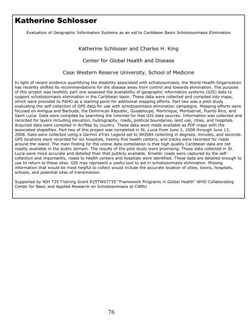
Katherine Schlosser<br />
Evaluation <strong>of</strong> Geographic Information Systems as an aid to Caribbean Basin Schistosomiasis Elimination<br />
Katherine Schlosser and Charles H. King<br />
Center for Global Health and Disease<br />
<strong>Case</strong> <strong>Western</strong> <strong>Reserve</strong> <strong>University</strong>, <strong>School</strong> <strong>of</strong> Medicine<br />
In light <strong>of</strong> recent evidence quantifying the disability associated with schistosomiasis, the World Health Organization<br />
has recently shifted its recommendations for the disease away from control and towards elimination. The purpose<br />
<strong>of</strong> this project was tw<strong>of</strong>old; part one assessed the availability <strong>of</strong> geographic information systems (GIS) data to<br />
support schistosomiasis elimination in the Caribbean basin. These data were collected and compiled into maps,<br />
which were provided to PAHO as a starting point for additional mapping efforts. Part two was a pilot study<br />
evaluating the self-collection <strong>of</strong> GPS data for use with schistosomiasis elimination campaigns. Mapping efforts were<br />
focused on Antigua and Barbuda, the Dominican Republic, Guadeloupe, Martinique, Montserrat, Puerto Rico, and<br />
Saint Lucia. Data were compiled by searching the Internet for free GIS data sources. Information was collected and<br />
recorded for layers including elevation, hydrography, roads, political boundaries, land use, cities, and hospitals.<br />
Acquired data were compiled in ArcMap by country. These data were made available as PDF maps with the<br />
associated shapefiles. Part two <strong>of</strong> this project was completed in St. Lucia from June 2, 2008 through June 13,<br />
2008. Data were collected using a Garmin eTrex Legend set to WGS84 collecting in degrees, minutes, and seconds.<br />
GPS locations were recorded for six hospitals, twenty-five health centers, and tracks were recorded for roads<br />
around the island. The main finding for the online data compilation is that high quality Caribbean data are not<br />
readily available in the public domain. The results <strong>of</strong> the pilot study were promising. These data collected in St.<br />
Lucia were more accurate and detailed than that publicly available. Smaller roads were captured by the selfcollection<br />
and importantly, roads to health centers and hospitals were identified. These data are detailed enough to<br />
use to return to these sites. GIS may represent a useful tool to aid in schistosomiasis elimination. Missing<br />
information that would be most helpful to collect would include the accurate location <strong>of</strong> cities, towns, hospitals,<br />
schools, and potential sites <strong>of</strong> transmission.<br />
Supported by NIH T35 Training Grant R25TW07735 ―Framework Programs in Global Health‖ WHO Collaborating<br />
Center for Basic and Applied Research on Schistosomiasis at CWRU<br />
76


