Urban Design - UF-Facilities Planning & Construction - University of ...
Urban Design - UF-Facilities Planning & Construction - University of ...
Urban Design - UF-Facilities Planning & Construction - University of ...

Create successful ePaper yourself
Turn your PDF publications into a flip-book with our unique Google optimized e-Paper software.
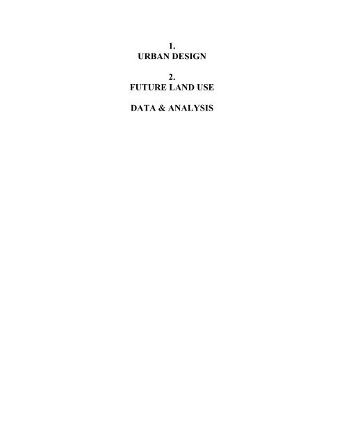
1.<br />
URBAN DESIGN<br />
2.<br />
FUTURE LAND USE<br />
DATA & ANALYSIS
UNIVERSITY OF FLORIDA FUTURE LAND USE AND URBAN DESIGN<br />
CAMPUS MASTER PLAN, 2005-2015 DATA & ANALYSIS<br />
I. Historic Campus Master Plans<br />
An important consideration in planning for the future <strong>of</strong> the <strong>University</strong> <strong>of</strong> Florida campus is to<br />
examine its past. The campus framework was first conceived as a series <strong>of</strong> arches, ellipses and<br />
circles, linking building sites situated on parallel axes. At a later stage, the campus followed grid<br />
patterns with rectangular buildings lining the access corridors and serving as focal points at<br />
terminating vistas. Eventually, unique building shapes appeared using arches and angles not<br />
previously seen in historic buildings. This later building form began to emphasize sweeping<br />
connections <strong>of</strong> open space that did not necessarily relate to the gridded roadway system.<br />
Remnants <strong>of</strong> these plans evolving over the past 100 years can be found in the built environment<br />
and the outdoor connections present in the Plaza <strong>of</strong> the Americas, Reitz Union Lawn, Flavet<br />
Field/Bandshell, Stadium Road (east end), Turlington Plaza and the recreation areas around Lake<br />
Alice.<br />
A. The 1905 Campus Master Plan<br />
The 1905 Master Plan is the first <strong>of</strong>ficial master plan for the <strong>University</strong> <strong>of</strong> Florida. The plan was<br />
created by the architect William A. Edwards in an aim to give the <strong>University</strong> <strong>of</strong> Florida an image<br />
that compares favorably to more renowned institutions. Two monumental arches represent the<br />
back bone for this master plan. The arches provide connectivity within the campus in addition to<br />
their aesthetic value. Three major open spaces could be observed in this plan. The main central<br />
green space is in the same location <strong>of</strong> today’s Plaza <strong>of</strong> the Americas. It was intended to be the<br />
main gathering area <strong>of</strong> campus, and this was further emphasized by the building organization<br />
around the space, its openness towards <strong>University</strong> Avenue, and the positioning <strong>of</strong> an<br />
administration building in the middle <strong>of</strong> the area.<br />
Open Space Analysis <strong>of</strong> 1905 Master Plan<br />
3<br />
1<br />
The second open space located to the east was distinguished by the chapel located in the middle,<br />
the space was intended to serve both the academic buildings, and the residence units located on<br />
2<br />
PAGE 1-1<br />
MARCH 2006
UNIVERSITY OF FLORIDA FUTURE LAND USE AND URBAN DESIGN<br />
CAMPUS MASTER PLAN, 2005-2015 DATA & ANALYSIS<br />
the east edge <strong>of</strong> campus. The third open space was located to the west and was also intended to<br />
serve both the academic units and the dormitories located on the west side <strong>of</strong> campus.<br />
Transportation and connectivity are major parts <strong>of</strong> this master plan. The two monumental arches<br />
were the main arteries <strong>of</strong> campus, providing access to most buildings within the campus area.<br />
Also, a series <strong>of</strong> geometrically-shaped pathways created linkage between the different areas <strong>of</strong><br />
campus and the different open spaces. Also noteworthy, the master plan is nearly symmetrical in<br />
building distribution north and south <strong>of</strong> the administration building and chapel. Additionally, all<br />
buildings are at right angles from each other.<br />
B. The 1920 Master Plan<br />
The architect <strong>of</strong> the 1920 master plan was also William A. Edwards. This plan shared a lot <strong>of</strong><br />
commonalities with the 1905 plan. The two monumental arches remained significant features <strong>of</strong><br />
this plan, but some obvious changes occurred in building locations and distributions. The<br />
administration building as suggested in 1905 was omitted in the 1920 plan. A new building, the<br />
<strong>University</strong> Auditorium, was built in the north side <strong>of</strong> the main open green space that was later<br />
known as the plaza <strong>of</strong> the Americas. The landscape <strong>of</strong> the Plaza <strong>of</strong> the Americas was designed by<br />
Fredrick Law Olmsted, Jr. in 1927, and the space was dedicated in 1931. The chapel also<br />
suggested in the 1905 plan was not present in the 1920 plan.<br />
Open Space Analysis <strong>of</strong> 1920 Master Plan<br />
3<br />
4<br />
1<br />
In 1920, the same three main open spaces from 1905 remained in the layout with some variations.<br />
Also, new open spaces and courtyards started to emerge due to building shapes and placements.<br />
The symmetry in building shapes and distribution noticeable in the 1905 plan began to disappear<br />
by 1920. An important aspect <strong>of</strong> this master plan was that some <strong>of</strong> the buildings in the plan<br />
actually existed by 1920, which meant that the plan was becoming more set compared to that <strong>of</strong><br />
1905. Some <strong>of</strong> these buildings include the halls <strong>of</strong> Flint, Anderson, Buckman, Thomas, Bryan,<br />
Peabody, Floyd, the <strong>University</strong> Auditorium, and Smathers Library. Despite all the modifications<br />
since 1905, the Plaza <strong>of</strong> the Americas space maintained its openness towards <strong>University</strong> Avenue<br />
helping to keep the campus open to the general public. Some changes were made to the campus<br />
5<br />
2<br />
PAGE 1-2<br />
MARCH 2006
UNIVERSITY OF FLORIDA FUTURE LAND USE AND URBAN DESIGN<br />
CAMPUS MASTER PLAN, 2005-2015 DATA & ANALYSIS<br />
walkways layout; the geometric shapes disappeared and a more grid-like pattern began to emerge.<br />
Also the walkways became narrower, simpler, and less monumental.<br />
C. The 1947/1948 Master Plan<br />
The 1947 land use master plan reflected a number <strong>of</strong> significant changes when compared to the<br />
previous years. The architect <strong>of</strong> this plan was Guy Fulton, and the period was the post World War<br />
II boom period. One <strong>of</strong> the most outstanding differences is the disappearance <strong>of</strong> the two<br />
monumental arches which were major features <strong>of</strong> the 1905 and the 1920 plans. By 1947, the area<br />
covered by campus grew significantly compared to previous years. The campus extended south to<br />
Archer Road. Norman Hall was built on the east side <strong>of</strong> 13 th Street, to be the first campus<br />
building built beyond the original campus site. In the west, the expansion was mostly in athletic<br />
facilities and housing. The residence units suggested adjacent to SW 13 th Street in the previous<br />
master plans were relocated to the west. A more diverse land use pattern emerged, with more<br />
emphasis on sports and agriculture especially to the south (for agriculture functions).<br />
Open Space Analysis <strong>of</strong> 1947 Land Use Plan<br />
Future Reitz<br />
Union location<br />
<strong>UF</strong> Auditorium<br />
The open space distribution was also significantly different compared to previous years. The main<br />
open space remained the Plaza <strong>of</strong> the Americas, however, the open space was extended east<br />
towards SW 13 th street. It also branched out south towards the location <strong>of</strong> today’s Reitz Union,<br />
forming an open space corridor. The <strong>University</strong> Auditorium was the focal point <strong>of</strong> the space<br />
located at the intersection <strong>of</strong> the three open spaces. Another significant building was planned, but<br />
never built, as the focal point <strong>of</strong> the open space to the southwest. This new proposed spatial<br />
PAGE 1-3<br />
MARCH 2006
UNIVERSITY OF FLORIDA FUTURE LAND USE AND URBAN DESIGN<br />
CAMPUS MASTER PLAN, 2005-2015 DATA & ANALYSIS<br />
configuration proved later to have a significant impact on building locations, orientations, and the<br />
future growth <strong>of</strong> campus.<br />
Transportation changes were also significant in this master plan. The two monumental arches<br />
disappeared from the plan. A larger network <strong>of</strong> roads and sidewalks emerged. Most sidewalks<br />
and roads remained at right angles from each other, with a few exceptions. By 1947, the<br />
automobile was becoming more common compared to previous years. Interestingly, no parking<br />
category was suggested in this land use plan although a large surface parking lot was shown in<br />
what is now known as the Criser Lot. It is also important to notice that railroad tracks were<br />
present on campus terminating south <strong>of</strong> the stadium. The tracks were connected to a railroad line<br />
parallel to Archer Road.<br />
Interestingly, the 1947 Land Use Plan was quickly followed by the 1948 Master Plan which<br />
added one additional open space linkage along a northwest-to-southeast alignment connecting the<br />
Florida Gym to the new student union proposed location (roughly today’s Reitz Union location)<br />
and southeast through McCarty Woods to what is now the Broward recreation area. This design<br />
plan retained a land use allocation in the middle <strong>of</strong> the Reitz Lawn open space that would allow<br />
for building construction.<br />
The 1948 Campus Master Plan<br />
PAGE 1-4<br />
MARCH 2006
UNIVERSITY OF FLORIDA FUTURE LAND USE AND URBAN DESIGN<br />
CAMPUS MASTER PLAN, 2005-2015 DATA & ANALYSIS<br />
D. The 1957/1958 Master Plan<br />
The 1957/1958 plan continued to reiterate some <strong>of</strong> the recent campus planning directions that first<br />
emerged in the 1948 master plan. The new spatial configuration suggested in the 1948 plan<br />
became the major feature <strong>of</strong> the 1957/1958 plan. The open space branched out even further than<br />
that suggested in 1948 to create a new open space corridor starting from the suggested location <strong>of</strong><br />
the student center, and ending close to the married housing units near Archer Road. Consistent<br />
with the 1948 plan, the open space corridor also extended west to the location <strong>of</strong> Flavet Field<br />
today, where men’s dorms are suggested in the plan.<br />
Another significant difference is related to building orientations. Most <strong>of</strong> the newer buildings are<br />
not at right angles and have different orientations. A large number <strong>of</strong> the suggested buildings<br />
frame the new open space corridors. In some cases, particularly the new dormitories, the angular<br />
placement <strong>of</strong> some buildings was designed to take advantage <strong>of</strong> prevailing winds. In this master<br />
plan, the area covered by campus land uses grew dramatically especially through agricultural<br />
functions. The agriculture land use expanded south beyond Lake Alice, and even further beyond<br />
Archer Road. Some important buildings were also shown in this plan. Such buildings include the<br />
Health Science Center, Shands Hospital, married housing units, Corry Village, sororities,<br />
fraternities, the president’s home, P.K. Yonge Laboratory School, Tigert Hall, and women’s<br />
dormitories.<br />
Another major difference in the 1957/1958 plan is that it shows a number <strong>of</strong> parking lots in<br />
different areas <strong>of</strong> campus. This indicates the wide use <strong>of</strong> vehicles on campus for the first time,<br />
and could be one <strong>of</strong> the most dramatic changes in campus development history. Yet, although<br />
there are a number <strong>of</strong> parking lots shown in the map, no separate land use is designated for<br />
parking. Such designation took place in later stages <strong>of</strong> the campus planning evolution. The<br />
presence <strong>of</strong> automobiles on campus influenced and continues to influence the development <strong>of</strong><br />
campus, especially campus open-spaces and circulation. Other than sweeping open spaces, the<br />
1957/1958 master plan reflects few pedestrian sidewalks with most <strong>of</strong> the emphasis on<br />
automobile-oriented access. The 1958 Master Plan document includes the land use and open<br />
space patterns consistent with the 1957 document.<br />
PAGE 1-5<br />
MARCH 2006
UNIVERSITY OF FLORIDA FUTURE LAND USE AND URBAN DESIGN<br />
CAMPUS MASTER PLAN, 2005-2015 DATA & ANALYSIS<br />
Space Analysis <strong>of</strong> 1957 Land Use Plan<br />
PAGE 1-6<br />
MARCH 2006
UNIVERSITY OF FLORIDA FUTURE LAND USE AND URBAN DESIGN<br />
CAMPUS MASTER PLAN, 2005-2015 DATA & ANALYSIS<br />
The 1958 Campus Master Plan<br />
E. The 1966 Master Plan<br />
The 1966 master plan was quite similar to the 1957 master plan. The campus area grew even<br />
further west and south by 1966. Most <strong>of</strong> the growth to the west and south was low density. Only<br />
a few buildings were constructed in the south and west, such as those at Physical Plant. The bulk<br />
<strong>of</strong> new buildings were established in the northeast part <strong>of</strong> campus around the open space<br />
corridors, particularly with new construction for family housing and dormitories. For the first<br />
time, the campus area expanded beyond SW 34 th Street. Also the golf course area was considered<br />
a part <strong>of</strong> campus and included in the campus plan.<br />
PAGE 1-7<br />
MARCH 2006
UNIVERSITY OF FLORIDA FUTURE LAND USE AND URBAN DESIGN<br />
CAMPUS MASTER PLAN, 2005-2015 DATA & ANALYSIS<br />
The 1966 Master Plan<br />
One <strong>of</strong> the significant changes to campus and its planning evolution was the construction <strong>of</strong> the<br />
Library West building. Although the building is not in itself monumental, its impact on campus<br />
and campus planning was monumental. The location <strong>of</strong> library west on the north end <strong>of</strong> the Plaza<br />
<strong>of</strong> the Americas signaled the end <strong>of</strong> this plaza as the main entrance to campus, a role it<br />
successfully fulfilled since the beginning <strong>of</strong> the century. Also, the new Fine Arts building was<br />
located on the east end <strong>of</strong> the open space extending from the <strong>University</strong> Auditorium to SW 13 th<br />
Street. Although the impact <strong>of</strong> the Fine Arts building was less significant, both <strong>of</strong> these buildings<br />
helped shift the focus away from these areas as entrance points to campus. More emphasis was<br />
placed on the new student center, the Reitz Union, as the center point <strong>of</strong> campus. Also, the open<br />
space north <strong>of</strong> Tigert Hall became the main gateway to campus, especially due to the major<br />
vehicle entrance area from SW 13 th Street, the parking lot, and the monumental features <strong>of</strong> Tigert<br />
Hall itself. Like the previous master plan, the focus <strong>of</strong> transportation was on automobile access<br />
and few sidewalks were shown on the map. New streets were created on campus, particularly in<br />
the west.<br />
PAGE 1-8<br />
MARCH 2006
UNIVERSITY OF FLORIDA FUTURE LAND USE AND URBAN DESIGN<br />
CAMPUS MASTER PLAN, 2005-2015 DATA & ANALYSIS<br />
Space Analysis <strong>of</strong> 1966 Plan, Core Campus<br />
Student<br />
Center<br />
Library West<br />
Building<br />
Tigert Hall<br />
Entrance Area<br />
Fine Arts<br />
Building<br />
F. The 1974 Master Plan<br />
In terms <strong>of</strong> spatial layout point, the <strong>University</strong> <strong>of</strong> Florida campus in the 1974 plan reflected some<br />
important changes compared to the plan <strong>of</strong> 1966. Very little change took place in the northeast<br />
area <strong>of</strong> campus around the Plaza <strong>of</strong> the Americas between the two years. By 1974, most <strong>of</strong> the<br />
new developments on campus were being built in the south and the southwest areas. The open<br />
space originally planned in 1966 between the Reitz Union lawn and Diamond Village area<br />
disappeared, as did the open space that had extended into Flavet Field in 1966. The area <strong>of</strong> Flavet<br />
Field itself was re-planned, and reflected a different distribution <strong>of</strong> buildings. In the southwest<br />
area <strong>of</strong> campus, both <strong>University</strong> Village South and Maguire Village were built. Also, new<br />
buildings emerged in the area to the south <strong>of</strong> Lake Alice and in the vicinity <strong>of</strong> Shands Hospital.<br />
PAGE 1-9<br />
MARCH 2006
UNIVERSITY OF FLORIDA FUTURE LAND USE AND URBAN DESIGN<br />
CAMPUS MASTER PLAN, 2005-2015 DATA & ANALYSIS<br />
The 1974 Campus Master Plan<br />
G. The 1987 Master Plan<br />
The 1987 master plan reflects a campus quite similar to the university campus today. Most <strong>of</strong> the<br />
main open spaces and plazas in 1987 remain unchanged in 2005. The open spaces depict a more<br />
disconnected system than had been envisioned in the late 1950’s and early 1960’s. Some <strong>of</strong> the<br />
new structures on campus reflected in this map were the O’Connell Center, and a number <strong>of</strong><br />
multi-level parking garages to accommodate increasing amounts <strong>of</strong> traffic. In this plan, the<br />
campus buildings expanded south beyond Archer Road. Most <strong>of</strong> this new expansion was through<br />
buildings associated with the Institute <strong>of</strong> Food and Agricultural Sciences and the College <strong>of</strong><br />
Veterinary Medicine.<br />
PAGE 1-10<br />
MARCH 2006
UNIVERSITY OF FLORIDA FUTURE LAND USE AND URBAN DESIGN<br />
CAMPUS MASTER PLAN, 2005-2015 DATA & ANALYSIS<br />
The 1987 Master Plan Framework<br />
H. The Campus Today<br />
As the campus master plans have evolved, the placement <strong>of</strong> buildings, roads and green spaces<br />
have also been modified. Some recommendations <strong>of</strong> past plans can be recognized in today’s built<br />
environment, while significant shifts from past plan schema can also be observed. The<br />
examination <strong>of</strong> historic campus master plans provides a glimpse into past decision making, as the<br />
campus evolved from a concept <strong>of</strong> arches and ellipses, to one <strong>of</strong> grids and rectilinear building<br />
orientations, to one <strong>of</strong> sweeping open spaces and irregular building shapes. In many ways these<br />
changing plan concepts reflect state-<strong>of</strong>-the-art thinking about urban design and architecture at the<br />
time they were conceived.<br />
In early plans, significant buildings such as the <strong>University</strong> Auditorium were deliberately placed in<br />
the center <strong>of</strong> prominent open spaces to emphasize the importance <strong>of</strong> the building. Similarly, a<br />
Chapel was planned to be a central focus <strong>of</strong> a large open space, but was never built. Buildings<br />
planned in 1966 for the areas now known as McCarty Woods, Harmonic Woods and Bartram-<br />
Carr Woods also never materialized. At one time, the new student union was sited in the middle<br />
<strong>of</strong> a significant open space, much like the <strong>University</strong> Auditorium, but was later positioned to the<br />
outer edge <strong>of</strong> the open space. Other buildings lining the Reitz Union lawn continue to frame this<br />
significant linear open space that had been envisioned as early as 1947. But over time, buildings<br />
such as Library West, Computer Science Engineering and the Fine Arts Complex were placed in<br />
what had been identified as open space. Still, the Plaza <strong>of</strong> the Americas, Turlington Plaza,<br />
McCarty Woods, Graham Woods and Broward Beach remain as reflections <strong>of</strong> earlier campus<br />
planning concepts. Today’s Flavet Field was filled with temporary student housing in the post<br />
World War II era, but was restored to open space with demolition <strong>of</strong> those buildings during the<br />
PAGE 1-11<br />
MARCH 2006
UNIVERSITY OF FLORIDA FUTURE LAND USE AND URBAN DESIGN<br />
CAMPUS MASTER PLAN, 2005-2015 DATA & ANALYSIS<br />
late 1970’s. The arrangement <strong>of</strong> land uses, building orientations and circulation systems also<br />
stand as testimony to the history <strong>of</strong> the <strong>University</strong> <strong>of</strong> Florida campus and its tradition <strong>of</strong> campus<br />
planning. Growth and change have come to the campus along with growth in prosperity and<br />
education <strong>of</strong> the people <strong>of</strong> Florida. However, the historic resources <strong>of</strong> the campus and its overall<br />
congruity have not been compromised. The <strong>University</strong> <strong>of</strong> Florida Historic Preservation Plan<br />
Report, prepared in 2004 for the Florida Division <strong>of</strong> Historic Resources, summarized this<br />
achievement as follows: “The <strong>University</strong> Record <strong>of</strong> 1906 predicted, ‘It may take a hundred years<br />
for the completion <strong>of</strong> these plans, but as the State grows…, the <strong>University</strong> will finally grow into a<br />
splendid and harmonious whole….’ It is through this ‘harmonious whole’ that the <strong>University</strong> <strong>of</strong><br />
Florida campus stands significant among large public universities; it is this harmonious and<br />
compatible growth that the Historic Preservation Plan seeks to protect for future generations.”<br />
1905 Campus Master Plan Overlay<br />
PAGE 1-12<br />
MARCH 2006
UNIVERSITY OF FLORIDA FUTURE LAND USE AND URBAN DESIGN<br />
CAMPUS MASTER PLAN, 2005-2015 DATA & ANALYSIS<br />
1966 Campus Master Plan Overlay<br />
I. Historic Impact Area<br />
In 1989, the <strong>University</strong> <strong>of</strong> Florida’s Historic District was placed on the National Register <strong>of</strong><br />
Historic Places. Subsequently, the university entered into a Memorandum <strong>of</strong> Agreement in 2001<br />
with the State <strong>of</strong> Florida Division <strong>of</strong> Historical Resources (DHR) to address the management <strong>of</strong><br />
this District. During 2003 and 2004, an extensive analysis <strong>of</strong> campus historic features was<br />
conducted with funding from the State DHR. This analysis included the designated National<br />
Register Historic District, and also an area around it containing buildings that are turning fifty<br />
years-<strong>of</strong>-age and are thereby eligible for registration. An ongoing research effort, funded through<br />
2006 by the Getty Foundation, will continue to develop design guidelines, preventive<br />
maintenance protocols and other mechanisms for the continued care <strong>of</strong> the university’s historic<br />
resources. One result <strong>of</strong> the initial study was the identification <strong>of</strong> an historic impact area as<br />
delineated in the following figure. This impact area contains the significant structures <strong>of</strong> the<br />
university architects William A. Edwards, Rudolph Weaver and Guy Fulton spanning 1905 to<br />
1956. The architecture and context <strong>of</strong> the historic impact area should be the framework for<br />
design guidelines and infill projects that could have an impact on historic resources.<br />
PAGE 1-13<br />
MARCH 2006
UNIVERSITY OF FLORIDA FUTURE LAND USE AND URBAN DESIGN<br />
CAMPUS MASTER PLAN, 2005-2015 DATA & ANALYSIS<br />
Campus Historic Impact Area<br />
J. Archaeological Resources<br />
In 2001, the <strong>University</strong> <strong>of</strong> Florida entered into a Memorandum <strong>of</strong> Agreement with the State <strong>of</strong><br />
Florida Division <strong>of</strong> Historic Resources for the preservation <strong>of</strong> the campus historic district and<br />
archaeological resources. This Agreement included a map <strong>of</strong> known Archaeological sites and<br />
zones <strong>of</strong> sensitivity, in which archaeological exploration must be conducted prior to any<br />
construction or significant earthwork. The locations <strong>of</strong> these resources are considered prior to<br />
any construction project and are depicted in a map that is part <strong>of</strong> the memorandum <strong>of</strong> agreement.<br />
The archaeological resources data is also included in the analysis performed as part <strong>of</strong> a<br />
campuswide composite constraints evaluation that is described elsewhere in this report.<br />
K. History and Archaeological Resources <strong>of</strong> the Alachua County Satellite<br />
Properties<br />
Historic and archaeological data was gathered from Alachua County and the Florida Department<br />
<strong>of</strong> State for the thirteen satellite properties in Alachua County. The findings <strong>of</strong> this inquiry<br />
revealed that there are few archaeological sites or historically significant structures on the<br />
properties. There are six archaeological sites on the Millhopper Horticulture Unit site; however,<br />
these areas are placed in the Conservation Future Land Use and considered for transfer to the<br />
State <strong>of</strong> Florida and Alachua County. Lake Wauburg North contains two identified historically<br />
significant structures, and is the only satellite property with historic buildings. Seven<br />
archaeological sites and an historic bridge exist on the Santa Fe River Beef Ranch site that are all<br />
placed within the Conservation Future Land Use that is owned by the Suwannee River Water<br />
Management District and managed by the <strong>University</strong> <strong>of</strong> Florida. The old warden’s house on the<br />
Eastside Campus may be <strong>of</strong> historical significance, but has not been thoroughly investigated or<br />
documented at this time.<br />
PAGE 1-14<br />
MARCH 2006
UNIVERSITY OF FLORIDA FUTURE LAND USE AND URBAN DESIGN<br />
CAMPUS MASTER PLAN, 2005-2015 DATA & ANALYSIS<br />
II. Composite Constraints<br />
Before updating future building sites or land use designations, an analysis was conducted <strong>of</strong> the<br />
natural and man-made constraints to building construction throughout campus. To this end, a<br />
taxonomy was created to group together different constraints by the relative degree to which they<br />
limit development or make it inappropriate based on the guiding principles <strong>of</strong> this master<br />
planning process. For each <strong>of</strong> these constraints, the best available data were used including some<br />
that was newly gathered for this purpose. The constraints were grouped in the following<br />
categories.<br />
• Severe Constraints include wetlands, surveyed floodplains, water bodies, caverns,<br />
archaeological sites and LEED-dedicated open space. Surveyed floodplains were<br />
included in this category because they are based on field-verified data that more<br />
accurately delineate boundaries. LEED-dedicated open space is a policy constraint that<br />
exists where open space was set aside for the express purpose <strong>of</strong> meeting requirements<br />
<strong>of</strong> the Leadership in Energy and Environmental <strong>Design</strong> (LEED) certification. Future<br />
applications <strong>of</strong> the LEED criteria will seek to apply the open space evaluation on a<br />
campus-wide conservation strategy, rather than a site-specific approach that creates<br />
these constraints in developed parts <strong>of</strong> campus. Land areas containing at least one <strong>of</strong><br />
these severe constraints are depicted in red on the following figure.<br />
• Moderate Constraints include FEMA floodplains, poorly drained soils, fifty-foot<br />
wetland buffers and hazardous materials sites. Floodplains identified by the Federal<br />
Emergency Management Agency are included as moderate constraints because they are<br />
delineated based on data extrapolated from aerial photography, and as such, have a<br />
lesser degree <strong>of</strong> accuracy than surveyed floodplains. Poorly drained soils were<br />
identified based upon the characteristics and mapping from the Soil Survey <strong>of</strong> Alachua<br />
County prepared by the U. S. Department <strong>of</strong> Agriculture and the Soil Conservation<br />
Service. Like FEMA floodplains, this information is not field-verified and lacks a high<br />
degree <strong>of</strong> accuracy, but it can still be useful as a guide. Poorly drained soils, where they<br />
exist, would not prevent construction but may require special construction techniques<br />
and mitigations. The fifty-foot wetland buffer identified as a moderate constraint is the<br />
area around a wetland which, if impacted, requires review by the St. Johns River Water<br />
Management District under the university’s existing master stormwater permit.<br />
Hazardous materials sites were included in the moderate constraints because, although<br />
they could add considerable expense to a construction project, the quality <strong>of</strong> the site<br />
would likely be improved after construction and remediation. For this reason, they were<br />
not categorized as a criterion that would severely constrain construction activity. Land<br />
areas containing at least one <strong>of</strong> these moderate constraints are depicted in yellow on the<br />
following figure.<br />
• Potential Constraints include corrosive soils (as identified in the Alachua County Soil<br />
Survey), Archaeologically Sensitive Sites and slopes <strong>of</strong> greater than five percent. Each<br />
<strong>of</strong> these constraints may pose additional design considerations or expense to a<br />
construction project, but would not necessarily be cause for abandoning an otherwise<br />
buildable site. Land areas containing at least one <strong>of</strong> these potential constraints are<br />
depicted in green on the following figure.<br />
PAGE 1-15<br />
MARCH 2006
UNIVERSITY OF FLORIDA FUTURE LAND USE AND URBAN DESIGN<br />
CAMPUS MASTER PLAN, 2005-2015 DATA & ANALYSIS<br />
Rare Plants. In addition to the constraints outlined above, the analysis also mapped known rare<br />
plants. These plants include unique ornamental specimens and naturally occurring plants such as<br />
poppy mallow and trillium. Because the occurrence <strong>of</strong> these plants is somewhat scattered across<br />
campus, their presence was not included in a constraint map layer, but was depicted in order to<br />
identify sensitive considerations for any construction activity. Ongoing data collection in<br />
collaboration with the university’s Department <strong>of</strong> Botany will expand the database <strong>of</strong> rare plant<br />
locations for future consideration.<br />
Conclusions. Much <strong>of</strong> the already developed eastern portion <strong>of</strong> campus was identified as having<br />
no natural or man-made constraints to further development based on the analysis <strong>of</strong> these<br />
characteristics. This finding is not surprising because the built areas are consistent with those<br />
places where infrastructure, buildings, utilities, excavation, and other human activities over the<br />
past 100 years have significantly altered the environment and located infrastructure that supports<br />
development. For this reason, the already developed parts <strong>of</strong> campus should be evaluated for<br />
potential infill sites that benefit from existing infrastructure and minimize negative impacts to less<br />
altered natural areas. Correspondingly, the parts <strong>of</strong> campus constrained by significant habitat,<br />
hydrological functions, or cultural resources should be protected from encroachment <strong>of</strong> new<br />
development. Other parts <strong>of</strong> campus identified as moderately or potentially constrained for<br />
development should seek to find a balance between retaining open space and creating functional<br />
clusters <strong>of</strong> development.<br />
Composite Constraints to Development<br />
PAGE 1-16<br />
MARCH 2006
UNIVERSITY OF FLORIDA FUTURE LAND USE AND URBAN DESIGN<br />
CAMPUS MASTER PLAN, 2005-2015 DATA & ANALYSIS<br />
III. Walking Distance and Activity Center Analysis<br />
In order to understand the distances and travel options across campus, an analysis <strong>of</strong> walking<br />
distances between parking and activity centers was conducted. For this purpose, activity centers<br />
were defined as clusters <strong>of</strong> university development. These centers include existing clusters <strong>of</strong><br />
development and those sites where existing development could be expanded to a more critical<br />
mass within an already impacted area. Similarly, existing parking structures and potential<br />
parking structure sites were analyzed to determine their proximity to activity centers. For this<br />
analysis, a five-minute walk distance was based on a 1,000-foot straight-line path. Although, the<br />
actual on-ground distance may be longer, the 1,000-foot path was based upon a very slow<br />
walking speed <strong>of</strong> three feet per second.<br />
The university has been operating under a policy to provide parking within a fifteen minute walk<br />
<strong>of</strong> final destination for employees. By depicting a 15-minute walk distance from existing<br />
structured parking, the following figure indicates that this policy has been met. However, a<br />
different distance between destinations should be used to evaluate the degree to which the campus<br />
accommodates walkable distances. Research on pedestrian and bicycle behavior indicates that<br />
people will walk 1,000 to 1,500 feet between destinations, and will bicycle up to three miles for<br />
everyday utilitarian purposes. For the pedestrian, these distances translate to approximately five<br />
to ten minutes <strong>of</strong> walking. Analysis <strong>of</strong> the walking distances between existing and potential<br />
activity centers reveals that the campus areas on the east side <strong>of</strong> campus (i.e. <strong>Planning</strong> Sectors<br />
“C”, “F” and “G” as defined elsewhere in this report) have the appropriate proximity for<br />
connectivity to destinations within and, in many cases, between these developed areas. The site<br />
<strong>of</strong> the Genetics/Cancer/Biotech Pavilion building has the necessary proximity to the College <strong>of</strong><br />
Veterinary Medicine and several properties owned or occupied by the Shands-<strong>UF</strong>. The cultural<br />
plaza area has the necessary proximity to the <strong>University</strong> <strong>of</strong> Florida Hilton Hotel, the Southwest<br />
Recreation Center and the Natural Area Teaching Laboratory. The potential activity center on<br />
Radio Road near SW 34 th Street is somewhat isolated, but could have convenient interactions<br />
with the existing village housing complexes and some student recreation areas. However, other<br />
sites including the area around the Law School, Fifield Hall, Mehrh<strong>of</strong> Hall and Energy Park will<br />
remain somewhat isolated for easy access by pedestrians. Although pedestrian movement within<br />
these activity centers can be accommodated, their more isolated locations will require that<br />
development be accessed by transit and automobile with appropriate parking facilities on site.<br />
Additionally, they will need to be more self-sufficient with either a mix <strong>of</strong> internal uses or a<br />
function that does not require frequent interaction with other entities on campus. Two additional<br />
figures presented below depict the five-minute walking distance analysis for activity centers and<br />
parking structures.<br />
PAGE 1-17<br />
MARCH 2006
UNIVERSITY OF FLORIDA FUTURE LAND USE AND URBAN DESIGN<br />
CAMPUS MASTER PLAN, 2005-2015 DATA & ANALYSIS<br />
15-Minute Walking Distance from Existing Structured Parking<br />
5-Minute Walking Distance from Existing and Potential Activity Centers<br />
PAGE 1-18<br />
MARCH 2006
UNIVERSITY OF FLORIDA FUTURE LAND USE AND URBAN DESIGN<br />
CAMPUS MASTER PLAN, 2005-2015 DATA & ANALYSIS<br />
5-Minute Walking Distance from Existing and Potential Structured Parking<br />
IV. Intensity and Density Analysis for Existing Development<br />
A. Intensity and Density <strong>of</strong> Land Use<br />
For the 2005-2015 campus master plan, an analysis was conducted <strong>of</strong> the existing development<br />
intensity and density by future land use classification. This analysis was also conducted for longterm<br />
potential development beyond the ten-year horizon as described in the build-out scenario<br />
presented in part II.B. <strong>of</strong> the data and analysis for capital improvements. Building density was<br />
calculated as Ground Area Coverage (GAC) measured by summing existing building footprints,<br />
then dividing by the total acreage <strong>of</strong> the future land use classification. Building intensity was<br />
calculated as Floor Area Ratio (FAR) measured by dividing the total gross square foot <strong>of</strong> building<br />
space by the total acreage <strong>of</strong> the future land use classification. Results <strong>of</strong> these calculations are<br />
presented in the table below. The Future Land Use Element includes a policy that establishes<br />
standards for densities and intensities for each land use classification expressed as a range <strong>of</strong><br />
GAC and FAR. These standards are based on this analysis as well as comparison to the standards<br />
published in the <strong>University</strong> <strong>of</strong> Florida Campus Master Plan, 2000-2010.<br />
Building Density and Intensity Analysis Based on Existing (2004) Buildings and<br />
Future Build-Out Scenario (beyond 2015)<br />
Future Land Use<br />
Classification<br />
Building Density or Ground<br />
Area Coverage, GAC<br />
(GSF <strong>of</strong> Building Footprint /<br />
GSF <strong>of</strong> Area<br />
Building Intensity or<br />
Floor Area Ratio, FAR<br />
(GSF <strong>of</strong> Building / GSF <strong>of</strong><br />
Area<br />
Low Range High Range Low Range High Range<br />
Academic 0.25 0.42 0.66 1.51<br />
PAGE 1-19<br />
MARCH 2006
UNIVERSITY OF FLORIDA FUTURE LAND USE AND URBAN DESIGN<br />
CAMPUS MASTER PLAN, 2005-2015 DATA & ANALYSIS<br />
Building Density or Ground<br />
Area Coverage, GAC<br />
(GSF <strong>of</strong> Building Footprint /<br />
GSF <strong>of</strong> Area<br />
Building Intensity or<br />
Floor Area Ratio, FAR<br />
(GSF <strong>of</strong> Building / GSF <strong>of</strong><br />
Area<br />
Future Land Use<br />
Classification<br />
Academic – Outdoor 0.03 0.04 0.03 0.03<br />
Active Recreation 0.18 0.22 0.21 0.26<br />
Active Recreation – Outdoor 0.01 0.02 0.01 0.01<br />
Buffer 0.00 0.00 0.00 0.00<br />
Conservation 0.00 0.00 0.00 0.00<br />
Cultural 0.20 0.38 0.30 1.23<br />
Housing 0.17 0.20 0.41 0.55<br />
Support 0.25 0.33 0.58 1.03<br />
<strong>Urban</strong> Park 0.01 0.01 0.01 0.01<br />
Utility 0.28 0.33 0.19 0.40<br />
NOTE: The analysis does not include parking, since the future land use generally coincides with<br />
the paved area <strong>of</strong> a surface parking lot such that the GAC equals approximately 1.0. Structured<br />
parking is expressed as a factor <strong>of</strong> the GAC based on the number <strong>of</strong> floors <strong>of</strong> parking. In general,<br />
the intensity and density <strong>of</strong> parking is more appropriately evaluated in terms <strong>of</strong> the number <strong>of</strong><br />
parking spaces and traffic impacts.<br />
In 2002, an analysis was conducted for several sub-areas and sites on campus to determine the<br />
land use and development pattern in terms <strong>of</strong> building footprint, building bulk, open space, tree<br />
coverage and transportation infrastructure. For the analysis, each area or site was delineated and<br />
a total site area was measured in square feet. Building density was defined as the total building<br />
gross square footage divided by the site area in order to account for building height and bulk.<br />
Ground Area Coverage (GAC) was measured by summing the land area covered by the building<br />
footprint, parking lots, streets, plazas and sidewalks, then dividing by the site area. The GAC<br />
provides a measure <strong>of</strong> building intensity by describing the land consumption <strong>of</strong> the building<br />
footprint and its associated hard-surface areas. Open space was calculated to include both<br />
pervious and impervious surfaces that provide outdoor areas for people to congregate or move<br />
through. To that end, open space included a sum <strong>of</strong> land coverage in sidewalks, plazas, natural<br />
areas and water divided by the site area. Tree canopy coverage was calculated as a subset <strong>of</strong> open<br />
space by measuring the amount <strong>of</strong> area covered in tree canopy divided by the land area in open<br />
space (as defined previously). The measure <strong>of</strong> motor vehicle infrastructure included the area <strong>of</strong><br />
land covered by streets and parking lots divided by the site area.<br />
Conclusions. From the 2002 analysis, the variations in intensity and density <strong>of</strong> land use across<br />
campus become apparent. The differences in the site area size accounts for some, but not all, <strong>of</strong><br />
this variation. The Shands/Health Science Center area has by far the densest and most intense<br />
land use pattern, nearly double the GAC <strong>of</strong> other campus areas and over three times the density <strong>of</strong><br />
any other sub-area analyzed. Particularly, the difference is observed when comparing this area<br />
with the similarly-sized IFAS area around Fifield Hall. Areas with large athletic fields and<br />
natural areas, such as the Fraternity, Greater Southwest or Recreational sub-areas, have<br />
significantly lower densities and intensities with more open space as would be expected. Another<br />
observation that can be made is the generally efficient development patterns in the northeastern<br />
part <strong>of</strong> campus, including the Historic and Reitz Union sub-areas, where open space and building<br />
density are fairly balanced. Also <strong>of</strong> note is the generally minimal land area given over to motor<br />
vehicle infrastructure. Interestingly, the motor vehicle infrastructure component is highest in the<br />
Historic Sub-Area where the grid street pattern is a significant feature, and much lower in the<br />
Shands/HSC area where structured parking creates land use efficiency.<br />
PAGE 1-20<br />
MARCH 2006
UNIVERSITY OF FLORIDA FUTURE LAND USE AND URBAN DESIGN<br />
CAMPUS MASTER PLAN, 2005-2015 DATA & ANALYSIS<br />
The analysis <strong>of</strong> individual sites is somewhat less useful for generalization, but does provide a<br />
glimpse into the allocation <strong>of</strong> land on development sites in different locations, time periods and<br />
building types. Each <strong>of</strong> these analyses, sub-area and site-specific, provide a range <strong>of</strong> measures<br />
currently found in the campus environment. The following table and maps summarize the<br />
analysis.<br />
Campus Sub-Area and Site Land Use Development Pattern Analysis<br />
IFAS<br />
Sub-Area<br />
Greater Southwest<br />
Recreational<br />
Cultural<br />
Veterinary Medicine<br />
Fraternity<br />
Reitz Union<br />
Historic<br />
Shands/HCS<br />
Sites<br />
Entomology Bldg:<br />
Greater SW Sub-Area<br />
Microbiology / Cell:<br />
Greater SW Sub-Area<br />
Lakeside Residence:<br />
Greater SW Sub-Area<br />
Gator Corner Dining:<br />
Fraternity Sub-Area<br />
Mallory / Yulee / Reid:<br />
Reitz Sub-Area<br />
<strong>University</strong> Auditorium:<br />
Historic Sub-Area<br />
Turlington / Rolfs:<br />
Historic Sub-Area<br />
Tigert Hall: Historic<br />
Sub-Area<br />
Site Area<br />
(sq. ft.)<br />
Building<br />
Density<br />
Ground<br />
Area<br />
Coverage<br />
(GAC)<br />
Open<br />
Space<br />
Tree<br />
Canopy<br />
Coverage<br />
Motor Vehicle<br />
Infrastructure<br />
1,808,908 0.12 0.46 0.79 0.24 0.11<br />
9,323,244 0.13 0.30 0.76 0.21 0.14<br />
4,215,463 0.13 0.33 0.81 0.14 0.10<br />
3,123,782 0.14 0.29 0.78 0.28 0.15<br />
2,818,909 0.20 0.37 0.64 0.25 0.18<br />
3,019,678 0.23 0.33 0.70 0.80 0.18<br />
2,828,379 0.55 0.44 0.69 0.54 0.12<br />
3,210,538 0.67 0.43 0.57 0.66 0.21<br />
1,671,724 2.07 0.71 0.40 0.46 0.16<br />
Site Area<br />
(sq. ft.)<br />
497,310<br />
263,229<br />
432,393<br />
60,632<br />
251,638<br />
139,744<br />
147,680<br />
126,317<br />
Building<br />
Density<br />
0.20<br />
0.26<br />
0.41<br />
0.36<br />
0.51<br />
0.42<br />
0.32<br />
0.63<br />
Ground<br />
Area<br />
Coverage<br />
(GAC)<br />
0.31<br />
0.44<br />
0.41<br />
0.58<br />
0.46<br />
0.47<br />
0.87<br />
0.43<br />
Open<br />
Space<br />
0.67<br />
0.60<br />
0.67<br />
0.64<br />
0.65<br />
0.83<br />
0.53<br />
0.82<br />
Tree<br />
Canopy<br />
Coverage<br />
0.45<br />
0.14<br />
0.12<br />
0.25<br />
0.57<br />
Motor Vehicle<br />
Infrastructure<br />
0.11<br />
0.13<br />
0.19<br />
0.01<br />
0.22<br />
0.42
UNIVERSITY OF FLORIDA FUTURE LAND USE AND URBAN DESIGN<br />
CAMPUS MASTER PLAN, 2005-2015 DATA & ANALYSIS<br />
Murphree Hall:<br />
Historic Sub-Area<br />
Peabody / Criser:<br />
140,134 0.69 0.57 0.59 0.53<br />
0.26<br />
Historic Sub-Area<br />
Smathers Library<br />
East: Historic Sub-<br />
77,537<br />
1.20 0.74 0.56 0.09
UNIVERSITY OF FLORIDA FUTURE LAND USE AND URBAN DESIGN<br />
CAMPUS MASTER PLAN, 2005-2015 DATA & ANALYSIS<br />
Greater Southwest Sub-Area Development Pattern Analysis<br />
Recreational Sub-Area Development Pattern Analysis<br />
PAGE 1-23<br />
MARCH 2006
UNIVERSITY OF FLORIDA FUTURE LAND USE AND URBAN DESIGN<br />
CAMPUS MASTER PLAN, 2005-2015 DATA & ANALYSIS<br />
Cultural Sub-Area Development Pattern Analysis<br />
Veterinary Medicine Sub-Area Development Pattern Analysis<br />
PAGE 1-24<br />
MARCH 2006
UNIVERSITY OF FLORIDA FUTURE LAND USE AND URBAN DESIGN<br />
CAMPUS MASTER PLAN, 2005-2015 DATA & ANALYSIS<br />
Fraternity Sub-Area Development Pattern Analysis<br />
Reitz Union Sub-Area Development Pattern Analysis<br />
PAGE 1-25<br />
MARCH 2006
UNIVERSITY OF FLORIDA FUTURE LAND USE AND URBAN DESIGN<br />
CAMPUS MASTER PLAN, 2005-2015 DATA & ANALYSIS<br />
Historic Sub-Area Development Pattern Analysis<br />
Shands Sub-Area Development Pattern Analysis<br />
PAGE 1-26<br />
MARCH 2006
UNIVERSITY OF FLORIDA FUTURE LAND USE AND URBAN DESIGN<br />
CAMPUS MASTER PLAN, 2005-2015 DATA & ANALYSIS<br />
V. Campus Sectors<br />
In order to evaluate and understand contiguous areas <strong>of</strong> campus at a smaller scale, the main<br />
campus was divided into twelve planning sectors as presented on the following figure. These<br />
sectors were delineated based, to some extent, on land use patterns and function. Pragmatically,<br />
they were also delineated so as to be proportionally correct for display on maps contained in this<br />
document. Some areas beyond the campus boundary were included in the planning sector<br />
coverage for the purpose <strong>of</strong> providing a community context and symmetric boundaries.<br />
However, this inclusion does not imply that the university will be making any recommendations<br />
in the non-campus areas.<br />
A general description <strong>of</strong> each planning sector is as follows:<br />
• <strong>Planning</strong> Sector “A” includes the <strong>University</strong> Golf Course as a unique land use situated<br />
on <strong>University</strong> Athletic Association lands and included in the campus master plan<br />
boundary.<br />
• <strong>Planning</strong> Sector “B” includes the Law School, student housing complexes, Greek<br />
housing, athletic and recreation facilities, student support facilities and open spaces.<br />
Because it includes large athletic fields and open spaces, its character is largely one <strong>of</strong><br />
lower density development with expansive open spaces between clusters <strong>of</strong> development.<br />
It includes small linear portion <strong>of</strong> the Historic Impact Area which straddles Gale<br />
Lemerand Drive to include Tolbert Hall and the former site <strong>of</strong> Flavet housing.<br />
• <strong>Planning</strong> Sector “C” includes the National Register Historic District, the Historic<br />
Impact Area and a concentration <strong>of</strong> campus buildings <strong>of</strong>ten referred to as the “core<br />
campus” or “northeast corner”. It is the portion <strong>of</strong> campus that is most interconnected<br />
with the Gainesville community across W. <strong>University</strong> Avenue and W. 13 th Street. The<br />
building pattern in Sector “C” is one <strong>of</strong> generally modest building sizes places in close<br />
proximity to one another with formal open spaces defined by the building locations and<br />
gridded streets.<br />
• <strong>Planning</strong> Sector “D” includes a large western part <strong>of</strong> campus containing student housing<br />
complexes, athletic and recreation facilities, physical plant facilities, and the new<br />
Orthopaedic Center west <strong>of</strong> SW 34 th Street.<br />
• <strong>Planning</strong> Sector “E” contains Lake Alice and its perimeter including a hydrologicallyconnected<br />
area south <strong>of</strong> Mowry Road, and the Bat House and student gardens north <strong>of</strong><br />
Museum Road. Significant IFAS academic facilities also exist in this area including<br />
Fifield Hall, Microbiology and Cell Science building, and numerous greenhouses and<br />
support facilities some <strong>of</strong> which utilize access to Lake Alice for research.<br />
• <strong>Planning</strong> Sector “F” includes a significant built area south <strong>of</strong> Museum Road containing<br />
a mix <strong>of</strong> academic buildings, student housing complexes, support facilities and open<br />
space. Its function is most similar to that <strong>of</strong> <strong>Planning</strong> Sector “C”, although its newer<br />
development period resulted in somewhat different patterns than in the historic part <strong>of</strong><br />
campus. It includes small linear portion <strong>of</strong> the Historic Impact Area which straddles<br />
Museum Road to include <strong>University</strong> Police Department building (former WR<strong>UF</strong> radio<br />
station). Compared to Sector “C”, buildings in this sector tend to have larger footprints<br />
and modernistic designs. This Sector contains the only high-rise residence hall on<br />
campus at Beaty Towers. And unlike Sector “C”, Sector “F” contains several large<br />
surface parking lots and open spaces that are retained in a more natural state (i.e. not<br />
manicured or formally landscaped).<br />
PAGE 1-27<br />
MARCH 2006
UNIVERSITY OF FLORIDA FUTURE LAND USE AND URBAN DESIGN<br />
CAMPUS MASTER PLAN, 2005-2015 DATA & ANALYSIS<br />
• <strong>Planning</strong> Sector “G” is the most intensely and densely developed areas <strong>of</strong> campus<br />
containing one <strong>of</strong> the most populous employment concentrations in North Florida. It<br />
includes the Shands/Health Science Center Complex, the College <strong>of</strong> Veterinary Medicine<br />
area south <strong>of</strong> SW 16 th Avenue, and numerous academic and research buildings as well as<br />
public hospital and clinic facilities. Four <strong>of</strong> the university’s ten parking garages are<br />
located in Sector “G”. Compared to other parts <strong>of</strong> campus, the buildings in Sector “G”<br />
tend to be modernistic and significantly taller, a trait which is blended into the rest <strong>of</strong><br />
campus by virtue <strong>of</strong> being downhill from other structures. Despite its already intense<br />
development, Sector “G” also contains some sizeable tracts appropriate for<br />
redevelopment such as the site <strong>of</strong> the new Genetics/Cancer/Biotech Pavilion building. Its<br />
position within the larger Gainesville community also suggests the opportunity for new<br />
development connected to <strong>of</strong>f-campus areas along SW 13 th Street and Depot Avenue.<br />
• <strong>Planning</strong> Sector “H” includes sorority row, P. K. Yonge Laboratory School and the<br />
Civil and Coastal Engineering facilities on SW 6 th Street. It is embedded into the<br />
Gainesville community in an area that is aggressively redeveloping to support community<br />
housing and economic development needs.<br />
• <strong>Planning</strong> Sector “I” includes the southwestern portion <strong>of</strong> campus containing the Hilton<br />
<strong>University</strong> Center Hotel and Cultural Complex along with a mix <strong>of</strong> mostly small-scale<br />
support facilities, academic buildings and resources focused on agriculture and<br />
environmental research. These research facilities include many outdoor teaching and<br />
research resources such as the orchard, irrigation park and various agricultural plots.<br />
• <strong>Planning</strong> Sector “J” is located south <strong>of</strong> Archer Road and includes a mix <strong>of</strong> research<br />
clusters such as Energy Park, the Swine Unit, Bee Biology Unit and the Animal Research<br />
<strong>Facilities</strong>. It also includes significant expanses <strong>of</strong> conservation lands, pastures and the<br />
organic gardens.<br />
• <strong>Planning</strong> Sector “K” includes the areas south <strong>of</strong> the major College <strong>of</strong> Veterinary<br />
Medicine buildings and north <strong>of</strong> Bivens Arm Lake. <strong>Facilities</strong> in this Sector include many<br />
small-scale research and academic support structures along with pastures and a dog track.<br />
• <strong>Planning</strong> Sector “L” includes the southernmost university main campus properties<br />
bordered by SW 23 rd Terrace, Bivens Arm Lake and Williston Road. This area is largely<br />
occupied by pasture, horticulture and other agricultural teaching resources. The few<br />
structures in this sector include pole barns, sheds and other small unoccupied buildings.<br />
PAGE 1-28<br />
MARCH 2006
UNIVERSITY OF FLORIDA FUTURE LAND USE AND URBAN DESIGN<br />
CAMPUS MASTER PLAN, 2005-2015 DATA & ANALYSIS<br />
<strong>Planning</strong> Sectors, 2005-2015 Data and Analysis<br />
VI. Campus Connections<br />
A. Open Space and <strong>Urban</strong> <strong>Design</strong> Connections<br />
Through the campus master plan development process, important corridors were identified that<br />
provide connectivity between open spaces, campus entry points and major destinations on<br />
campus. These are depicted in two separate maps. The Open Space Connections map identifies<br />
important corridors that provide access for pedestrians and bicyclists moving through and<br />
between the various campus open spaces, as well as physical connections between open spaces<br />
that may accommodate movement <strong>of</strong> animals, birds, invertebrates and plant seeds. An <strong>Urban</strong><br />
<strong>Design</strong> Connections map includes these corridors, but also adds a concept <strong>of</strong> a roadway hierarchy<br />
and identification <strong>of</strong> campus gateways and facilities that attract high volumes <strong>of</strong> many different<br />
users.<br />
PAGE 1-29<br />
MARCH 2006
UNIVERSITY OF FLORIDA FUTURE LAND USE AND URBAN DESIGN<br />
CAMPUS MASTER PLAN, 2005-2015 DATA & ANALYSIS<br />
Open Space Connections<br />
<strong>Urban</strong> <strong>Design</strong> Connections<br />
PAGE 1-30<br />
MARCH 2006
UNIVERSITY OF FLORIDA FUTURE LAND USE AND URBAN DESIGN<br />
CAMPUS MASTER PLAN, 2005-2015 DATA & ANALYSIS<br />
B. Roadway Hierarchy<br />
A roadway hierarchy is a means to distinguish different roadway types on campus that provide<br />
different levels <strong>of</strong> access. This differentiation can be used to develop design guidelines and<br />
traffic management approaches. In terms <strong>of</strong> open space connectivity, many <strong>of</strong> these roadways<br />
also provide pedestrian and bicycle access to urban parks and conservation areas. This typology<br />
is similar to that which is developed by other federal, state and local agencies to classify<br />
roadways for design and funding considerations. As part <strong>of</strong> the process <strong>of</strong> developing the<br />
Campus Master Plan for 2005-2015, definitions were developed for a campus roadway hierarchy<br />
as follows. A map <strong>of</strong> the recommended designations is also included below. The<br />
recommendations even suggest a hierarchy designation for roads that are not built, but are<br />
included as recommended new construction projects. These designations could guide the design<br />
<strong>of</strong> such facilities if and when they are constructed.<br />
• Core Campus roads are within or immediately proximate to the <strong>University</strong>’s Pedestrian<br />
Enhancement Zone. These roads are also within the <strong>University</strong>’s Historic Impact Area.<br />
Their primary function is to provide access for bicyclists and pedestrians, with limited<br />
daytime access for service, delivery and emergency vehicles or vehicles accessing<br />
disabled and gated parking areas. Transit vehicles are allowed on core campus roads<br />
where necessary to provide convenient access to this core academic area. Slow speeds<br />
and pedestrian priority are emphasized on all core campus roadways.<br />
• Local Connector roads provide access to campus facilities that are more internally<br />
focused with less emphasis on providing public access or through movement. They are<br />
low-volume roadways that are located in more isolated areas <strong>of</strong> campus and do not<br />
provide direct access to any primary destinations. Due to their low-volume <strong>of</strong> vehicles,<br />
bicycle access can be provided in bicycle lanes, wide-curb lanes or general shared-use<br />
pavements (with or without lane striping). Sidewalks may be provided on one side <strong>of</strong> the<br />
street only. Campus transit routes may run on local connector roads, but are discouraged<br />
when conflicting with bicycle and pedestrian access. Transportation planning should<br />
strive to maintain these roadways in low-volume use. Appropriate traffic calming<br />
techniques are compatible on local connectors where necessary to maintain low volumes<br />
and low speeds.<br />
• Secondary Connector roads provide internal circulation, but also serve primary<br />
destinations and or gateways. They carry moderate vehicle volumes and should<br />
accommodate bicycles and pedestrians with bicycle lanes and sidewalks on both sides.<br />
When vehicle volumes are higher or a major gateway is served, access management to<br />
restrict turning vehicles and limited development on the road frontage are appropriate<br />
techniques to maintain traffic flow without the turn lanes and medians that would be<br />
expected on a Primary Connector. Campus and City transit routes may be present on<br />
these roadways. Appropriate traffic calming techniques are compatible on secondary<br />
connectors where feasible with designs that do not create hazards for transit or bicycle<br />
users.<br />
• Primary Connector roads provide access into and through the campus. They serve<br />
primary destinations and gateways including critical intersections with state arterial<br />
roadways. They carry the highest vehicular volumes on campus and high volume transit<br />
routes including City and Campus routes. Transit service should be accommodated with<br />
bus shelters and bus pull-out bays where appropriate. Bicycles should be accommodated<br />
on bicycle lanes and, in some cases, additional shared-use paths that are located on<br />
parallel or alternate alignments. Pedestrians should be provided with sidewalks on both<br />
sides <strong>of</strong> the road, high-visibility crosswalks and other means <strong>of</strong> identifying conflict points<br />
PAGE 1-31<br />
MARCH 2006
UNIVERSITY OF FLORIDA FUTURE LAND USE AND URBAN DESIGN<br />
CAMPUS MASTER PLAN, 2005-2015 DATA & ANALYSIS<br />
with vehicles. Appropriate traffic calming techniques are compatible on primary<br />
connectors where feasible with designs that do not create hazards for transit or bicycle<br />
users. Traffic calming and transportation system management techniques should strive to<br />
maintain low speeds, smooth traffic flow and provide safe integration <strong>of</strong> multiple travel<br />
modes. Landscaped medians with turn lanes should be included in a standard divided<br />
roadway design unless access management and limited development allow smooth traffic<br />
flow on a more narrow travel way.<br />
• Gateway Roads are state arterials that form the perimeter <strong>of</strong> the campus. They provide<br />
primary regional access to the university while also accommodating regional throughtraffic<br />
on the state highway system. As these major throughways pass by the university,<br />
their design and intent must create a pleasing and safe environment that enhances the<br />
campus experience and accommodates safe movement <strong>of</strong> pedestrians and bicyclists.<br />
These roadways should not form barriers between the university campus and the<br />
community <strong>of</strong> apartments, neighborhoods, shops and restaurants that serve the campus<br />
population.<br />
Roadway Hierarchy<br />
VII. Future Land Use Trends<br />
Since the 1995-2005 Campus Master Plan, the university has tracked land use designations on its<br />
main campus. The 2000-2010 Campus Master Plan, and a subsequent amendment in 2004<br />
brought additional Alachua County properties under the auspices <strong>of</strong> the campus master plan. In<br />
order to gauge changes on campus and evaluate the impact <strong>of</strong> proposed plan amendments, the<br />
university tracks the amount <strong>of</strong> acreage included in each land use category.<br />
PAGE 1-32<br />
MARCH 2006
UNIVERSITY OF FLORIDA FUTURE LAND USE AND URBAN DESIGN<br />
CAMPUS MASTER PLAN, 2005-2015 DATA & ANALYSIS<br />
Significant improvements in campus mapping and analysis capabilities occurred during the<br />
period from 2002-2005 enabling more accurate measurements to be made. These improvements<br />
have been fully employed for the 2005-2015 campus master plan, and may account for some<br />
fluctuation in the land use category acreages described. Prior to these data management<br />
improvements, the 1995-2005 Campus Master Plan inconsistently measured water bodies such<br />
that approximately 20 acres were double-counted and included in the Conservation land use<br />
coverage. None <strong>of</strong> the acreages from the 1995-2005 and 2000-2010 campus master plans include<br />
the approximately 46 acres occupied by campus roadways or an additional 184 acres +/- covered<br />
by water bodies. Beginning with the 2005-2015 campus master plan, all water bodies are<br />
included in the Conservation land use coverage and are calculated as such. Despite these data<br />
discrepancies, the range <strong>of</strong> acreages is still reasonably consistent and a view <strong>of</strong> the map<br />
chronology provides insight into the minimal changes that have been made through amendments<br />
to future land use designations.<br />
A. 1995-2005 Adopted Future Land Use<br />
The Future Land Use designations are an expression <strong>of</strong> the preferred use for campus lands. These<br />
uses may be different than the current use <strong>of</strong> the land. Also, the future recommended uses may<br />
change based on new information or changing external or internal needs. When the<br />
recommended Future Land Use is changed, it must be formalized through an amendment to the<br />
campus master plan. The 1995-2005 Future Land Use designations are those recommended at the<br />
time the campus master plan for 1995 to 2005 was adopted. The 2000-2010 Future Land Use<br />
designations are those recommended when the 2000-2010 campus master plan was adopted, and<br />
following a series <strong>of</strong> amendments through 2004. Data are tracked separately for the main campus<br />
and the satellite properties.<br />
Adopted Future Land Use,<br />
1995-2005 Campus Master Plan and 2000-2010 Campus Master Plan<br />
Academic Support Housing Utility Cultural<br />
Passive<br />
Rec<br />
Active<br />
Rec<br />
Conservation<br />
* Parking<br />
MP1995-2005 Acres 585 135 129 21 15 180 268 342 158<br />
MP 1995-2005<br />
Acres (as amended<br />
through 1999) 581 125 106 21 13 202 270 345 165<br />
MP2000-2010 Acres 574.0 120.7 131.0 21.8 10.6 217.0 273.0 327.1 134.1<br />
Change in Acres 0.0 0.6 0.0 0.0 0.0 -1.2 0.0 0.0 0.6<br />
MP2000-2010 Acres<br />
(as amended 12/02) 574.0 121.3 131.0 21.8 10.6 215.8 273.0 327.1 134.7<br />
Change in Acres -0.7 0.1 0.0 -1.5 0.0 -0.7 -1.9 1.3 3.4<br />
MP2000-2010 Acres<br />
(as amended 8/03) 573.3 121.4 131.0 20.3 10.6 215.1 271.1 328.4 138.1<br />
Change in Acres 0.0 0.2 0.0 0.0 0.0 0.0 0.0 0.0 0.0<br />
MP2000-2010 Acres<br />
(as amended 3/04) 573.3 121.6 131.0 20.3 10.6 215.1 271.1 328.4 138.1<br />
* Note that the 1995-2005 Campus Master Plan calculations inconsistently measured water bodies, causing<br />
approximately 20 acres <strong>of</strong> water bodies to be incorrectly included in the Conservation land use coverage.<br />
PAGE 1-33<br />
MARCH 2006
UNIVERSITY OF FLORIDA FUTURE LAND USE AND URBAN DESIGN<br />
CAMPUS MASTER PLAN, 2005-2015 DATA & ANALYSIS<br />
Adopted Future Land Use,<br />
2000-2010 Campus Master Plan, Alachua County Satellite Properties<br />
Alachua County<br />
Passive Active Conser- Parking/<br />
Satellite Property<br />
Austin Cary<br />
Academic Support Housing Utility Cultural Rec Rec vation Roads<br />
Memorial Forest 1976.7 110.3<br />
Beef Research Unit<br />
Dairy Research<br />
1147.6 120.4<br />
Unit 1022.2 140.7<br />
Eastside Campus 3.4 1.9 0.3 2.9 3.8<br />
Lake Wauburg<br />
Millhopper<br />
93.2<br />
Horticulture Unit 441.7 90.6<br />
Newnans Lake<br />
Santa Fe River<br />
92.6<br />
Ranch Beef Unit 950.6 749.6<br />
TREEO Center<br />
<strong>UF</strong> Libraries<br />
5.0<br />
Remote Services 4.6 6.5<br />
Wall Farm / HTU 68.6<br />
WR<strong>UF</strong> Tower 57.2<br />
W<strong>UF</strong>T Tower 2.4<br />
NOTE: The Eastside Campus and <strong>UF</strong> Libraries Remote Services were added to the campus master plan by<br />
an amendment in March 2004. A subsequent amendment in January 2005 slightly modified the Eastside<br />
Campus Future Land Use allocations as represented above.<br />
B. 2004 Existing Land Use<br />
A map was prepared <strong>of</strong> the existing use <strong>of</strong> land on the main campus. From this map, the acreage<br />
was calculated for each land use classification. Differences between the existing land use and<br />
future land use indicate areas that are targeted to change from their existing use over time, or<br />
areas that were reallocated based on updated mapping. For example, the 2005-2015 Future Land<br />
Use allocations included small parking lots or landscaped areas associated with individual<br />
buildings in the land use <strong>of</strong> the building (i.e. Academic/Research, Support, Housing, etc.) rather<br />
than identify them as Parking or Passive Recreation as was <strong>of</strong>ten the approach <strong>of</strong> previous<br />
mapping efforts. In addition to the acreages shown in the table below, there are approximately 73<br />
acres devoted to roads and sidewalks, and another 69 acres in water. A map <strong>of</strong> the existing<br />
campus land use appears at the end <strong>of</strong> this report.<br />
Existing Main Campus Land Use, 2004<br />
Academic Support Housing Utility Cultural<br />
Passive<br />
Rec<br />
Active<br />
Rec Conservation Parking<br />
570 106 107 19 8 247 250 324 176<br />
C. 2005-2015 Future Land Use Recommendations<br />
The Future Land Use designations for 2005-2015 represent a comprehensive review and update<br />
to previous designations. The Future Land Use classifications were significantly redefined and<br />
four new land use classifications were created. An Academic/Research-Outdoor classification<br />
was created to recognize those areas used for outdoor teaching and research such as pastures, row<br />
PAGE 1-34<br />
MARCH 2006
UNIVERSITY OF FLORIDA FUTURE LAND USE AND URBAN DESIGN<br />
CAMPUS MASTER PLAN, 2005-2015 DATA & ANALYSIS<br />
crops, greenhouses, arboretums, orchards, irrigation farms and other such outdoor laboratories<br />
typically associated with the Institute for Food and Agricultural Sciences or the College <strong>of</strong><br />
Veterinary Medicine. Similarly, an Active Recreation-Outdoor land use classification was<br />
created to recognize the open space quality <strong>of</strong> recreation fields as compared to recreation centers,<br />
gymnasiums, stadiums and other enclosed or semi-enclosed recreation resources. The Passive<br />
Recreation land use was deleted and replaced with two different land use classifications – <strong>Urban</strong><br />
Park and Green Space Buffer – to recognize the functional value <strong>of</strong> these different types <strong>of</strong> open<br />
space. As mentioned previously, the application <strong>of</strong> land uses was somewhat generalized and the<br />
definitions rewritten so that auxiliary uses <strong>of</strong> a building, such as service drives and courtyards, are<br />
included within the primary use <strong>of</strong> the building to which the auxiliary uses are associated.<br />
The following tables present Future Land Use designations proposed for the period 2005-2015 as<br />
compared to those <strong>of</strong> previous campus master plans. Although roads are not a land use<br />
classification, their acreage is included in the table so as to account for the entire campus acreage.<br />
A map at the end <strong>of</strong> this report displays the areas <strong>of</strong> campus where Future Land Use designations<br />
are changed from the campus master plan for 2000-2010 to the campus master plan for 2005-<br />
2015.<br />
Comparison <strong>of</strong> Future Land Use - Main Campus, 2005-2015<br />
Land Use<br />
Classification<br />
Future Land Use<br />
2005-2015<br />
(Proposed)<br />
Future Land Use<br />
2000-2010<br />
(as Amended 2004)<br />
Future Land Use 2000-2010<br />
(as Originally Adopted)<br />
Academic 275 573 574<br />
Academic - Outdoor 325 na na<br />
Active Recreation 72 271 273<br />
Active Recreation -<br />
Outdoor 198 na na<br />
Green Space Buffer 23 na na<br />
Conservation 447 328 327<br />
Cultural 20 11 11<br />
Housing 159 131 131<br />
Parking 93 138 134<br />
Passive Recreation na 215 217<br />
Support / Clinical 167 122 121<br />
<strong>Urban</strong> Park 68 na na<br />
Utility 24 20 22<br />
Roads 84 46 46<br />
TOTAL 1955 1855 1855<br />
NOTE: The additional 100 acres reported in the Campus Master Plan for 2005-2015 is the result <strong>of</strong><br />
correcting previous mapping errors in the campus boundary and in accounting for roads and water.<br />
PAGE 1-35<br />
MARCH 2006
UNIVERSITY OF FLORIDA FUTURE LAND USE AND URBAN DESIGN<br />
CAMPUS MASTER PLAN, 2005-2015 DATA & ANALYSIS<br />
Future Land Use Change - Main Campus, 2004 to 2015<br />
Land Use Classification<br />
Change from 2004 Amended<br />
CMP to 2015 Proposed CMP<br />
Academic and Academic-Outdoor 32<br />
Active Recreation and Active<br />
Recreation-Outdoor -1<br />
Buffer and <strong>Urban</strong> Park<br />
(formerly Passive Recreation) -124<br />
Conservation 115<br />
Cultural 9<br />
Housing 28<br />
Parking -45<br />
Support / Clinical 45<br />
Utility 4<br />
Roads 38<br />
Total * 100<br />
* The increase in total acreage is due to mapping errors in the original 2000 base year data primarily<br />
accounting for water and roads. The net gain in Conservation acreage includes the addition <strong>of</strong> open water<br />
bodies, without which, the net gain in Conservation is 56 acres. Water acreage adds a total <strong>of</strong> 68 +/- acres<br />
to the total campus acreage that was not previously counted in a land use classification.<br />
VIII. Future Building Sites and <strong>Urban</strong> <strong>Design</strong> Recommendations<br />
The Future Land Use designations and the identified future building sites (as discussed in the<br />
Capital Improvements Element) present a concept for the long-term continued growth <strong>of</strong> the<br />
<strong>University</strong> <strong>of</strong> Florida. New buildings are located within land uses that reflect the future needs <strong>of</strong><br />
the university. The spatial organization <strong>of</strong> these sites reflects a desire to provide infill<br />
development in the already-built parts <strong>of</strong> campus including sensitive infill in the Historic Impact<br />
Area, and more intense infill development south <strong>of</strong> Museum Road, along Center Drive and<br />
particularly focused in the Health Science Area along Archer Road. Other development is<br />
anticipated to occur in clusters around existing buildings including the Orthopaedic and Sports<br />
Medicine Institute, the Cultural Plaza, Fifield Hall and the Cancer/Genetics Center. These areas<br />
should seek to develop as walkable activity centers with a critical mass <strong>of</strong> buildings and<br />
occupants that are connected as transit hubs. Additional land is designated to accommodate<br />
future housing and recreation field expansion, particularly in the western portion <strong>of</strong> campus near<br />
SW 34 th Street, Hull Road and Radio Road. In this way, this area can begin to function as a<br />
neighborhood <strong>of</strong> campus housing, recreation and student services, particularly focused on the<br />
needs <strong>of</strong> graduate students and their families.<br />
Long-term change is suggested in this campus master plan by providing Future Land Use<br />
designations in the locations <strong>of</strong> Diamond Village and the SW 6 th Street Civil and Coastal<br />
Engineering sites to indicate that the current uses may not be the highest and best use <strong>of</strong> the land<br />
in the future. However, these changes are not anticipated to occur during the ten-year horizon <strong>of</strong><br />
the Campus Master Plan, 2005-2015. Similarly, some change <strong>of</strong> land use is indicated in the area<br />
occupied by a portion <strong>of</strong> the Physical Plant complex on Radio Road. While some change in this<br />
PAGE 1-36<br />
MARCH 2006
UNIVERSITY OF FLORIDA FUTURE LAND USE AND URBAN DESIGN<br />
CAMPUS MASTER PLAN, 2005-2015 DATA & ANALYSIS<br />
area may realized in the next ten years, significant displacement <strong>of</strong> existing facilities in that<br />
location are not anticipated during this plan horizon.<br />
IX. Legal Description<br />
The <strong>University</strong> <strong>of</strong> Florida consists geographically <strong>of</strong> many individual parcels <strong>of</strong> land<br />
located in 26 different counties throughout the state <strong>of</strong> Florida. For both functional and<br />
administrative purposes, the <strong>University</strong> has grouped many <strong>of</strong> the parcels together, in most<br />
cases by county, to form 39 separate sites identified on the following table that was first<br />
published in the inventory documents for the 1995-2005 campus master plan. The<br />
individual parcels comprising each <strong>of</strong> these sites range in size from less than one acre to<br />
over 1,850 acres. Collectively, the sites total 20,602+/- acres. The main campus located<br />
in Gainesville contains approximately 1,955 acres and represents the largest single land<br />
holding in the state.<br />
These properties consist <strong>of</strong> educational, recreational, agricultural and physical plant<br />
support facilities, and include the land holdings <strong>of</strong> the <strong>University</strong> htaht have been lesed<br />
from the Board <strong>of</strong> Trustees <strong>of</strong> the State Internal Improvement Trust Fund (IITF).<br />
Properties leased by the <strong>University</strong> form other sources are not included in this inventory.<br />
The <strong>University</strong> <strong>of</strong> Florida does not maintain an “<strong>of</strong>ficial” consolidated set <strong>of</strong> property<br />
deed records; however, the majority <strong>of</strong> deed records are maintained on the main campus<br />
at the Physical Plant Division. Additional records are available through the Department<br />
<strong>of</strong> Environmental Protection for IITF-owned properties, the IFAS <strong>Facilities</strong> Management<br />
Division and the <strong>University</strong> <strong>of</strong> Florida Foundation.<br />
Since the 1995 inventory, two Alachua County Satellite Properties located within the<br />
City <strong>of</strong> Gainesville were added to the campus master plan jurisdiction and two significant<br />
properties were added to the university main campus. The two properties added to the<br />
main campus included parcel #16252-000-000 on the north rim <strong>of</strong> Bivens Arm Lake, and<br />
parcel #06698-000-000 located west <strong>of</strong> SW 34 th Street. These properties are contiguous<br />
to the remainder <strong>of</strong> the university main campus. Additional information about these main<br />
campus properties follows:<br />
Bivens Arm Lake: West <strong>of</strong> 34th St.:<br />
Parcel #: 16252-000-000<br />
Grantor: Dennis R. O'Neil<br />
Section/Township/Range: 18-10-20<br />
Deed Date: 12/19/86<br />
Deed book/Page: OR 1647/139<br />
IITF lease #: Unknown<br />
Lease Status Date: Unknown<br />
Period <strong>of</strong> lease: 40 years<br />
Acres: 20.55<br />
Parcel #: 06698-000-000<br />
Grantor: Dennis R. O'Neil<br />
Section/Township/Range: 11-10-19<br />
Deed Date: 12/19/86<br />
Deed book/Page: OR 1647/139<br />
IITF lease #: Unknown<br />
Lease Status Date: Unknown<br />
Period <strong>of</strong> lease: 40 years<br />
Acres: 13.42<br />
The satellite properties added within the City <strong>of</strong> Gainesville include the Eastside Campus<br />
and the Libraries Remote Storage Facility that were amended into the campus master<br />
plan jurisdiction in 2004. Legal descriptions <strong>of</strong> these satellite properties follow:<br />
PAGE 1-37<br />
MARCH 2006
UNIVERSITY OF FLORIDA FUTURE LAND USE AND URBAN DESIGN<br />
CAMPUS MASTER PLAN, 2005-2015 DATA & ANALYSIS<br />
<strong>UF</strong> Libraries Remote Services: 2715 NE 39th Avenue<br />
Commence at the Northwest corner <strong>of</strong> Section 26, Township 9 South, Range 20 East, and<br />
run South 1°33’59” East 1225.74 feet; thence South 29°33’01” West 50 feet to the South<br />
Right <strong>of</strong> Way line <strong>of</strong> State Road Number S-232, the Point <strong>of</strong> Beginning:<br />
Thence run South 60°27’59” East, along said Right <strong>of</strong> Way line, 800 feet to the West<br />
Right <strong>of</strong> Way line <strong>of</strong> a 60 foot graded road; thence Southwesterly along said West Right<br />
<strong>of</strong> Way line approximately 600 feet; thence North 60°27’59” West approximately 800<br />
feet to the Easterly Right <strong>of</strong> Way line <strong>of</strong> the Seaboard Coast Line Railroad; thence North<br />
29°33’01” East 600 feet to the Point <strong>of</strong> Beginning.<br />
<strong>UF</strong> Eastside Campus: 2006 NE Waldo Road<br />
Commence at intersection <strong>of</strong> Glen Springs Road (NE 23 Avenue) & State Road 24, run 2<br />
28 2/3 degrees west 672.32 feet to point <strong>of</strong> beginning northwest perpendicular to<br />
highway; 1045 feet southwest parallel to highway; 617 feet southeast perpendicular to<br />
highway; 1045 ft northeast along highway; 622 feet to beginning.<br />
<strong>University</strong> <strong>of</strong> Florida Main Campus Property Deeds<br />
PAGE 1-38<br />
MARCH 2006
UNIVERSITY OF FLORIDA FUTURE LAND USE AND URBAN DESIGN<br />
CAMPUS MASTER PLAN, 2005-2015 DATA & ANALYSIS<br />
<strong>University</strong> <strong>of</strong> Florida Main Campus Property Deeds, cont.<br />
PAGE 1-39<br />
MARCH 2006
UNIVERSITY OF FLORIDA FUTURE LAND USE AND URBAN DESIGN<br />
CAMPUS MASTER PLAN, 2005-2015 DATA & ANALYSIS<br />
<strong>University</strong> <strong>of</strong> Florida Main Campus Property Deeds, cont.<br />
X. 2000-2010 Campus Master Plan Evaluation and Appraisal<br />
The evaluation <strong>of</strong> any policy document is based in the level <strong>of</strong> commitment to implementation<br />
and the results achieved as a result <strong>of</strong> implementation. Rather than reciting policies with<br />
simplistic “yes” or “no” achievement evaluations, this Evaluation and Appraisal summary seeks<br />
to identify the specific actions employed by the university to implement master plan policies, and<br />
the specific outcomes <strong>of</strong> these actions where milestones can be identified.<br />
A. Policies Related to <strong>Urban</strong> <strong>Design</strong> and Enhancement Projects<br />
Policies <strong>of</strong> the <strong>Urban</strong> <strong>Design</strong> Element seek to improve certain areas <strong>of</strong> campus and focus design<br />
enhancements on campus perimeters and gateways, specifically those policies under Goal 2,<br />
Objectives 2.0 and 3.0. In response to these policies, the <strong>University</strong> implanted several<br />
landscaping, sidewalk and plaza improvements including completion <strong>of</strong> seat walls with<br />
landscaping along the W. <strong>University</strong> Avenue boundary. As called for in Policy 2.5, a first phase<br />
<strong>of</strong> site improvements was implemented at the Cultural Plaza and additional improvements have<br />
been conceived. Similarly, gateways signage, lighting and landscaping enhancements were<br />
completed at several main entry points along W. <strong>University</strong> Avenue, SW 13 th Street and SW 34 th<br />
Street to improve the visual appearance <strong>of</strong> the campus perimeter. In keeping with policies under<br />
Goal 1, several academic infill projects were completed or underway in existing academic areas.<br />
Particularly successful projects on the campus perimeter included Gerson Hall and an expansion<br />
<strong>of</strong> Library West. Each <strong>of</strong> these projects contributed to the campus perimeter appearance through<br />
architectural and landscape treatments that were aesthetically pleasing and respected their historic<br />
PAGE 1-40<br />
MARCH 2006
UNIVERSITY OF FLORIDA FUTURE LAND USE AND URBAN DESIGN<br />
CAMPUS MASTER PLAN, 2005-2015 DATA & ANALYSIS<br />
district location. In the area <strong>of</strong> the historic residence halls, a significant exterior enhancement<br />
was accomplished through the Yardley Courtyard project. This project was the first phase <strong>of</strong> a<br />
larger site design that includes landscaping, sidewalks, plazas, street furniture, lighting and an<br />
interactive fountain.<br />
Policies related to the development <strong>of</strong> a greenway system, including Goal 3, policies 1.3 and 2.3<br />
were not accomplished due to a lack <strong>of</strong> funding for these projects. Another policy that was not<br />
accomplished was under Goal 1, policy 2.4 that seeks to expand the auto-free zone. Although the<br />
physical area was not expanded, some parking was removed (i.e. at the Women’s Gym, Criser<br />
parking lot and Library West) while some streetscape and landscaping improvements were<br />
accomplished.<br />
B. Policies Related to Project <strong>Design</strong> and Review Processes<br />
Several policies in the <strong>Urban</strong> <strong>Design</strong> Element and Future Land Use Element describe the capital<br />
project review process and design considerations such as underground powerlines, screened<br />
service drives, utility coordination, soil/geotechnical analysis, building orientations, and building<br />
heights. The <strong>University</strong> maintained a project review process that includes the Transportation and<br />
Parking Committee, the Preservation <strong>of</strong> Historic Buildings and Sites Committee, the Lakes,<br />
Vegetation and Landscaping Committee and the Land Use and <strong>Facilities</strong> <strong>Planning</strong> Committee.<br />
These committees engage in a three-step process to review capital projects at the programming,<br />
schematic design and design development phase including detailed reviews <strong>of</strong> landscaping plans.<br />
In addition to the committee reviews, the <strong>University</strong> provides for input through a design charrette<br />
process for major construction and departmental reviews including the <strong>University</strong> Police<br />
Department, Environmental Health and Safety Office and the Physical Plant Division. Through<br />
these processes, the <strong>University</strong> achieves thorough site plan review and consideration <strong>of</strong> the<br />
policies contained in this element.<br />
Another step toward implementing these design-related policies was accomplished with a rewrite<br />
<strong>of</strong> the <strong>University</strong> <strong>of</strong> Florida <strong>Design</strong> and <strong>Construction</strong> Standards in 2003-2004 to incorporate the<br />
revised Florida Building Code and Campus Master Plan policies. These standards include<br />
requirements for indoor air quality, erosion control and tree protection, among other standards.<br />
Compliance with relevant state, federal and university requirements for facility construction and<br />
management is provided by the building permit and hazardous materials monitoring programs<br />
administered by the <strong>University</strong>’s Office <strong>of</strong> Environmental Health and Safety.<br />
C. Policies Related to Future Land Use Consistency and Master Plan Amendments<br />
Several policies in the <strong>Urban</strong> <strong>Design</strong> Element (Goal 4) and Future Land Use Element (Goal 1,<br />
Objective 4 and Goal 2, Objective 2) describe the desire to avoid major deviations from the<br />
campus master plan’s future land use designations, and to provide for an open amendment<br />
process to modify the land use coverages or add property to the campus master plan jurisdiction.<br />
As documented elsewhere in this report, the campus master plan’s Future Land Use acreages<br />
have not been drastically modified during the plan’s implementation from 2000 to 2004. During<br />
that period, there were three amendments that changes land use designations on the main campus.<br />
These changes were minor, and cumulatively resulted in the addition <strong>of</strong> one acre to Support, one<br />
acre to Conservation, four acres to Parking and the loss <strong>of</strong> one acre in Academic, one acre in<br />
Utility, two acres in Active Recreation, and two acres in Passive Recreation. These main campus<br />
changes included the addition <strong>of</strong> a contiguous parcel consisting <strong>of</strong> 0.2 acres <strong>of</strong> land that had been<br />
used by the <strong>University</strong> for many years. At the same time this property was brought into the<br />
campus master plan jurisdiction, two additional satellite properties (Eastside Campus and <strong>UF</strong><br />
PAGE 1-41<br />
MARCH 2006
UNIVERSITY OF FLORIDA FUTURE LAND USE AND URBAN DESIGN<br />
CAMPUS MASTER PLAN, 2005-2015 DATA & ANALYSIS<br />
Libraries Remote Services) were brought into the campus master plan following the State’s<br />
reassignment <strong>of</strong> the lease from the Florida Department <strong>of</strong> Transportation (FDOT) to the<br />
<strong>University</strong> <strong>of</strong> Florida. Campus Master Plan policies were followed for these land additions and<br />
the university closely coordinated with the City <strong>of</strong> Gainesville, including conducting a public<br />
workshop and adding related campus master plan policies at the request <strong>of</strong> the City.<br />
D. Policies Related to Conservation Area Management<br />
Goal 1, Objective 5.0 <strong>of</strong> the Future Land Use Element reiterates several policies <strong>of</strong> the<br />
Conservation Element targeting protection and management <strong>of</strong> natural areas. To implement these<br />
policies, the <strong>University</strong> has completed final drafts <strong>of</strong> a campuswide Conservation Area Land<br />
Management (CALM) Plan that will be finalized during the 2005-2006 academic year concurrent<br />
with adoption <strong>of</strong> the 2005-2015 Campus Master Plan. This CALM Plan provides site conditions<br />
inventory data, best management practices and recommended actions for each individual<br />
conservation area on the main campus. These recommended actions include a variety <strong>of</strong><br />
strategies such as access control, interpretive signage, habitat restoration, bird boxes, invasive<br />
non-native plant removal, erosion control, no-mow zones, etc. The CALM Plan was developed<br />
with the involvement <strong>of</strong> many university and community stakeholders including faculty with<br />
expertise in a variety <strong>of</strong> ecological disciplines. Together with the 2005-2015 Campus Master<br />
Plan development, the definition and identification <strong>of</strong> campus Conservation Areas was<br />
thoroughly reviewed and revised.<br />
Implementation <strong>of</strong> some CALM Plan recommendations occurred simultaneous with plan<br />
development as the university sought to solve immediate problems with currently available<br />
resources. The 2005-2006 release <strong>of</strong> Capital Improvement Trust Fund monies will be used to<br />
finance an additional $500,000 <strong>of</strong> enhancements and restoration in campus Conservation Areas.<br />
A Florida Department <strong>of</strong> Environmental Protection grant was obtained through a joint-application<br />
with the City <strong>of</strong> Gainesville to implement removal <strong>of</strong> invasive non-native plants in two campus<br />
Conservation Areas. Additional funding is sought through routine operating capital to address<br />
issues related to stormwater, erosion control and landscaping. Future construction projects and<br />
private benefactors are other possible sources <strong>of</strong> implementation funds.<br />
E. Policies Related to Preservation <strong>of</strong> Historical and Archaeological Resources<br />
Goal 1, Objective 6.0 sets policies for the <strong>University</strong> in regard to historical and archaeological<br />
resources. The <strong>University</strong> has complied with the provisions <strong>of</strong> its Memorandum <strong>of</strong> Agreement<br />
with the State <strong>of</strong> Florida Division <strong>of</strong> Historical Resources (DHR). Consistent with this<br />
agreement, several building restorations, upgrades and infill projects were initiated in the Historic<br />
District with review from the DHR. These projects included the new Gerson Hall, Library West<br />
addition, Women’s Gym/Ustler Hall rehabilitation and Murphree Hall window replacement with<br />
new air conditioning. In addition, the university’s <strong>Facilities</strong> <strong>Planning</strong> and <strong>Construction</strong> Division<br />
and the Physical Plant Division collaborated with faculty in the College <strong>of</strong> <strong>Design</strong> <strong>Construction</strong><br />
and <strong>Planning</strong> to successfully pursue two campus historic preservation grants. During 2003-2004,<br />
a grant from the DHR allowed the <strong>University</strong> to document the history <strong>of</strong> campus development,<br />
recreate an historic campus walking tour map, and inventory historically significant buildings that<br />
are turning fifty-years <strong>of</strong> age and becoming eligible for nomination to the National Register <strong>of</strong><br />
Historic Places. A subsequent grant from the Getty Foundation continues through 2007 for the<br />
purpose <strong>of</strong> further identifying character-defining features <strong>of</strong> campus historic resources and<br />
developing design guidelines, cyclical maintenance protocols and training modules to address the<br />
management <strong>of</strong> historic structures.<br />
PAGE 1-42<br />
MARCH 2006
UNIVERSITY OF FLORIDA FUTURE LAND USE AND URBAN DESIGN<br />
CAMPUS MASTER PLAN, 2005-2015 DATA & ANALYSIS<br />
F. Policies Related to Intergovernmental Coordination<br />
Goal 2, Objectives 1.0 and 3.0 <strong>of</strong> the Future Land Use Element discuss various intergovernmental<br />
coordination policies. In keeping with the policies, the <strong>University</strong> has remained an active<br />
member <strong>of</strong> the Metropolitan Transportation <strong>Planning</strong> Organization, and has appointed the City<br />
and County planning directors to the <strong>University</strong> Future Land Use and <strong>Facilities</strong> <strong>Planning</strong><br />
Committee. The <strong>University</strong> has also engaged in meetings, field trips and other activities <strong>of</strong> the<br />
City <strong>of</strong> Gainesville’s Economic Development <strong>University</strong> and Community College Committee, as<br />
well as other town-gown committees and task forces. The <strong>University</strong>’s redevelopment and<br />
occupation <strong>of</strong> the former FDOT properties in east Gainesville also represent a step toward<br />
supporting local government economic goals.<br />
Other informal collaborations also produce significant results such as the coordination during<br />
2004 that improved the <strong>University</strong> Arboretum located on W. <strong>University</strong> Avenue and W. 22 nd<br />
Street. This improvement project was initiated by the NW 22 nd Street Neighborhood Association<br />
to provide fencing, landscaping, and stormwater improvements. Several university units<br />
collaborated to provide physical improvements and clean-up at the site, including the <strong>Facilities</strong><br />
<strong>Planning</strong> and <strong>Construction</strong> Division, Physical Plant Division, Office <strong>of</strong> the Dean <strong>of</strong> Students and<br />
the <strong>University</strong> <strong>of</strong> Florida Foundation. The City’s Public Works Department and Gainesville<br />
Regional Utilities contributed to the overall improvements with stormwater modifications, road<br />
resurfacing and utility pole relocation adjacent to the university project. Members <strong>of</strong> the<br />
neighborhood association provided financial contributions and volunteer labor. The <strong>University</strong><br />
Arboretum effort is one example <strong>of</strong> university and community collaborations that work toward<br />
implementing master plan policies.<br />
PAGE 1-43<br />
MARCH 2006