Fernerkundung I (Digitale Bildverarbeitung) - Friedrich-Schiller ...
Fernerkundung I (Digitale Bildverarbeitung) - Friedrich-Schiller ...
Fernerkundung I (Digitale Bildverarbeitung) - Friedrich-Schiller ...
Create successful ePaper yourself
Turn your PDF publications into a flip-book with our unique Google optimized e-Paper software.
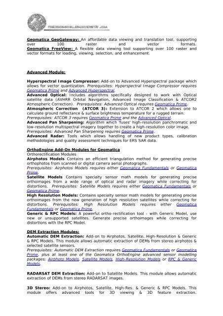
Geomatica GeoGateway: An affordable data viewing and translation tool, supporting<br />
over 100 raster and vector formats.<br />
Geomatica FreeView: A flexible data viewing tool supporting over 100 raster and<br />
vector formats for loading, viewing, selection, and enhancement.<br />
Advanced Module:<br />
Hyperspectral Image Compressor: Add-on to Advanced Hyperspectral package which<br />
allows for vector quantization. Prerequisites: Hyperspectral Image Compressor requires<br />
Geomatica Prime and Advanced Hyperspectral.<br />
Advanced Optical: Includes algorithms specifically designed to work with Optical<br />
satellite data (AVHRR Orbital Navigation, Advanced Image Classification & ATCOR2<br />
Atmospheric Correction). Prerequisites: Advanced Optical requires Geomatica Prime.<br />
Atmospheric Correction (ATCOR 3): Extension to ATCOR 2 which allows one to<br />
calculate ground reflectance & surface brightness temperature for a rugged terrain.<br />
Prerequisites: ATCOR 3 requires Geomatica Prime and the Advanced Optical.<br />
Advanced Pan Sharpening: Algorithm which 'fuses' high-resolution panchromatic and<br />
low-resolution multispectral imagery together to create a high-resolution color image.<br />
Prerequisites: Advanced Pan Sharpening requires Geomatica Prime.<br />
Advanced Radar: Tools which allows handling of new product types, calibration<br />
methodologies and quality assessment techniques for ERS SAR data.<br />
OrthoEngine Add-On Modules for Geomatica<br />
Orthorectification Modules<br />
Airphotos Models Contains an efficient triangulation method for generating precise<br />
orthophotos from scanned or digital camera aerial photographs.<br />
Prerequisites: Airphotos Models requires either Geomatica Fundamentals or Geomatica<br />
Prime.<br />
Satellite Models Contains specialty sensor math models for generating precise<br />
orthoimages from a wide range of optical and radar imagery while correcting for<br />
distortions. Prerequisites: Satellite Models requires either Geomatica Fundamentals or<br />
Geomatica Prime.<br />
High Resolution Models: Contains specialty sensor math models for generating precise<br />
orthoimages from the new generation of high resolution satellites while correcting for<br />
distortions. Prerequisites: High Resolution Models requires either Geomatica<br />
Fundamentals or Geomatica Prime.<br />
Generic & RPC Models: A powerful ortho-rectification tool - with Generic Model, use<br />
new or unsupported satellites. Generate precise orthoimages while correcting for<br />
distortions with the RPC Model.<br />
DEM Extraction Modules:<br />
Automatic DEM Extraction: Add-on to Airphotos, Satellite, High-Resolution & Generic<br />
& RPC Models. This module allows automatic extraction of DEMs from stereo airphotos &<br />
selected satellite sensors.<br />
Prerequisites: Automatic DEM Extraction requires Geomatica Fundamentals or Geomatica<br />
Prime, plus at least one of the Geomatica OrthoEngine advanced sensor modelling<br />
packages; Airphoto Models, Satellite Models, High-Resolution Models or RPC & Generic<br />
Models.<br />
RADARSAT DEM Extraction: Add-on to Satellite Models. This module allows automatic<br />
extraction of DEMs from stereo RADARSAT images.<br />
3D Stereo: Add-on to Airphotos, Satellite, High-Res. & Generic & RPC Models. This<br />
module offers advanced tools for 3D viewing & 3D feature extraction.


