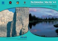

Create successful ePaper yourself
Turn your PDF publications into a flip-book with our unique Google optimized e-Paper software.
Alternative Route 4<br />
From Grödner pass to Pisciadù mountain hut via the<br />
Tridentina-Klettersteig (fixed rope route)<br />
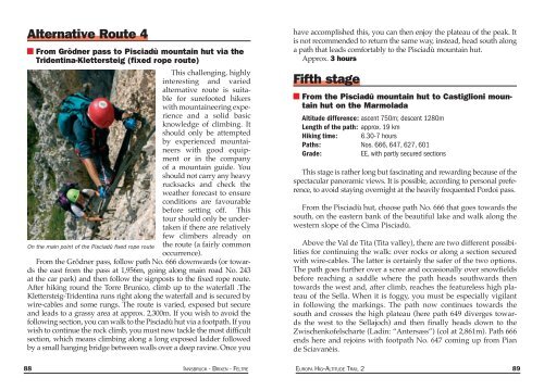
This challeng<strong>ing</strong>, highly<br />
interest<strong>ing</strong> and varied<br />
alternative route is suitable<br />
for surefooted hikers<br />
with mountaineer<strong>ing</strong> experience<br />
and a solid basic<br />
knowledge of climb<strong>ing</strong>. It<br />
should only be attempted<br />
by experienced mountaineers<br />
with good equipment<br />
or in the company<br />
of a mountain guide. You<br />
should not carry any heavy<br />
rucksacks and check the<br />
weather forecast to ensure<br />
conditions are favourable<br />
before sett<strong>ing</strong> off. This<br />
tour should only be undertaken<br />
if there are relatively<br />
few climbers already on<br />
On the main point of the Pisciadù fixed rope route the route (a fairly common<br />
occurrence).<br />
From the Grödner pass, follow path No. 666 downwards (or towards<br />
the east from the pass at 1,956m, go<strong>ing</strong> along main road No. 243<br />
at the car park) and then follow the signposts to the fixed rope route.<br />
After hik<strong>ing</strong> round the Torre Brunico, climb up to the waterfall .The<br />
Klettersteig-Tridentina runs right along the waterfall and is secured by<br />
wire-cables and some rungs. The route is varied, exposed but secure<br />
and leads to a grassy area at approx. 2,300m. If you wish to avoid the<br />
follow<strong>ing</strong> section, you can walk to the Pisciadù hut via a footpath. If you<br />
wish to continue the rock climb, you must now tackle the most difficult<br />
section, which means climb<strong>ing</strong> along a long exposed ladder followed<br />
by a small hang<strong>ing</strong> bridge between walls over a deep ravine. Once you<br />
have accomplished this, you can then enjoy the plateau of the peak. It<br />
is not recommended to return the same way, instead, head south along<br />
a path that leads comfortably to the Pisciadù mountain hut.<br />
Approx. 3 hours<br />
Fifth stage<br />
From the Pisciadù mountain hut to Castiglioni mountain<br />
hut on the Marmolada<br />
Altitude difference: ascent 750m; descent 1280m<br />
Length of the path: approx. 19 km<br />
Hik<strong>ing</strong> time: 6.30-7 hours<br />
Paths: Nos. 666, 647, 627, 601<br />
Grade:<br />
EE, with partly secured sections<br />
This stage is rather long but fascinat<strong>ing</strong> and reward<strong>ing</strong> because of the<br />
spectacular panoramic views. It is possible, accord<strong>ing</strong> to personal preference,<br />
to avoid stay<strong>ing</strong> overnight at the heavily frequented Pordoi pass.<br />
From the Pisciadù hut, choose path No. 666 that goes towards the<br />
south, on the eastern bank of the beautiful lake and walk along the<br />
western slope of the Cima Pisciadù.<br />
Above the Val de Tita (Tita valley), there are two different possibilities<br />
for continu<strong>ing</strong> the walk: over rocks or along a section secured<br />
with wire-cables. The latter is certainly the safer of the two options.<br />
The path goes further over a scree and occasionally over snowfields<br />
before reach<strong>ing</strong> a saddle where the path heads southwards then<br />
towards the west and, after climb, reaches the featureless high plateau<br />
of the Sella. When it is foggy, you must be especially vigilant<br />
in follow<strong>ing</strong> the mark<strong>ing</strong>s. The path now continues towards the<br />
south and crosses the high plateau (here path 649 diverges towards<br />
the west to the Sellajoch) and then finally heads down to the<br />
Zwischenkofelscharte (Ladin: “Antersass”) (col at 2,861m). Path 666<br />
ends here and rejoins with footpath No. 647 com<strong>ing</strong> up from Pian<br />
de Sciavanèis.<br />
88 INNSBRUCK - BRIXEN - FELTRE EUROPA HIG--ALTITUDE TRAIL 2 89