
Create successful ePaper yourself
Turn your PDF publications into a flip-book with our unique Google optimized e-Paper software.
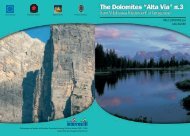
Hay barns in Fuciàde<br />
cutt<strong>ing</strong> steps into ice and crampons. Such equipment is heavy and adds<br />
a lot of weight and bulk to a rucksack. You must always consider that<br />
you will have to carry this baggage dur<strong>ing</strong> the complete High Altitude<br />
Trail journey. However, there is no alternative unless you live by the<br />
motto “eyes closed and let’s go” and “what will be, will be” which can<br />
lead to putt<strong>ing</strong> yourself or your companions in danger and, in the worst<br />
scenario, endanger the lives of the rescue service. In any case, there is an<br />
alternative route for this stage at the end of this section. The alternative<br />
route 6 is easier to complete and the scenery is just as impressive.<br />
From the Mulàz mountain hut, head uphill (towards the west)<br />
through a scree under the Passo del Mulàz for a while. Near a junction<br />
turn left (southwards) and walk along path No. 703, which soon leads<br />
to the Forcella Margherita (col at 2,655m) on the north crest of the Cima<br />
di Focobòn. Keep head<strong>ing</strong> south and you will skirt past the rock before<br />
cross<strong>ing</strong> the depression in the land. Walk through the scree (risk of rock<br />
fall) and over reasonably large patch of ice. With the help of a wirecable,<br />
you will reach the beautiful rocky terrac<strong>ing</strong> of the Passo delle<br />
Faràngole, (pass at 2,932m) - the highest point of this classic route.<br />
When you have crossed the col, you head rapidly downhill with the<br />
help of a wire-cable in order to reach the rocky hollow and the basin<br />
that gradually narrows. Here, the path suddenly turns left (eastwards)<br />
and then back towards the south in the direction of the Col de Burèla.<br />
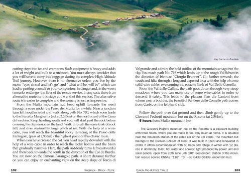
You are now on the famous Faràngole path. A short distance further<br />
on you can enjoy an enchant<strong>ing</strong> view on the steep slope of Torcia di<br />
Valgrande and admire the bold outline of the mountain set against the<br />
sky. You reach path No. 716 which leads up to the rough Val Schutt in<br />
the direction of bivouac “Giorgio Brunner”. Go further towards the<br />
south and hike through a long and exposed area with the help of some<br />
solid wire-cables overcom<strong>ing</strong> the eastern flank of Val Delle Comelle.<br />
From the Val delle Galline, the path goes down through very steep<br />
meadows where you can make use of some wire-cables in order to<br />
descend it safely. This leads to the plateau Pian die Cantoni from<br />
where, near a boulder, the beautiful Sentiero delle Comelle path comes<br />
from Garès, on the left-hand side.<br />
Follow the path over flat ground and then climb gently up to the<br />
Giovanni Pedrotti mountain hut on the Rosetta (at 2,581m).<br />
5 hours from Mulàz mountain hut<br />
The Giovanni Pedrotti mountain hut on the Rosetta is a pleasant build<strong>ing</strong><br />
with three floors, where you are made to feel very much at home. It is situated<br />
near the mountain station of the cable car of the Col Verde. The mountain hut<br />
belongs to the Division CAI-SAT of Trent. It was built in 1890 and renovated in<br />
2000. It offers accommodation with 80 beds and refuge in winter with 12 places<br />
in dormitory; toilet, hot water and shower; light produced by power unit and<br />
solar panels; open from 20th June until 20th September; Station of the mountain<br />
rescue service CNSAS “118“; Tel +39 0439 68308. (mountain hut)<br />
102 INNSBRUCK - BRIXEN - FELTRE EUROPA HIG--ALTITUDE TRAIL 2 103