
Create successful ePaper yourself
Turn your PDF publications into a flip-book with our unique Google optimized e-Paper software.
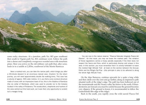
Monte Ramizza<br />
some rocky structures. At a junction, path No. 803 goes southeast<br />
then south to Vignùi path No. 801 continues west. Follow the path<br />
into a dense and completely overgrown wooded area with mountain<br />
pines. Here you arrive on the old military cart path that, after scree,<br />
leads in to a saddle at 2,205m, southwest of the Monte Ramèzza<br />
Near a marked rock, you can take the narrow path, which br<strong>ing</strong>s you after<br />
a 20-minute descent to an enormous natural cave. (Caution: for the return<br />
journey, you will need approximately double the walk<strong>ing</strong> time). This cave has<br />
a volume of approx. 500 cubic metres. In it, you find a cone (conical structure<br />
made of snow) with an impressive base of ice; this is the Giazèra di Ramèzza<br />
(the ice cellar of Ramèzza), which was used to provide ice to the brewery<br />
located in the valley of Pedavena. The woodcutters, shepherds and hunters of<br />
the area carried out this hard work, as it was their only opportunity to scratch<br />
out a meagre liv<strong>ing</strong>.<br />
You are now in the nature reserve: “Riserva Naturale Integrale Piazza del<br />
Diavolo”. On this route, you may not leave the marked path. The violation<br />
of these regulations carries a heavy penalty especially if the hiker does not<br />
respect the fauna and flora, which is particularly diverse and unique in this<br />
area. In this section, you must remember that it is strictly forbidden to leave<br />
the marked High Altitude Trail - at least on the section between the bivouac<br />
Feltre and the Rifugio Dal Piaz - (this principle is also to be adhered to along<br />
the whole High Altitude Trail).<br />
On the Alpe Ramezza, continue upwards for a quite a long while<br />
and then climb over the crest and go further, along an impressive path<br />
situated north of the ridge’s edge. The path has been hollowed out of<br />
the mountainside and the Noana valley lies below to the north. If thunderstorms<br />
are forecast you must be careful because the ground becomes<br />
very slippery. If the ground is frozen, it is recommended to follow the<br />
Gratschneide (the edge of the ridge).<br />
Back in the south, you rapidly cross the wild sacred Piazza Del<br />
118 INNSBRUCK - BRIXEN - FELTRE EUROPA HIG--ALTITUDE TRAIL 2 119