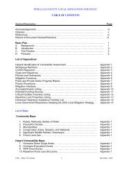
Book 4: Pinellas County Storm Tide Atlas - Tampa Bay Regional ...
Book 4: Pinellas County Storm Tide Atlas - Tampa Bay Regional ...
Book 4: Pinellas County Storm Tide Atlas - Tampa Bay Regional ...

Create successful ePaper yourself
Turn your PDF publications into a flip-book with our unique Google optimized e-Paper software.
112thPl<br />
108th<br />
106th Ln<br />
eUnnamed Stre<br />
Blvd<br />
87th St<br />
ed Str<br />
Dr<br />
D 30 ft<br />
®v ®v<br />
BARDMOOR<br />
OUTPATIENT<br />
£¤ 19<br />
CENTER<br />
84 84<br />
27°52'0"N<br />
Village<br />
114th Pl<br />
99th<br />
15 ft<br />
83<br />
D<br />
83<br />
27°51'0"N<br />
30 80 27°50'0"N<br />
000m.N<br />
110th St<br />
ve<br />
Te mpl e A<br />
117th Ave<br />
109th Ln<br />
109th Way<br />
Groveland St<br />
D<br />
31.9 ft<br />
GreenAve<br />
Crestview St<br />
90th Ave<br />
88th Ave<br />
Pl<br />
Valencia Ter<br />
Temple Ter<br />
76th Pl<br />
75th Pl<br />
115th Ave<br />
108th Way<br />
100th Ave<br />
Freedom Blvd<br />
91st Ter<br />
91st Ave<br />
90th Ter<br />
109th St<br />
108th Ln<br />
108th Way<br />
109th St<br />
108th St<br />
84th Ave<br />
Oakdale Ter<br />
Liberty Ln<br />
72nd Ave<br />
71st Ave<br />
The <strong>Pinellas</strong> Trl<br />
2nd St<br />
Pl<br />
108th Ln<br />
108th St<br />
Grove Ter<br />
Johnson Blvd<br />
24<br />
Forest Ln<br />
Sem<br />
inole Blvd<br />
110th Ave<br />
Lake Breeze Dr<br />
Dixon Dr<br />
Gordon Dr<br />
<strong>County</strong> Hwy 694<br />
70th Ave<br />
117th Dr<br />
Saunders Ave<br />
104th Ave<br />
Sunrise Point Dr<br />
Linda Dr<br />
Village<br />
106th St<br />
Ramp<br />
101st Ave<br />
Driveway<br />
98th Ter<br />
James Ave<br />
94th Pl<br />
94th Ave<br />
Skipper Dr<br />
Guy Dr<br />
Lake Vista Dr<br />
3<br />
24 000m. E<br />
116th Ave<br />
105th Ln<br />
Dr<br />
77th Ter<br />
Lake Dr<br />
105th Ln<br />
t<br />
Lakeside Dr<br />
104th Ln<br />
114th Ave<br />
113th Ave<br />
106th St<br />
Tiffin Wa y<br />
Unnamed Street<br />
116th Ter<br />
Holiday Ln<br />
111th Ter<br />
104th St<br />
111th Ave<br />
107th Ave<br />
106th Ave<br />
Gazeb o<br />
105th St<br />
82°47'0"W<br />
105th St<br />
104th St<br />
104th Ln<br />
Dr<br />
66th Ave<br />
103rd St<br />
114th Ter<br />
103rd Ln<br />
111th Pl<br />
Palm Dr<br />
117th Ter<br />
Tahitian Ln<br />
102nd Ln<br />
102nd Way<br />
102nd St<br />
106th Ter<br />
Lake Dr<br />
118th Ave<br />
117th Pl<br />
101st Way<br />
113th Pl<br />
100th St<br />
110th Pl<br />
102nd Ave<br />
Seminole, Lake<br />
SEMINOLE<br />
82°47'0"W<br />
67th Ave<br />
101st St<br />
100th Way<br />
25<br />
Lake<br />
25<br />
99th St<br />
97th St<br />
Seminole Dr<br />
Drivew ay<br />
D 9.8 ft<br />
3rd St<br />
98th St<br />
St<br />
4th<br />
5th St<br />
Parkwood<br />
6th<br />
St<br />
105th Ter<br />
105th Ave<br />
7th St<br />
Harborside Dr<br />
97thSt<br />
12th<br />
8th St<br />
9th St<br />
St<br />
10th St<br />
Denise<br />
UV 694<br />
11th St<br />
Myrtle Dr<br />
Halyard<br />
108th Ter<br />
Dr<br />
89th Ter<br />
Garden Dr<br />
Dr<br />
Leeward Ave<br />
96th St<br />
Harborside<br />
95th<br />
St<br />
Joel Dr<br />
S Unn amedtreet<br />
94th St<br />
Walkway<br />
Bryan Dairy Rd<br />
88th Ter<br />
Monica Dr<br />
Elmwood<br />
Cir<br />
Tradewinds<br />
Cir<br />
Blvd<br />
Scott Dr<br />
Buttonwood Cir<br />
A spe n<br />
Pebble<br />
Beach Ln<br />
118th T er<br />
94th St<br />
93rd St<br />
89th Ave<br />
87th Ter<br />
86th Ave<br />
Pebble Beach Ct<br />
92nd Way<br />
87th Ave<br />
ir<br />
C<br />
93rd St<br />
26<br />
92nd St<br />
Fairweather Dr<br />
92nd<br />
92nd St<br />
81st Ave<br />
80th Ave<br />
82°46'0"W<br />
92nd Way<br />
Greenbrier Dr<br />
Southern Comfort Dr<br />
Ave<br />
90th Ave<br />
109th Ave<br />
84th<br />
82nd Ave<br />
76th<br />
Enchantment Dr<br />
108th Ave<br />
Birch Dr<br />
Cherry Tr ce<br />
C ypress Trl<br />
98th Ave<br />
91st St<br />
85th Ave<br />
82°46'0"W<br />
Sunrise D r<br />
90th Way<br />
Av e<br />
Te<br />
A n<br />
r<br />
Shady O ak Ln<br />
Leisure Ln<br />
t<br />
90th St<br />
90th St<br />
Dream Way<br />
109th Ter<br />
Sain<br />
89th St<br />
igua<br />
89th Way<br />
East St<br />
D<br />
Ramp<br />
r<br />
90th Ter<br />
<strong>County</strong> Road 1<br />
D<br />
7.8 ft<br />
Augusta Blvd<br />
t A ndrews Dr<br />
Easy St<br />
Starkey Rd<br />
88th Way<br />
Tequesta Dr<br />
115th<br />
L argo Lakes Dr<br />
BARDMOOR<br />
ER CENTER<br />
Rd<br />
Robin<br />
88th St<br />
Longwoo<br />
Rd<br />
Quail<br />
100th Ave<br />
Ln<br />
Pelican<br />
Burning<br />
Esplande<br />
Tree Dr<br />
Ave<br />
Piper Ln<br />
86th Way<br />
G ardenia Dr<br />
79th Pl<br />
78th Pl<br />
d Dr<br />
Maidstone<br />
Orchid<br />
Concept Blvd<br />
N arcissus Ave<br />
Andrew Ln<br />
101st Ave<br />
85th Way<br />
Annwood Rd<br />
Brentwood Rd<br />
94th Ave<br />
86th St<br />
Dr<br />
Osprey Ln<br />
Magnolia Dr<br />
Lantana<br />
Jacaranda<br />
Iris Ave<br />
85th Ln<br />
85th St<br />
Hollyhock Ave<br />
Owl Rd<br />
Bardes<br />
93rd A<br />
91st Ter<br />
Oriole Ln<br />
Kumquat Ave<br />
Gerbera Ave<br />
eet<br />
Unnam<br />
Ct<br />
Park Blvd<br />
Park St<br />
Ct<br />
84th Way<br />
ve<br />
92nd Ter<br />
Candlewood Rd<br />
Ave<br />
79th Ave<br />
78th Ter<br />
Portulaca Ave<br />
Mockingbird Ln<br />
78th Ave<br />
77th Ave<br />
84th Ln<br />
Nightingale Ln<br />
75th Pl<br />
75th Ave<br />
95th Ter<br />
95th Ave<br />
83rd Ln<br />
Indian Hills Ct<br />
Rose Ter<br />
Oakdale Rd<br />
83rd St<br />
State Hwy 694<br />
B a you B oa<br />
Bardmoor Pl<br />
St<br />
84th<br />
Martin Ln<br />
Lark St<br />
83rd Way<br />
rd walk<br />
<strong>County</strong> Road 296<br />
Elisabeth Ln<br />
101st Ct<br />
Lynn Ln<br />
82nd Way<br />
82 nd A ve<br />
82nd St<br />
82nd Ln<br />
Norwood Rd<br />
Way<br />
81st<br />
Canterbury<br />
Larchwood Rd<br />
Merrimoor<br />
<strong>Bay</strong>ou Dr<br />
81stSt<br />
82°45'0"W<br />
Cir<br />
Jaywoo d<br />
Kenwood Rd<br />
Driveway<br />
118th Ave<br />
PINELLAS PARK<br />
85 85<br />
114th Ave<br />
PINELLAS COUNTY<br />
82 82<br />
81 81<br />
US National Grid<br />
100,000-m Square ID<br />
LL<br />
Grid Zone Designation<br />
17R<br />
Datum = NAD 1983, 1,000-m USNG<br />
This map is for reference & planning purposes only.<br />
Hurricane evacuation decision-making and growth<br />
management implementation are local responsibilities.<br />
Please consult with local authorities.<br />
^<br />
GN<br />
#<br />
Diagram<br />
Not to Scale<br />
Mag. Declination<br />
4 0 31'W<br />
Changing by<br />
5' W per yr<br />
Date 2009<br />
Produced by <strong>Tampa</strong> <strong>Bay</strong> <strong>Regional</strong> Planning Council for Florida Division of Emergency Management, 2009-2010<br />
26<br />
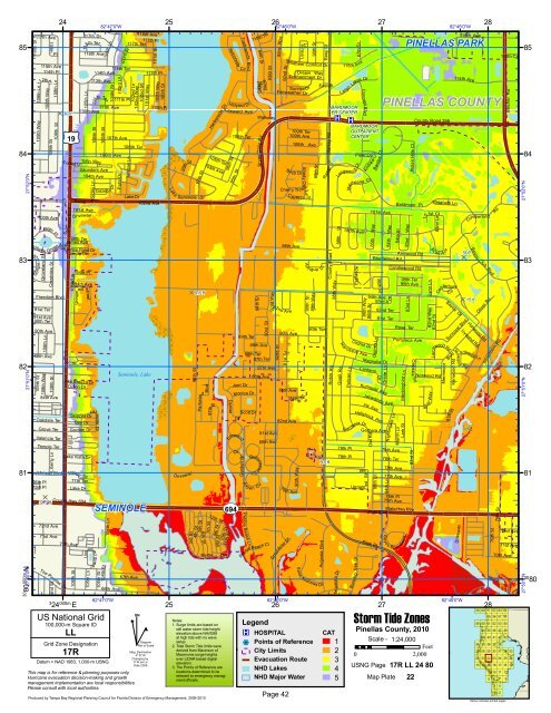
Legend<br />
®v HOSPITAL<br />
%2 Points of Reference<br />
City Limits<br />
Evacuation Route<br />
NHD Lakes<br />
Notes:<br />
1. Surge limits are based on<br />
still water storm tide height<br />
elevation above NAVD88<br />
at high tide with no wave<br />
setup.<br />
2. Total <strong>Storm</strong> <strong>Tide</strong> limits were<br />
derived from Maximum of<br />
Maximums surge heights<br />
over LIDAR based digital<br />
elevation.<br />
3. The Points of Reference are<br />
locations determined to be<br />
relevant to emergency manag-<br />
CAT<br />
1 Scale - 1:24,000<br />
Feet<br />
2<br />
0 2,000<br />
3<br />
USNG Page<br />
4<br />
17R LL 24 80<br />
NHD Major Water<br />
ment officials. 5 Map Plate 22<br />
Page 42<br />
27<br />
27<br />
<strong>Storm</strong> <strong>Tide</strong> Zones<br />
<strong>Pinellas</strong> <strong>County</strong>, 2010<br />
<strong>Bay</strong>ou<br />
D 15 ft<br />
Suncrest Blvd<br />
Blvd<br />
82°45'0"W<br />
Rd<br />
Cumberland<br />
Club<br />
Harwood Rd<br />
Ivywood R d<br />
Idlewild Ln<br />
59<br />
49<br />
34<br />
27<br />
20<br />
13<br />
28<br />
Blvd<br />
Oliver Rd<br />
60<br />
50<br />
44<br />
39<br />
35<br />
28<br />
21<br />
14<br />
Rd<br />
Silverthorn Rd<br />
79th St<br />
28<br />
61<br />
55<br />
51<br />
45<br />
40<br />
36<br />
29<br />
22<br />
15<br />
9<br />
5<br />
78th St<br />
112th Cir<br />
Belcher Rd<br />
72nd Ave<br />
71st Ave<br />
70th Ave<br />
62<br />
56<br />
52<br />
46<br />
41<br />
37<br />
30<br />
23<br />
16<br />
10<br />
6<br />
3<br />
1<br />
63<br />
57<br />
53<br />
47<br />
42<br />
38<br />
31<br />
24<br />
17<br />
11<br />
7<br />
4<br />
2<br />
64<br />
58<br />
54<br />
48<br />
43<br />
32<br />
25<br />
18<br />
12<br />
Yellow indicates printed pages<br />
8<br />
33<br />
26<br />
19<br />
27°52'0"N<br />
27°51'0"N<br />
27°50'0"N<br />
30<br />
80