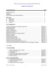
Book 4: Pinellas County Storm Tide Atlas - Tampa Bay Regional ...
Book 4: Pinellas County Storm Tide Atlas - Tampa Bay Regional ...
Book 4: Pinellas County Storm Tide Atlas - Tampa Bay Regional ...

Create successful ePaper yourself
Turn your PDF publications into a flip-book with our unique Google optimized e-Paper software.
16<br />
82°52'0"W<br />
17<br />
18<br />
82°51'0"W<br />
19<br />
3<br />
20<br />
82°50'0"W<br />
31<br />
10<br />
31<br />
10<br />
28°6'0"N<br />
28°6'0"N<br />
09 09<br />
08 08<br />
28°5'0"N<br />
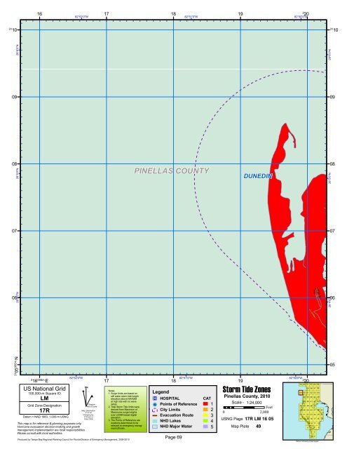
PINELLAS COUNTY<br />
DUNEDIN<br />
28°5'0"N<br />
07 07<br />
28°4'0"N<br />
06 06<br />
Edinburgh<br />
Dr<br />
28°4'0"N<br />
31 05<br />
000m.N<br />
3<br />
16 000m. E<br />
US National Grid<br />
100,000-m Square ID<br />
LM<br />
Grid Zone Designation<br />
17R<br />
Datum = NAD 1983, 1,000-m USNG<br />
82°52'0"W<br />
This map is for reference & planning purposes only.<br />
Hurricane evacuation decision-making and growth<br />
management implementation are local responsibilities.<br />
Please consult with local authorities.<br />
^<br />
GN<br />
#<br />
Diagram<br />
Not to Scale<br />
Mag. Declination<br />
4 0 31'W<br />
Changing by<br />
5' W per yr<br />
Date 2009<br />
Produced by <strong>Tampa</strong> <strong>Bay</strong> <strong>Regional</strong> Planning Council for Florida Division of Emergency Management, 2009-2010<br />
17<br />
18<br />
82°51'0"W<br />
Legend<br />
®v HOSPITAL<br />
%2 Points of Reference<br />
City Limits<br />
Evacuation Route<br />
NHD Lakes<br />
Notes:<br />
1. Surge limits are based on<br />
still water storm tide height<br />
elevation above NAVD88<br />
at high tide with no wave<br />
setup.<br />
2. Total <strong>Storm</strong> <strong>Tide</strong> limits were<br />
derived from Maximum of<br />
Maximums surge heights<br />
over LIDAR based digital<br />
elevation.<br />
3. The Points of Reference are<br />
locations determined to be<br />
relevant to emergency manag-<br />
CAT<br />
1 Scale - 1:24,000<br />
Feet<br />
2<br />
0 2,000<br />
3<br />
USNG Page<br />
4<br />
17R LM 16 05<br />
NHD Major Water<br />
ment officials. 5 Map Plate 49<br />
Page 69<br />
19<br />
<strong>Storm</strong> <strong>Tide</strong> Zones<br />
<strong>Pinellas</strong> <strong>County</strong>, 2010<br />
82°50'0"W<br />
3<br />
20<br />
59 60 61 62 63 64<br />
55 56 57 58<br />
49 50 51 52 53 54<br />
44 45 46 47 48<br />
39 40 41 42 43<br />
34 35 36 37 38<br />
27 28 29 30 31 32 33<br />
20 21 22 23 24 25 26<br />
13 14 15 16 17 18 19<br />
9 10 11 12<br />
5 6 7 8<br />
3 4<br />
1 2<br />
Yellow indicates printed pages<br />
05