Silver Creek - Division of Water Quality - Utah.gov
Silver Creek - Division of Water Quality - Utah.gov
Silver Creek - Division of Water Quality - Utah.gov

Create successful ePaper yourself
Turn your PDF publications into a flip-book with our unique Google optimized e-Paper software.
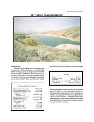
<strong>Silver</strong> <strong>Creek</strong> <strong>Water</strong>shed TMDL Final Report<br />
Contaminated water within each wetland will become continuously cleaner as it is routed<br />
through the wetland complexes prior to discharge into the creek; enhance the existing wetland<br />
complexes by enlarging the emergent marsh areas and by planting heavy metal removing plant<br />
species. Enhancement should also include site monitoring and maintenance. Additionally,<br />
ensuring proper erosion control measures are employed during construction and other earth<br />
disturbing activities.<br />
Flood Plain Tailings (site inspection 11/8/2002)<br />
The flood plain tailings site is located on the north side <strong>of</strong> <strong>Silver</strong> <strong>Creek</strong>, between the Rail Trail<br />
and the access road to Richardson’s Flat. The site is characterized by “perched” wetlands and<br />
scrub-shrub vegetation. The source <strong>of</strong> water for the wetlands appears to be surface and ground<br />
water flowing from the west to the creek.<br />
Recommended BMPs include: either removal <strong>of</strong> contaminated tailings and or construction <strong>of</strong><br />
water control structures to manage surface flows from wetland complex to wetland complex and<br />
possibly to a constructed wetland area for treatment. Contaminated water within each wetland<br />
will become continuously cleaner as it is routed through the wetland complexes prior to<br />
discharge into the creek; enhance the existing wetland complexes by enlarging the emergent<br />
marsh areas and by planting heavy metal removing plant species. Enhancement should also<br />
include site monitoring and maintenance.<br />
Richardson Flat (site inspection 11/8/2002)<br />
At this time, it is believed that Richardson Flat is a potential contributor <strong>of</strong> contaminants to<br />
<strong>Silver</strong> <strong>Creek</strong>. Groundwater data including flows, flow direction, and contaminant concentrations<br />
is currently being collected and will be assessed by others in the future.<br />
Above Atkinson (site inspection 11/8/2002)<br />
The topography <strong>of</strong> the area is fairly flat for a 4-6 mile reach. The area is characterized by a<br />
slightly meandering stream channel, fairly wide vegetated flood channel, and widespread tailing<br />
deposits that includes some mounds <strong>of</strong> mine tailings. The stream channel runs through tailings<br />
for a stretch <strong>of</strong> approximately 4 miles in this meadow area. Anecdotal evidence suggests that<br />
tailings from the mines were brought to this area in an attempt to further extract valuable<br />
materials. One <strong>of</strong> the largest recovery operations in this area was the Big Four mill, in operation<br />
from approximately 1915 to 1918. The mill site has a large concentration <strong>of</strong> tailings depositions.<br />
There are currently no BMPs in place.<br />
Recommended BMPs include: removal <strong>of</strong> all contaminated materials to a secure location;<br />
stabilizing and isolating contaminated materials onsite. This may not be practicable due to the<br />
large geographic extent <strong>of</strong> the area covered by the tailings. Additionally, groundwater<br />
contributes to the flows in <strong>Silver</strong> <strong>Creek</strong> through this reach. Isolating the tailings may affect<br />
groundwater flows; “seal” the creek bed using clay, bentonite, or some other material thus<br />
preventing flow to or from <strong>Silver</strong> <strong>Creek</strong>. Again, sealing the creek may adversely affect flows if<br />
ground water is isolated from the creek.<br />
Other items to take into account when considering applicable BMPs are current irrigation<br />
practices. Numerous diversions exist along <strong>Silver</strong> <strong>Creek</strong> that allow farmers/ranchers to access<br />
water for irrigation and livestock use. The number <strong>of</strong> diversions and amount <strong>of</strong> water drawn<br />
Page 55