Arrow Prospectus - PGS
Arrow Prospectus - PGS
Arrow Prospectus - PGS

Create successful ePaper yourself
Turn your PDF publications into a flip-book with our unique Google optimized e-Paper software.
ARROW SEISMIC ASA – INITIAL PUBLIC OFFERING<br />
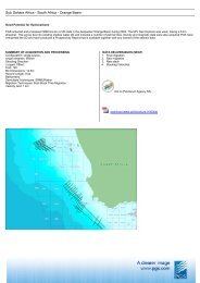
7.2 OVERVIEW OF THE GLOBAL SEISMIC MARKET<br />
7.2.1 Marine geophysical services<br />
Planning a seismic survey and acquiring, processing and interpreting the seismic data are the various activities of<br />
a seismic project. The data acquired from the surveys are then used to produce computer generated graphic cross<br />
sections (2D) or three-dimensional images (3D) of the subsurface. Companies acquire marine seismic data both<br />
on exclusive contract basis for customers, and for their own risk as multi client data for marketing on a nonexclusive<br />
basis to customers (further described in section 7.2.2).<br />
Conventional streamer operations involve the acquisition of marine seismic data by discharging a wave of<br />
acoustic energy just below the water’s surface from one or more energy sources towed behind a survey vessel.<br />
The wave travels through the water and subsurface earth, with part of it being reflected back at rock layer<br />
boundaries. The reflections are then detected by hydrophones contained in the towed streamers, converted into<br />
digital data, and transmitted to a recording unit onboard the survey vessel. Before being put into a processing<br />
system, the data is analysed for quality control purposes, enabling production of subsurface images.<br />
A 2D marine seismic survey is typically produced by a survey vessel towing a single streamer and one energy<br />
source. The data acquired from such a survey will generally represent a vertical cross-section along the line<br />
tracked by the streamer. The concept used to acquire 3D data is similar. A vessel will tow multiple streamers to<br />
produce a combination of parallel 2D cross-sectional data which can be processed to produce a 3D image of<br />
subsurface strata. Sophisticated navigation equipment, permitting constant and precise determination of the<br />
positions of streamers and energy sources during shooting, is needed for such data acquisitions.<br />
A fourth dimension, evolved over time, is used to efficiently determine the changes occurring in the reservoir as<br />
a result of hydrocarbon production or injection of water or gas into the reservoir by comparing the repeated<br />
datasets. Time-lapse or 4D seismic involves comparing the results of 3D seismic surveys repeated at<br />
considerable time intervals (e.g. before a field starts producing versus various production stages).<br />
Adding to the conventional techniques, various seabed seismic operations are being used. Such methods are<br />
more precise, as they are conducted by laying out permanent or mobile cable systems, or deployment of<br />
individual nodes in grid patterns. Data collection takes place by multi components, 4C (pressure waves in 3<br />
dimensions (x, y, z) and shear waves in one dimension). The cable systems are connected to the oil installation<br />
or to a buoy. 2D or 3D vessels may be used as source vessels; in that case 2D vessels will normally be preferred<br />
as they are less costly. Multi component seabed operations will usually only be performed where conventional<br />
techniques are not possible or economically feasible due to access limitations, as streamer analyses are cheaper<br />
and new seismic methods contribute to a closing gap on quality.<br />
In addition, different methods of electro magnetic surveying (“EM”) are evolving. While seismic surveying<br />
(using acoustic energy) can be used to find reservoirs deep below ground, it cannot always provide good<br />
information on what kind of liquids they contain. EM has the unique feature of being able to, at a relatively high<br />
degree of certainty, distinguish between hydrocarbon filled and water filled reservoirs in deepwater areas. The<br />
two are separated by measuring subsurface resistivity, as hydrocarbon filled reservoirs typically have high<br />
resistivity compared to shale or water filled reservoirs. EM contributes to reducing the uncertainty element of<br />
exploration by further analyzing reservoirs detected by seismic surveys. EM has been tested in water depths from<br />
110 to 3,100 metres and is most viable in offshore areas such as West-Africa, Brazil, South-East Asia, the<br />
Norwegian Sea and in the Gulf of Mexico. Work is now under way to reduce the noise – or interference –<br />
experienced by the signals in shallower waters, which would significantly extend the area of application for EM.<br />
7.2.2 Contract work vs. multi-client work<br />
The seismic industry operates with two types of business models – contract (proprietary) and multi-client data<br />
acquisition. Proprietary contract data is acquired based upon a request from one specific customer and the<br />
seismic data is exclusive for that customer. Multi-client data acquisition is on the other hand mostly initiated by<br />
the seismic company itself with the aim to licence the data to multiple customers on a non-exclusive basis. The<br />
seismic companies normally require a certain percentage of pre-funding before commencing multi-client data<br />
acquisition.<br />
One distinct difference between contract and multi-client acquisition is the risk with multi-client of not being<br />
able to licence the data to other customers, compared to contract work where the company is guaranteed<br />
predetermined revenue.<br />
46