Native Habitat Inventory Final Report 2004 - St. Lucie County
Native Habitat Inventory Final Report 2004 - St. Lucie County
Native Habitat Inventory Final Report 2004 - St. Lucie County

You also want an ePaper? Increase the reach of your titles
YUMPU automatically turns print PDFs into web optimized ePapers that Google loves.
“Edge is the place where plant communities meet or where successional stages or<br />
vegetative conditions within plant communities come together” (Thomas 1979). The<br />
edge is attractive to generalist species but most rare species are habitat specialists and are<br />
attracted to a narrow habitat, such as interior forest. Edges increase access to core<br />
habitats for feral animals, invasive exotic species, and human-related activities (e.g., offroad<br />
vehicles). Thus a high percentage of edge is generally undesirable in natural areas.<br />
The edge calculation provided makes two assumptions. First, that the entire perimeter of<br />
a site is non-natural. Second, that the effect of the edge extends 230 feet interiorly. Edge<br />
extends interiorly 2-3 times the canopy height of the tallest vegetation at maturity (Harris<br />
1984). The south Florida slash pine is 115 feet tall at maturity thus twice that height is<br />
230 feet. The south Florida slash pine was chosen because it is a common element in<br />
many of the forest ecosystems. In some ecosystems (e.g., prairies and marshes) this will<br />
exaggerate the amount of edge.<br />
The data collected and the results of these analyzes are summarized in the Site Data<br />
Summaries and Ranks section.<br />
Conversion of FLUCCS to FNAI<br />
Site Inventories and Reclassification<br />
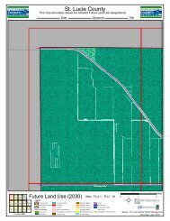
The 30 sites (40,142 acres) that were selected for this project were chosen based on their<br />
potentially high quality natural areas. Each site was inventoried and all natural areas<br />
were mapped and reclassified into FNAI Natural Communities (10.2 percent of the<br />
county was sampled (40,142 of 391,700 acres)). Four sites (sites 4, 9, 43, and 44) were<br />
inventoried via helicopter.<br />
Intersection with FLUCCS<br />
The FNAI Natural Community maps for all the sites were intersected with the 1995<br />
FLUCCS coverage for the these sites, using ArcGIS 8.3. This generated a map and table<br />
that had both the FLUCCS and the FNAI classification for all sites (4371 polygons).<br />
From this table, areas that are developed were excluded from further analysis since no<br />
FNAI Natural Community type would apply. The data was then sorted and summarized<br />
by FLUCCS type (37 types). Then for each of these 37 FLUCCS types the FNAI<br />
classification was sorted and summarized. Then the data was divided into FLUCCS<br />
categories that were potentially natural and FLUCCS categories that were natural (Tables<br />
13 and 14).<br />
The Natural and Potentially Natural FLUCCS designations are grouped separately<br />
because of their different relationship between FLUCCS and FNAI Types. The<br />
boundaries of Potentially Natural FLUCCS type are often determined by human<br />
47