

Mapping a Better Future - World Resources Institute
Mapping a Better Future - World Resources Institute
Mapping a Better Future - World Resources Institute

You also want an ePaper? Increase the reach of your titles
YUMPU automatically turns print PDFs into web optimized ePapers that Google loves.
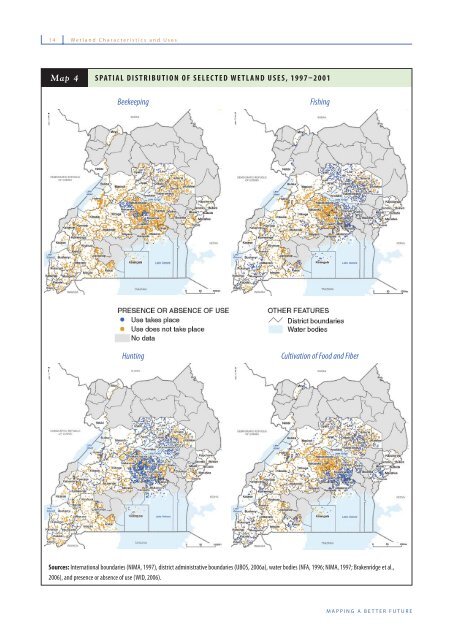
14 Wetland Characteristics and Uses<br />
Map 4<br />
SPATIAL DISTRIBUTION OF SELECTED WETLAND USES, 1997–2001<br />
Beekeeping<br />
Fishing<br />
Hunting<br />
Cultivation of Food and Fiber<br />
Sources: International boundaries (NIMA, 1997), district administrative boundaries (UBOS, 2006a), water bodies (NFA, 1996; NIMA, 1997; Brakenridge et al.,<br />
2006), and presence or absence of use (WID, 2006).<br />
MAPPING A BETTER FUTURE


