

Mapping a Better Future - World Resources Institute
Mapping a Better Future - World Resources Institute
Mapping a Better Future - World Resources Institute

Create successful ePaper yourself
Turn your PDF publications into a flip-book with our unique Google optimized e-Paper software.
24 Spatial Analysis of Wetland and Poverty Indicators<br />
Map 9<br />
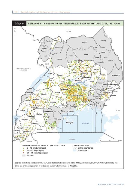
WETLANDS WITH MEDIUM TO VERY HIGH IMPACTS FROM ALL WETLAND USES, 1997–2001<br />
Sources: International boundaries (NIMA, 1997), district administrative boundaries (UBOS, 2006a), water bodies (NFA, 1996; NIMA 1997; Brakenridge et al.,<br />
2006), and combined impacts from all wetland uses (authors’ calculation based on WID, 2006).<br />
MAPPING A BETTER FUTURE


