

Mapping a Better Future - World Resources Institute
Mapping a Better Future - World Resources Institute
Mapping a Better Future - World Resources Institute

Create successful ePaper yourself
Turn your PDF publications into a flip-book with our unique Google optimized e-Paper software.
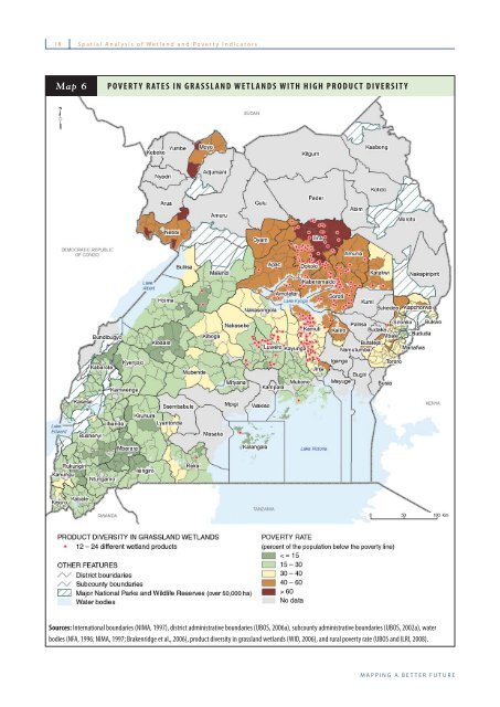
18 Spatial Analysis of Wetland and Poverty Indicators<br />
Map 6<br />
POVERTY RATES IN GRASSLAND WETLANDS WITH HIGH PRODUCT DIVERSITY<br />
Sources: International boundaries (NIMA, 1997), district administrative boundaries (UBOS, 2006a), subcounty administrative boundaries (UBOS, 2002a), water<br />
bodies (NFA, 1996; NIMA, 1997; Brakenridge et al., 2006), product diversity in grassland wetlands (WID, 2006), and rural poverty rate (UBOS and ILRI, 2008).<br />
MAPPING A BETTER FUTURE


