

Mapping a Better Future - World Resources Institute
Mapping a Better Future - World Resources Institute
Mapping a Better Future - World Resources Institute

You also want an ePaper? Increase the reach of your titles
YUMPU automatically turns print PDFs into web optimized ePapers that Google loves.
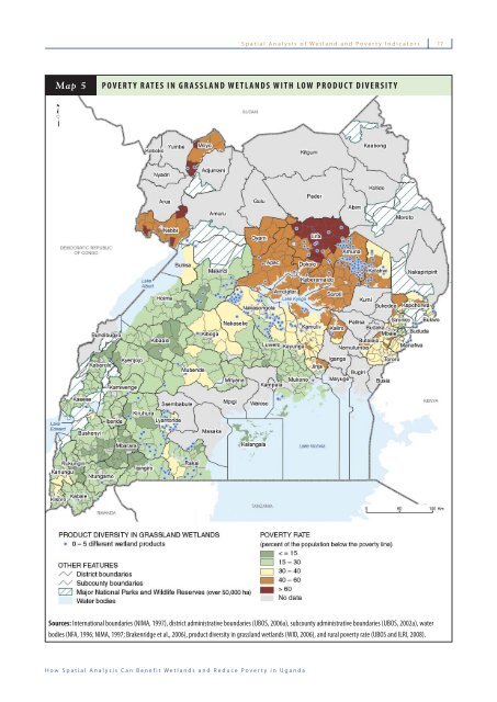
Spatial Analysis of Wetland and Poverty Indicators<br />
17<br />
Map 5<br />
POVERTY RATES IN GRASSLAND WETLANDS WITH LOW PRODUCT DIVERSITY<br />
Sources: International boundaries (NIMA, 1997), district administrative boundaries (UBOS, 2006a), subcounty administrative boundaries (UBOS, 2002a), water<br />
bodies (NFA, 1996; NIMA, 1997; Brakenridge et al., 2006), product diversity in grassland wetlands (WID, 2006), and rural poverty rate (UBOS and ILRI, 2008).<br />
How Spatial Analysis Can Benefit Wetlands and Reduce Poverty in Uganda


