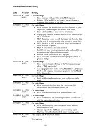
guideline and standards for skytem measurements, processing and ...
guideline and standards for skytem measurements, processing and ...
guideline and standards for skytem measurements, processing and ...

Create successful ePaper yourself
Turn your PDF publications into a flip-book with our unique Google optimized e-Paper software.
2 INTRODUCTION<br />
This report is a translation of the Danish version of the “Guideline <strong>and</strong> st<strong>and</strong>ards<br />
<strong>for</strong> SkyTEM <strong>measurements</strong>, <strong>processing</strong> <strong>and</strong> inversion”. The intention is to keep<br />
the English version up-to-date with the Danish version. The Danish version is<br />
valid <strong>for</strong> the partners involved in SkyTEM surveys in Denmark.<br />
The helicopter-borne transient electromagnetic measurement method, SkyTEM,<br />
is the leading geophysical method used <strong>for</strong> groundwater mapping in Denmark.<br />
This <strong>guideline</strong> was made as a quality assurance measure to ensure the quality<br />
of the procedures per<strong>for</strong>med during SkyTEM data collection <strong>and</strong> <strong>processing</strong>.<br />
The st<strong>and</strong>ards presented herein are tailored to Danish geological conditions <strong>and</strong><br />
to local Danish requirements concerning data quality <strong>and</strong> inversion.<br />
The manual is comprised by two main sections: Data collection, validation <strong>and</strong><br />
documentation are detailed in sections 3-5. Processing, inversion <strong>and</strong> reporting<br />
to GERDA are described in sections 6-8. Furthermore, the manual contains a<br />
number of appendices detailing various instrumentation <strong>and</strong> <strong>processing</strong><br />
parameters. These appendices may be useful in connection with the drafting of<br />
agreements.<br />
As the measurement equipment <strong>and</strong> inversion software are improved over time,<br />
the manual will be updated, as needed.<br />
The requirements to field work <strong>and</strong> data <strong>processing</strong> presented in the manual are<br />
st<strong>and</strong>ard requirements. In case these requirements cannot be met, the reasons<br />
<strong>for</strong> this shall be stated clearly in the final report <strong>and</strong>, where relevant, the involved<br />
parties shall be in<strong>for</strong>med. The <strong>guideline</strong> also provides a number of<br />
recommended <strong>processing</strong> <strong>and</strong> inversion settings.<br />
The <strong>guideline</strong> was circulated <strong>for</strong> comment in GEUS <strong>and</strong> among consulting<br />
engineers. All interested parties were invited to a meeting held at the<br />
Department of Earth Sciences in January 2010.<br />
Please note that the percentages provided in section 4.3 are presently<br />
instructive only. Final determination of the percentages presupposes thorough<br />
investigation.<br />
Version 2.0 of the manual came into <strong>for</strong>ce on 15 February 2010. The newest<br />
version is available from the web page of the HydroGeophysics Group:<br />
www.gfs.au.dk<br />
5