

Download Guidebook as .pdf (1.8 Mb) - Carolina Geological Society
Download Guidebook as .pdf (1.8 Mb) - Carolina Geological Society
Download Guidebook as .pdf (1.8 Mb) - Carolina Geological Society

Create successful ePaper yourself
Turn your PDF publications into a flip-book with our unique Google optimized e-Paper software.
CAROLINA GEOLOGICAL SOCIETY<br />
<strong>Guidebook</strong> for 1992 Annual Meeting<br />
Pages 59-62<br />
NANNOFOSSIL BIOSTRATIGRAPHY AND SEQUENCE STRATIGRAPHY OF MIDDLE TO UPPER EOCENE<br />
STRATA IN THE SOUTHWESTERN SAVANNAH RIVER SITE AND ADJACENT AREAS OF GEORGIA<br />
Richard A. Laws, W. Burleigh Harris and Victor A. Zullo<br />
Department of Earth Science<br />
University of North <strong>Carolina</strong> at Wilmington<br />
Wilmington, N.C. 28403<br />
INTRODUCTION<br />
Core VSC-4 (Figure 1, 2) contains a relatively complete<br />
middle to upper Eocene stratigraphic section typical of the<br />
southwestern Savannah River Site and adjacent are<strong>as</strong> of<br />
Georgia. The core is at an elevation of 156.7 feet; and penetrates<br />
a Cenozoic section of almost 500 feet; the Cretaceous<br />
Tertiary boundary is placed at a depth of 494.6 feet. Paleogene<br />
stratigraphic units recognized in the core include the<br />
Paleocene Ellenton Formation, an upper Paleocene/lower<br />
Eocene Un-named unit, the middle Eocene Congaree Formation,<br />
Warley Hill () Formation and Blue Bluff Marl, and<br />
the upper Eocene Utley Limestone Member of the Clinchfield<br />
Formation, the Griffins Landing Member of the Dry<br />
Branch Formation and undifferentiated Barnwell Group<br />
sands. We will focus our attention on the middle to upper<br />
Eocene section which extends from the surface to a depth of<br />
325 feet at the b<strong>as</strong>e of the Congaree Formation (see Figure<br />
2).<br />
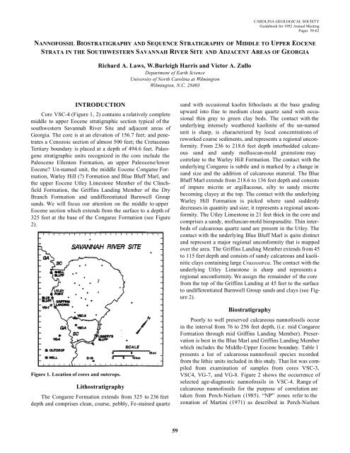
Figure 1. Location of cores and outcrops.<br />
Lithostratigraphy<br />
The Congaree Formation extends from 325 to 236 feet<br />
depth and comprises clean, coarse, pebbly, Fe-stained quartz<br />
sand with occ<strong>as</strong>ional kaolin lithocl<strong>as</strong>ts at the b<strong>as</strong>e grading<br />
upward into fine to medium clean quartz sand with occ<strong>as</strong>ional<br />
thin gray to green clay beds. The contact with the<br />
underlying intensely weathered kaolinite of the un-named<br />
unit is sharp, is characterized by local concentrations of<br />
reworked coarse sediments, and represents a regional unconformity.<br />
From 236 to 218.6 feet depth interbedded calcareous<br />
sand and sandy molluscan-mold grainstone may<br />
correlate to the Warley Hill Formation. The contact with the<br />
underlying Congaree is subtle and is marked by a change in<br />
sand size and the addition of calcareous material. The Blue<br />
Bluff Marl extends from 218.6 to 136 feet depth and consists<br />
of impure micrite or argillaceous, silty to sandy micrite<br />
becoming clayey at the top. The contact with the underlying<br />
Warley Hill Formation is picked where sand suddenly<br />
decre<strong>as</strong>es in quantity and size; it represents a regional unconformity.<br />
The Utley Limestone in 21 feet thick in the core and<br />
comprises a sandy, molluscan-mold biosparudite. Thin interbeds<br />
of calcareous quartz sand are present in the Utley. The<br />
contact with the underlying Blue Bluff Marl is quite distinct<br />
and represent a major regional unconformity that is mapped<br />
over the area. The Griffins Landing Member extends from 45<br />
to 115 feet depth and consists of sandy calcareous and kaolinitic<br />
clays containing large Cr<strong>as</strong>sostrea. The contact with the<br />
underlying Utley Limestone is sharp and represents a<br />
regional unconformity. We <strong>as</strong>sign the remainder of the core<br />
from the top of the Griffins Landing at 45 feet to the surface<br />
to undifferentiated Barnwell Group sands and clays (see Figure<br />
2).<br />
Biostratigraphy<br />
Poorly to well preserved calcareous nannofossils occur<br />
in the interval from 76 to 256 feet depth, (i.e. mid Congaree<br />
Formation through mid Griffins Landing Member). Preservation<br />
is best in the Blue Marl and Griffins Landing Member<br />
which includes the Middle-Upper Eocene boundary. Table 1<br />
presents a list of calcareous nannofossil species recorded<br />
from the lithic units included in this study. That list w<strong>as</strong> compiled<br />
from examination of samples from cores VSC-3,<br />
VSC4, VG-7, and VG-8. Figure 2 shows the occurrence of<br />
selected age-diagnostic nannofossils in VSC-4. Range of<br />
calcareous nannofossils for the purpose of correlation are<br />
taken from Perch-Nielsen (1985). “NP” zones refer to the<br />
zonation of Martini (1971) <strong>as</strong> described in Perch-Nielsen<br />
59


