Natural Resource Inventory and Assessment - Town of Guilford
Natural Resource Inventory and Assessment - Town of Guilford
Natural Resource Inventory and Assessment - Town of Guilford
You also want an ePaper? Increase the reach of your titles
YUMPU automatically turns print PDFs into web optimized ePapers that Google loves.
I4<br />
<strong>Natural</strong> <strong>Resource</strong>-Based Recreation<br />
Nature study/birdwatching: Connecticut lies in the path <strong>of</strong> the Atlantic Flyway, a major bird migration<br />
route, which affords exceptional spring <strong>and</strong> fall birdwatching. The DEP has launched a project to link<br />
coastal birding areas in the state with a highway-based trail which will include <strong>Guilford</strong>. Spring warblers<br />
abound in our local forests <strong>and</strong> preserves. (See Appendix D-1 Birds <strong>of</strong> <strong>Guilford</strong>, Noble Proctor.)<br />
Bicycling: road bikes require pavement, <strong>and</strong> the issue <strong>of</strong> bike lanes on roadways is beyond the scope <strong>of</strong><br />
this document. Mountain bikers have become a significant user group in our forests, particularly in<br />
Westwoods <strong>and</strong> Timberl<strong>and</strong>s. These bikes require use <strong>of</strong> either existing woods roads or trails designed to<br />
h<strong>and</strong>le the considerable impact <strong>of</strong> aggressive tire tread. The potential for conflict between mountain bike<br />
users <strong>and</strong> other trail users exists, but there is also the opportunity for creative cooperation.<br />
I.5 NRB Recreation Areas <strong>Inventory</strong><br />
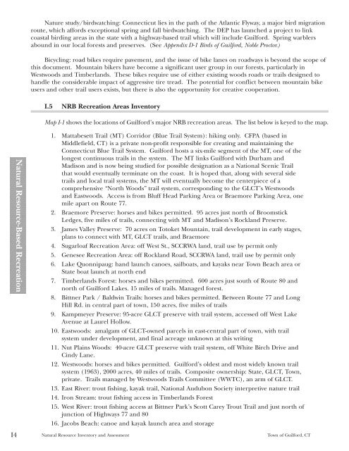
Map I-1 shows the locations <strong>of</strong> <strong>Guilford</strong>’s major NRB recreation areas. The list below is keyed to the map.<br />
1. Mattabesett Trail (MT) Corridor (Blue Trail System): hiking only. CFPA (based in<br />
Middlefield, CT) is a private non-pr<strong>of</strong>it responsible for creating <strong>and</strong> maintaining the<br />
Connecticut Blue Trail System. <strong>Guilford</strong> hosts a six-mile segment <strong>of</strong> the MT, one <strong>of</strong> the<br />
longest continuous trails in the system. The MT links <strong>Guilford</strong> with Durham <strong>and</strong><br />
Madison <strong>and</strong> is now being studied for possible designation as a National Scenic Trail<br />
that would eventually terminate on the coast. It is hoped that, along with several side<br />
trails <strong>and</strong> local trail systems, the MT will eventually become the centerpiece <strong>of</strong> a<br />
comprehensive “North Woods” trail system, corresponding to the GLCT’s Westwoods<br />
<strong>and</strong> Eastwoods. Access is from Bluff Head Parking Area or Braemore Parking Area, one<br />
mile apart on Route 77.<br />
2. Braemore Preserve: horses <strong>and</strong> bikes permitted. 95 acres just north <strong>of</strong> Broomstick<br />
Ledges, five miles <strong>of</strong> trails, connecting with MT <strong>and</strong> Madison’s Rockl<strong>and</strong> Preserve.<br />
3. James Valley Preserve: 70 acres on Totoket Mountain, trail development in early stages,<br />
plans to connect with MT, GLCT trails, <strong>and</strong> Braemore<br />
4. Sugarloaf Recreation Area: <strong>of</strong>f West St., SCCRWA l<strong>and</strong>, trail use by permit only<br />
5. Genesee Recreation Area: <strong>of</strong>f Rockl<strong>and</strong> Road, SCCRWA l<strong>and</strong>, trail use by permit only<br />
6. Lake Quonnipaug: h<strong>and</strong> launch canoes, sailboats, <strong>and</strong> kayaks near <strong>Town</strong> Beach area or<br />
State boat launch at north end<br />
7. Timberl<strong>and</strong>s Forest: horses <strong>and</strong> bikes permitted. 600 acres just south <strong>of</strong> Route 80 <strong>and</strong><br />
north <strong>of</strong> <strong>Guilford</strong> Lakes. 15 miles <strong>of</strong> trails. Managed forest.<br />
8. Bittner Park / Baldwin Trails: horses <strong>and</strong> bikes permitted. Between Route 77 <strong>and</strong> Long<br />
Hill Rd. in central part <strong>of</strong> town, 150 acres, five miles <strong>of</strong> trails<br />
9. Kampmeyer Preserve: 95-acre GLCT preserve with trail system, accessed <strong>of</strong>f West Lake<br />
Avenue at Laurel Hollow.<br />
10. Eastwoods: amalgam <strong>of</strong> GLCT-owned parcels in east-central part <strong>of</strong> town, with trail<br />
system under development, <strong>and</strong> final acreage unknown at this writing<br />
11. Nut Plains Woods: 40-acre GLCT preserve with trail system, <strong>of</strong>f White Birch Drive <strong>and</strong><br />
Cindy Lane.<br />
12. Westwoods: horses <strong>and</strong> bikes permitted. <strong>Guilford</strong>’s oldest <strong>and</strong> most widely known trail<br />
system (1963), 2000 acres, 40 miles <strong>of</strong> trails. Composite ownership: State, GLCT, <strong>Town</strong>,<br />
private. Trails managed by Westwoods Trails Committee (WWTC), an arm <strong>of</strong> GLCT.<br />
13. East River: trout fishing, kayak trail, National Audubon Society interpretive nature trail<br />
14. Iron Stream: trout fishing access in Timberl<strong>and</strong>s Forest<br />
15. West River: trout fishing access at Bittner Park’s Scott Carey Trout Trail <strong>and</strong> just north <strong>of</strong><br />
junction <strong>of</strong> Highways 77 <strong>and</strong> 80<br />
16. Jacobs Beach: canoe <strong>and</strong> kayak launch area <strong>and</strong> storage<br />
<strong>Natural</strong> <strong>Resource</strong> <strong>Inventory</strong> <strong>and</strong> <strong>Assessment</strong> <strong>Town</strong> <strong>of</strong> <strong>Guilford</strong>, CT


