Natural Resource Inventory and Assessment - Town of Guilford
Natural Resource Inventory and Assessment - Town of Guilford
Natural Resource Inventory and Assessment - Town of Guilford

Create successful ePaper yourself
Turn your PDF publications into a flip-book with our unique Google optimized e-Paper software.
Appendix<br />
C-1b<br />
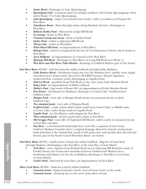
• Sucker Brook - discharges to Lake Quonnipaug<br />
• Quonnipaug Pond - (common name for swampy northern end <strong>of</strong> Lake Quonnipaug); flows<br />
under Route 77 to Lake Quonnipaug<br />
• Lake Quonnipaug - (major recreational water body); outlet at southern end begins the<br />
West River<br />
• Schoolhouse Brook - (flows through ravine along Hemlock Avenue); discharges to<br />
West River<br />
• Baldwin Dudley Pond - (bisected by Ledge Hill Road)<br />
• Ivy Swamp - drains to West River<br />
• Unnamed swamp <strong>and</strong> stream - drain to Endres Pond<br />
• Endres Pond - outlets to Spinning Mill Brook<br />
• Thirsty Lake - outlets to West River<br />
• Witch Hazel Mill Pond - an impoundment <strong>of</strong> West River<br />
• Bishops Pond - outlets to unnamed brook west <strong>of</strong> Cox Elementary School, which drains to<br />
West River<br />
• <strong>Town</strong> Millpond - an impoundment <strong>of</strong> a branch <strong>of</strong> the West River<br />
• Spinning Mill Brook - discharges to West River (at Long Hill Road near Route 1)<br />
• West River <strong>and</strong> West River Tidal Marshes - discharge to <strong>Guilford</strong> Harbor, part <strong>of</strong> the Sound<br />
East River Basin (#5108) - half this basin lies within <strong>Guilford</strong> <strong>and</strong> half within Madison.<br />
• Little Meadow Brook - (headwaters begin just over the Madison line); (public water supply<br />
watershed area); drains south, diverted to SCCRWA Genesee Tunnel Aqueduct; ...<br />
undiverted flow continues south, discharging to Capello Pond<br />
• Hall Lot Brook - (parallels Hoop Pole Road, to the east); joins Little Meadow Brook<br />
• Kelsey Pond - an impoundment <strong>of</strong> Hall Lot Brook<br />
• Malley’s Pond - (just south <strong>of</strong> Route 80); an impoundment <strong>of</strong> Little Meadow Brook<br />
• Iron Stream - (headwaters in Madison); discharges to Laurel Lake (northern-most<br />
<strong>Guilford</strong> Lake)<br />
• Maupus Pond - (west side <strong>of</strong> Maupus Road)-drains via unnamed stream to third<br />
<strong>Guilford</strong> Lake<br />
• Two unnamed ponds - (west side <strong>of</strong> Maupus Road)<br />
• <strong>Guilford</strong> Lakes - a lake system which drains south from Laurel Lake, to Middle Lake,<br />
to Lower Lake; outlet drains south to Capello Pond<br />
• Capello Pond - (in Nut Plains); outlet begins the East River<br />
• Three unnamed ponds - (former gravel pits); drain to East River<br />
• Old Scroggie Pond - (east side <strong>of</strong> Clapboard Hill Road); outlets south via unnamed stream<br />
to East River marshes<br />
• East River - (a freshwater-brackish-tidal river; near I-95, a segment <strong>of</strong> river forms<br />
<strong>Guilford</strong>/Madison boundary line); (original drainage altered by Amtrak construction)<br />
basin boundary is the Amtrak bed (south <strong>of</strong> this point river <strong>and</strong> marshes flow directly into<br />
Sound, part <strong>of</strong> the South Central Shoreline Basin - see below)<br />
Neck River Basin (#5107) - small section <strong>of</strong> basin lies within <strong>Guilford</strong>. Majority <strong>of</strong> basin flows<br />
through Madison, discharging to the East River at the town line at Grass Isl<strong>and</strong>.<br />
• Neck River - (river segment from Podunk Road area to Opening Hill Road just south <strong>of</strong><br />
Gould’s Pond; river forms town boundary between <strong>Guilford</strong> <strong>and</strong> Madison here;<br />
headwaters <strong>and</strong> balance <strong>of</strong> river lie in Madison; discharges to East River at town line<br />
at Grass Isl<strong>and</strong>)<br />
• Gould’s Pond - (bisected by town line); an impoundment <strong>of</strong> Neck River<br />
Sluice Creek Basin (#5109) - basin lies entirely within <strong>Guilford</strong>.<br />
• Unnamed stream - drains freshwater marsh (west <strong>of</strong> Goose Lane) to the south<br />
• Unnamed stream - (draining area to the west); joins above stream<br />
<strong>Natural</strong> <strong>Resource</strong> <strong>Inventory</strong> <strong>and</strong> <strong>Assessment</strong> <strong>Town</strong> <strong>of</strong> <strong>Guilford</strong>, CT