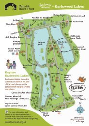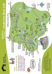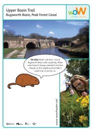
Montgomery Canal Conservation Management Strategy (1.2MB PDF)
Montgomery Canal Conservation Management Strategy (1.2MB PDF)
Montgomery Canal Conservation Management Strategy (1.2MB PDF)

You also want an ePaper? Increase the reach of your titles
YUMPU automatically turns print PDFs into web optimized ePapers that Google loves.
3.1 LANDSCAPE HERITAGE<br />
3.1.1 Overview and Survey Approach<br />
The assessment of the character and significance of the landscape heritage has been informed by national and regional<br />
character assessments, a landscape appraisal of the <strong>Montgomery</strong> <strong>Canal</strong> corridor, an assessment of the historic<br />
landscape, and community consultation work. The area assessed comprises the area visible from the canal – the visual<br />
envelope – as well as land immediately adjacent or historically connected with the waterway. The significance of the canal<br />
as a feature in the landscape has also been considered. More detailed landscape character assessments, which cover<br />
the whole land areas and include natural, historic, and cultural influences, are close to being published by Shropshire<br />
County Council and the Countryside Council for Wales (Landmap).<br />
The assessment identified a predominantly attractive rural landscape, gently undulating in Shropshire and more hilly in<br />
Powys, with the Breidden and Llanymynech hills forming landmarks on the border. Mostly pastoral, historic landscape<br />
features, although diminished by modern agricultural practices, continue to shape and contribute to the local character.<br />
Landscape designations and responses from the local community show that it is a valued landscape, with the peaceful<br />
and unspoilt character of particular importance to local people. The built heritage and wildlife habitats along the canal<br />
make a key contribution to the character of landscape viewed from the waterway, as well as forming features in the<br />
landscape in their own right, and are again particularly valued by local people.<br />
3.1.2 Landscape History<br />
i. The Historic Landscape<br />
The canal in all its phases cuts through a series of landscapes that have been used by humans in different ways for<br />
several millennia. It passes three known major areas of Late Neolithic and Early Bronze Age activity on the valley floors of<br />
the Severn and the Vyrnwy:<br />
• Berriew: barrow remains, a standing stone and the remains of a ceremonial monument known as a henge.<br />
• South of Welshpool: a complex of Late Neolithic and Early Bronze Age ritual monuments focused on the Sarn-ybryn-caled<br />
cursus.<br />
• Four Crosses: extensive cropmarks include the remnants of ploughed-out barrows, which excavations between 1981<br />
and 1985 showed to be Late Neolithic and Early Bronze Age in origin.<br />
Later in prehistory and into the Roman period, the same valley floor areas and the low hills beyond them, were<br />
populated by farming establishments which make their appearance as ditched enclosures of varying complexity. A<br />
remarkable number of such farmsteads lie within the immediate environs of the canal and in one case the canal<br />
appears to have impinged on such an enclosure. These are now evident only as below ground remains or cropmarks<br />
visible from the air. The enclosures themselves do not necessarily represent the full picture of these late prehistoric and<br />
Romano-British farms; while stock keeping undoubtedly played a major role in the local economy, cereals would also<br />
have been cultivated.<br />
ii. Defensive Structures<br />
The most important enclosures in the late prehistoric period are the hillforts:<br />
• Llanymynech Hill, straddling the border of England and Wales and overlooking the canal, is one of the largest<br />
enclosures in Britain, and extending well over 50 ha. is usually considered to relate to the control of the lead ore<br />
sources on the hill.<br />
• Dolforwyn Castle; the hill is occupied by a later defensive structure.<br />
• Gaer-fawr at the western end of the Guilsfield branch of the canal.<br />
• Bryn Mawr fort looks down on the canal adjacent to Pentreheylin Hall.<br />
The centuries after the Roman withdrawal remain difficult to detect in the archaeological record. Churches are likely to<br />
have been founded in those centuries, even though nothing from that time is visible in the structures of today. Some holy<br />
wells, too, may have originated in this period.<br />
19