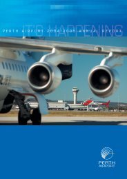
PERTH AIRPORT Master Plan 2009
PERTH AIRPORT Master Plan 2009
PERTH AIRPORT Master Plan 2009

You also want an ePaper? Increase the reach of your titles
YUMPU automatically turns print PDFs into web optimized ePapers that Google loves.
P E R T H A I R P O R T M a s t e r P l a n 2 0 0 9<br />
• runway dimensions and allocation to respective operations;<br />
• flight track descriptions and flight track dispersal to take<br />
into account the spread on the track by aircraft operations;<br />
• aircraft destinations or origins (stage lengths) to take into<br />
consideration track allocation;<br />
• day/night split of operations;<br />
• terrain data; and<br />
• normalised wind velocity and temperature information.<br />
Noise abatement procedures restricting the use of the<br />
06/24 runway over more densely populated suburbs to the<br />
southwest of Perth Airport have formed the basis for runway<br />
usage since the 1980’s. In 1999, these noise abatement<br />
procedures were agreed in principle by the Perth Airport<br />
Municipalities Group and are specified in a formal Deed of<br />
Agreement between the City of Bayswater and WAC. The<br />
Deed reaffirms a commitment that the proposal to extend the<br />
06/24 runway to the north east will include the adoption of<br />
strict and explicit use procedures such that take-offs to and<br />
landings from the southwest will only occur:-<br />
- in emergencies;<br />
- in extreme weather conditions; or<br />
- through the loss of the use of runway 03/21; and<br />
• noise abatement procedures and current runway approach<br />
(06) and take-off paths (24) for aircraft greater than<br />
20,000 kilograms would be maintained in the event of the<br />
extension of the 06/24 runway.<br />
• airport information publications will reflect the operating<br />
procedures and restrictions set out above and will be<br />
incorporated in future approved <strong>Master</strong> <strong>Plan</strong>s.<br />
• take-off and approach noise abatement procedures will be<br />
reviewed and improved as appropriate for runway 06/24.<br />
The flight tracks used in the production of the ultimate<br />
capacity ANEF are shown at Figure 11.2.<br />
A 2007 ANEI has been produced for Perth Airport (see Figure<br />
11.3). The ANEI drawing shows noise exposure contours<br />
based on actual aircraft movement data and shows the<br />
average daily aircraft noise exposure around the airport for<br />
the year 2007. Australian Noise Exposure Index plans are<br />
used principally as benchmarks or indicators of change of<br />
aircraft noise exposure. The extent of the ANEI contours on<br />
the 2007 drawing has increased from the ANEI produced in<br />
2002 due to an increase in aircraft movements.<br />
It should also be recognised that the 2002 ANEI was<br />
abnormally affected by a reduction in traffic due to events<br />
such as the Asian financial crisis, Middle East conflicts,<br />
collapse of Ansett, September 11 2001, the Bali bombing and<br />
SARS events.<br />
It should be noted that there can be significant confusion in the<br />
community about the meaning of ANEF or ANEI contours as<br />
they do not represent the noise impact of a single aircraft but<br />
a combination of aircraft. To assist members of the community<br />
to understand how aircraft noise directly affects them, other<br />
indicators have been developed to provide more meaningful<br />
aircraft noise information. This information is published in<br />
Perth Airport’s Annual Environment Report and includes:<br />
• flight path maps;<br />
• track density plots;<br />
• flight path movements; and<br />
• decibel charts.<br />
11.4 Land Use Development in the<br />
Vicinity of Perth Airport<br />
As outlined in Chapter 4 the ANEF produced in accordance<br />
with the requirements of the Airports Act 1996, for<br />
Perth Airport has been incorporated into State <strong>Plan</strong>ning<br />
Regulations. This measure helps to provide Perth Airport<br />
and the surrounding community with protection from<br />
inappropriate development in areas within the ultimate<br />
development noise exposure contour for the airport.<br />
The inclusion of the ultimate development ANEF (based on<br />
350,000 movements) in the state planning policy represents<br />
a major step forward in ensuring that long-term development<br />
of the airport is compatible with the long-term development<br />
of land surrounding the airport. This achieves the desired<br />
outcome of adopting the ANEF system for land use planning<br />
around airports.<br />
95