User Guide - Digimap
User Guide - Digimap
User Guide - Digimap
- No tags were found...

Create successful ePaper yourself
Turn your PDF publications into a flip-book with our unique Google optimized e-Paper software.
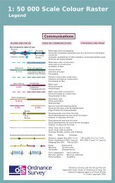
Chapter 6GeoreferencingTo be able to view each tile in the correct geographic relation to the National Grid and to each other, the tilesmust be georeferenced. GIS typically provide georeferencing as part of their functionality, but for each set oftiles it is necessary to provide the information on how the tiles should be ordered.Ordnance Survey provides this information in a set of georeferencing files, also known as World files. Acomplete set for 1:50 000 Scale Colour Raster is available to download free of charge from the1:50 000 Scale Colour Raster product page on the Ordnance Survey website.There are several different types of World file. Prior to downloading one of the sets, customers are advisedto check with their system suppliers to find out which type their system supports.The conventions behind the files’ creation can be found in chapter 4 of the technical specification. By usingthe conventions outlined there, this means that other datasets using the same conventions can be importedinto the same GIS to add value to the raster map; for example, overlaying a routing or logistics network overthe map or displaying a customer’s demographic information.The georeferencing files should be saved in the same directory as the files of the map tiles themselves.1:50 000 Scale Colour Raster and Gazetteer user guide chapter 6 v2.0.1 – 01/2008 © Crown copyright Page 12 of 33