User Guide - Digimap
User Guide - Digimap
User Guide - Digimap
- No tags were found...
Create successful ePaper yourself
Turn your PDF publications into a flip-book with our unique Google optimized e-Paper software.
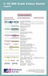
Annexe AGlossaryThe purpose of this chapter is to provide a glossary of terms used in the definition of products, services,licensing and other terms and conditions for 1:50 000 Scale Colour Raster and 1:50 000 Scale Gazetteer.American Standard Code for Information Interchange (ASCII)A standard binary coding system used to represent characters within a computer.binary digit (BIT)The smallest possible unit of data, resulting from a choice between 0 and 1.boundaryA boundary forms the division between two similar real-world objects, for example, property boundary oradministrative boundary, and is defined by one or more lines.byteA unit of computer storage of binary data, usually comprising 8 bits, equivalent to a character.characterA distinctive mark; an inscribed letter; one of a set of writing symbols.character codeThe binary representation of a single element of a character set; for example, EBCDIC, ASCII.coordinate pairA coordinate pair is an easting and a northing.coordinate transformationA computational process of converting an image or map from one coordinate system to another.compact discRead-only memory (CD-ROM). A data storage medium. A 12-cm disc similar to the audio CD. It is an alloydisc pitted with tiny holes and then coated in plastic. A laser head reads the pattern of the holes andtranslates them into binary data.copyrightThe sole legal right to print or publish a work. Crown Copyright subsists in all Ordnance Survey publicationsfor a 50-year period, from the end of the year in which they were first published, by virtue of the CopyrightDesigns and Patents Act 1988.customerAn organisation or individual that makes use of Ordnance Survey’s data supply facilities. This includes bothdirect sales customers of Ordnance Survey as well as customers of Licensed Partners. It does not includeanyone, or any organisation, that has access to Ordnance Survey material without charge.dataA representation of facts, concepts or instructions in a formalised manner suitable for communication,interpretation or processing.databaseAn organised, integrated collection of geographic data, which may or may not be spatial data. It is stored sothose specific applications can access the data by different logical paths. A database is accessed andmanaged by a database management system (software for managing database information).data formatA specification that defines the order in which data is stored or a description of the way data is held in a fileor record.data qualityAttributes of a dataset that define its suitability for a particular purpose, such as completeness, positionalaccuracy, currency and so on.1:50 000 Scale Colour Raster and Gazetteer technical specification annexe A v2.0.1 – 01/2008 © Crown copyright Page 25 of 33


