User Guide - Digimap
User Guide - Digimap
User Guide - Digimap
- No tags were found...

Create successful ePaper yourself
Turn your PDF publications into a flip-book with our unique Google optimized e-Paper software.
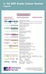
data structureThe defined logical arrangement of data as used by a system for data management; a representation of adata model in computer form.data transfer mediumThis is the means by which computer files are transferred from one computer to another. Transfer mediamay be subdivided into communications media and physical media.datasetData as supplied in a particular format to customers, whether internal or external to Ordnance Survey.densityA measure of the number of units of data held on a stated length of storage surface. For example, somemagnetic tapes may be recorded at a density of 1 600 bits per inch (bpi). Often referred to as packingdensity.delivery mechanismThe method of supply of data to a customer (such as offline and online).descriptive nameA name describing a real-world object or feature (for example, School) as shown on the1:50 000 Scale Colour Raster map.definitive nameThe name as shown on the 1:50 000 Scale Colour Raster map.digitalData that is expressed as numbers (digits) in computer-readable form.digital updateThe supply of revised digital data to a customer at a predetermined interval of time.direct saleA direct transaction between Ordnance Survey and a customer.distinctive nameA text feature that forms a name that distinguishes it from other text features of the same type, for example,Millbrook School.dots per inch (dpi)The resolution, or fineness, of a raster image.eastingsSee rectangular coordinates.JPEGAn image named after the Joint Photographic Experts Group, it uses a lossy compression format. It isdesigned for compressing full colour or greyscale images of natural, real-world scenes and works well onphotographs. It is the de facto standard for photographs on the web.encodingThe process of converting information to a computer-readable form, for example, digitising maps.featureA geographic entity such as a building or stream, either taken from a map or surveyed directly from the realworld. Can be a point/symbol, text or line.formatThe specified arrangement of data, for example, the layout of a printed document, the arrangement of theparts of a computer instruction, the arrangement of data in a record.1:50 000 Scale Colour Raster and Gazetteer technical specification annexe A v2.0.1 – 01/2008 © Crown copyright Page 26 of 33