User Guide - Digimap
User Guide - Digimap
User Guide - Digimap
- No tags were found...

You also want an ePaper? Increase the reach of your titles
YUMPU automatically turns print PDFs into web optimized ePapers that Google loves.
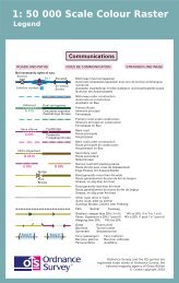
Annexe C1:50 000 Scale Gazetteer feature code listFeaturecodeAFFMHRCTOWDescriptionNon-Roman antiquity: shown on the OS Landranger Map in Lutheran type.Forest or wood: named areas on the OS Landranger Map identified by a green colour fill.Farm: all buildings named on the OS Landranger Map with the text string 'Farm' or 'Fm' aspart of their name. These features can include private houses that include 'Farm' as part oftheir name.NOTE: not all farms shown on OS Landranger Maps are covered under this classification astheir names, especially in Wales, do not contain the word 'Farm'.Large hill features or mountains with a minimum height difference of 30 m (three ringcontours): hills are only named where their name has been selected for depiction on theOS Landranger Map and the feature contains three contour lines. If less than three contourlines are present classification 'X' is used. Spurs, saddles and slopes are not classified.Roman antiquity: shown on the OS Landranger Map in Spartan antiquity type.CityTownOther settlements (urban area, village: Place names relating to built-up areas as shown on theOS Landranger Map).Water features: rivers, lakes, lochs, reservoirs and other water features, including coastalwaters shown in blue type on OS Landranger Maps, except marsh, which is recorded underclassification 'X'.X: Other feature: all distinctive names not covered by the above classifications, for example,private houses, isolated buildings, airports, commons, greens, marshes.1:50 000 Scale Colour Raster and Gazetteer technical specification annexe C v2.0.1 – 01/2008 © Crown copyright Page 33 of 33