User Guide - Digimap
User Guide - Digimap
User Guide - Digimap
- No tags were found...

Create successful ePaper yourself
Turn your PDF publications into a flip-book with our unique Google optimized e-Paper software.
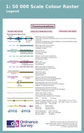
generalisationThe cartographic process of simplifying the depiction of features to fit the output scale. For example, roadwidening is necessary at smaller scales to enhance their visibility.geocodeAssigning a geographic location to data, for example, adding coordinates to an address.geographic coordinatesCoordinates, usually expressed as latitudes and longitudes, which define position on the Earth's surface.georeferenceA definition for registering raster images within a geographic framework is the process of assigning mapcoordinates to the raster image data and resampling the pixels of the image to conform to the map projectiongrid.gigabyte (Gb)1 073 741 824 bytes, a measure of data storage capacity (see megabyte).kilobyte (Kb)1 024 bytes, a measure of data storage capacity.Licensed PartnerAny organisation that has entered into a formal licence agreement with Ordnance Survey to market mapinformation or to incorporate map data with their application or service.linear featureMap feature in the form of a line (for example, river, and boundary) that may or may not represent areal-world (existent) feature.local originThe local origin of rectangular coordinates is the south-west corner of the 1 km by 1 km National Grid squarethey identify.Map scaleThe ratio between the extent of a feature on the map and its extent on the ground, normally expressed as arepresentative fraction, for example, 1:1250, 1:50 000 and so on.megabyte (Mb)1 048 576 bytes, a measure of data storage capacity (see gigabyte).National GridThe metric grid on the Transverse Mercator projection used by Ordnance Survey on all post-Second WorldWar mapping to provide an unambiguous spatial reference in Great Britain for any place or entity, whateverthe map scale.northingsSee rectangular coordinates.Oracle ®The relational database management system used for the 1:50 000 Scale Gazetteer.originThe zero point in a system of rectangular coordinates.pixelIn the 1:50 000 scale product a pixel is a single point represented by a square.pointsA pair of coordinates.raster dataAttribute data expressed as an array of pixels, with spatial position implicit in the ordering of the pixels.1:50 000 Scale Colour Raster and Gazetteer technical specification annexe A v2.0.1 – 01/2008 © Crown copyright Page 27 of 33