

Storm Data and Unusual Weather Phenomena - CIG
Storm Data and Unusual Weather Phenomena - CIG
Storm Data and Unusual Weather Phenomena - CIG
- No tags were found...

You also want an ePaper? Increase the reach of your titles
YUMPU automatically turns print PDFs into web optimized ePapers that Google loves.
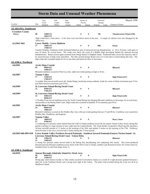
ALABAMA, SouthwestCrenshaw CountyPetreyALZ063>064ALASKA, NorthernAKZ001AKZ007AKZ009AKZ009AKZ001AKZ007AKZ003-006-009>010ALASKA, SoutheastAKZ02508<strong>Storm</strong> <strong>Data</strong> <strong>and</strong> <strong>Unusual</strong> <strong>Weather</strong> <strong>Phenomena</strong>TimePath PathNumber ofEstimatedLocal/ Length WidthPersonsDamageLocation DateSt<strong>and</strong>ard (Miles) (Yards) Killed Injured Property Crops Character of <strong>Storm</strong>1600CST1601CST005KMarch 1998Thunderstorm Wind (G50)High winds blew a barn down. A few trees were also blown down in the area. A couple of vehicles were also damaged by thefallen trees.Lower Mobile - Lower Baldwin17 1000CST0 0 30KFlood1700CSTCoastal Flooding...Southeast winds increased behind an area of eastward moving thunderstorms to 20 to 30 knots, with gusts tonear 45 knots, for several hours. The winds were likely the result of a Bubble High developing behind the eastward movingthunderstorms. Beach erosion again occurred from Orange Beach to Dauphin Isl<strong>and</strong>. Eastbound lanes across the causeway had tobe closed because of high water <strong>and</strong> debris. The tides around Orange Beach were 4 to 6 feet above normal during this time. Thehigh winds also extended inl<strong>and</strong> for five to ten miles <strong>and</strong> lasted for three to four hours.Arctic Slope Coastal05 0900AST1500AST0 0BlizzardBlizzard conditions occured at Point Lay only, under east winds gusting as high as 36 kts.Tanana Valley17 1300AST0 0High Wind (G47)1700ASTA weather front moved north across the Alaska Range, producing strong southerly winds for a time at Healy (maximum gust 47 kt)<strong>and</strong> Delta Junction (maximum gust 43 kt).St. Lawrence Isl<strong>and</strong>-Bering Strait Coast22 0300AST0 0Blizzard1700ASTSt. Lawrence Isl<strong>and</strong>-Bering Strait Coast22 0400AST0 0High Wind (G49)0600ASTA <strong>Weather</strong> Front moved northeast across the North Central Bering Sea bringing Blizzard conditions to Savoonga, for several hours,<strong>and</strong> possibly to the Bering Strait Coast. High winds also occurred at Gambell: 41 kt sustained, gust 49 kt.Arctic Slope Coastal24 0600AST0 0Blizzard1900ASTBlizzard Conditions occurred in the Prudhoe Bay Area with east winds gusting between 35 <strong>and</strong> 40 kts. Conditions were reported atPrudhoe Bay, Deadhorse, <strong>and</strong> Kuparuk.Tanana Valley25 1800AST0 0Heavy Snow27 0700ASTA weakening low pressure center tracked from the Gulf of Alaska northeast across the far eastern Tanana Valley slowly during thisperiod, resulting in a large amount of snow right near the Canada Border. The Alcan Border Cooperative Observing Site reported a24-hour snowfall amount of 13 inches on the morning of the 26th, <strong>and</strong> another 8 inches on the morning of the 27th. Northway,about 60 miles to the west, received only 6 inches during the 37-hour period.Lower Kobuk Valley-Northern Seward Peninsula - Southern Seward Peninsula-Eastern Norton Sound - St.Lawrence Isl<strong>and</strong>-Bering Strait Coast - Yukon Delta30 1300AST0 0Blizzard31 1400ASTA strong low pressure center moved north in the Bering Sea, decellerating, but weakening only slowly. This storm producedblizzard <strong>and</strong> near-blizzard conditions across much of the West Coast of Alaska, notably Cape Romanzof (Zone 10), Nome (Zone 6),Gambell (Zone 9), <strong>and</strong> Point Hope (Zone 3).Juneau Borough-Admiralty Isl<strong>and</strong>-Icy Strait Area08090600AST1100AST0 0High Wind (G48)Strong gap winds (known locally as Taku winds) occurred in downtown Juneau as a result of a tight pressure gradient between adeep low in the Northeast Pacific <strong>and</strong> a strong arctic high in the Yukon. The peak wind recorded during the event was 48 kt atMayflower Isl<strong>and</strong>.14 8


