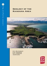
Geology of the Kaikoura Area - GNS Science
Geology of the Kaikoura Area - GNS Science
Geology of the Kaikoura Area - GNS Science
- No tags were found...
You also want an ePaper? Increase the reach of your titles
YUMPU automatically turns print PDFs into web optimized ePapers that Google loves.
iotite granite, locally with megacrystic K-feldspar, andfine-grained muscovite-biotite granite (Dkg). At MtMantell, biotite granodiorite and tonalite (Dkt)predominate (Stewart 1974). U-Pb dating <strong>of</strong> <strong>the</strong> KarameaSuite beyond <strong>the</strong> map area gave crystallisation ages <strong>of</strong>388–358 Ma (Muir & o<strong>the</strong>rs 1994, 1996).Median BatholithThe rocks separating <strong>the</strong> Eastern and Western provincesinclude a range <strong>of</strong> mafic, intermediate and felsic plutonicintrusions, some extrusive equivalent rocks and severalsignificant sedimentary units in and to <strong>the</strong> north <strong>of</strong> <strong>the</strong>map area. The Median Tectonic Zone (MTZ, Bradshaw1993) was defined to include <strong>the</strong>se diverse and, in places,structurally dismembered rocks. Mortimer & o<strong>the</strong>rs (1999)recognised that <strong>the</strong> MTZ is more than 90% plutonic inorigin and that much <strong>of</strong> <strong>the</strong> deformation was superimposedin <strong>the</strong> Cenozoic. Moreover <strong>the</strong> plutonic rocks extendbeyond <strong>the</strong> western limit <strong>of</strong> <strong>the</strong> MTZ into parts <strong>of</strong> <strong>the</strong>Western Province and are viewed as part <strong>of</strong> an originallycontiguous batholith, <strong>the</strong> Median Batholith (Fig. 4,Mortimer & o<strong>the</strong>rs 1999; Mortimer 2004). The batholith isdominated by I-type plutonic rocks ranging from ultramaficthrough to felsic compositions (Mortimer & o<strong>the</strong>rs 1999).In <strong>the</strong> <strong>Kaikoura</strong> map area <strong>the</strong> Median Batholith is obliquelytruncated by <strong>the</strong> Alpine Fault to <strong>the</strong> sou<strong>the</strong>ast, and <strong>the</strong>western contact is obscured under <strong>the</strong> Murchison Basin.Northwards from <strong>the</strong> Alpine Fault <strong>the</strong> Median Batholithbecomes increasingly obscured by a cover <strong>of</strong> late Cenozoicrocks, dominated by <strong>the</strong> Moutere Gravel, although it reemergesnor<strong>the</strong>ast <strong>of</strong> Nelson city. In Northwest Nelson<strong>the</strong> batholith intrudes <strong>the</strong> Takaka terrane (Rattenbury &o<strong>the</strong>rs 1998). In <strong>the</strong> east <strong>the</strong> batholith is separated from <strong>the</strong>Brook Street terrane by <strong>the</strong> Delaware-Speargrass FaultZone (Johnston & o<strong>the</strong>rs 1987; Johnston 1990; Rattenbury& o<strong>the</strong>rs 1998). The Median Batholith includes <strong>the</strong> RotoroaComplex, Tasman Intrusives and Separation Point Suite.The latter two intrusive units are separated by <strong>the</strong> FlaxmoreFault. Adjacent sedimentary and volcanic rocks, rangingfrom subgreenschist to amphibolite facies metamorphicgrade, are volumetrically minor and some have been derivedfrom extrusive equivalents or erosion <strong>of</strong> <strong>the</strong> MedianBatholith intrusive rocks.Late Triassic to Late Jurassic igneous rocks andassociated sedimentary rocksThe Tasman Intrusives group several Late Triassic to LateJurassic plutons in <strong>the</strong> sou<strong>the</strong>ast <strong>of</strong> <strong>the</strong> MoutereDepression (Johnston 1990). The Buller Diorite (Tab), nearLake Rotoiti, consists <strong>of</strong> medium-grained, commonlyaltered, diorite to tonalite (Fig. 15a) with sparse dikes <strong>of</strong>fine-grained diorite and quartz-rich pegmatites. The BullerDiorite characteristically contains plagioclase (oligoclase/andesine) and hornblende with minor interstitial quartz andaccessory minerals. Sou<strong>the</strong>ast, towards <strong>the</strong> Delaware-Speargrass Fault Zone, it becomes progressively foliatedwith <strong>the</strong> development <strong>of</strong> alternating white to greyish-white,feldspar-rich and dark grey to black, biotite and hornblenderichlayers. Within <strong>the</strong> Delaware-Speargrass Fault Zone<strong>the</strong> diorite grades into <strong>the</strong> foliated Rotoiti Gneiss (Tar)composed <strong>of</strong> quartz, plagioclase (oligoclase), K-feldspar,biotite, muscovite and porphyroblastic garnet. Radiometricdating <strong>of</strong> <strong>the</strong> Buller Diorite yielded Late Triassic ages <strong>of</strong>225 Ma (K-Ar, Johnston 1990) and 228 Ma (U-Pb zircon,Kimbrough & o<strong>the</strong>rs 1994). O<strong>the</strong>r rock types within <strong>the</strong>Delaware-Speargrass Fault Zone include altered coarset<strong>of</strong>ine-grained gabbro and minor pyroxenite <strong>of</strong> <strong>the</strong>Seventeen Gabbro (Jas) <strong>of</strong> Mesozoic age (Johnston 1990).The One Mile Gabbronorite (Jao) consists <strong>of</strong> diorite,tonalite and hornblende gabbronorite that are commonlyaltered (Tulloch & o<strong>the</strong>rs 1999). The pluton intrudes <strong>the</strong>Rainy River Conglomerate in <strong>the</strong> east and is bounded by<strong>the</strong> Flaxmore Fault in <strong>the</strong> west. U-Pb dating <strong>of</strong> zirconsindicates a 147 Ma (Late Jurassic) intrusive age (Kimbrough& o<strong>the</strong>rs 1994).Big Bush Andesite (Jeb) <strong>of</strong> <strong>the</strong> Teetotal Group (Johnston1990) forms an 800 m wide strip in <strong>the</strong> upper Rainy Riverand consists <strong>of</strong> grey to greenish-grey, fine- to mediumgrainedandesite and overlying andesitic breccia. Theandesite is largely massive but flows, up to 2 m thick, withdark, fine-grained margins are locally recognisable. It ischaracterised by andesine phenocrysts with a dominanttrachytic texture. The breccia is predominantly unstratifiedalthough locally fragments are weakly aligned. The brecciagrades eastwards, and probably stratigraphically upwards,into <strong>the</strong> c. 2000 m thick Rainy River Conglomerate (Jer).Within <strong>the</strong> conglomerate are rare sills or flows <strong>of</strong> porphyriticBig Bush Andesite. The lower 200 m <strong>of</strong> <strong>the</strong> Rainy RiverConglomerate is dominated by andesitic breccia with layers<strong>of</strong> subrounded to rounded andesitic pebbles. This brecciagrades upwards into very poorly sorted, greenish-greyconglomerate with a variety <strong>of</strong> clasts, up to 0.5 m across, ina fine- to coarse-grained grey or greenish-grey sandstonematrix (Fig. 15b). The clasts include andesite, felsicplutonics, basalt, and altered sandstone and siltstone. Inplaces <strong>the</strong> clasts are dominated by diorite eroded from <strong>the</strong>underlying Buller Diorite (Tulloch & o<strong>the</strong>rs 1999). TheRainy River Conglomerate contains rare, very thicksandstone beds locally with coal seams up to 0.4 m thick,and minor siltstone. The formation has undergone zeolitefacies metamorphism and <strong>the</strong> coal is <strong>of</strong> high-volatilebituminous rank.Clasts within <strong>the</strong> Rainy River Conglomerate are sourcedfrom <strong>the</strong> Median Batholith and <strong>the</strong> Brook Street terrane,<strong>the</strong> closest terrane <strong>of</strong> <strong>the</strong> Eastern Province. No clasts from<strong>the</strong> Western Province have been identified. The ages <strong>of</strong><strong>the</strong> Big Bush Andesite and Rainy River Conglomerate arenot known, although <strong>the</strong>y are constrained by <strong>the</strong>underlying Buller Diorite and <strong>the</strong> intruding One MileGabbronorite (see above). U-Pb zircon dating <strong>of</strong> two quartzmonzonite clasts from <strong>the</strong> Rainy River Conglomerateyielded 273–290 Ma (Early Permian) and 176–185 Ma (EarlyJurassic) ages. A late Middle or Late Jurassic age isassigned to <strong>the</strong> Big Bush Andesite and Rainy RiverConglomerate (Tulloch & o<strong>the</strong>rs 1999).14


