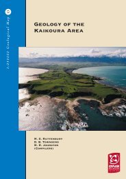
Geology of the Kaikoura Area - GNS Science
Geology of the Kaikoura Area - GNS Science
Geology of the Kaikoura Area - GNS Science
- No tags were found...
You also want an ePaper? Increase the reach of your titles
YUMPU automatically turns print PDFs into web optimized ePapers that Google loves.
TECTONIC HISTORYEarly to mid-PaleozoicGreenland Group rocks <strong>of</strong> <strong>the</strong> Buller terrane were depositedon <strong>the</strong> Australo-Antarctic margin <strong>of</strong> Gondwanaland in <strong>the</strong>Early Ordovician (Cooper & Tulloch 1992). In <strong>the</strong> Silurian<strong>the</strong> group was tightly folded and metamorphosed to lowergreenschist facies (Adams & o<strong>the</strong>rs 1975). The HaupiriGroup <strong>of</strong> <strong>the</strong> Takaka terrane formed in a volcanic island arcand back-arc setting at a convergent plate boundary(Münker & Cooper 1999). The carbonate-rich Mt ArthurGroup rocks were deposited on a passive continentalmargin, east <strong>of</strong> <strong>the</strong> volcanic arc, after cessation <strong>of</strong>subduction; <strong>the</strong>y were subsequently thrust over <strong>the</strong>volcanic rocks <strong>of</strong> <strong>the</strong> Haupiri Group and folded (Cooper &Tulloch 1992). Accretion <strong>of</strong> <strong>the</strong> Takaka terrane onto <strong>the</strong>Buller terrane occurred in <strong>the</strong> mid-Devonian, in part bymovement along <strong>the</strong> Anatoki Fault. The tectonic suturingwas followed shortly afterwards by <strong>the</strong> intrusion <strong>of</strong>voluminous granitic rocks <strong>of</strong> <strong>the</strong> Karamea Batholithbetween 370 and 328 Ma (Cooper & Tulloch 1992).Late Paleozoic to Early CretaceousThe emplacement <strong>of</strong> <strong>the</strong> Median Batholith, dominated in<strong>the</strong> <strong>Kaikoura</strong> map area by Triassic to Early Cretaceousintrusions, occurred along <strong>the</strong> margin <strong>of</strong> Gondwanalandand sutured <strong>the</strong> Western Province to <strong>the</strong> western part <strong>of</strong><strong>the</strong> Eastern Province (Bradshaw 1993; Mortimer & o<strong>the</strong>rs1999). Subsequently much <strong>of</strong> <strong>the</strong> eastern part <strong>of</strong> <strong>the</strong>batholith has been excised by <strong>the</strong> Delaware-SpeargrassFault Zone (Johnston & o<strong>the</strong>rs 1987; Johnston 1990). TheEastern Province contains six terranes within <strong>the</strong> map areaand all record convergent margin tectonism and volcanosedimentaryprocesses (Coombs & o<strong>the</strong>rs 1976; Bradshaw1989; Mortimer 2004). The westernmost is <strong>the</strong> volcanogenicBrook Street terrane, consisting <strong>of</strong> a tectonicallydismembered remnant <strong>of</strong> a calc-alkaline island arc. Anintrusive contact between <strong>the</strong> Brook Street terrane and <strong>the</strong>Median Batholith in Southland constrains accretion <strong>of</strong> <strong>the</strong>terrane to Gondwanaland to between 230 and 245 Ma(Middle to Late Triassic; Mortimer & o<strong>the</strong>rs 1999). In eastNelson <strong>the</strong> contact between <strong>the</strong> Brook Street and Murihikuterranes is faulted. However <strong>the</strong> Brook Street terrane mayhave originally been overlain by <strong>the</strong> volcaniclasticMurihuku terrane in a Triassic-Jurassic back-arc basin.Far<strong>the</strong>r east, a “slab” <strong>of</strong> Permian oceanic ridge or back-arcbasin crust, <strong>the</strong> Dun Mountain Ophiolite Belt, wasobducted onto Murihiku and Brook Street terranes duringEarly to mid-Permian subduction (Coombs & o<strong>the</strong>rs 1976;Sano & o<strong>the</strong>rs 1997). Overlying Late Permian to TriassicMaitai Group accumulated in a trench forearc settingadjacent to a convergent margin. Although faulted, andfolded into <strong>the</strong> Roding Syncline, <strong>the</strong> group has largelyretained internal stratigraphic coherence.The Patuki Mélange separates <strong>the</strong> Dun Mountain-Maitaiterrane rocks from <strong>the</strong> Caples terrane; <strong>the</strong> latteraccumulated as an accretionary wedge in a Late Permianto Triassic trench or trench slope. The original suturebetween <strong>the</strong> Caples and Rakaia terranes (not seen in <strong>the</strong><strong>Kaikoura</strong> map area) is within a zone <strong>of</strong> greenschist toamphibolite facies schist with multiple generations <strong>of</strong>recumbent folds and penetrative foliations (Mortimer1993a,b; Johnston 1994; Begg & Johnston 2000). In <strong>the</strong><strong>Kaikoura</strong> map area <strong>the</strong> Caples-derived schist was laterjuxtaposed by Cenozoic movement <strong>of</strong> <strong>the</strong> Alpine Faultagainst non-schistose Rakaia terrane rocks. Greenschistfacies (garnet zone) schist is present in <strong>the</strong> western part <strong>of</strong><strong>the</strong> Rakaia terrane (Turnbull & Forsyth 1986), including<strong>the</strong> Aspiring lithological association, but far<strong>the</strong>r eastweakly metamorphosed, lithologically monotonous,quartz<strong>of</strong>eldspathic sedimentary rocks predominate. Theserocks accumulated in a Late Triassic to Early Jurassicsubduction setting and were progressively imbricated anddeformed in an accretionary wedge (MacKinnon 1983;Bradshaw 1989). The Esk Head belt, comprising mélangeand generally more deformed rock, including <strong>the</strong>Silverstream Fault Zone in Branch River, is <strong>the</strong> tectonicsuture between <strong>the</strong> Rakaia terrane and <strong>the</strong> Pahau terraneto <strong>the</strong> east. Rocks <strong>of</strong> <strong>the</strong> Pahau terrane were deposited in asubduction setting and deformed in an accretionary wedgein <strong>the</strong> Late Jurassic to Early Cretaceous. The Caples, Rakaiaand Pahau terranes were amalgamated during convergenttectonism along <strong>the</strong> Gondwanaland margin between <strong>the</strong>Middle Jurassic and <strong>the</strong> late Early Cretaceous, whensubduction ceased (Coombs & o<strong>the</strong>rs 1976; Bradshaw1989). Major igneous intrusion occurred in and beyond<strong>the</strong> west <strong>of</strong> <strong>the</strong> <strong>Kaikoura</strong> map area in <strong>the</strong> Early Cretaceouswith <strong>the</strong> emplacement <strong>of</strong> <strong>the</strong> Separation Point suite ando<strong>the</strong>r granitoids (Tulloch 1983).Mid- to Late Cretaceous and PaleogeneFollowing cessation <strong>of</strong> subduction and amalgamation <strong>of</strong><strong>the</strong> Eastern Province terranes, a prolonged period <strong>of</strong>extensional tectonics resulted in <strong>the</strong> opening <strong>of</strong> <strong>the</strong> TasmanSea and, within <strong>the</strong> <strong>Kaikoura</strong> map area, widespread erosionand deposition into numerous mid-Cretaceous basins(Crampton & o<strong>the</strong>rs 2003). Intrusion <strong>of</strong> <strong>the</strong> TapuaenukuIgneous Complex and associated dikes was accompaniedby extrusive basalt flows, which interfingered withterrestrial and shallow marine sedimentary rocks.In <strong>the</strong> Late Cretaceous, subsidence become more regionalin extent (Crampton & Laird 1997) as <strong>the</strong> tempo <strong>of</strong>extensional tectonics waned and a passive margindeveloped. Relative quiescence from <strong>the</strong> end <strong>of</strong> <strong>the</strong>Cretaceous resulted in regional subsidence and marinetransgression, followed by <strong>the</strong> slow accumulation <strong>of</strong>widespread, fine-grained clastic and carbonate rocks (Field,Browne & o<strong>the</strong>rs 1989). This was punctuated by sporadicintraplate volcanism, particularly in <strong>the</strong> Canterbury Basin(Browne & Field 1985). In <strong>the</strong> nor<strong>the</strong>ast <strong>of</strong> <strong>the</strong> map areathis passive, basinal regime continued through into at least<strong>the</strong> Middle Eocene (Strong & o<strong>the</strong>rs 1995; Crampton &o<strong>the</strong>rs 2003). In nor<strong>the</strong>rn Canterbury, deposition on a broad,relatively sheltered shallow shelf led to accumulation <strong>of</strong>fine-grained clastic rocks and glauconitic sands. Thenor<strong>the</strong>rn basins extended southwards during <strong>the</strong> Eoceneand Oligocene, resulting in <strong>the</strong> deposition <strong>of</strong> a blanket <strong>of</strong>carbonate rocks. The Early Oligocene period <strong>of</strong> erosion48


