Vauxhall Nine Elms Battersea Opportunity Area Planning Framework
Vauxhall Nine Elms Battersea Opportunity Area Planning Framework
Vauxhall Nine Elms Battersea Opportunity Area Planning Framework

You also want an ePaper? Increase the reach of your titles
YUMPU automatically turns print PDFs into web optimized ePapers that Google loves.
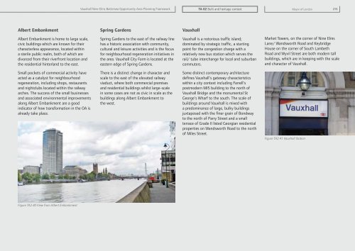
<strong>Vauxhall</strong> <strong>Nine</strong> <strong>Elms</strong> <strong>Battersea</strong> <strong>Opportunity</strong> <strong>Area</strong> <strong>Planning</strong> <strong>Framework</strong>TA 02 Built and heritage contextMayor of London 215Albert EmbankmentSpring Gardens<strong>Vauxhall</strong>Albert Embankment is home to large scale,civic buildings which are known for theircharacterless appearance, located withina sterile public realm, both of which aredivorced from their riverfront location andthe residential hinterland to the east.Spring Gardens to the east of the railway linehas a historic association with community,cultural and leisure activities and is the focusfor neighbourhood regeneration initiatives inthe area. <strong>Vauxhall</strong> City Farm is located at theeastern edge of Spring Gardens.<strong>Vauxhall</strong> is a notorious traffic island;dominated by strategic traffic, a startingpoint for the congestion charge with arelatively new bus station which serves therail/ tube interchange for local and suburbancommuters.Market Towers, on the corner of <strong>Nine</strong> <strong>Elms</strong>Lane/ Wandsworth Road and KeybridgeHouse on the corner of South LambethRoad and Wyvil Street are both modern tallbuildings, which are in keeping with the scaleand character of <strong>Vauxhall</strong>.Small pockets of commercial activity haveacted as a catalyst for neighbourhoodregeneration, including shops, restaurantsand nightclubs located within the railwayarches. The success of the small businessesand associated environmental improvementsalong Albert Embankment are a goodindicator of how transformation in the OA isalready take place.There is a distinct change in character andscale to the east of the elevated railwayviaduct, where both commercial premisesand residential buildings whilst large-scalein some cases are not as civic in scale as thebuildings along Albert Embankment tothe west.Some distinct contemporary architecturedefines <strong>Vauxhall</strong>’s gateway characteristicswithin a city context including Farrell’spostmodern MI5 building to the north of<strong>Vauxhall</strong> Bridge and the monumental StGeorge’s Wharf to the south. The scale ofbuildings around <strong>Vauxhall</strong> is mixed witha predominance of large, bulky buildingsjuxtaposed with the finer grain of Bondwayto the north of Parry Street and a smallterrace of Grade II listed Georgian residentialproperties on Wandsworth Road to the northof Miles Street.Figure TA2.41 <strong>Vauxhall</strong> StationFigure TA2.40 View from Albert Embankment