Vauxhall Nine Elms Battersea Opportunity Area Planning Framework
Vauxhall Nine Elms Battersea Opportunity Area Planning Framework
Vauxhall Nine Elms Battersea Opportunity Area Planning Framework

Create successful ePaper yourself
Turn your PDF publications into a flip-book with our unique Google optimized e-Paper software.
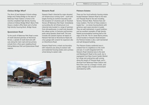
<strong>Vauxhall</strong> <strong>Nine</strong> <strong>Elms</strong> <strong>Battersea</strong> <strong>Opportunity</strong> <strong>Area</strong> <strong>Planning</strong> <strong>Framework</strong>TA 02 Built and heritage contextMayor of London 217Chelsea Bridge WharfThe sliver of land between Victoria railwaybridge and Chelsea Bridge to the west of<strong>Battersea</strong> Power Station is home to therecently completed high density housingscheme at Chelsea Bridge Wharf, Marco PoloHouse a modern office block and a furtherhigh density housing block, Bridge House.Queenstown RoadTo the south of <strong>Battersea</strong> Park Road a seriesof small industrial premises at PatchmoreTerrace, a parade of small retail and caféuses along the main road and two primaryschools form a finer grain neighbourhoodlinking <strong>Battersea</strong> Park and Queenstown Roadstations.Stewarts RoadStewarts Road is bisected by major elevatedrail infrastructure running north – south andlargely forming its northern boundary withthe exception of a business park at HavelockTerrace off <strong>Battersea</strong> Park Road. Immediatelysurrounding the rail infrastructure is anindustrial area located in a range of premisesfrom old warehouses, to small units beneaththe railway arches, to factories and businessparks along Stewarts Road itself. This areaincludes the Gatwick Express rail depot onNetwork Rail land at Silverthorne Road anda bus garage with consent for expansion alsoon Silverthorne Road.Stewarts Road forms a mixed use boundarywith industrial uses along its western sideand residential housing estates and a primaryschool along its eastern side.Patmore EstatesThere are four local authority housing estateslocated between Stewarts Road to the westand Thessaly Road to the east including,Savona, Patmore West, Patmore East andCarey Gardens. The form of these estates islargely four – six storey housing blocks withgenerous open space provision at grade.They are well maintained, in good conditionand are excellent examples of high densityflatted accommodation working well at theedge of the OA. The Sir James Barrie primaryschool located on Stewarts Road betweenthe Patmore Estates is also a well maintainedand well designed building.The Patmore Estates residential area isisolated from its neighbours to the northand east. It is well integrated with theStewarts Road industrial area to the westand Wandsworth Road to the south, but issegregated from New Covent Garden Marketby a large and unattractive wall runningalong the length of Thessaly Road, and isdivorced from <strong>Battersea</strong> Power Station and<strong>Nine</strong> <strong>Elms</strong> Lane by a change in levels, poorquality linkages and a hostile environmentdominated by traffic.Figure TA2.44 Stewarts Road industrial area