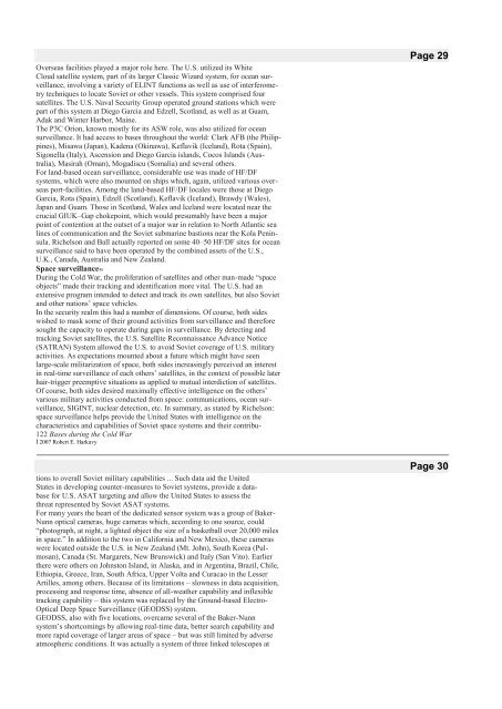
Overseas facilities played a major role here. The U.S. utilized its WhiteCloud satellite system, part of its larger Classic Wizard system, for ocean surveillance,involving a variety of ELINT functions as well as use of interferometrytechniques to locate Soviet or o<strong>the</strong>r vessels. This system comprised foursatellites. The U.S. Naval Security Group operated ground stations which werepart of this system at Diego Garcia and Edzell, Scotland, as well as at Guam,Adak and Winter Harbor, Maine.The P3C Orion, known mostly for its ASW role, was also utilized for oceansurveillance. It had access to bases throughout <strong>the</strong> world: Clark AFB (<strong>the</strong> Philippines),Misawa (Japan), Kadena (Okinawa), Keflavik (Iceland), Rota (Spain),Sigonella (Italy), Ascension and Diego Garcia islands, Cocos Islands (Australia),Masirah (Oman), Mogadiscu (Somalia) and several o<strong>the</strong>rs.For land-based ocean surveillance, considerable use was made of HF/DFsystems, which were also mounted on ships which, again, utilized various overseasport-facilities. Among <strong>the</strong> land-based HF/DF locales were those at DiegoGarcia, Rota (Spain), Edzell (Scotland), Keflavik (Iceland), Brawdy (Wales),Japan and Guam. Those in Scotland, Wales and Iceland were located near <strong>the</strong>crucial GIUK–Gap chokepoint, which would presumably have been a majorpoint of contention at <strong>the</strong> outset of a major war in relation to North Atlantic sealines of communication and <strong>the</strong> Soviet submarine bastions near <strong>the</strong> Kola Peninsula.Richelson and Ball actually reported on some 40–50 HF/DF sites for oceansurveillance said to have been operated by <strong>the</strong> combined assets of <strong>the</strong> U.S.,U.K., Canada, Australia and New Zealand.Space surveillance48During <strong>the</strong> <strong>Cold</strong> <strong>War</strong>, <strong>the</strong> proliferation of satellites and o<strong>the</strong>r man-made “spaceobjects” made <strong>the</strong>ir tracking and identification more vital. The U.S. had anextensive program intended to detect and track its own satellites, but also Sovietand o<strong>the</strong>r nations’ space vehicles.In <strong>the</strong> security realm this had a number of dimensions. Of course, both sideswished to mask some of <strong>the</strong>ir ground activities from surveillance and <strong>the</strong>reforesought <strong>the</strong> capacity to operate <strong>during</strong> gaps in surveillance. By detecting andtracking Soviet satellites, <strong>the</strong> U.S. Satellite Reconnaissance Advance Notice(SATRAN) System allowed <strong>the</strong> U.S. to avoid Soviet coverage of U.S. militaryactivities. As expectations mounted about a future which might have seenlarge-scale militarization of space, both sides increasingly perceived an interestin real-time surveillance of each o<strong>the</strong>rs’ satellites, in <strong>the</strong> context of possible laterhair-trigger preemptive situations as applied to mutual interdiction of satellites.Of course, both sides desired maximally effective intelligence on <strong>the</strong> o<strong>the</strong>rs’various military activities conducted from space: communications, ocean surveillance,SIGINT, nuclear detection, etc. In summary, as stated by Richelson:space surveillance helps provide <strong>the</strong> United States with intelligence on <strong>the</strong>characteristics and capabilities of Soviet space systems and <strong>the</strong>ir contribu-122 <strong>Bases</strong> <strong>during</strong> <strong>the</strong> <strong>Cold</strong> <strong>War</strong>İ 2007 Robert E. Harkavytions to overall Soviet military capabilities ... Such data aid <strong>the</strong> UnitedStates in developing counter-measures to Soviet systems, provide a databasefor U.S. ASAT targeting and allow <strong>the</strong> United States to assess <strong>the</strong>threat represented by Soviet ASAT systems.For many years <strong>the</strong> heart of <strong>the</strong> dedicated sensor system was a group of Baker-Nunn optical cameras, huge cameras which, according to one source, could“photograph, at night, a lighted object <strong>the</strong> size of a basketball over 20,000 milesin space.” In addition to <strong>the</strong> two in California and New Mexico, <strong>the</strong>se cameraswere located outside <strong>the</strong> U.S. in New Zealand (Mt. John), South Korea (Pulmosan),Canada (St. Margarets, New Brunswick) and Italy (San Vito). Earlier<strong>the</strong>re were o<strong>the</strong>rs on Johnston Island, in Alaska, and in Argentina, Brazil, Chile,Ethiopia, Greece, Iran, South Africa, Upper Volta and Curacao in <strong>the</strong> LesserArtilles, among o<strong>the</strong>rs. Because of its limitations – slowness in data acquisition,processing and response time, absence of all-wea<strong>the</strong>r capability and inflexibletracking capability – this system was replaced by <strong>the</strong> Ground-based Electro-Optical Deep Space Surveillance (GEODSS) system.GEODSS, also with five locations, overcame several of <strong>the</strong> Baker-Nunnsystem’s shortcomings by allowing real-time data, better search capability andmore rapid coverage of larger areas of space – but was still limited by adverseatmospheric conditions. It was actually a system of three linked telescopes atPage 29Page 30
each site, providing variable coverage by altitude. The five locations were inHawaii (Maui) and New Mexico (White Sands), within <strong>the</strong> U.S. and externallyin South Korea (Taegu), Diego Garcia and Portugal.Systems used primarily for early warning – BMEWS, FSS-7, PAVE PAWS,Enhanced Perimeter Acquisition Radar Attack Characterization System(EPARCS) and FPS-85 radars – were usable as collateral space-trackingsensors. Of <strong>the</strong>se, BMEWS – based at Thule (Greenland), Fylingdales (U.K.)and Clear (Alaska) – involved extensive use of foreign access. Additionally,COBRA DANE (Shemya Island, Aleutians – 120 arc, 46,000-km range againstspace targets) and also <strong>the</strong> AN/FPS-79 (Pincirlik/Diyarbakir, Turkey) radar wereusable in a space-surveillance role, as supplementary to <strong>the</strong> primary missions ofmonitoring missile-test re-entry trajectories.Numerous o<strong>the</strong>r foreign facilities were used as part of <strong>the</strong> U.S. SatelliteTracking and Data Acquisition Network (STADAN) network of installationsused to track and monitor U.S. space activities, including <strong>the</strong> down-rangecourse of launches. Among <strong>the</strong>se were facilities in: Australia (Orooral Valley,Toowoomba), <strong>the</strong> U.K. (Winkfield), Ascension, Bermuda, <strong>the</strong> Canaries (Tenerife),Spain (Madrid), Brazil (Fernando de Noronha) and Antigua, in connectionwith space surveillance and under <strong>the</strong> heading of “miscellaneous radars.”Earlier STADAN tracking facilities were operated, among o<strong>the</strong>r places, inChile, Ecuador, <strong>the</strong> Malagasy Republic, Grand Turk Islands, South Africa andZaire.<strong>Bases</strong> <strong>during</strong> <strong>the</strong> <strong>Cold</strong> <strong>War</strong> 123İ 2007 Robert E. HarkavySatellite control stations49One of <strong>the</strong> most secret or classified areas of overseas bases was that of satellitecontrol stations. Ford, in his work on command and control, in analyzing <strong>the</strong>vulnerable and non-redundant nature of <strong>the</strong> U.S. early-warning system involving<strong>the</strong> DSP East satellite, its down-link facility in Australia and <strong>the</strong> communicationslink from <strong>the</strong>re to <strong>the</strong> satellite control facility in Sunnyvale, California,provided some indication of what was involved. Thus, according to him:There are several dozen U.S. defense satellites now in orbit – providingcommunications, photoreconnaissance, electronic intelligence, navigational,meteorological, and o<strong>the</strong>r data-and <strong>the</strong>y require contact with <strong>the</strong> Sunnyvaleground control station and its seven substations around <strong>the</strong> globe in order toremain functional. A great deal of fine-tuning, for example, is needed tosteer <strong>the</strong> satellites in precise orbits and to keep <strong>the</strong>ir sensors, and antennasaimed properly. . . . A catastrophic loss of this control center would result ina major disruption of communications, tracking, and control of its spacesystems . . .And, fur<strong>the</strong>r:O<strong>the</strong>r officials are less optimistic. “We lose <strong>the</strong> SCF and <strong>the</strong> satellites basicallygo haywire,” a Pentagon expert who has studied this subject told me.“The communications satellites drift off to Pluto.” Certain intelligencega<strong>the</strong>ringsatellites in low-earth orbit would be in especially bad shape, hesaid, since <strong>the</strong> Sunnyvale facility has to “feed <strong>the</strong>m” with instructions everytime <strong>the</strong>y complete an orbit. “You should see <strong>the</strong>m scrambling when one of<strong>the</strong>ir satellites comes within range.” Desmond Ball estimated that <strong>the</strong>typical U.S. defense satellite might be able to remain in operation for threeto four days without <strong>the</strong> Sunnyvale SCF; <strong>the</strong> most critical satellites, such asDSP East, which require a great deal of caretaking attention from <strong>the</strong>ground, could go out of service within hours.The seven sub-stations linked to Sunnyvale comprised three within <strong>the</strong> U.S. –at Manchester AF Station in New Hampshire, Kaena Point in Hawaii and VandenbergAir Force Base (AFB) in California. O<strong>the</strong>rs outside <strong>the</strong> U.S. were atThule, Greenland – collocated with various o<strong>the</strong>r technical facilities as well as abomber and tanker base – at Guam at Andersen AFB, at Oakhanger in <strong>the</strong> U.K.and at Mahe in <strong>the</strong> Seychelles. Mahe had long hosted a U.S. satellite controlfacility (SCF) collocated with a DSCS ground terminal. This facility was apparentlyimportant in relation to reconnaissance satellites and for monitoring injectioninto orbit of satellites launched from Cape Canaveral. Earlier, up to 1975,<strong>the</strong> U.S. also had what apparently was an SCF at Majunga in <strong>the</strong> MalagasyRepublic, one also used to monitor satellites launched from Cape Canaveral.U.S. access to this facility was <strong>the</strong>n lost at a time when Tananarive shifted124 <strong>Bases</strong> <strong>during</strong> <strong>the</strong> <strong>Cold</strong> <strong>War</strong>İ 2007 Robert E. HarkavyPage 31
- Page 2 and 3: This provided the U.S. access to a
- Page 4 and 5: ecame a hot issue within Japan, and
- Page 6 and 7: SpainRotaMajor naval base; also air
- Page 8 and 9: eturn to the link here with aircraf
- Page 10 and 11: which were in Fairbanks (Alaska), T
- Page 13: Molesworth), Belgium (Florennes), t
- Page 17 and 18: III,” 14 stations giving flexible
- Page 19 and 20: wire retaliation strike plan. The n
- Page 21: Ocean surface surveillance47The U.S
- Page 25 and 26: Pinetree LineCanadaBroughton Island
- Page 27 and 28: that is, the Limited Test Ban Treat
- Page 29 and 30: Missile Crisis.68At another level,
- Page 31 and 32: Access for Soviet surface ships.Per
- Page 33 and 34: nel in Libya, whose air force compr
- Page 35 and 36: systems (an exception, of course wa
- Page 37 and 38: Madagascar). There was also a signi
- Page 39 and 40: Aden, Bahrain, Malta, Mauritius, Si


