Part A - EIA 400 kV OHTL Stp - мепÑо а.д.
Part A - EIA 400 kV OHTL Stp - мепÑо а.д.
Part A - EIA 400 kV OHTL Stp - мепÑо а.д.

Create successful ePaper yourself
Turn your PDF publications into a flip-book with our unique Google optimized e-Paper software.
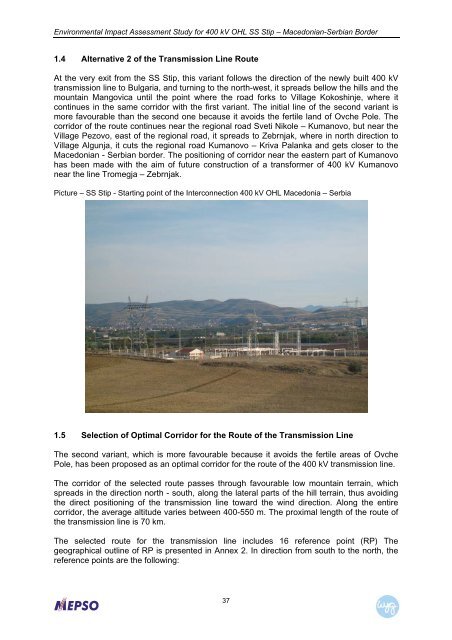
Environmental Impact Assessment Study for <strong>400</strong> <strong>kV</strong> OHL SS Stip – Macedonian-Serbian Border1.4 Alternative 2 of the Transmission Line RouteAt the very exit from the SS Stip, this variant follows the direction of the newly built <strong>400</strong> <strong>kV</strong>transmission line to Bulgaria, and turning to the north-west, it spreads bellow the hills and themountain Mangovica until the point where the road forks to Village Kokoshinje, where itcontinues in the same corridor with the first variant. The initial line of the second variant ismore favourable than the second one because it avoids the fertile land of Ovche Pole. Thecorridor of the route continues near the regional road Sveti Nikole – Kumanovo, but near theVillage Pezovo, east of the regional road, it spreads to Zebrnjak, where in north direction toVillage Algunja, it cuts the regional road Kumanovo – Kriva Palanka and gets closer to theMacedonian - Serbian border. The positioning of corridor near the eastern part of Kumanovohas been made with the aim of future construction of a transformer of <strong>400</strong> <strong>kV</strong> Kumanovonear the line Tromegja – Zebrnjak.Picture – SS Stip - Starting point of the Interconnection <strong>400</strong> <strong>kV</strong> OHL Macedonia – Serbia1.5 Selection of Optimal Corridor for the Route of the Transmission LineThe second variant, which is more favourable because it avoids the fertile areas of OvchePole, has been proposed as an optimal corridor for the route of the <strong>400</strong> <strong>kV</strong> transmission line.The corridor of the selected route passes through favourable low mountain terrain, whichspreads in the direction north - south, along the lateral parts of the hill terrain, thus avoidingthe direct positioning of the transmission line toward the wind direction. Along the entirecorridor, the average altitude varies between <strong>400</strong>-550 m. The proximal length of the route ofthe transmission line is 70 km.The selected route for the transmission line includes 16 reference point (RP) Thegeographical outline of RP is presented in Annex 2. In direction from south to the north, thereference points are the following:37