Part A - EIA 400 kV OHTL Stp - мепÑо а.д.
Part A - EIA 400 kV OHTL Stp - мепÑо а.д.
Part A - EIA 400 kV OHTL Stp - мепÑо а.д.

Create successful ePaper yourself
Turn your PDF publications into a flip-book with our unique Google optimized e-Paper software.
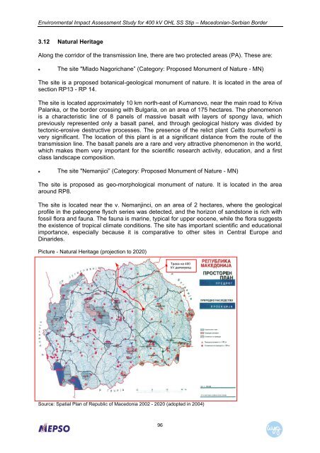
Environmental Impact Assessment Study for <strong>400</strong> <strong>kV</strong> OHL SS Stip – Macedonian-Serbian Border3.12 Natural HeritageAlong the corridor of the transmission line, there are two protected areas (PA). These are:• The site "Mlado Nagorichane” (Category: Proposed Monument of Nature - MN)The site is a proposed botanical-geological monument of nature. It is located in the area ofsection RP13 - RP 14.The site is located approximately 10 km north-east of Kumanovo, near the main road to KrivaPalanka, or the border crossing with Bulgaria, on an area of 175 hectares. The phenomenonis a characteristic line of 8 panels of massive basalt with layers of spongy lava, whichpreviously represented only a basalt panel, and through geological history was divided bytectonic-erosive destructive processes. The presence of the relict plant Celtis tournefortii isvery significant. The location of this plant is at a significant distance from the route of thetransmission line. The basalt panels are a rare and very attractive phenomenon in the world,which makes them very important for the scientific research activity, education, and a firstclass landscape composition.• The site "Nemanjici” (Category: Proposed Monument of Nature - MN)The site is proposed as geo-morphological monument of nature. It is located in the areaaround RP8.The site is located near the v. Nemanjinci, on an area of 2 hectares, where the geologicalprofile in the paleogene flysch series was detected, and the horizon of sandstone is rich withfossil flora and fauna. The fauna is marine, typical for upper eocene, while the flora suggeststhe existence of tropical climate conditions. The site has important scientific and educationalimportance, especially because it is comparative to other sites in Central Europe andDinarides.Picture - Natural Heritage (projection to 2020)Траса на <strong>400</strong><strong>kV</strong> далекуводSource: Spatial Plan of Republic of Macedonia 2002 - 2020 (adopted in 2004)96