

Strategic Flood Risk Assessment - Wiltshire Council
Strategic Flood Risk Assessment - Wiltshire Council
Strategic Flood Risk Assessment - Wiltshire Council

Create successful ePaper yourself
Turn your PDF publications into a flip-book with our unique Google optimized e-Paper software.
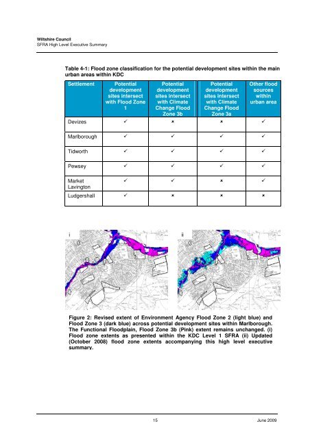
<strong>Wiltshire</strong> <strong>Council</strong>SFRA High Level Executive SummaryTable 4-1: <strong>Flood</strong> zone classification for the potential development sites within the mainurban areas within KDCSettlementPotentialdevelopmentsites intersectwith <strong>Flood</strong> Zone1Potentialdevelopmentsites intersectwith ClimateChange <strong>Flood</strong>Zone 3bPotentialdevelopmentsites intersectwith ClimateChange <strong>Flood</strong>Zone 3aOther floodsourceswithinurban areaDevizes Marlborough Tidworth Pewsey MarketLavington Ludgershall iiiFigure 2: Revised extent of Environment Agency <strong>Flood</strong> Zone 2 (light blue) and<strong>Flood</strong> Zone 3 (dark blue) across potential development sites within Marlborough.The Functional <strong>Flood</strong>plain, <strong>Flood</strong> Zone 3b (Pink) extent remains unchanged. (i)<strong>Flood</strong> zone extents as presented within the KDC Level 1 SFRA (ii) Updated(October 2008) flood zone extents accompanying this high level executivesummary.15 June 2009


